
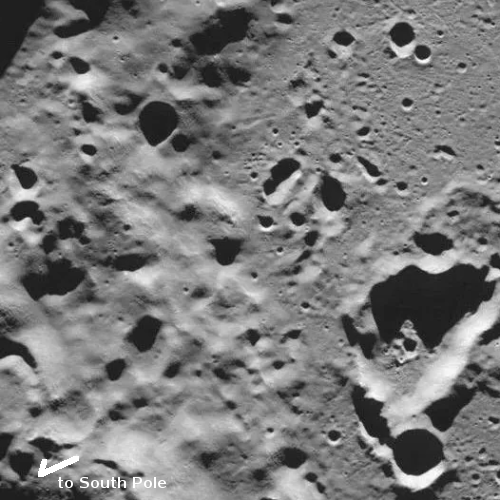
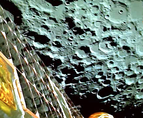
Luna-25 takes first image of lunar surface
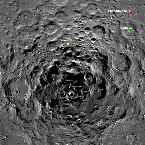
Click for interactive map. Zeeman is located on the lower left.
Russia’s state-run press today issued the first picture taken by Luna-25 after entering lunar orbit two days ago. That picture, to the right and cropped and reoriented to post here, shows part of Zeeman Crater at 75 degrees south latitude and 135 degrees west, on the far side of the Moon. From the TASS announcement:
“The Luna-25 spacecraft, flying in a circular orbit as the Moon’s artificial satellite, has taken pictures of the lunar surface with television cameras of the STS-L system. The image, taken today at 08:23 Moscow time, shows the southern polar crater Zeeman on the far side of the Moon. The coordinates of the crater center are 75 degrees south and 135 degrees west,” the state corporation said. Roscosmos said the Zeeman crater is of great interest to researchers. Its rim rises eight kilometers above its relatively flat floor.
The picture shows Zeeman’s southern rim to the left, with its pockmarked crater floor to the right. The crater the lander is targeting, Broguslawsky Crater, sits in the opposite hemisphere of Zeeman, slightly closer to the south pole but on the Moon’s near side.


