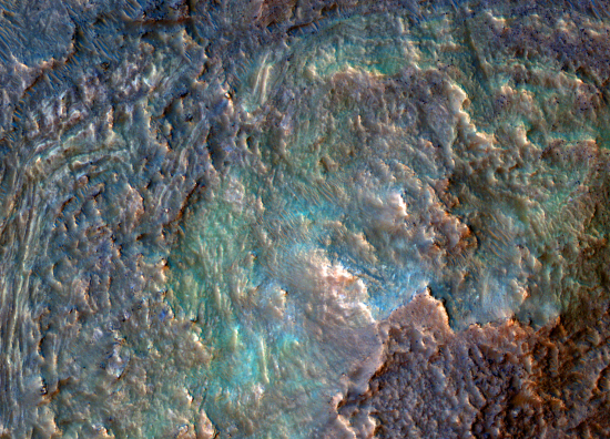
The fractured floor of the south Utopia Basin

The fracture floor of South Utopia Basin

Cool image time! The picture to the right, rotated, cropped, reduced, and enhanced to post here, was taken on August 5, 2023 by the high resolution camera on Mars Reconnaissance Orbiter (MRO). The central darker strip however comes from a September 27, 2008 image by MRO’s lower resolution context camera, inserted to fill in the blank section where one component on the high resolution camera has failed.

The picture focuses on what the scientists call a “pit interacting with a mound.” The 100-foot-deep pit is one of a very long meandering string of such pits, all of which suggest the existence of an buried river canyon into which debris is sinking. Altogether this particular string runs from several dozen miles, and its interaction with the triangular 300-foot-high mound suggests at first glance that the river that created the canyon did a turn to the left to avoid a large underground mountain, now mostly buried but revealed by its still exposed peak.

As is usual in planetary research, the first glance is often wrong. The overview map below provides a different answer, which says the formation of the aligned pits is related to the formation of the mound itself.
» Read more

5 comments

Webb detects high altitude jet stream above Jupiter’s equatorial band

Jupiter's newly discovered jet stream
Click for original false-color infrared image.

Using the Webb Space Telescope’s infrared capability, scientists have now detected a high altitude jet stream that flows above the equatorial band of Jupiter at speeds estimated to 320 miles per hour.

The false-color infrared image to the right shows evidence of this jetstream in three places by the brightest features seen there. From the caption:

In this image, brightness indicates high altitude. The numerous bright white ‘spots’ and ‘streaks’ are likely very high-altitude cloud tops of condensed convective storms. Auroras, appearing in red in this image, extend to higher altitudes above both the northern and southern poles of the planet. By contrast, dark ribbons north of the equatorial region have little cloud cover. In Webb’s images of Jupiter from July 2022, researchers recently discovered a narrow jet stream traveling 320 miles per hour (515 kilometers per hour) sitting over Jupiter’s equator above the main cloud decks.

These features sit about 25 miles higher than the planet’s previously detected cloudtops.

This discovery only proves what has always been evident, that Jupiter’s atmosphere is very complex with many features earlier optical observations could not see. It also only gives us a hint of that complexity. It will take numerous Jupiter orbiters observing in all wavebands, not just Webb in the infrared millions of miles away, to begin to untangle that complexity. And that untangling will take decades as well, since global weather unfolds over time. You can’t understand it simply by one snapshot. You have to watch the changes from season to season and from year to year. As Jupiter’s year is 12 Earth-years long, this research will take many lifetimes.

1 comment

Erosion revealing ridges on Mars?

Erosion revealing lava dikes on Mars?
Click for original image.

Cool image time! The picture to the right, rotated, cropped, reduced, and sharpened to post here, was taken on June 30, 2023 by the high resolution camera on Mars Reconnaissance Orbiter (MRO). The science team calls the features here “narrow ridges”, but what makes these criss-crossing ridges interesting is their location within the picture.

They appear only inside the hollows and depressions, as if erosion had stripped out a top layer of softer material to reveal these ridges, made of a harder material. The almost random but straight orientations of the ridges also suggest they formed along faults or cracks, which also suggests we are seeing dikes where lava was pushed up from below.

Whether the eroded softer material is lava or volcanic ash is unclear, though it certainly resembles the ash layers seen in the giant Medusa Fossae Formation ash field on the opposite side of Mars.

As always, a wider look helps clarify things.
» Read more

0 comments

Location of mud volcanoes in Martian chaos terrain suggest past existence of mud lake

Mud volcanoes in the inland sea

Scientists mapping the location of mud volcanoes in chaos terrain in the dry equatorial regions of Mars have found numerous mud volcanoes, adding weight to the theory that an intermittent shallow lake once existed there.

The inset on the overview map to the right indicates the location of those mud volcanoes (of two types) in white and orange dots. What is significant is that none of the volcanoes are found on the mesas within this chaos terrain, only in the low flats below. From the caption:

Both feature types result from sedimentary volcanism – instead of magma upwells and eruptions, wet sediments, and salts reach and breach the surface, forming mounds and flows. Interestingly, these mounds only occur over the chaotic terrain floor materials and not on the mesas (red-shaded areas) they embay. This suggests a material composition link rather than a genesis by regional extensional forces generated by magmatic rises.

The blue areas are where this same science team think an intermittent inland sea once existed. This new data reinforces that hypothesis.

Features that look like mud volcanoes are common in the icy northern lowland plains. Finding them in the dry equatorial regions strengthens the theory that water was once common there. For this reason the scientists are proposing a mission to this location, especially because the possibility of water might increase the chances of discovering past life.

0 comments

Ingenuity completes 62nd flight on Mars

Overview map
Click for interactive map.

On October 12, 2023 the Mars helicopter Ingeniuty successfully completed its 62nd flight on Mars, flying a total of 880 feet for just over two minutes while setting a new ground speed record of 22.4 miles per hour.

The flight was a scouting trip to the northeast about 440 feet, then returning to land back at about its take-off point. The green line on the overview map above shows the route of that flight, with the green dot marking Ingenuity’s landing spot. The blue dot marks Perseverance’s present location.

The distance and time of the flight, as well as the speed record, were almost identical to the flight plan released prior to the flight.

0 comments

More Martian inverted rivers?

More Martian inverted rivers?
Click for original image.

Cool image time! The picture to the right, rotated, cropped, reduced, and sharpened to post here, was taken on June 23, 2023 by the high resolution camera on Mars Reconnaissance Orbiter (MRO). It shows what the scientists label “branching deposits,” two wiggling ridgelines with other ridges branching off from them.

What caused this? On Mars there are many such meandering ridges, all of which look like rivers that have positive relief, the opposite of what you would expect. The theory is that these weaving ridges were once canyons where either water or ice once flowed, compacting the streambed so that it was more dense than the surrounding terrain. When that terrain eroded away it left that streambed behind, as a raised meandering ridge.

That answer however might not apply here.
» Read more

0 comments

New Io images from Juno

Io as seen on October 15, 2023 by Juno
Click for original image.

The Jupiter orbiter Juno completed its 55th close pass of the gas giant on October 15, 2023, which also included a close pass of the Jupiter moon Io. The science team has now released the first images of Io from that fly-by, and several citizen scientists have released their processed versions.

The picture to the right, cropped, reduced, and sharpened to post here, was processed by Ted Stryk. It is the best view seen of this volcano-covered world since the Galileo orbiter in the 1990s. The dark patches are lava flows, with the dimensions of mountains along the terminator line between night and day clearly distinguishable.

An even closer look will occur during Juno’s 57th Jupiter orbit on December 30, 2023, when it will get within 1000 miles of Io’s surface, crossing the mid- to high latitudes of the planet’s western hemisphere.

5 comments

Blue Origin announces another big project, with few details

Blue Origin has now announced another proposed big project, dubbed Blue Ring, which will put a platform into orbit as part of a new division focused on in-space services.

Blue Ring serves commercial and government customers and can support a variety of missions in medium Earth orbit out to the cislunar region and beyond. The platform provides end-to-end services that span hosting, transportation, refueling, data relay, and logistics, including an “in-space” cloud computing capability. Blue Ring can host payloads of more than 3,000 kg and provides unprecedented delta-V capabilities and mission flexibility.

The company did not reveal many details about the size of this orbital platform, nor did it reveal a time schedule. It appears to be an effort by the company to enter the orbital tug/satellite repair market, though the announcement is so vague it is hard to determine what exactly is being proposed.

The list of big ambitious Blue Origin projects is long and impressive: the New Glenn reusuable rocket, the Orbital Reef space station, the Blue Moon manned lunar lander, and now Blue Ring. However, since none of these projects has yet launched, and the first is years behind schedule, no one should put much money on this new project ever seeing fruition. Right now Blue Origin needs to actually fly something before anyone should take seriously any proposal it puts forth.

6 comments

China to launch its second lunar relay communications satellite next year

China now plans to launch its second Queqiao lunar relay communications satellite early next year in order to support several upcoming missions, including Chang’e-6 mission to bring samples back from the far side of the Moon.

Queqiao-2 is set to launch on a Long March 8 rocket from the coastal Wenchang spaceport in early 2024, according to Zhang Lihua of DFH Satellite under the China Aerospace Science and Technology Corp. (CASC), the satellite’s developer. The 1,200-kilogram satellite will feature a 4.2-meter-diameter parabolic antenna and a mission lifetime of more than eight years, Zhang said during a presentation at the 74th International Astronautical Congress (IAC) in Baku, Oct. 3.

It will also be used later to provide relay communications to two additional Chang’e missions to the Moon’s south pole.

The satellite is an upgrade from the first Queqiao relay satellite, which is still operational but now at one of the Lagrange points rather than in orbit around the Moon. This new satellite is intended to be the first in a future constellation of lunar communications satellites, and is also being considered for the same use at Venus and Mars.

Once again it seems that China’s long term plan for the exploration of the solar system is not only rational and carefully thought out, it is also being implemented with increasing speed. Meanwhile in the U.S. our federal government seems schizophrenic, with one agency (NASA) trying to put together a long term plan using commercial space while other departments (FAA, FCC, Fish & Wildlife) doing everything they can to stymie this effort.

3 comments

Ancient flood lava on the upper slopes of the solar system’s largest volcano

Ancient flood lava
Click for original image.

Cool image time! The picture to the right, cropped, reduced, and sharpened to post here, was taken on July 13, 2023 by the high resolution camera on Mars Reconnaissance Orbiter (MRO).

In this one picture can be seen a glimpse of the entire history of the numerous lava eruptions that once dominated Mars when its giant volcanoes were active one to three billion years ago. The three aligned craterlike depressions likely signal the existence of a large lava tube below ground, placed there during an early large eruption, when the volcano was spewing out so much flood lava that such large tubes could form. The smaller meandering surface rills signal later eruptions that carried less flood lava and thus produced a smaller drainage features.

And finally, the rough and cracked appearance of the surface indicates the ancient age of those last eruptions, probably laid down about a billion years ago. Since then, the volcano has been dormant, and the frozen lava here has had time to erode, become roughened, and show signs of slowly wearing away.
» Read more

2 comments

Falcon Heavy successfully launches Psyche asteroid mission

SpaceX’s Falcon Heavy rocket this morning successfully launched the Psyche mission to the metal asteroid Psyche, lifting off from Cape Canaveral.

The two side boosters successfully landed at their landing zones at the cape, each completing their fourth flight.

Psyche will now spend the next six years traveling to the asteroid Psyche, first flying by Mars in 2026 to gain some speed to get there. It will then go into orbit around the asteroid for almost two years.

The leaders in 2023 launch race:

72 SpaceX
45 China
13 Russia
7 Rocket Lab
7 India

American private enterprise now leads China in successfully launches 84 to 45, and the entire world combined 84 to 73. SpaceX by itself only trails the entire world combined (excluding American companies) 72 to 73.

13 comments

Martian pseudo-frost terrain

Martian pseudo-frost terrain
Click for original image.

Cool image time! It is always dangerous to come to any quick conclusions about what you see from pictures from another planet. The photograph to the right, rotated, cropped, reduced, and sharpened to post here, was taken on August 19, 2023 by the high resolution camera on Mars Reconnaissance Orbiter (MRO), and shows what at first glance looks like a surface similar to frosting seen on window panes on Earth in the winter, where water condensation freezes to form crystalline patterns.

Your first glance would be wrong. This terrain is about 120 miles north of the Martian equator, placing inside the dry equatorial regions where no near-surface ice is known to exist. If this geological feature is formed by the same condensation processes that create ice frost, then it must involve the deposition of some other type of material.

The explanation would also have to account for the change in the terrain, from finely patterned on the right to more crystalline on the left.
» Read more

0 comments
1 53 54 55 56 57 89