The crumbling cliffs of Mars

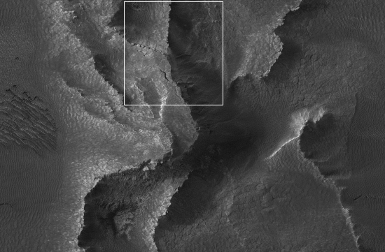
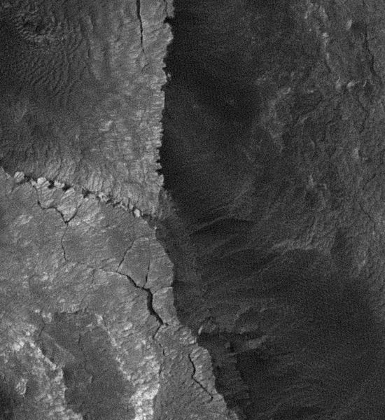
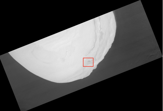
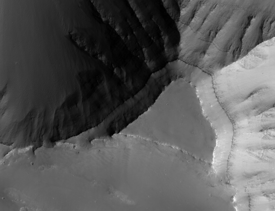
Among the new images posted last week by the HiRise camera on Mars Reconnaissance Orbiter is a picture showing the layered and looping ridgelines within Galle Crater. A close-up of these ridgelines revealed the precarious nature of those crumbling cliff tops.

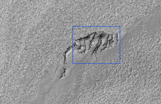
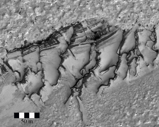
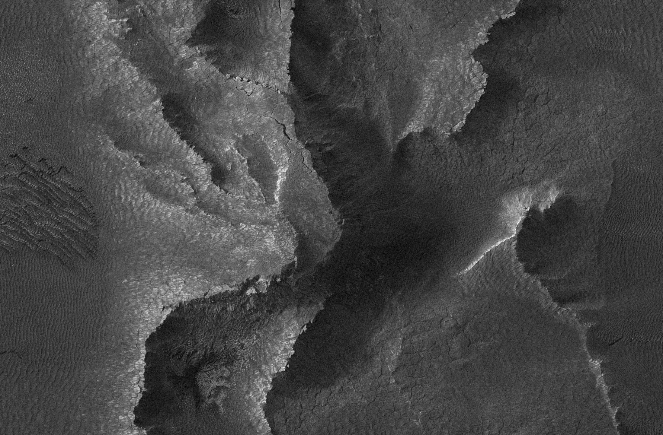
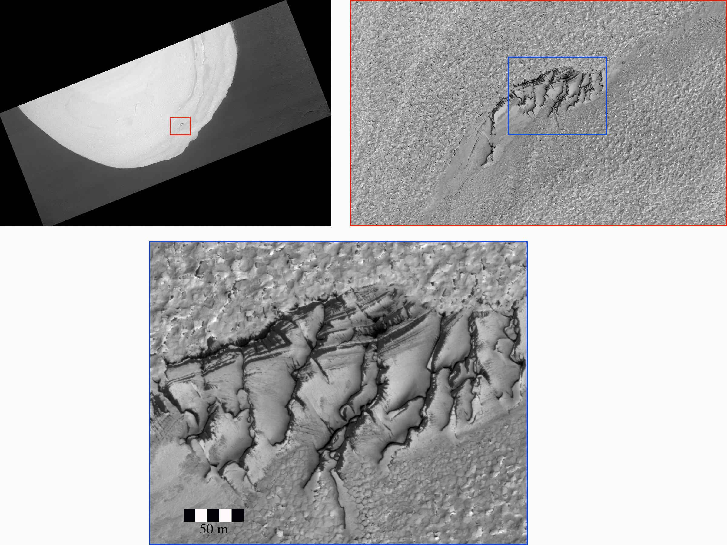
Below is a low resolution version of the image, with a high resolution cropped inset below that, showing a close-up of the most interesting looking area. In the inset you can see that the top of the cliff has separated away. It almost looks as if several large pieces are about to break off. You can also see that the top of the cliff to the north is made up of hanging rocks that appear to almost float in the air. They too look as if they are about to break off.

What makes this even more intriguing is that there are no boulder piles at the bottom of any cliff. All we can see on the valley floor is a pattern of polygonal fractures, possibly “due to ground ice, or regional tectonic stresses.” If large pieces of these ridge lines are breaking off periodically, as they surely appear to be doing, where has the debris gone?

Martian cliffs

crumbling cliffs

0 comments

Something is recycling the methane on Mars

Research results posted today [pdf] at the European Planetary Science Congress show that the methane in Mars’s atmosphere is seasonally variable and far more short-lived than predicted, disappearing in less than a year. Some process, therefore, must be both using it and replenishing it. On Earth, that’s almost always done by some form of life process. Key quote by one of the scientists, from the press release:

“Only small amounts of methane are present in the martian atmosphere, coming from very localised sources. We’ve looked at changes in concentrations of the gas and found that there are seasonal and also annual variations. The source of the methane could be geological activity or it could be biological Β­ we can’t tell at this point.”

The image below shows the three regions (in yellow) where the methane is concentrated.

Mars methane locations

0 comments

Opportunity’s journey continues

On August 18, 2010, the Mars rover Opportunity took this panorama image of the Martian terrain. Up close, patches of bedrock can be seen where the sand had blown clear. In the far distance the rim of Endeavour Crater, the rover’s long term destination, pokes up over the horizon.

Endeavour Crater on the horizon

Update: A press notice from JPL today notes that Opportunity has now traveled about half of the 11.8 mile distance to Endeavour Crater. As it took two years to go this far, the journey still has two years to go, assuming the rover survives that long.

0 comments

Life on Mars?

New research now suggests that it was premature to conclude that Mars has no life, based on the data from the Viking missions to Mars in the 1970s. This is vindication for Gilbert Levin, one of the chief scientists for those missions, who had said so then and was subsequently pilloried for it.

0 comments

Melting Ice on Mars?

These Mars Reconnaissance Orbiter images show in increasing magnification a puzzling feature in the southeast part of a ice mound in Louth Crater on Mars. Located at 70 degrees north latitude, this is the farthest south that scientists have found permanent water ice. The close-up image suggests melting ice with the draining water running down hill to the south, though on Mars the low air pressure would cause any liquid water to evaporate instantly. Key quote:

These may be the crests of partially defrosted dark sand dunes or perhaps some other feature that we do not understand. This is the only area on Louth where these enigmatic ridges are found.

wide view of crator mound

Middle view of ice mound

Closeup of ice mound

0 comments

Picture of the day from Mars

Sand dunes on Mars, from the HiRise camera on Mars Reconnaissance Orbiter:

Dunes on Mars

Fun quote:

These dunes are “barchan” dunes, which are also commonly found on Earth. Barchan dunes are generally crescent-shaped, with their “horns” oriented in the downwind direction. They have a steep slip face (the downwind side of the dune). Barchan dunes form by winds that blow mostly in one direction and thus are good indicators of the dominant wind direction. In this case, the strongest winds blow approximately north to south.

0 comments

Exploring Mars from Earth

Want to poke around on Mars? Since it might be a while before you can actually go there, I suggest you instead make frequent visits to the images page for the HiRise camera on Mars Reconnaissance Orbiter. The pictures that appear here are routinely breath-taking. Below is a cropped image showing the flat top of a mesa in Coprates Chasma. The full image shows detailed layers down the side of the mesa as well as rippled dunes on the mesa top. Everything is remarkably reminescent of something you’d see if you visited the Grand Canyon. Only on Mars, this grand canyon is many times larger and deeper.

Mesa top on Mars

0 comments
1 209 210 211 212