
Scientists refine Martian interior based on quakes detected by InSight
Scientists today published three studies in the journal Science outlining their conclusions about the interior of Mars, based on the quakes that have been detected by InSight since it arrived on Mars in November 2018.
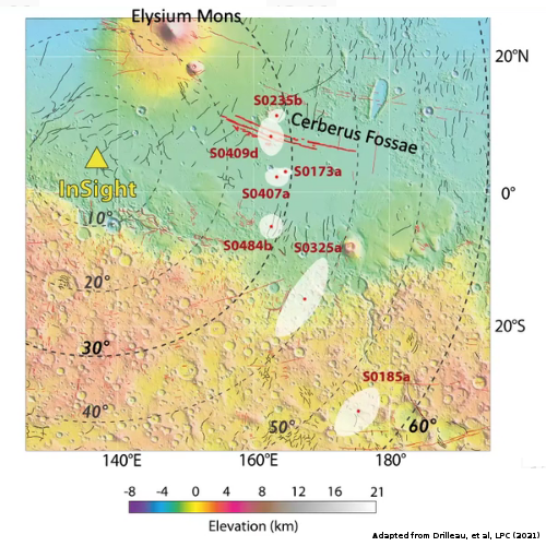
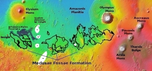
Reporting in a trio of studies published in the July 23rd Science, the Insight science team has now analyzed about 10 marsquakes to make the first direct observations of the structure within another rocky planet. The results — a surprisingly thin crust, an undifferentiated mantle, and a larger-than-expected core — will help determine how Mars formed and evolved.
There results are essentially what was described in April by the InSight science team at the annual 52nd Lunar and Planetary Science Conference (and reported here but no where else), though now more carefully and thoroughly described.
The discovery that the Martian crust is much thinner than expected, either 12 or 24 miles thick, with a core that is still liquid, has ramifications that might help explain both the planet’s formation and its volcanic history and giant volcanoes.
One piece of good engineering news in connection with the lander InSight:
Despite a dust-fueled energy crisis earlier this year, the solar-powered lander has since regained some power-generating capacity. “We are at least safe for this season’s winter and probably far into 2022,” Stähler says.

