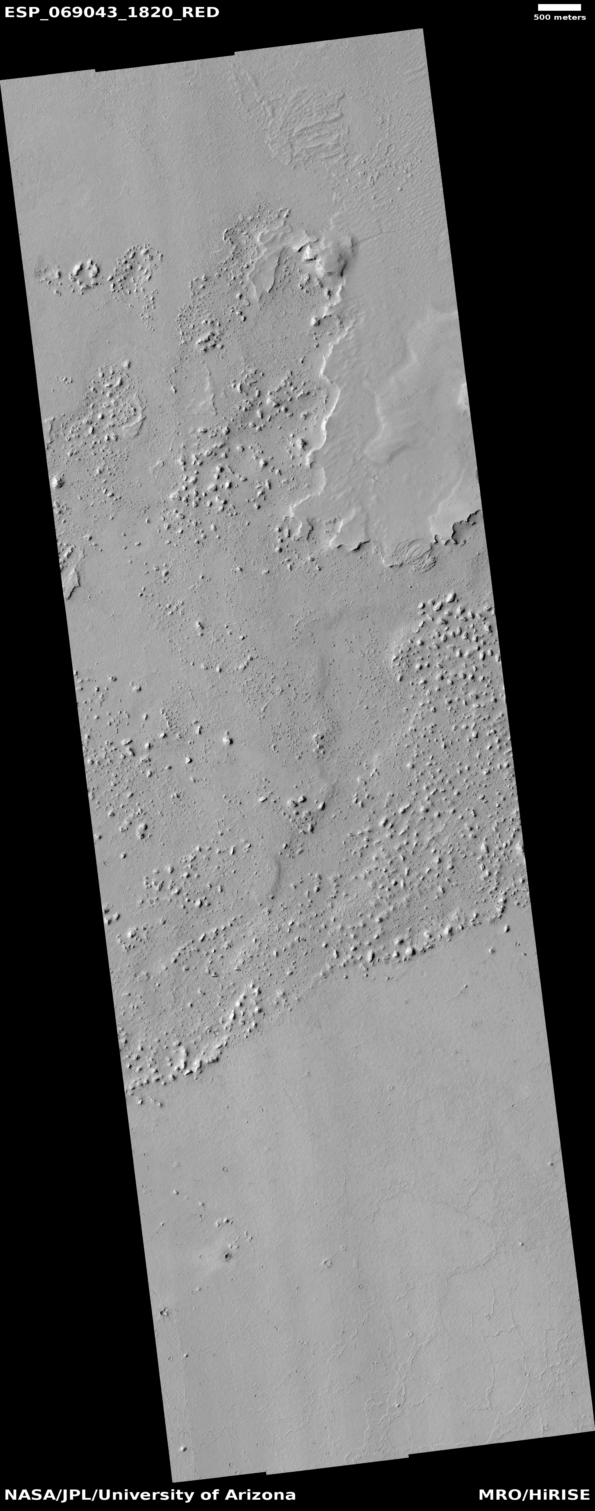
A sample of typical but strange Martian northern lowland plain geology

Typical lowland features on Mars
Click for full image.

Cool image time! The photo to the right, rotated, cropped and reduced to post here, was taken on April 18, 2021 by the high resolution camera on Mars Reconnaissance Orbiter (MRO). It shows a nice sample of the typical glacial-filled craters found often in the mid-latitudes between 30 to 60 degree latitudes, surrounded by a lot of erosion features representative of these lowland northern plains.

The biggest crater is very symptomatic of what scientists have dubbed concentric crater fill, a feature that they believe reveals that there is buried ice water glaciers here, protected by a thin layer of debris. The apron of brighter material surrounding the crater could be a splash feature created during impact and now more obvious because it has been revealed as sublimation and erosion lowered the terrain nearby.

The location is north of the Cydonia region in Acidalia Planitia, several thousand miles to the northeast of the region where Viking 1 landed in 1976 and Mars Pathfinder landed in 1997, as shown in the overview map below.
» Read more

0 comments

A confused river of ice on Mars

A river of ice on Mars
Click for full image.

Cool image time! The photo to the right, rotated, cropped, and reduced to post here, was taken on March 4, 2021 by the high resolution camera on Mars Reconnaissance Orbiter (MRO). It shows what MRO’s science team labeled a “Landform in Source Region of Harmakhis Vallis.”

They are being very correct and careful with that label. The landform here is quite clearly reminiscent of a glacier, but because they don’t yet have confirmation of its watery nature, as good scientists they can’t call it that.

I however am a mere journalist, so I am free to speculate more wildly. Sure looks like glaciers to me, the ice flowing downhill from the left to the right and flowing around that central mound.

The overview map below gives a wider context, but also makes the behavior of the glaciers here far more puzzling.
» Read more

19 comments

The Mountains of Mars

The mountains of Mars
Click for full resolution. The highest mountain on the right is about 450 feet high.

Even as the rover Perseverance is beginning its first science campaign on the floor of Jezero Crater, the rover Curiosity about 3,000 miles to the east has begun its climb into the mountains of Mars that surround the central peak of Gale Crater, Mount Sharp.

The mosaic above, made from two images taken by the rover’s right navigation camera (here and here), shows what Curiosity sees ahead. Since my last update on June 4th describing Curiosity’s future travels, the rover’s science team has pushed forward directly uphill towards the entrance to the canyon Gediz Vallis, visible as the gap between the mountains to the right and left in the above mosaic.

The overview map below shows the rover’s approximate present position, with the yellow lines indicating what the above photo is looking at.
» Read more

0 comments

Rocket Lab wins contract to build two Mars smallsat planetary probes

Capitalism in space: Rocket Lab has won a contract to build two Mars smallsat planetary probe as part of a NASA project.

The project, led by the University of California, will have two probes dubbed Blue and Gold that will launch in 2024 on a Falcon Heavy rocket. The science goal is to place two spacecraft in Mars orbit to provide a more global look at is atmosphere. The financial goal is to show that smallsats built for less can do the same job as larger probes costing millions more.

0 comments

Boxwork in the basement of Mars

Polygon ridges in Hellas Basin
Click for full image.

Cool image time! The photo to the right, rotated, cropped, and reduced to post here, shows what resembles closely what in Earth caves are called boxwork, polygonal ridges sticking out from the bedrock and usually indicating cracks filled with harder material that resist erosion.

Taken by the high resolution camera on Mars Reconnaissance Orbiter (MRO) on March 23, 2021, what makes this boxwork especially interesting is its size and location. On Earth cave boxwork generally ranges from a few inches to a few feet across. Not only do these Martian ridges range from 100 feet to a half mile in length, they are located at the lowest point in Hellas Basin, the basement of Mars. In fact, this spot is as close as you can get to Mars’ Death Valley, as shown by the overview map below.
» Read more

3 comments

China releases more images from Zhurong

Zhurong looking north past its lander
Click for full image.

The new colonial movement: Three weeks after its Mars rover Zhurong rolled off its lander to begin its 90 day mission, China yesterday finally released the first high resolution images taken by the rover.

The images included a 360 degree panorama, taken while the rover was still sitting on the lander, an image of both the rover and lander taken by a mini-camera that was dropped from the bottom of the rover, a picture of some interesting nearby boulders to the east, and a picture looking past the lander looking north.

This last picture is above, reduced and annotated by me. The small flat but distinct hill to the north I think is the nearest pitted cone that could be either a mud or lava volcano. That cone is about 3.75 miles away, and though a very enticing target is probably too far away for Zhurong to reach, unless it survives for years past its planned three-month mission, as did the American rovers Spirit and Opportunity.

The closer small ridges and hills just to its right could be the east and west rims of the nearest large crater, about 650 feet wide with a distorted shape, that is visible in the high resolution orbital images taken by both Tianwen-1 and Mars Reconnaissance Orbiter (MRO). This crater is about 1,600 feet away.

Based on these images it appears that once Zhurong rolled off the lander to the east, it immediately turned to the right to move several feet south, where it turned right again to move several feet to the west until it was just to the west of the lander, where it took the picture above. During that last move it dropped the small camera behind it so that it could take the picture showing both the rover and the lander.

These maneuvers and the rover’s position south of the lander and facing west suggest they are going to head to the west, where there are some nearby smaller craters and other interesting features. Whether they eventually go north, with that pitted cone a long term goal should the rover last longer than its planned mission through the end of August, remains entirely unknown.

8 comments

Zhurong finally located on Mars

Zhurong as seen by MRO
Click for full image.

Though the Chinese had earlier this week released one image taken by their Mars orbiter, Tianwen-1, showing their rover Zhurong on the surface of Mars, they did not provide any specific location information.

This lack has now been filled by a new high resolution image of Zhurong taken by Mars Reconnaissance Orbiter (MRO) on June 6, 2021. This image, cropped to match the Tianwen-1 image and annotated by me to post here, shows the parachute, entry capsule, heat shield, lander, and rover. I have added white dots to distinguish the rover from the lander, which indicate that since the Tianwen-1 orbital image the rover had moved south about 70 feet, suggesting it has been able to travel on the surface.

What this MRO image provides that the Chinese refused to reveal is the latitude and longitude of that landing site, which in turn tells us that the lander put down about 14 miles to the northwest of its targeted landing spot. The mosaic of MRO context camera images below show this landing spot in context with the surrounding terrain.
» Read more

0 comments

Update on Perseverance’s future travel plans

Perseverance's future travels
Click for full image.

The science team for the rover Perseverance yesterday released a revised map of where they intend over the next few months to send the rover on the floor of Jezero Crater.

The map to the right, cropped and reduced to post here, shows that route.

The first science campaign (depicted with yellow hash marks) begins with the rover performing an arching drive southward from its landing site to Séítah-North (Séítah-N). At that point the rover will travel west a short distance to an overlook where it can view much of the Séítah unit. The “Séítah-N Overlook” could also become an area of scientific interest – with Perseverance performing a “toe dip” into the unit to collect remote-sensing measurements of geologic targets.

Once its time at the Séítah-N Overlook is complete, Perseverance will head east, then south toward a spot where the science team can study the Crater Floor Fractured Rough in greater detail. The first core sample collected by the mission will also take place at this location. After Cratered Floor Fractured Rough, the Perseverance rover team will evaluate whether additional exploration (depicted with light-yellow hash marks) farther south – and then west – is warranted.

Whether Perseverance travels beyond the Cratered Floor Fractured Rough during this first science campaign, the rover will eventually retrace its steps. As Perseverance passes the Octavia B. Butler landing site, the first science campaign will conclude. At that point, several months of travel lay ahead as Perseverance makes its way to “Three Forks,” where the second science campaign will begin.

At that point the rover will begin studying the base of the delta of material that in the far past poured through a gap in the western rim of Jezero Crater.

0 comments

Evidence of past underground water in the Martian equatorial regions?

Mosaic of strange feature
Click here, here, here, and here for full images.

Today’s cool image, to the right, takes us to the equatorial regions of Mars, a region that today appears quite arid and dry based on all the orbital and rover/lander data so far gathered. The photo and its complex geology however provides us a hint that once liquid water did exist here. At least, that is the hypothesis that scientists presently favor, though making it fit this complex geology is not simple or straightforward.

The mosaic to the right is made from four context camera images taken by Mars Reconnaissance Orbiter (MRO). It shows a very complicated series of depressions — one of which vaguely resembles a crater — that appear to have been washed out by some past erosion process, though that process could not have been that simple because of the fissures and cracks that dominate the floor of the circular feature.

I contacted Chris Okubo of the U.S. Geological Survey, who had requested a high resolution image from MRO of a small part of this mosaic, as indicated by the white box, to ask him what we are looking at. His answer was appropriately noncommittal:
» Read more

28 comments

Ingenuity completes 7th flight on Mars

Locations of Perseverance and Ingenuity on Mars
Click for interactive map.

Ingenuity yesterday successfully completed its 7th flight on Mars, heading south and landing exactly as planned.

Ingenuity lifted off around 12:34 local mean solar time on Tuesday, which corresponds to 11:54 a.m. EDT (1554 GMT). As planned, the chopper then traveled 348 feet (106 meters) south from its previous location on the floor of Mars’ Jezero Crater, staying aloft for nearly 63 seconds, JPL officials wrote in another tweet. The solar-powered rotorcraft set down at a new airfield, the fourth one it has reached since landing on the Red Planet with NASA’s Perseverance rover on Feb. 18.

Both the rover Perseverance and Ingenuity are traveling south on the floor of Jezero Crater, with the helicopter leapfrogging ahead every few weeks. On the map the red dot indicates Perseverance location, with the green dots Ingenuity’s last three landing sites. They have not yet added to the map exactly where Ingenuity landed yesterday (#7), so I have estimated it based on the information above.

The red outline indicates the region they are planning to explore over the next few months in order to gather a very thorough understanding of the geology of the floor of Jezero Crater. They will eventually head to the northwest towards the cliffs in the upper left, which is the foot of the large delta that flowed in the past into the crater through a gap in its western rim. The route they will take to get there however remains undetermined.

0 comments

Eroding Martian lava?

Eroding Martian lava?
Click for full image.

Cool image time! The photo to the right, rotated, cropped, and reduced to post here, was taken on April 19, 2021 by the high resolution camera on Mars Reconnaissance Orbiter (MRO). Requested by Colin Dundas of the U.S. Geological Survey’s Astrogeology Science Center in Arizona, the image was entitled “Enigmatic Terrain in Elysium Planitia.” The image is labeled so because, as Dundas explained,

Flood lava is a key part of the feature, best seen at the north and south ends of the image. What’s unusual is the knobby terrain at the center. … I haven’t yet been able to do a more thorough study of these features, so plenty of puzzles remain!

The higher material in the upper right is likely flood lava. A 2016 paper [pdf] led by Dundas on similar features in Elysium Planitia that were not as knobby found their origin somewhat baffling. The evidence suggested that lava, mud, wind, and ice could all be involved in their formation, but the evidence was also not sufficient to eliminate any possibility.

In the case of today’s image, the explanation might also be any of these possibilities. For example, we might be looking at the erosion of the flood lava, exposing harder knobs of different material that had been there before and had been covered by the lava. Or maybe the knobs are simply the last bits of that layer of flood lava that has not yet eroded away.

As always, the overview map provides some context.
» Read more

0 comments

China releases orbital image showing Zhurong on Mars

Zhurong on Mars
Click for original image.

China’s state-run press today released two images taken by its Tianwen-1 Mars orbiter showing its Zhurong rover on the surface of Mars.

Those photos are to the right. The top shows the location prior to the rover’s landing. The bottom, taken on June 2nd, shows the rover and its landing platform, as well as its entry capsule, heat shield, and parachutes.

In the image, taken by a high-resolution camera installed on the orbiter of Tianwen-1 at 6 p.m. on June 2 (Beijing Time), two bright spots are visible in the upper right corner. The larger one is the landing platform, and the smaller one is the Zhurong Mars rover, the CNSA said.

…The dark area surrounding the landing platform might be caused by the influence of the engine plume during landing. The symmetrical bright stripes in the north-south direction of the landing platform might be from fine dust when the landing platform emptied the remaining fuel after landing, the CNSA said.

The bright spots in the center of the image are the back cover of the entry capsule and the parachute jettisoned during the landing. Another bright spot in the lower left of the image is the heat shield of the entry capsule, the CNSA said.

Based on the second photo, it appears that Zhurong has barely moved far from the lander since it rolled off on May 22nd.

And that’s all we really know. The Chinese press release provides no details about how well the rover is functioning, where exactly this location is on the surface of Mars, nor anything else of interest. The rover might be in the region covered by the MRO photos I posted yesterday, but if so the resolution isn’t good enough for me to find the spot. I am sure however that MRO scientists are presently carefully comparing their highest resolution version with these Tianwen-1 images to pinpoint it. They will then follow-up with their own high-resolution images of Zhurong from MRO.

The rover has a planned mission length of 90 Martian days, which runs through the end of August. How much the Chinese government will reveal about its operations and results however remains completely unknown. If it functions as planned expect science papers published in about a year. If not we will only get silence.

0 comments

Mini-volcanoes (mud or lava?) near Zhurong’s Mars landing site

Mosaic of features near Zhurong's planned landing site on Mars
Click here, here, and here for full images.

Cool image time! Though we still do not know exactly where the Chinese Mars rover Zhurong landed on Mars, we have a rough idea based on the latitude and longitude numbers leaked to the Chinese press in October 2020 and were apparently confirmed by photos taken by the Tianwen-1 orbiter soon after reaching Mars. We also know Zhurong’s engineers wanted to land in the northern lowland plains dubbed Utopia Planitia, a region that is relatively flat and thus makes a safe landing spot for their first attempt to reach the surface of Mars.

The mosaic to the right, rotated and reduced to post here, is made from three context camera images taken by Mars Reconnaissance Orbiter (MRO). The white cross on the right edge is essentially Zhurong’s leaked landing spot. The red box indicates the area covered by one of only two photos that China has released that were taken by its Tianwen-1 orbiter.

The white box in the upper left shows the area covered by today’s cool image, shown below.
» Read more

0 comments

Curiosity’s dramatic path forward

Curiosity's future travels
Click for full image.

Cool image time! In the coming weeks and months the view from Curiosity is going to give us the most spectacular views of another world since the Apollo astronauts walked on the Moon.

In today’s download of new images from the Mars rover Curiosity was the photo above, reduced to post here. Taken by rover’s right navigation camera, it looks west directly in line with Curiosity’s future travels, and shows that it is now finally entering mountain country.

The overview map below provides the context.
» Read more

3 comments

Inexplicable ridges north of China’s Mars rover

Wrinkle ridges in Utopia Planitia?
Click for full image.

Cool image time! The photo to the right, rotated, cropped, and reduced to post here, shows some unusual geology about 450 miles north of the approximate area where China’s Zhurong rover landed in the northern lowlands of Mars. It was taken on April 14, 2021 by the high resolution camera on Mars Reconnaissance Orbiter (MRO).

These scattered ridges remind me of wrinkle ridges, formed when the surface of a place shrinks. With less surface area, the extra material needs somewhere to go, and so ridges are forced up at weak points to release the pressure.

Assuming this hand-waving explanation is true, the next question would be: What causes the shrinking? The overview map below might help provide an answer.
» Read more

1 comment

A visit to a crater near the non-face on Mars

Glacial erosion features inside crater
Click for full image.

Cool image time! The photo to the right, rotated, cropped, and reduced to post here, was taken on March 12, 2021 by the high resolution camera on Mars Reconnaissance Orbiter (MRO). It looks down at small six-mile-wide Apt crater in the northern lowland plains of Mars located at about 40 degrees north latitude. The image’s focus were the layers on the crater interior rim as well as the eroded glacial features on the crater’s floor. The color strip suggests [pdf] that the bluish material on the north-facing south interior rim and floor are likely icy, while the tan-colored material seen in the crater’s north half are likely dusty.

While the suggestion of glacial material on the crater’s interior is very typical for many craters in the mid-latitudes, what makes this crater of interest is its location, only a short few miles south of that mesa on Mars that for decades the shallow-minded insisted was a face and proof of an alien Martian civilization.
» Read more

4 comments

Ingenuity has issues on sixth flight

On its sixth flight and first intended as an operational scouting mission for Perseverance, the Mars helicopter Ingenuity had problems, requiring an emergency landing.

The trouble cropped up about a minute into the helicopter’s sixth test flight last Saturday at an altitude of 33 feet (10 meters). One of the numerous pictures taken by an on-board camera did not register in the navigation system, throwing the entire timing sequence off and confusing the craft about its location.

Ingenuity began tilting back and forth as much as 20 degrees and suffered power consumption spikes, according to Havard Grip, the helicopter’s chief pilot.

A built-in system to provide extra margin for stability “came to the rescue,” he wrote in an online status update. The helicopter landed within 16 feet (5 meters) of its intended touchdown site.

Engineers are presently trouble-shooting the issue, which they suspect was a “navigation timing error.”

1 comment

The strange flows in Shalbatana Vallis on Mars

Strange flows in Shalbaltana Vallis
Click for full image.

Cool image time! The photo to the right, rotated, cropped, and reduced to post here, was taken by the high resolution camera on Mars Reconnaissance Orbiter (MRO) on March 31, 2021, and shows a series of very distinct arrowhead-shaped sloping ridges interspersed with hollows flowing down from the southern cliff face of Shalbatana Vallis, one of the larger long meandering drainages flowing into the northern lowlands of Chryse Planitia and north of Valles Marineris.

This location is at 5 degrees north latitude, so nothing we see in the picture is likely glacial or evidence of ice.

So what are we looking at? My guess is that the parallel ridges show us a hint of the original slope of alluvial fill. In the past canyon’s south rim or cliff either did not exist, or was much smaller. Instead the ground mostly sloped gently downhill from the plateau to the canyon floor.

Scientists believe that in the far past catastrophic floods of water flowed through Shalbatana. If a massive flood of water off that rim came down that slope of alluvial fill, it could have pushed into that fill and created the hollows, washing the fill down into the canyon floor and leaving behind the ridges in between.

The overview maps below provide the geographical context.
» Read more

1 comment

Glacial flows covering a crater on Mars?

Partially covered crater by glacial flows?

Cool image time! The photo to the right, cropped and reduced to post here, was taken on March 4, 2021 by the high resolution camera on Mars Reconnaissance Orbiter (MRO). It shows an eroded mound that appears to have flows coming off its north and south slopes that fill the surrounding low spots, including half-covering a nearby crater.

The science team for MRO’s high resolution camera chose this picture as their April 28th picture of the day, noting the following:

The objective of this observation is to examine a crater which seems to be in the process of getting covered by flow from a mound. This image, in Protonilus Mensae, may show us characteristics of the covering material: could it be debris-covered glaciers?

Below is a global map of Mars, with this mound’s location in Protonilus Mensae in the northern mid-latitudes indicated by a black cross.
» Read more

0 comments

The big cliffs of Gediz Vallis on Mars

The Big Cliffs of Mt Sharp
Click for full image.

Cool image time! The photo to the right, cropped and reduced to post here, was taken on May 21, 2021 by Curiosity’s chemistry camera (ChemCam), normally designed to look at high resolution close-up imagery of nearby objects.

However, it can also be used as what the science team call “a long distance spyglass.” The image to the right is an example, looking at what I think are the distant but steadily approaching big cliffs on the western wall of the canyon Gediz Vallis. Make sure you look close at the shadowed cliff-face, probably several hundred feet high. It is filled with huge rock faces reminiscent of the most stark rock cliffs on the mountains of Earth.

The two images below provide the context, which makes the image even more quite breath-taking.
» Read more

3 comments
1 57 58 59 60 61 128