
The inexplicable behavior of Martian dust devils
Click for original image.
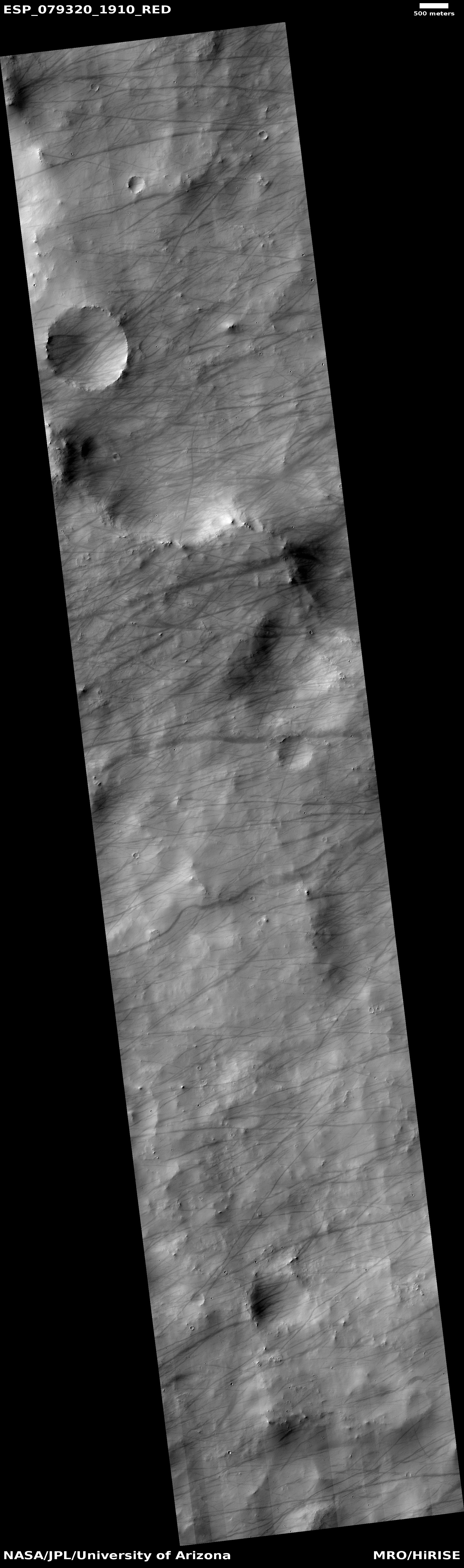
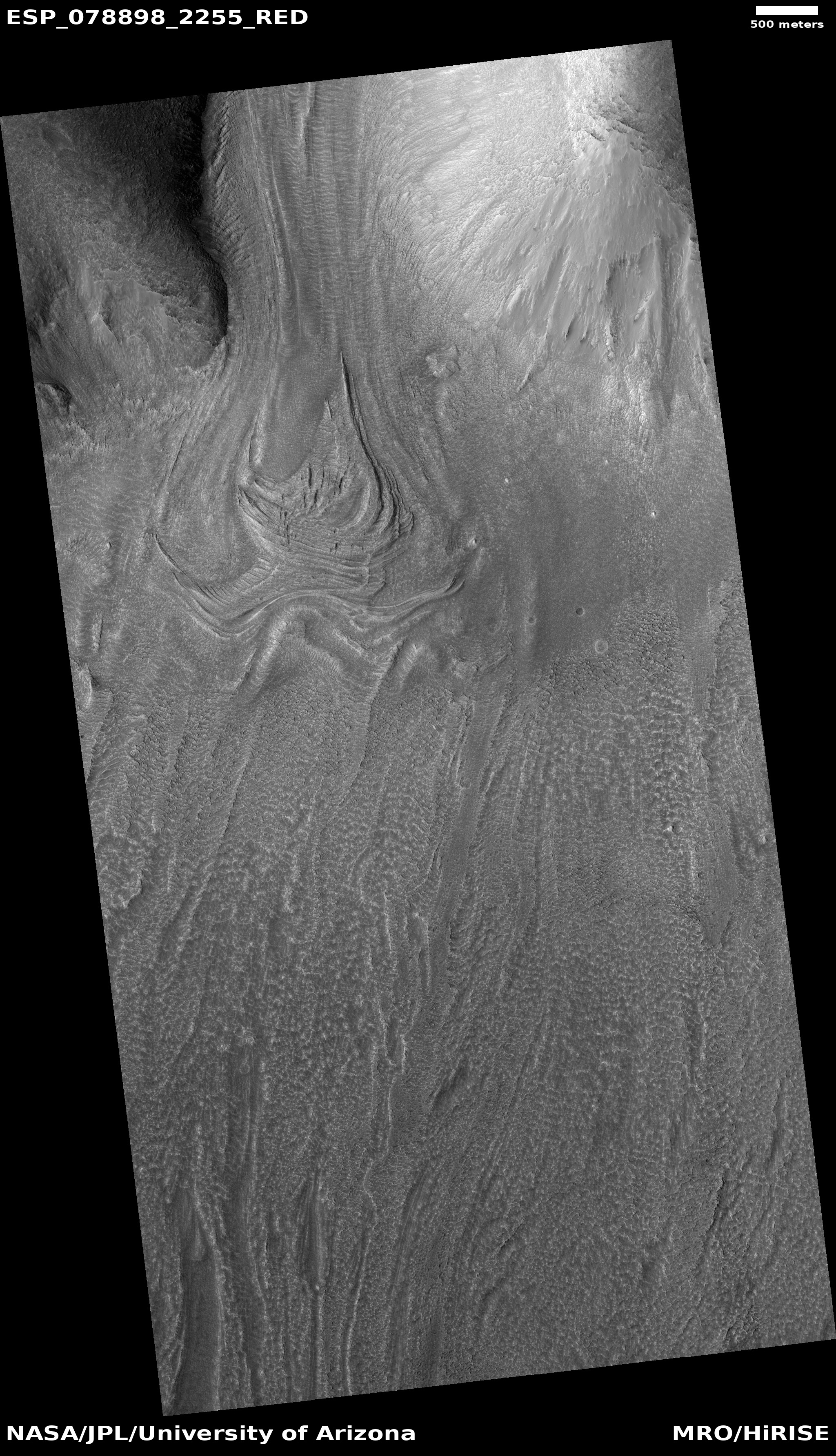
Today’s cool image illustrates the puzzling inclination of Martian dust devils to strongly favor specific regions on the Martian surface, for reasons that at present no one can confidently explain.
The picture to the right, rotated, cropped, reduced, and sharpened to post here, was taken on June 28, 2023 by the high resolution camera on Mars Reconnaissance Orbiter (MRO). It shows a plethora of dust devil tracks, almost all of which have an east-west orientation. Moreover, the tracks seem uninfluenced by the surface topography, continuing on their path without deviation, even as they cross cliffs, craters, and mounds. The orientation tells us the direction of the prevailing winds, though I don’t know if those winds blow to the east or to the west.
What makes this image revealing is that a gathering of such dust devil tracks is seen so rarely in other MRO high resolution photographs. I look at a lot of MRO pictures, and though dust devil tracks are not rare, most images don’t show this many. Apparently, there are specific conditions on Mars that cause a lot of tracks to appear in specific locations, either because atmospheric conditions create a lot more dust devils, or the ground conditions allow the tracks to become more visible.
» Read more


