
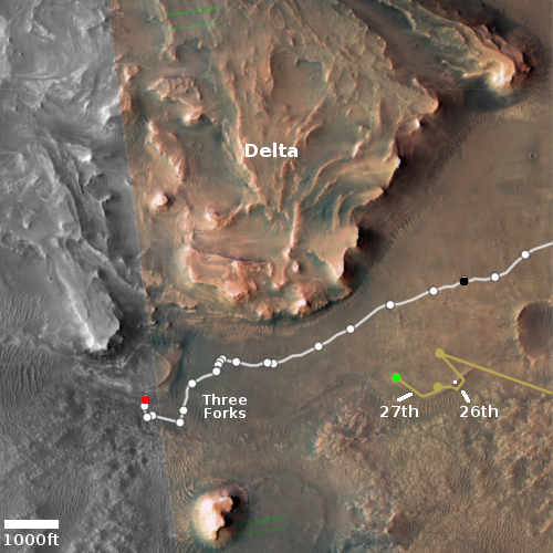
Watch today’s launches by SpaceX and Rocket Lab
UPDATE: The Rocket Lab launch has been pushed back to May 1st because of poor weather today. The live stream below is still valid but it won’t go active until about 20 minutes before launch.
Capitalism in space: Two American rocket launches are scheduled for today, first a launch of another 53 Starlink satellites on SpaceX’s Falcon 9 rocket from Cape Canaveral followed by the launch of 34 smallsats on Rocket Lab’s Electron rocket from New Zealand.
I have embedded the live stream of both below. The Rocket Lab launch will be especially exciting, because the company is going to attempt for the first time the recovery of the first stage for reuse by snatching it in the air with a helicopter as it slowly descends on parachutes.
The SpaceX launch is scheduled for 5:27 pm (Eastern), with the live stream going active about 20 minutes before launch. If successful it will be the shortest turnaround for a Falcon 9 first stage, only 21 days and shaving almost a week off the previous record.
About one hour later the Rocket Lab launch will occur, the live stream also going active about 20 minutes beforehand.


