Update on Ingenuity’s 9th flight
Ingenuity’s engineering team late yesterday posted an update on the helicopter’s successful 9th flight on July 5th, describing in detail the changes they made to their software that made the challenging flight possible.
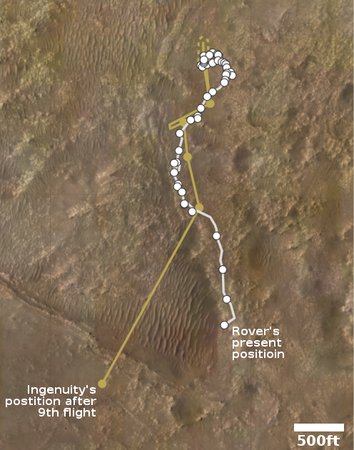
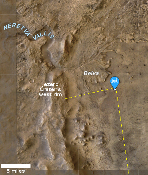
The changes were required because the helicopter flew for the first time over much rougher terrain then initially planned, as shown by the map to the right.
Flight 9 was not like the flights that came before it. It broke our records for flight duration and cruise speed, and it nearly quadrupled the distance flown between two airfields. But what really set the flight apart was the terrain that Ingenuity had to negotiate during its 2 minutes and 46 seconds in the air – an area called “Séítah” that would be difficult to traverse with a ground vehicle like the Perseverance rover. This flight was also explicitly designed to have science value by providing the first close view of major science targets that the rover will not reach for quite some time.
In other words, Ingenuity flew for the first time over terrain that Perseverance cannot drive to, recording images from above of surface features beyond the rover’s range.
We began by dipping into what looks like a heavily eroded crater, then continued to descend over sloped and undulating terrain before climbing again to emerge on a flat plain to the southwest.
The images of that rough terrain have not yet been downloaded to Earth, but will be in the next week.

