
The wind-scoured dusty and cratered dry tropics of Mars
Click for original image.
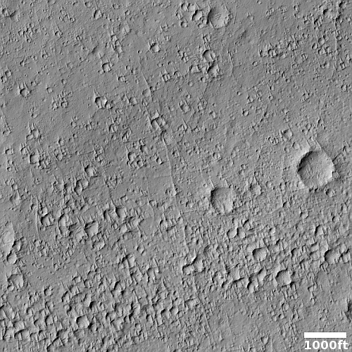
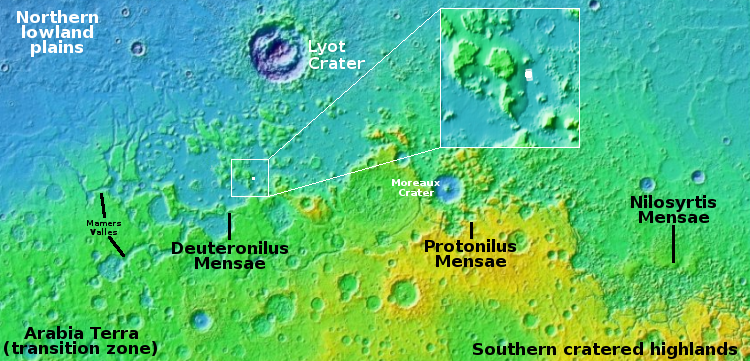
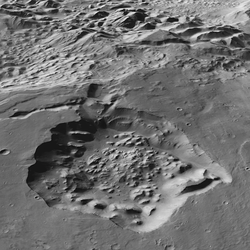
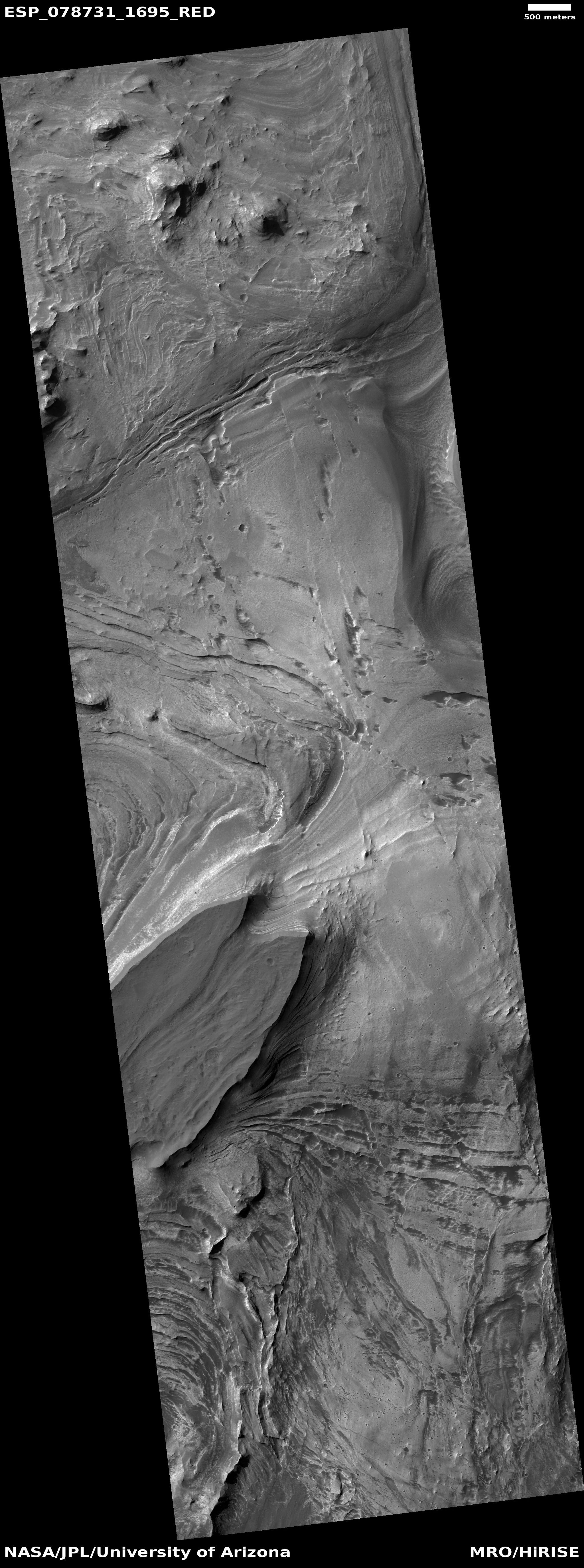
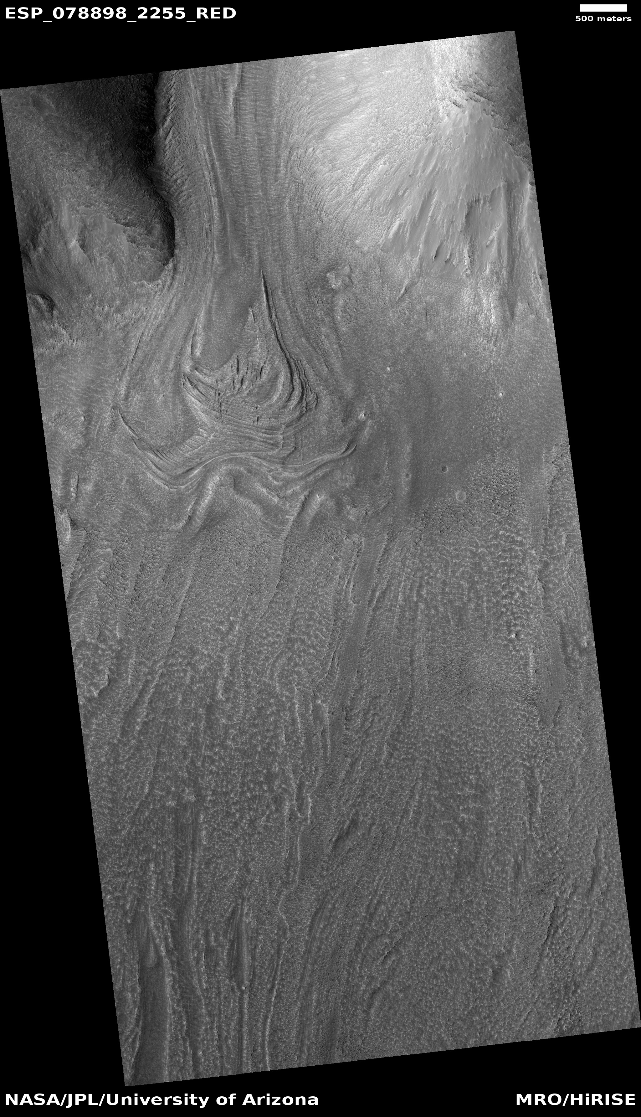
Cool image time! The picture to the right, cropped, reduced, and sharpened to post here, was taken on June 2, 2023 by the high resolution camera on Mars Reconnaissance Orbiter (MRO), and shows one small area in Martian equatorial regions where the main features are a dusty plain interspersed with craters, not entirely dissimilar to the Moon .
In the picture the northwest-to-southeast orientation of ridge-lines, plus the position of divots with their steep and deep end all on the northwest side, all suggest the prevailing winds here blow in the same direction, from the northwest to the southeast.
We are looking at a very ancient terrain. Many of these craters likely date from the early bombardment period of the solar system, just after the planets had formed but there was still a lot of objects around crashing into them.
» Read more

Click for original image.
Cool image time! The picture to the right, cropped, reduced, and sharpened to post here, was taken on June 2, 2023 by the high resolution camera on Mars Reconnaissance Orbiter (MRO), and shows one small area in Martian equatorial regions where the main features are a dusty plain interspersed with craters, not entirely dissimilar to the Moon .
In the picture the northwest-to-southeast orientation of ridge-lines, plus the position of divots with their steep and deep end all on the northwest side, all suggest the prevailing winds here blow in the same direction, from the northwest to the southeast.
We are looking at a very ancient terrain. Many of these craters likely date from the early bombardment period of the solar system, just after the planets had formed but there was still a lot of objects around crashing into them.
» Read more


