
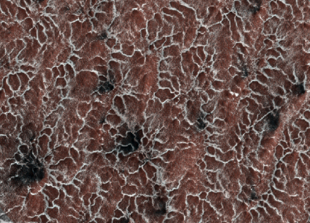
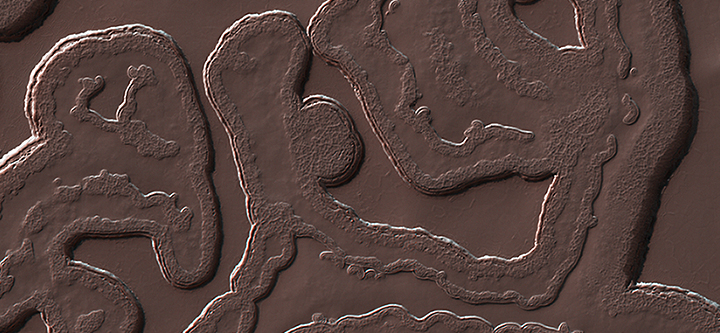
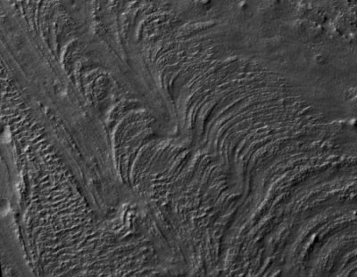
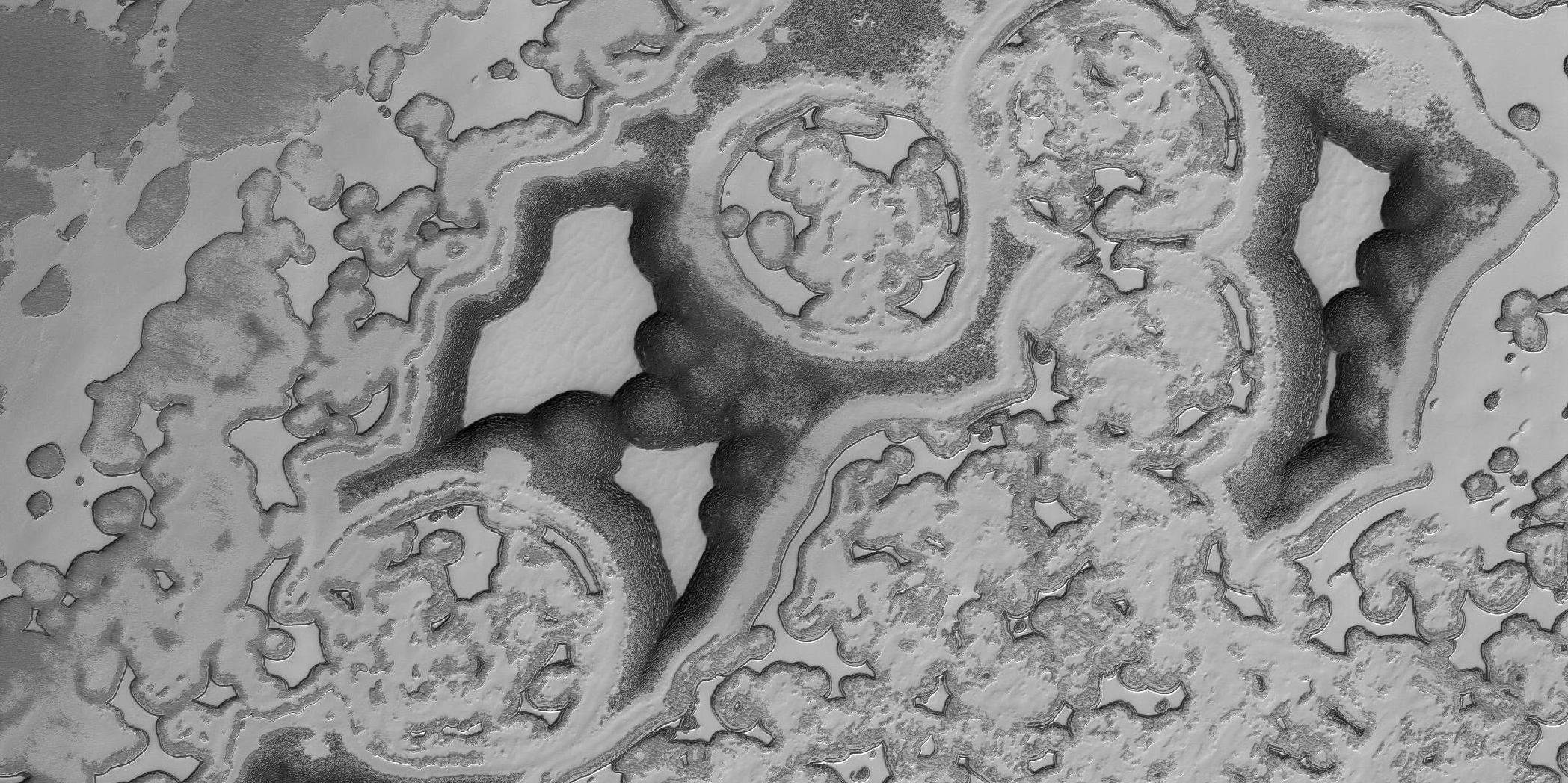
Mars or a bacterial cell?
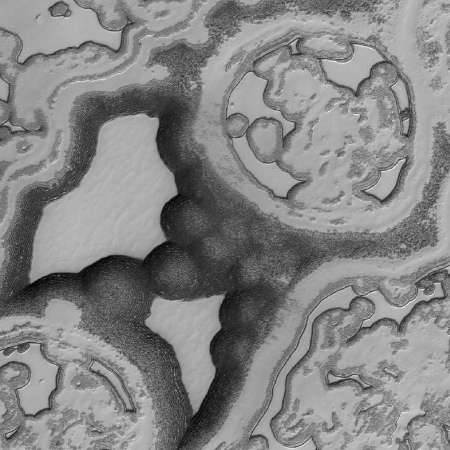
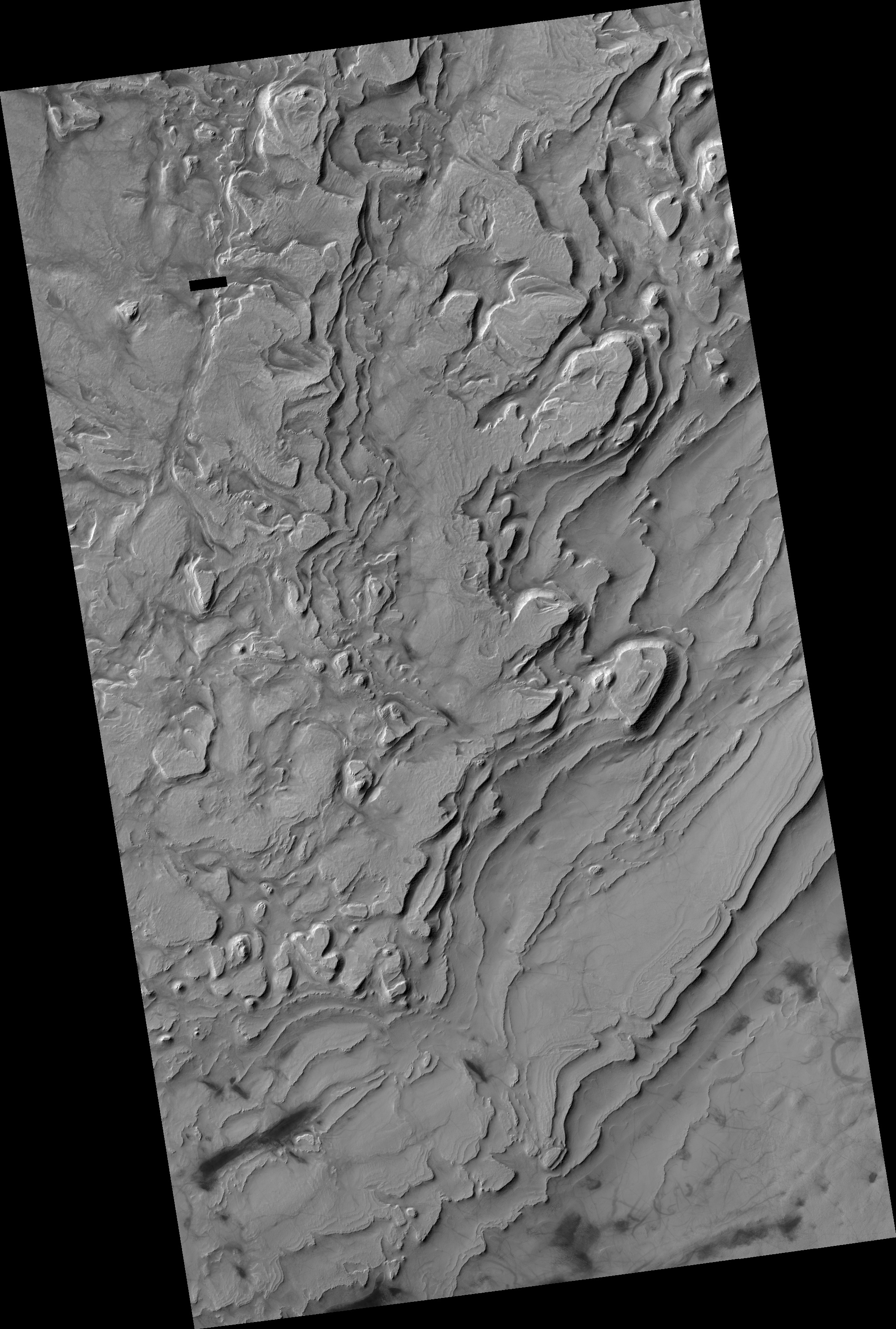
Cool image time! The image on the right, reduced and cropped to show here, was taken by Mars Reconnaissance Orbiter and shows just one spot in Mars’s southern polar regions. The surface only looks like bacteria because the basic structure of both is based on fractals. Scientists call this area “swiss-cheese terrain” because of the many holes that have opened up there.
The texture is very alien, bearing more of a resemblance to the universe of the very small, rather than the universe far, far away. But if this is a polar cap, then why does it not look like the polar caps on Earth? Indeed, there is no equivalent terrain observed here on Earth.
The so-called “Swiss cheese terrain,” referencing the numerous holes of the region, is a product of seasonal exchange between the surface and the Martian atmosphere. With a predominantly carbon dioxide content at 98 percent, the colder temperatures condense the gas out of the atmosphere to produce dry ice. The prevalence of water is more concentrated in the north, leaving the South polar region more carbon dioxide rich, and it’s this difference in composition that generates the unusual texture of the Swiss cheese terrain.
Be sure and take a look at the full resolution image. It is quite wild.