
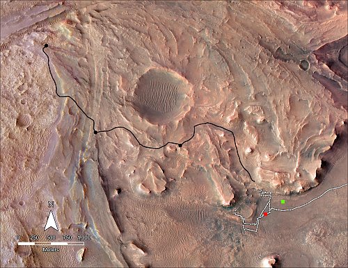
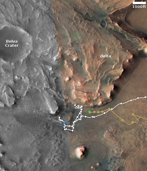
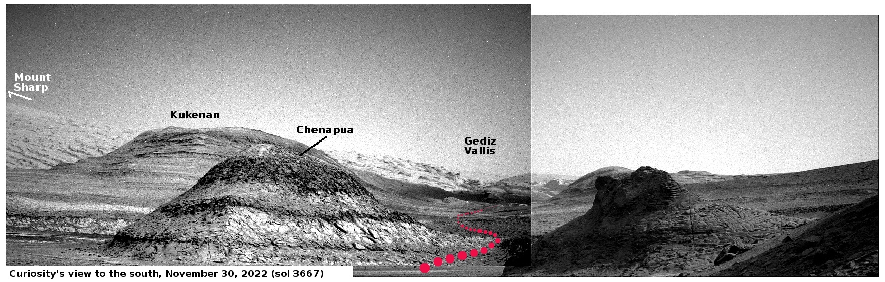
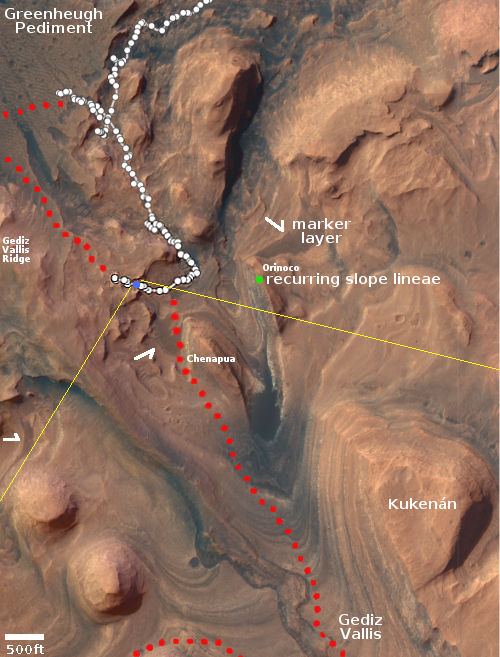
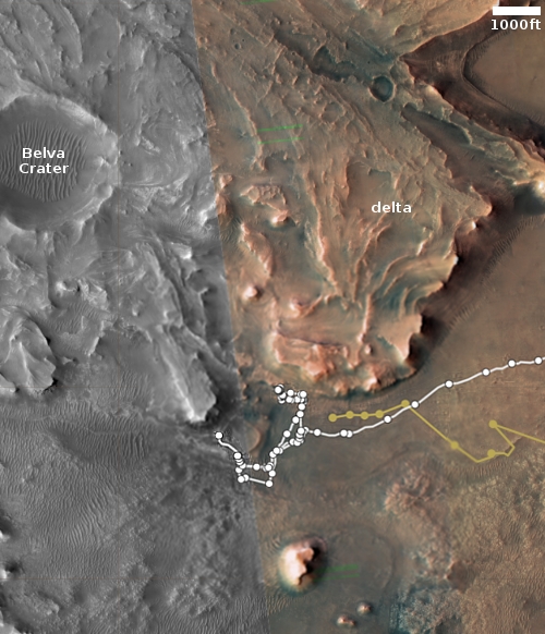
Perseverance’s planned route up onto the Jezero Crater delta
Click for original image.
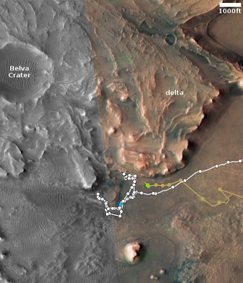
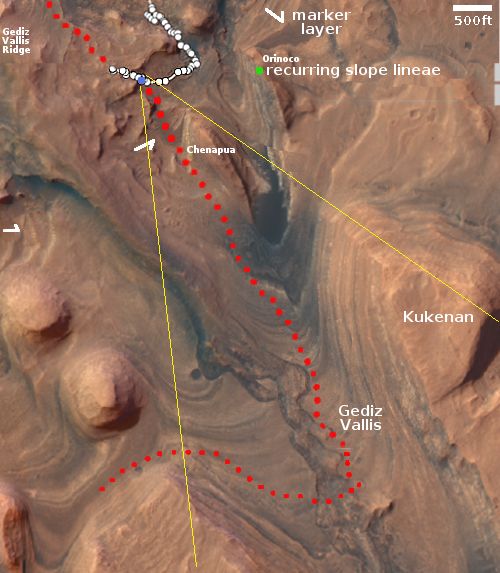
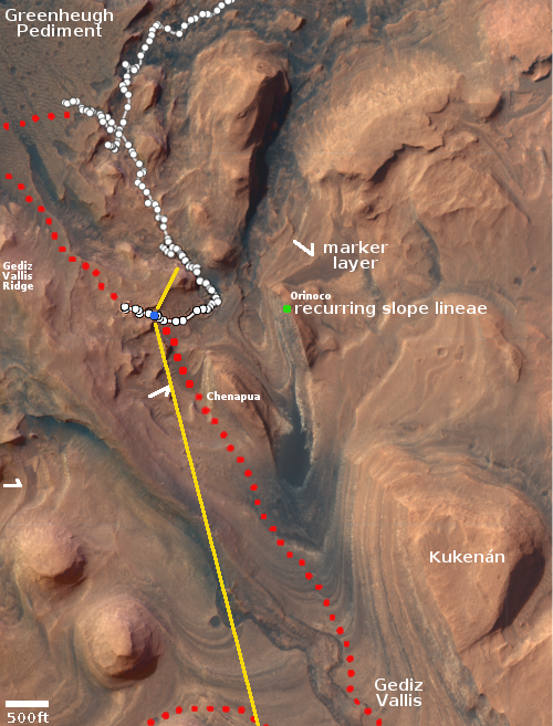
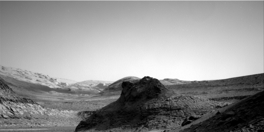
Even as the Perseverance science team prepares to cache the ten first core samples on the surface of Mars for later pickup by a future Mars helicopter for return to Earth, they have also released the planned route they intend to follow as they drive the rover up onto the delta that flowed into Jezero Crater in the distant past.
The black line on the map to the right shows that route, with the black dots indicating points in which further core samples will likely be taken. The red dot indicates Perseverance’s present position, with the white line indicating its past travels. The green dot marks Ingenuity’s present position.

Click for original image.
Even as the Perseverance science team prepares to cache the ten first core samples on the surface of Mars for later pickup by a future Mars helicopter for return to Earth, they have also released the planned route they intend to follow as they drive the rover up onto the delta that flowed into Jezero Crater in the distant past.
The black line on the map to the right shows that route, with the black dots indicating points in which further core samples will likely be taken. The red dot indicates Perseverance’s present position, with the white line indicating its past travels. The green dot marks Ingenuity’s present position.
