
An avalanche in the West Virginia of Mars
Click for original image.
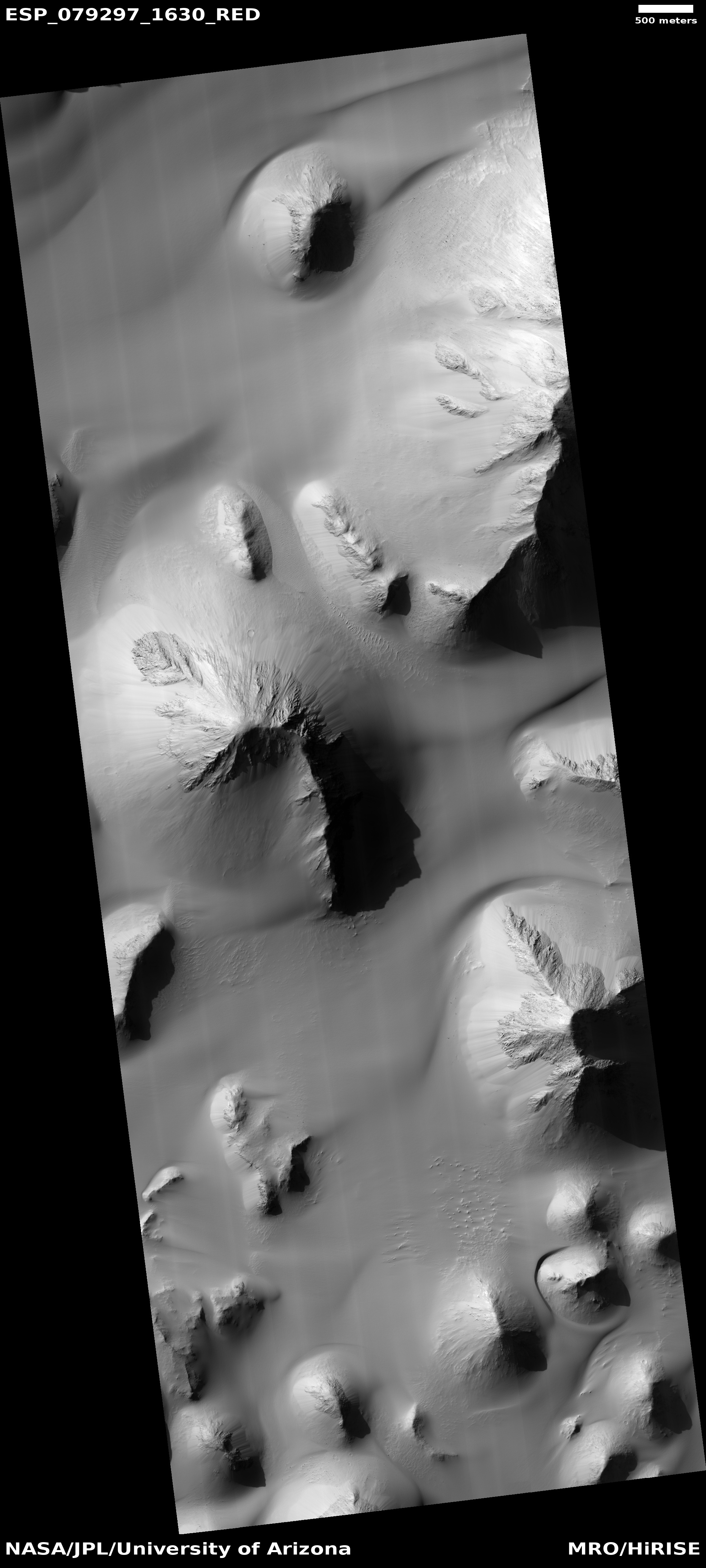
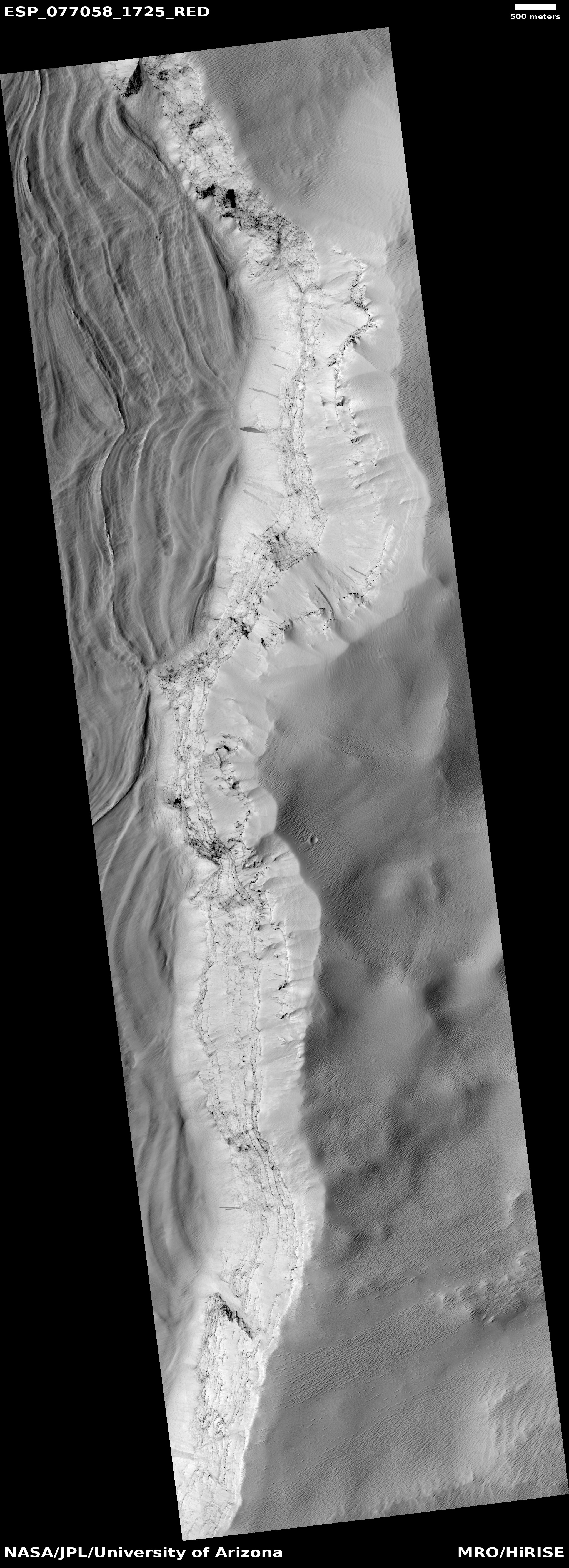
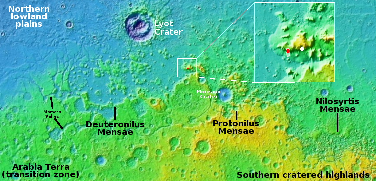
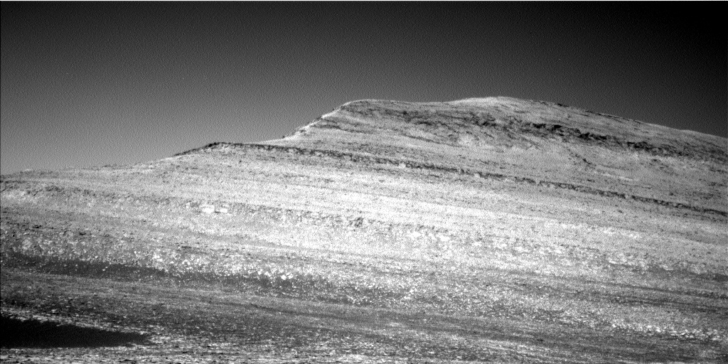
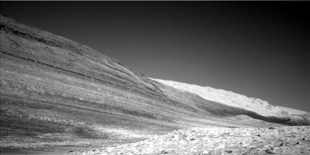
Cool image time! The picture to the right, rotated, cropped, and reduced to post here, was taken on June 27, 2023 by the high resolution camera on Mars Reconnaissance Orbiter (MRO).
I have cropped it to focus on this one hill, about 900 feet high (though the elevation data from MRO is somewhat uncertain at this resolution), because of that major landslide on its northern slopes. At some point in the past a major piece of the exposed bedrock at the top broke off and slide about halfway down the mountain, almost as a unit, settling on the alluvial fill that comprises the bottom half of the hill’s flanks.
The bedrock surrounding the peak is also of interest because of its gullies, all of which were created by downward flowing material. Was it ice? Water? Sand? Or maybe a combination of two or three? If water or ice was involved it was a very long time ago, as this location is in the dry equatorial regions of Mars. There is little known near-surface ice here.
» Read more


