
Frozen lava rapids on Mars
Click for original image.
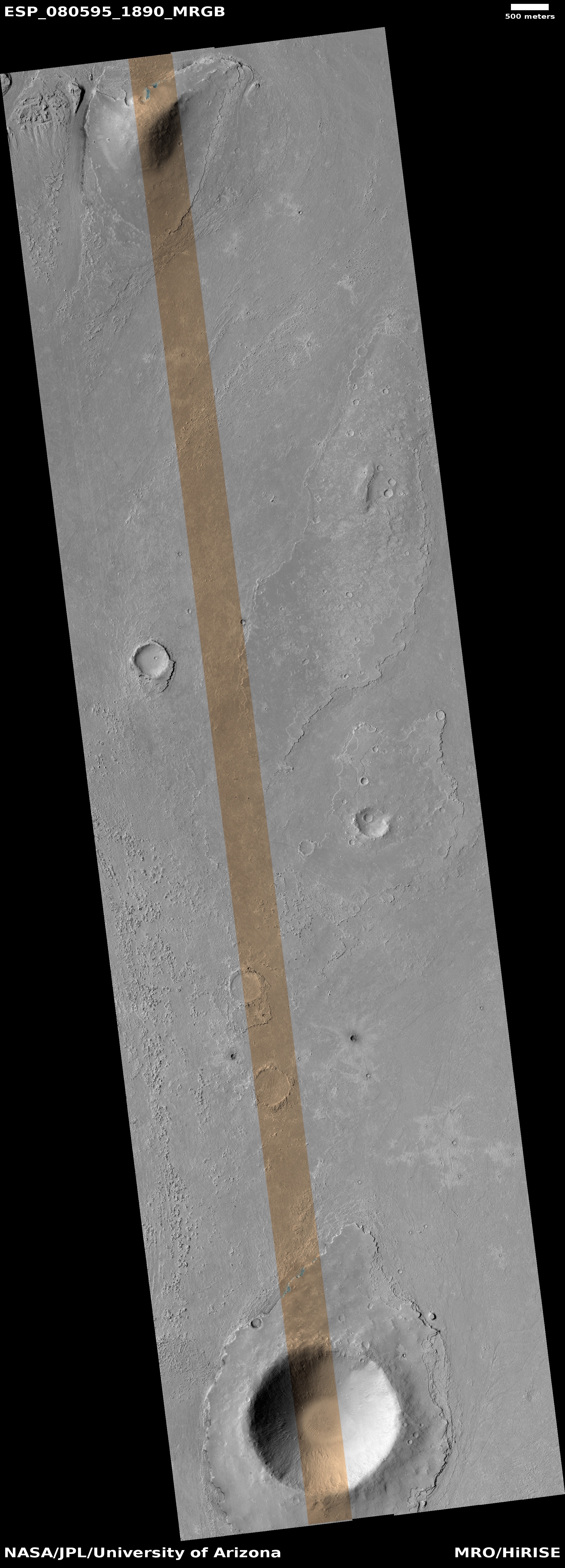
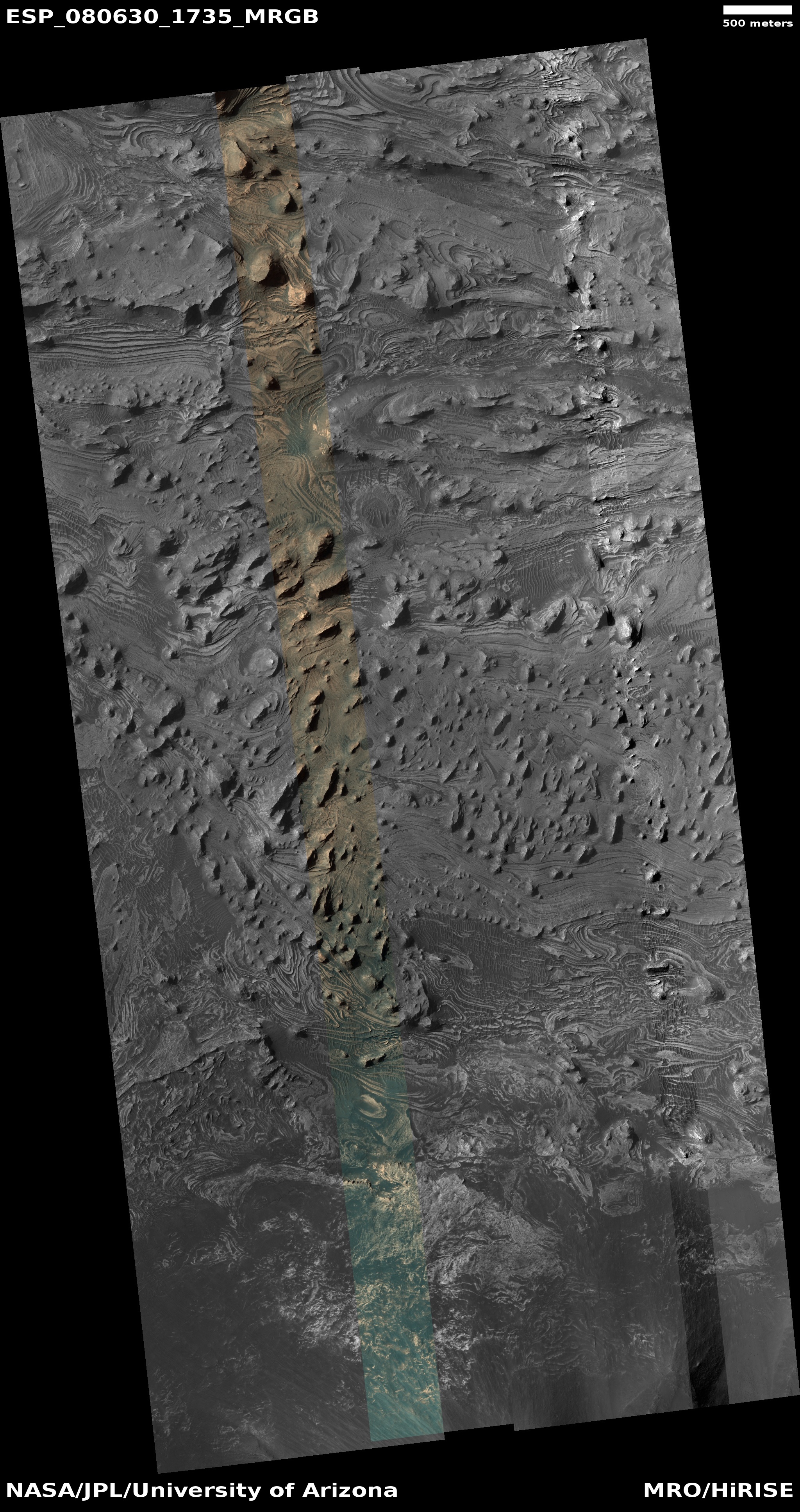
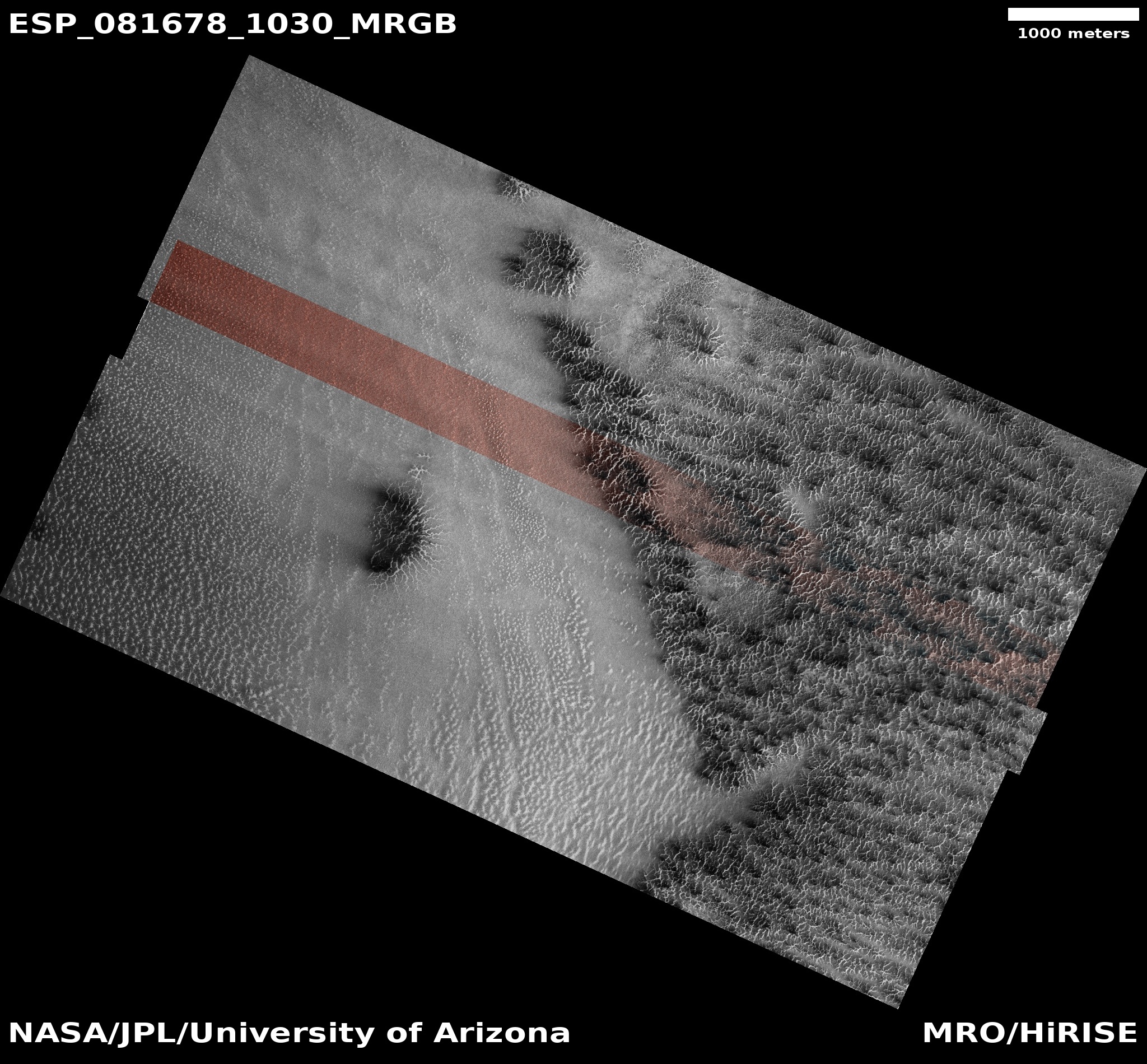
Cool image time! The picture to the right, rotated, cropped, reduced, and sharpened to post here, was taken on October 6, 2023 by the high resolution camera on Mars Reconnaissance Orbiter (MRO), and shows a spot on Mars where lava was squeezed between and around some small peaks as it flowed quickly south, flooding all the low areas in this landscape.
The science team describes the features in the full image as “streamlined”, a description that is literally accurate. As this “stream” of lava rushed past, it “lined” the higher terrain, carving it into tear-dropped shapes.
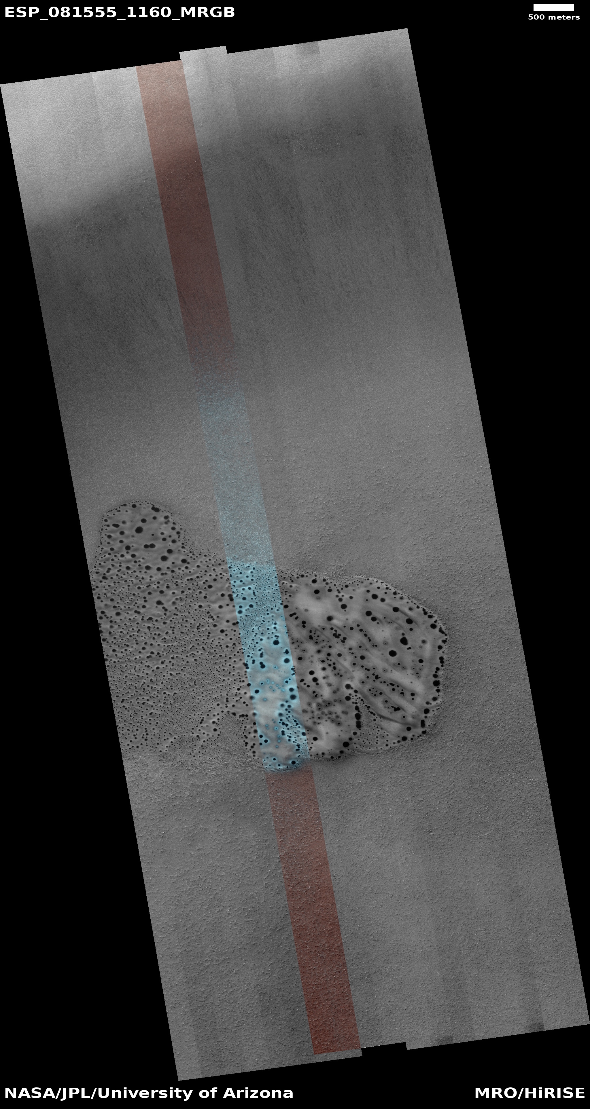
In the color strip, note the blueish spots at the northern base of the 400-foot-high hill. According to the science team’s explanation [pdf] of the colors in MRO images, “Frost and ice are also relatively blue, but bright, and often concentrated at the poles or on pole-facing slopes.” The picture was taken in summer, so if these bright spots are frost or ice, it suggests they are well shaded from sunlight in those north-facing alcoves. This location is only 9 degrees north of the equator, so finding any near surface ice here is highly unlikely. That frost might exist however is intriguing, to say the least.
» Read more

