
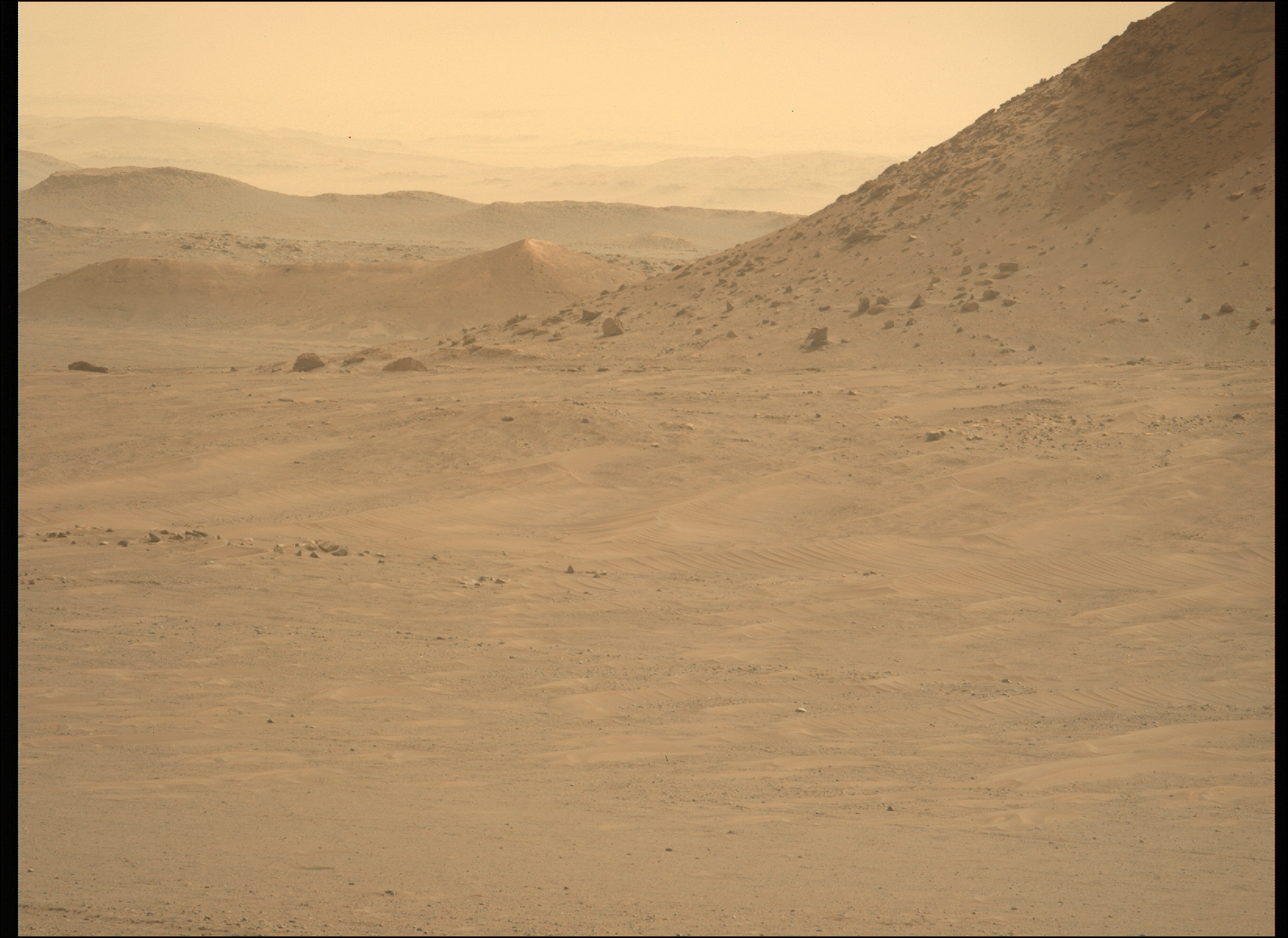
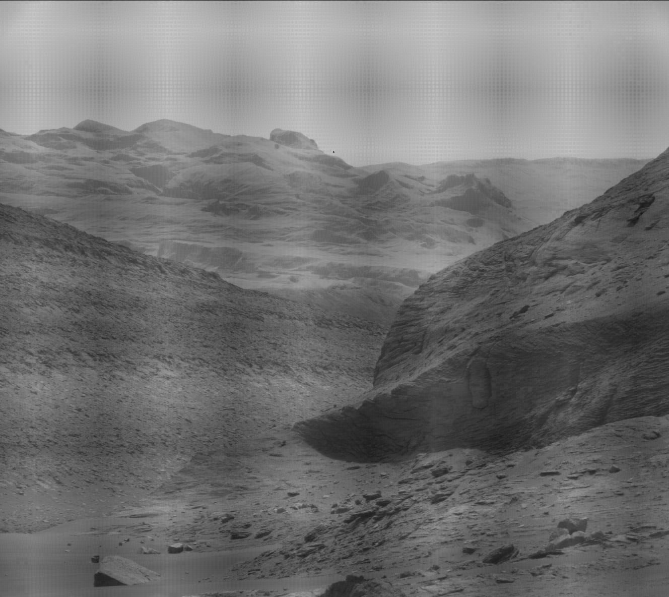
Martian terraces
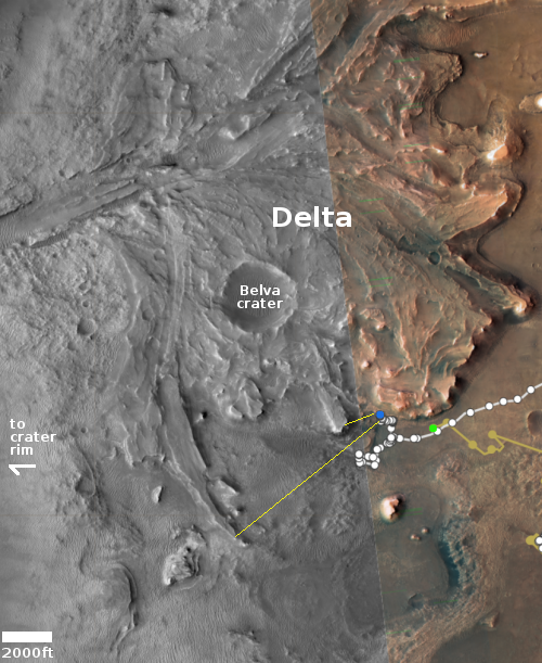
Glacier country on Mars
Click for full image.
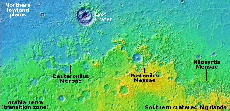
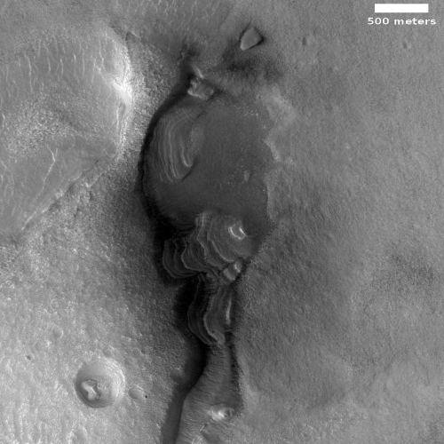
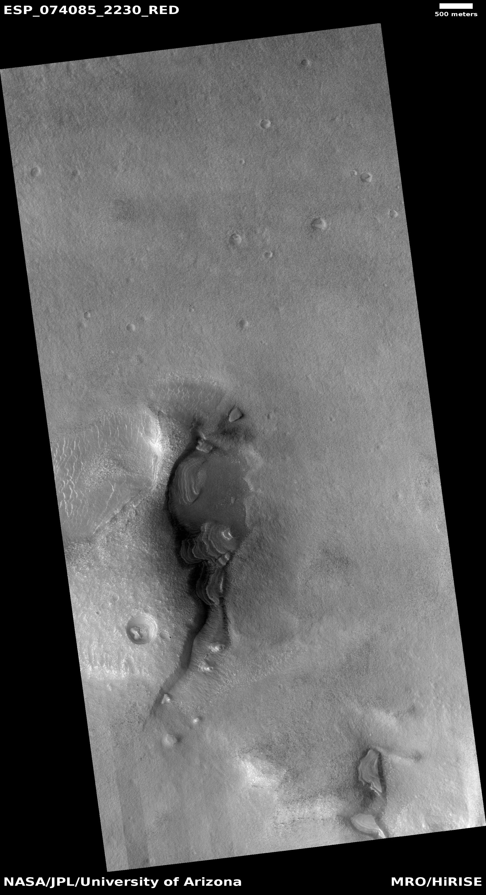
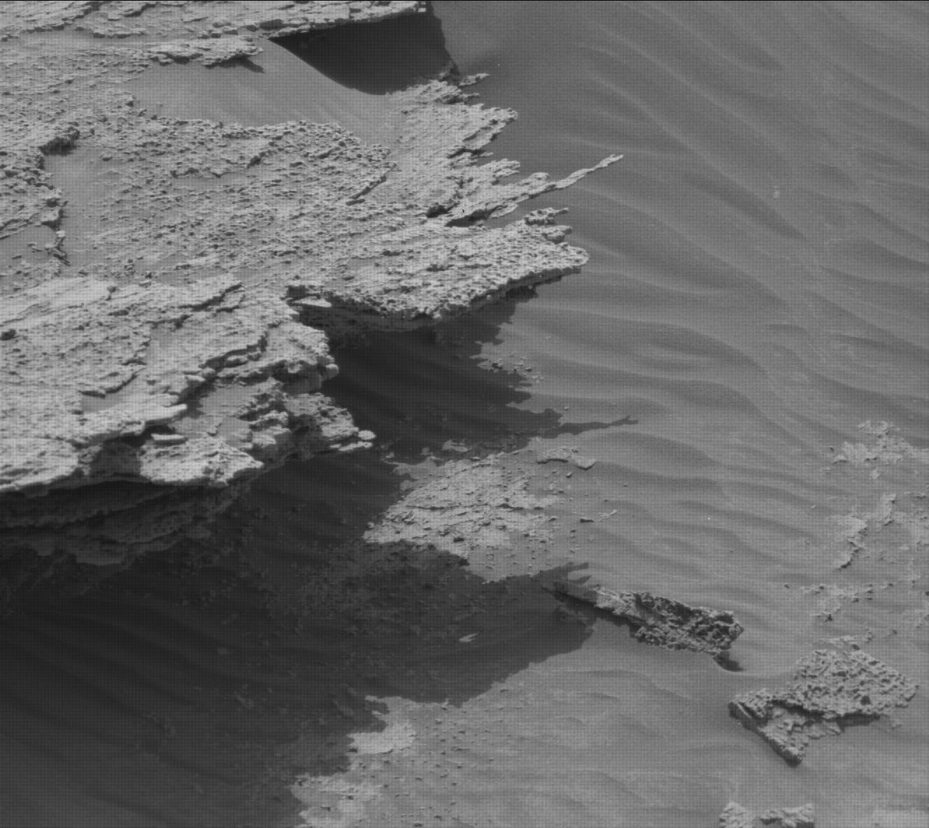
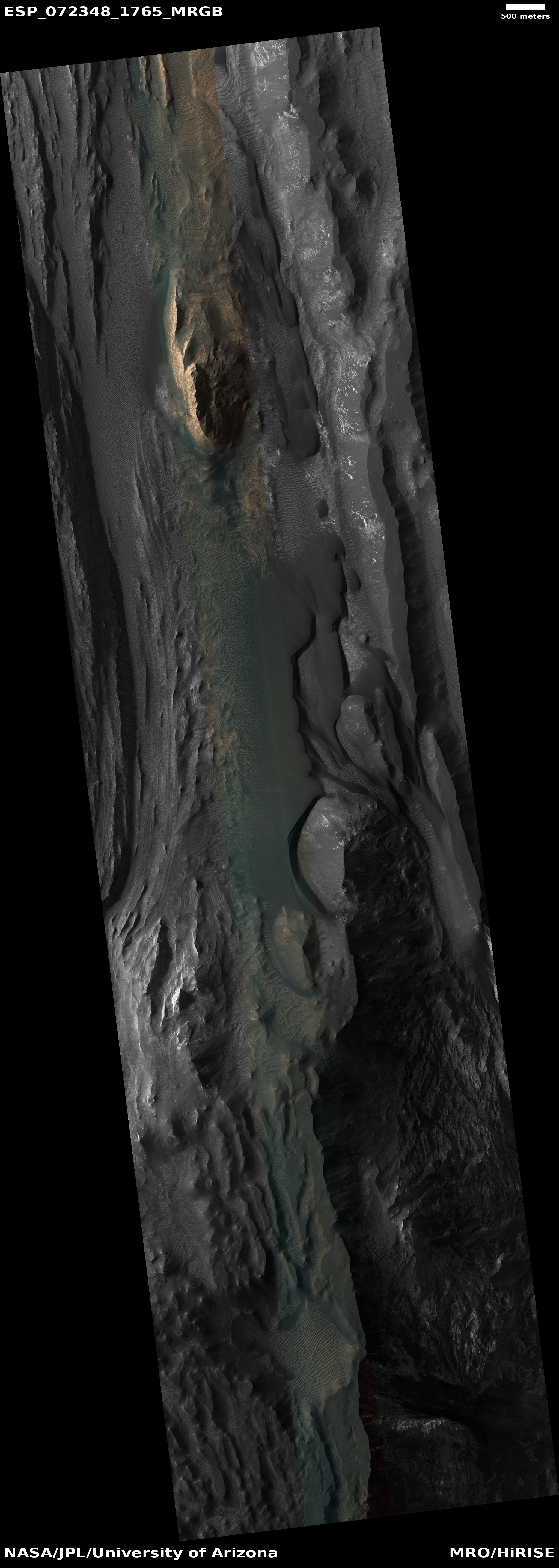
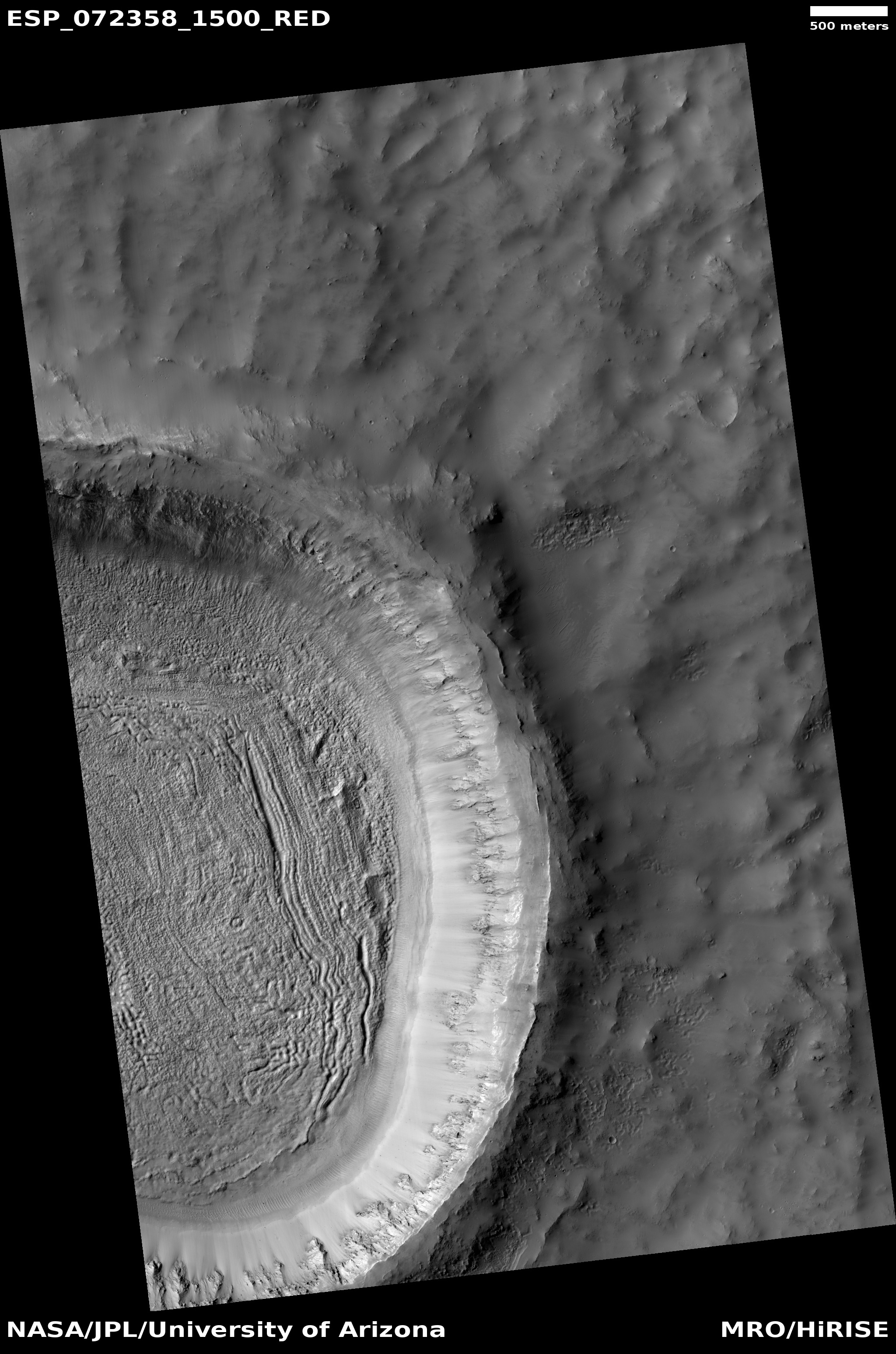
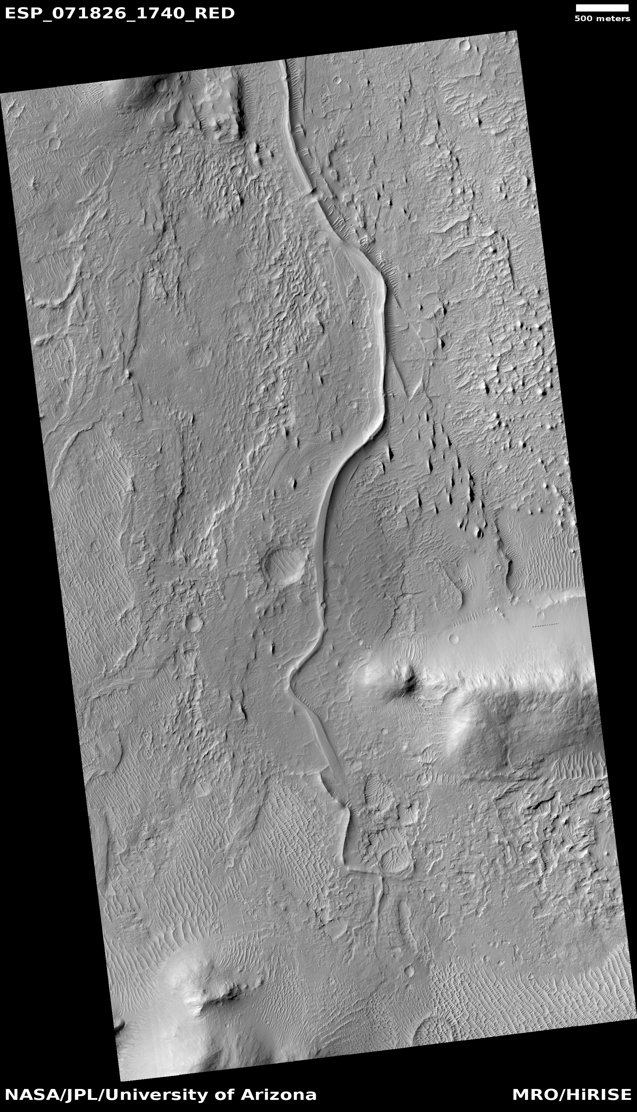
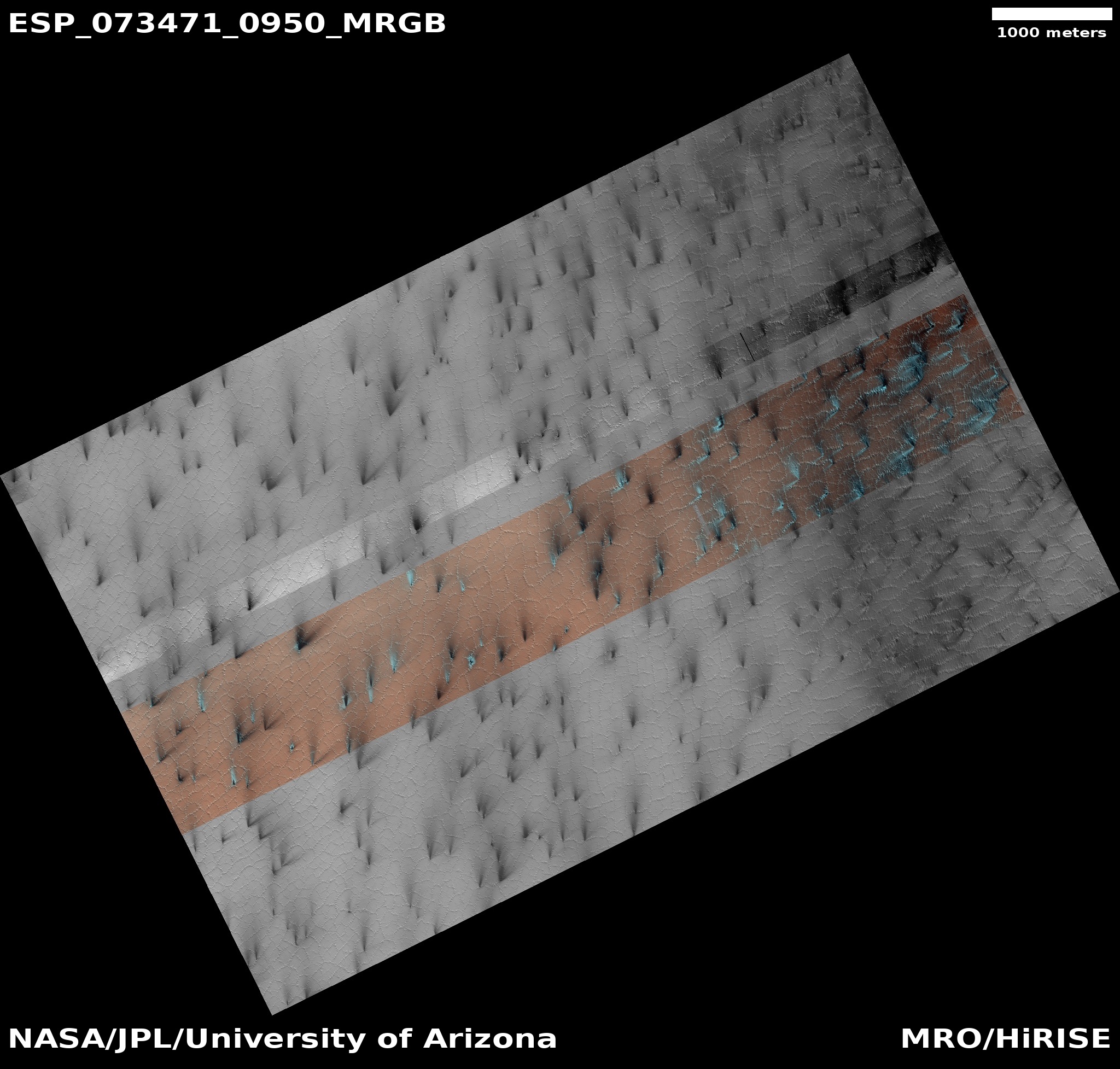
Cool image time! The photo to the right, cropped and reduced to post here, was taken on May 17, 2022 by the high resolution camera on Mars Reconnaissance Orbiter (MRO). It shows what the scientists have labeled “Dipping layers against mound in Deuteronilus Mensae.”
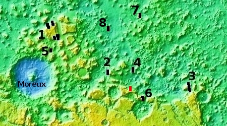
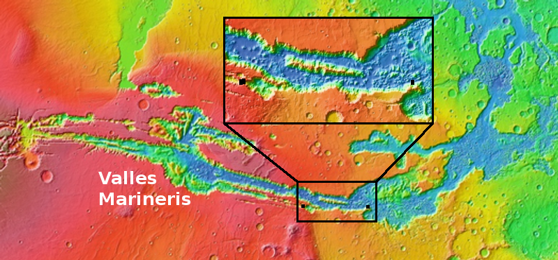
Deuteronilus is the westernmost mensae region in the 2,000-mile-long strip of heavy glaciers found in the northern mid-latitudes that I dub glacier country. This photo, the location of which is marked by the white cross on the overview map above, is another example, though somewhat strange and puzzling. Normally the layers will dip away from the high point. Here, the layers dip towards the mound. I can think of only one explanation, that of prevailing winds causing the erosion in this unusual manner, but I also find that explanation very unsatisfactory.
The layers themselves illustrate the cycles that have shaped Martian geology, caused by the wide swings in the planet’s rotational tilt, from 11 to 60 degrees. When that tilt is high, the poles are warmer than the mid-latitudes, and water ice migrates from the poles towards the equator. When the tilt is low, the mid-latitudes are warmer, and the water ice heads back towards the poles. Thus, the many many layers the orbiters and rovers are now finding everywhere on Mars.
Right now scientists think, because Mars’ tilt is in the middle of these swings at 25 degrees, the planet is in equilibrium, with the water at the poles and mid-latitudes essentially going no where. This conclusion however is not yet confirmed.
Glacier country on Mars
Click for full image.
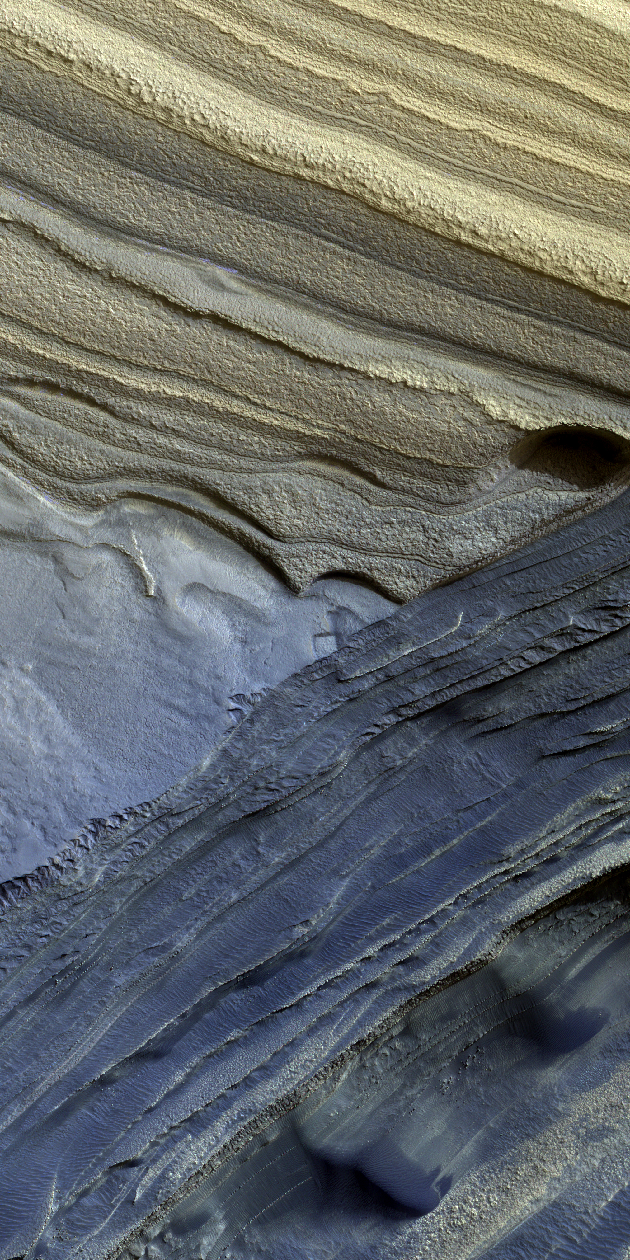
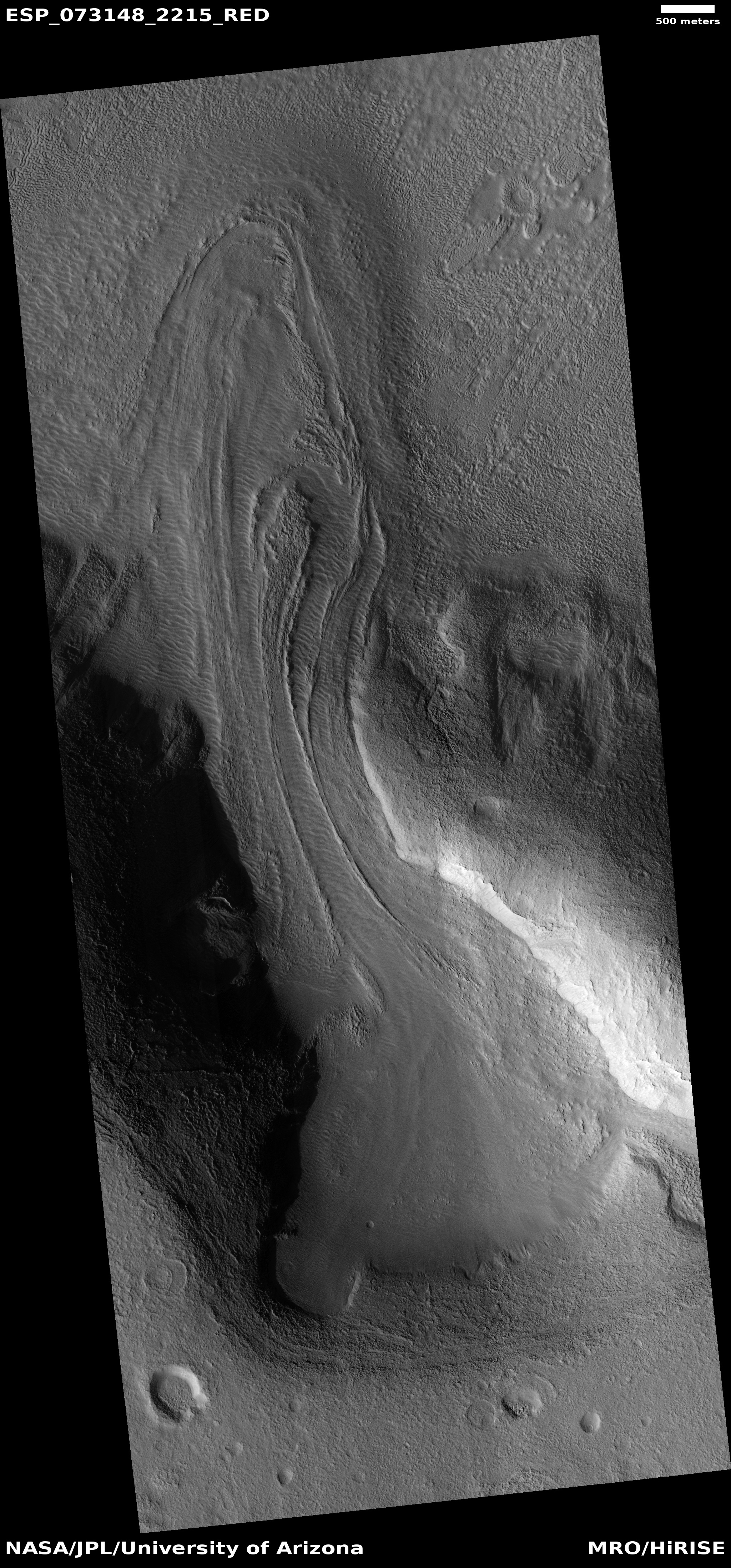
Cool image time! The photo to the right, cropped and reduced to post here, was taken on May 17, 2022 by the high resolution camera on Mars Reconnaissance Orbiter (MRO). It shows what the scientists have labeled “Dipping layers against mound in Deuteronilus Mensae.”
Deuteronilus is the westernmost mensae region in the 2,000-mile-long strip of heavy glaciers found in the northern mid-latitudes that I dub glacier country. This photo, the location of which is marked by the white cross on the overview map above, is another example, though somewhat strange and puzzling. Normally the layers will dip away from the high point. Here, the layers dip towards the mound. I can think of only one explanation, that of prevailing winds causing the erosion in this unusual manner, but I also find that explanation very unsatisfactory.
The layers themselves illustrate the cycles that have shaped Martian geology, caused by the wide swings in the planet’s rotational tilt, from 11 to 60 degrees. When that tilt is high, the poles are warmer than the mid-latitudes, and water ice migrates from the poles towards the equator. When the tilt is low, the mid-latitudes are warmer, and the water ice heads back towards the poles. Thus, the many many layers the orbiters and rovers are now finding everywhere on Mars.
Right now scientists think, because Mars’ tilt is in the middle of these swings at 25 degrees, the planet is in equilibrium, with the water at the poles and mid-latitudes essentially going no where. This conclusion however is not yet confirmed.


