
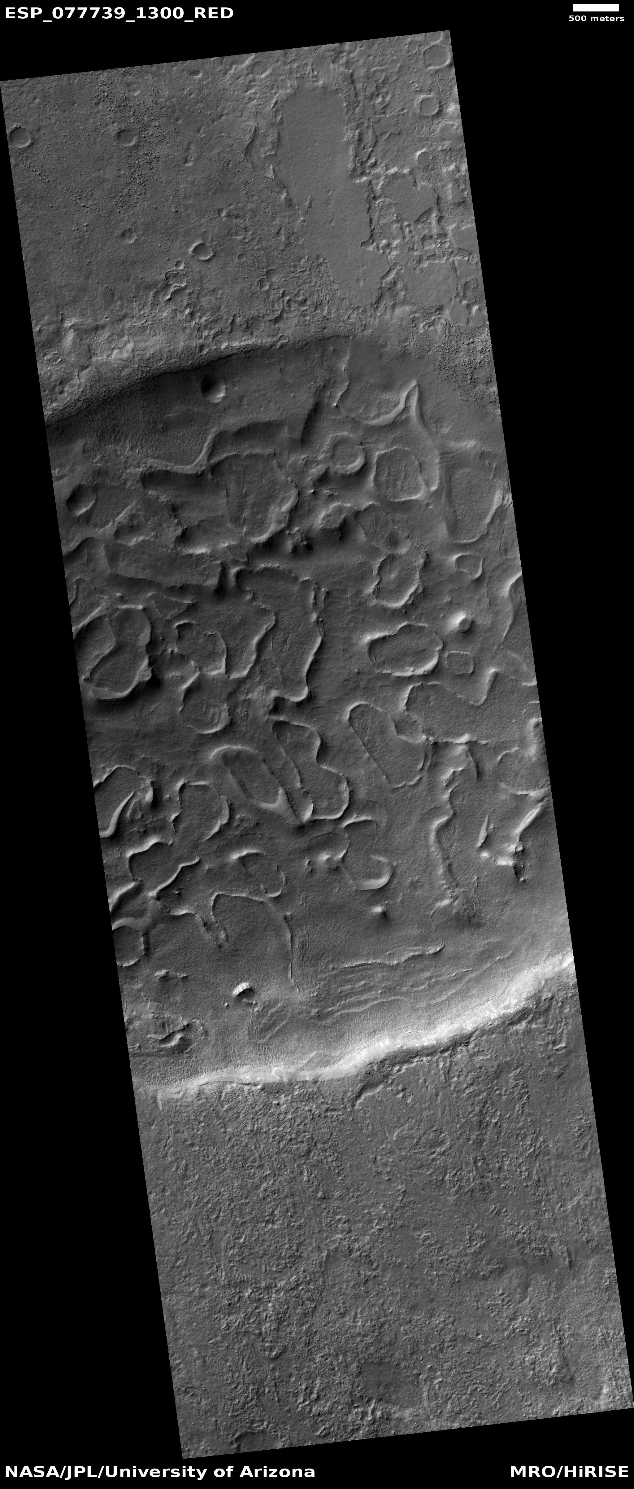
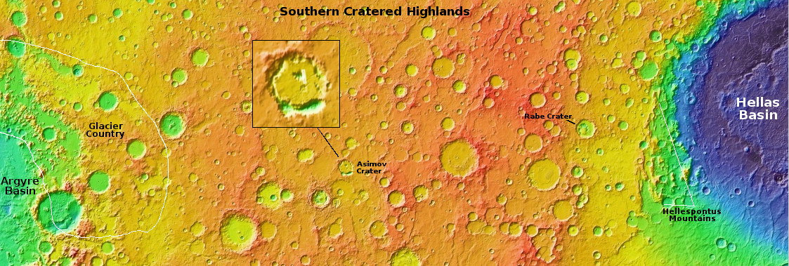
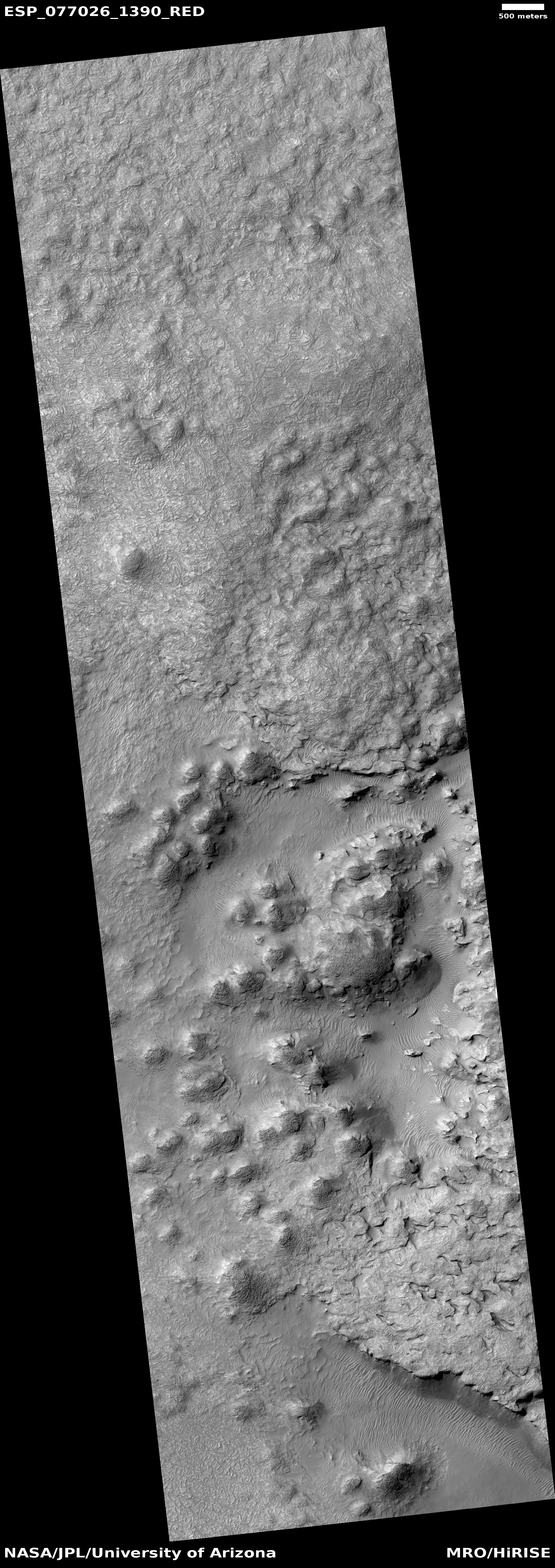
The peeling floor of a crater in the southern cratered highlands
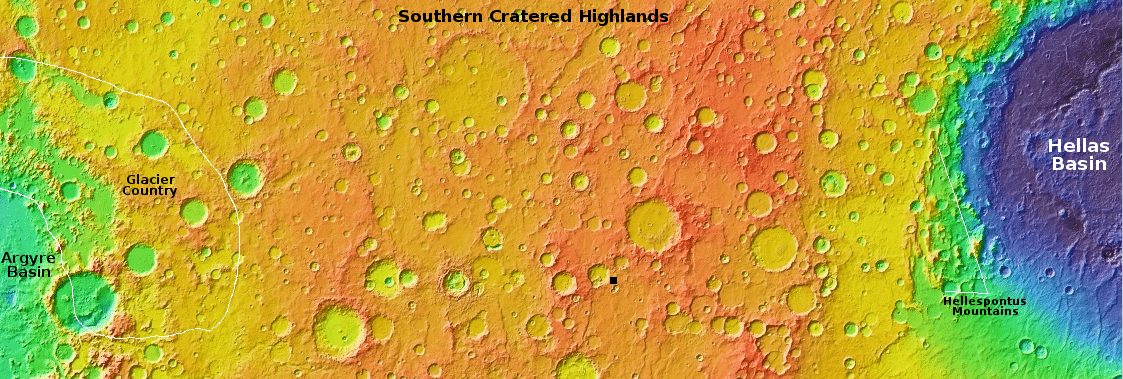
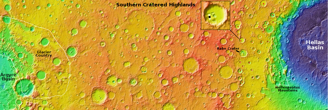
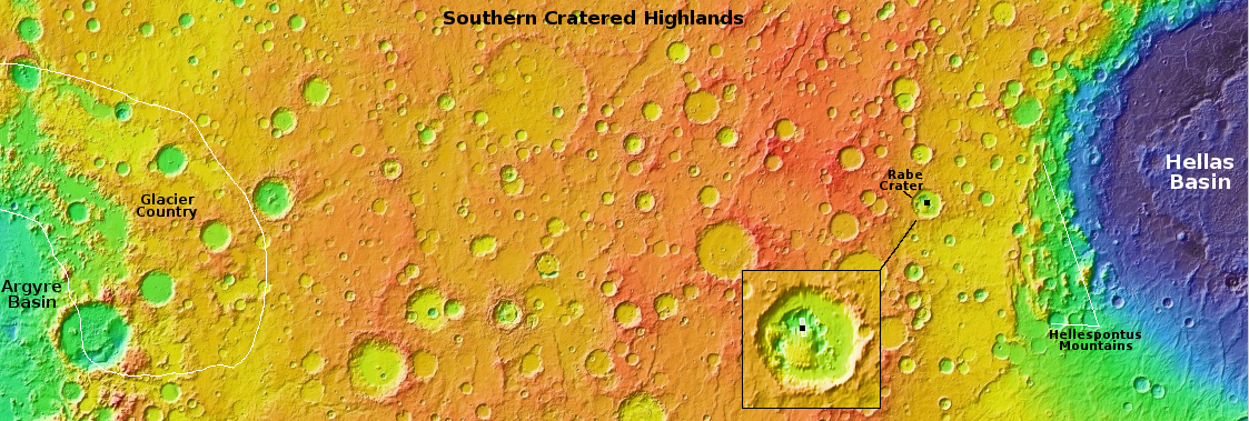
From Argyre Basin to Hellas Basin is about 7,000 miles.
Click for original image.
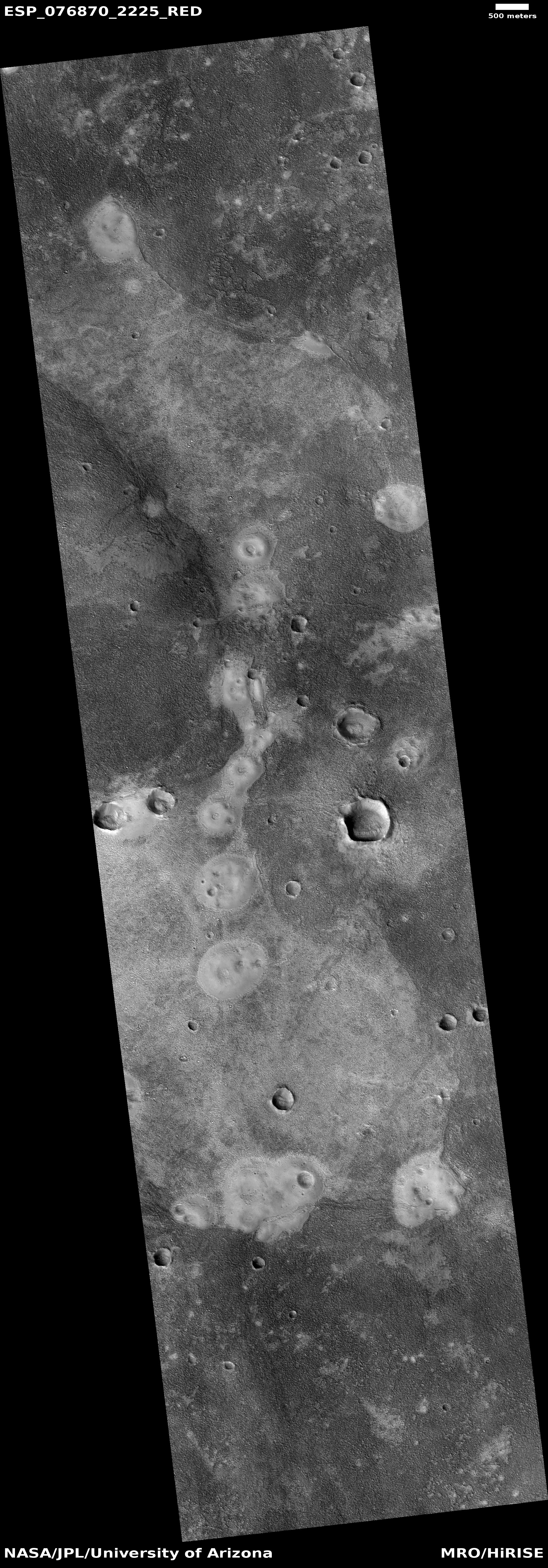
Cool image time! The picture to the right, rotated, cropped, reduced, and sharpened to post here, was taken on February 25, 2023 by the high resolution camera on Mars Reconnaissance Orbiter (MRO).
The scientists labeled this image “Crater fill”, but that hardly suffices. First, the fill appears at first glance to resemble peeling paint. At closer inspection, rather than peeling paint we have instead a collection of ridges vaguely resembling cave rimstone dams that either enclose a blob-shaped region or simply meander about until they reach the crater’s interior rim.
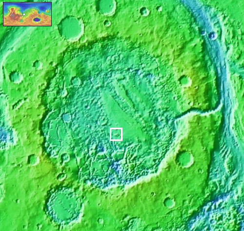
The crater interior itself appears largely filled with material so that its rims are subdued. The location, as indicated by that black dot near the center of the overview map above, marks the location at 49 degrees south latitude, in the middle of the cratered southern highlands of Mars where many craters have strangely eroded interiors.
What makes this crater however more puzzling is that none of the surrounding nearby craters look like this. A context camera image taken March 23, 2019 shows that while some of the nearby craters have what appears to be glacial material in their interiors, none exhibit these meandering ridges. This crater stands unique, for reasons that are utterly unknown.
Are these ridges a manifestation of the glacial material filling the crater? Or are they bedrock sticking up through that glacial debris? Your guess is as good as mine.


