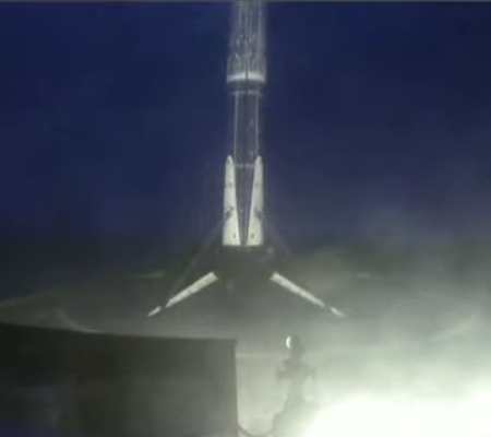
New problem found on Orion that could delay its launch by a year

The failure of a power unit on the Orion capsule slated to fly on SLS’s first test flight late in ’21 could delay that test flight by as much as an additional year.

Replacing the PDU isn’t easy. The component is difficult to reach: it’s located inside an adapter that connects Orion to its service module — a cylindrical trunk that provides support, propulsion, and power for the capsule during its trip through space. To get to the PDU, Lockheed Martin could remove the Orion crew capsule from its service module, but it’s a lengthy process that could take up to a year. As many as nine months would be needed to take the vehicle apart and put it back together again, in addition to three months for subsequent testing, according to the presentation.

Lockheed has another option, but it’s never been done before and may carry extra risks, Lockheed Martin engineers acknowledge in their presentation. To do it, engineers would have to tunnel through the adapter’s exterior by removing some of the outer panels of the adapter to get to the PDU. The panels weren’t designed to be removed this way, but this scenario may only take up to four months to complete if engineers figure out a way to do it.

A third option is that Lockheed Martin and NASA could fly the Orion capsule as is. The PDU failed in such a way that it lost redundancy within the unit, so it can still function. But at a risk-averse agency like NASA, flying a vehicle without a backup plan is not exactly an attractive option. It’s still not clear what went wrong inside the unit, which was tested before it was installed on the spacecraft, according to a person familiar with the matter.

None of these options are good. The first two will certainly delay the planned November 2021 launch, which by the way is already four years behind schedule. The third will risk a failure of the mission, which though unmanned would certainly lead to further delays in the manned mission expected one or two years later.

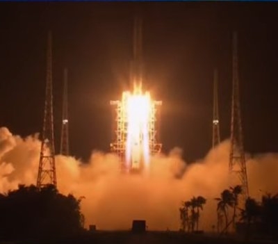
That they don’t know why the unit failed and cannot fix it easily speaks very badly to the design of Orion and SLS. Compare this with SpaceX, which in the past month has demonstrated it can in only days switch out engines on both its commercial Falcon 9 rocket and its new next generation Starship rocket. Moreover, SpaceX has demonstrated repeatedly that once they identify an issue they move immediately to understand it and fix it.

With NASA, Orion, and Orion’s contractor Lockheed Martin, such flexibility and agility appears all but impossible. They have designed a monster that cannot be fixed easily, cannot launched quickly, and costs an ungodly amount of money.

I increasingly believe that Starship will reach orbit before SLS/Orion, even though the latter has been in development for almost three times longer, and will cost 25 times more.

13 comments

A place on Mars where lakes, snowfall, and rivers once existed

Inverted channels near Juventae Chasma
Click for full image.

Cool image time! The photo to the right, cropped and enhanced to post here, attracted my immediate interest when I was going through the November image dump from Mars Reconnaissance Orbiter (MRO) because of its meandering sharp ridges, estimated to be about sixty feet high on average. While I have previously posted MRO images of inverted channels such as these, their particular sharpness, plus their large number in this localized single image, aroused my curiosity. What is their history? Does this illustrate an particularly interesting place on Mars?

The picture itself was taken was on September 29, 2020 by MRO’s high resolution camera. The blue areas in the color strip probably indicate coarser-grained surface. This makes sense, as these ridges are believed to have been initially carved as channels by flowing water or ice, which compressed their riverbed and thus made it resistant to erosion. Over time, the surrounding terrain eroded away, leaving that channel behind now as a upstanding ridge. The surrounding eroded terrain should thus be expected to be rougher.

Where did the water for these rivers come from, however? As always, the overview maps below give the context, and a possible explanation.
» Read more

2 comments

Eroded and possibly wet Lohse Crater

Gully flow near central peak of Lohse Crater on Mars
Click for full image.

Cool image time! Today we take a look at one particular 100-mile-wide crater, Lohse Crater, located in the southern cratered highlands on Mars. The photo to the right, cropped and reduced to post here, focuses in on one of the many eroding gullies found in the mountainous region surrounding the crater’s central peak. Taken on August 20, 2020 by the high resolution camera on Mars Reconnaissance Orbiter (MRO), the full image is centered on that central peak, just off the south edge of this cropped section. This new image is part of a long monitoring campaign, begun in 2007, of this central peak region. For more than six Martian years, scientists have been tracking the numerous gullies found throughout the central peak region to see if there have been any changes.

I focused on this specific gully because I think it illustrates well why planetary scientists are monitoring these gullies. Whatever flowed down from the cliff on the left hit the material on the right hard enough and fast enough to imprint a curve into the material on the crater floor. Moreover, it does not appear to have simply been a landslide, for several reasons. First, the cliff does not appear cut back at the flow’s head, as you would expect if a section had broken off. Second, the material in the flow does not look like debris from an avalanche. In fact, there does not appear to be very much debris in the gully at all.

Third, and most important, the flow appears to originate at the cliff base, kind of what you’d expect if there was seepage coming out of a layer in that cliff face. Kind of what you’d expect on Earth, at a spring!

Was that flow water? This is the big question. Lohse Crater is significant in that it was one of the first locations on Mars [pdf] spotted by Mars Global Surveyor in the late 1990s where gullies were found suggesting some form of regular erosion possibly caused by flowing water. As this 2005 paper then concluded,
» Read more

3 comments

Russian company proposes new Russian space station post-ISS

Energia, the division in Roscosmos that manages the Russian manned program, including its share of ISS, has proposed that Russia build its own space station after 2025, and the reasons it gives strongly suggest they are worried about the condition of their 20-year-old and leaking Zvezda module.

The International Space Station’s systems are likely to keep breaking down after 2025, Energia company, which manages the Russian module, said and suggested building a national station instead. “Russia has commitments regarding the ISS through 2025. Several elements are already seriously damaged and about to stop functioning. Many of them are impossible to replace. After 2025, we expect many ISS elements to start breaking down en masse,” the deputy director-general of Energia, Vladimir Soloviev, said at a meeting of the Russian Academy of Sciences. [emphasis mine]

They don’t mention Zvezda by name, but the highlighted words point to it. Assuming the persistent leaks in the module are related to stress damage and age, this statement is recognizing publicly that replacing Zvezda is very difficult, or impossible, and that it is on the verge of complete failure.

Whether Russia has the money or resources to get another station built soon after 2025 is questionable, however. If they do decide to go it alone, I doubt they could launch a replacement before 2030, at the earliest, and likely much later than that.

If they do end the partnership with the U.S., it is unclear what happens to ISS. If the Russians choose to undock their portion of the station it will leave ISS somewhat crippled. It has been my impression that without all of the environmental systems in the Russian half, ISS cannot function. This might no longer be true, and will likely not be true with the planned arrival of Axiom’s private modules by the mid-20s. Timing however of all this remains critical.

6 comments

Giant wind eddies in the sands of Mars

Wind eddies on Mars
Click for full image.

Cool image time! The image to the right, cropped and reduced to post here, was photographed by the high resolution camera on Mars Reconnaissance Orbiter (MRO) on August 5, 2020. It shows a cluster of the crescent-shaped gullies, apparently carved from desert sand by the prevailing winds.

Those prevailing winds here are from the southwest to the northeast. As the wind blows the sand to the east, it hits a more solid object, such as a mountain buried in the sand, which forces the wind and the blown sand to go around, much as water passes a boulder in river rapids. That solid object also causes an eddy to form at its face, the wind forced downward and then around and up, carving out the gullies by lifting the sand at the base of that solid object. The result are these crescent gullies, dubbed blow-outs.

The overview map helps explain why there is so much sand here, enough apparently to bury whole mountains.
» Read more

3 comments

SpaceX sets numerous launch records in placing 60 more Starlink satellites in orbit

Falcon 9 booster landing for a record 7th time

Capitalism in space: SpaceX tonight broke a whole bunch of new launch records in launching another sixty Starlink satellites into orbit using its Falcon 9 rocket.

First, the leaders in the 2020 launch race:

31 China
22 SpaceX
12 Russia
5 ULA
5 Rocket Lab

The US now leads China 35 to 31 in the national rankings.

For SpaceX, this launch established the following landmarks for the company:
» Read more

9 comments

Regulators coming after SpaceX’s Boca Chica facility and Starship

Capitalism in space? New FAA documents suggest that government regulators are not happy with the rapid and spectacular development by SpaceX of its Super Heavy/Starship rocket at Boca Chica, Texas, and are eager to impose restrictions and delays.

The issue revolves around revisions to SpaceX’s original FAA approval for its work at Boca Chica because the company has switched from flying Falcon 9 and Falcon Heavy rockets to developing and flying Starship and Super Heavy. While the FAA has been cooperative in issuing the necessary revisions, other agencies have raised red flags.

But the most important document of the bunch is the written reevaluation signed by the FAA on May 22. The file spans 26 pages, was required for SpaceX to receive its suborbital launch license from the FAA on May 28, and incorporates concerns from state and federal environmental agencies.

In the reevaluation, the Texas Parks and Wildlife Department and the US Fish and Wildlife Service took issue with several aspects of SpaceX’s plans and ongoing activities. Those criticisms targeted the “fluid nature” of the company’s construction projects, excessive road closures to Boca Chica Beach (which Brownsville locals prize), around-the-clock work that may affect nocturnal threatened or endangered species, prototype explosions, and sprawling wildfires the company has triggered.

The FAA responded to each concern in the document, ultimately determining “there are no significant environmental changes, and that all pertinent conditions and requirements of the prior approval have been met or will be met” with SpaceX’s suborbital test-flight plans.

However, SpaceX does not yet have the FAA’s go-ahead to launch any Starships to orbit from Boca Chica.

In its replies to concerns noted by other agencies — some of which call for a new EIS [environmental impact statement], which could take years to complete (an eternity in Musk time) — the agency repeatedly noted it is working with SpaceX to draft an “environmental review” of those plans.

Should Joe Biden and the power-hungry and controlling Democrats take control of the executive branch of the federal government, expect the FAA’s desire to help SpaceX to quickly end.

27 comments

Faulty valve on one Soyuz causes Russians to delay second Soyuz launch

Due to the discovery of a faulty valve on a Soyuz rocket being prepared for launch in French Guiana, Roscosmos has delayed today’s Soyuz rocket launch from Plesetsk, Russia, until December 3rd to allow engineers to inspect similar valves on that rocket.

This quote from Dmitry Rogozin, head of Roscosmos, from the first link, describing the problem, is somewhat amusing:

“The ‘faulty valve’ would be launched with the rocket, and it would return to Earth being just a heap of mishap metal, that would be the problem. There are always some flaws, but in our case, they cost too much. Happily, the low-quality detail was timely detected by the quality control system. However, in general, I do note a sharp decline in our suppliers’ responsibility and quality of their work,”

It appears the quality control problems with Russia’s aerospace industry are continuing. No one, including the Russians, should be surprised by this, as that industry has no competition to stimulate quality work and force bad companies out of business. Instead, everything is managed by Roscosmos from on top, with much of that management designed to eliminate competition entirely and protect the companies that presently exist..

0 comments

China successfully launches its Chang’e-5 lunar sample mission

screen capture at Long March 5 launch of Chang'e-5
Screen capture from launch live feed

The new colonial movement: China today successfully used its Long March 5 rocket to launch its Chang’e-5 on the first lunar sample return mission since the 1970s.

If all goes well, the return capsule will return to Earth with its sample on December 15th.

China provided a live stream, in English, which I have embedded below the fold.

The leaders in the 2020 launch race:

31 China
21 SpaceX
12 Russia
5 ULA
5 Rocket Lab

The U.S. still leads China 34 to 31 in the national rankings.
» Read more

1 comment

Glacial eddies on Mars?

Glacial eddies on Mars?
Click for full image.

Cool image time! The photo to the right, cropped and reduced to post here, was taken on August 15, 2020 by the high resolution camera on Mars Reconnaissance Orbiter (MRO). It shows a truly strange bunch of blocks beside a clean flow neatly organized in almost straight parallel lines.

What is going on? This location is at 38 degrees south latitude, a latitude where scientists have found a lot of features that resemble water ice glaciers, generally protected from sublimating away by a thin layer of dust and debris.

A first guess is that the smooth glacial flow at the lower right is disturbing the glacial material next to it, causing it to rip apart and break up. At the same time, the hollowed look of these glacial blocks suggests that the ice below that protective debris layer is also slowly sublimating away, causing the surface to sink.

The wider shot below helps confirm this impression.
» Read more

0 comments

SpaceX launches oceanography satellite

Capitalism in space: SpaceX today successfully launched an oceanography satellite using its Falcon 9 rocket from the company’s California launch site at Vandenberg Air Force Base..

The first stage, making its first flight, successfully landed back on land near the launch site.

This was also SpaceX’s 21st successful launch in 2020, tying their record from 2018 for the most launches in a single year by a private company, ever. That record should be broken tomorrow, with their next Starlink launch.

The leaders in the 2020 launch race:

30 China
21 SpaceX
12 Russia
5 ULA
5 Rocket Lab

The U.S. now leads China 34 to 30 in the national rankings.

9 comments

Curiosity data suggests the occurrence of mega floods in Gale Crater

The uncertainty of science: Using Curiosity data a team of scientists are now suggesting that some of the features the rover has seen were created during mega flood within Gale Crater, and this data also requires a rethinking of the present theories of the crater’s geological history.

This case includes the occurrence of giant wave-shaped features in sedimentary layers of Gale crater, often called “megaripples” or antidunes that are about 30-feet high and spaced about 450 feet apart, according to lead author Ezat Heydari, a professor of physics at Jackson State University.

The antidunes are indicative of flowing megafloods at the bottom of Mars’ Gale Crater about 4 billion years ago, which are identical to the features formed by melting ice on Earth about 2 million years ago, Heydari said.

The most likely cause of the Mars flooding was the melting of ice from heat generated by a large impact, which released carbon dioxide and methane from the planet’s frozen reservoirs. The water vapor and release of gases combined to produce a short period of warm and wet conditions on the red planet.

The press release above focuses on the catastrophic floods, but the research paper itself is really much more focused on the need to rethink present hypotheses for explaining the observed geology in Gale Crater. This report notes that they are finding patches of material that could not have been laid down as seen, based on those past theories, and proposes the catastrophic flood event as a possible solution.

In reading the paper however it is evident that even this new hypothesis is based on a limited amount of data, and thus can have holes punched in it as well. This is not to say that the paper is invalid, only that it must be taken with some skepticism. The data being obtained at Gale Crater simply incomplete. Curiosity is following only one path, and has not even left the foothills of Mount Sharp. In order to gain a wider and fuller understanding geologists need to study the entire crater floor, as well as the geology on the mountain.

1 comment
1 120 121 122 123 124 126