China targets May 2024 for launch of its Chang’e-6 lunar sample return mission

The Moon's far side
The Moon’s far side. Click for interactive map.

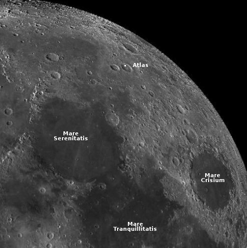
China is now working to a May 2024 launch of its Chang’e-6 lunar sample return mission to bring back about four pounds of material from the far side of the Moon.

The map to the right, created from a global mosaic of Lunar Reconnaissance Orbiter (LRO) imagery, shows the planned location of Chang’e-6’s landing site, in Apollo Basin. The landing site of China’s previous mission to the Moon’s far side, Chang’e-4 and its rover Yutu, is also shown. Both are still operating there, since landing five years ago on January 2, 2019.

Chang’e-6’s mission will be similar to China’s previous lunar sample mission, Chang’e-5, which included a lander, ascender, orbiter, and returner. It launched in November 23, 2020, landed a week later, and within two days grabbed its samples and its ascender lifted off. The samples were back on Earth by December 16, 2020.

There are indications however that Chang’e-6 might spend more time on the surface before its ascender lifts off with samples.

0 comments

The shoreline of a Martian lava sea

The shoreline of a Martian lava sea
Click for original image.

Cool image time! The picture to the right, cropped, reduced, and enhanced to post here, was taken on October 2, 2023 by the high resolution camera on Mars Reconnaissance Orbiter (MRO).

The science team labeled this a “lava margin.” The darker material on the right is apparently a newer deposit of lava, flowing on top of the lighter lava on the left. The newer deposit is only about three feet thick, so it had to have flowed fast almost like water to cover this large area with such a thin layer before freezing. Even so, this new lava layer has a roughness greater than the older layer below it. Either the older layer is smoother because of erosion from wind over eons, or the lava in these two layers was comprised of slightly different materials that froze with different textures.

The small ridges appear to be wrinkle ridges, created when material shrinks as it freezes.

This margin marks the edge of a very large flood lava event, as illustrated by the overview map below.
» Read more

0 comments

Spiders on the rim of a Martian crater

Spiders on the rim of a Martian crater
Click for original image.

Cool image time! The picture to the right, cropped to post here, was taken on December 29, 2023 by the high resolution camera on Mars Reconnaissance Orbiter (MRO). It shows strange spidery formations on the rim of a 17-mile-wide crater about 500 miles from the south pole of Mars.

Scientists think these spider features are formed due to the seasonal cycle on Mars. In the winter at the poles the carbon dioxide in the atmosphere falls as snow in the polar regions, creating a thin dry ice mantle that covers everything. When spring arrives, sunlight goes through the clear mantle to heat its base, causing that dry ice to sublimate into gas that is trapped below the mantle. Eventually that mantle cracks at a weak point and the gas escapes, spewing dark dust on its top. By summer the mantle is entirely gone, and the black splotches disappear as they blend back into the same colored ground.

At the south pole the ground appears to be firmer and more structurally sound than at the north pole. The trapped gas appears to travel upward along the same tributary paths to the same escape points each year, thus carving these spidery features that are permanent features.
» Read more

1 comment

German-built mini-rover for Japanese Phobos mission shipped to Japan

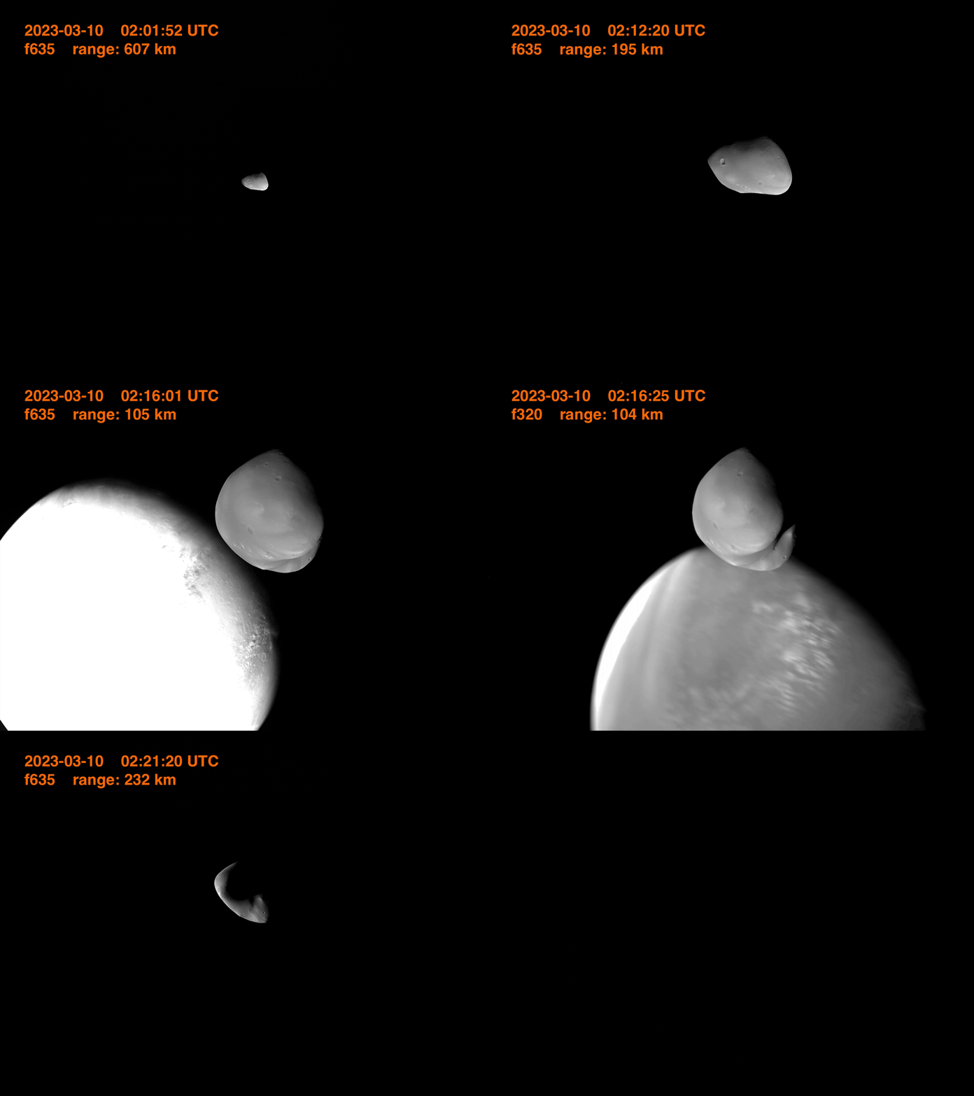
A German-built mini-rover, dubbed Idefix, has now been shipped to Japan to intergrate it as a secondary payload on that country’s MMX mission to the Martian moon Phobos.

The rover itself weighs 25 kilograms (55 pounds), is 51 centimeters long (20 inches), and is designed to explore up to 100 meters of Phobos’ surface. During one of MMX’s closest approaches to Phobos, the rover will be released at an altitude between 40 and 100 meters above the surface and touch down on Phobos. The drop utilizes the low gravity of Phobos, which will allow IDEFIX to just fall onto the surface, roll, and then raise itself to prepare for the roughly three-month-long mission. The gravity of Phobos is only roughly 1/1000th of the gravity of Earth, which can be attributed to the moon’s small size. Phobos only has a diameter of approximately 27 kilometers.

“Thanks to the low gravity, IDEFIX will need between 60 to 80 seconds from release to the touchdown on Phobos. The impact will be with less than one meter per second,” explained Professor Markus Grebenstein, who is DLR’s project lead for IDEFIX, in an interview with NSF.

If all goes right, the rover’s mission will last at least 100 days. MMX itself it scheduled to reach Phobos in 2029.

Meanwhile, scientists used one of the Perseverance’s high resolution cameras to capture another partial eclipse of the Sun by Phobos. This is not the first such Phobos eclipse that Perseverance has photographed (see for example here and here), but it is neat nonetheless.

0 comments

Martian dunes with strange splotches

Martian dunes with splotches

Cool image time! The picture to the right, cropped to post here, was taken on December 20, 2023 by the high resolution camera on Mars Reconnaissance Orbiter (MRO). It shows what the science team labels as “Dunes with Blotches.”

The blotches, or as I call them splotches, are the round dark patches on dunes themselves. Though their darkness is reminiscent of the dark patches that appear as spider features in the south polar regions of Mars, there are problems linking the two. The spiders form when the winter mantle of dry ice that falls as snow begins to weaken when the Sun reappears in the spring. Sunlight travels through the clear dry ice to warm the base of the mantle, causing it to sublimate into carbon dioxide gas. That gas however is trapped at the base, and only escapes when the thin mantle cracks at weak points. As the gas puffs out it carries with it dust, which leaves dark patches on the surface that disappear when the mantle disappears entirely by summer.

In the southern hemisphere at the poles the ground is somewhat stable, so the trapped gas appears to travel along the same paths each year to the same weak spots. This in turn causes it to carve spidery patterns in the ground, like river tributaries, except here the tributaries of gas flow uphill to their escape point. At the north pole the ground is not as stable. Instead we have many dunes, so that the dry ice mantle sublimates away at different places each year. There is no chance to form such spider patterns over time.

Making these splotches more puzzling is the season. This picture was taken in the winter, at a time one would think no dry ice is sublimating away.
» Read more

0 comments

More hiking possibilities on Mars!

More hiking possibilities on Mars
Click for original image.

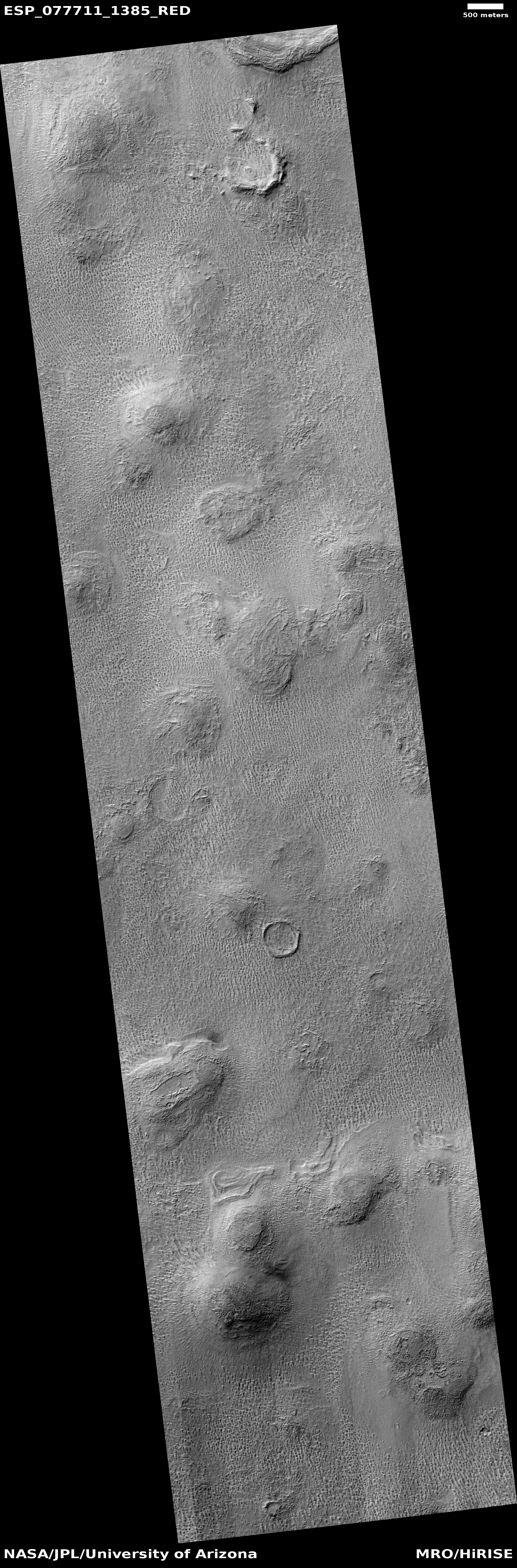
Cool image time! The picture to the right, rotated, cropped, reduced, and sharpened to post here, was taken on September 27, 2023 by the high resolution camera on Mars Reconniassance Orbiter (MRO). Dubbed a “terrain sample” by the science team, this picture was likely chosen not as part of any specific research project but to fill a gap in the camera schedule so as to maintain that camera’s proper temperature.

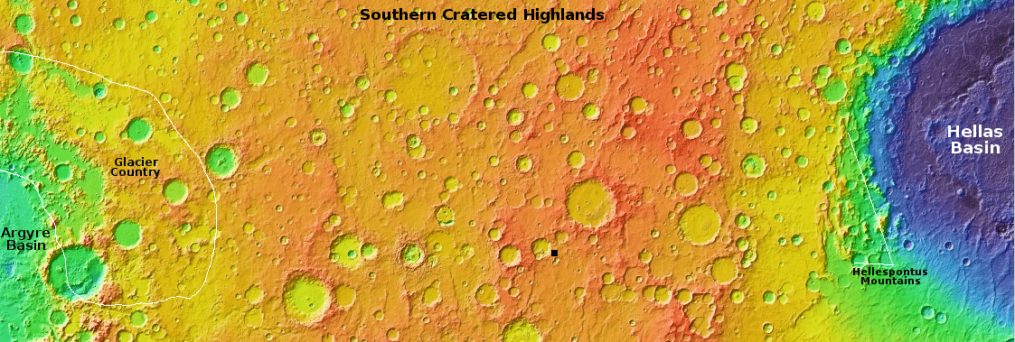
When the team needs to do this they try to pick interesting targets. In this case the location is the region of many many parallel north-south fissures that extend for more than 800 miles south of the giant but relative flat shield volcano Alba Mons. These fissures are grabens, cracks formed when underground pressure pushed the ground up and caused it to spread and crack.

What attracted me to this picture is the ridgeline. It struck me as a wonderful place to hike. I have even indicated in red the likely route any trail-maker would pick to go from the valley below up onto the ridge, and then along its knifelike edge to the south. The height of the cliff down to the east valley averages about six hundred feet, guaranteeing beautiful scenery the entire length.
» Read more

0 comments

A small Martian volcano?

A small Martian volcano?
Click for original image.

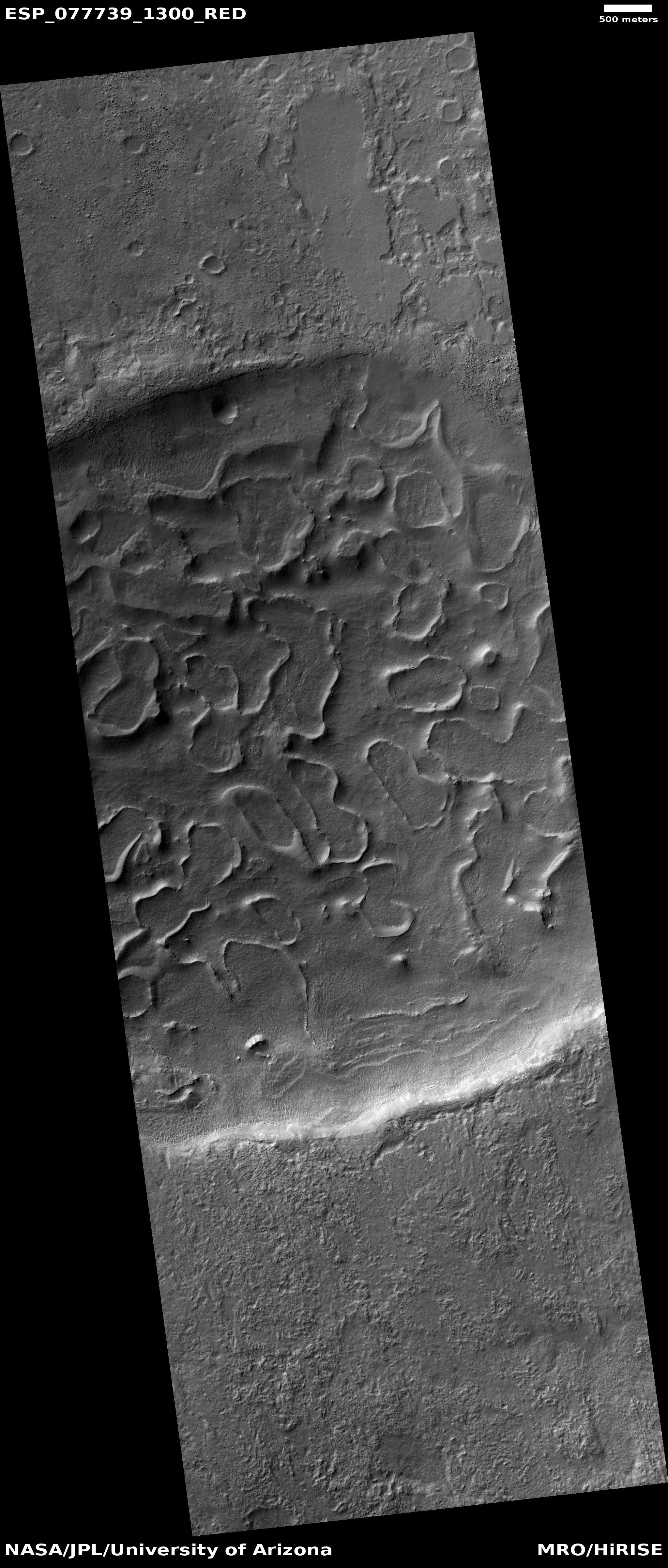
Cool image time! The picture to the right, cropped, reduced, and sharpened to post here, was taken on December 21, 2023 by the high resolution camera on Mars Reconnaissance Orbiter (MRO). The science team labeled it a “fresh crater”, but that description I think is misleading, as it implies a recent impact.

The crater does not look like a fresh impact crater to me. Such things on Mars usually appear very dark, as the impact dredges up dark material. This crater is not dark. More significant is the crater itself. The small 300-foot-wide inner crater, surrounded by a circular plateau and all sitting inside the larger 1,200-foot-wide crater is completely unique compared to any impact crater I have ever seen. Impacts in soft material, such as ice-impregnated ground, can cause concentric ripple rings, but they don’t look like this.

Instead, this crater more resembles the caldera of a volcano, where subsequent eruptions can produce overlapping depressions at the volcano peak. (See for example this picture of Olympus Mons.)

Moreover, the crater sits on top of a peak approximately 300 feet high. While impacts in ice-impregnated ground on Mars can produce splash aprons as seen here, the crater usually sits at about the same elevation as the surrounding terrain, not at the top of a peak. This peak suggests the apron was forned not by a splash but repeated flows coming down from the top.
» Read more

0 comments

Curiosity’s damaged wheels continue to appear stable despite the rough Martian terrain

A new look at Curiosity's worst wheel
To see the original images, go here and here.

The rover Curiosity on Mars has for more than two years been traveling across a very rocky and rough terrain as it climbs higher and higher on Mount Sharp inside Gale Crater. Since the rover’s wheels experienced far more damage than expected early in its mission, when it was on the floor of the crater where the terrain was not as severe, engineers have adopted a whole range of techniques to try to reduce any further damage.

First, they increased the safety margins on the software that guides Curiosity. It picks its way very carefully through the rocks, and stops immediately if it finds itself crossing terrain that is too rough.

Second, the science team does a photo survey of the wheels after every kilometer of travel. The two pictures to the right compare the damage on the rover’s most damaged wheel, with an image from the previous survey on top and the most recent image, taken yesterday, on the bottom. I have numbered the same treads, called grousers, in the two images to make it easier to compare them.

As you can see, it does not appear as if the damage has increased in the 210 sols or seven months of travel since the last survey. This wheel looks bad, but it is the worst wheel on the rover, and the strategies that the engineering team adopted years ago to reduce further damage continue to work, even as Curiosity traverses some very rough ground.

The software requires the rover to travel shorter distances in each drive when the ground is this rough, but the consequence is that it will last much longer, and thus have a better chance of reaching higher elevations on Mount Sharp.

0 comments

Perseverance snaps its first picture of grounded Ingenuity

Overview map
Click for interactive map.

Ingenuity on dune, as seen by Perseverance on February 4, 2024
Click for original image.

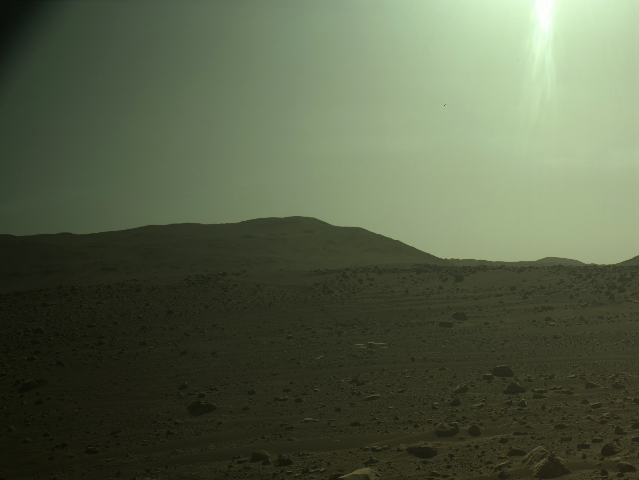
Perseverance on February 4, 2024 finally moved into a position where it was close enough to take its first picture of the now grounded Ingenuity helicopter. That picture, cropped, reduced, and enhanced to post here, is to the right, taken by the rover’s left high resolution camera. You can see Ingenuity sitting on the slope of a dune near the upper right.

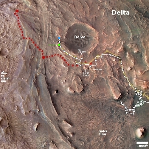
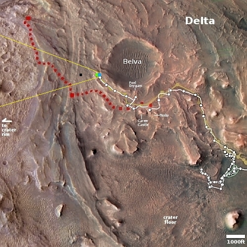
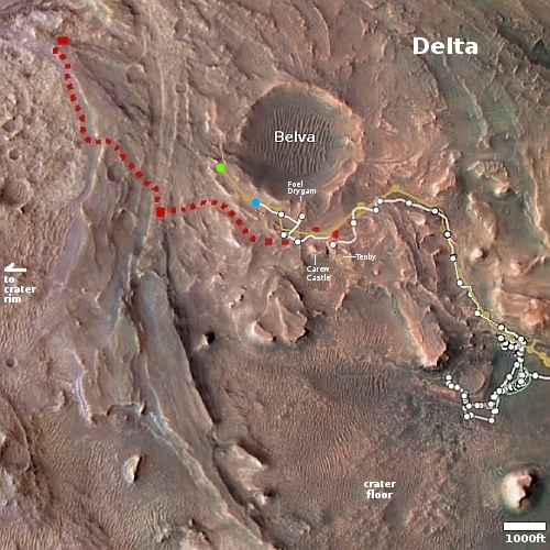
The overview map above provides the context. The green dot marks Ingenuity’s final resting spot. The blue dot marks Perseverance’s present location, with the yellow lines indicating approximately the area covered by the photo.

Whether the rover is now close enough to get good imagery for a final engineering test of Ingenuity — where its rotors will be rotated and shifted slowly to determine the extent of the propeller damage — is not clear. Perseverance could move much closer, but its science team might not want to cross these dunes out of fear the rover would get stuck. They might move forward a few more feet, to the top of the south bank of Neretva Vallis, before doing that test.

7 comments

Juno completes its closest approach of the Jupiter moon Io

Io on February 3, 2024
Click for full image.

The Jupiter orbiter Juno successfully completed its 58th close fly-by of the gas giant, during which it also made its closest approach to the volcanic moon Io, zipping past at a distance of 932 miles. The image of Io to the right, cropped and reduced to post here, was taken at that closest Io approach, and shows a mountain on the horizon as well as a large shield volcano in the center (the dark splotch), with a major lava flow to the south. The picture was processed by citizen scientist Brian Swift.

Another image, processed by Björn Jónsson, shows the differences at one volcano dubbed Loki between the December 30, 2023 and the February 3, 2024 flybys. It appears that the brightness of the apron of lava that surrounds the volcano changes significantly depending on the lighting and the angle of view. In December it was almost black. In February it was greyish silver, almost shiny.

Another image, processed by Andrea Luck, captured faint eruption plumes on Io’s edge, caused by an ongoing eruption just beyond the horizon.

Juno still has four more flybys of Io coming up, but none will be as close as the February 3rd approach.

0 comments

A spot where the surface of Mars cracked

The spot where Mars cracked
Click for original image.

Cool image time! The picture to the right, rotated, cropped, reduced, and sharpened to post here, was taken on September 14, 2023 by the high resolution camera on Mars Reconnaissance Orbiter (MRO). It shows a small section of the Cerberus Fossae cracks, a parallel series of cracks that stretch more than 700 miles across the volcanic plains of Mars.

These cracks formed when the ground spread apart, creating a void in which the surface collapsed. You can see this process illustrated quite clearly by the crater in the lower right, as indicated by the arrow. The crater had existed prior to the crack. When the ground split and collapsed, only the northeast quadrant of the crater was destroyed.

These cracks might also have been the source of Mars’ most recent large volcanic event, as shown by the overview map below.
» Read more

0 comments

Curiosity looks ahead at very rough terrain higher on Mount Sharp

Panorama on Sol 4086, February 3, 2024
Click for full image.

The rough terrain higher on Mount Sharp
Click for original image.

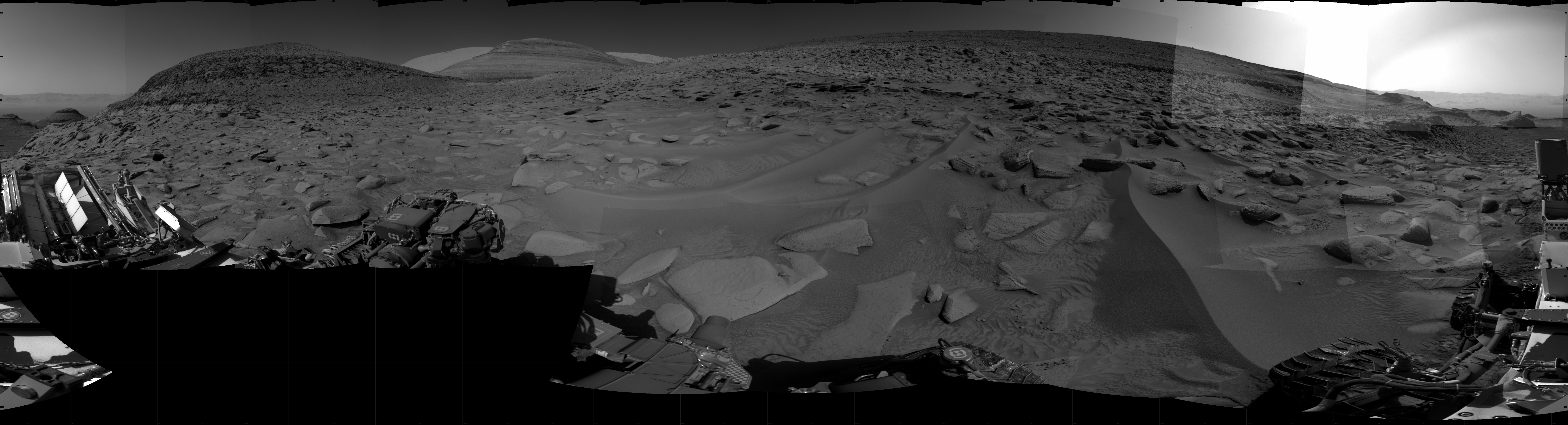
Cool image time! The picture to the right, reduced and enhanced to post here, was taken on February 3, 2024 by the high resolution camera on the Mars rover Curiosity. The area it covers is indicated by the rectangle on the panorama above, which has been cropped, reduced, and enhanced to post here. That panorama was created from 46 photos taken by the rover’s right navigation camera on that same day.

Those rough small peaks are higher on Mount Sharp, though far below its summit. The summit itself is not visible, and in fact has never been visible to Curiosity since it landed on Mars in August 2012. The peak is about 26 miles to the south and about 16,000 feet higher up, with much of the mountain in the way.

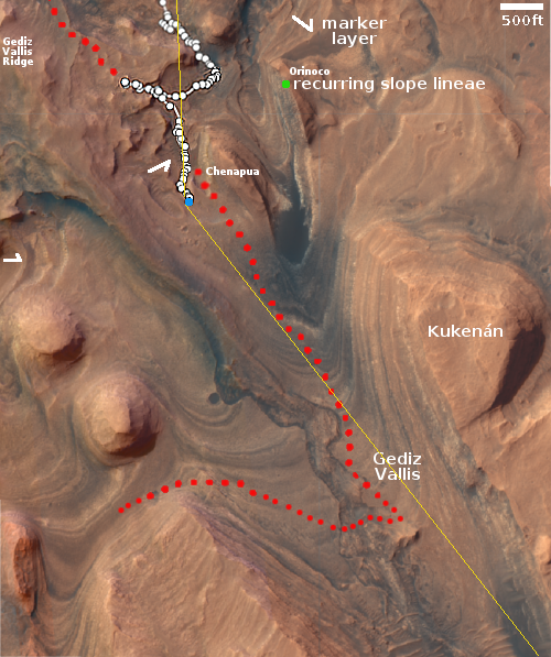
These small, rough peaks are in an area that the rover will likely never go, as shown in the overview map below.
» Read more

0 comments
1 45 46 47 48 49 89