Have these Martian dunes changed in sixteen years?

Comparing two MRO images taken 16 years apart
Click here and here for the original images.

Overview map

Cool image time! The two pictures above, both rotated, cropped, reduced, and enhanced to match and to post here, were taken by the high resolution camera on Mars Reconnaissance Orbiter (MRO) sixteen years apart. The first, on the left, was taken on February 23, 2007, while the second, on the right, was taken on November 1, 2023.

What drew me to both images was the label for the second: “Dune Change in Arabia Region Crater.” To find out if this image had revealed any changes in the dunes I went back and found the earliest MRO picture of this location, and sized and enhanced the dunes in both to match.

Do you see any changes? I don’t. However, that really means nothing. These are not the highest resolution versions that MRO obtains, and a very careful comparison of those best images might detect more subtle changes than our eyes can perceive in the versions above. Also, there might be brightness changes that require careful software analysis.

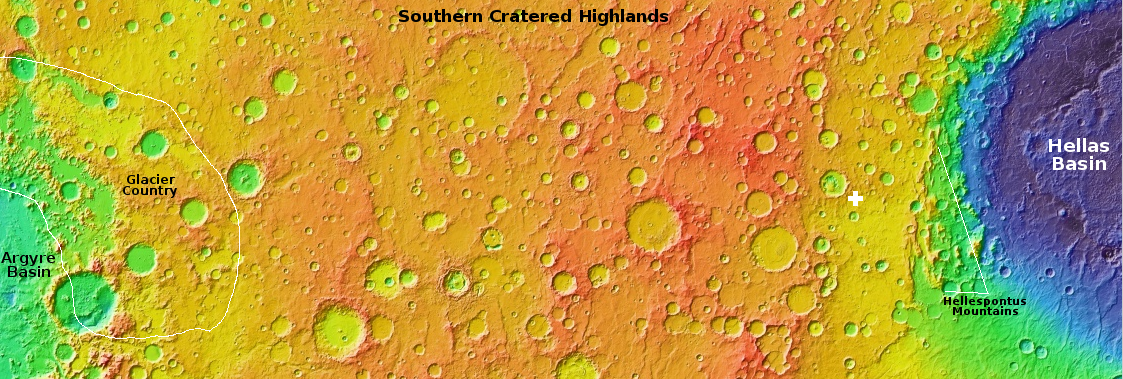
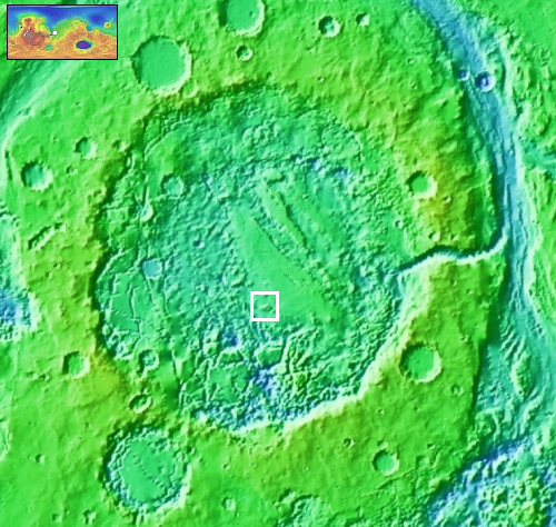
The white dot on the overview map to the right marks the location, in Arabia Terra, the largest transition region on Mars between the northern lowland plains and the southern cratered highlands. The inset shows the half filled crater in which these dunes sit. The grayed area on the floor of the crater marks the entire dune field, extending eastward to the crater rim from this one spot, indicated by the black dot.

It is likely that the dust is blown into this crater and gets trapped there. Whether the dunes move or change is not clear, though if they do the changes are small, even after almost two decades. Instead, the two pictures suggest these dunes have hardened into a form of sandstone, that can be eroded over time by the wind, but only very very slowly.

3 comments

A plateau of friable rock on Mars

A plateau of friable rock on Mars
Click for original image.

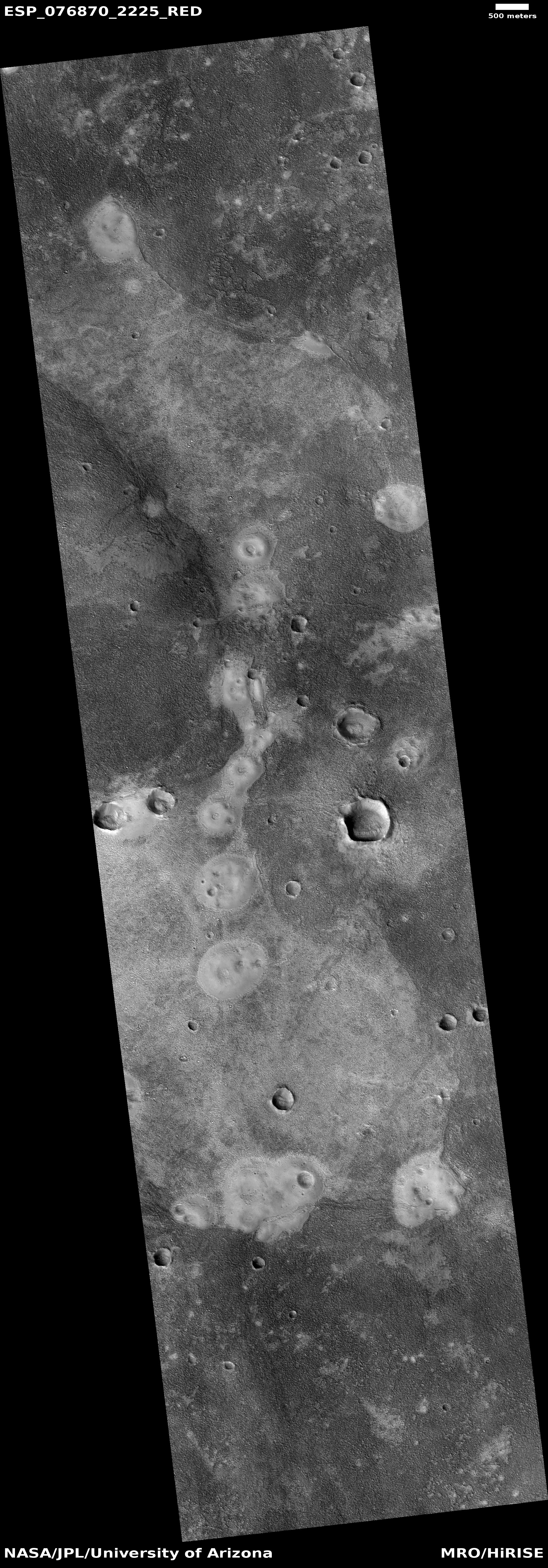
Cool image time! The picture to the right, rotated, cropped, reduced, and sharpened to post here, was taken on September 13, 2023 by the high resolution camera on Mars Reconnaissance Orbiter (MRO).

The science team labels this “Friable Outcrops in Aeolis Dorsa.” What we are looking at is the northeasternmost tip of a 30-mile long plateau that marks the northern edge of Mars southern cratered highlands. For most of its length the top of that plateau is relatively smooth, broken by some vague surface features and a few scattered craters (suggesting it is relatively young). However, as you approach the plateau’s edges and especially that northeastern tip the surface begins to break up into the rough terrain shown to the right. It appears that the prevailing winds from the north are scouring the soft topsoil here and causing it to wear away, leaving behind those innumerable small ridges, almost all of which are oriented from north-to-south.

But why is the topsoil here soft and so easily scoured?
» Read more

0 comments

Lunar Reconnaissance Orbiter photographs SLIM on the Moon

LRO images showing before and after SLIM's landing
Click for blink animation.

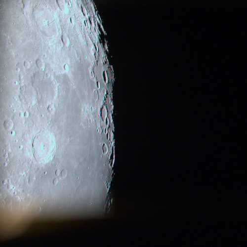
Scientists using Lunar Reconnaissance Orbiter (LRO) were able on January 24, 2024 to obtain a photograph of the SLIM landing site on the Moon, and produce a before and after blink animation showing the lander on the ground.

The two pictures to the right, before and after, were taken from that animation. The bright speck in the after image is SLIM, sitting upside down on the surface. The faint streak of light material going from right to left lower in the photo comes from the fresh ejecta material thrown out from the nearby 1,425-foot-wide Shioli Crater to the west.

This picture confirms once again that SLIM achieved its main goal, landing precisely within a tiny landing zone only 300 feet across.

The landing occurred in the morning on the Moon, so the Sun was in the east. Because SLIM got flipped upside down just before touchdown, its one solar panel ended up facing west, where no sunlight could touch it. Based on the shadows in this picture, east is to the left, and west to the right. The solar panel is sitting in the shadow on SLIM’s right side.

In about a week the Sun will begin setting to the west, illuminating that panel. Engineers in Japan hope that at that time the panel will begin to recharge the spacecraft’s batteries, and it will then begin to operate again, if only a short while before the Sun sets and the very cold and hostile lunar night begins. There is little expectation of SLIM surviving that long two-week lunar night, even if it gets its batteries fully charged.

4 comments

Ingenuity’s final resting site on Mars

Overview map
Click for interactive map.

Ingenuity's damaged propeller
Click for orignal image.

The photo to the right was downloaded from Ingenuity today, and looks downward at the ground below the helicopter, showing the shadow of one of its propellers, with the damage at its tip indicated by the arrow.

It is this damage that forced NASA management to retire the helicopter yesterday. With the tip of one of Ingenuity’s two propellers damaged, the helicopter simply can no longer fly reliably, or at all.

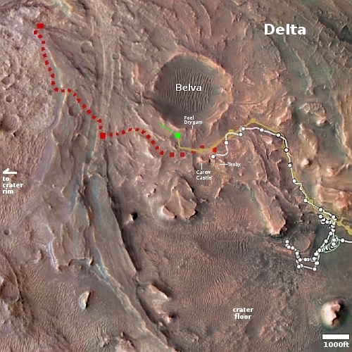
The green dot on the map above shows Ingenuity’s final resting spot. The blue dot shows Perseverance’s present position. Perseverance will surely at some point approach Ingenuity closely to get better pictures of the damage to help engineers better figure out what happened and why. For example, did the propellor simply break during flight? And if so, why?

I freely admit that my optimistic speculations last week were wrong, that Ingenuity was merely having communications issues with Perseverance. I also suspect the Ingenuity engineers were hoping the same thing, and were far more disappointed than I to discover otherwise.

7 comments

Ingenuity’s mission on Mars is over

Ingenuity takes off!
Ingenuity takes off on its first flight, April 19, 2021.
For full images go here and here.

NASA today announced that Ingenuity’s mission on Mars has now ended due to damage sustained to one of its propellers during its 72nd flight.

While the helicopter remains upright and in communication with ground controllers, imagery of its Jan. 18 flight sent to Earth this week indicates one or more of its rotor blades sustained damage during landing, and it is no longer capable of flight.

Ingenuity’s engineering mission was designed initially to simply prove that air-powered flight in Mars’ thin atmosphere was possible by a test program of four flights over 30 days. It worked so well that it just kept going and going. During its almost three years of operation on Mars, the helicopter completed 72 flights, for a total air time of about 128 minuntes. It flew a total of about eleven miles, reaching a maximum speed of over 22 miles per hour and a top altitude of about 79 feet. On its 69th flight it traveled a record 2,315 feet, almost a half mile.

All future Mars missions have been changed forever by the success of Ingenuity and its designers and engineers. For example, there are already hints of a helicopter mission to Mars’ giant canyon Valles Marineris. In addition, NASA redesigned its Mars Sample Return Mission to include helicopters based on what it learned from Ingenuity.

More important, Ingenuity suggests that when settlers finally colonize the red planet, it is very possible that air travel will start out more important than ground transport. In fact, long distance roads might never be built, for any number of reasons, because air travel will be available from the beginning.

2 comments

SLIM landed on the Moon softly, but upside down!

SLIM upside down
Click for original image.

We now know why SLIM’s solar panel was not facing the Sun after the Japanese lunar lander touched down. When it was only 10 to 15 feet above the ground, preparing to land, one of its two descent engines failed, causing the spacecraft to tumble as it softly touched down. As a result, it landed softly, but upside down, thus putting the panel on its west side instead of its east side as planned.

The image to the right, cropped to post here, was taken by one of the two tiny rovers released by SLIM just prior to landing. It shows SLIM upside down, but essentially undamaged.

The lander however still apparently achieved its primary goal, landing within a small zone only 300 feet across, or 100 meters.

Analysis of the data acquired before shutting down the power confirmed that SLIM had reached the Moon’s surface approximately 55m east (180 feet) of the original target landing site. The positional accuracy before the commencement of the obstacle avoidance maneuver (at around a 50m altitude) which indicates the pinpoint landing performance, was evaluated to be at approximately 10m or less, possibly about 3 – 4m.

…Under these circumstances, the SLIM onboard software autonomously identifies the anomaly, and while controlling the horizontal position as much as possible, SLIM continued the descent with the other engine and moved gradually towards the east. The descent velocity at the time of contact with the ground was approximately 1.4 m/s or less, which was below the design range., but conditions such as the lateral velocity and attitude were outside the design range, and this is thought to have resulted in a different attitude than planned.

In other words, when that engine failed, SLIM was only about 10 to 30 feet from its pinpoint landing target, but then drifted eastward as its dropped those last few feet because of the unbalanced engine burn caused by only one engine.

That the spacecraft is still operating and can communicate with Earth, even though it is upside down, is remarkable. Moreover, SLIM did achieve its main goals quite successfully. It landed within its tight target zone, it released two mini-rovers which operated successfully, and has been able to send its own pictures back to Earth. It was not able however to test its crushable landing legs, as they remain in the air.

11 comments

Saw-toothed razor rocks on Mars

Saw-toothed razor rock on Mars
Click for original image.

Looking at the base of Kukenan
Click for original image.

Cool image time! The picture above, cropped and enhanced to post here, was taken on January 22, 2024 by the high resolution camera on the Mars rover Curiosity.

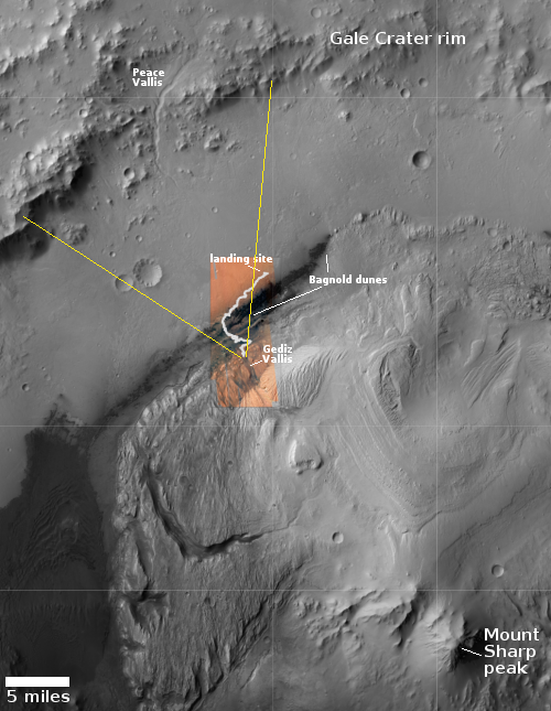
The photo gives us a fine example of the many very strange and delicate formations seen on Martian rocks and boulders as it slowly weaves its way up Mount Sharp, inside the slot canyon Gediz Vallis. On Earth such thin flakes like these are generally only seen inside caves, where there is almost no life to disturb their development and the natural conditions are as benign as well. On Mars, the only thing that can disturb this rock is the wind, and though over time it can erode things the thin atmosphere allows such flakes to form, aided by the gravity about 39% that of Earth’s.

The photo to the right, cropped, reduced, and sharpened to post here, was taken the same day by the rover’s left navigation camera, and illustrates the overall rocky nature of all of the terrain surrounding Curiosity. It looks to the southeast, at the base of nearby 400-foot-high Kukenan.

For a map showing Curiosity’s location (as well as another weird Martian rock, see my prevous post on January 17, 2024, A rock tadpole on Mars.

1 comment

An ancient Martian river system now meandering ridges

Context camera mosaic of river system.

An ancient Martian river system
Click for original image.

Cool image time! The picture to the right, cropped and reduced to post here, was taken on August 27, 2023 by the high resolution camera on Mars Reconnaissance Orbiter (MRO). It was featured by MRO’s science team yesterday, in which Shane Byrne of the Lunar and Planetary Lab University of Arizona wrote the following:

River beds often get filled with gravel and the surrounding terrain is often built up of fine-grained mud from river overflows. The gravely river bottom and the fine-grained surroundings can lead to a strange phenomenon that geologists call inverted channels. After the river disappears, the fine-grained surroundings can be easily eroded away leaving the gravely river bed as a high-standing ridge.

These ridges show the location of the old river beds in Mars’ distant past. The angle at which the ridges join together indicate that these rivers flowed from top-right to bottom-left (i.e. southwest).

The picture above is a mosaic produced from the global survey taken by MRO’s lower resolution context camera. It gives us a fuller picture of this river system, with the rectangle showing the small area covered by the photo on the right. Overall this ancient and extinct river of ridges travels more than thirty miles downhill from the northeast to the southwest.
» Read more

1 comment

Another apparent splat on Mars

Another apparent splat on Mars
Click for original image.

This cool image poses a mystery that might be important for future colonists. The picture to the right, cropped, reduced, and sharpened to post here, was taken on October 23, 2023 by the high resolution camera on Mars Reconnaissance Orbiter (MRO).

The science team merely labels this vaguely as simply “landforms.” What it appears to be is an ancient flow of mudlike material or a delta that moved from the west to the east. Its nature is even more evident in the full picture. The top of the delta however appears corroded and old, with a number of craters on top suggesting it has been here for a long time.

Its mudlike appearances suggests water was involved, possibly as ice impregnated within the soil. However, the location says no, unless this occurred so long ago that the entire climate of Mars and this region was vastly different. And in fact, it might have been.
» Read more

0 comments

Perseverance looks back at the floor of Jezero Crater

Overview map
Click for interactive map.

Looking out across Jezero Crater
Click for original image.

Cool image time. The picture to the right, cropped, reduced, and enhanced to post here, was taken today by the left high resolution camera on the Mars rover Perseverance.

Though I am guessing somewhat, I think this image looks east and down into the floor of Jezero Crater, as indicated by the yellow lines in the overview map above. The mountains in the distance are not the easter rim of Jezero, which is generally indistinct, but some peaks inside the crater itself. They appear higher because Perseverance is looking down at them from the delta, near the western rim.

The white line on the map shows the rover’s entire journey so far since landing in February 2021, about 14.77 miles. Since Perseverance’s recent travels should be within this picture, and I can see no rover tracks, it suggests my guess as to what the picture looks at could be very wrong. No matter. Up until now the landscape inside Jezero Crater has in general been less spectacular than seen by Curiosity in Gale Crater many miles away. This picture however shows us that Perseverance can provide us some good views also. It is also a precursor to the views we shall get once the rover exits Jezero and begins to explore the rough regions to the west.

1 comment

Scientists finally look at prime samples captured by OSIRIS-REx of the asteroid Bennu

The inside of OSIRIS-REx's sample return capsule
Click for original image.

Scientists have finally opened the sample capsule from OSIRIS-REx to see the prime asteroid material obtained from the asteroid Bennu during the spacecraft’s touch-and-go sample grab.

The captured material inside the capsule can be seen in the picture to the right. It is the debris inside the ring.

Erika Blumenfeld, creative lead for the Advanced Imaging and Visualization of Astromaterials (AIVA) and Joe Aebersold, AIVA project lead, captured this photograph of the open TAGSAM head including the asteroid material inside using manual high-resolution precision photography and a semi-automated focus stacking procedure. The result is an image that shows extreme detail of the sample.

Next, the curation team will remove the round metal collar and prepare the glovebox to transfer the remaining sample from the TAGSAM head into pie-wedge sample trays.

The final mass of material will be determined once it is removed and weighed, though the team has already recovered more than 70 grams that had clung to the outside the capsule, which in itself exceeded the mission’s targeted goal.

5 comments

Ingenuity’s status uncertain but likely healthy

Overview map
Click for interactive map.

Updates from the engineering team that operates the Mars helicopter Ingenuity in the past two days have suggested the helicopter might be in trouble. First the team issued a status update yesterday that indicated communications had been lost prematurely during the helicopter’s 72nd flight.

The flight was designed as a quick pop-up vertical flight to check out the helicopter’s systems, following an unplanned early landing during its previous flight. Data Ingenuity sent to the Perseverance rover (which acts as a relay between the helicopter and Earth) during the flight indicates it successfully climbed to its assigned maximum altitude of 40 feet (12 meters). During its planned descent, communications between the helicopter and rover terminated early, prior to touchdown.

A further update today said that communications had been regained, but also noted that the engineering team still did not have a full understanding of the helicopter’s status.

We’ve reestablished contact with the #MarsHelicopter after instructing @NASAPersevere
to perform long-duration listening sessions for Ingenuity’s signal.

Based on the information released (or lack thereof) from the previous flight, the 71st, it is my sense that the situation is not as dire as these reports suggest, and that the situation might simply be related to issues of communications. Let me explain why I have come to this conclusion.
» Read more

1 comment
1 46 47 48 49 50 89