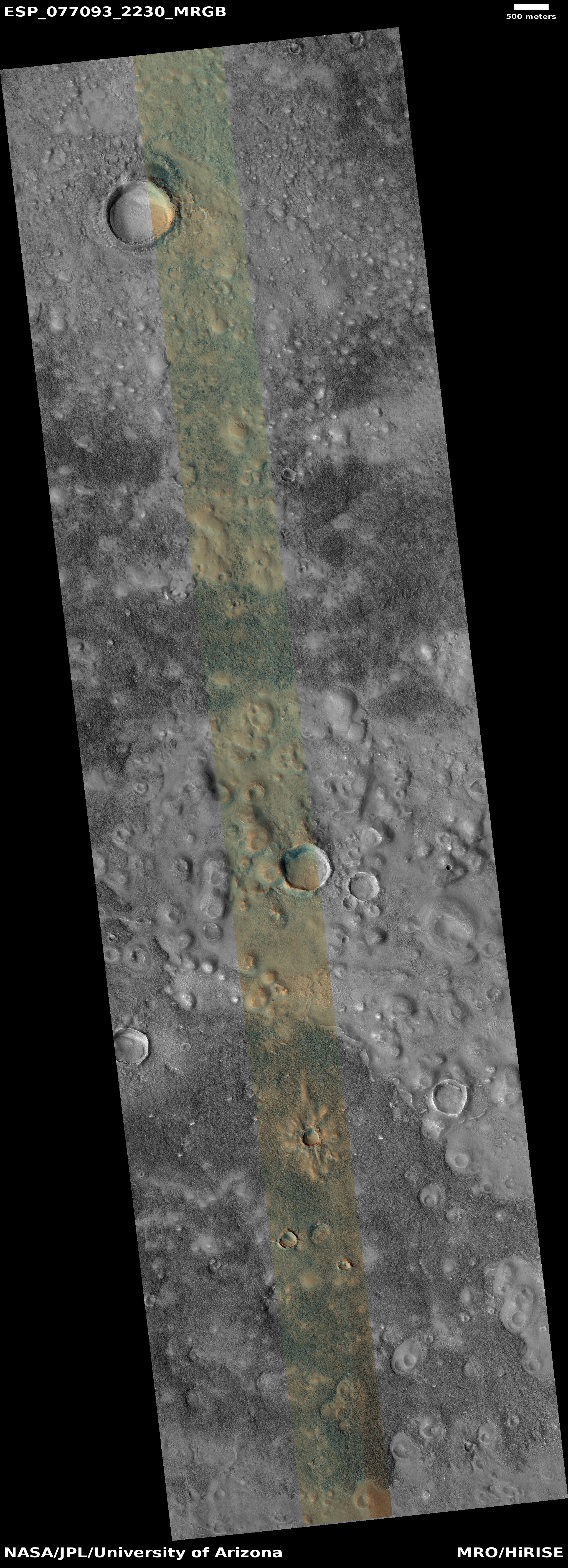
Mapping the layered geology of Mars

Mapping the layers on Mars
Click for original image.

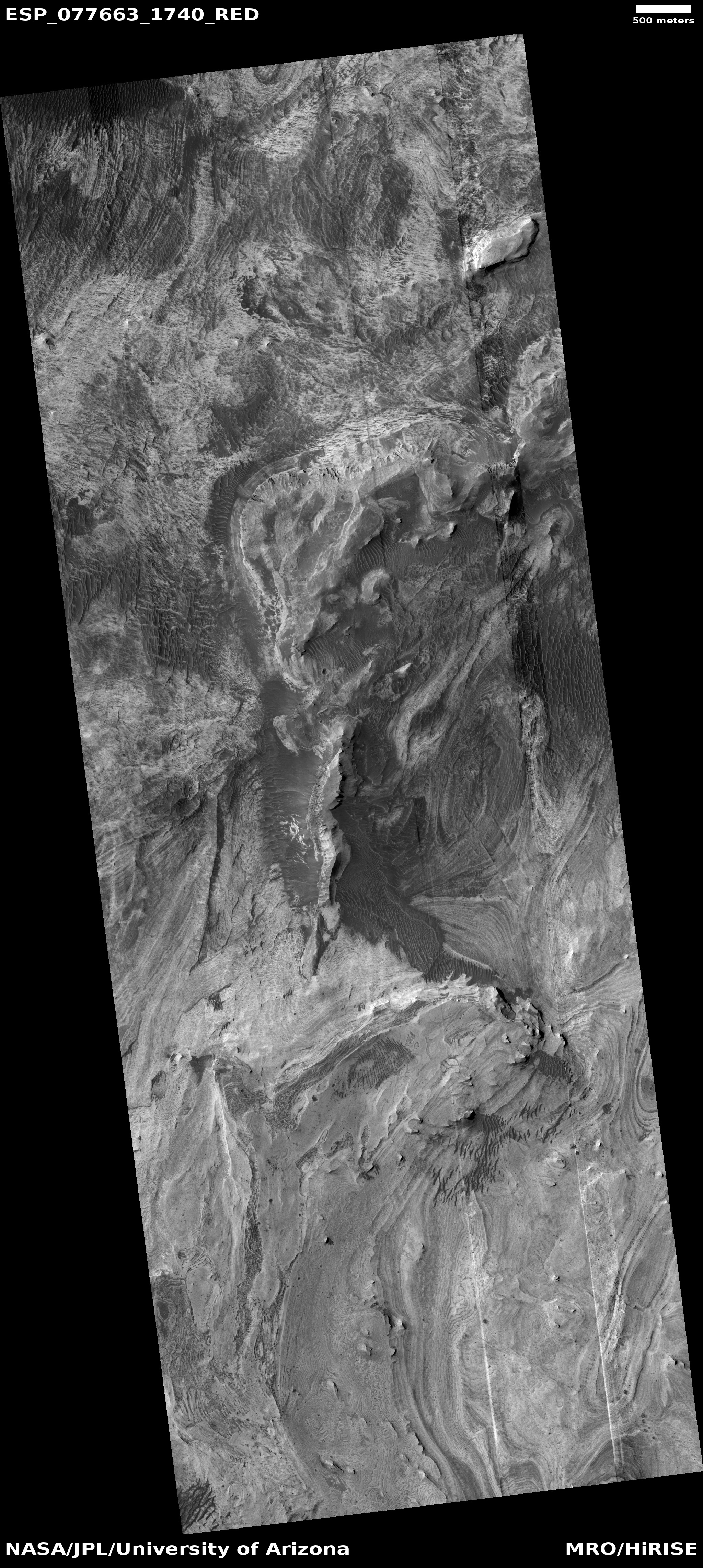
Today’s cool image is an update of a previous cool image from July 2021. Then, I posted a captioned high resolution Mars Reconnaissance Orbiter (MRO) photo of the many terraced layers within a 13-mile-wide crater dubbed Jiji and located in Arabia Terra, the largest transition zone between the Red Planet’s northern lowland plains and the southern cratered highlands. At that time the caption noted that research was on-going to see if the same layers could be identified in two other nearby craters, Banes and Sera, and thus use that data to extrapolate the long term geological history of this region on Mars.

Today’s cool image to the right, rotated, cropped, reduced, and enhanced to post here, was taken on January 4, 2024 as part of this research, and shows the layers in 18-mile-wide Sera crater, located only about ten miles to the east of Jiji crater. The highest mesa near the bottom of the picture is about twenty feet high on its southern side, but about 140 feet high to the north. The difference is because the crater floor under the mesa is sloping downward to its lowest point to the north.
» Read more

0 comments

A Martian tadpole

Overview map

A Martian tadpole
Click for original image.

Cool image time! The picture to the right, rotated, cropped, reduced, and sharpened to post here, was taken on December 28, 2023 by the high resolution camera on Mars Reconnaissance Orbiter (MRO).

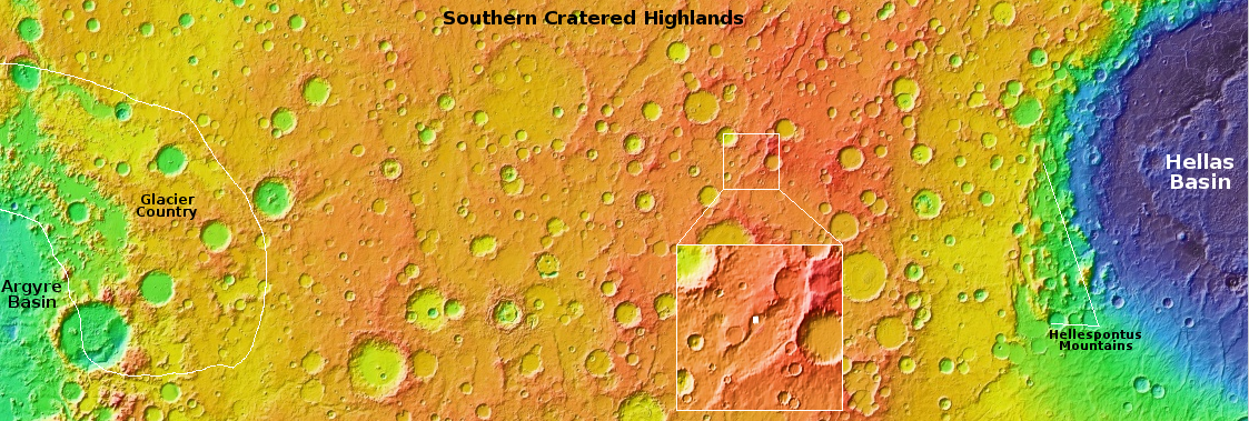
The white dot on the overview map above marks the location, with the rectangle in the inset marking the area covered by the picture. The science team labels this “inverted features,” a more vague way to describe the feature geologists dub “inverted channels.” The flow of a river or glacier acts to harden and increase the density of the channel bed. Later, the water or ice disappears, leaving just the canyon.

Even later, erosion begins to wear away the surrounding terrain. Because the canyon floor is now harder than that surrounding terrain, that floor is more resistent to erosion, and eventually becomes ridge following the exact same path as the long gone river or glacier.

This is what we have here, with this inverted channel, which is about five miles long, once draining into the deeper eroded valley to the south.

The location is at 38 degrees north latitude and inside the 2,000-mile-long mid-latitude region I dub glacier country, because almost every image shows evidence of glaciers or ice flows on the surface. This picture however is a rare exception. The features in this picture instead appear to be bedrock, something that is rarely seen in the canyons and craters in glacier country. It is beyond my pay grade however to explain why this spot lacks such features. Or it could be the near surface ice here looks so much like bedrock I am misinterpreting the picture.

0 comments

The strange surface of the perennial dry ice cap at Mars’ south pole

The strange surface of Mars' dry ice cap
Click for original image.

Cool image time! The picture to the right, cropped to post here, was taken on January 24, 2024 by the high resolution camera on Mars Reconnaissance Orbiter (MRO). It shows a region about 180 miles from the south pole of Mars.

This terrain is intriguing because is the pattern of ridges that cover it entirely. I have simply cropped the original image to show these ridges in highest resolution. The full image shows them covering a region much larger than this.

What are we looking at? Because it is near the pole, it is likely that the black splotches are caused by carbon dioxide gas breaking through the winter mantle of dry ice that covers the poles during the winter months and then sublimates away, from the bottom, each spring. As the dry ice turns to CO2 gas that gas is trapped, until it can find a weak spot in the overlying mantle. When the pressure builds enough, the mantle breaks, the gas escapes, and as it does so it deposits the dark dust around the breakage. That dust fades as the mantle disappears.

Sounds good, eh? Not so fast.
» Read more

1 comment

The really really strange landscape of Cydonia on Mars

Some really strange terrain on Mars
Click for original image.

Cool image time! The picture to the right, cropped, reduced, and sharpened to post here, was taken on January 3, 2024 by the high resolution camera on Mars Reconnaissance Orbiter (MRO), and shows what the camera team describes merely as “landforms.”

In truth, these features, as well as almost everything in the surrounding terrain beyond the edge of this picture, are possibly the weirdest geological features on Mars. The two mounds, no more than fifteen feet high at the most, resemble pimples. The rough ground to the north actually appears to be some flow that worked its way around the mounds, as indicated by the arrows. The crack to the southeast of the two mounds appears to be an extension of a fault line that cuts through the center of the larger mound, suggesting the mound is some form of eruption belching out of that fissure.

That the latitude is 42 degrees north, these weird features all suggest some form of ice-based volcanic activity, because the ground here is probably impregnated with ice.

As for the bridge connecting the two mounds, who knows what caused it?
» Read more

9 comments

Another helicopter mission under development for Mars?

Another helicopter mission for Mars?
Click for original image.

Today’s cool image to the right, cropped to post here, is probably on its own one of the more boring cool images I have posted over the years, a generally featureless plain with some ripple dunes within a few low hollows.

What makes this picture cool however is the label for the image: “Sample Landing and Traverse Hazards at Possible Helicopter Landing Site.” The picture was taken on January 23, 2024 by the high resolution camera on Mars Reconnaissance Orbiter (MRO), with the obvious goal of seeing whether this location can serve as a landing site for a helicopter mission to Mars.

The site is relatively uninteresting because the first goal is to find a safe place to land, but to do so near a location where there is rough geology which only a helicopter can explore. And it appears, from the overview map below, that is exactly what this location is.
» Read more

2 comments

Ingenuity’s final resting place on Mars

Panorama showing Ingenuity in Jezero Crater
Click for original image.

Overview map
Click for interactive map.

Time for one last cool image of Ingenuity. The picture above, cropped, reduced, and annotated to post here, was created from a mosaic of 67 images taken on February 21, 2024 by the high resolution camera on the Mars rover Perseverance. The white rectangle marks the approximate area covered by the image below, a mosaic of seven pictures taken on February 24, 2024 by Perseverance’s Remote Microscopic Imager camera, normally used to take very close images of nearby rocks but repurposed here to provide a close up of Ingenuity about 1,365 feet away, inside Neretva Vallis. Ingenuity is on the right, and the speck on the left is the section of the rotor blade that broke off and was apparently flung about 49 feet away.

On the overview map to the right, the blue dot marks Perseverance’s position, the green dot Ingenuity’s, and the yellow lines mark the approximate area covered by the panorama above. The red dotted line is Perseverance’s planned route in the coming months.

Close-up of Ingenuity and broken rotor blade
Click for original image.

4 comments

A Martian cliff of ash, flushed by wind

A Martian cliff of ash flushed by wind
Click for original image.

Cool image time! The picture to the right, rotated, cropped, reduced, and sharpened to post here, was taken on December 27, 2023 by the high resolution camera on Mars Reconnaissance Orbiter (MRO). Described merely as an “exposed scarp” by the science team, this cliff edge is actually much more.

First some basic details. The elevation drop from the plateau down to the base of this cliff is about a thousand feet. The material that forms this plateau, scarp, and its base is all volcanic ash. The thicker sections of ash has caused its lower levels to compress, harden into a kind of sandstone. Near the surface however it is more friable, and like sandstone can break apart somewhat more easily.

The prevailing winds at this site are generally blowing to the south, but beginning to turn to the east, which explains the northwest to southeast orientation of the features.

The best analogy I can come up with to explain the erosion of this scarp is as follows: Imagine a deposit of dry mud a few inches thick on pavement. Take a leaf blower and blow at it hard, always in one direction. Eventually the outer edge will break up and blow away, leaving a sharp edge, that will also retreat with time as the wind continues to blow.

Here the winds are eroding that cliff, causing periodic avalanches which dissolve into sand that then blows away, leaving no debris pile at the base of the cliff. The ridges indicate harder material, that breaks away last, which is why there are some ridgelines extending outward from the scarp in line with these ridges. At the same time, these ridges of harder ash still break up with time, as some are cut off suddenly at the cliff edge.
» Read more

0 comments

A recent volcanic eruption on Mars?

A recent volcanic eruption on Mars?
Click for original image.

Cool image time! The picture to the right, cropped, reduced, and sharpened to post here, was taken on December 16, 2023 by the high resolution camera on Mars Reconnaissance Orbiter (MRO). The science team labels the two darkened patches in the picture “plume-like features,” suggesting that the dark material was eruptive material thrown out from the depressions in a volcanic venting, that then settled on the nearby surrounding terrain.

Is that a correct interpretation? It is certainly strengthened by a different feature located about 550 miles to the northwest that looks almost the same. There, researchers theorize that the dark material surrounding a surface fissure was caused by a small volcanic event that occurred somewhere between 50,000 to 210,000 years ago. For that other location, scientists concluded as follows:

After careful comparison of this symmetrical dark feature with other dark wind-caused streaks in this region, the scientists concluded that it was not caused by wind, but is the remains of a relatively recent volcanic eruption that laid down a thin layer of material only about one foot thick.

» Read more

0 comments

Ingenuity broke off one blade entirely

Ingenuity with missing blade
Click for original image.

Images using a camera on Perseverance originally designed to look closely at rocks nearby but was found capable of doing distant photography (by engineers running the rover Curiosity), Perseverance has obtained the first good close-up picture of Ingenuity since its last flight, and found that one half of one propeller blade apparently broke off during or at the end of its last flight.

That image is to the right, cropped and sharpened to post here. It was taken on February 25, 2024 by Perseverance’s Supercam camera. A second Supercam image spotted the broken blade about fifty feet away, on the sand.

Why the blade broke off remains unknown. You can see from the tracks on the ground that Ingenuity jumped downhill and sideways after landing, but if the blade had hit the ground while spinning that jump would probably have been more violent. The pictures instead suggest it broke off not from contact with something else but because it broke on its own.

The Ingenuity engineers will of course do some very careful analysis of both pictures, and possibly determine better what happened.

4 comments

Frozen lava rapids on Mars

Frozen lava rapids on Mars
Click for original image.

Cool image time! The picture to the right, rotated, cropped, reduced, and sharpened to post here, was taken on October 6, 2023 by the high resolution camera on Mars Reconnaissance Orbiter (MRO), and shows a spot on Mars where lava was squeezed between and around some small peaks as it flowed quickly south, flooding all the low areas in this landscape.

The science team describes the features in the full image as “streamlined”, a description that is literally accurate. As this “stream” of lava rushed past, it “lined” the higher terrain, carving it into tear-dropped shapes.

In the color strip, note the blueish spots at the northern base of the 400-foot-high hill. According to the science team’s explanation [pdf] of the colors in MRO images, “Frost and ice are also relatively blue, but bright, and often concentrated at the poles or on pole-facing slopes.” The picture was taken in summer, so if these bright spots are frost or ice, it suggests they are well shaded from sunlight in those north-facing alcoves. This location is only 9 degrees north of the equator, so finding any near surface ice here is highly unlikely. That frost might exist however is intriguing, to say the least.
» Read more

0 comments

Martian gullies caused by glacial and water erosion

A gully on the north rim of Niquero Crater
Click for original image.

Cool image time! The picture to the right, rotated, cropped, reduced, and sharpened to post here, was taken on December 23, 2023 by the high resolution camera on Mars Reconnaissance Orbiter (MRO).

The image shows us the north interior rim of 7-mile-wide Niquero Crater on Mars. From the high to the low points the elevation difference is about 2,500 feet, with a steep downhill slope averaging about 18 degrees. The terrain appears to show several avalanche collapses that pushed lower material out of the way, though at the bottom where that material has been pushed aside there is no obvious large debris pile.

The science team labels this image simply “volatiles and gullies”, a label that carries a host of significant information. These gullies, which were among the earliest found by Mars Global Surveyor in the late 1990s, were the first evidence that the surface of Mars had a lot of near surface ice. It is for this reason that this relatively small crater on Mars has a name. Most craters this small remain unnamed, but the gullies on Niquero’s north slopes required more study, and thus the crater was given a name.

Subsequent orbital imagery has now shown that craters like Niquero, located in latitudes higher than 30 degrees, quite often are filled with glacial debris. In fact, the material that these avalanches pushed aside at the base of the slope is that glacial material, protected by a thin layer of dust and debris. The avalanche essentially disturbed that protected layer, and thus the debris pile (made up mostly of ice) sublimated away when warmed by sunlight. Thus. no big debris pile.

The gullies tend to be on the pole-facing slopes. Scientists believe they are the remnant evidence of ancient glaciers that grew on these slopes because they were protected from sunlight. In subsequent eons, when the climate on Mars changed, those glaciers collapsed, leaving behind the gullies we see now.
» Read more

0 comments

Alternating dark and light terraces inside Valles Marineris

Overview map

Alternating dark and light layered terraces in Valles Marineris
Click for original image.

Cool image time! The picture to the right, cropped and enhanced to post here, was taken on October 9, 2023 by the high resolution camera on Mars Reconnaissance Orbiter (MRO), and shows what appear to be the somewhat typical terrain at this location, in a part of the giant Martian canyon Valles Marineris dubbed West Candor Chasma. For example, I featured similar swirls in August 2022 at a place only about six miles to the east, that spot indicated by the green dot on the overview map above. The white dot marks the location of today’s image.

So, what are we looking at? The elevation drop from the high and low points is only about 180 feet, but in that short distance it appears there are more than two dozen visible layers, and those layers form terraces that alternate between bright and dark material.

The shape of the swirls also suggest that a flow of some kind, either water, ice, or wind, moved from the northwest to the southeast, carving these terraces as it descended the stair steps downward. It is also just as likely that we are seeing repeated lava flows going downhill to the southeast, each even laying another layer on top of the preceeding one. And it is also possible that we are looking at a combination of both.

The alternating dark and light layers suggest that each dark layer was an event that put down dark material, such as volcanic dust, that was subsequently covered with light material, with this process repeating itself many times over the eons.

That the floor of this part of Valles Marineris is uniquely covered in this manner is in itself intriguing. Why here, and not elsewhere within the canyon?

1 comment
1 44 45 46 47 48 89