SLIM lands on the Moon

Telemetry after SLIM's landing

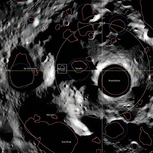
According to telemetry data (as shown on the screen capture to the right), Japan’s SLIM lander has apparently landed on the Moon near Shioli Crater, proving its autonomous precision landing system worked as planned.

At the moment however Japan’s space agency JAXA has not yet confirmed that the landing was completely successful. After landing the announcers on the live stream repeatedly noted that though the telemetry indicated it had landed as planned, engineers had not yet confirmed that the lander was still operational. Note how the data to the right suggests the spacecraft is tilted slightly. This tilt appears to match the tilt of the surface, but it could also indicate a problem with communications.

A press conference announcing either a confirmation or a failure will begin shortly at the live stream above.

4 comments

Scientists: Evidence of large deposits of buried ice along Martian equator

Theorized buried ice deposits on Mars
Click for original figure from paper.

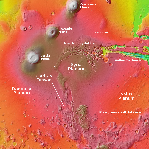
Using data obtained from Europe’s Mars Express orbiter, scientists believe they have detected evidence of a very large and extensive deposit of buried ice in the dry Martian equatorial regions, buried within the Medusae Fossae Formation, what is thought to be the largest volcanic ash deposit on Mars.

The blue-to-orange areas inside the Medusae on the map to the right, taken from figure 5 of the paper, shows where they have detected potential buried ice, at depths ranging from one to two thousand feet below the surface. The orange areas indicate the thickest ice deposits, as much as two miles thick. From the paper’s abstract:

The MARSIS radar sounder [on Mars Express] detects echoes in Medusae Fossae Formation deposits that occur between the surface and the base which are interpreted as layers within the deposit like those found in Polar Layered Deposits of the North and South Poles. The subsurface reflectors suggest transitions between mixtures of ice-rich and ice-poor dust analogous to the multi-layered, ice-rich polar deposits.

Assuming this detection is real, this would be the largest reservoir of potential water in the dry equatorial regions found yet, comparable to another similar buried detection deep below the giant canyon Valles Marineris but much larger.

Accessing this water however will not be simple, as it is deep underground. You couldn’t just drill a well, as it is ice, not a liquid water table. It would have to mined like minerals on Earth. There are uncertainties about this conclusion as well. It is possible the detection is not water but volcanic ash or dust compacted in a way that mimics an ice detection.

1 comment

A rock tadpole on Mars

A rock tadpole on Mars

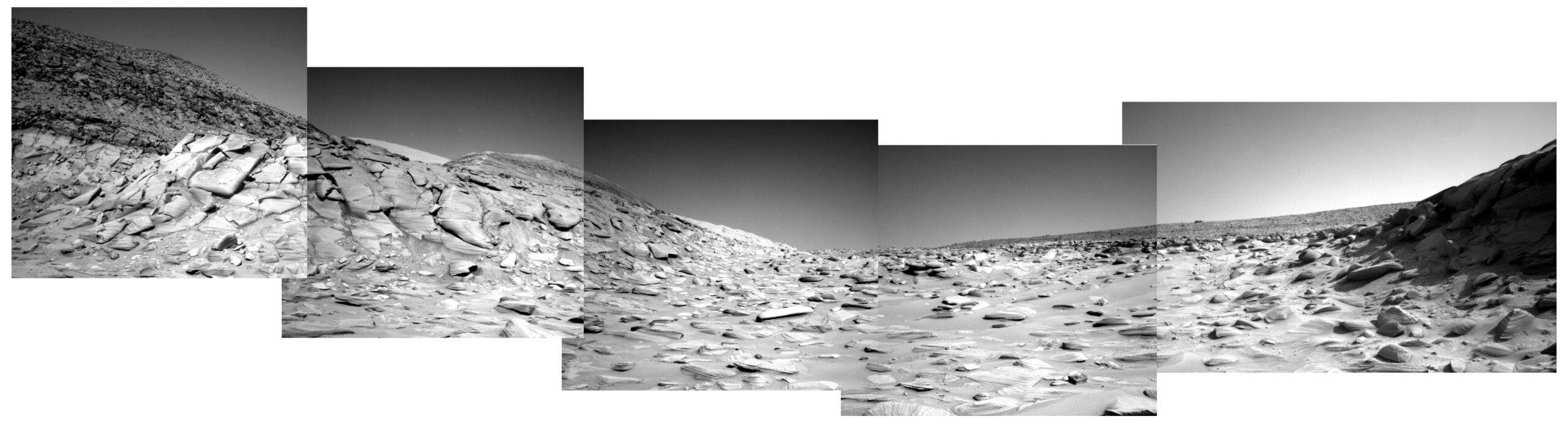
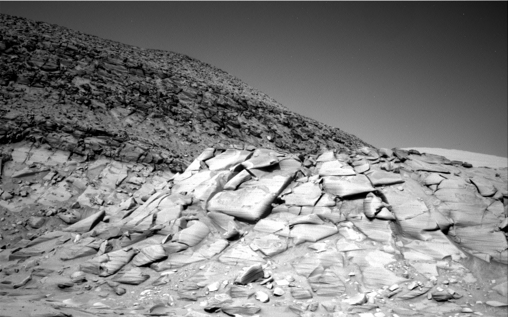
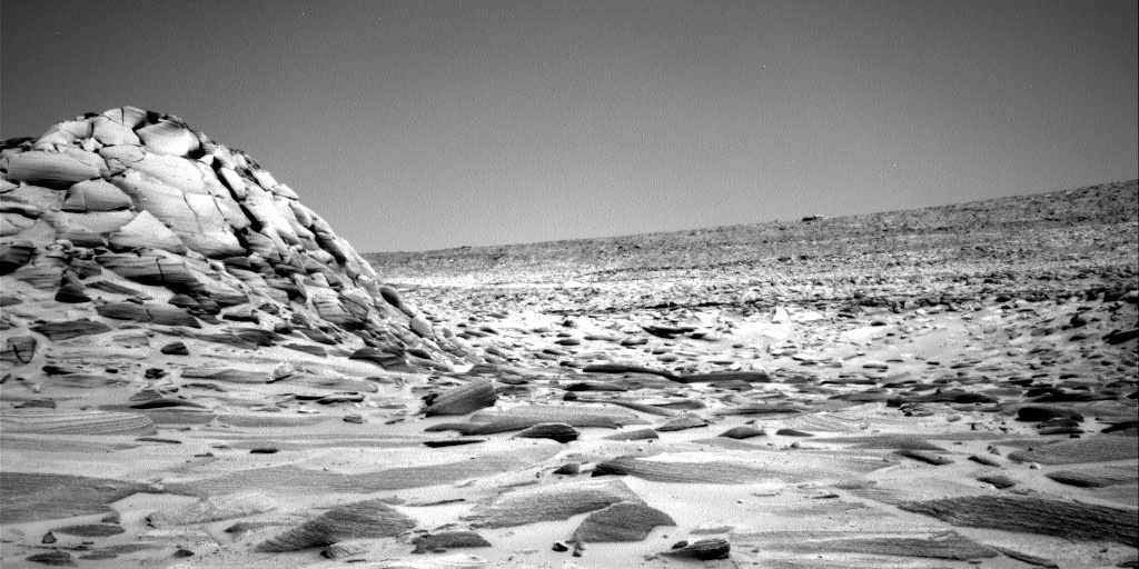
Cool image time! The picture to the right, cropped, reduced, and sharpened to post here, was taken on January 11, 2024 by the left navigation camera of the Mars rover Curiosity.

The picture was highlighted in yesterday’s update from the rover’s science team, describing the team’s upcoming geological goals for the next few days.

We have observed resistant, polygonal fractures/ridges in many recent bedrock blocks. There is much speculation among the team as to the origin of these features. Hypotheses have different implications for past environments, and the polygonal fractures are therefore of high interest. As well as the polygonal fractures, there are more continuous linear veins. The relationship between the polygonal and linear fractures can also help to inform our interpretations

You can see the polygonal fractures in the full image. The thin line of rock sticking up from the tadpole illustrates one of these continuous linear veins. The material that fills the vein is obviously more resistent to erosion, so as the wind (and maybe ancient ice or water activity) scoured the rock into its tadpole shape, the vein material remained.
» Read more

3 comments

Gullies and avalanches in Martian crater

Gullies and avalanches in a Martian crater
Click for original image.

Cool image time! The picture to the right, cropped, reduced, and sharpened to post here, was taken on September 17, 2023 by the high resolution camera on Mars Reconnaissance Orbiter (MRO). It shows two significant features, both of which suggest the action of near-surface water ice to change to surface of Mars.

First are the gullies on the cliff wall, which also happens to be the interior slope of a 30-mile-wide crater. Since the first discovery of gullies on Mars, scientists have pondered their origin, with all their hypothesises always pointing to some form of water process. One popular theory [pdf] points to some form of intermittent water flow linked to long term climate cycles caused by the extreme shifts in the red planet’s rotational tilt, from 11 to 60 degrees. Another theory suggests the gullies form from the winter-summer freeze-thaw cycle and the accumulation of frost during winter.

The second feature are the three avalanche debris piles at the base of these gullies. The long extent of each suggests the avalanches flowed more like wet mud than falling rocks. If the ground here was impregnated with ice, than this look makes sense.
» Read more

0 comments

The divide in a giant Martian lava river

The divide in a giant Martian lava river
Click for original image.

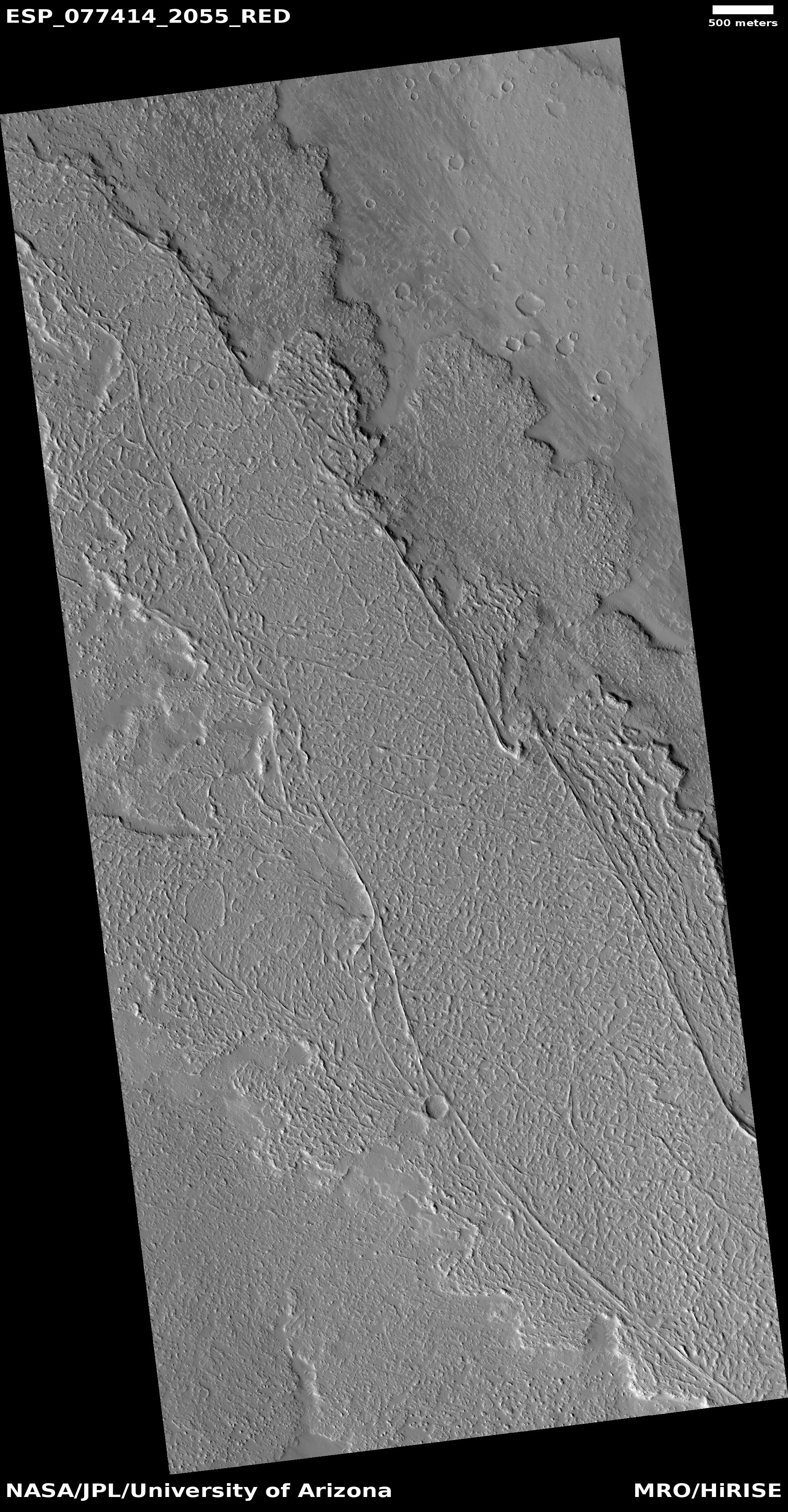
Cool image time! The photo to the right, rotated, cropped, reduced, sharpened, and annotated to post here, was taken on September 24, 2023 by the high resolution camera on Mars Reconnaissance Orbiter (MRO).

As indicated by the arrows, this is a frozen river of lava on Mars, flowing to the southwest and then splitting into two streams, one to the west and the other to the south. Being a Martian lava flow, when it was liquid it flowed much faster than lava on Earth, almost like a thick water. The flow bored into any high features, such as the two mesas in this picture, and streamlined their shapes, tearing material away as the lava moved by quickly. In the process the lava flow exposed many layers in those mesas, indicating many other previous lava flow events.

The crater in the lower mesa, where the stream splits, appears to have been more resistent to the flow, having been compacted into harder and denser material by the impact itself.
» Read more

0 comments

A cluster of strange terrain in Martian glacier country

Overview map

A cluster of strange terrain on Mars
Click for original image.

Cool image time! The picture to the right, rotated, cropped, reduced, and sharpened to post here, was taken on October 21, 2023 by the high resolution camera on Mars Reconnaissance Orbiter (MRO).

The science team labels this “patterned ground.” I see instead a whole range of inexplicable Martian geological features that, while each has been documented previously, each remains puzzling as to its formation process.

First there is the stucco-like peaks of all sizes on the upper left. This surface really looks like it had been wet plaster covered with Saran Wrap that had its peaks pulled up when that wrap was pulled off quickly.

Then there is brain terrain on the right. Always associated with glacier features on Mars, these convolutions are unique to Mars and as yet not entirely understood.

Next there is the circular arc on the middle left. It appears to be the remains of an impact crater now filled partly, but if so why has its northern rim disappeared so completely?

If you look close at the image above as well as the full image, you will find other mysterious features as well.

The location is the white dot on the overview map above. The rectangle in the inset shows the area covered by this picture, part of the floor of an unnamed eighteen-mile-wide and one-mile deep crater. The glacial material that appears to fill its interior as well as the splash apron that surrounds it all suggest the ground here is impregnated with water ice. Located as it is on the western end of the 2,000-mile-long north mid-latitude strip I dub glacier country — where practically every image shows glacial features — this conclusion is not surprising.

In fact, this photo illustrates well the alieness of Mars. We understand glaciers and ice, but on Mars, with its very cold temperatures, one-third Earth gravity, and thin atmosphere, those glaciers and ice are able to do things that we don’t yet understand. Untangling these geological processes will take decades of work, and likely will not be completed until people can walk the Martian surface and study it up close.

And won’t that be fun?

0 comments

A new plan to send a probe to interstellar object Oumuamua

Project Lyra about to rendezvous with Oumuamua
Click to watch the animation.

Scientists have proposed a project to send an unmanned probe to Oumuamua, using the Earth, Jupiter, and then the Sun to slingshot onto a path that would catch up with the interstellar object on its journey leaving the solar system in the mid-2050s.

The project, dubbed Lyra, was first proposed in 2023. The scientists have now revised the plan to account for the greater speeds needed to catch up with Oumuamua as it continues to move away from us. It is still within the solar system, but it is moving away very fast.

The graphic to the right, a screen capture of an animation at the link, shows the spacecraft as it finally approaches the interstellar object in 2055. To get there it would launch in the early 2030s, slingshot past the Earth to reach Jupiter, which would then slow it down so that it would fall back to the Sun, passing it by less than 450,000 miles, which would slingshot it out to Oumuamua (with the help of an additional engine burn). To survive the close solar approach it would use the same technology used by the Parker Solar Probe, which has already successfully flown that close to the Sun.

It seems this is an entirely worthwhile project, since Oumuamua continues to baffle scientists as to its nature. While most belief it is a natural but very unusual interstellar asteroid, none can dismiss the possibility that it instead an alien spacecraft. The data precludes nothing. Getting close to it seems worthwhile, no matter what.

For me, that rendezvous will happen when I would be 102 years old. I don’t think I’ll be here to see it.

20 comments

Double-ringed crater near the Starship landing zone on Mars

Double-ringed crater
Click for original image.

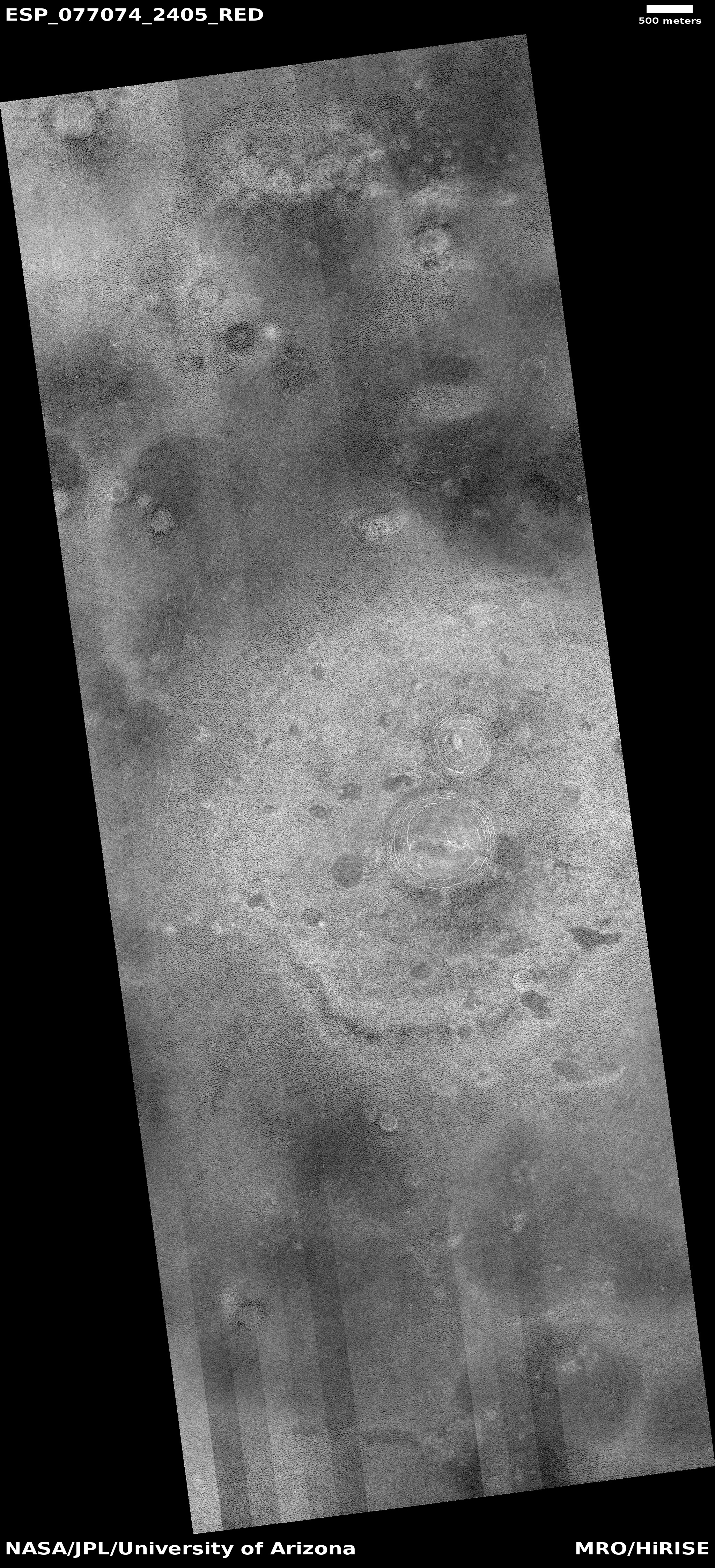
Cool image time! The picture to the right, rotated, cropped, reduced, and sharpened to post here, was taken on September 10, 2023 by the high resolution camera on Mars Reconnaissance Orbiter (MRO). It shows what the scientists label simply as a “double-rim crater.”

If you look close you might not be unreasonable to call this instead a triple-rim crater, as there appear to be two rings on each side of the highest crater rim.

Multple rings in craters are not rare. We see many on the Moon. Most however are associated with very large impacts, and are an expression of the ripples formed at impact, not unlike the ripples seen when you drop a pebble in water. Unlike water ripples, the ripples formed in rock are impact melt that quickly refreezes, thus capturing those ripples as concentric rings.

In this case, these rings likely signal not freezing rock but freezing ice.
» Read more

0 comments

Endless ash fields on Mars

Endless ash fields on Mars
Click for original image.

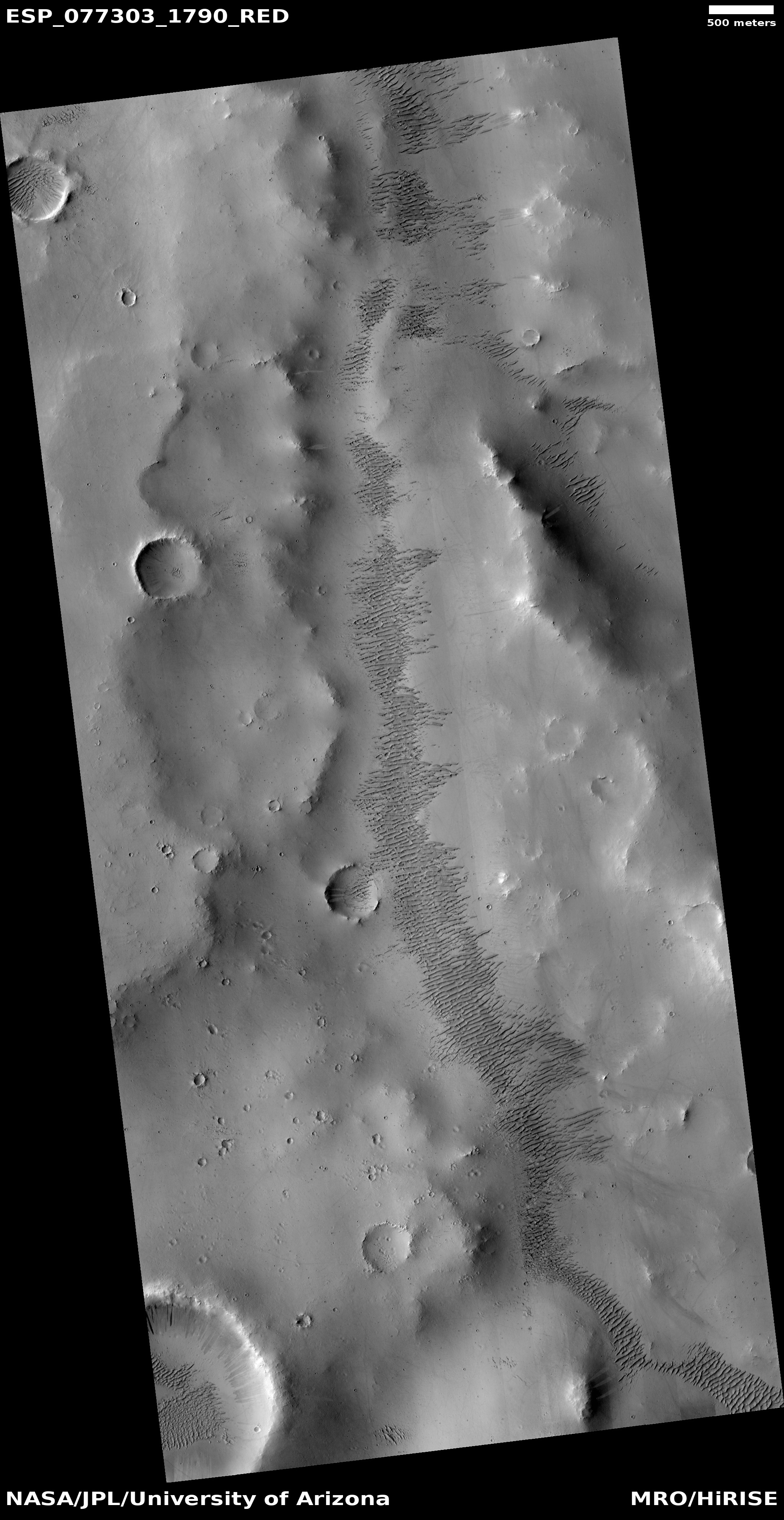
Cool image time! The picture to the right, cropped, reduced, and sharpened to post here, was taken on September 18, 2023 by the high resolution camera on Mars Reconnaissance Orbiter (MRO).

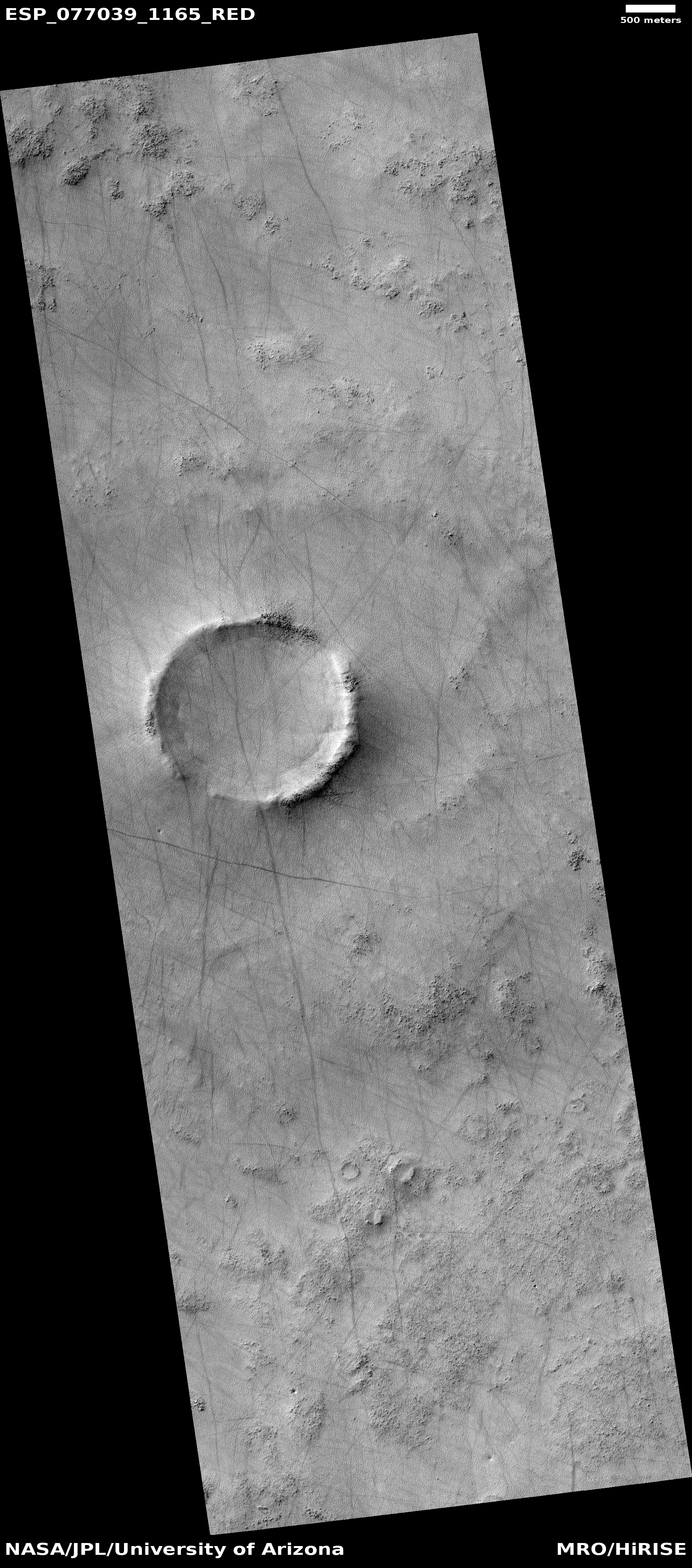
It shows the very typical surface on a high plateau in Mars’ dry tropical regions. The dunes you see here, in this very small slice, cover a region about 80 miles square, with the prevailing winds appearing to consistently blow from the northeast to the southwest and forming these endless striations.

The dunes are made of volcanic ash, and the size of this particular ash field gives us a sense of the past volcanic activity that once dominated the red planet. Once, the atmosphere was filled with ash, which covered the ground across large regions. In the subsequent eons the thin Martian atmosphere has reshaped and piled that ash into giant mounds hundreds of miles across, with the surface striated as we see here.
» Read more

4 comments

Layered volcanic vent on Mars

Layered volcanic vent on Mars
Click for original image.

Cool image time! The picture to the right, rotated, cropped, reduced, and sharpened to post here, was taken on August 31, 2023 by the high resolution camera on Mars Reconnaissance Orbiter (MRO), and shows what the science team labels as a “vent near Olympica Fossae.”

The grade within the fissure is downhill to its center. Outside the vent the grade is downhill to the north and south, with the overall grade sloping to the west as well. Note the layers on each side of the depression. Each indicates another volcanic flood event that laid down another layer of lava. At some point this vent either blew up through those layers, or it had remained opened during all those many events, the lava flowing out and acting like water to erode the layers on the north and the south.

As always, the scale of Martian geology is daunting, as shown by the overview map below.
» Read more

0 comments

Canyons formed from the giant crack that splits Mars

Canyons formed by the giant crack that splits Mars
Click for original image.

Cool image time! The photo to the right, cropped, reduced, and sharpened to post here, was taken on September 22, 2023 by the high resolution camera on Mars Reconnaissance Orbiter (MRO). It shows a complex of north-south trending canyons, with easternmost cliff about 400 feet high (though the full drop to the large canyon on its east is closer to 800 feet).

These canyons however have nothing to do with ice or water flow. They were formed by underground tectonic forces that pushed the ground upward, forced it to split and form cracks. Those cracks in turn produced these canyons. In some cases, such as the depression on top of the central ridge, the formation process probably occurred because fissures formed below ground, causing the surface to sag.

As always, the hiker in me wants to walk up the nose of that ridge and then along its western edge, with the western canyon on my left and that smaller depression on my right.

The larger context of this location is in itself even more spectacular.
» Read more

0 comments

The mining potential on Mars

The mining potential on Mars
Click for original image.

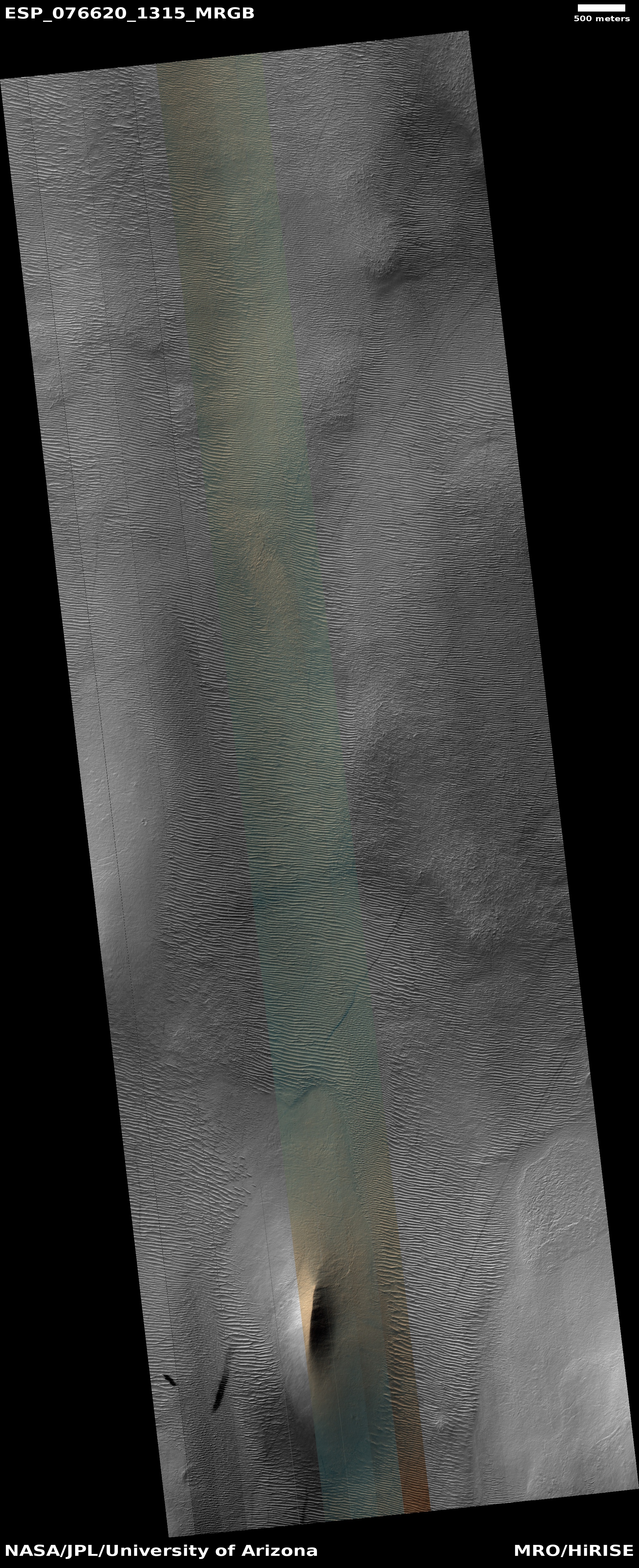
Cool image time! The picture to the right, cropped, reduced, and sharpened to post here, was taken on October 30, 2023 by the high resolution camera on Mars Reconnaissance Orbiter (MRO). Labeled simply as a “terrain sample,” it was probably taken not as part of any specific research project but to fill a gap in the schedule in order to properly maintain the camera’s temperature.

Nonetheless, the larger region where this photo is located is one of great interest to scientists as well as to future explorers. First note the colors. The wide variations between the bright orange of that peak (only a few tens of feet high) and the light orange and aqua-green of the bedrock to the north and south suggest a terrain with a lot of different materials within it.

The location is in the dry equatorial regions, so the swirls visible on the plateaus north and south of that small peak are not related to near surface ice. Instead, this is warped bedrock, with those swirls also suggesting material of a varied nature, exposed to the surface by erosion processes.
» Read more

1 comment
1 47 48 49 50 51 89