Data from Opportunity suggests surface dew periodically appears even in the dry equatorial regions

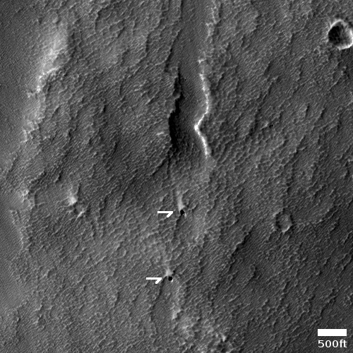
Using data from the rover Opportunity, scientists now think that the renewal of Martian salt crusts on rock surfaces on the rim of Endeavour Crater could possibly by caused by the appearance of rare thin wetting events, and that such events could have even occurred very recently and be on-going..

The scientists looked at the rate of erosion and renewal of the salt crusts, and found them to be in a steady state. The erosion is slow, taking from 200,000 to 2,000,000 years to remove 1 to 2 millimeters. However, periodically a thin film of water or wetting occurs, not unlike dew on Earth, which quickly acts to renew the crust. As David Mittlefehldt of the Astromaterials Research Office at the Johnson Space Center and the lead author of the paper explained to me,

Taken together, the data leaves open the possibility the salt mobilization has occurred within the last few thousand years. It could be ongoing in the sense that over a period of thousands? or hundreds? of years it might happen again.

In other words, the evidence suggests that every few hundred or thousand years the surface of these rocks gets wet, which results in the placement of a new thin layer of salt crusts.

Mittlefehldt also emphasized to me that these wetting events are rare, and “there is also the case that such an event may never come again because of changing conditions.”

The situation is essentially like on Earth, where in some places hydrologists measure the size of floods by how rare they are. A 1,000 year flood is big, but it happens very rarely. At Endeavour Crater these wetting events are comparably rare, but they do not involve big floods, but a mere moistening of the ground.

The location of Endeavour Crater is about 2 degrees south latitude, so it sits in the dry equatorial regions where no surface or near surface ice has so far been found. However, the cyclic nature of Mars’ orbit and obliquity could have changed this in the past, and could change this again in the future. At this time we simply don’t have enough information to know.

On the edge of Mars’ glacier country

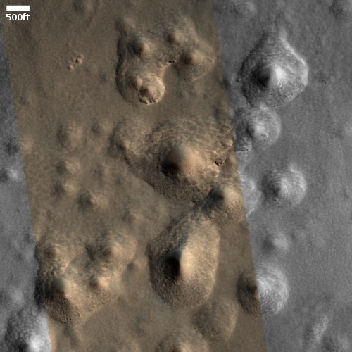
Color dry mesas on Mars
Click for full image.

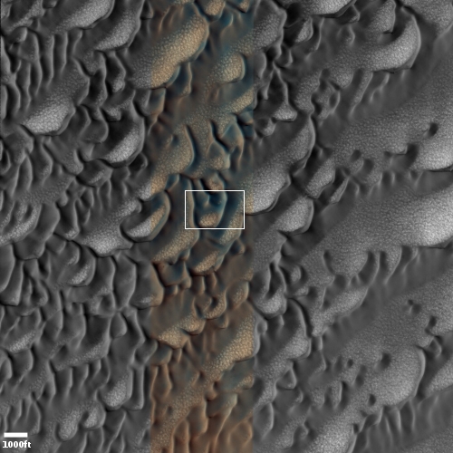
Today’s cool image sits right on the southern edge of Mars’ northern glacier country, at 29 degrees north latitude. The picture to the right, cropped and reduced to post here, was taken of this location on June 4, 2021 by the high resolution camera on Mars Reconnaissance Orbiter (MRO). It shows what appears to be the exposed and scraped bedrock and mesas on the floor of an unnamed 60-mile-wide crater.

That scraped bedrock is quite beautiful, reminiscent of the bare carved mesas and bedrock one sees throughout the southwest of the United States. To hike from that central valley to the top of the bright mesa would be a fine experience, especially because of the suggested change in colors in the color strip.

The overview map below gives more context.
» Read more

Glaciers and mesas on Mars

Overview map

Cool image time! Today we return to glacier country on Mars, that band of mensae mesas and glaciers that stretches more than 2,000 miles in the northern mid-latitudes, as shown on the overview map above.

No rovers or landers have yet visited this region, nor are any planned. To the west just beyond the map’s left edge is the planned landing site of Europe’s Franklin rover. To the east and south and just beyond the map’s right edge is where America’s Perseverance rover presently travels in Jezero Crater.

Our journey today begins from afar, and will steadily zoom into the area of the red cross and a most intriguing feature seen in a recent picture taken by the high resolution camera on Mars Reconnaissance Orbiter (MRO).

Before we look at that high resolution image, it is better to view the area using MRO’s context camera, as what it shows helps make sense of the features in the close-up.
» Read more

Ingenuity completes 13th flight

Ingenuity landing on September 5, 2021
Click for full image.

Though the full slate of images taken has not yet been released, it appears from the five images available that the thirteenth flight of Ingenuity on September 5, 2021 ended successfully. The photo to the right is the last available, and shows the helicopter’s shadow on the ground mere seconds before touch down. The landing legs’ shadows suggest it is oriented properly for that landing.

No word yet on how successful the flight itself was. The goal had been to fly back over the South Seitah area from a different angle and lower altitude, getting different perspectives of the ridges there to help plan Perseverance’s coming travels across that terrain.

The second picture below, cropped, reduced, and enhanced to post here, was taken about forty minutes before take-off by Perseverance and captures Ingenuity in the lower left, as indicated by the arrow.
» Read more

Perseverance’s 2nd drill attempt to get sample appears successful

It appears that Perseverance’s second drill attempt on Mars has successfully obtained sample material in its core.

Data received late Sept. 1 from NASA’s Perseverance rover indicate the team has achieved its goal of successfully coring a Mars rock. The initial images downlinked after the historic event show an intact sample present in the tube after coring. However, additional images taken after the arm completed sample acquisition were inconclusive due to poor sunlight conditions. Another round of images with better lighting will be taken before the sample processing continues.

Once they know for sure if they have a sample, they will store it and then move on, heading to the area that Ingenuity scouted for them in mid-August.

Posted halfway to Las Vegas.

A peanut-shaped crater in the northern plains of Mars

Context camera image of peanut-shaped crater
Click for full image.

Cool image time! The photo to the right, rotated, cropped and reduced to post here, was taken in May 2008 by the wide angle context camera on Mars Reconnaissance Orbiter (MRO). It shows what the scientists have since labeled a “peanut-shaped crater.”

What caused this unusual shape? The obvious and most likely explanation is that this was a double impact that occurred simultaneously. Imagine the ground being hit either by an asteroid with two lobes or by two similar-sized asteroids falling side-by-side.

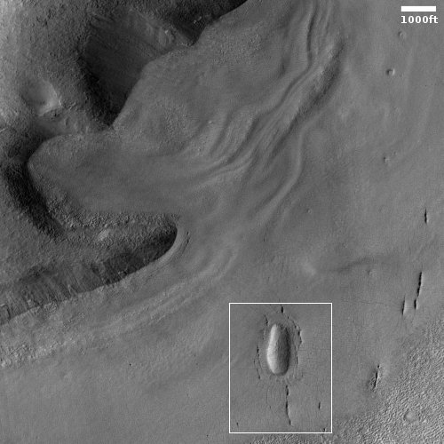
Fast forward thirteen years to 2021. In the fifteen years since 2006 when MRO begin science operations in orbit around Mars no high resolution images were taken of this crater. Finally, on July 30, 2021, scientists finally decided to take a high resolution image of this crater’s western half. You can see that image below, rotated, cropped, and reduced to post here.
» Read more

Stucco on Mars!

Stucco on Mars
Click for full image.

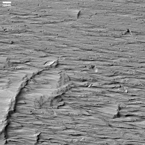
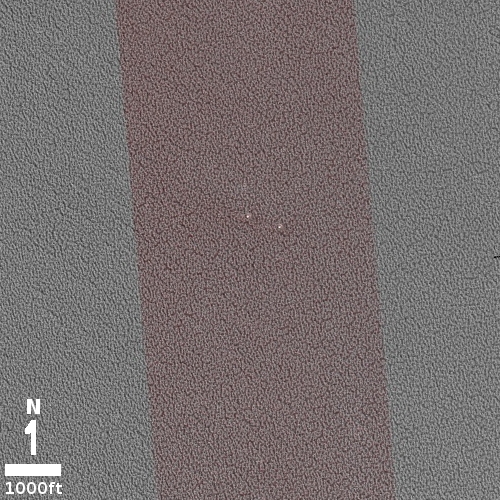
Cool image time! The picture to the right, cropped to post here, was taken on June 8, 2021 by the high resolution camera on Mars Reconnaissance Orbiter (MRO). It shows a strangely flat plain with a complex stucco-type surface of ridges and depressions. The sunlight is coming from the west, which makes the smoother flat areas depressions.

What are we looking at? What causes this strange surface? Make sure you look at the full image, because the section I cropped out doesn’t give a true sense of the terrain’s vastness.

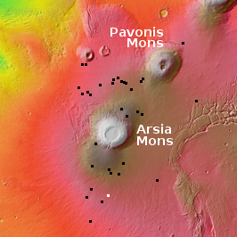
The MRO science team labeled the photo “volcanic terrain,” but that tells only part of the story, since this volcanic terrain is actually part of Mars’ most interesting lava plains, as the overview map below shows.
» Read more

Zhurong completes 100 days on Mars

Zhurong's loaction, August 31, 2021

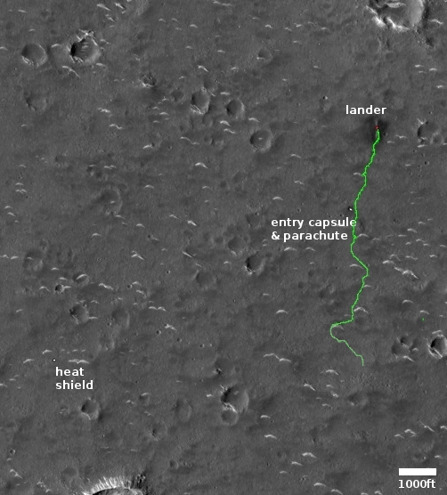
The new colonial movement: In announcing today that its Mars rover Zhurong has completed 100 days on the Martian surface, the state-run Chinese press released one very low-resolution panorama taken at the rover’s new position, and a map showing its full route since landing.

The map to the right, created by placing that route on a high resolution Mars Reconnaissance Orbiter image, shows us where Zhurong presently sits as well as where it might travel next. It still appears that they are attempting to reach the heat shield used during landing, which also suggests that they are giving high priority to the engineering aspects of this mission, possibly ranking that component higher than any science they get.

If high resolution versions of that panorama are available, they are probably only available on the Chinese language sites, which makes it very difficult for a non-Chinese-speaker to find.

According to the release, the rover has now traveled just under 3,500 feet, which means it is maintaining a pace greater than 1,000 feet per month. The release also noted this fact about the rover’s upcoming travels, as well as the Tianwen-1 orbiter being used as a communications relay satellite:

The probes will experience a sun outage in mid-to-late September when the Sun is aligned with Earth and Mars, with the solar radiation interfering with the communication between the probes and ground stations. The orbiter and rover will stop working until the sun outage comes to an end.

This conjunction occurs every two years. It means there will also be a pause in data from the American rovers and orbiters. When the last conjunction occurred in September 2019, the communications shutdown lasted about two weeks.

An ancient curving channel on Mars

Context image of curving channels
Click for full image.

Cool image time! The photo to the right, rotated, cropped, and reduced to post here, was taken by the wide angle context camera on Mars Reconnaissance Orbiter (MRO) in April 2019. It shows an area on Mars where a number of meandering curving channels flow downhill from the west to the east.

Earlier MRO images had already spotted these channels, so when this context image was taken the scientists also took a high resolution image of the same channels, with the white box indicating the area covered by the rotated, cropped, and reduced image below.

Both images are today’s MRO image of the day, where the MRO team notes that “The objective of this observation is to examine a complex network of channels. Some parts of the channels are quite curved.”
» Read more

Another mountain view from Curiosity

Low resolution panorama
Click for full resolution panorama. The original images can be found here, here, here, here, here, and here.

I hope my readers won’t get tired of seeing these mountain views from Curiosity, but I can’t get enough of them.

The image above is a panorama I’ve created from six photos taken by Curiosity’s right navigation camera yesterday. The box marks the location of that spectacular outcrop I highlighted in the previous mountain view five days ago. The red dotted line shows the rover’s upcoming planned route. The white cross indicates the pavement bedrock where the science team hopes to next drill.

For scale, Navarro Mountain is rises about 400 feet from where the rover presently sits. The peak of Mount Sharp is actually not visible, blocked by its near white flank on the panorama’s left edge. That peak is still 13,000 feet higher up from where the rover presently sits.

The rise of rocks next to the words “entering Gediz Vallis” is actually only probably five to ten feet high, as it is very close to the rover.

Curiosity’s travels continue to get more and more exciting to follow.

Perseverance’s upcoming targets: sand ripples, rocks, and a lot of dust

Ingenuity's view during 12th flight

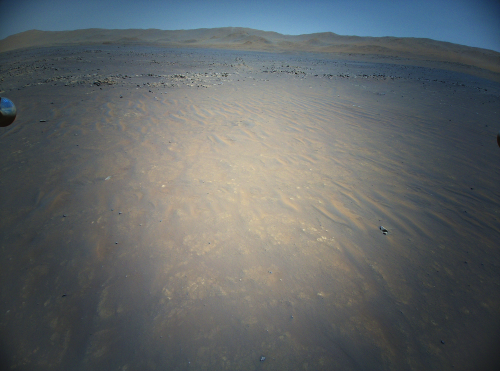
Cool image time! The photo to the right was one of ten color images taken by Ingenuity on its twelfth flight on August 15, 2021. This photo is one of two images looking the same area from slightly different positions in order to create a stereoscopic view, with the other image found here.

The ground the helicopter was scouting, dubbed South Seitah, is an area that the Perseverance team hopes to send the rover. Ingenuity’s images from this flight will not only tell them whether the terrain is safe to traverse, it will allow them to map out a route that will avoid problems while effectively targeting the most interesting rocks.

The photo shows a lot of Martian dust, with a good portion forming small sand dune ripples. The rocks appear to be bedrock pavement stones, which because these are on the floor of the crater and the lowest elevation, likely hold the oldest geology that Perseverance will see on its journey in Jezero Crater. For this reason the science team is spending a lot of time studying that floor, and will make probably several drilling attempts to obtain samples.

The terrain in general looks entirely safe for the rover to travel. I expect the science team will thus continue north, crossing to North Seitah, rather than backtrack and travel over already traversed ground. Initially they had decided to avoid this ground because they feared it might be too rough for the rover. I suspect they were just being overly cautious at the start of the mission, and will now work past that fear.

Wind-blown dark material on Mars

Dark wind-blown material on Mars
Click for full image.

Cool image time! The photo to the right, cropped and reduced to post here, was taken on May 13, 2021 by the high resolution camera on Mars Reconnaissance Orbiter (MRO). It shows a cluster of small depressions from which has blown dark material across the ground to the south. The full image also shows two craters north and south of this cluster that have similar dark material blown from their interiors.

When I first looked at this image, I wondered if the dark material and these depressions signaled a recently active volcanic vent where magma had spewed upward to stain the nearby ground. See for example this recent post about what some scientists believe might the most recent volcanic event so far found on Mars. I emailed several scientists for their thoughts, all of whom said this appears to not be active volcanism but merely windblown dark material.

Kim Seelos, science operations lead for MRO’s visible-near infrared spectrometer, put it simply. “My own reading of this image is that the dark areas here are likely akin to wind streaks.” Instead of the dark material being thrown from the depressions by a volcanic event, it was swept to the south by the prevailing winds.

How that dark material got into the depressions, and why it was so comparably darker than the surrounding terrain, remains unclear. David Horvath of the Planetary Science Institute in Arizona speculated that the low hills just north of the dark patch might be a factor.
» Read more

First hi-res radio wavelength images of metal asteroid Psyche

Psyche in thermal

Using the ALMA telescope in Chile astronomers have obtained the highest resolution radio images of the surface of the metal-rich asteroid Psyche yet obtained. The image to the right is from their just published paper. From the article:

These new images reveal that some regions of the asteroid have surface temperatures different from the average, indicating that Psyche’s composition is not uniform. The researchers also found that Psyche has a relatively high thermal inertia compared to other asteroids, yet it radiates approximately 60% less heat than would be expected for an object with such a high inertia. The researchers hypothesize that this is because the asteroid’s surface is at least 30% metal. However, the light reflecting off Psyche’s surface is unpolarized, which would not be the case for an object with a smooth or solid metallic surface. They therefore hypothesize that metallic grains are spread throughout its surface material, causing the light to scatter.

Though Psyche is large, 178 by 144 by 101 miles, it is not spherical like Ceres, the largest asteroid in the asteroid belt at 580 miles diameter. Thus, somewhere from the size of Psyche to the size of Ceres we move from an irregular asteroid body to a spherical planetary body, as it appears most planetary scientists define planets.

The probe Psyche is scheduled to launch in August ’22 to arrive at Psyche in ’26.

Curiosity’s coming mountainous target

Curiosity's upcoming mountainous target
Click for full image.

Overview map


Click for interactive map.

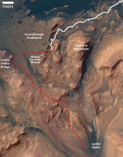
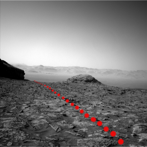
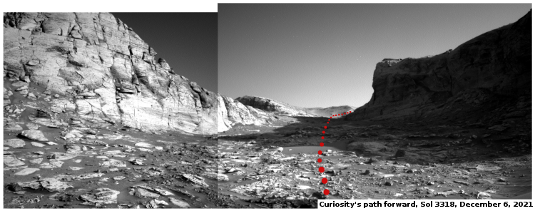
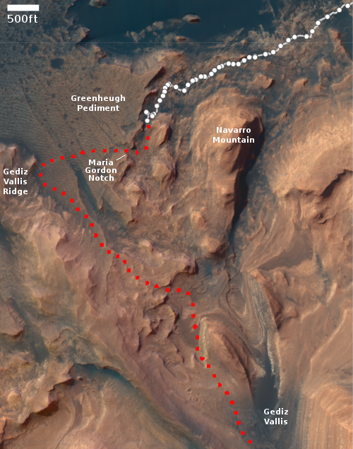
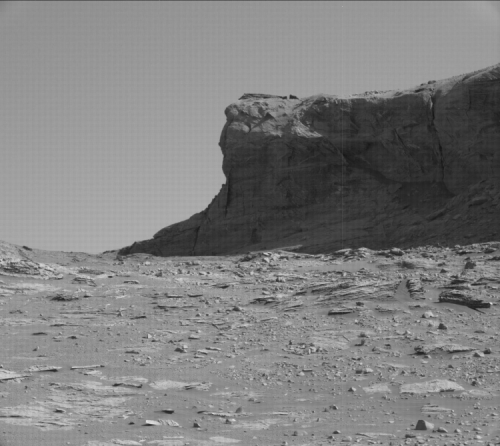
Cool image time! The photo above, taken on August 22, 2021 by Curiosity’s left navigation camera and reduced to post here, looks ahead at the rover’s upcoming mountainous goals. The overview map to the right shows the area covered by this image by the yellow lines. The dotted red line indicates the rover’s original planned route, with the white dotted line its actual path of travel.

The cliff ahead is about 400-500 feet away. The top of this cliff is the Greenheugh Pediment, its blocky top geological layer visible as the dark cap at the top of the cliff face. Back in March 2020 Curiosity had climbed up to view across this pediment, from a point to the northwest and off the overview map to the left. (Go to this link to see what the view was like from there.) Since then the science team has had the rover travel quite a distance, to circle around to now approach the pediment from the east.

The white box marks the area covered by a close-up high resolution mast camera image, shown below.
» Read more

New cracks across old Martian lava flows

New cracks across an old lava flow
Click for full image.

Cool image time! The photo to the right, cropped and reduced to post here, was taken on June 4, 2021 by the high resolution camera on Mars Reconnaissance Orbiter (MRO). It captures one of the many deep straight fissure canyons that make up the feature dubbed Cerberus Fossae in the center of Mars’ volcano country.

The crack is called a graben, and happens when the ground is either stretched from pressure from below, or when two adjacent large blocks of material move sideways relative to each other.

What makes this particular graben interesting are two features. First, the overlapping break suggests something complex took place at this spot when the crack separated. Second, the crack cut across the foot of an older frozen lava flow, meaning it has to be younger than that flow.

The overview map below provides a clue when that lava flow might have occurred, while also suggesting this crack in Cerberus Fossae might be much younger than expected.
» Read more

Perseverance’s next drill attempt

Perseverance short term planned route
Click for full image.

The Perseverance science team today announced its near-future plans for where it will send the rover, but also when and how it will attempt its next core sample drilling.

The map to the right, cropped and reduced to post here, shows the rover’s future route. The red dot indicates its present location. The blue dot indicates where next they will attempt to drill. The route shows that they have decided to also make a short side trip south, an target that until now was considered optional.

As for what they plan to do in that next drill attempt:

We will first abrade the selected rock and use the science instruments to confirm (to the best of our ability) that the new target is likely to result in a core after the sampling process.

If we choose to sample the rock, Perseverance will perform a set of activities very close to what was done on the prior coring target. The main difference will be, after coring, we’ve added a “ground in the loop” session to review the images of the tube in the bit and confirm a sample was collected. Then, the tube will be transferred into the rover for processing.

If post-coring imagery shows no sample in the tube, we may elect to try again, using an alternate geometry (e.g. more horizontal) for the coring activity. Another option, if the targeted rock doesn’t allow for a change in geometry, is to look for a different rock in this region that is more easily cored horizontally.

They really want to get a sample of this particular bedrock on the floor of Jezero Crater. Their problem is that the first core sample failed because the bedrock was too structurally weak, crumbled into powder during drilling, and thus poured out of the drillbit once retracted from the ground. It could be that this will be a consistent issue with any sample attempts in this bedrock. This is why they are also considering drilling sideways, in order to hold any material they grab.

I suspect that the short side trip south might be to an outcrop that the rover could drill sideways into. Thus, if they are successful in getting a sample at the blue dot they might still cancel that side trip.

A weak avalanche season on Mars?

The north pole scarp
Click for full image.

Today’s cool image from Mars is cool both for what is visible in the photo and for what is not, the latter of which might turn out to be a discovery of importance.

The photo to the right, cropped and reduced to post here, was taken on June 24, 2021 by the high resolution camera on Mars Reconnaissance Orbiter (MRO). It shows a section of the edge of Mars’ north polar ice cap, with north at the top.

This scarp is probably more than 2,000 feet high, though that height drops to the south as the upper layers disappear one by one from either long term erosion or sublimation. Those layers represent the visible information in the photo that is cool. They give us tantalizing clues about the geological and climatic history of Mars. Each layer probably represents a climate period when the north icecap was growing because the tilt of the planet’s rotation was even less than the 25 degrees it is now. When that tilt is small, as small as 11 degrees, the poles of Mars are very cold, and water ice migrates from the mid-latitudes to the poles, adding thickness to the icecaps. When the tilt grows, to as much as 55 degrees, the mid-latitudes are colder than the poles, and the water ice migrates back to the mid-latitudes.

What is not visible in this picture, however, might be far more significant.
» Read more

A dry bedrock Martian crater floor?

A dry bedrock crater floor?
Click for full image.

Cool image time! The photo to the right, cropped and reduced to post here, was taken on June 21, 2021 by the high resolution camera on Mars Reconnaissance Orbiter (MRO). The location is a very eroded crater at about 26 degrees north latitude. The image shows the crater’s crater floor, with a variety of bedrock-type features, sharp ridges, abrupt scarps, and flat smooth plateaus, with a hint of lobate glacial flows in the image’s southeast quadrant.

At 26 north latitude, it is unlikely that anything here is icy, unless it is very well protected by debris. Most of these features are almost certainly bedrock, though their formation could very well have been shaped by ice in past eons when this location was more amenable to water ice.

The wider MRO context camera image of the entire crater, plus the overview map, give a larger picture, and raise some interesting questions.
» Read more

Curiosity produces new 360 degree hi-res panorama

360 degree hi-res panorama from Curiosity
Click for full resolution image.

The Curiosity science team has used the rover’s high resolution camera to produce a new 360 degree panorama, with the center of the image looking directly up at Navarro Mountain.

To get a really good idea of what this panorama shows, I have embedded below a video the scientists have produced giving a tour of the image, which reveals two especially interesting details. First, their future route will go between Navarro Mountain (the highest visible peak) and the 80-foot-high dark butte to its right. This is as planned, as indicated by the red dotted line on the overview map show in this July 8, 2021 post.

Second, the air was very clear when this panorama was taken, and so the rim of Gale Crater can be distinctly seen, 20 miles away.

» Read more

Zhurong completes its planned 90-day mission on Mars

China’s state-run press announced today that its Mars rover Zhurong has successfully completed its planned 90-day mission, is operating without issues, and will continue its exploration of the Red Planet.

The rover has traveled 889 meters as of Aug. 15, and its scientific payloads have collected about 10 Gb of raw data. Now the rover runs stably and operates in good condition with sufficient energy. The CNSA added that the rover will continue to move to the boundary zone between the ancient sea and the ancient land in the southern part of Utopia Planitia and will carry out additional tasks.

According to the administration, Zhurong operated with a cycle of seven days during its exploration and detection. Its navigation terrain camera obtained topographic data along the way to support the rover’s path planning and detection target selection.

Zhurong’s subsurface detection radar acquired the data of the layered structure below the Martian surface, which analyzes the shallow surface structure and explores the possible underground water and ice. [emphasis mine]

This announcement reveals two tantalizing details. First, they are extending the mission, and plan to continue traveling to the south, with a very long term fantasy goal of reaching the transition zone between the northern lowland plains that Zhurong landed in and the southern cratered highlands. That fantasy goal is about 250 miles away. At the pace Zhurong is traveling, about 1,000 feet per month, it will take about a 100 years to cover that ground. Even so, as they move south they are slowly going up hill, and have the chance of seeing some change in the geology along the way.

The second tantalizing detail is indicated by the highlighted last sentence, and is probably the most important data obtained by Zhurong. It suggests they obtained good data from the rover’s ground penetrating radar, and it indicated the existence of underground layers. Whether those layers contain ice however is not clear. From the story it appears the data has not yet been analyzed enough to say.

Lacy patterns in the high north of Mars

lacy patterns in the high north of Mars

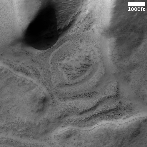
Cool image time! The photo to the right, cropped, reduced, and rotated so that north is up, was taken on May 12, 2021 by the high resolution camera on Mars Reconnaissance Orbiter (MRO). It shows the strange lacy patterns seen routinely in the very high northern latitudes surrounding the Martian north pole.

Located in a region of the vast northern lowland plains dubbed Scandia Tholi, such features are apparently common here. From a 2011 geology paper of the region’s geological history:

We find that Scandia Tholi display concentric ridges, rugged peaks, irregular depressions, and moats that suggest uplift and tilting of layered plains material by diapirs and extrusion, erosion, and deflation of viscous, sedimentary slurries as previously suggested. These appear to be long-lived features that both pre-date and post-date impact craters.

The small circular feature near the bottom of the picture appears to be a mesa, and might be a pedestal crater, so old that the surrounding terrain has worn away and left the hardened-by-impact crater as a butte. To its right is a larger circular mesa with its scarp well eroded into hollows. This might also be a pedestal crater, or not.

The white lacy patterns could be frost, either water ice or dry ice. That the white lace tends to favor the north-facing slopes lends support to this guess. The photo was taken in the early spring, so the thin mantle of carbon dioxide that falls to cover the polar region south to sixty degrees latitude is only beginning to sublimate away.

Ingenuity’s 12th flight successful

Ingenuity's shadow just before landing.

According to the Perseverance science team, the Mars helicopter Ingenuity successfully completed its twelfth flight on Mars early yesterday, making a short scouting round trip over an area called South Seitah to provide images that the team can use to plan the rover’s future route.

All told, Ingenuity flew just under 1,500 feet flying about 30 feet above the ground for just under three minutes. The picture to the right was taken just before landing, and shows the helicopter’s shadow on the ground. It is one of six so far downloaded. The remaining images will follow later.

The announcement was made on Twitter, and included some embarrassingly over-the-top prose:

The #MarsHelicopter’s latest flight took us to the geological wonder that is the “South Séítah” region.

South Seitah is hardly a “geological wonder”. It is a sandy area with some rocks and interesting geology.

I’m not sure why, but the Perseverance rover team seems prone to do this with their press releases and announcements. The claim they make over and over that Perseverance’s prime mission is to look for ancient life is junk Now they call a relatively undistinguished and small area on a crater floor a “wonder.”

Makes one think they somehow feel a need to justify what they are doing, something that is patently absurd. They are controlling a robotic rover and helicopter tens of millions of miles away as both explore a place on another planet no one had ever visited before. That certainly is spectacular enough, and does not need purple prose to justify.

Regional Martian dust storms help suck water from Mars

Orbital data now shows that both global and regional dust storms on Mars help remove the planet’s water, allowing it to reach higher atmospheric elevations where solar radiation breaks it up and it escapes into space.

Scientists have long suspected that Mars, once warm and wet like Earth, has lost most of its water largely through this process, but they didn’t realize the significant impact of regional dust storms, which happen nearly every summer in the planet’s southern hemisphere. Globe-enveloping dust storms that strike typically every three to four Martian years were thought to be the main culprits, along with the hot summer months in the southern hemisphere when Mars is closer to the Sun.

But the Martian atmosphere also gets heated during smaller, regional dust storms, according to a new paper published August 16 in the journal Nature Astronomy. The researchers, an international team led by Chaffin, found that Mars loses double the amount of water during a regional storm as it does during a southern summer season without regional storms.

This conclusion is based on data gathers from three different orbiters during a regional dust storm in early 2019.

A Martian river of ice

Glacial flow on Mars?
Click for full image.

Cool image time! The photo to the right, rotated, cropped and reduced to post here, was taken on May 13, 2021 by the high resolution camea on Mars Reconnaissance Orbiter (MRO). It spans the entire 4.7 mile width of the southern hemisphere canyon dubbed Reull Vallis. The white arrow indicates the direction of the downhill grade

The scientists title this image “Lineated Valley Fill.” The vagueness of this title is because they have not yet confirmed that this lineated valley fill is a glacier flowing downhill to the west.

Nonetheless, the material filling this valley has all the features one expects glaciers to exhibit. Not only is the the lineation aligned with the flow, it varies across the width of the canyon as glaciers normally do. At the edge the parallel grooves are depressed, probably because they are torn apart by the canyon walls as the glacier flows past. In turn, at the center of the flow the grooves are thinner and more tightly packed, and appear less disturbed. Here, the flow is smooth, less bothered by surrounding features.

This pattern also suggests the merging of two flows somewhere upstream.

A glance at the spectacular Concordia glacier in the Himalayas near the world’s second highest mountain, K2, illustrates the similarity of this Martian feature to Earth glaciers.

Reull Vallis itself flows down to Hellas Basin, the deepest basin on Mars. As it meanders downhill along its 650 mile length it steadily gets wider and less distinct as it drops into Hellas. Along its entire length MRO has photographed numerous similar examples of this lineated fill, all suggesting that under a thin layer of debris is a thick glacier, slowerly carving this canyon out.

The overview map below illustrates these facts nicely, while further reinforcing these glacial conclusions.
» Read more

Ingenuity’s next flight

Ingenuity's flight plane for 12th flight
Click for full image.

The Ingenuity engineering team today announced their plans for the helicopter’s twelfth flight on Mars, scheduled for early tomorrow.

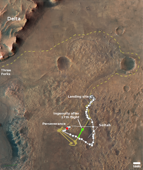
Ingenuity will climb to an altitude of 10 meters and fly approximately 235 meters east-northeast toward the area of interest in Séítah. Once there, the helicopter will make a 5-meter “sidestep” in order to get side-by-side images of the surface terrain suitable to construct a stereo, or 3D, image. Then, while keeping the camera in the same direction, Ingenuity will backtrack, returning to the same area from where it took off. Over the course of the flight, Ingenuity will capture 10 color images that we hope will help the Perseverance science team determine which of all the boulders, rocky outcrops and other geologic features in South Séítah may be worthy of further scrutiny by the rover.

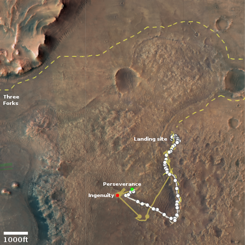
The map above shows South Seitah in the yellow oval. The yellow line marks Ingenuity’s past flights. The white line marks the path Perseverance has taken south since landing. The dashed lines mark Perseverance’s planned route.

Thus, the helicopter will be obtaining aerial photos of the region in Seitah where the scientists want to send Perseverance, in order to help them pick the best route.

Curiosity looks backwards

Curiosity panorama looking southeast
Click for full resolution version. For original images go here and here.

Overview map
Click for interactive map.

Cool image time! The mosaic above was created from two photos taken on August 13, 2021 by Curiosity’s right navigation camera. It looks to the southeast, at the mountainous Martian terrain that the rover had been traveling just below for the past two months.

The overview map to the right shows with the yellow lines the approximate area covered by this mosaic. The white mountain at the top is the highest visible flank of Mount Sharp, and is beyond the right/bottom edge of the overview map. Mt. Sharp’s peak itself is not visible, as it is higher up and to the right. It is presently blocked by these mountainous foothills.

The science team probably took this image partly to provide another view of these mountains for comparison with earlier views. They can use this new data to look for changes as well as obtain better three-dimensional data.

They also took the image for the same reason I post it here. Having now climbed more than 1,500 feet from the floor of Gale Crater, Curiosity’s view is routinely spectactular. Why not enjoy it?

Mt. Sharp’s peak however is still about 13,000 feet above the rover. The climb up the mountain has just begun.

A chain of Martian sinkholes

Chain of sinkholes on Mars
Click for full image.

Cool image time! The photo to the right, rotated, cropped, and reduced to post here, was taken on June 17, 2021 by the high resolution camera on Mars Reconnaissance Orbiter (MRO). It shows a somewhat straight depression with several wider and deeper pits along it.

The feature immediately suggests sinkholes that exist because the ground is sagging into voids below ground. Yet, both the straight and circular depressions also appear filled, showing no evidence that they connect to any below ground cavities.

Are the sinks the result of a fissure produced by a graben, when two large blocks shift relative to each other to cause a fissure to appear? Or are they evidence of an underground lava tube? Or maybe they are the filled remains of a now mostly buried canyon carved by water or ice?

As always, a wider view helps clarify things, though whether it answers the question is uncertain.
» Read more

China to fly asteroid sample mission in ’24

The new colonial movement: Chinese scientists have revealed that China is now building an asteroid sample mission to launch in ’24 and grab samples in ’25 from the near Earth asteroid dubbed Kamoʻoalewa.

According to a correspondence in Nature Astronomy, there are two typical approaches to sampling asteroids like Kamoʻoalewa, namely anchor-and-attach and touch-and-go.

The former requires delicate and dangerous interactions with the planetary body but allows more controllable sampling and more chances for surface analysis. The latter, used by Hayabusa 2 and OSIRIS-Rex, is a quick interaction facilitated by advanced navigation, guidance and control and fine control of thrusters.

China’s mission will use both architectures in order to “guarantee that at least one works.” The paper states that there is “still no successful precedent for the anchor-and-attach architecture,” meaning a possible deep space first. A 2019 presentation reveals that China’s spacecraft will attempt to land on the asteroid using four robotic arms, with a drill on the end of each for anchoring.

The attempt to do both these approaches is audacious, especially because the evidence from both OSIRIS-REx and Hayabusa-2 is that it will be difficult to safely land and hold onto a rubble pile asteroid. The material is too loosely held together.

Confirmed: Perseverance sample was too crumbly and poured away

Perseverance scientists have confirmed that the reason their sample container was empty once stored on the rover was because the material that they had drilled into was more crumbly than expected, and when the core was extracted from the ground the powder simply poured out of the core tube.

The team has decided to move on.

Rather than try again with the cratered floor fractured rough, Perseverance has already departed the area and is heading towards a region named South Séítah, which likely contains layered sedimentary rocks that are more similar to the Earth rocks that engineers drilled during tests before the mission’s launch. “We are going to step back and do something we are more confident of,” says Trosper. The rover will try to drill a core there, perhaps in early September. When it does, engineers will pause the automated drilling process to check whether a core has been extracted before the rover takes the next steps of sealing the tube and storing it away.

While it makes sense to find a different place to drill for a core sample, it appears that Perseverance is designed in a manner that it can do no analysis of any drill hole material:

Curiosity and Perseverance are similar in many respects — Perseverance was actually built using much of the leftover hardware from Curiosity — but there is one major difference in how they drill into the Martian surface. Curiosity intentionally grinds rock into powder, which it then places inside analytical instruments it has onboard to conduct scientific studies. NASA designed Perseverance to extract intact cores that slide into its sampling tubes. So crumbly rocks are good for Curiosity, but not for Perseverance.

If Perseverance can do no analysis of any drillholes, this limits the science it can do significantly. While putting aside samples for later return to Earth is an excellent idea, to make this the priority so that Perseverance can analyze nothing seems a terrible decision. What if that sample return mission never gets built?

If my supposition here is correct it also means NASA’s repeated claim that Perseverance is searching for ancient life on Mars is even more of a lie than I had assumed. It isn’t merely that this claim is a distortion of Perseverance’s actual research goals — to study the geology of Mars — the rover can’t look for ancient life. It has no way of looking at any samples it digs up.

I am not sure if my conclusions here are entirely correct. For example, maybe they hope to find this alien evidence by looking at the sealed core samples they store. Unfortunately, I have no idea, because I am somewhat handicapped in describing Perseverance’s day-by-day operations because, unlike Curiosity, the Perseverance team is providing no regular updates of their operations at their blog. While the Curiosity team posts something at least twice a week, the Perseverance team has posted nothing since just after landing in February. I’ve emailed NASA about this, but have gotten no response.

Glacial ice sheets on Mars?

Glacial ice sheets on Mars?
Click for full image.

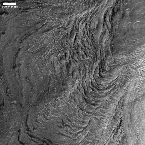
Cool image time! The photo to the right, rotated, cropped, and reduced to post here, was taken on June 29, 2021 by the high resolution camera on Mars Reconnaissance Orbiter (MRO). The location is in Mars’ glacier country, that strip of chaos terrain that runs about 2,000 miles along the transition zone between the northern lowland plains and the southern cratered highlands at 30 to 47 degrees north latitude. This particular feature is located in Deuteronilus Mensae, the westernmost region of that strip of chaos.

I call this glacier country because practically every image taken by MRO’s high resolution camera in this region suggests the presence of glacial material covered by a protective layer of debris. The photo to the right is typical, though a bit more puzzling because of the depressions that appear to run along highpoints.

As usual, the overview map below helps explain what we are looking at.
» Read more

1 31 32 33 34 35 60