
Martian impacts and streaks
Click for full image.
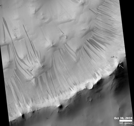
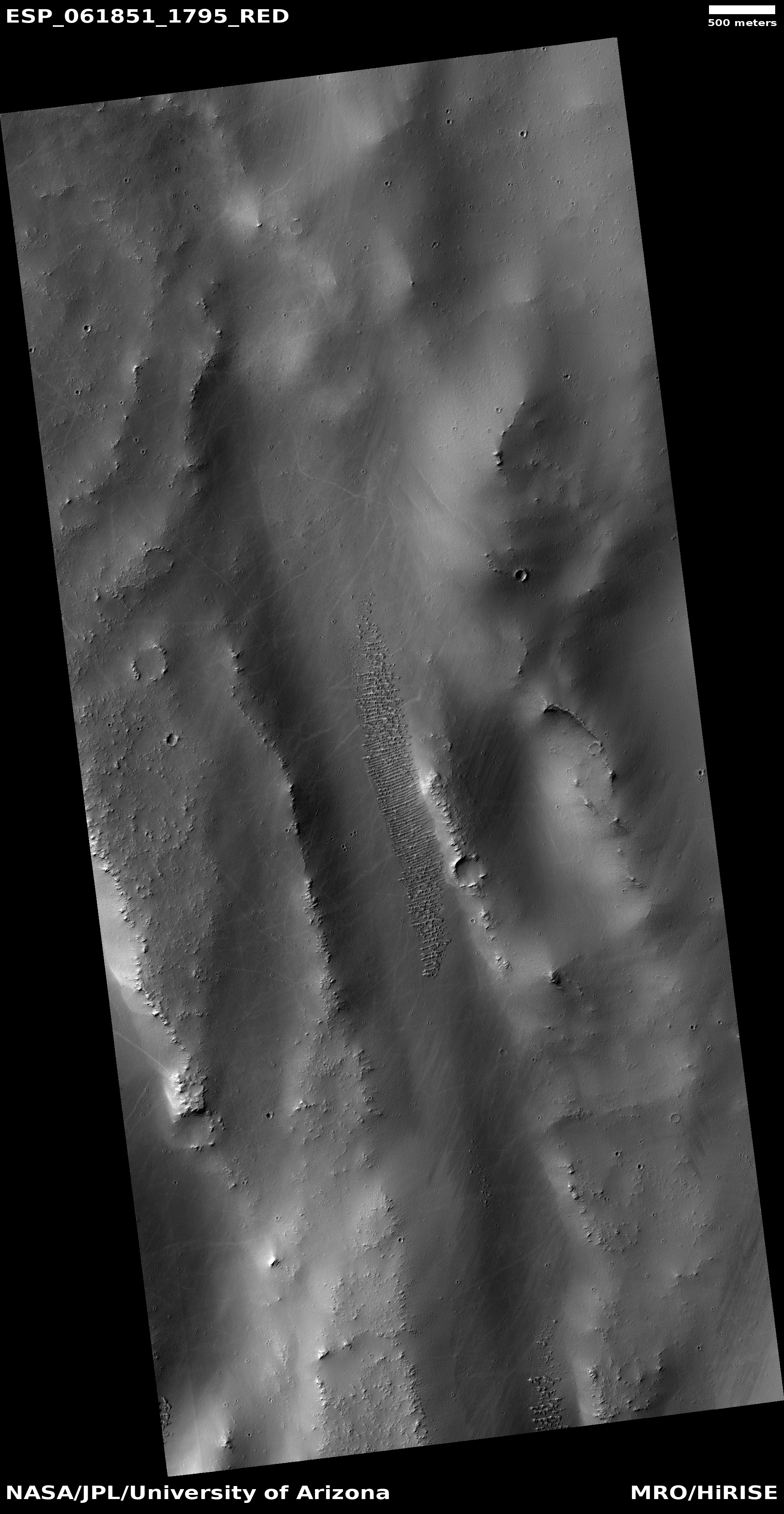
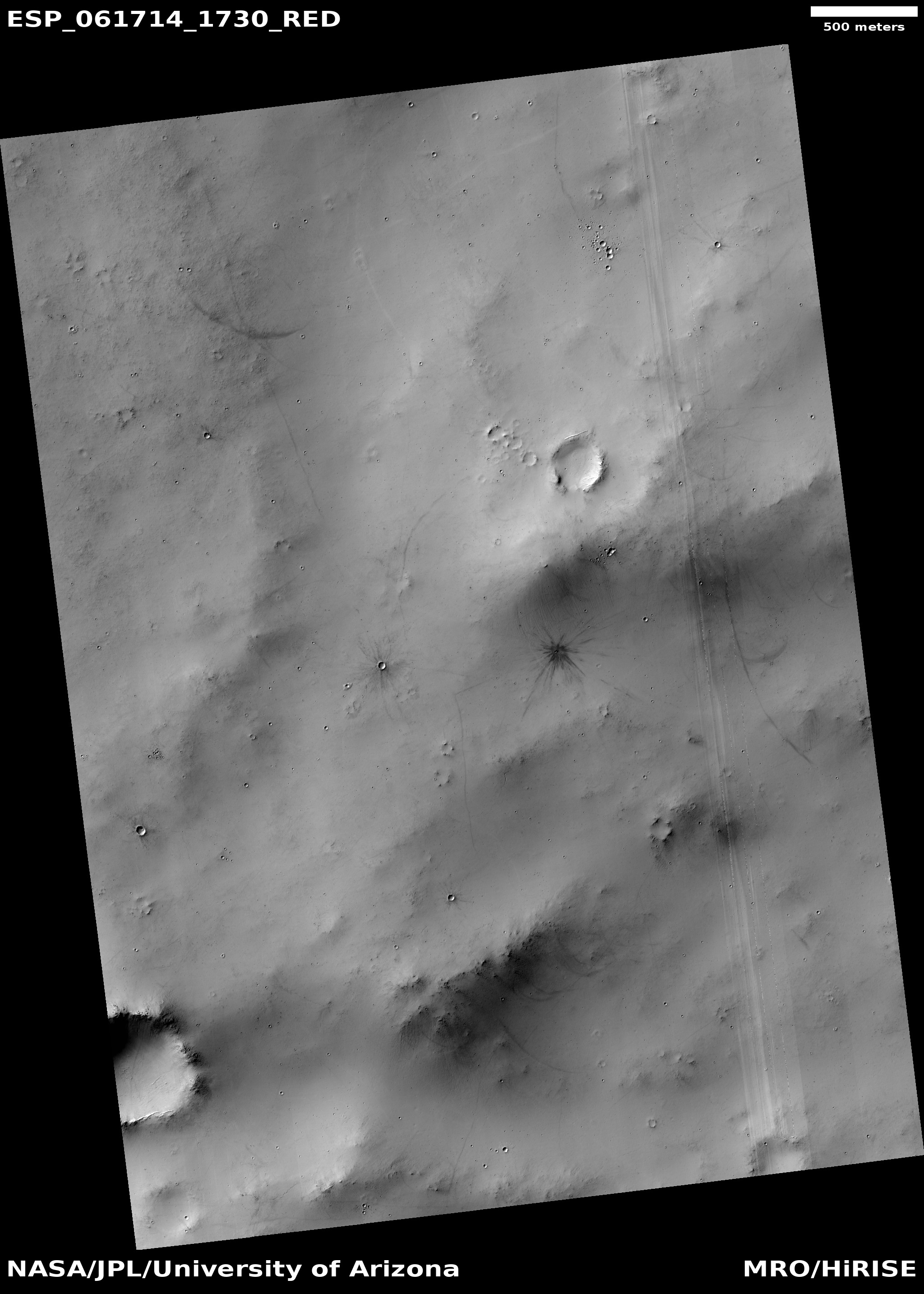
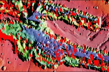
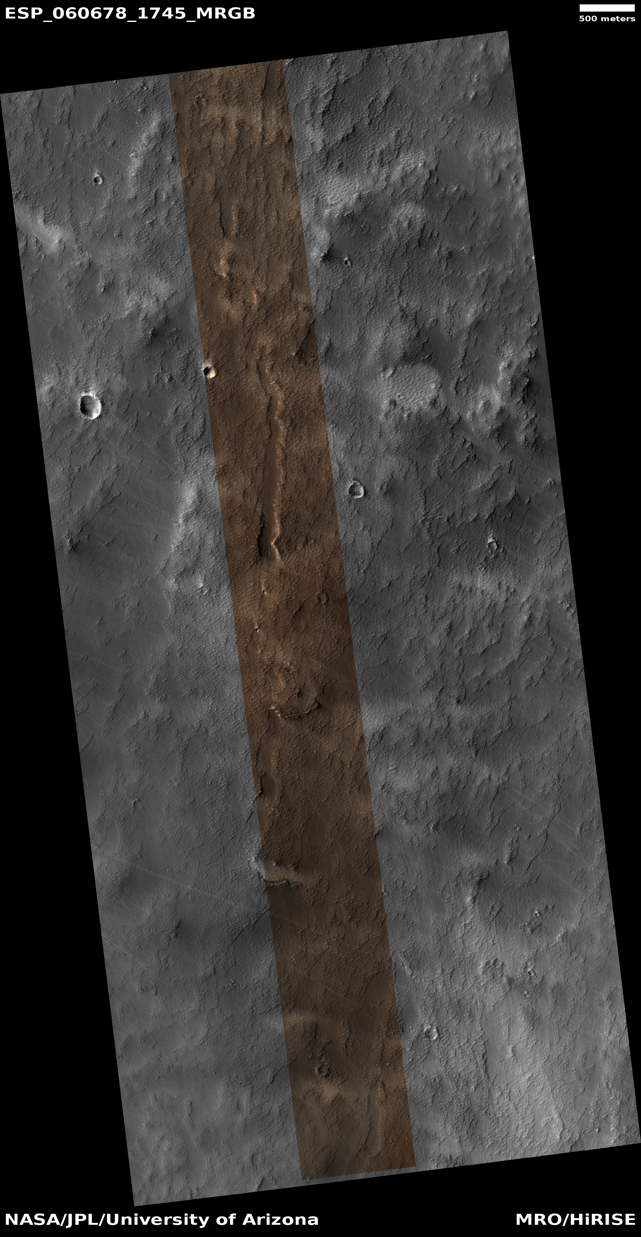
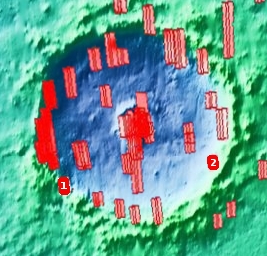
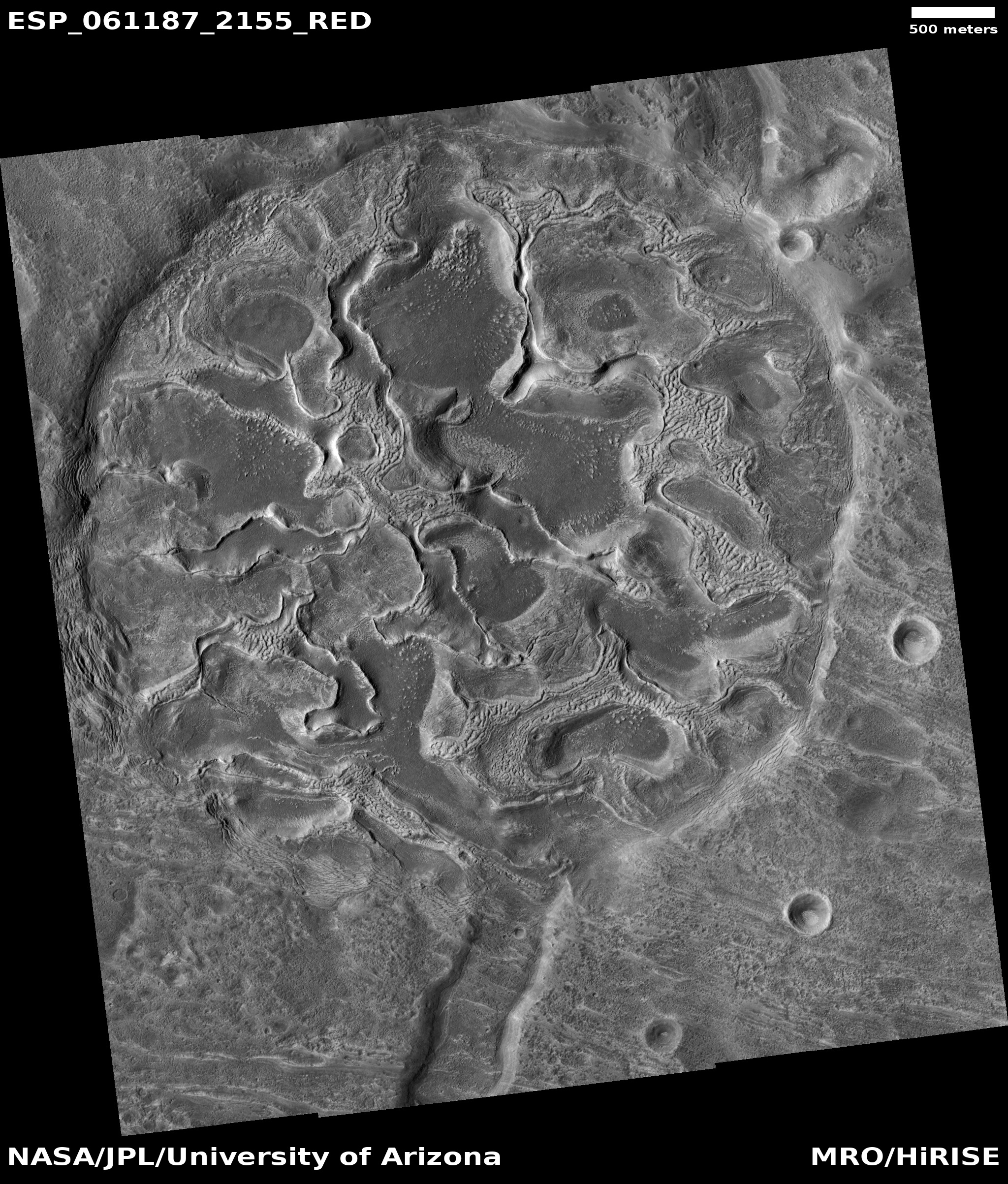
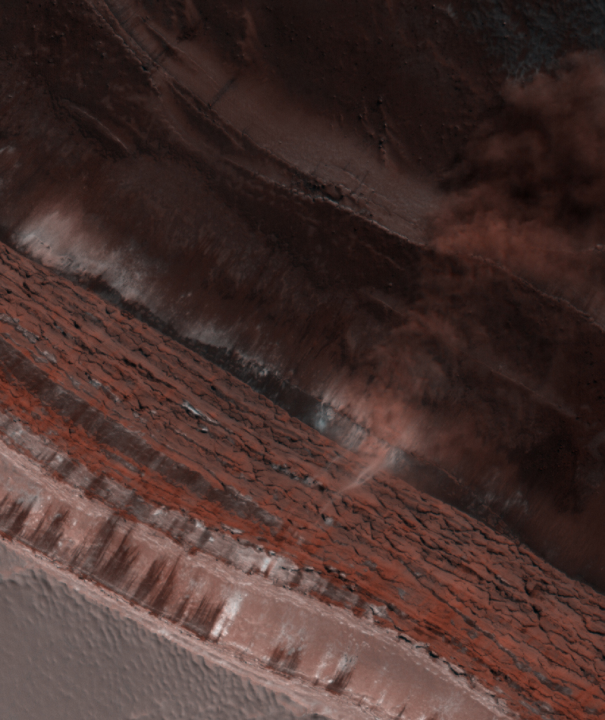
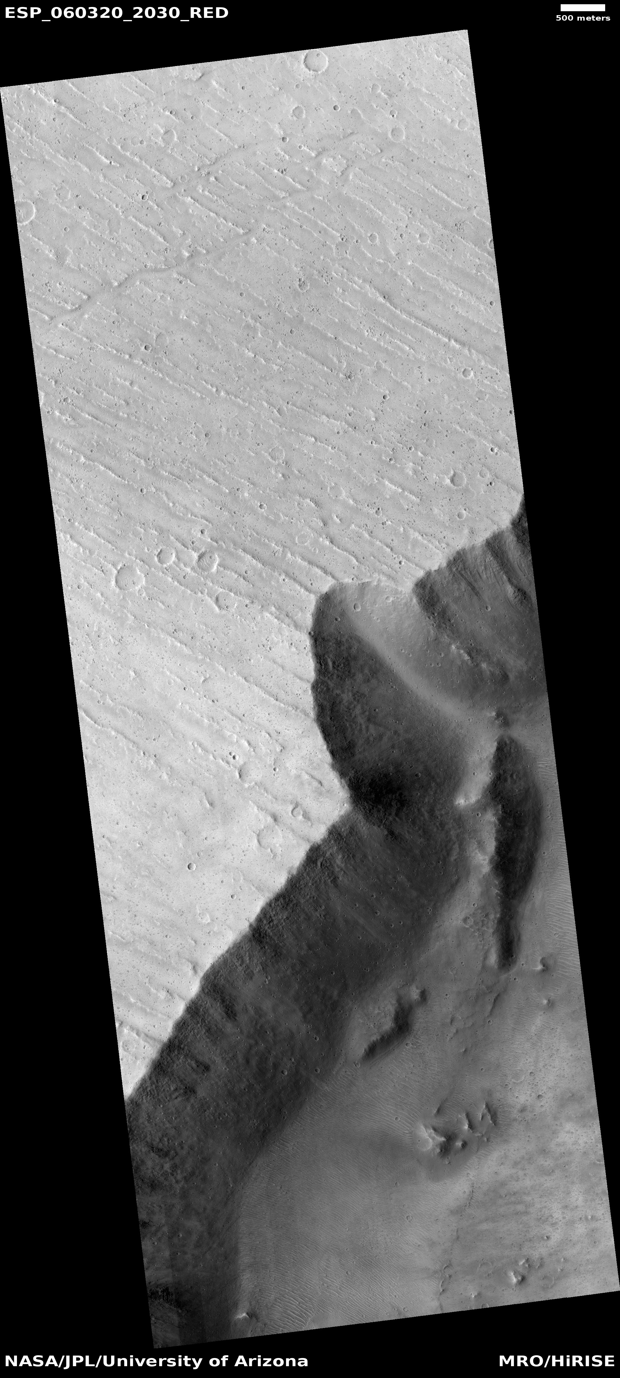
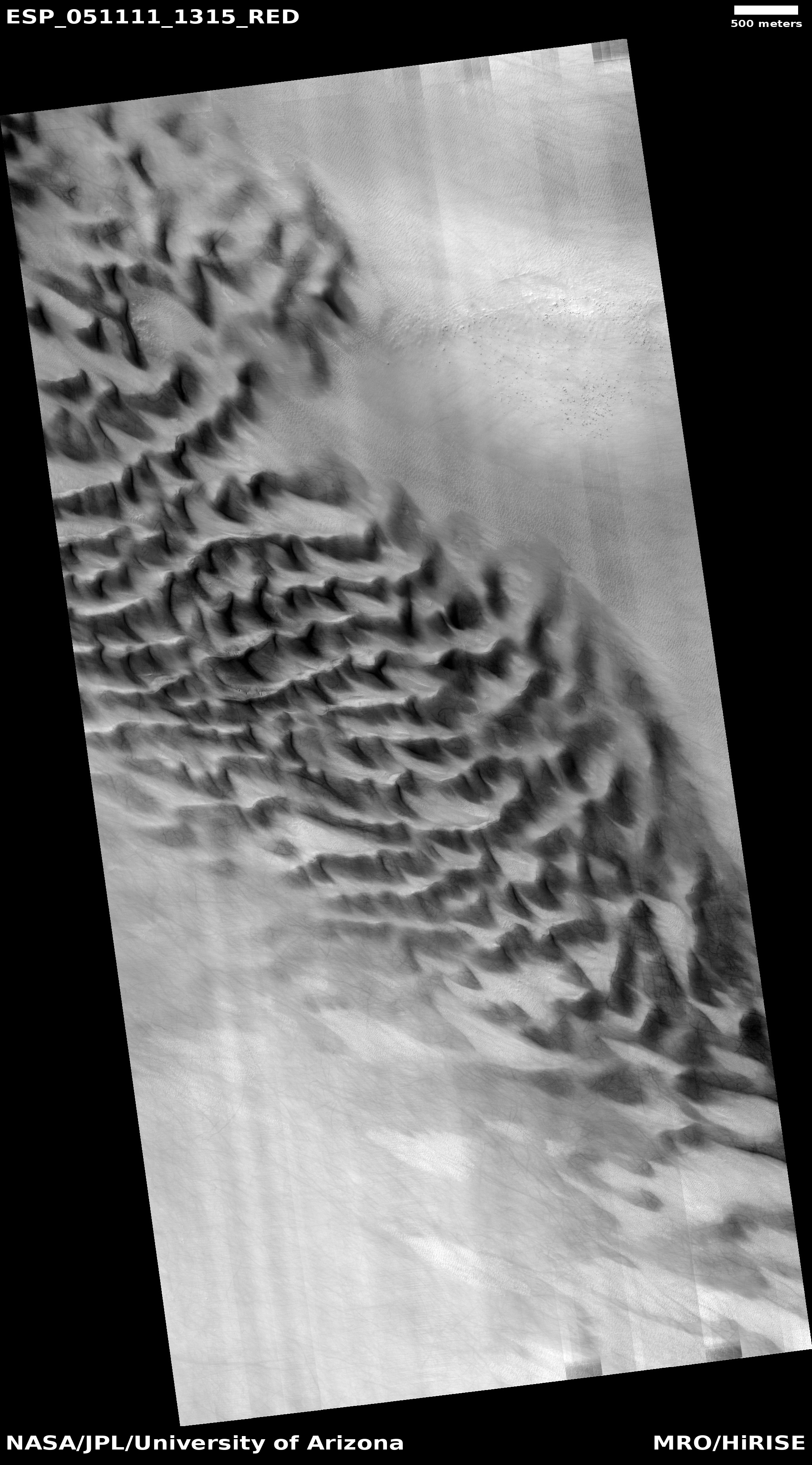
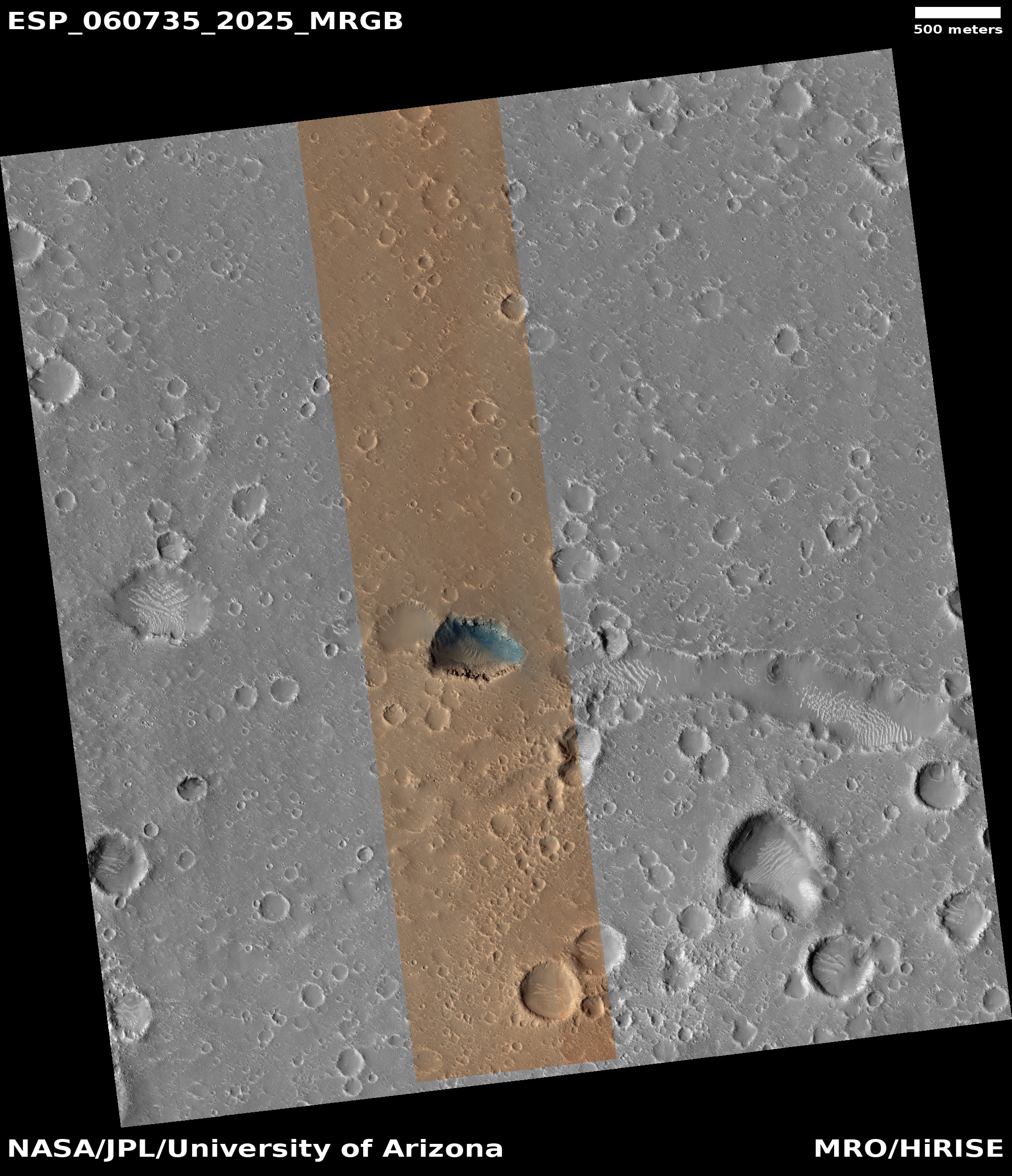
In the most recent image download from the high resolution camera on Mars Reconnaissance Orbiter (MRO), there was the cool image to the right, reduced and cropped to post here, of a crater that appeared to have hundreds and hundreds of slope streaks along its inner slopes.
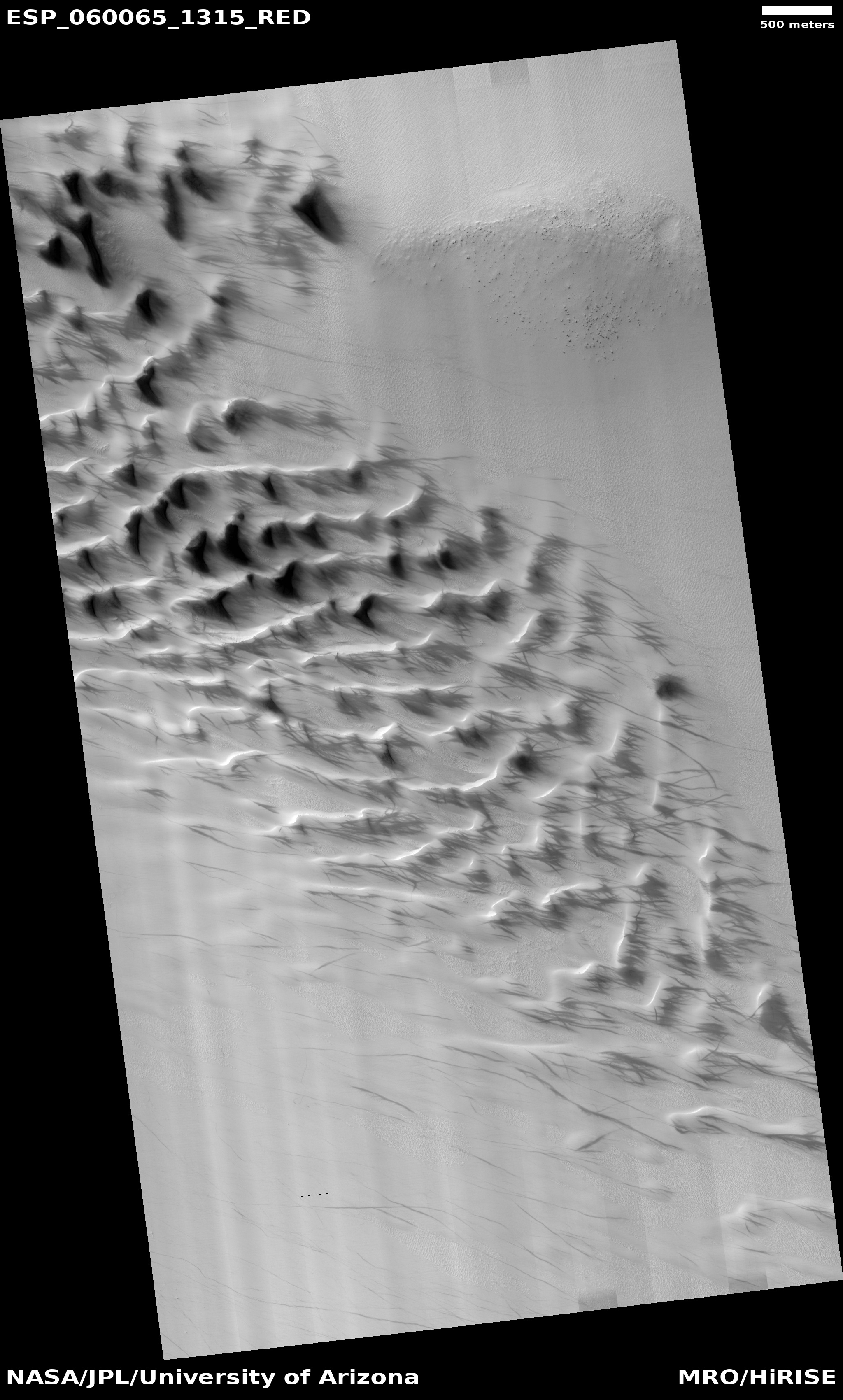
Slope streaks are quite mysterious. They are found in the equatorial regions as dark (though sometimes light) streaks on steep slopes, appearing throughout the year and slowly fading over time. They also appear to be a geological phenomenon unique to Mars. Nothing on Earth or any other planet appears to correspond.
As such, their nature and cause remains unknown, though there are a bunch of theories, with the most popular being that these are a kind of dust avalanche. They are always found in connection with dust-covered terrain, but they also make no significant topological change to the surface, other than brightness.
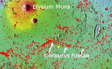
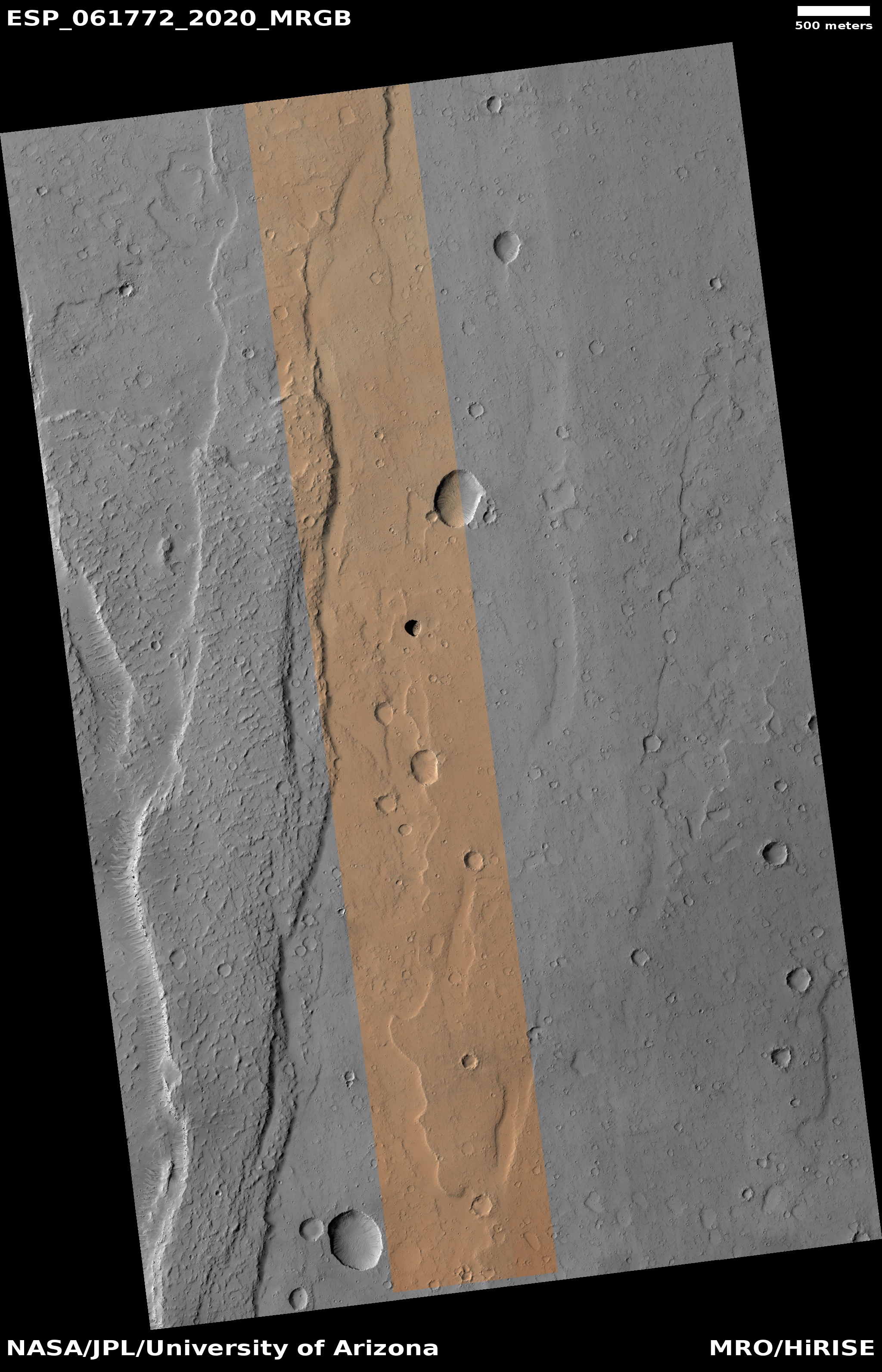
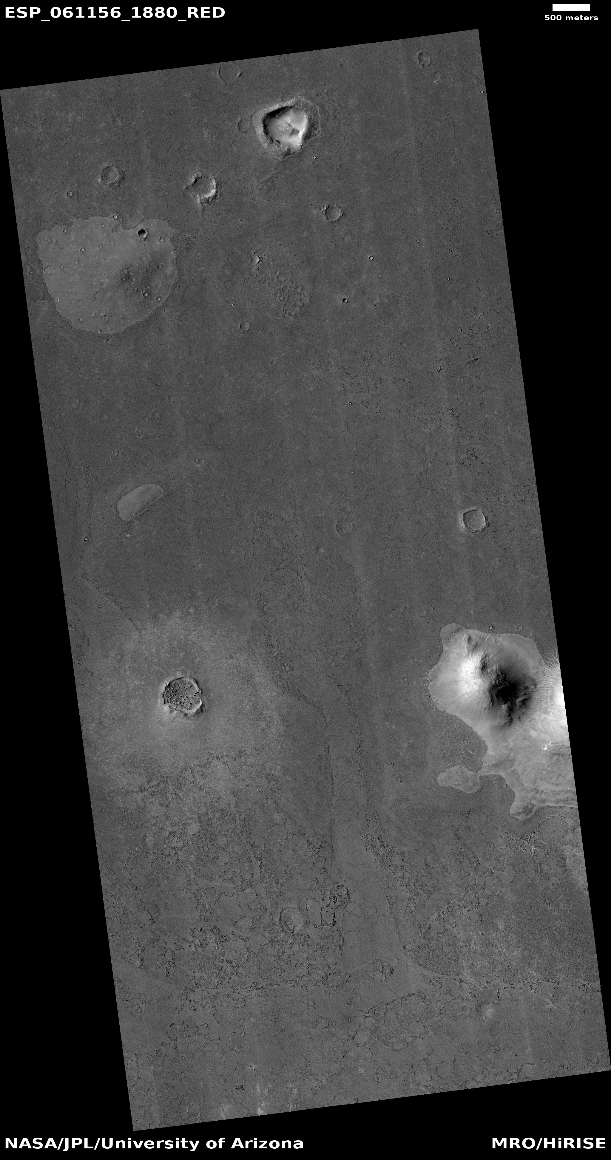
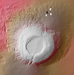
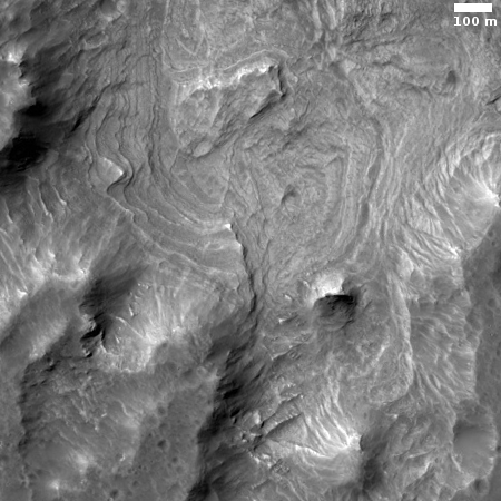
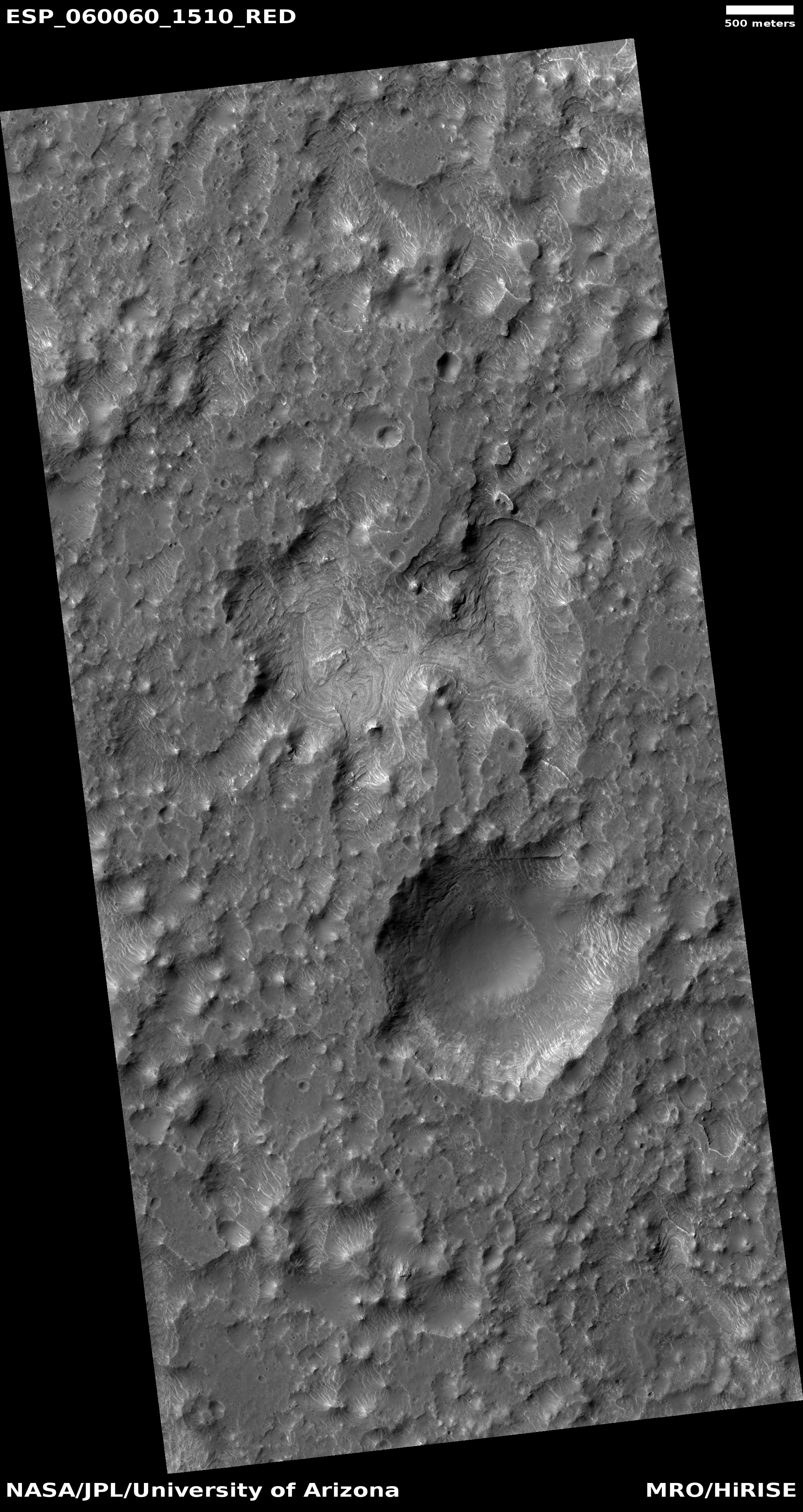
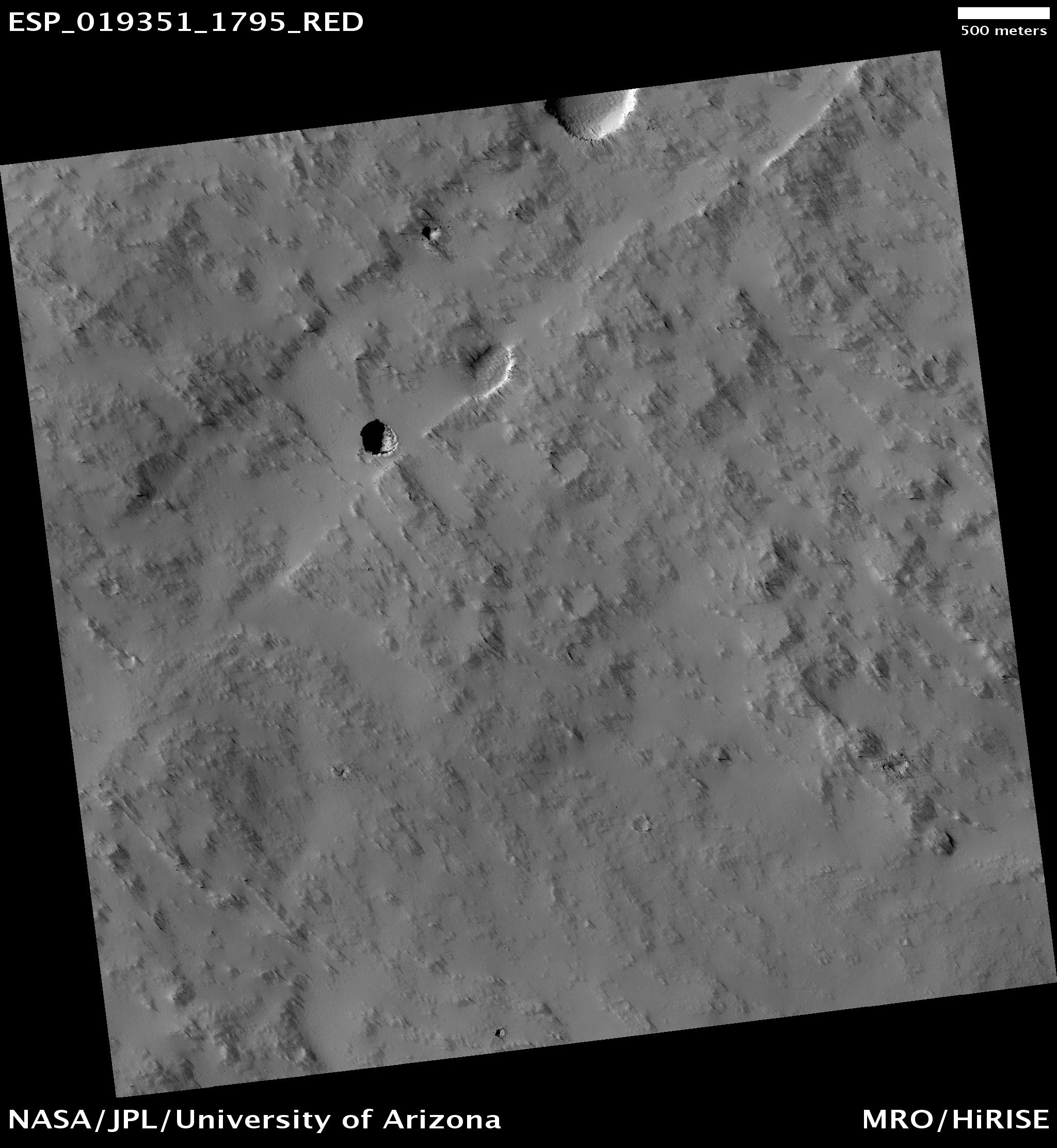
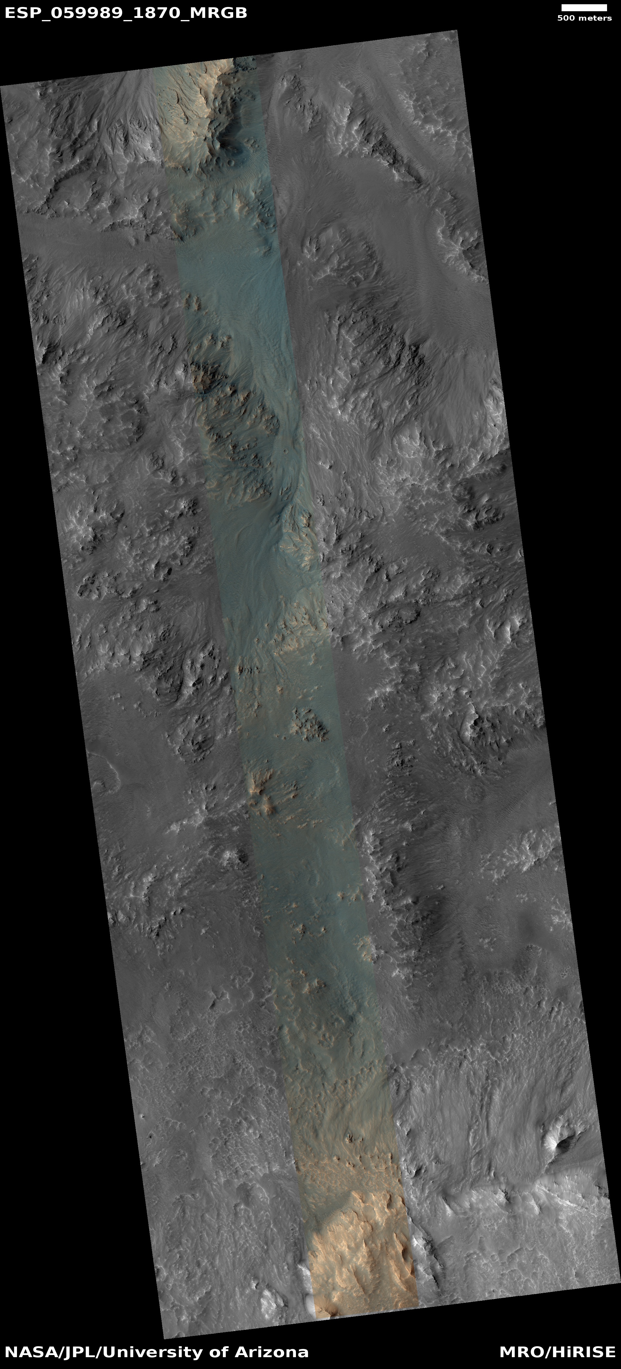
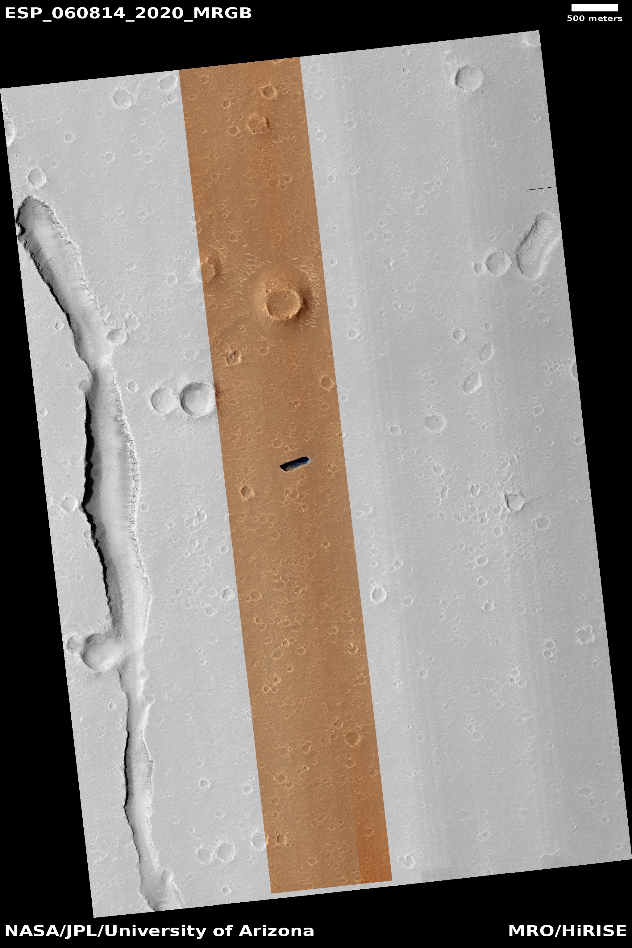
The slope streaks in this crater are especially intriguing, because of the number of streaks. In digging further into the MRO archive I found a number of images of this crater and its surrounding terrain. It appears that sometime before 2012 there was a relatively recent impact close to the exterior of the eastern rim of this crater. The image below, taken in 2014 by MRO, shows this impact as the large dark splotch, with the new crater indicated by the arrow..
» Read more
Click for full image.
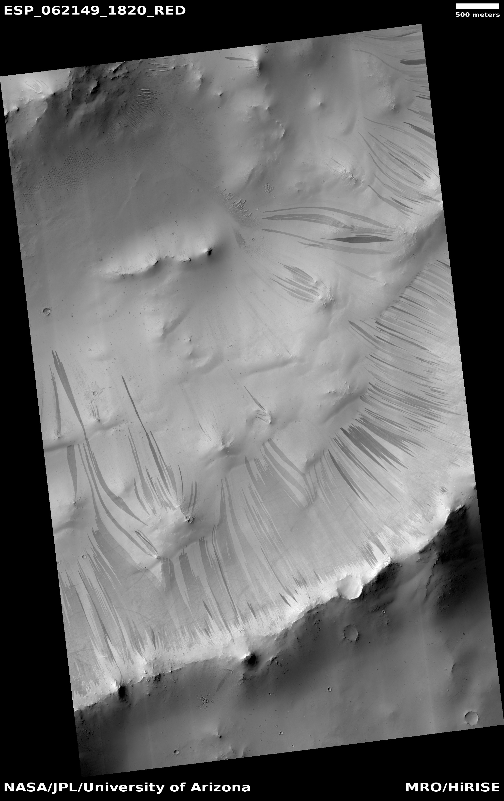
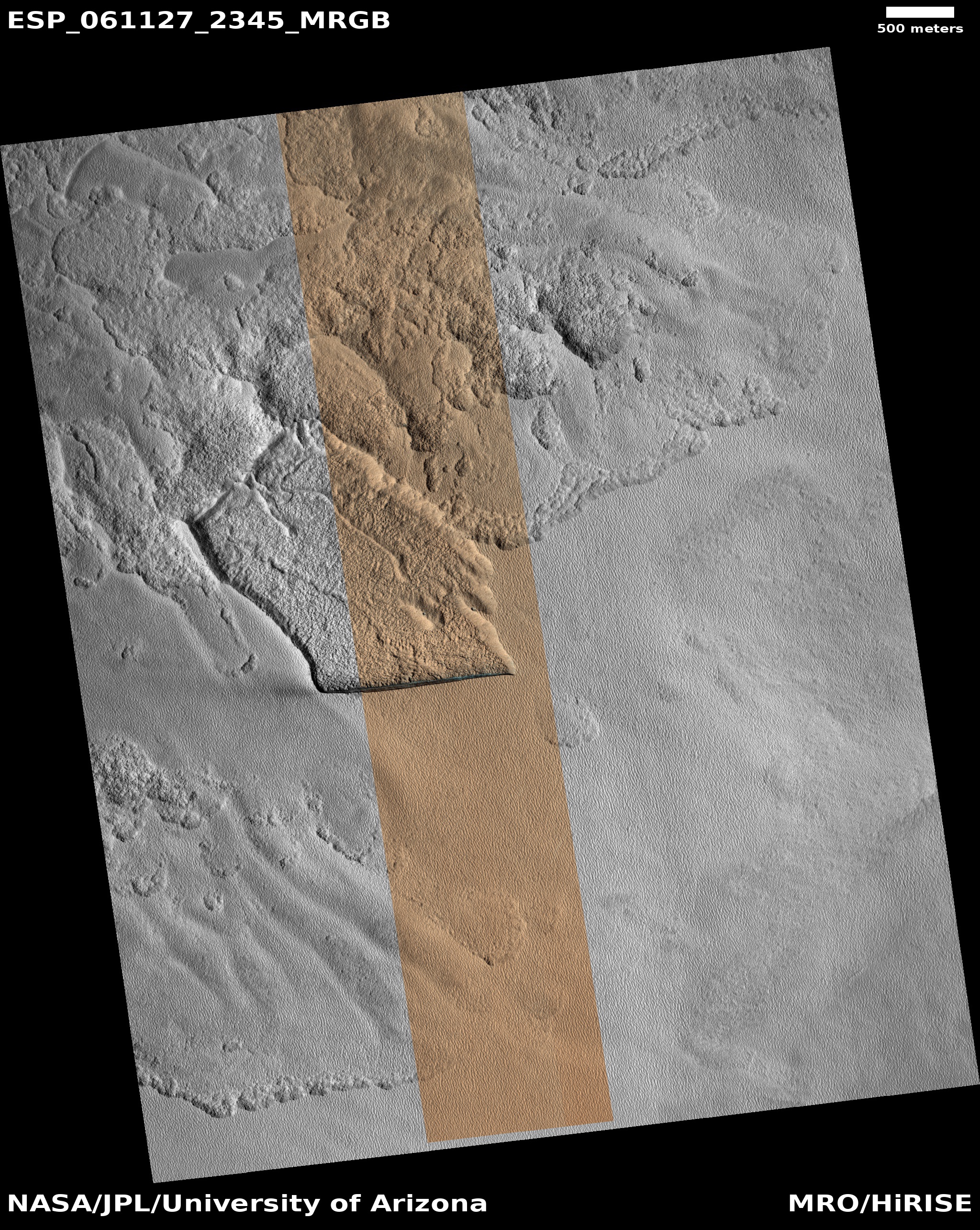
In the most recent image download from the high resolution camera on Mars Reconnaissance Orbiter (MRO), there was the cool image to the right, reduced and cropped to post here, of a crater that appeared to have hundreds and hundreds of slope streaks along its inner slopes.
Slope streaks are quite mysterious. They are found in the equatorial regions as dark (though sometimes light) streaks on steep slopes, appearing throughout the year and slowly fading over time. They also appear to be a geological phenomenon unique to Mars. Nothing on Earth or any other planet appears to correspond.
As such, their nature and cause remains unknown, though there are a bunch of theories, with the most popular being that these are a kind of dust avalanche. They are always found in connection with dust-covered terrain, but they also make no significant topological change to the surface, other than brightness.
The slope streaks in this crater are especially intriguing, because of the number of streaks. In digging further into the MRO archive I found a number of images of this crater and its surrounding terrain. It appears that sometime before 2012 there was a relatively recent impact close to the exterior of the eastern rim of this crater. The image below, taken in 2014 by MRO, shows this impact as the large dark splotch, with the new crater indicated by the arrow..
» Read more

