
Strange pitted and isolated ridges on Mars
Click for full image.
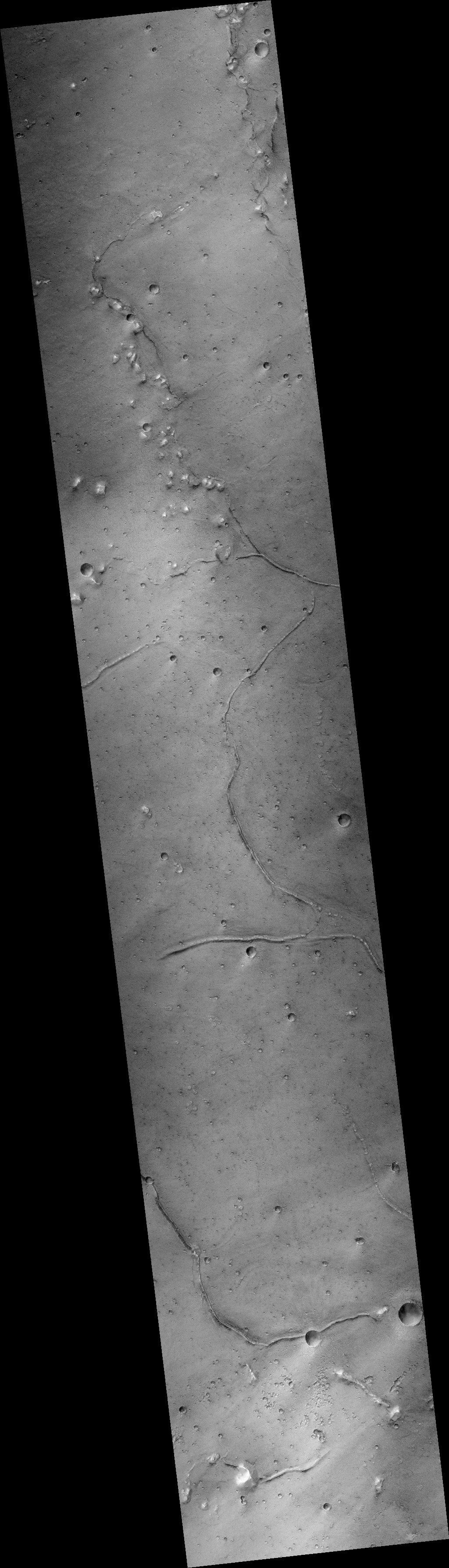
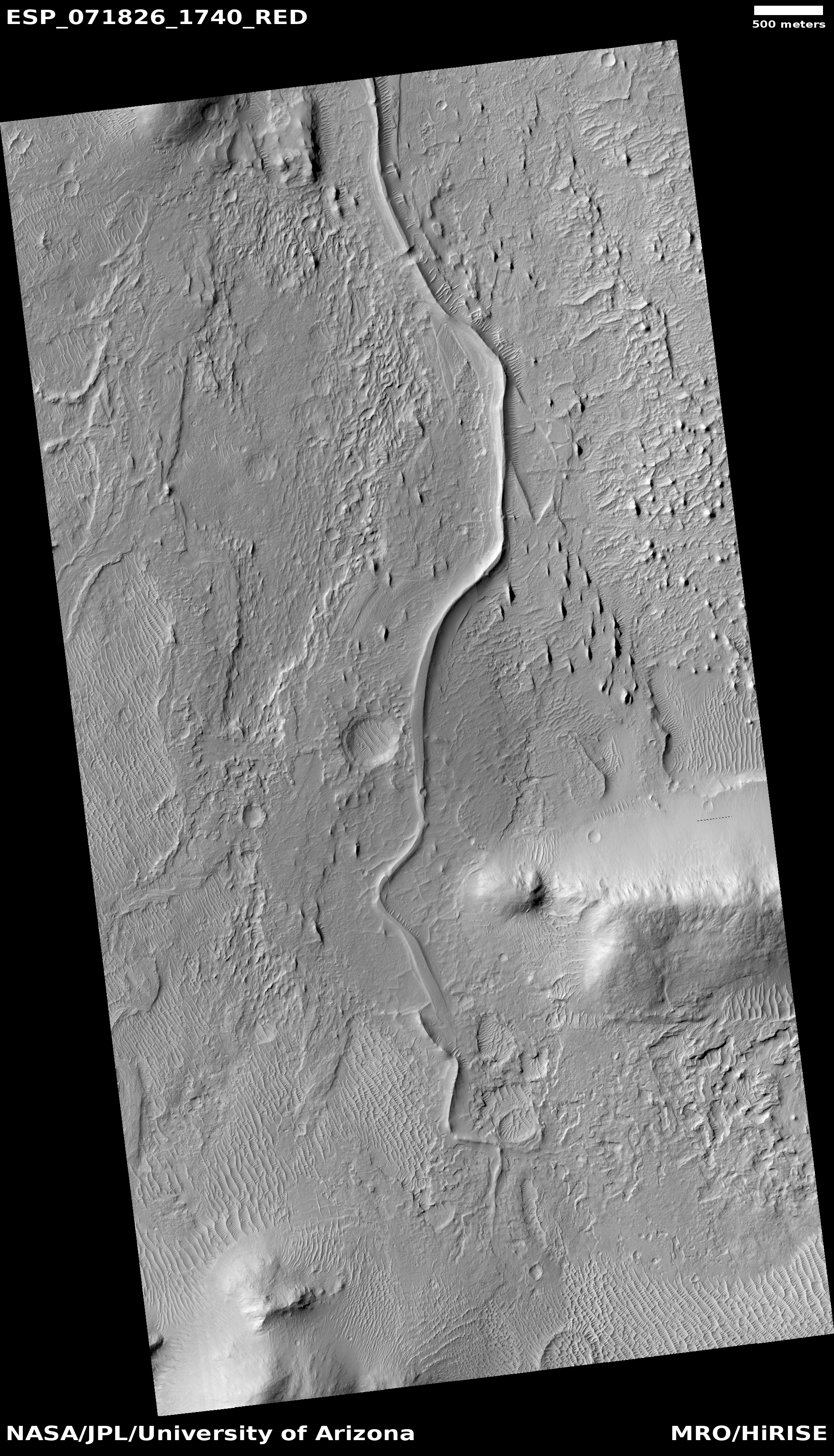
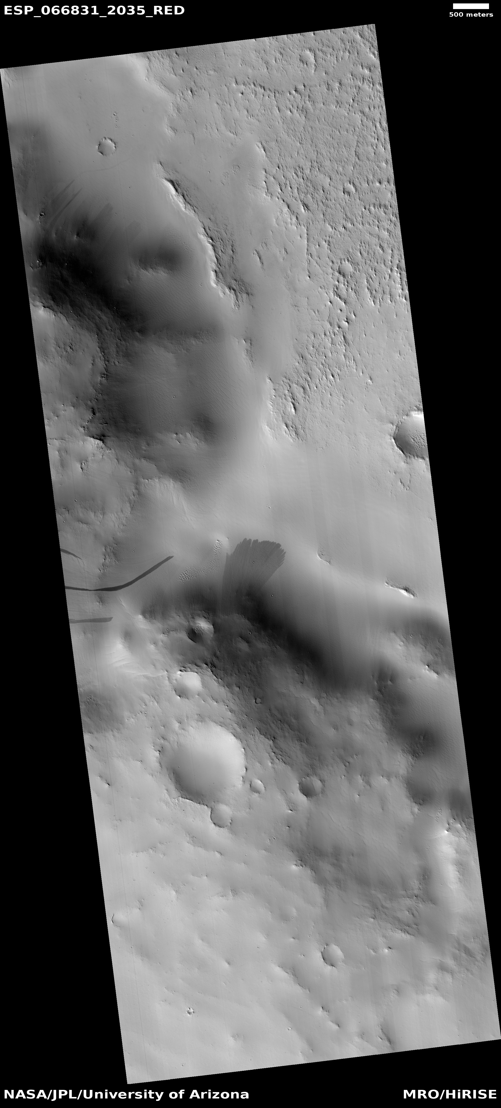
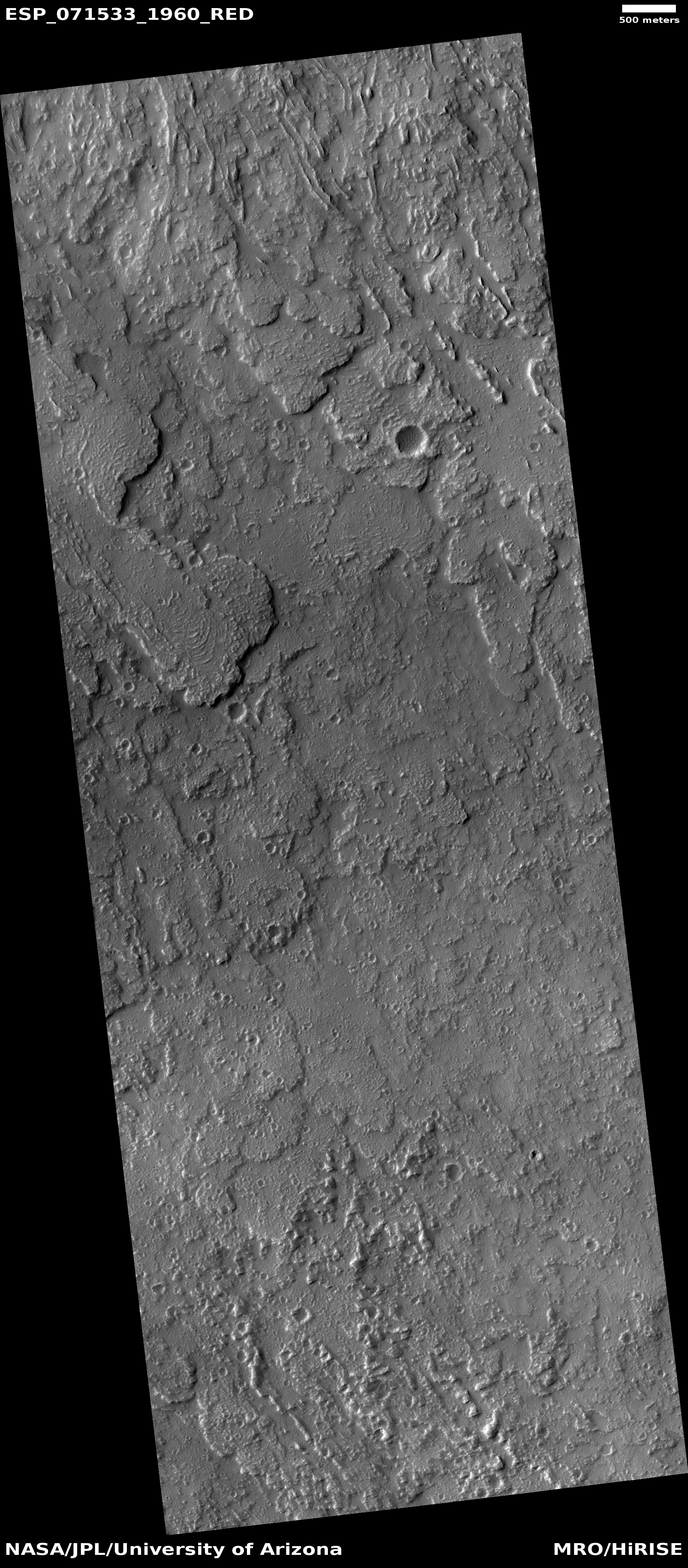
Cool image time! The photo to the right, rotated, cropped, and reduced to post here, was taken on February 17, 2012 by the wide-view context camera on Mars Reconnaissance Orbiter (MRO). It shows a section of the northern lowland plains of Mars, latitude 31 degrees north, where several very inexplicable and isolated ridges can be seen.
One ridge meanders mostly in a north-south direction, while a second instead meanders east-west. The shape of both says that neither has anything to do with any past impact crater. In fact, their random snakelike shape doesn’t really fit any obvious explanation. For example, they do not fit the look of the many fossil rivers found on Mars, where the hardened and dry riverbed channel resists erosion and becomes a ridge when the surrounding terrain erodes away.
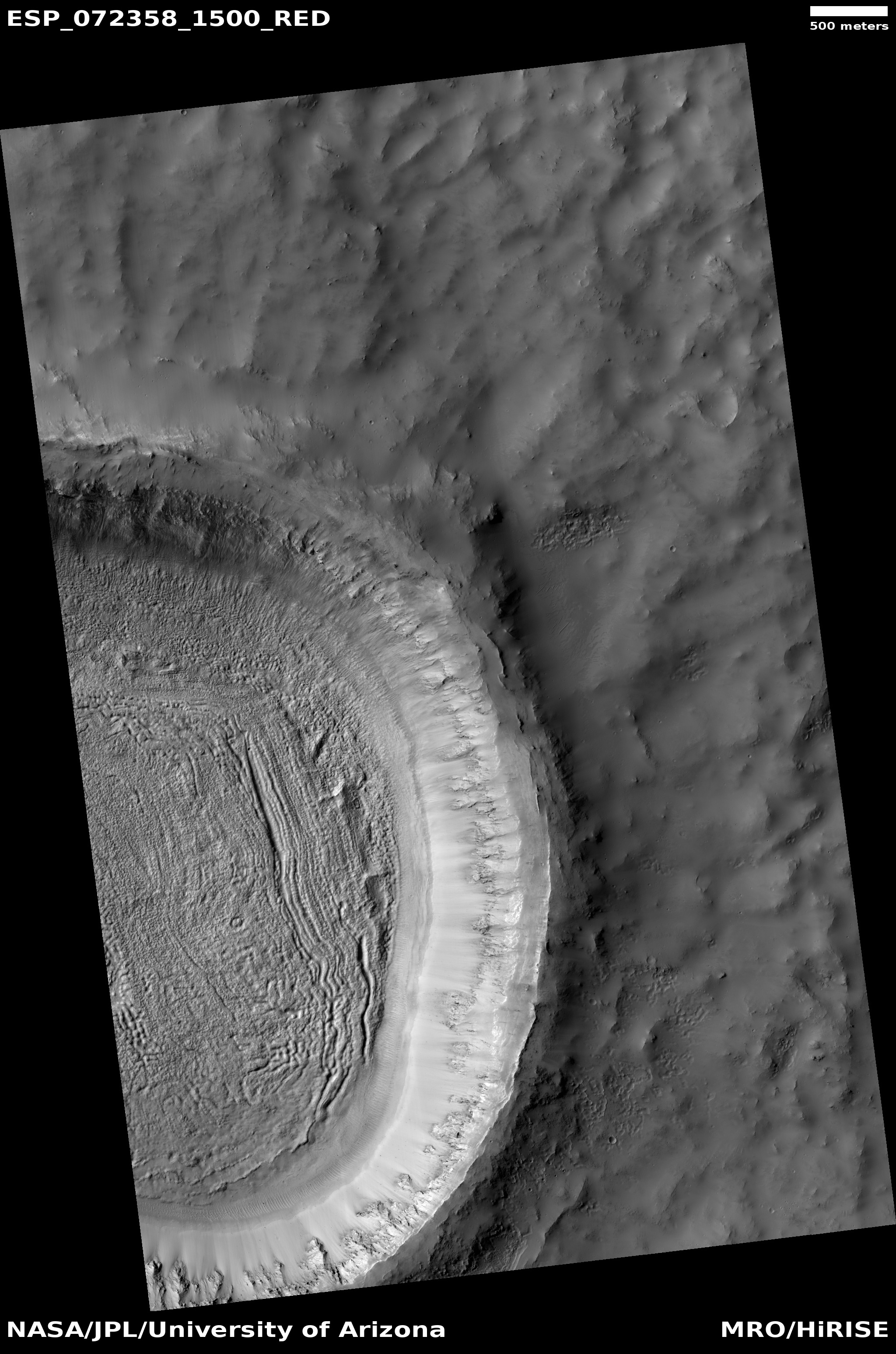
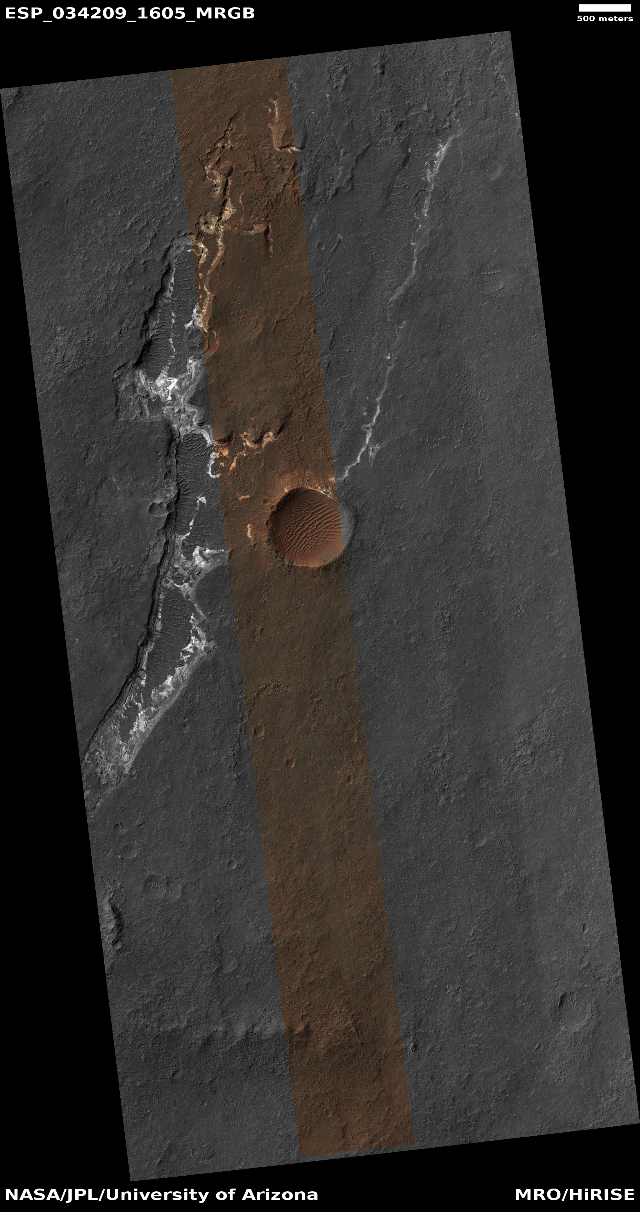
What geological process caused them? In the decade since this photo was taken the scientists who use MRO have only been able to snap a handful of high resolution images of these ridges. The image below is the most recent, covering the area in the white rectangle above.
» Read more


