Looking down a canyon on Mars
Click for original image.
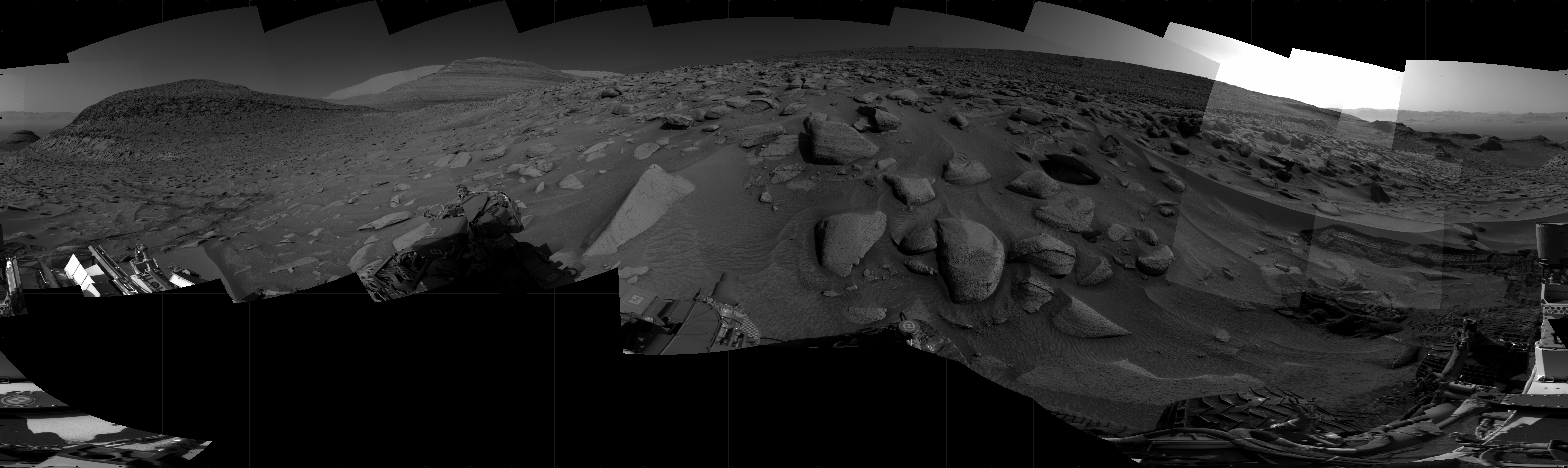
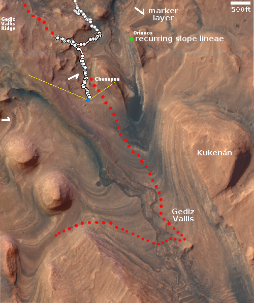
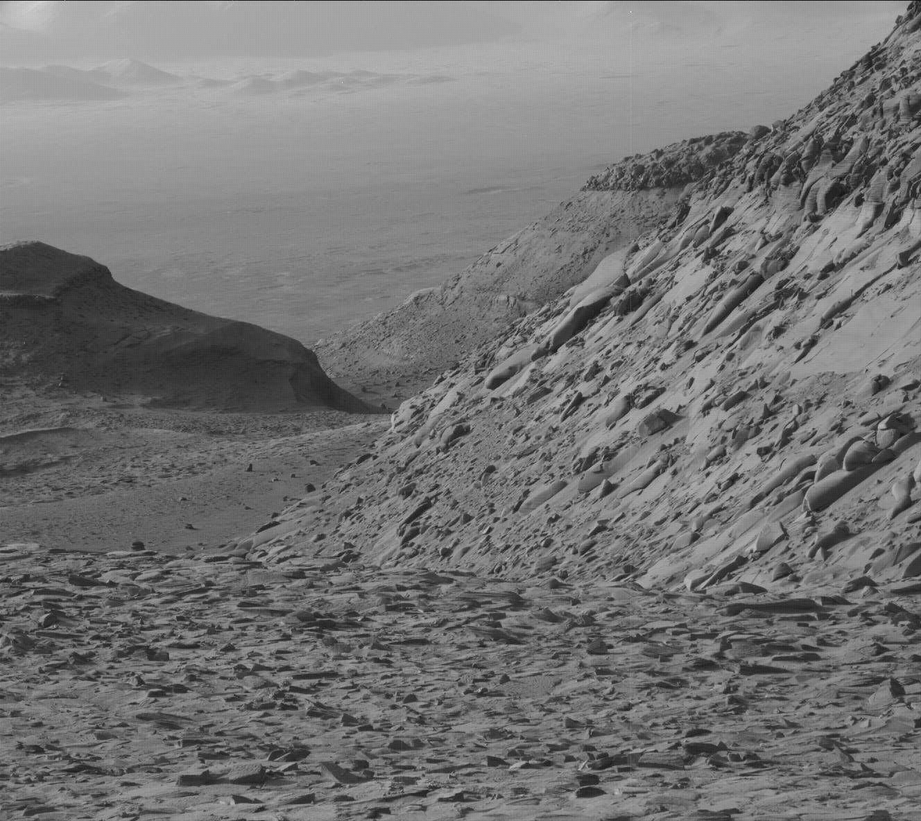
Cool image time! The picture to the right was taken on June 17, 2023 by Curiosity’s high resolution camera, looking back down Gediz Vallis and out across the distant floor of Gale Crater, far below. The white dotted line shows the route within this image where Curiosity had previously traveled inside this canyon, coming up around that shadowed mesa and then off to the west to try to get to terrain that it had earlier retreated because it was too rough on the rover’s wheels. Its subsequent path to the spot where this picture was taken was off to the left of the image, out of view.
This picture illustrates well the steepness and roughness of the mountainous canyon through which Curiosity presently travels. The small mountains visible on the floor of Gale Crater, about sixteen miles away, are no more than 450 feet high. The floor of the crater is 1,900 feet below where Curiosity present sits.
» Read more