Volcanic rills and lava tubes on Mars

Rills and lava tubes on Pavonis Mons

Cool image time! The image on the right, cropped somewhat to show here, was taken by Mars Odyssey of the southwestern slope of Pavonis Mons, the middle volcano of the line of three giant volcanoes located between the biggest volcano in the solar system, Olympus Mons, and the biggest canyon in the solar system, Marineris Valles. The slope goes down to the south, from the top to the bottom of the image. As noted on the image page,

The channel and nearby oval depressions are both related to the flow of lava. Narrow lava flows can create channels. The cooling of the top of the channel will form a roof over the flow, creating a tube beneath the surface. After the lava stops flowing the tube can empty, leaving a subsurface void. The roof will then collapse into the void forming the oval surface features.

I have added arrows to the image to draw your eye to the features that extend south in line with those oval depressions, eventually widening out to resemble a river delta, with the obvious rill probably indicating the lowest point in that delta.

Though the oval depressions are likely sections of a lava tube that collapsed, the features in line with those depressions suggest that the tube itself might still exist below the surface to the south, feeding into that delta where the rill meanders. It is also possible that my desire to find underground voids here, where glacier ice might possibly exist, might be skewing my conclusion. It could also be that the lava tube ended at these depressions, and what the features indicate is a wide surface flow, later embellished by the smaller flow of the meandering rill.

2 comments

A strange bulge on Mars

Pollack Crater

Cool image time! The image on the right is not the cool image, but a context image of 59-mile-wide Pollack Crater, located slightly south of the Martian equator in the planet’s southern cratered highlands. What makes this crater intriguing to planetary scientists, and has prompted them to take many images over the decades, is the bulge in the southwest part of the crater’s floor. You don’t normally see a rise off-center like this inside craters. If there were any peaks, you’d expect them to be in the center, formed during the impact, when the crater floor melts and acts more like water in a pond when you drop a pebble into it, forming ripples with an uplifting drop in the dead center.

It therefore isn’t surprising that planetary scientists have taken a lot of pictures of this bulge, going back to the Mariner 9 orbiter in 1972, which first discovered it. Scientists then dubbed it “White Rock” because in the first black & white images it looked much brighter than the surrounding terrain. Later color images revealed that it is actually somewhat reddish in color, not white. As noted at this Mars Global Surveyor webpage,
» Read more

0 comments

Opportunity’s uncertain future

Link here. This article from JPL provides a detailed status report on the rover, as well as what will happen if they should regain communications.

After the first time engineers hear from Opportunity, there could be a lag of several weeks before a second time. It’s like a patient coming out of a coma: It takes time to fully recover. It may take several communication sessions before engineers have enough information to take action.

The first thing to do is learn more about the state of the rover. Opportunity’s team will ask for a history of the rover’s battery and solar cells and take its temperature. If the clock lost track of time, it will be reset. The rover would take pictures of itself to see whether dust might be caked on sensitive parts, and test actuators to see if dust slipped inside, affecting its joints.

Once they’ve gathered all this data, the team would take a poll about whether they’re ready to attempt a full recovery.

Even if engineers hear back from Opportunity, there’s a real possibility the rover won’t be the same. The rover’s batteries could have discharged so much power — and stayed inactive so long — that their capacity is reduced. If those batteries can’t hold as much charge, it could affect the rover’s continued operations. It could also mean that energy-draining behavior, like running its heaters during winter, could cause the batteries to brown out.

They remain hopeful, but this article is clearly meant to prepare the public for the possibility that Opportunity’s long journey on Mars might have finally ended.

5 comments

Ancient drainage on Mars?

Drainage on Mars?

Cool image time! The image on the right, cropped from the original to post here, was taken by Mars Odyssey on May 13, 2018, and shows what clearly looks like a point where a south-to-north drainage broke through a cliff wall to allow a liquid to flow down into the larger and deeper east-west flowing canyon.

The caption at the website for this image provides only a little analysis.

The right angle intersection of the depressions in this VIS image is one of the graben that form Sacra Fossae. The fossae are located on Sacra Mensa, near the beginning of Kasei Valles. Graben are depressions caused by parallel faults where a block of material drops down along the fault face.

According to this geological interpretation, the depressions initially formed due to this geological process. The image however suggests that a flow of liquid also played a part.

Overview map

This region, indicated by the white cross on the map to the right, is part of the vast drainages that flow down from Mars’ four giant Martian volcanoes. It is located north of Valles Marineris, the largest of all these drainages. This region is also where you find a lot of chaos terrain, which is what the hummocky depression at the bottom of the image resembles. Much of this mysterious geology is thought to have been formed by the liquid water that is theorized to have once flowed down from the volcanoes. Here, it appears that the liquid ponded in the depression at the bottom of the image until it found a path along the north-south graben to break through into the east-west deeper graben.

0 comments

Cryptic terrain in Martian high southern latitudes

Cryptic terrain in Reynolds Crater near Mars south pole

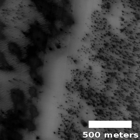
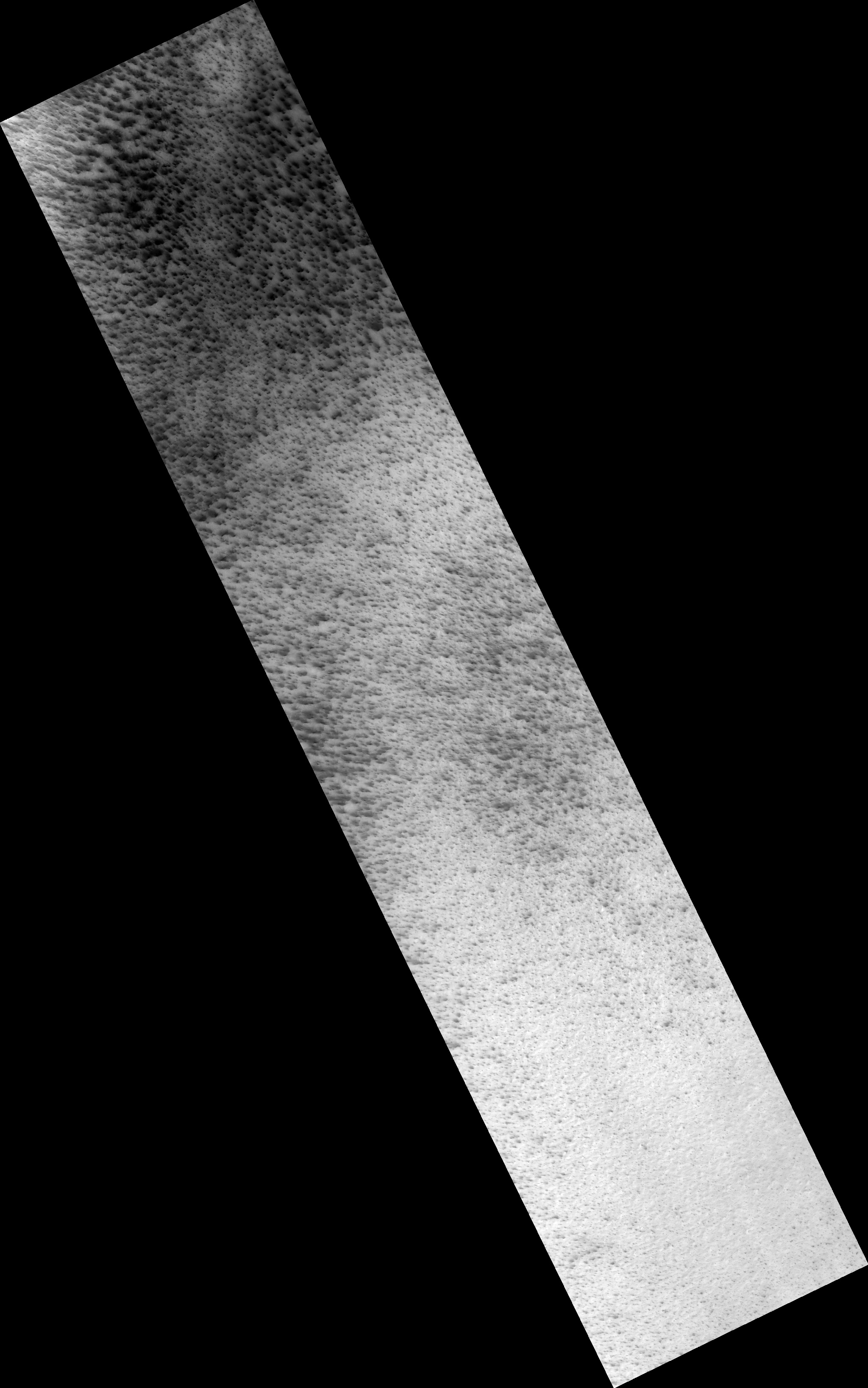
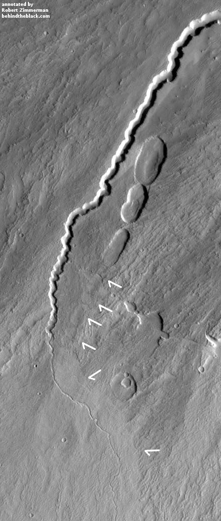
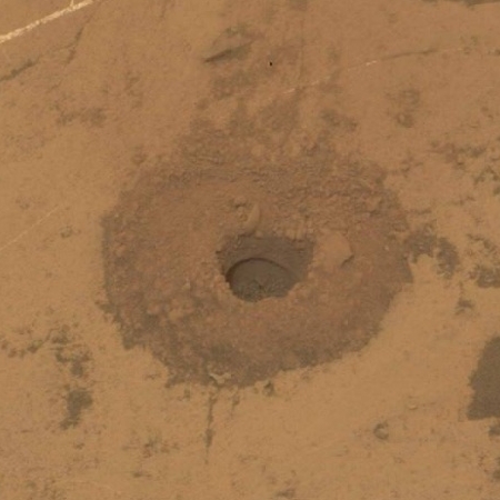
Cool image time! The image on the right is a small cropped section from a larger image taken of the floor of Reynolds Crater, near the margins of the Martian southern polar carbon dioxide icecap.

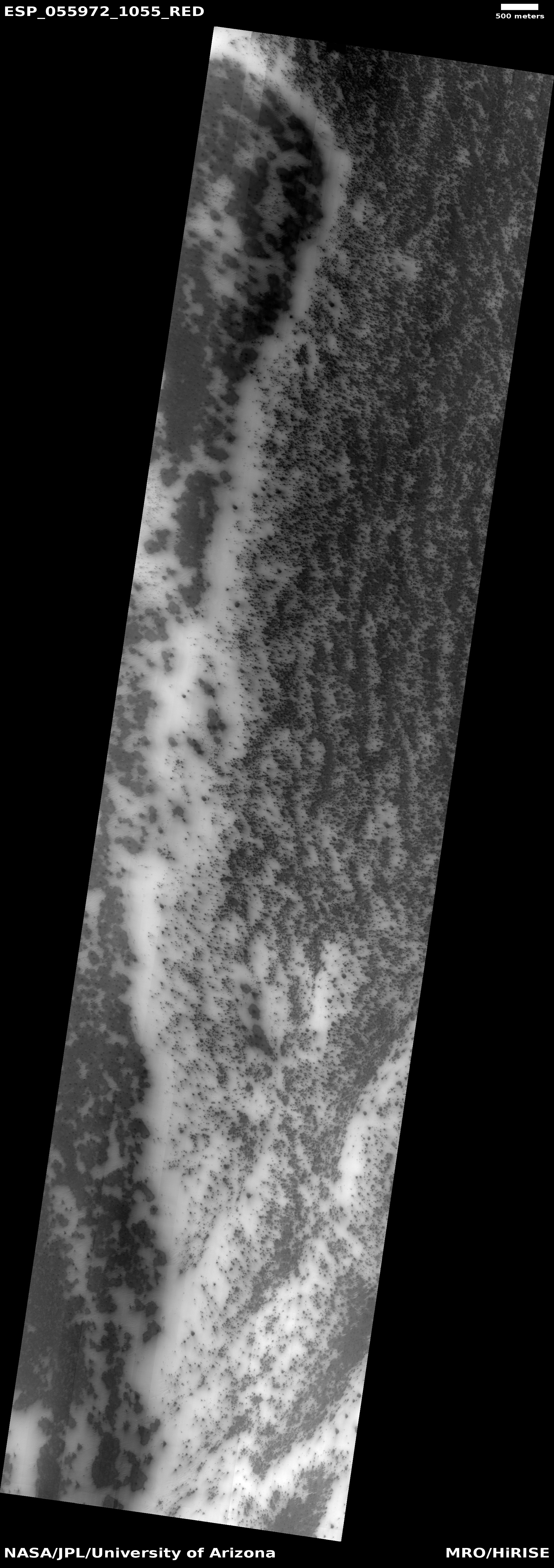
The image was part of the August 1, 2018 image release from the high resolution camera on Mars Reconnaissance Orbiter (MRO) and was taken on July 5, 2018. Because that was during the peak of now clearing global dust storm, a large majority of MRO’s images were obscured. Only images taken at high latitudes appeared clear and sharp.

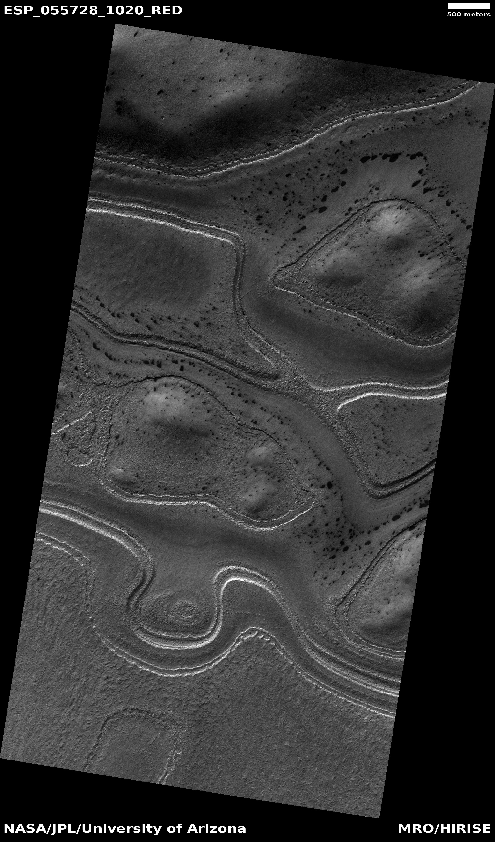
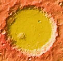
The image link, which has no caption, calls this “cryptic terrain.” Since this is at the margin of the polar cap, the white areas are almost certainly still-frozen dry ice. The white strip down the center of the image appears to be a low drainage gully, made even more evident on the full image.

What are the dark spots however? These are probably related to the dark spiders that appear wherever the carbon dioxide starts to melt and evaporate into gas, releasing the darker dust from below to coat the surface. The dark spots in this image are probably that same darker dust, but why it is scattered about as spots and splotches is a mystery. It does appear that the dark areas more completely cover the higher terrain, but why and if so is definitely unclear.

Back in 1999 I attended a press conference just prior to the failure of Mars Polar Lander. One of the mission’s investigators explained that, based on the orbiter images available at the time, they expected the lander to see some very weird land forms once it reached the surface, shaped in ways that are not seen on Earth. Unfortunately, contact with the spacecraft was lost just before it entered the Martian atmosphere, and was never recovered.

This image however remains me of that scientist’s lost expectation. The seasonal growth and retreat of the Martian icecaps will likely create some strange geology, which is only hinted at in this particular MRO image.

0 comments

Curiosity successfully drills another hole

Successful drill hole on Vera Rubin Ridge

Curiosity has finally drilled its first successful hole in the geology layer found on Vera Rubin Ridge.

This weekend’s plan is focused on the Stoer drill hole, the tailings derived from the drill and on portion characterization observations. The portion characterization is done prior to sending samples to the analytical instruments, SAM and CheMin, to ensure that the materials will not pose any threat to the instruments. ChemCam passive and Mastcam multispectral imaging will be taken of the drill tailings, to identify any potential differences between the surface and material from deeper within the drill hole. The ChemCam laser (LIBS) will be used to characterize the Stoer drill hole and a bedrock target “Greian,” which appears to show some colour variations. Mastcam will provide colour documentation for Greian.

In order to find rock soft enough on Vera Rubin Ridge, they had to once again retrace their route, retreating back down off the ridge slightly, to a lower point. The image on the right, cropped to post here, shows the drill hole. If you click on the image you can see the full picture.

With this successful drilling, I suspect they will now finally cross Vera Rubin Ridge and head up Mount Sharp.

2 comments

Weird Martian crater?

Weird crater on Mars

Time for another cool image! The image on the left, cropped to post here, was taken by the high resolution camera on Mars Reconnaissance Orbiter (MRO) on May 31, 2018, and shows a very strange layered mesa sitting in what looks like a crater or collapse feature. If you click on the image you can see the entire picture.

The location of this image is out in the middle of the vast northern plains of Mars. This region has few pronounced features, and generally sits at a lower elevation to the rest of Mars. It is suspected by some scientists that an intermittent ocean was once here, and that we are looking at the floor of a now dry sea.

This image was part of the July image release from MRO, and thus included no caption. They simply refer to it as a layered feature. It sits about a half mile (about 800 meters) to the west of a rough and indistinct cliff that drops down into an area of rougher terrain. This suggests that if this was formed by an impact, it cut down into that lower rougher layer, and since the impact there has been some upwelling from below creating the layered mesa.

I would not take my hypothesis very seriously, however. This feature could have nothing to do with an impact. It might also have been a mesa that now sits in a collapsed sinkhole. Or not. I could come up with many theories, all of which are likely wrong. What I do see here is something that geologically is very strange and baffling.

2 comments

The shrinking and growth of the poles of Mars

Using infrared data from several Mars orbiters over a period of a full Martian year, equivalent to two Earth years, scientists have created an animation showing the growth and retreat and regrowth of the carbon dioxide icecaps of the red planet’s two poles.

This animation shows a side-by-side comparison of CO2 ice at the north (left) and south (right) Martian poles over the course of a typical year (two Earth years). This simulation isn’t based on photos; instead, the data used to create it came from two infrared instruments capable of studying the poles even when they’re in complete darkness.

As Mars enters fall and winter, reduced sunlight allows CO2 ice to grow, covering each pole. While ice at the north pole is fairly symmetrical, it’s somewhat asymmetrical during its retreat from the south pole for reasons scientists still don’t understand. Scientists are especially interested in studying how global dust events affect the growth and retreat of this polar ice. Mars’ seasons are caused by a tilt in the planet, resulting in winter at one of the planet’s poles while it’s summer at the other.

I have embedded the animation below the fold.
» Read more

1 comment

How to build a scaled-down version of Curiosity, all by yourself!

JPL has released open-source plans for building a scaled down version of the rover Curiosity at a total cost of only $2,500.

This project is a successor to an earlier educational rover model called “ROV-E,” which received positive responses in schools and museums, NASA said. The Open Source Rover offers a more affordable, less complicated model, and according to agency officials, people can assemble the new model with off-the-shelf parts for about $2,500.

“While the OSR [Open Source Rover] instructions are quite detailed, they still allow the builder the option of making their own design choices,” JPL officials said. “For example, builders can decide what controllers to use, weigh the trade-offs of adding USB cameras or solar panels and even attach science payloads. The baseline design of OSR … will allow users to choose how they want to customize and add to their rover, touching on multiple hardware and software principles along the way.”

I wonder how heavy a home-built rover would be, and whether it could be launched on a Falcon Heavy to Mars.

4 comments

Another failed drilling attempt by Curiosity

The second attempt by Curiosity to drill into Vera Rubin Ridge was a failure, the rock once again being too hard using the rover’s new improvised drilling technique.

They are now in search of “softer rock.” The scientists very much want to get at least one drill hole in the hematite unit on Vera Rubin Ridge. However, it does appear that the new drill technique, that uses the robot arm to push the drill bit down as its drills, does not provide enough force for some hard geological features.

The failure to drill is in itself not a complete scientific washout. Knowing the hardness of a rock can tell a geologist a great deal about it. Nonetheless, the Curiosity science team seems determined to find something they can drill into on Vera Rubin Ridge.

0 comments

Mars dust storm blocks Mars Reconnaissance Orbiter images

In my normal routine to check out the periodic posting of new high resolution images from Mars Reconnaissance Orbiter (MRO), the August 1 update brought what at first was a disturbing surprise. If you go to the link you will see that a large majority of the images show nothing by a series of vertical lines, as if the high resolution camera on MRO has failed.

Yet, scattered among the images were perfectly sharp images. I started to look at these images to try to figure out the differences, and quickly found that the sharp images were always of features in high latitudes, while the blurred images were closer to the equator.

The August 1 image release covered the June/July time period, when the on-going Martian dust storm was at its height. The images illustrate also where the storm was most opaque, closer to the equator.

The next few updates, which occur every three weeks or so, should show increasing clarity as the storm subsides. And the storm is subsiding, according to the latest Opportunity update. The scientists have still not re-established contact with the rover, and do not expect to for at least a month or more, but they are finding that the atmospheric opacity at Endeavour Crater seems to be dropping.

0 comments

Landslide on Mars

Landslide on Mars

Cool image time! The image on the right, cropped and reduced in resolution to post here, was taken by Mars Reconnaissance Orbiter on May 30, 2018. It shows the remains of a landslide where it appears a huge chunk of the cliff face broke off and then flowed downward, pushing ahead of it more material to produce a tongue of debris more than four miles long. (If you click on the image you can see the full photograph.)

The picture invokes a spectacular single event. When the cliff broke off, it hit the ground below it like a rock would in wet beach mud. Like wet sand, the ground was pushed away in a muddy gloppy mess.

Is this terrain wet however? The location of this landslide provides some intriguing geological context. Below are two context images, showing this landslide’s location on Mars.
» Read more

0 comments

Martian dust storm beginning to clear

The Martian global dust storm that started in mid-June and has left the rover Opportunity with little power appears to be finally clearing.

Don’t expect any word from Opportunity however for at least a month. The storm might be dying off, but it will take time for the dust to settle out of the atmosphere, especially in Mars’s light gravity.

0 comments

A vegetable grater on Mars

A vegetable grater on Mars

Cool image time! I honestly can’t think of any better term but “vegetable grater” to describe the strange surface in the image on the right, cropped from the full sized image that was released with the July 11, 2018 monthly release of new images from the high resolution camera on Mars Reconnaissance Orbiter (MRO).

If you click on the image you can see the whole image, which merely shows more of the same terrain over a wider area. When I cropped it, I literally picked a random 450×450 pixel-sized area, since other than slight variations the entire terrain in the full image is as equally rough. The resolution captures objects as big as five feet across.

Looking at the full image there does seem to be flow patterns moving across the middle of the image, but if so these flow patterns had no effect on the surface roughness, other than indicating a very slight difference in the size of the knobs and pits. Overall, very strange.

The location of this place on Mars is in the cratered southern highlands, to the southwest of Hellas Basin, as indicated by the black cross in the image below.
» Read more

2 comments

Liquid water found beneath Martian south pole

Data from Europe’s Mars Express orbiter has detected a pond of liquid water buried beneath the Martian south pole.

The radar investigation shows that south polar region of Mars is made of many layers of ice and dust down to a depth of about 1.5 km in the 200 km-wide area analysed in this study. A particularly bright radar reflection underneath the layered deposits is identified within a 20 km-wide zone.

Analysing the properties of the reflected radar signals and considering the composition of the layered deposits and expected temperature profile below the surface, the scientists interpret the bright feature as an interface between the ice and a stable body of liquid water, which could be laden with salty, saturated sediments. For MARSIS to be able to detect such a patch of water, it would need to be at least several tens of centimetres thick.

The data here is somewhat uncertain, but is also not to be dismissed. It is very likely this is liquid water.

I must add that this is not really a big surprise. Many scientists expected this. Also, this water is not very accessible, and is also located at the pole, the Mars’s harshest environment. Just because it is liquid is not a reason to aim to mine it. There is plenty of evidence of ice in much more accessible and reasonable locations.

What this discovery suggests is that it is possible to have liquid water on Mars. The great geological mystery of the planet is while that much of its geology appears formed by flowing water, scientists have not been able to devise good climate histories that make that flowing water possible. This discovery helps those scientists in devising those histories.

3 comments

Another skylight entrance pit found on Mars

Pit in Hephaestus Fossae

Cool image time! In my routine monthly review of the hundreds of new images released from the high resolution camera on Mars Reconnaissance Orbiter (MRO), I came across another most intriguing geological feature, the image of which is posted to the right, after cropping.

As the scale shows, the pit is about 300 feet across. Calculating the pit’s depth would require someone with better math skills than I. The website provides information about the sun angle, which can be used to extrapolate the shadows and then roughly calculate the depth.

The most fascinating aspect of this pit is the impression of incredible thinness for the pit’s overhung edges. All of the pit’s edges appear significantly overhung, and the thickness of the overhang seems incredibly paper-thin. This thinness is likely only an illusion, though in Mars’s light gravity it is perfectly possible for the overhang to be far thinner and more extended than anything you would find on Earth.

The image itself is in color, though the only color visible is within the pit itself. In that blueness at the base it seems to me that there is a pile of dust/debris, but once again, that conclusion should not be taken very seriously.

If you take a look at the full image, what is impressive is the bland flatness of the surrounding terrain. There is no hint that there might be underground passages hidden here. While most of the scattered craters are probably impact craters, many (especially those with unsymmetrical shapes) could be collapse features indicating the presence of underground voids. None however is very deep. Nor is there any other pits visible.

Below is a global map of Mars with the location of this pit indicated by a black cross. It is just on the edge of the transition zone between the lower northern plains and the southern highlands, where the shoreline of an intermittent sea is thought by some scientists to have once existed. This is also an area where not a lot of high resolution images have been taken, mostly because of its apparent blandness as seen in previous imagery.

This image demonstrates however that Mars is going to have interesting geology everywhere, and that we won’t really know it well until we have explored it all.
» Read more

11 comments

The dust on Mars comes from one specific Martian region

Scientists have concluded that a large bulk of the dust that covers much of the Martian surface actually comes from one specific region called Medusae Fossae, located to the southwest of the planet’s giant volcanoes.

The dust that coats much of the surface of Mars originates largely from a single thousand-kilometer-long geological formation near the Red Planet’s equator, scientists have found.

A study published in the journal Nature Communications found a chemical match between dust in the Martian atmosphere and the surface feature, called the Medusae Fossae Formation. β€œMars wouldn’t be nearly this dusty if it wasn’t for this one enormous deposit that is gradually eroding over time and polluting the planet, essentially,” said co-author Kevin Lewis, an assistant professor of Earth and planetary science at the Johns Hopkins University.

It is thought that Medusae Fossae is volcanic in origin.

0 comments

A dark dust avalanche on Mars

No dust avalanche

After dust avalanche

Cool image time! The two images to the right, both cropped to post here, were taken six years apart by Mars Reconnaissance Orbiter (MRO) of the western lava slopes of the giant volcano Olympus Mons. They show the appearance of a dark dust avalanche during the interim. As noted by members of the MRO science team.

Dust avalanches create slope streaks that expose darker materials usually hidden below a lighter-toned layer. Cascading fine-grained material easily diverts around boulders or alters direction when encountering a change in slope. The dark steak … is approximately 1 kilometer in length that we didn’t see in a previous image. Past avalanche sites are still visible and fading slowly as dust settles out of the atmosphere and is deposited on the dark streaks over time.

We also see boulders and their shadows that are a meter or greater in size. Movement of any of these boulders down the slope could trigger future avalanches.

The appearance of these Martian dark streaks on slopes is actually not uncommon. As more pictures are taken of Mars scientists are beginning to accumulate a large number all across the Martian surface.

What I find fascinating is the wet look of these dark streaks. Below is a close-up of the new avalanche, near its head.
» Read more

4 comments

Europe initiates website to name ExoMars 2020 rover

The European Space Agency has created a website where people can offer their suggestions to name the ExoMars 2020 rover.

Astronaut Tim Peake is leading the hunt for a great moniker. He wants everyone to go to a special website set up for the purpose and enter a suggestion. But don’t think “Spacey McSpaceFace” is a goer because this is not an online poll. All ideas will be put before an expert panel and it is they who will make the final choice.

If all goes right, 2020 should see two new rovers arrive on the Martian surface.

4 comments

Dust storm update on Mars

Link here. This press release basically reviews what each Martian spacecraft, in orbit or on the surface, is doing to study or survive the global dust storm that erupted on Mars in in early June.

The storm itself has not yet eased, and the general expectation is that it will last for a couple of months, through August.

2 comments
1 90 91 92 93 94 128