
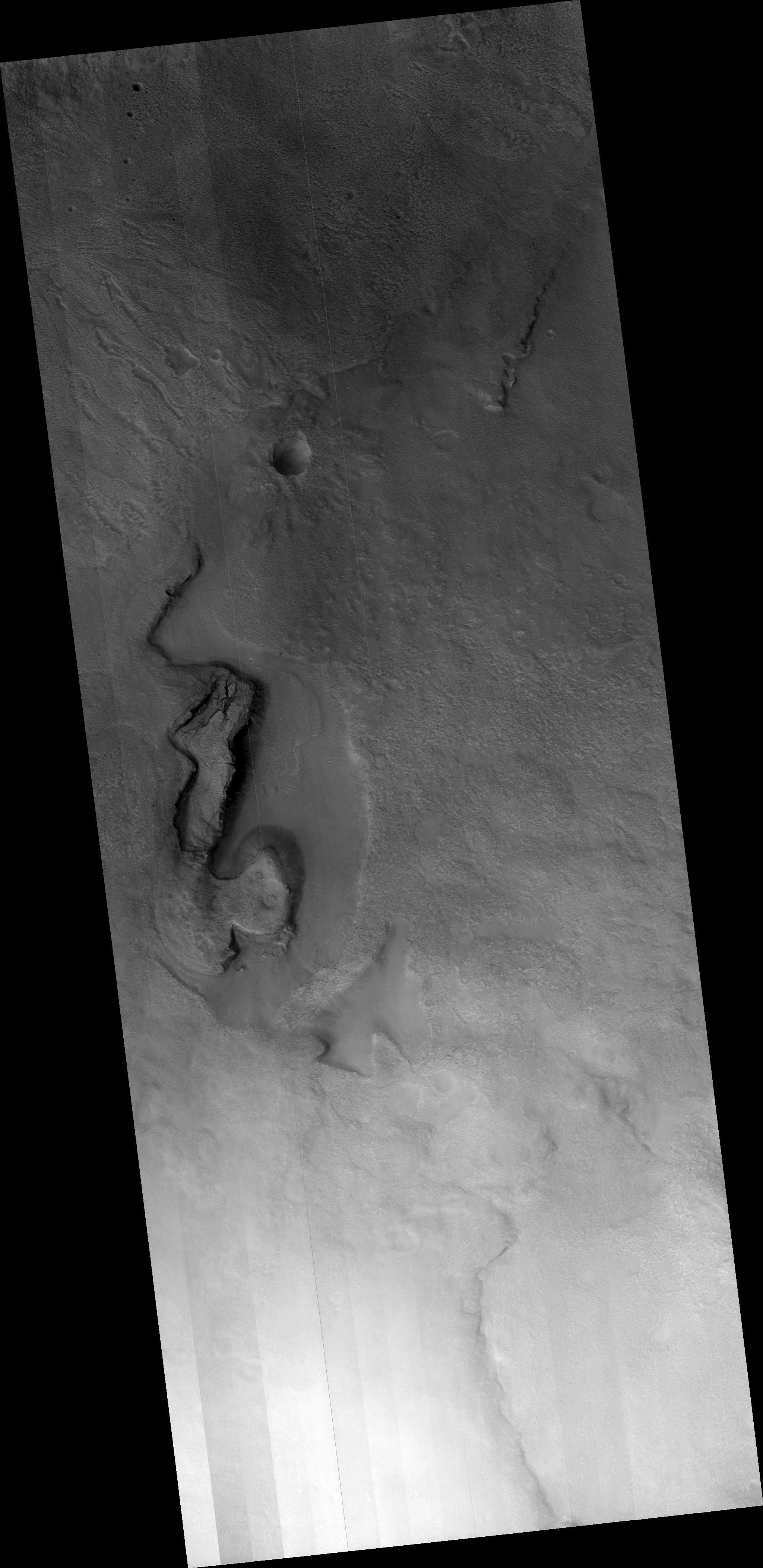
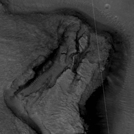
The steep slumping wall of a Martian volcano caldera
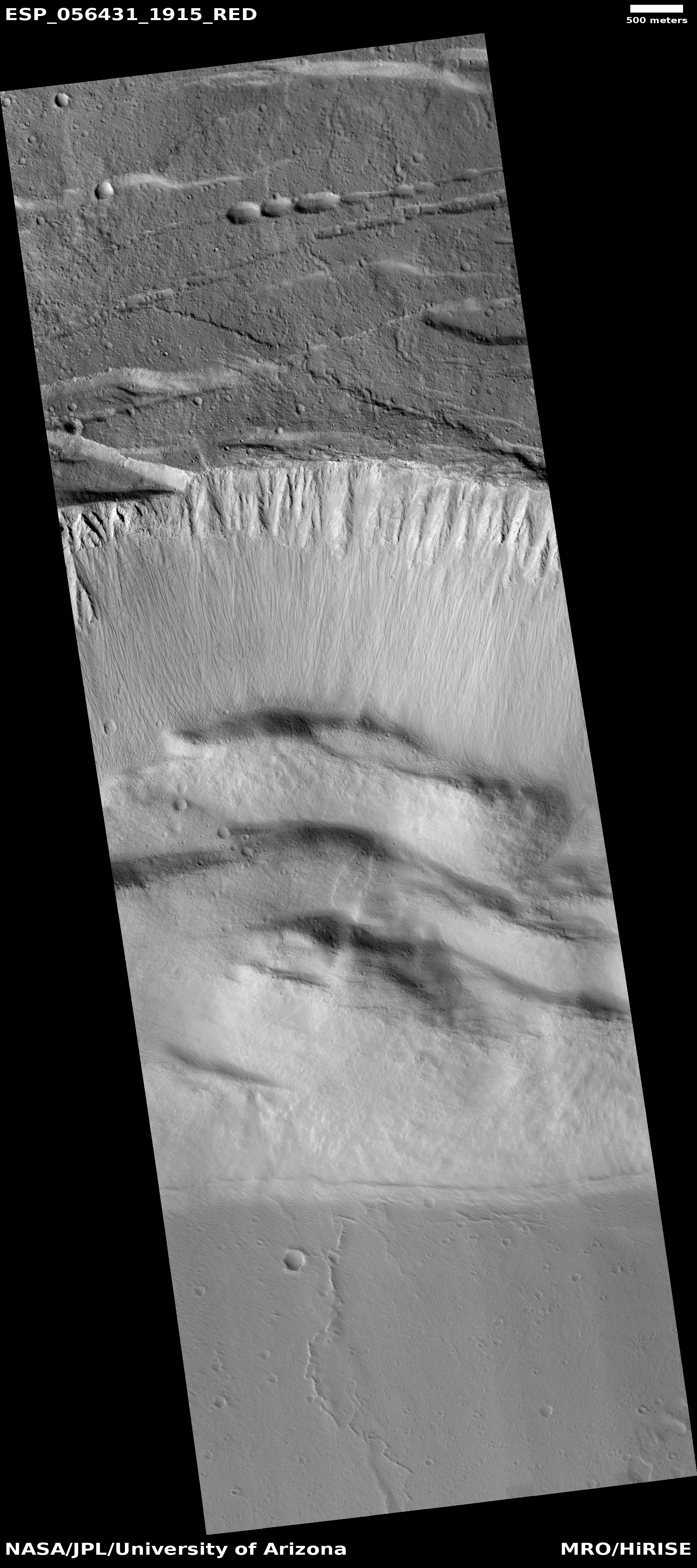
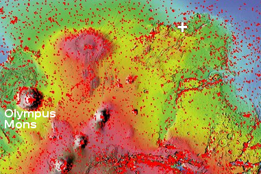
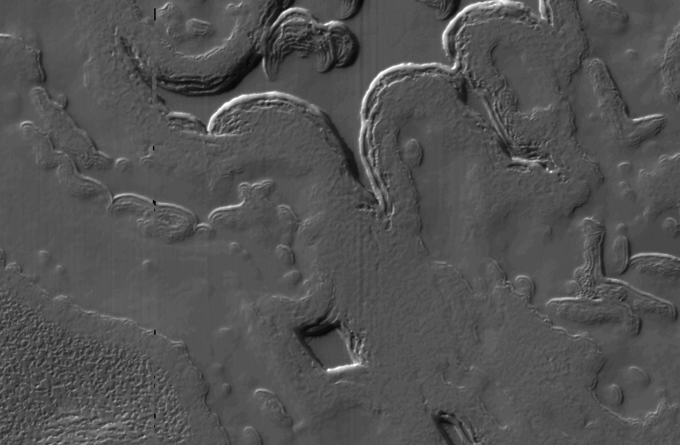
Cool image time. The Mars Reconnaissance Orbiter science team today released a nice captioned image of the steep wall of the caldera of Ascraeus Mons, the northernmost of the three giant volcanoes that lie to the east of Olympus Mons, the biggest volcano of all. The image on the right, reduced and cropped, shows that steep wall, with full image available by clicking on it. The caption from the release focuses on the fluted upper parts of the wall.
We can see chutes carved into the soft dust that has built up on the slope, with some similarities to gully landforms elsewhere on the planet.
More revealing to me is how this image reveals the slumping that is slowing eroding the caldera’s walls while also making that caldera larger. First, the plateau above the cliff shows multiple small cliffs and pit chains, all more or less parallel to the wall. This suggests that the plateau is over time breaking apart and falling into that caldera. Think of it as an avalanche in slow motion, with the upper plateau separating into chunks as sections slowly tilt down toward eventual collapse. As these chunks separate, they cause cracks to form in that plateau, and hence the parallel cliffs and strings of pits.
On the floor of the caldera we can see evidence of past chunks that did fall, piled up in a series terraces at the base of the wall. These are covered with the soft dust that dominates Martian geology. That soft dust also apparently comprises much of the wall’s materials, and almost acts like a liquid as it periodically flows down the wall, producing the chutes at the top of the wall.
The weak Martian gravity here is an important factor that we on Earth have difficulty understanding. It allows for a much steeper terrain, that also allows structurally weaker materials to hold together that would be impossible on Earth.This image gives a taste of this alien geology, on a large scale.
