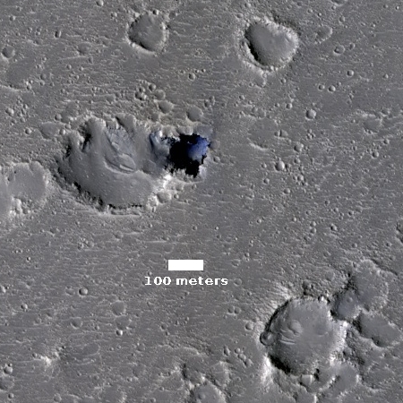
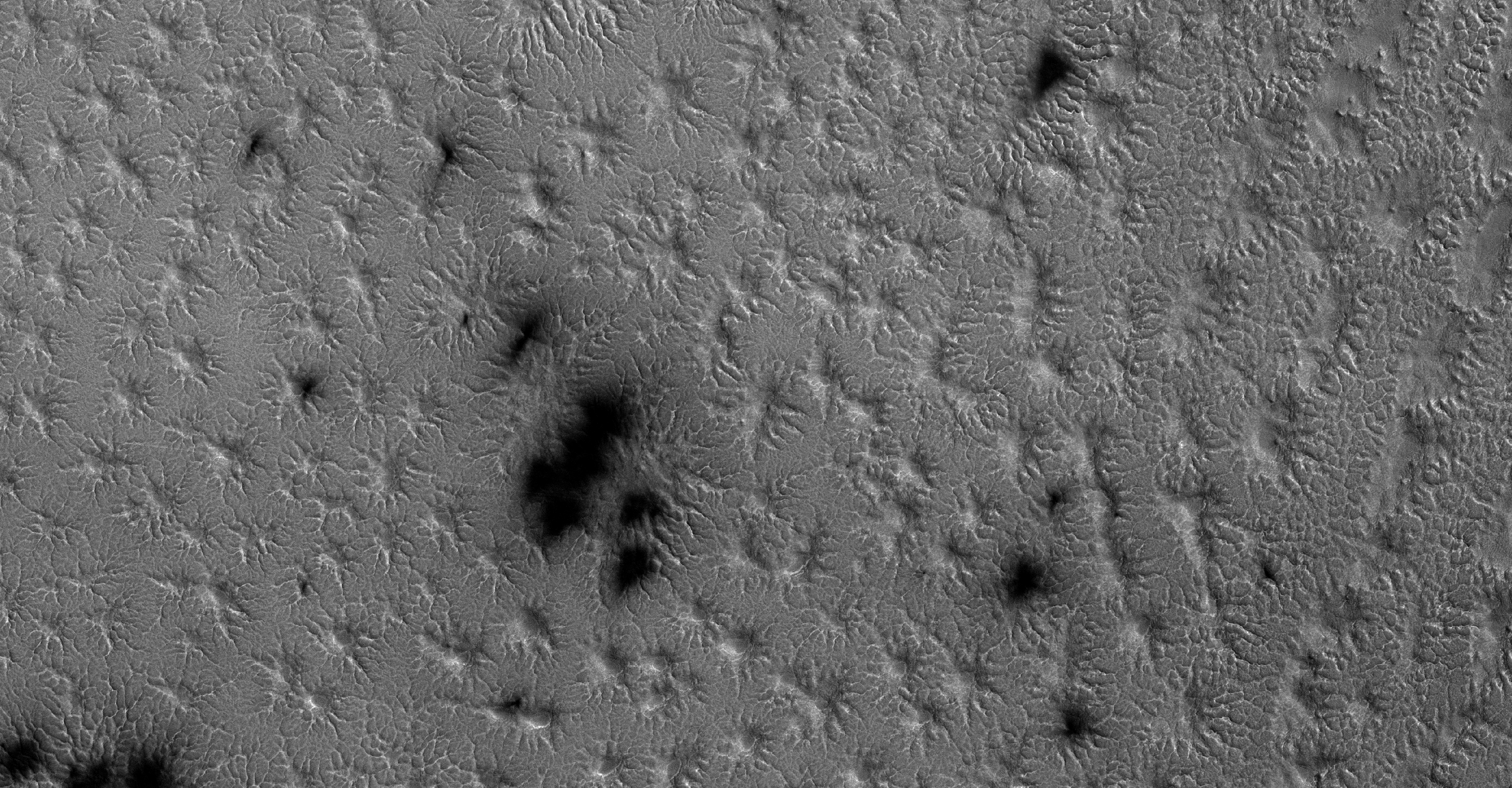
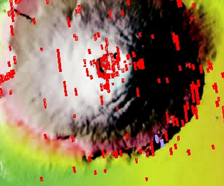
Cool image time! In my routine monthly review of the hundreds of new images released from the high resolution camera on Mars Reconnaissance Orbiter (MRO), I came across another most intriguing geological feature, the image of which is posted to the right, after cropping.
As the scale shows, the pit is about 300 feet across. Calculating the pit’s depth would require someone with better math skills than I. The website provides information about the sun angle, which can be used to extrapolate the shadows and then roughly calculate the depth.
The most fascinating aspect of this pit is the impression of incredible thinness for the pit’s overhung edges. All of the pit’s edges appear significantly overhung, and the thickness of the overhang seems incredibly paper-thin. This thinness is likely only an illusion, though in Mars’s light gravity it is perfectly possible for the overhang to be far thinner and more extended than anything you would find on Earth.
The image itself is in color, though the only color visible is within the pit itself. In that blueness at the base it seems to me that there is a pile of dust/debris, but once again, that conclusion should not be taken very seriously.
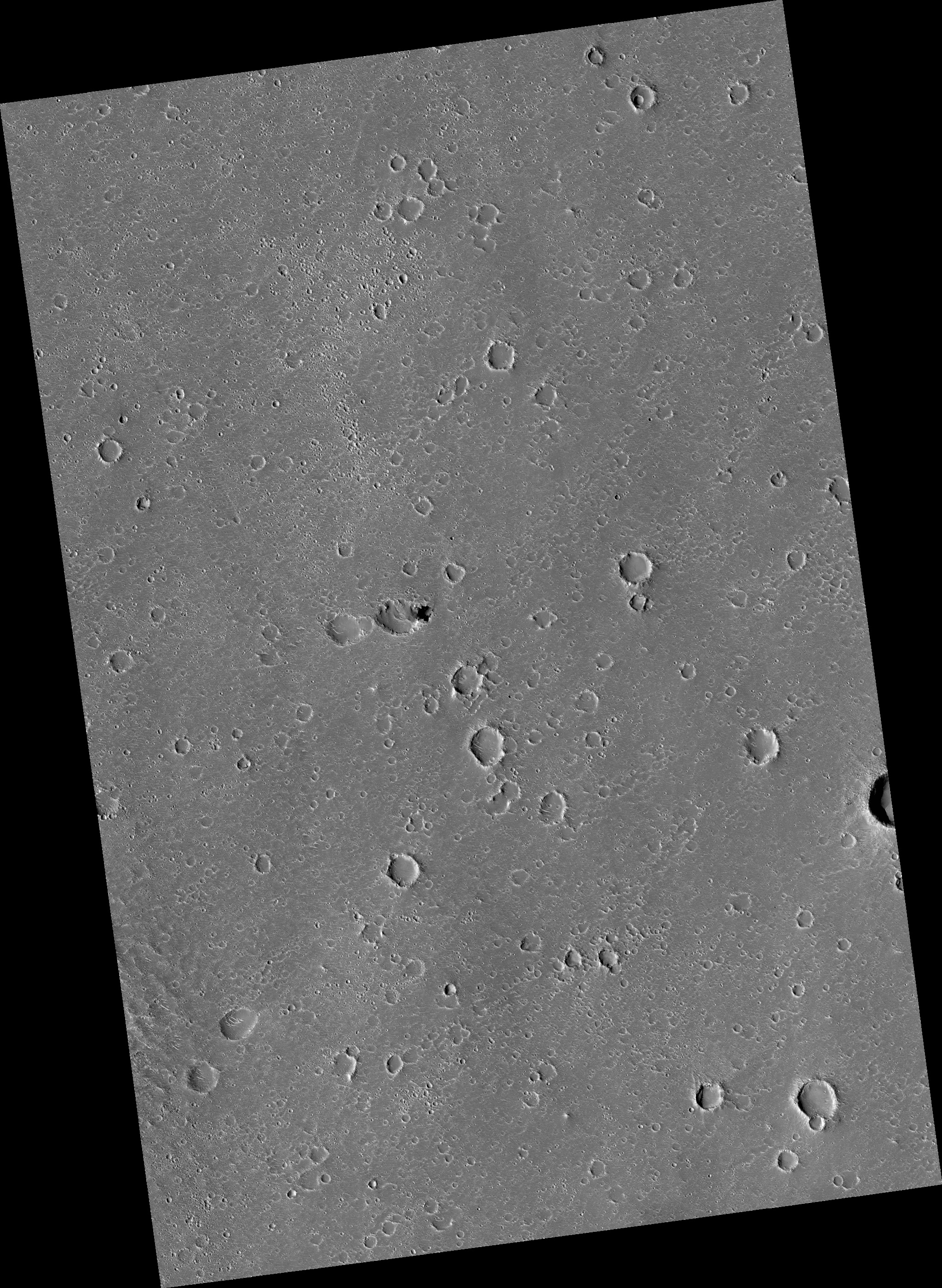
If you take a look at the full image, what is impressive is the bland flatness of the surrounding terrain. There is no hint that there might be underground passages hidden here. While most of the scattered craters are probably impact craters, many (especially those with unsymmetrical shapes) could be collapse features indicating the presence of underground voids. None however is very deep. Nor is there any other pits visible.
Below is a global map of Mars with the location of this pit indicated by a black cross. It is just on the edge of the transition zone between the lower northern plains and the southern highlands, where the shoreline of an intermittent sea is thought by some scientists to have once existed. This is also an area where not a lot of high resolution images have been taken, mostly because of its apparent blandness as seen in previous imagery.
This image demonstrates however that Mars is going to have interesting geology everywhere, and that we won’t really know it well until we have explored it all.
» Read more


