
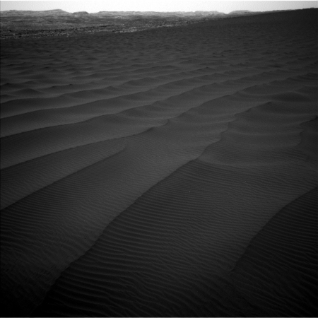
Curiosity’s last dune investigation
As Curiosity moves closer to the very base of Mount Sharp, it is presently making its last investigation of the various types of dunes found at the foot of the mountain.
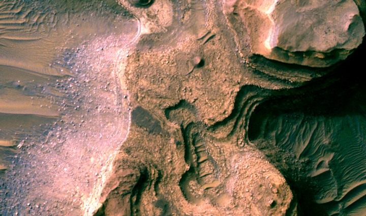
From early February to early April, the rover examined four sites near a linear dune for comparison with what it found in late 2015 and early 2016 during its investigation of crescent-shaped dunes. This two-phase campaign is the first close-up study of active dunes anywhere other than Earth.
Among the questions this Martian dune campaign is addressing is how winds shape dunes that are relatively close together, on the same side of the same mountain, into different patterns. Others include whether Martian winds sort grains of sand in ways that affect the distribution of mineral compositions, which would have implications for studies of Martian sandstones. “At these linear dunes, the wind regime is more complicated than at the crescent dunes we studied earlier,” said Mathieu Lapotre of Caltech, in Pasadena, California, who helped lead the Curiosity science team’s planning for the dune campaign. “There seems to be more contribution from the wind coming down the slope of the mountain here compared with the crescent dunes farther north.”
The article also included a vague update on the status of Curiosity’s drill, out of commission since its drill feed mechanism had problems moving the drill up and down back in the fall of 2016.
Engineers are assessing how the use of vibration to deliver samples may affect the drill feed mechanism, which is used to move the drill bit forward and backwards. In addition, high winds at the linear-dunes location were complicating the process of pouring sample material into the entry ports for the laboratory instruments.
“A balky brake appears to be affecting drill feed mechanism performance,” said Curiosity Deputy Project Manager Steven Lee, of NASA’s Jet Propulsion Laboratory, Pasadena, California. “In some cases, vibration has been observed to change feed effectiveness, so we’re proceeding cautiously until we better understand the behavior. In the meantime, the engineering team is developing several methods to improve feed reliability.”
What this release does not say is whether they are any closer to solving the problem, or whether the drill is essentially out of business for the reminder of Curiosity’s life. To me, the silence on this question is deafening, and strongly suggests that they have decided the drill cannot be used, for the foreseeable future.
