
Mars rover update: December 18, 2017
Summary: The scientists and engineers of both Curiosity and Opportunity have route decisions to make.
Curiosity
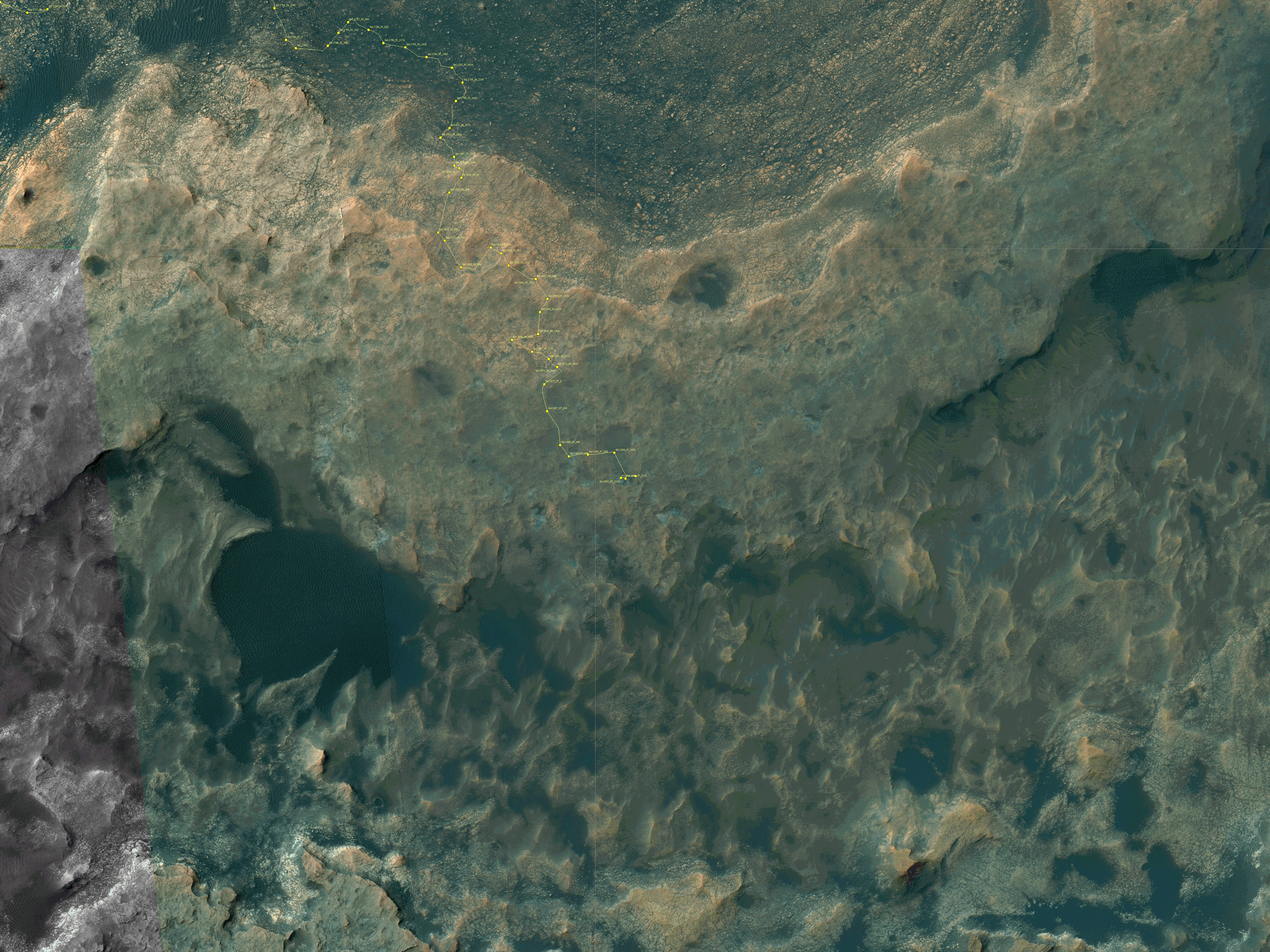
For the overall context of Curiosity’s travels, see Pinpointing Curiosity’s location in Gale Crater.
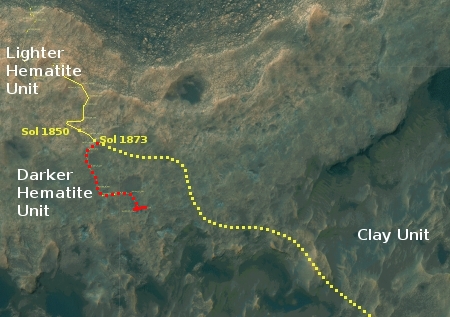
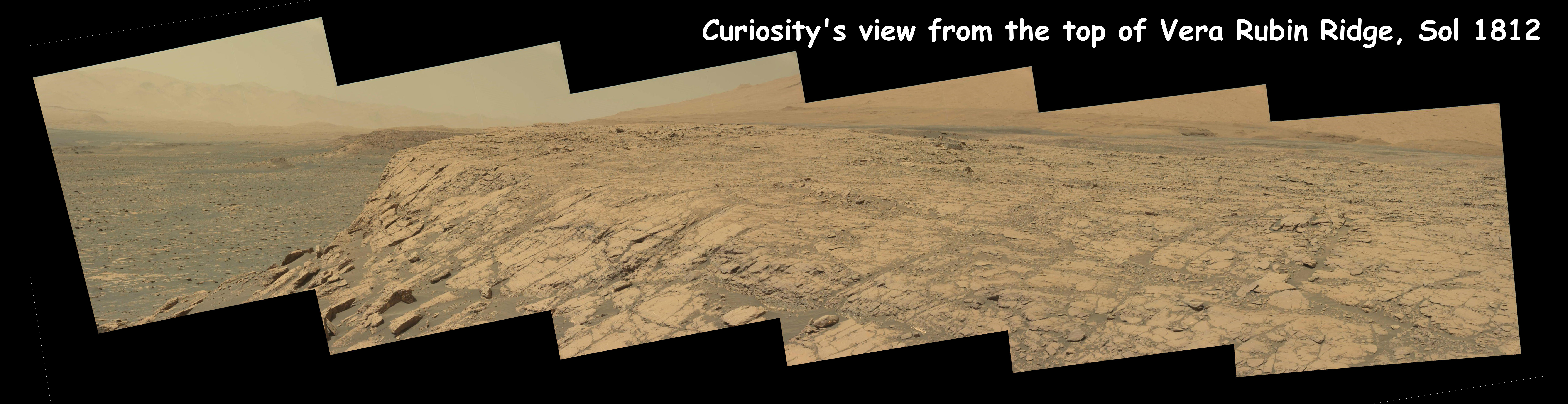
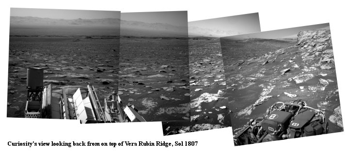
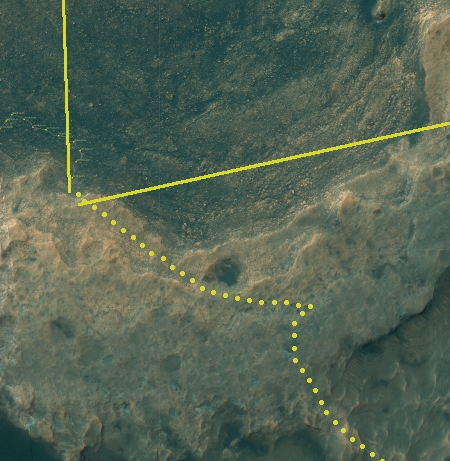
Since my November 16 update, Curiosity’s travels crossing Vera Rubin Ridge, a geological bedding plain dubbed the Hematite Unit, has continued apace. They however have not been following the route that had been planned beforehand, as shown by the yellow dotted line on the right. Instead, they have headed south, along the red dotted line. For the past week or so they have been doing a variety of research tasks in the same area, analyzing samples taken months before, studying sand deposits, and taking many images of some interesting rock layers.
I also suspect that the lack of movement in the past week is partly because they need to make some route-finding decisions. The planned yellow route shown above appears to be somewhat rough in the full resolution orbital image. While I suspect they will still head in that direction, I also think they are doing some very careful analysis of this route and beyond, to make sure they will not end up in a cul de sac where the rover will not be able to continue its climb of Mount Sharp.
Opportunity
For the context of Opportunity’s recent travels along the rim of Endeavour Crater, see my May 15, 2017 rover update.
» Read more
