
Monitoring gullies on Mars for changes
Click for original image.
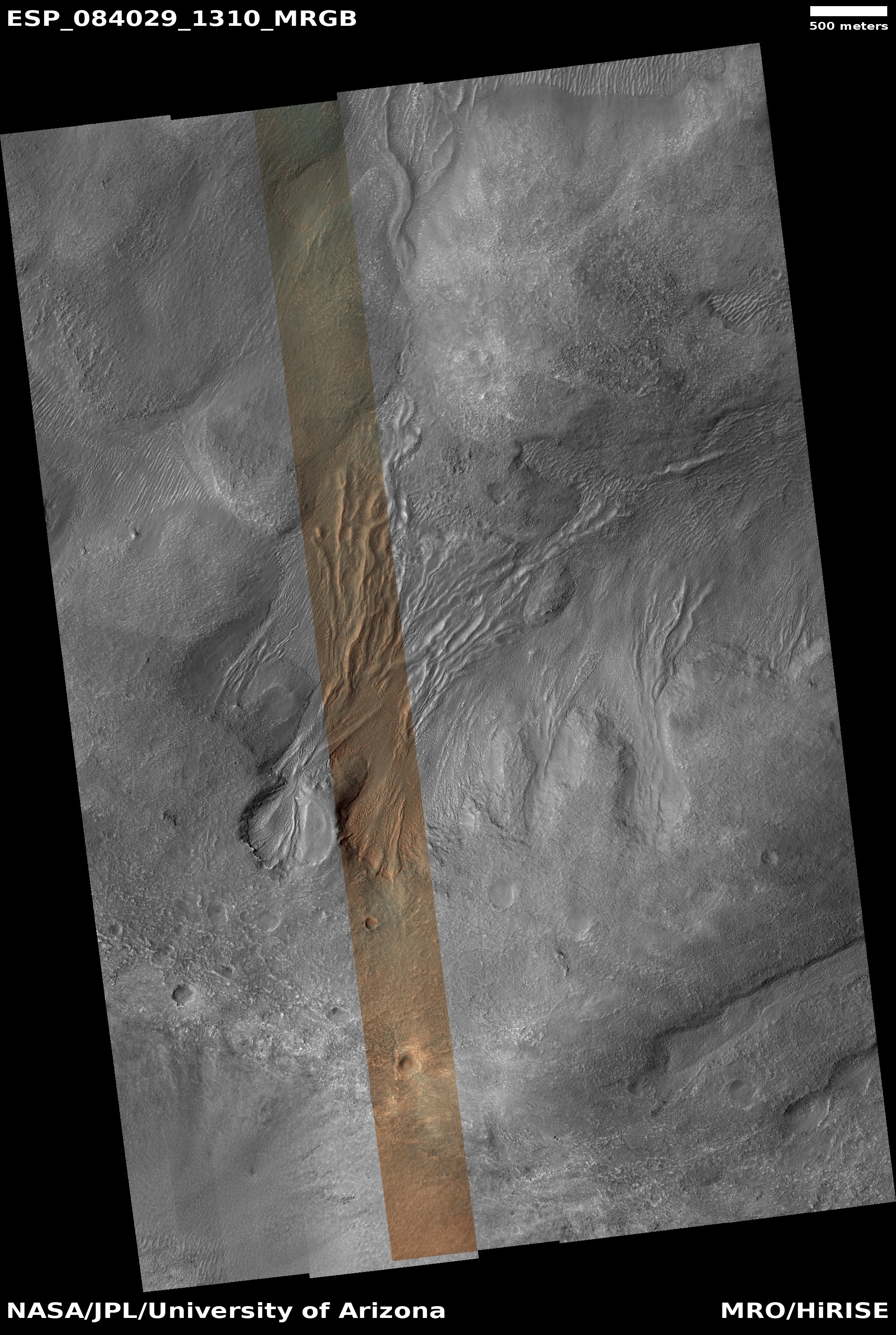
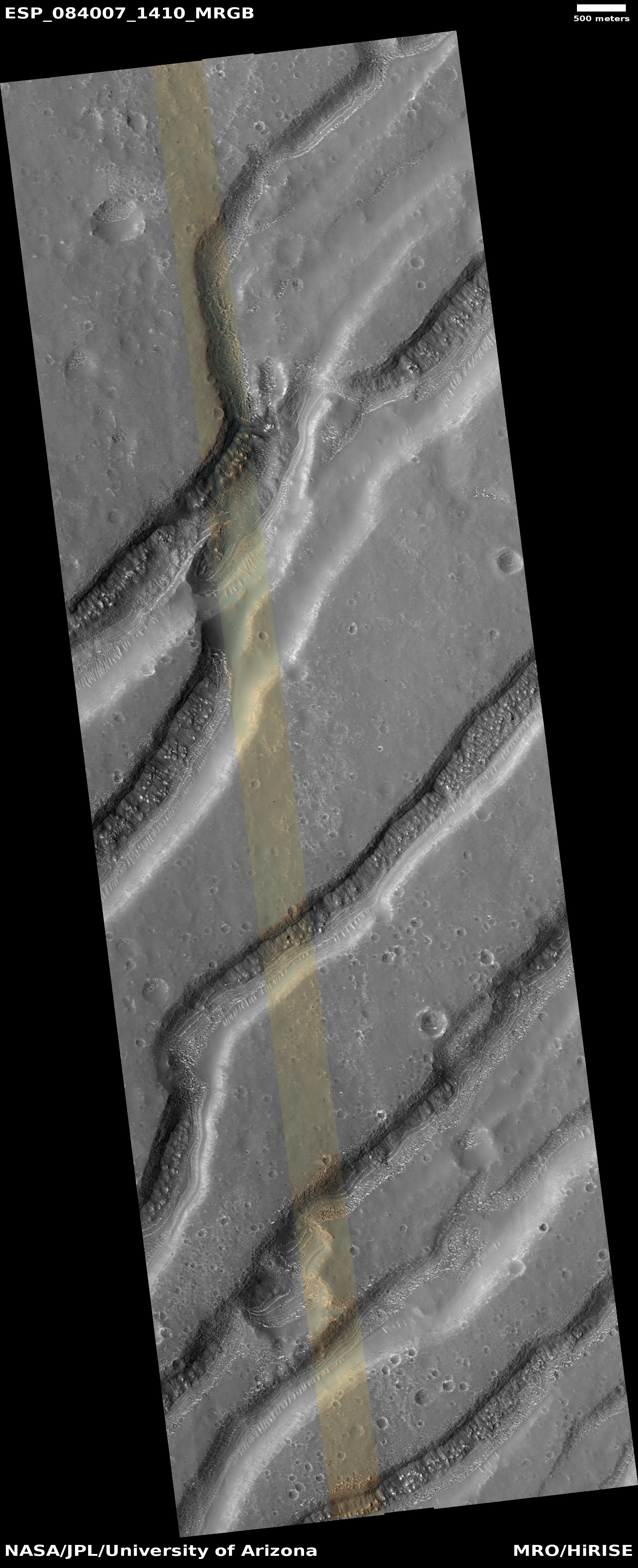
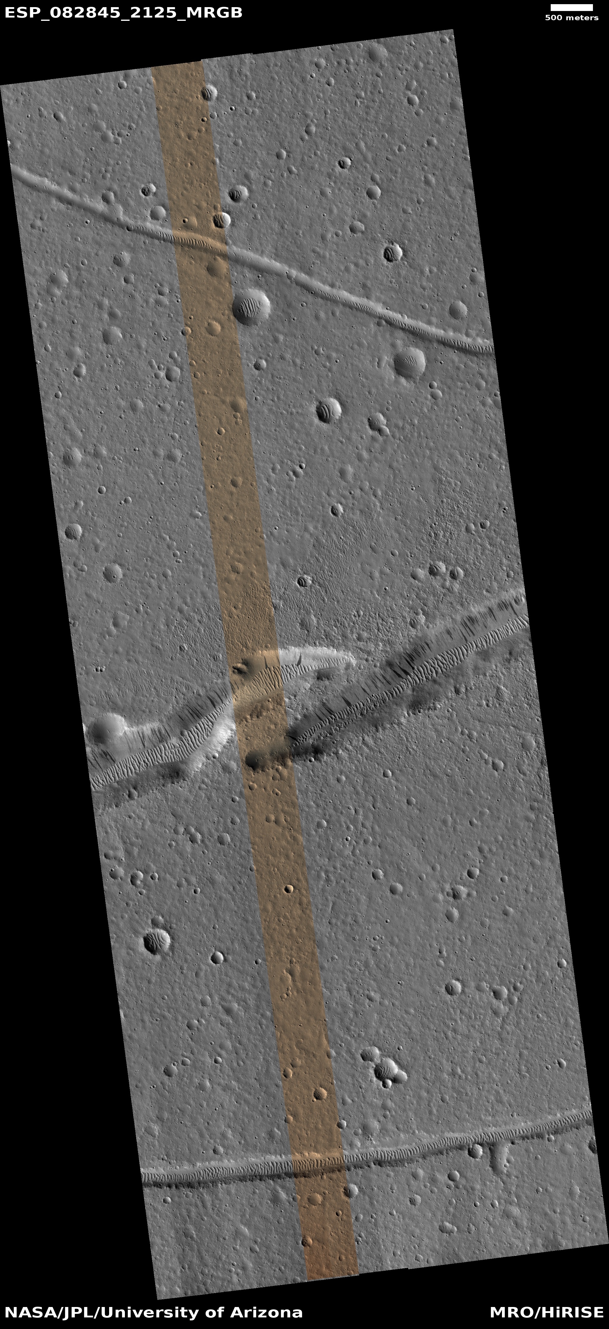
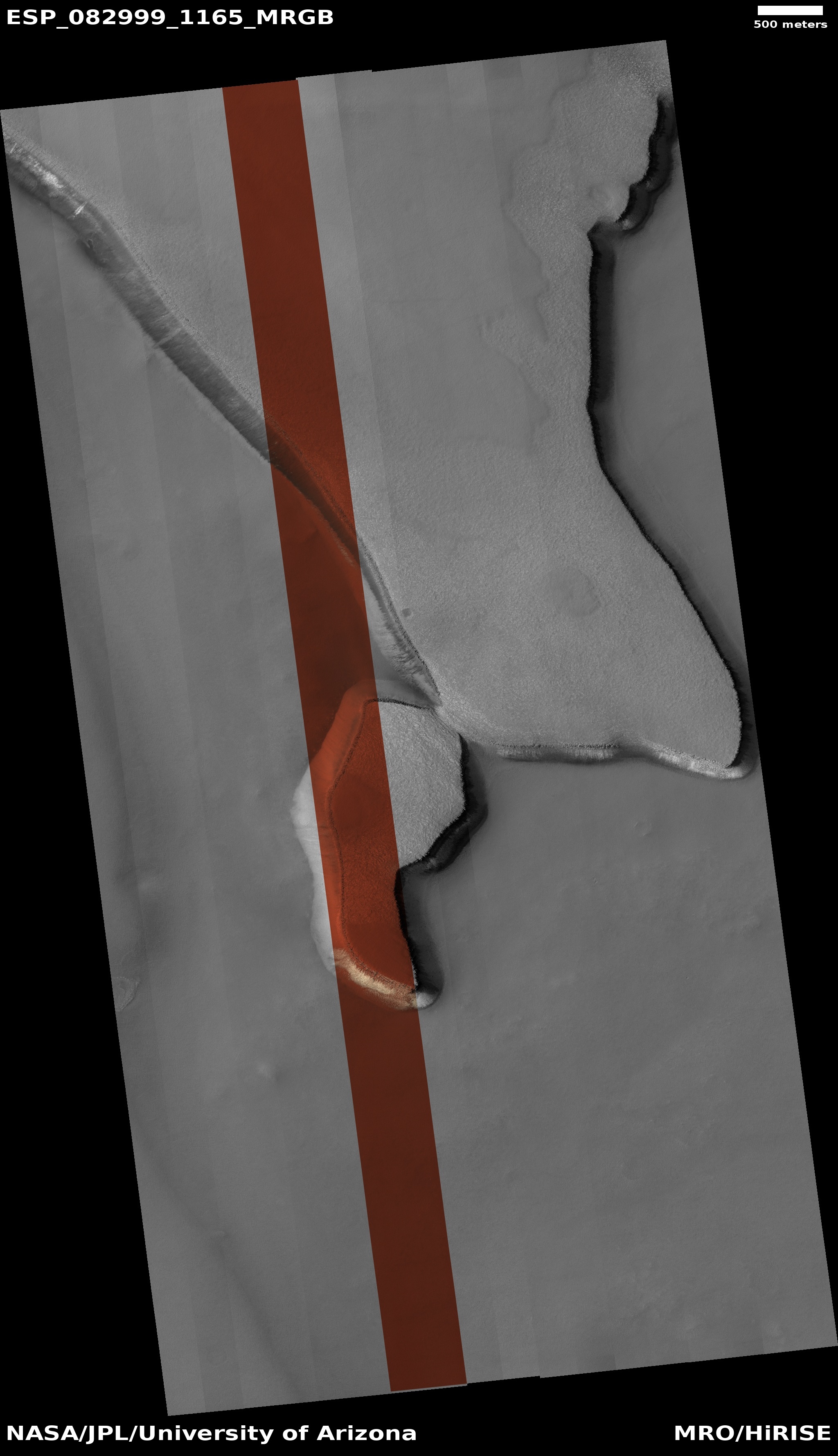
Cool image time! The picture to the right, cropped, reduced, and enhanced to post here, was taken on June 29, 2024 by the high resolution camera on Mars Reconnaissance Orbiter (MRO). The scientists label the picture simply as “gully monitoring,” with an apparent goal of looking to see if this gully has changed since MRO took the first high resolution image two years previously. In the interim this terrain went from Martian spring, through summer and winter, and has now returned to spring.
As far as I can tell, no changes are visible, but then I am not using the highest resolution data available. Small changes might be detectable in the highest resolution using good detection software. Overall, the gully drops about 3,000 feet.
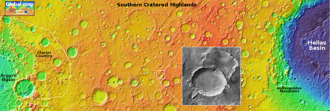
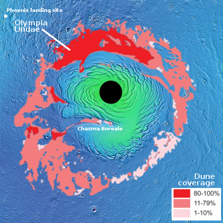
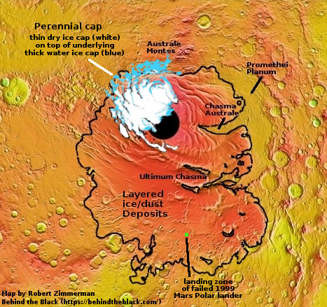
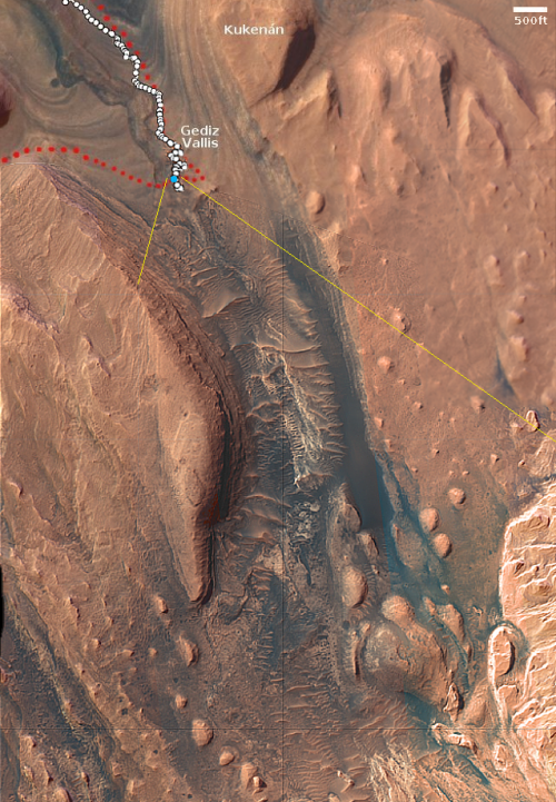
The white dot in the overview map above marks the location, on the southwest interior rim of an unnamed 30-mile wide crater. This region in the Martian cratered highlands was featured in a four part cool image series I did back 2023 (here, here, here, and here), with this as my conclusion:
Overall, our short survey of the southern cratered highlands suggests that the glacial material and ice found in the southern mid-latitudes affects the Martian surface differently than in the northern lowland plains. In the north the craters and the surrounding terrain often appear blobby, as if the ice is close to the surface and also a dominant component of the ground. Impacts therefore cause significant soft melt features, with craters often heavily distorted. Similarly, there is evidence of the existence of past mud volcanoes that once spewed water and mud from below ground.
In the south however the surface is at a higher elevation, and it appears the ice layer is deeper underground. Thus, it appears the ground is more firm, and the only obvious evidence of an underground layer of ice is revealed when sublimation and the subsequent erosion produce these large pits inside craters.
In the case of this crater, a small impact on its interior southwest slope apparently caused that underground layer of ice to melt temporarily and flow downhill, leaving behind the gully and flow features we see today. Based on the two MRO pictures taken a full Martian year apart, it appears the feature is generally stable and thus likely old, left over from that impact. If things are changing seasonally they are doing so in small amounts and slowly.


