Another “What the heck?” formation on Mars
Click for full image.
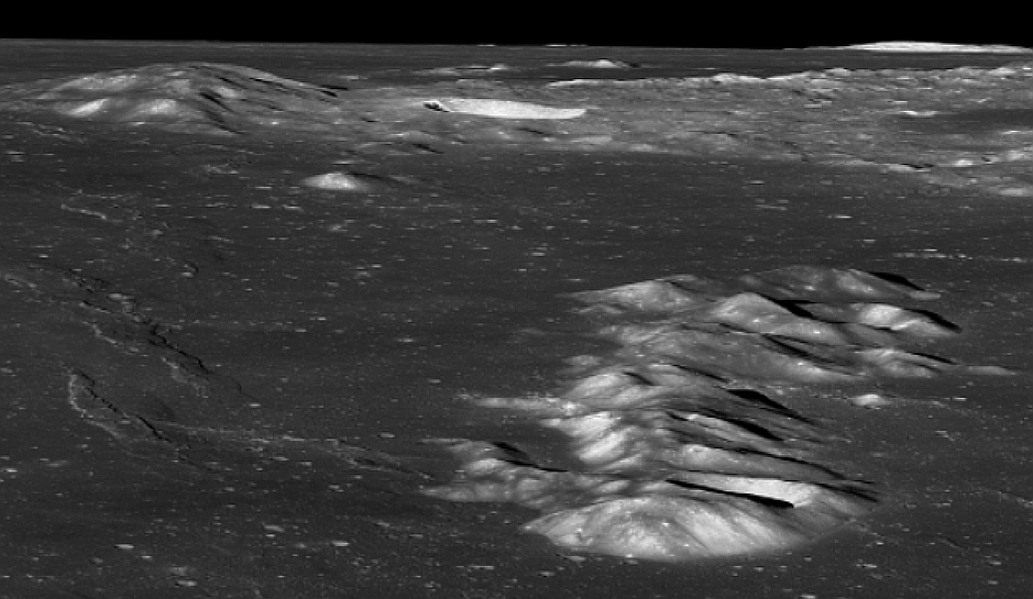
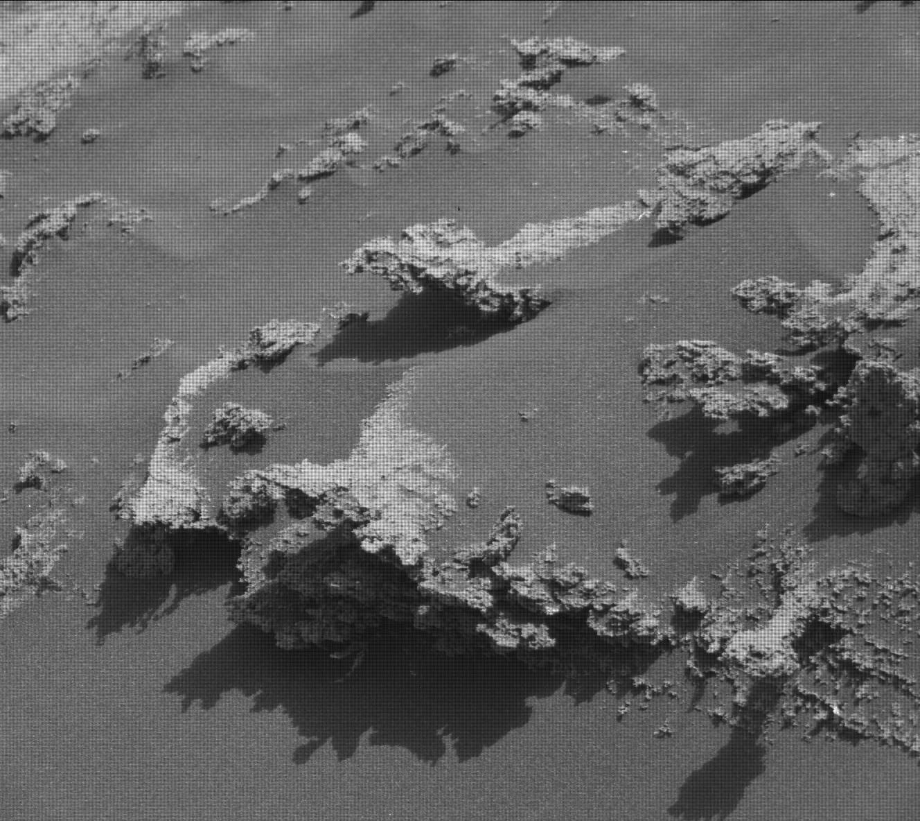
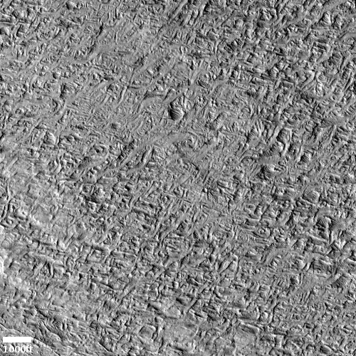
Cool image time! The photo to the right, cropped, reduced, and enhanced to post here, was taken on May 28, 2022 by the high resolution camera on Mars Reconnaissance Orbiter (MRO), and shows what the scientists label “unique terrain.”
I have increased the contrast to bring out the details. It appears that we have a flat plain of criss-crossing ridges that in large areas have somehow gotten flattened across their top. Imagine someone laying plaster on a wall and using a scraper tool to smooth the surface, but only partially. In this case on Mars, our imaginary worker only smoothed the surface a little, and only in some areas. To try to come up with a geological process however to explain this seems daunting.
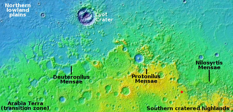
And what created the criss-crossing ridges? The overview map provides only a little help in answering these questions.
» Read more
Click for full image.
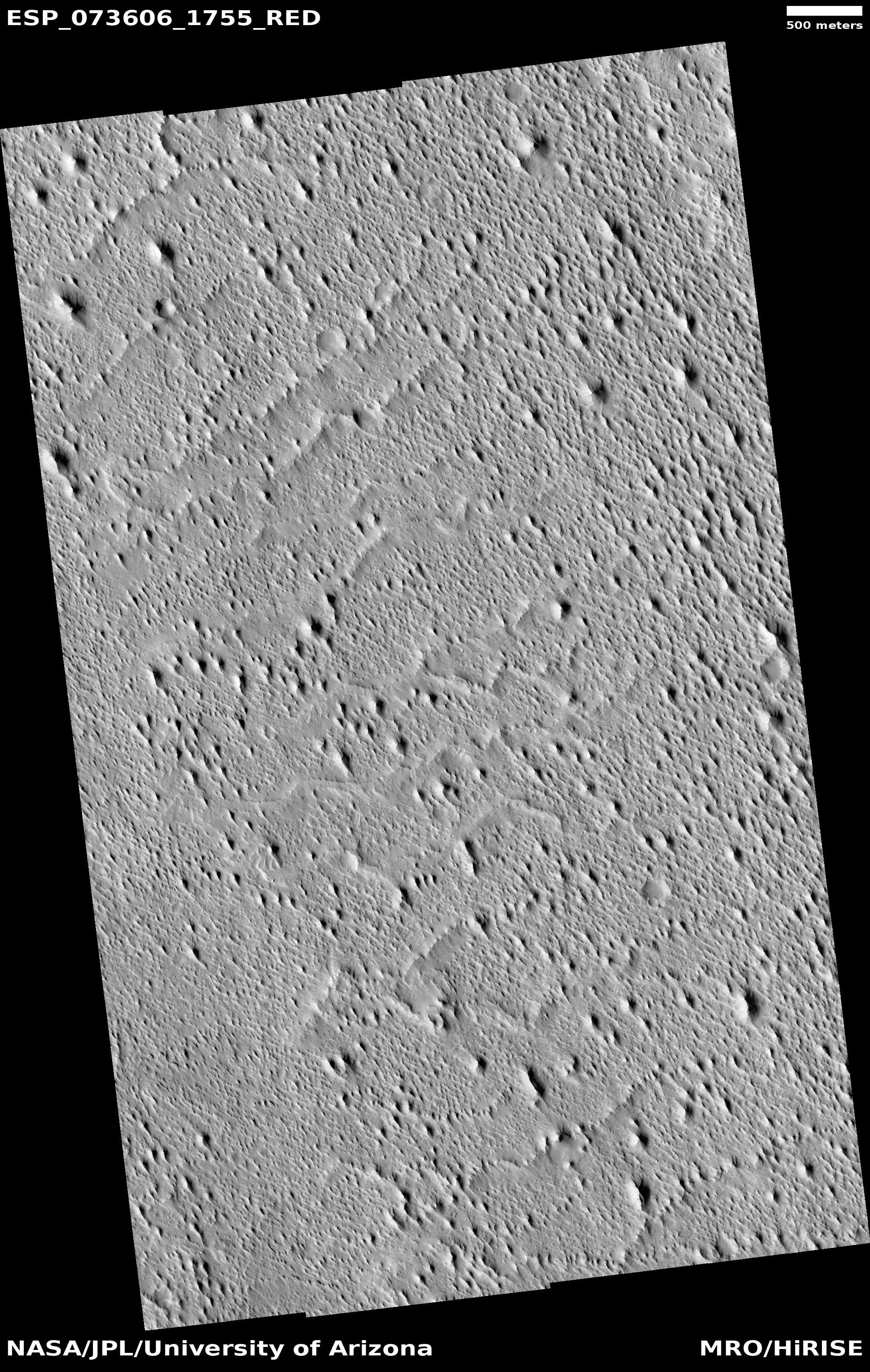
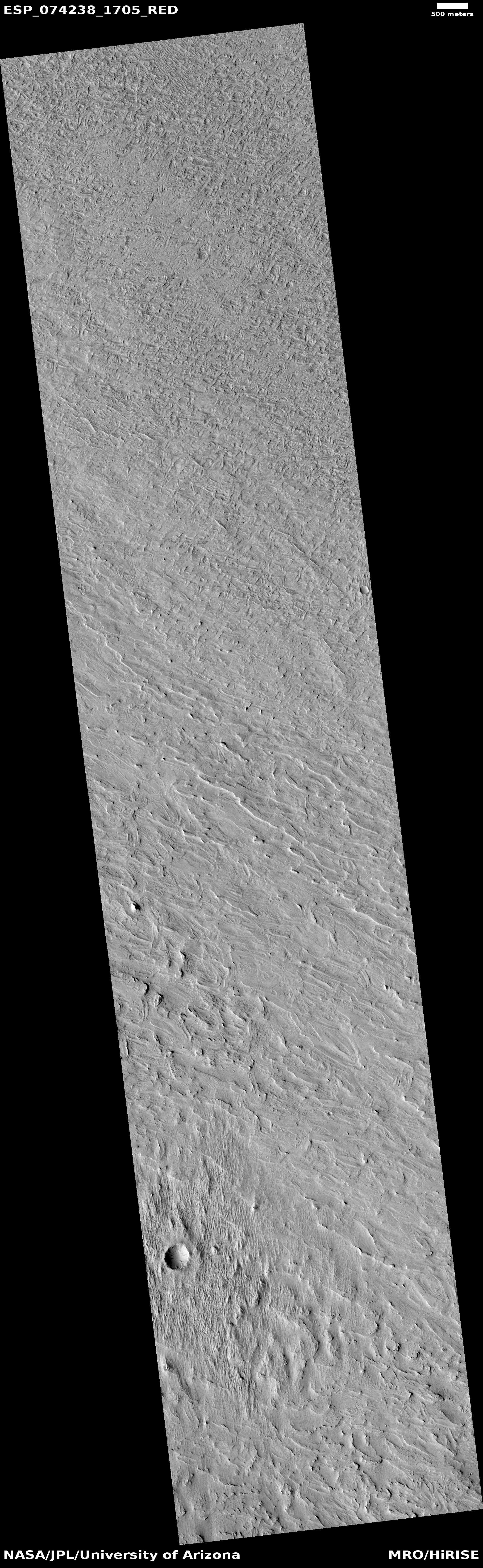
Cool image time! The photo to the right, cropped, reduced, and enhanced to post here, was taken on May 28, 2022 by the high resolution camera on Mars Reconnaissance Orbiter (MRO), and shows what the scientists label “unique terrain.”
I have increased the contrast to bring out the details. It appears that we have a flat plain of criss-crossing ridges that in large areas have somehow gotten flattened across their top. Imagine someone laying plaster on a wall and using a scraper tool to smooth the surface, but only partially. In this case on Mars, our imaginary worker only smoothed the surface a little, and only in some areas. To try to come up with a geological process however to explain this seems daunting.
And what created the criss-crossing ridges? The overview map provides only a little help in answering these questions.
» Read more