
Ingenuity photographs Perseverance’s abandoned parachute on 26th flight
Click for full image.
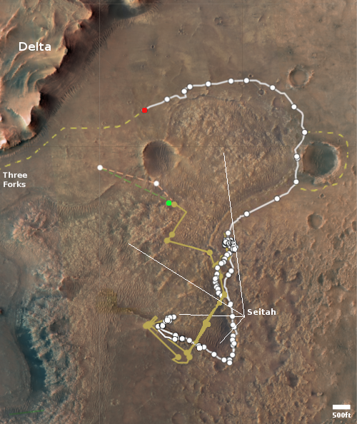
Click for interactive map.
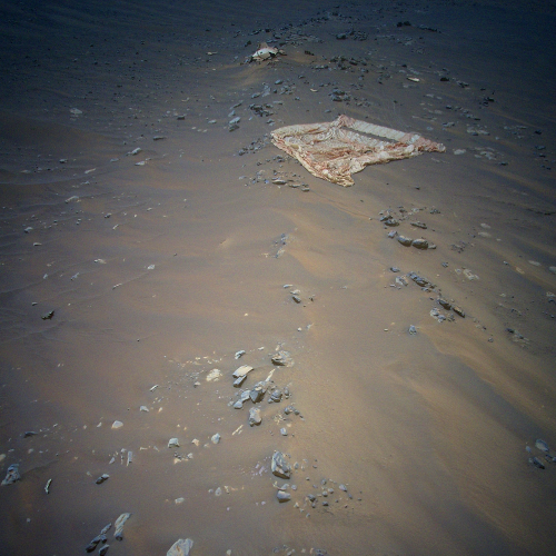
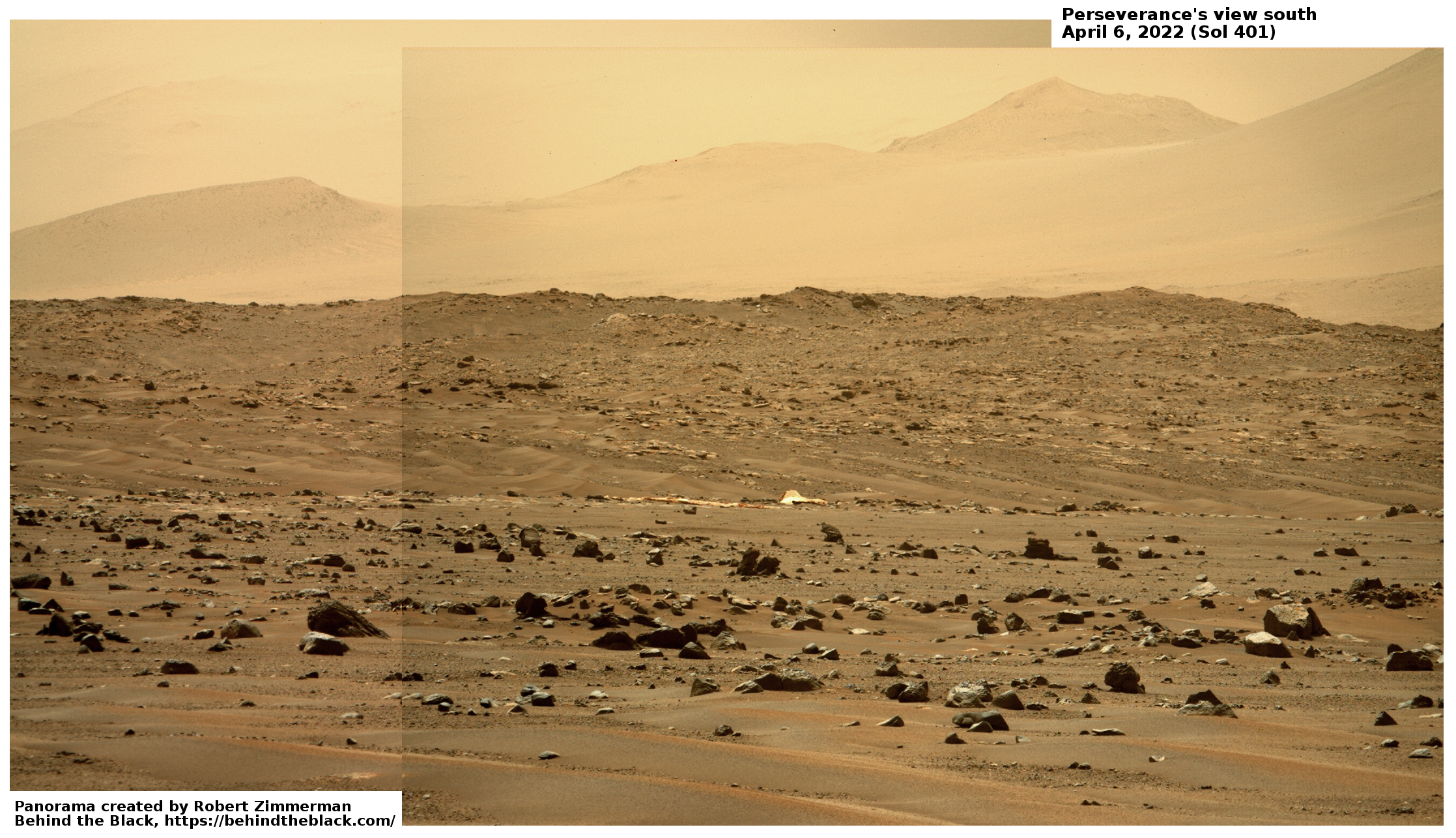
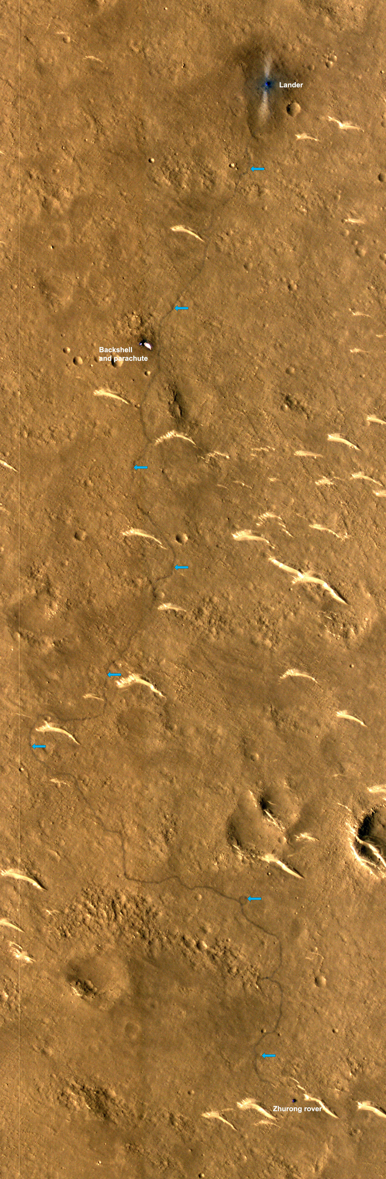
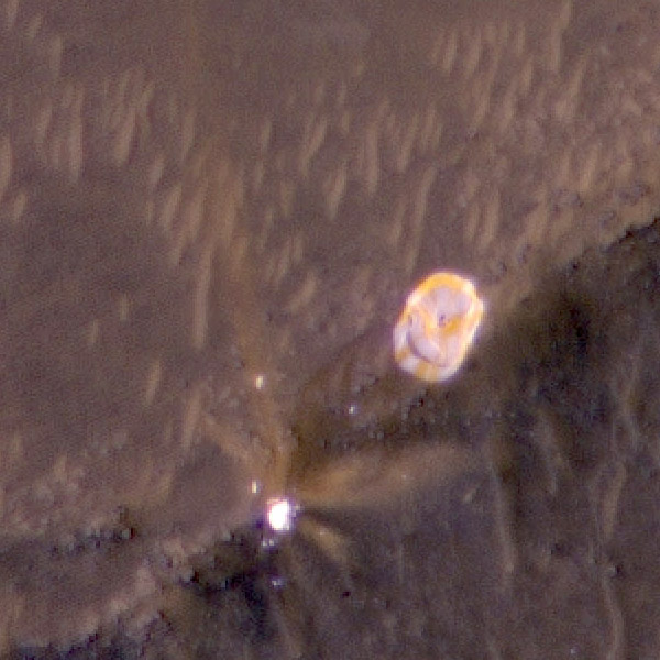
In the past week the Mars helicopter Ingenuity successfully completed its 26th and 27th flights, with the first specifically planned to fly over the parachute that had been used by Perseverance when it landed on Mars on February 18, 2021. The first photo to the right, enhanced, cropped, and reduced to post here, is the color photo of that parachute that Ingenuity took during that flight on April 20th. Near the top of the frame you can also see the equipment used to attach the chute to the rover. The photo looks to the southwest.
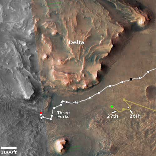
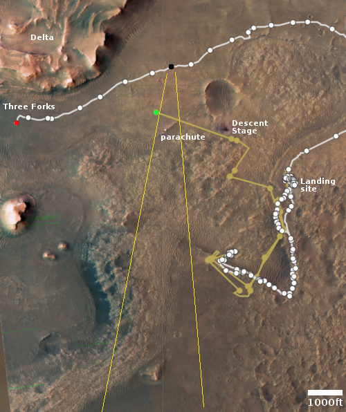
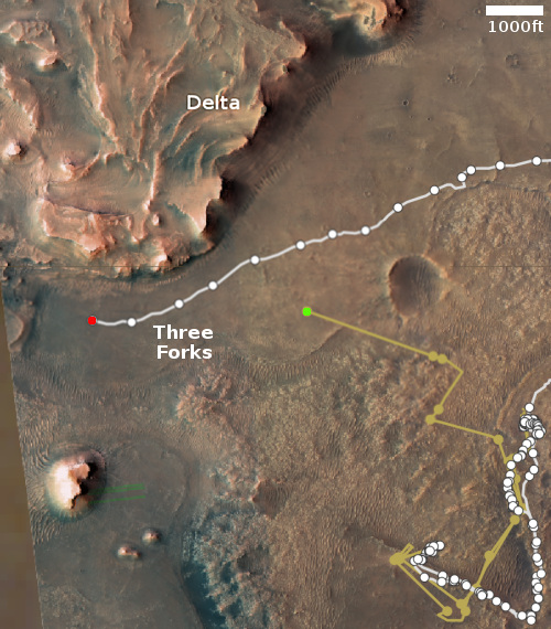
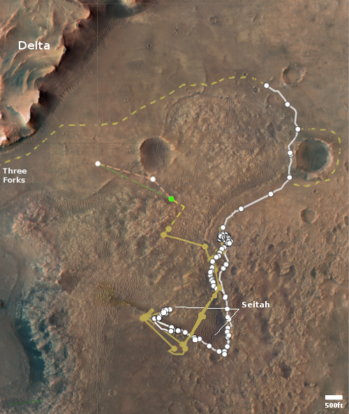
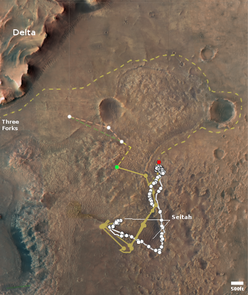
The map to the right indicates the flight paths for both hops, both slightly more than 1,000 feet total. The green dot marks Ingenuity’s position yesterday, the red dot Perseverance’s position. The small white dot indicates the parachute’s location.
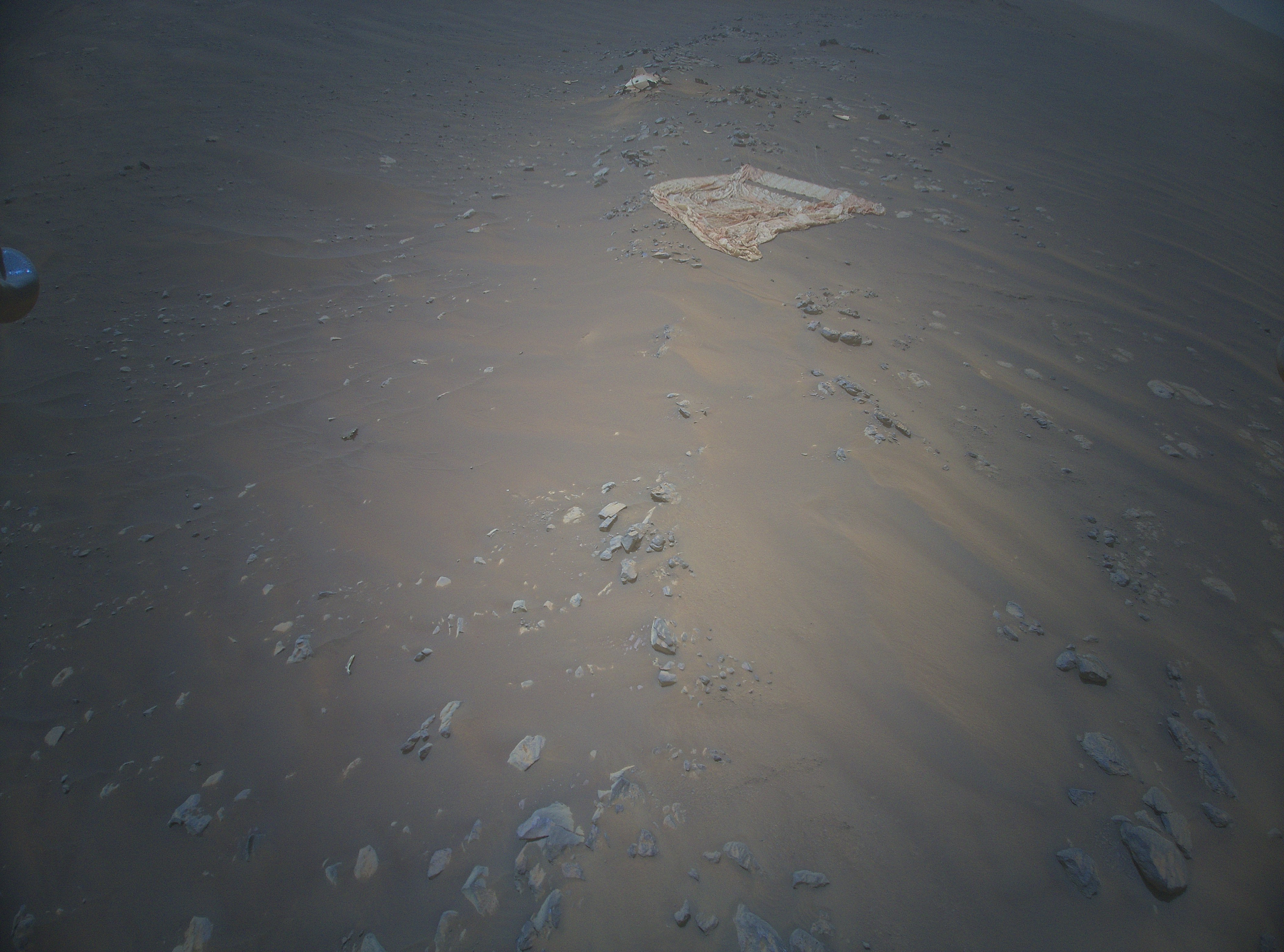
On April 8th Perseverance had snapped a picture of the parachute, from the position indicated by the black dot. Since that photo was taken from a distance, it could not show much. Ingenuity’s more recent photo from overhead however captures the chute quite clearly, and suggests that in the year since landing the weak Martian wind has shifted its edges slightly while depositing some dust on its surface.
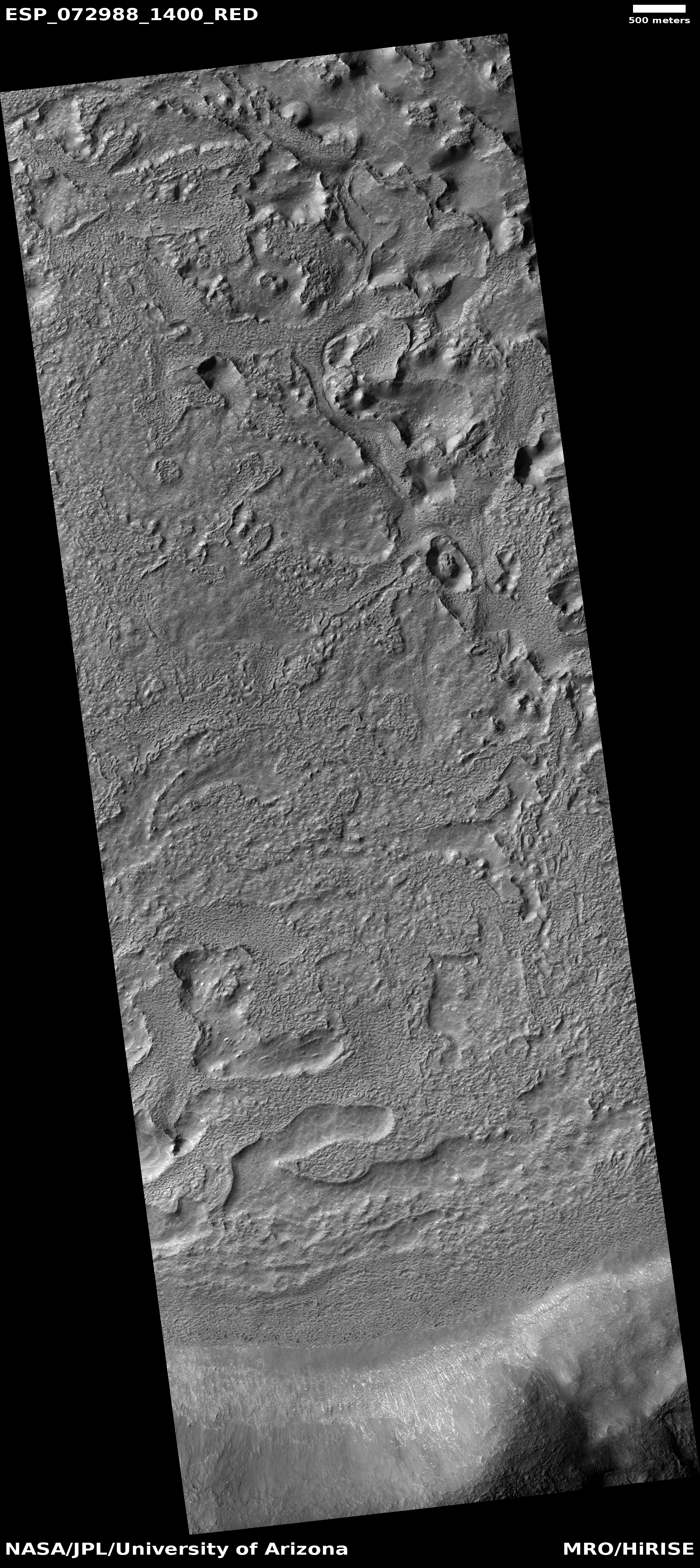
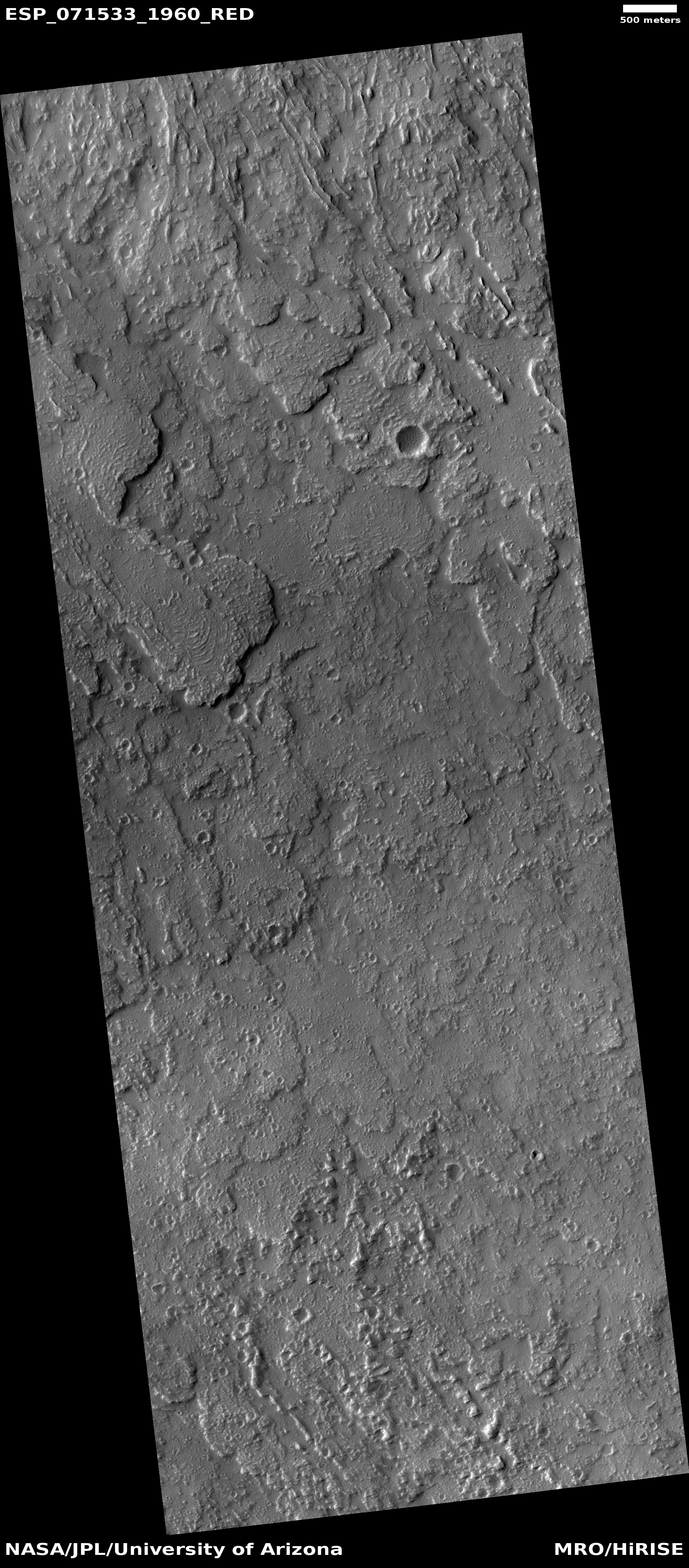
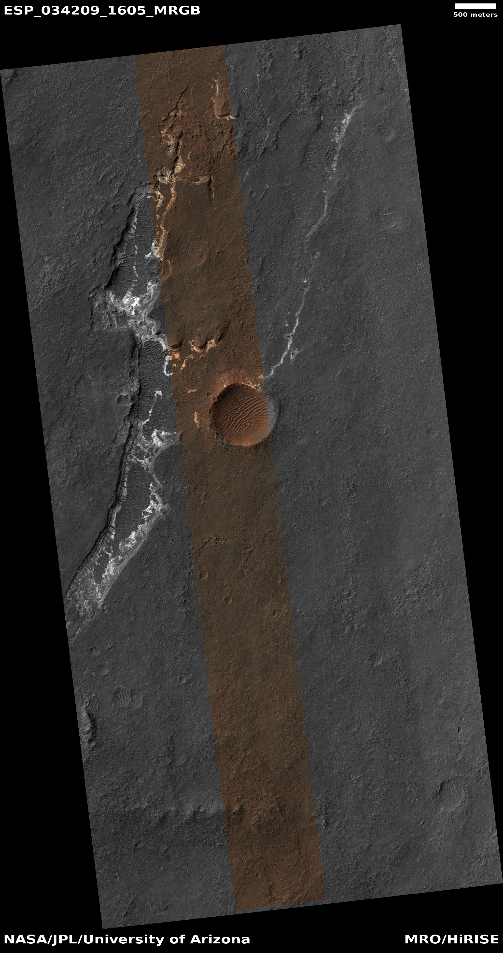
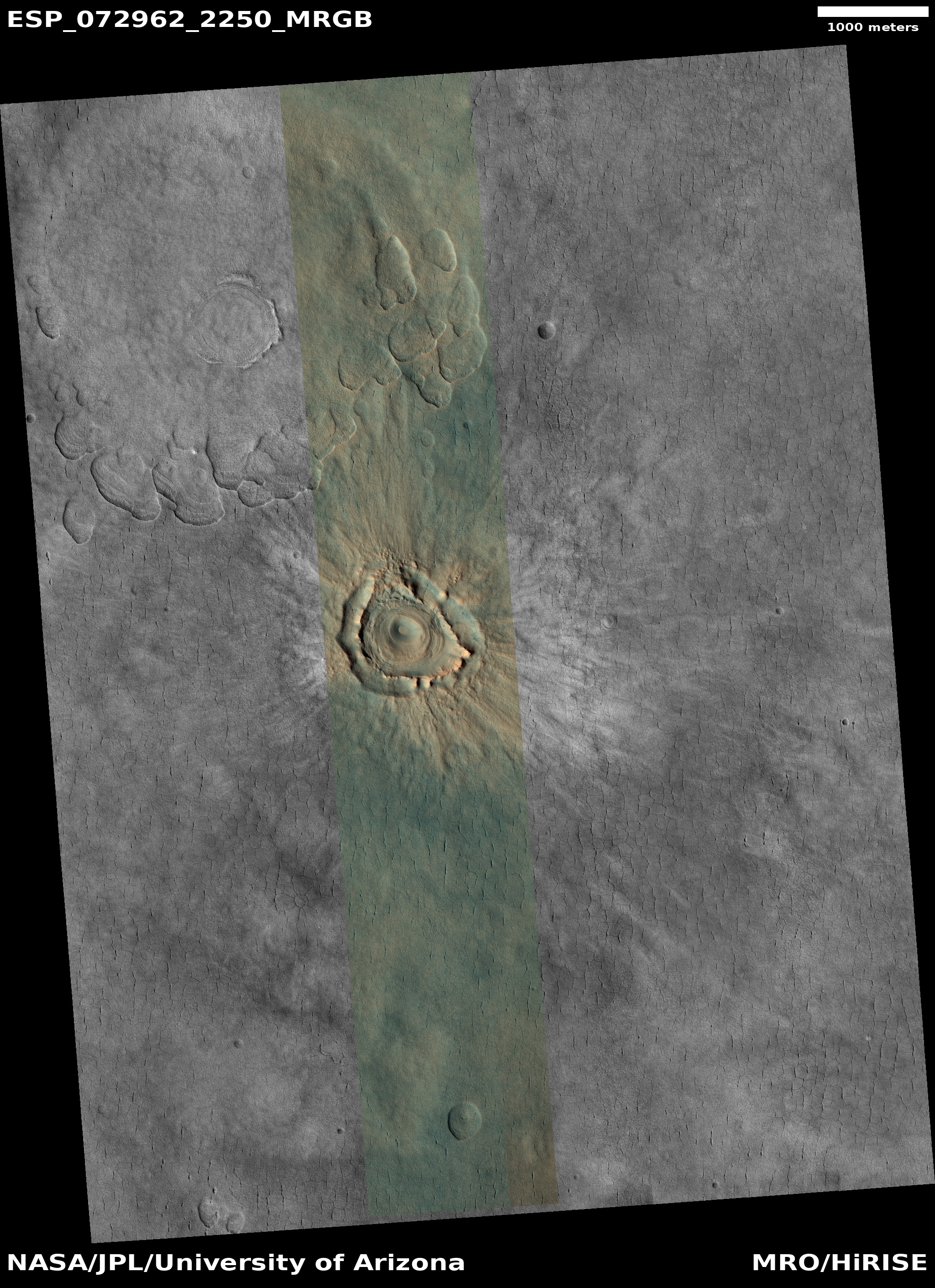
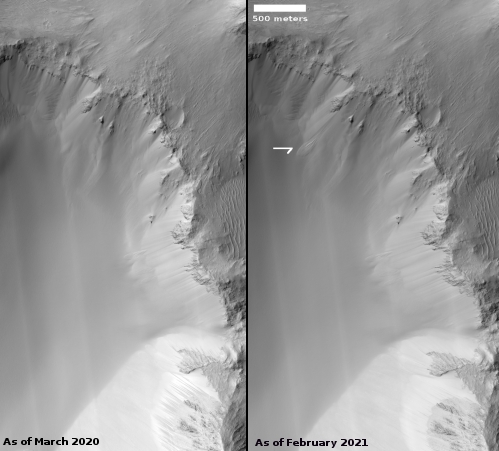
You can see the changes at the edges by comparing Ingenuity’s picture with a photo taken on February 19, 2021 by Mars Reconnaissance Orbiter (MRO). In Ingenuity’s picture the near edge of the parachute especially appears to have become bunched up over time, suggesting the prevailing and strongest winds have come from the south.
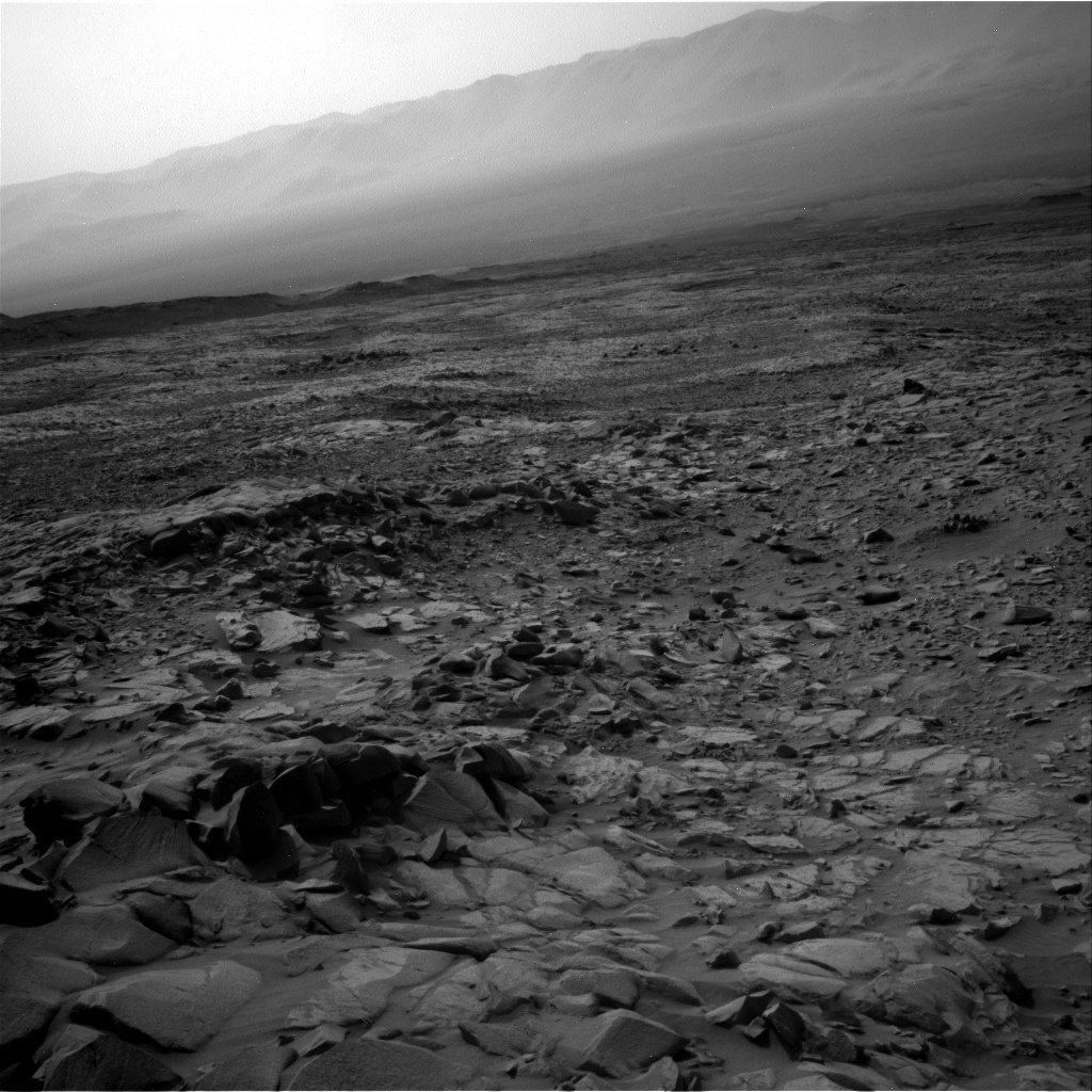
Click for full image.
Click for interactive map.
In the past week the Mars helicopter Ingenuity successfully completed its 26th and 27th flights, with the first specifically planned to fly over the parachute that had been used by Perseverance when it landed on Mars on February 18, 2021. The first photo to the right, enhanced, cropped, and reduced to post here, is the color photo of that parachute that Ingenuity took during that flight on April 20th. Near the top of the frame you can also see the equipment used to attach the chute to the rover. The photo looks to the southwest.
The map to the right indicates the flight paths for both hops, both slightly more than 1,000 feet total. The green dot marks Ingenuity’s position yesterday, the red dot Perseverance’s position. The small white dot indicates the parachute’s location.
On April 8th Perseverance had snapped a picture of the parachute, from the position indicated by the black dot. Since that photo was taken from a distance, it could not show much. Ingenuity’s more recent photo from overhead however captures the chute quite clearly, and suggests that in the year since landing the weak Martian wind has shifted its edges slightly while depositing some dust on its surface.
You can see the changes at the edges by comparing Ingenuity’s picture with a photo taken on February 19, 2021 by Mars Reconnaissance Orbiter (MRO). In Ingenuity’s picture the near edge of the parachute especially appears to have become bunched up over time, suggesting the prevailing and strongest winds have come from the south.


