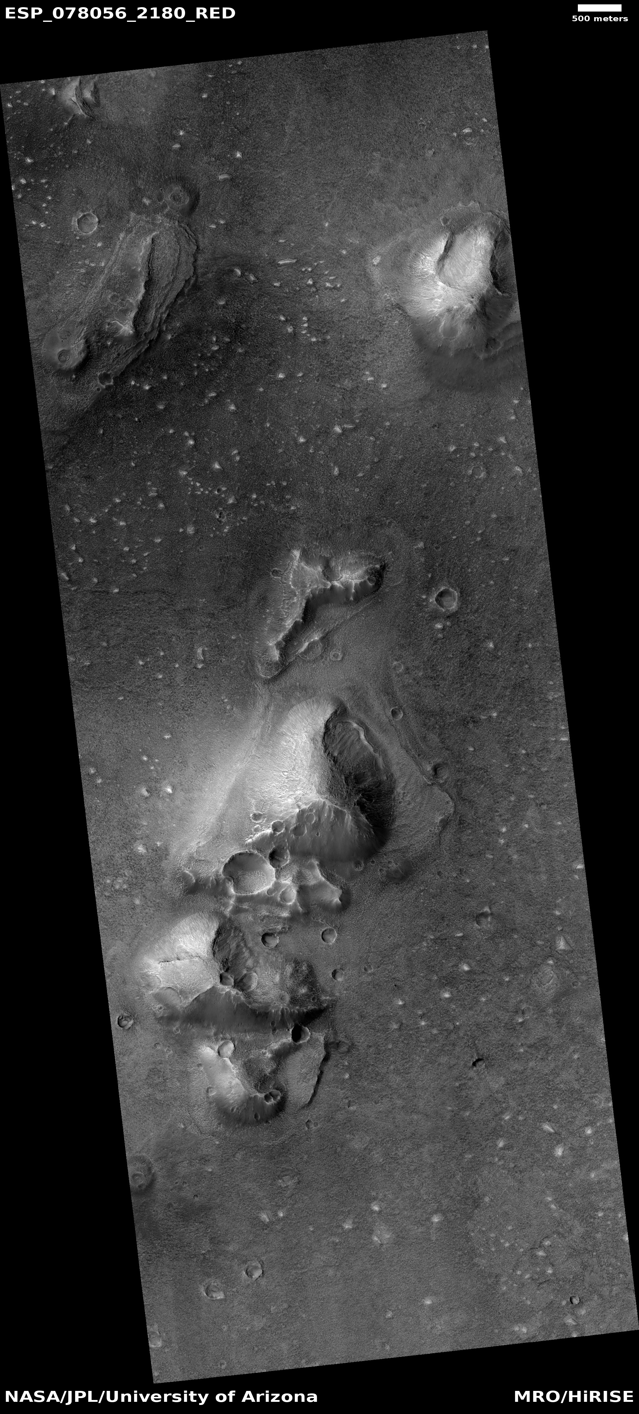
Click for higher resolution. Original images can be found here, here, and here.
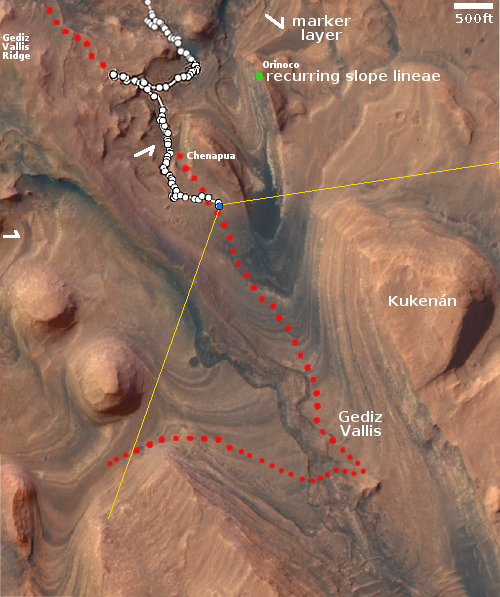
Click for interactive map.
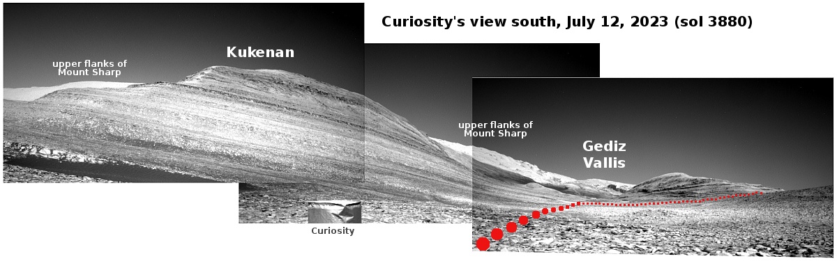
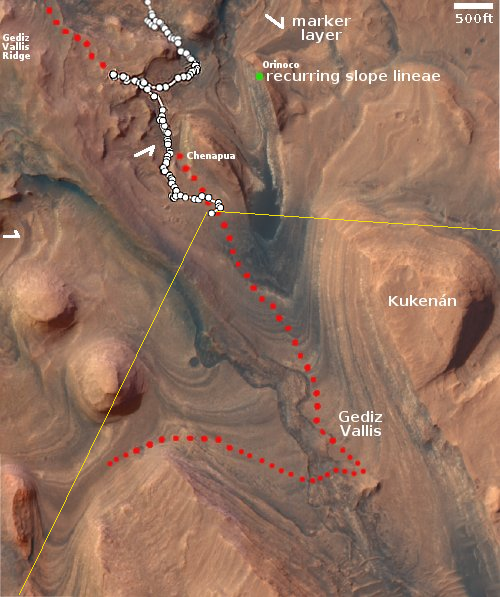
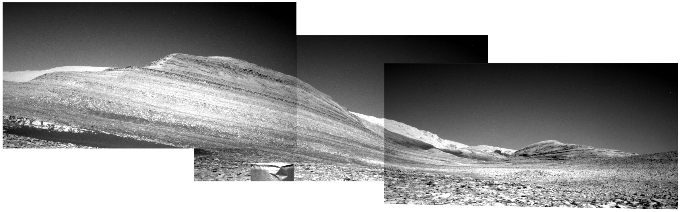
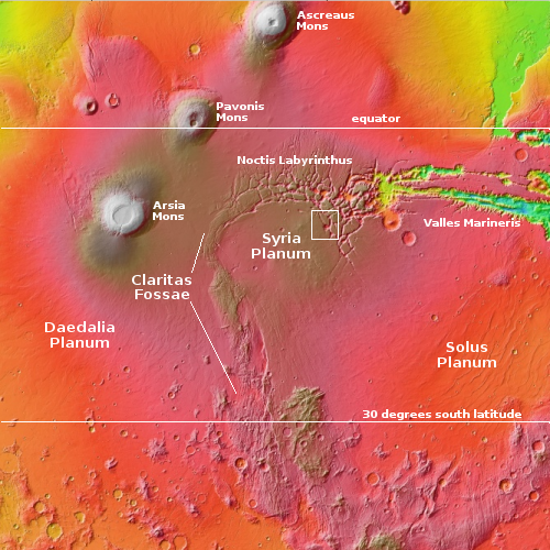
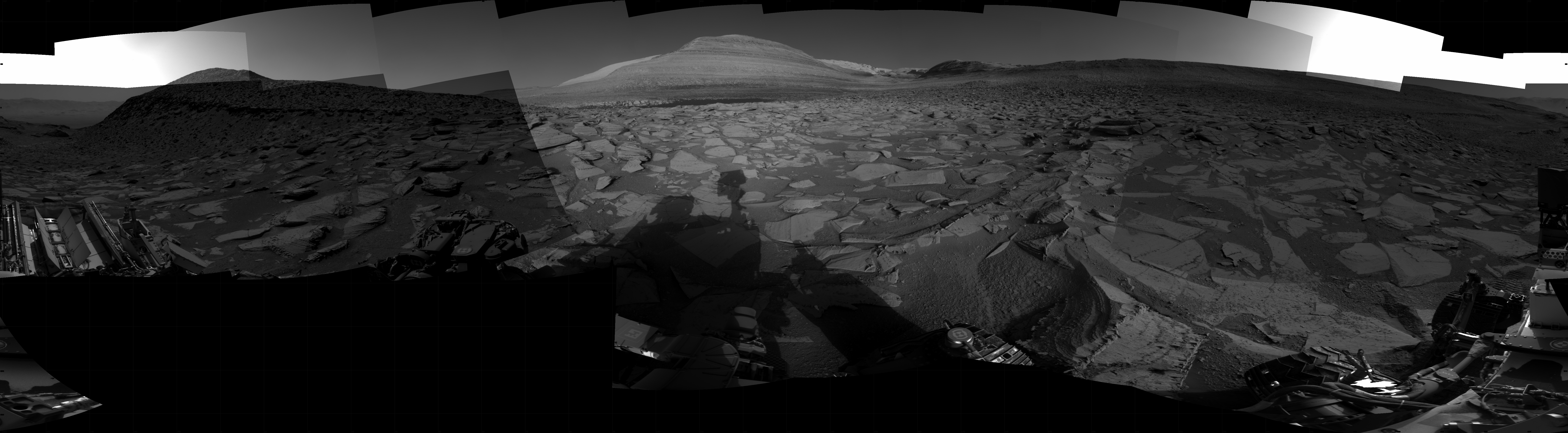
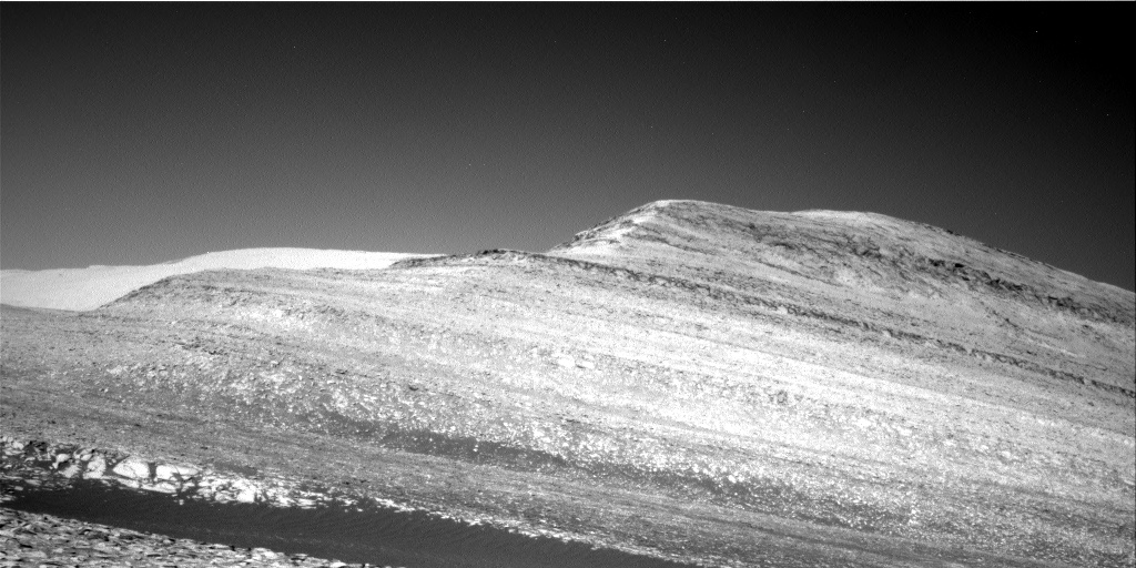
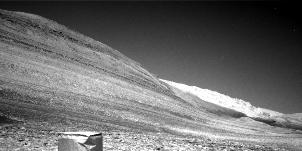
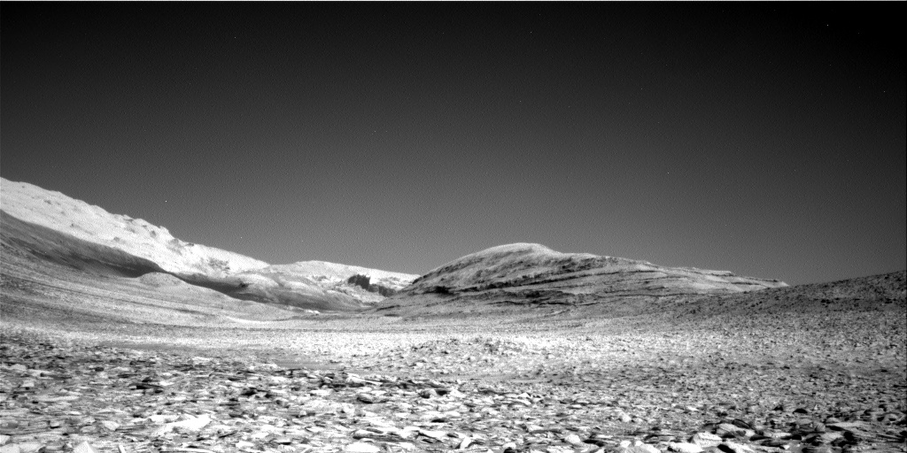
The panorama above, created from three images, was taken by Curiosity on July 12, 2023 using its right navigation camera. It looks south in the direction that the science team eventually plans to send the rover, as indicated by the red dotted line on both the panorama and the overview map to the right. The yellow lines on the overview map indicate approximately the area covered by the panorama. Kukenan’s peak rises about 500 feet above the rover, and I guarantee there will be many planetary geologists that are going to study the pictures of its many layers for many years.
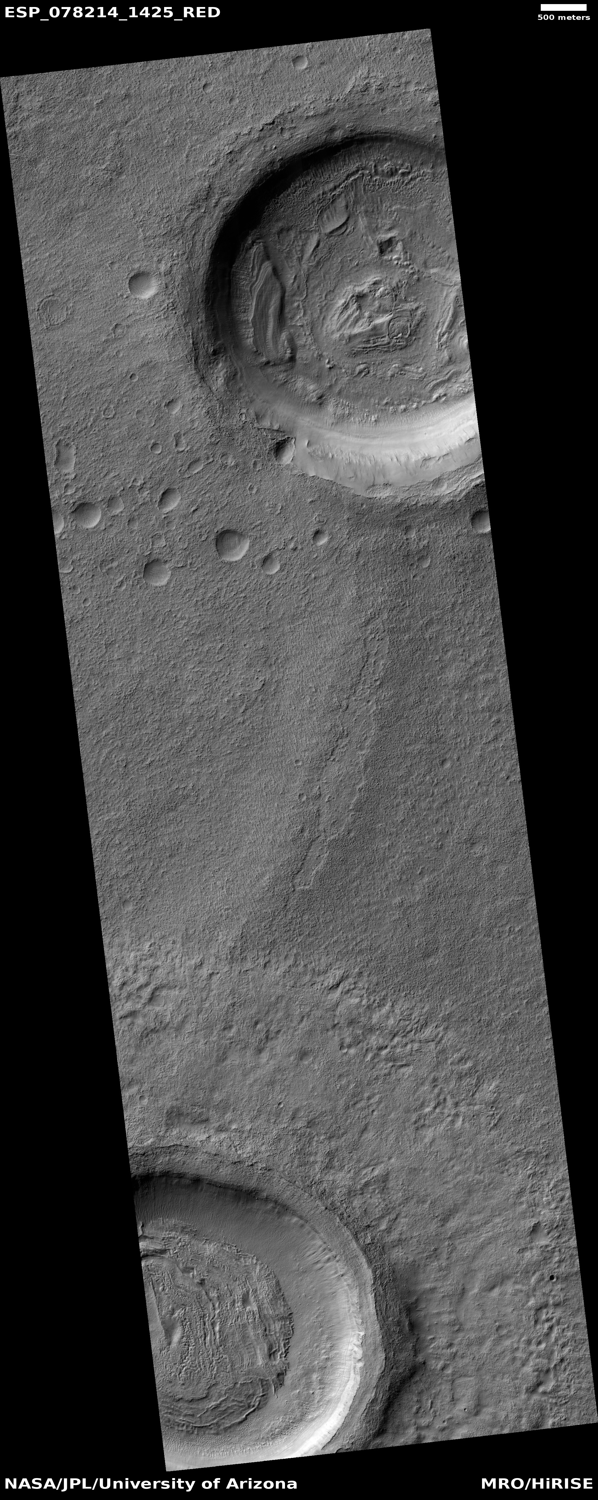
At present however Curiosity is heading west, away from that planned route, to visit the small craters about 500 feet away. For almost all of the rover’s decade-long journey in Gale Crater, it has seen relatively few craters, and since it left the floor of the crater and began its climb up the flanks of Mount Sharp three years ago, it has seen none.
Inspecting the floors and surrounding ejecta of these small craters will give the scientists a look at materials that are presently below the surface. While it is likely that material will be of geological layers Curiosity has already traveled over lower down the mountain, it is also possible there will be surprises. The scientists decided they couldn’t pass up this opportunity to find out.
Why have there been so few craters in Gale Crater? Though Mars is hardly as active as Earth, its geological history is almost as dynamic. The surface of Gale has been reshaped by the processes that created Mount Sharp, processes that destroyed craters from early in Mars’ history. The craters the rover is about to see are almost certainly relatively young.


