
Frozen glacial eddies on Mars?
Click for full image.
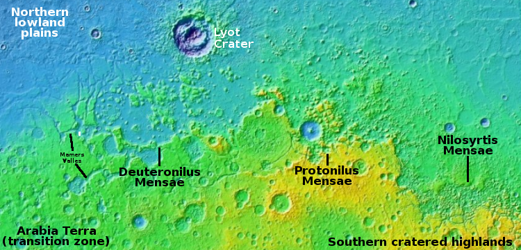
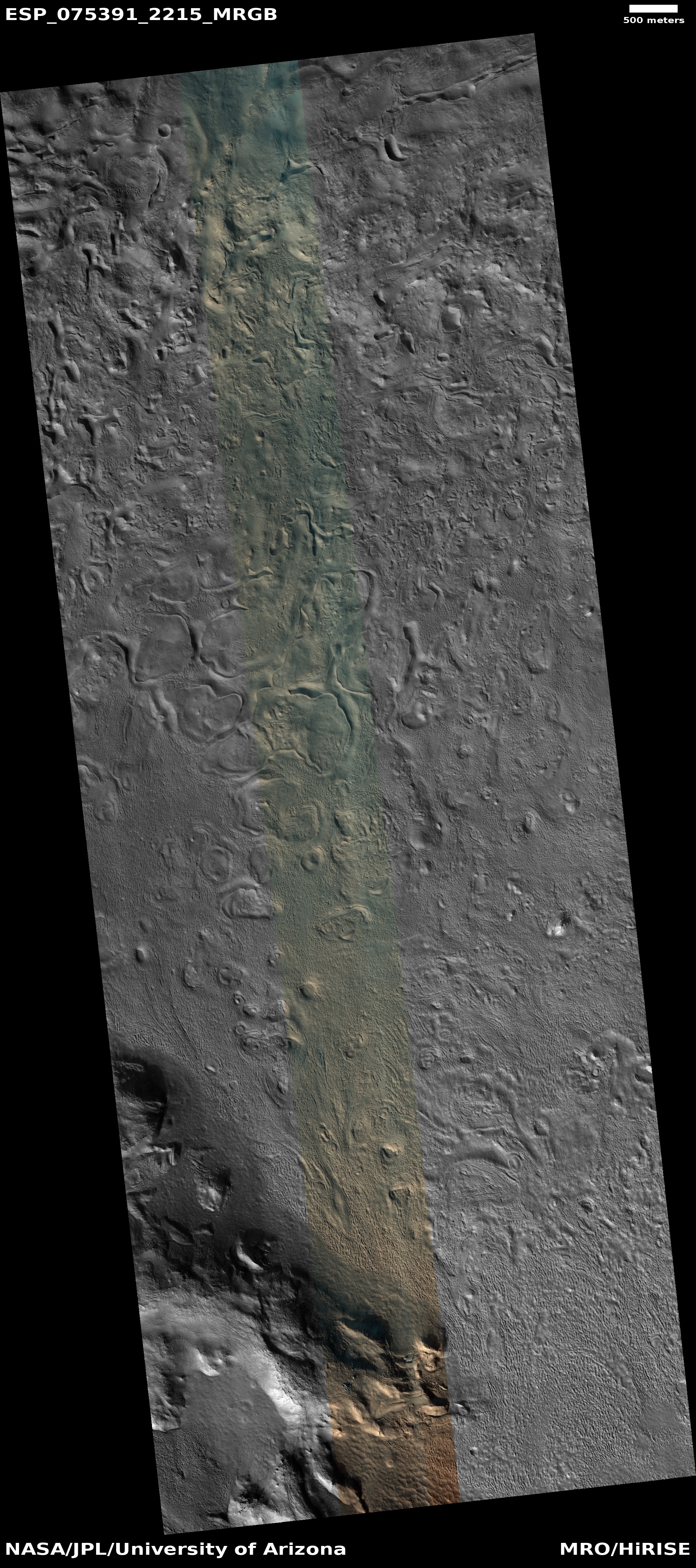
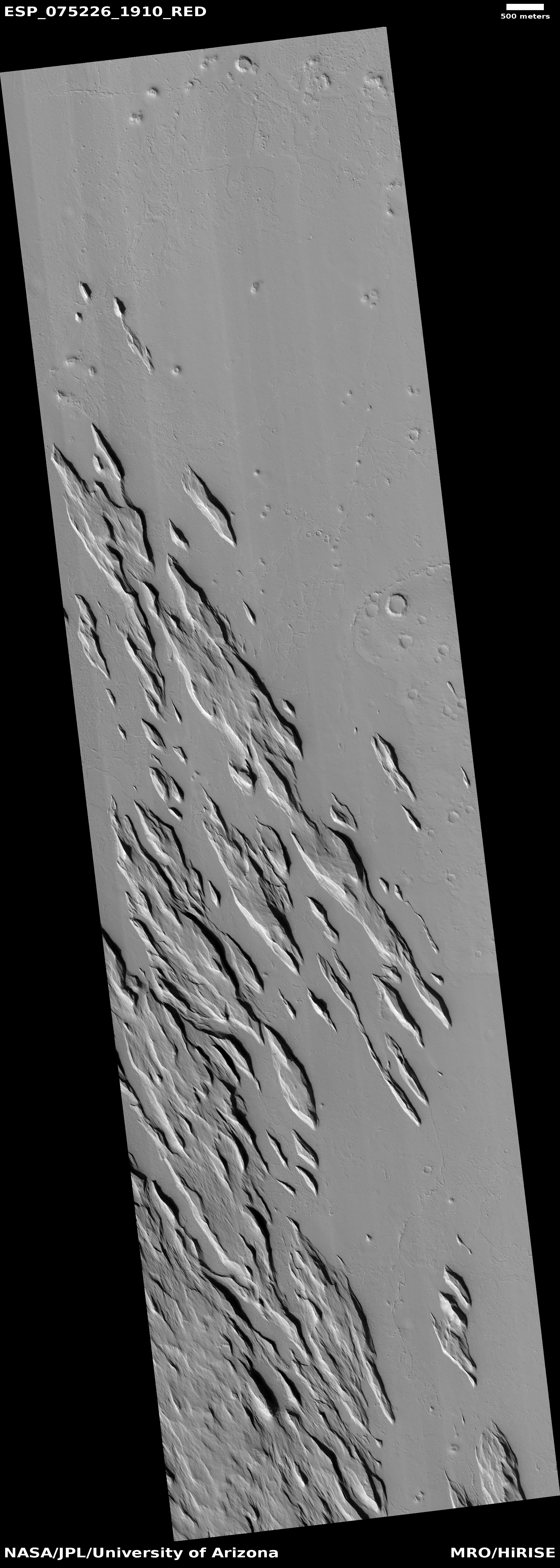
Cool image time! The photo to the right, cropped, reduced, and enhanced to post here, was taken on August 26, 2022 by the high resolution camera on Mars Reconnaissance Orbiter (MRO). Though the science team labels this image vaguely as showing “Features in Mamers Valles,” the features are likely glacial ice since this location is at the western end of the 2,000-mile-long northern mid-latitude strip I dub glacier country, where glacial features are seen everywhere.
The white dot marks this picture’s location in Mamers Valles, as shown on the overview map above. This particular Martian channel, that meanders in a wildly random manner (including a few sharp ninety degree turns), is theorized [pdf] by some scientists to have formed not by surface flows but by a subterranean drainage that created voids. On the surface the voids caused sagging, collapses, and the eventual formation of the surface channel.
Under such conditions, any ice in the channel would not necessarily have a clear flow direction, thus providing an explanation (though hardly certain) of the eddy-like shape of these features.


