
Big sink near the Martian south pole
Click for full image.
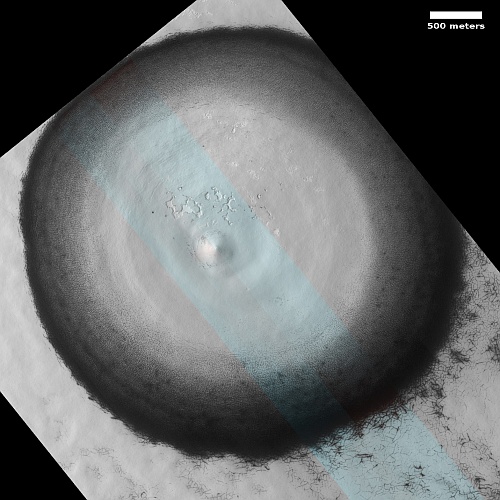
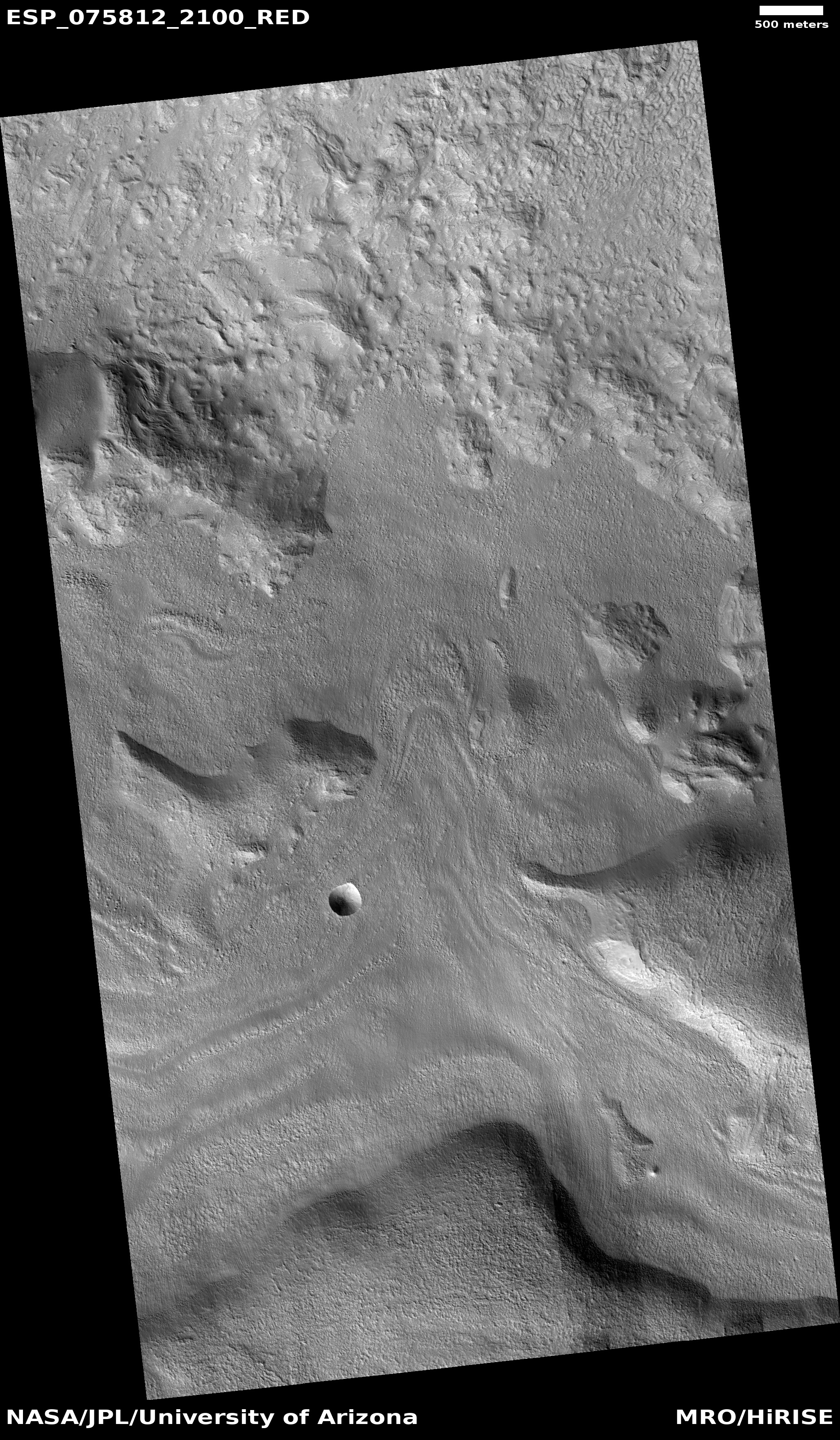
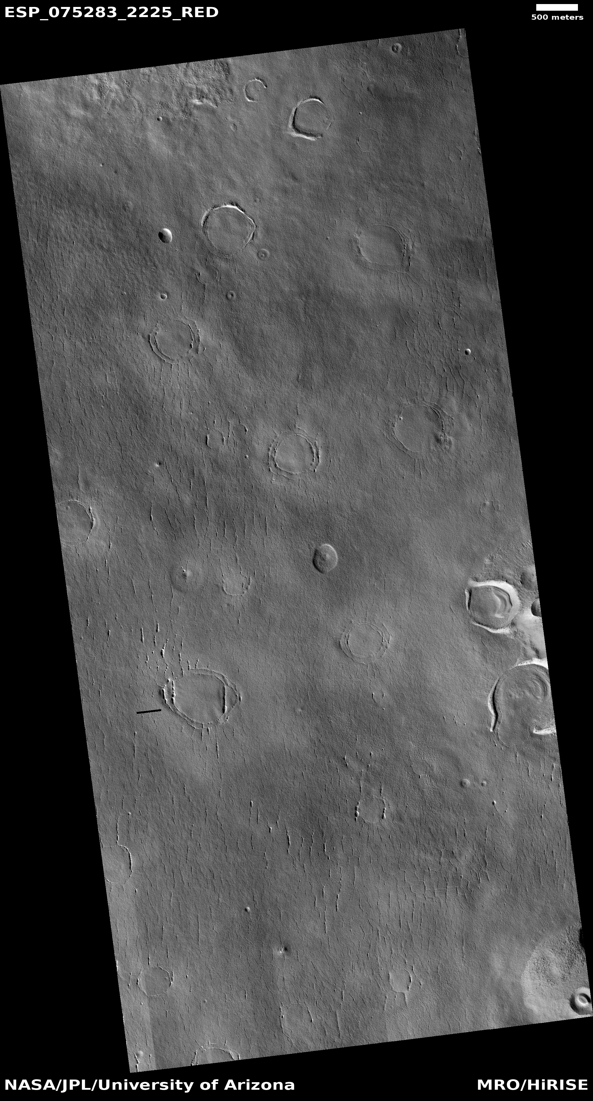
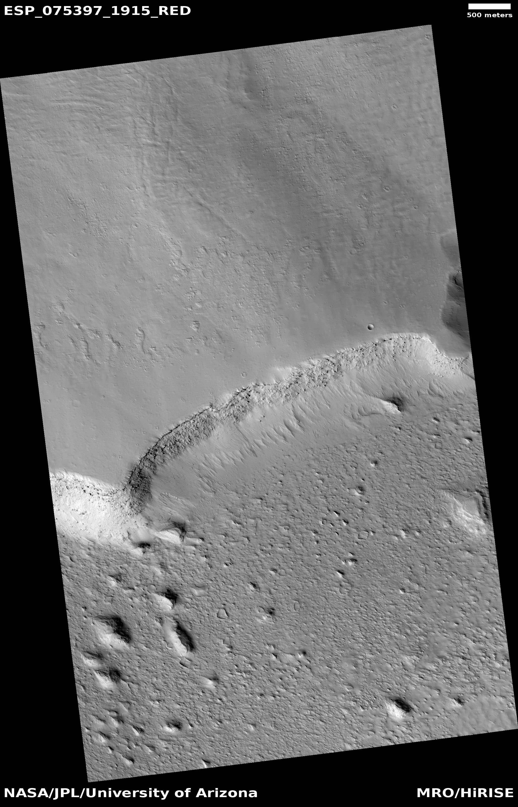
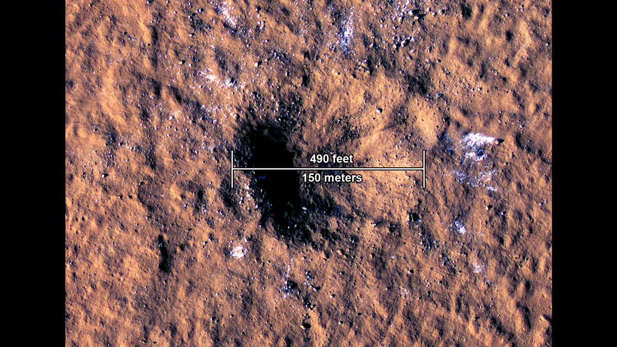
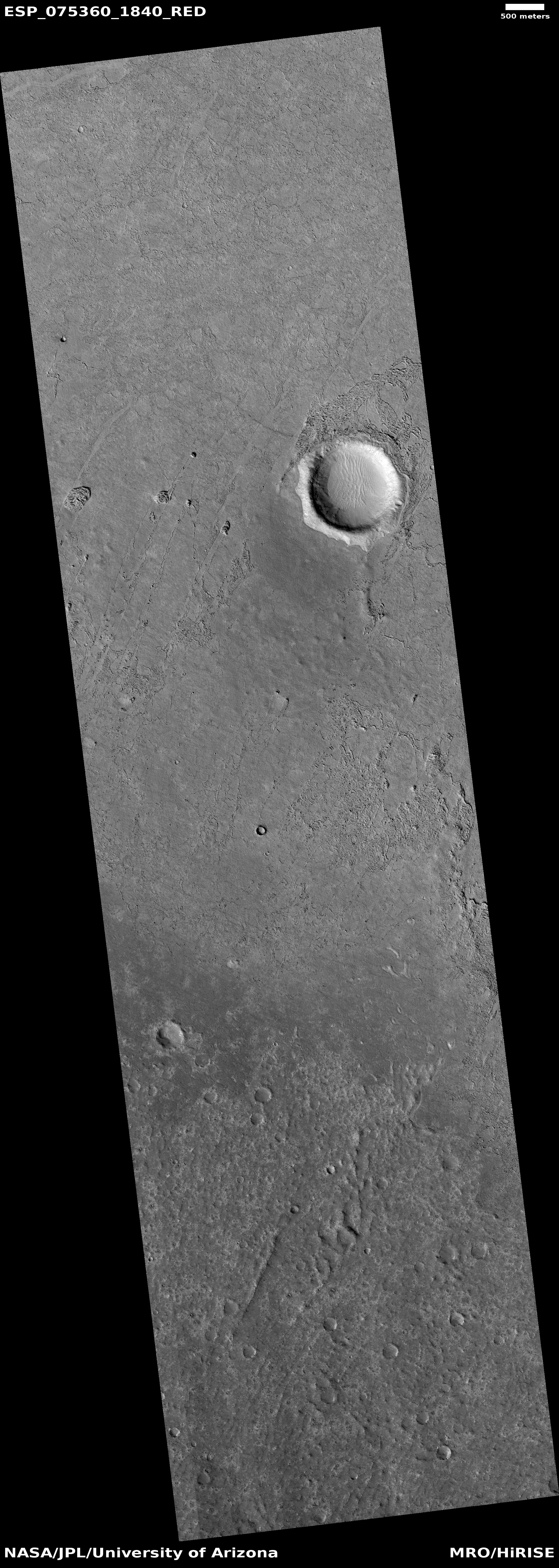
Cool image time! The photo to the right, rotated, cropped, reduced, and sharpened to post here, was taken on September 12, 2022 by the high resolution camera on Mars Reconnaissance Orbiter (MRO). The image is rotated so that south is at the top. The science team labels this a “subsidence feature,” or in plain English, a sinkhole.
Its perfectly circular shape, plus its central peak, strongly suggests we are looking at an impact crater. However, the lack of a raised rim of debris, produced by the ejecta from the impact, raises questions about this conclusion, and is one reason why the scientists think this is a sinkhole instead. Its shape however could be telling us that this sink is simply mirroring the existence of a buried crater.
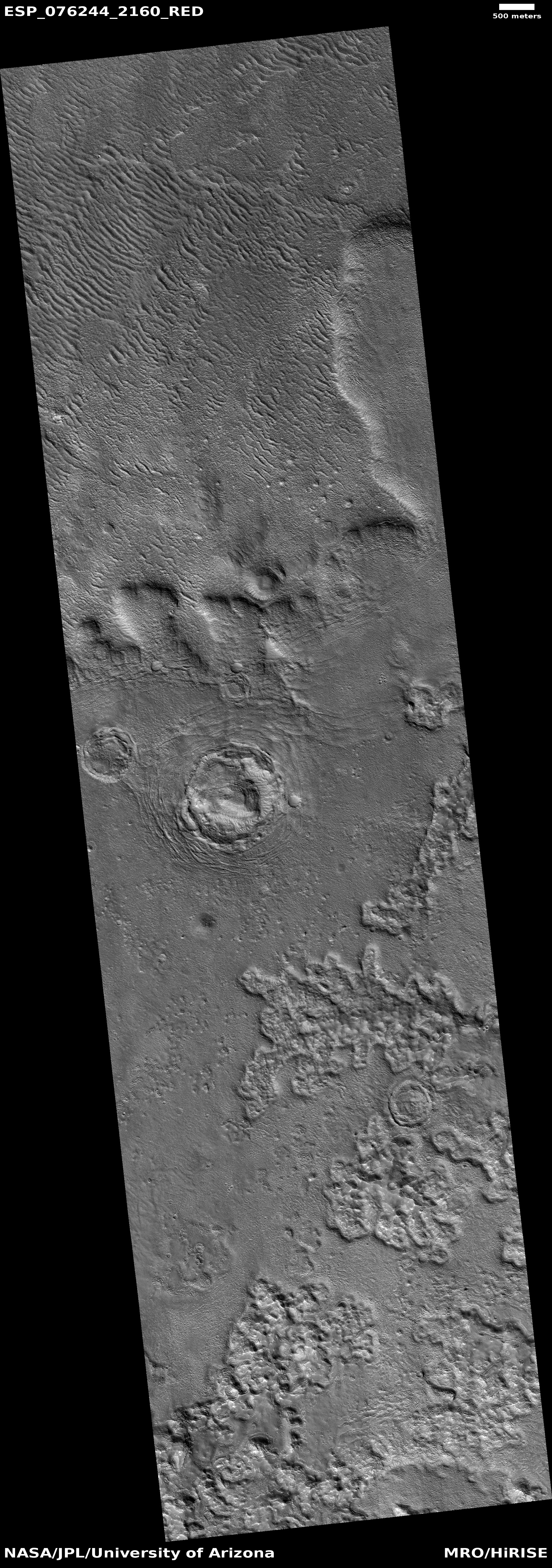
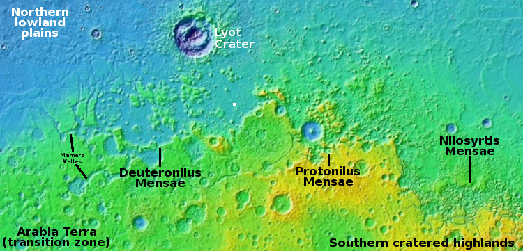
The overview map below as always provides more context.
» Read more
Click for full image.
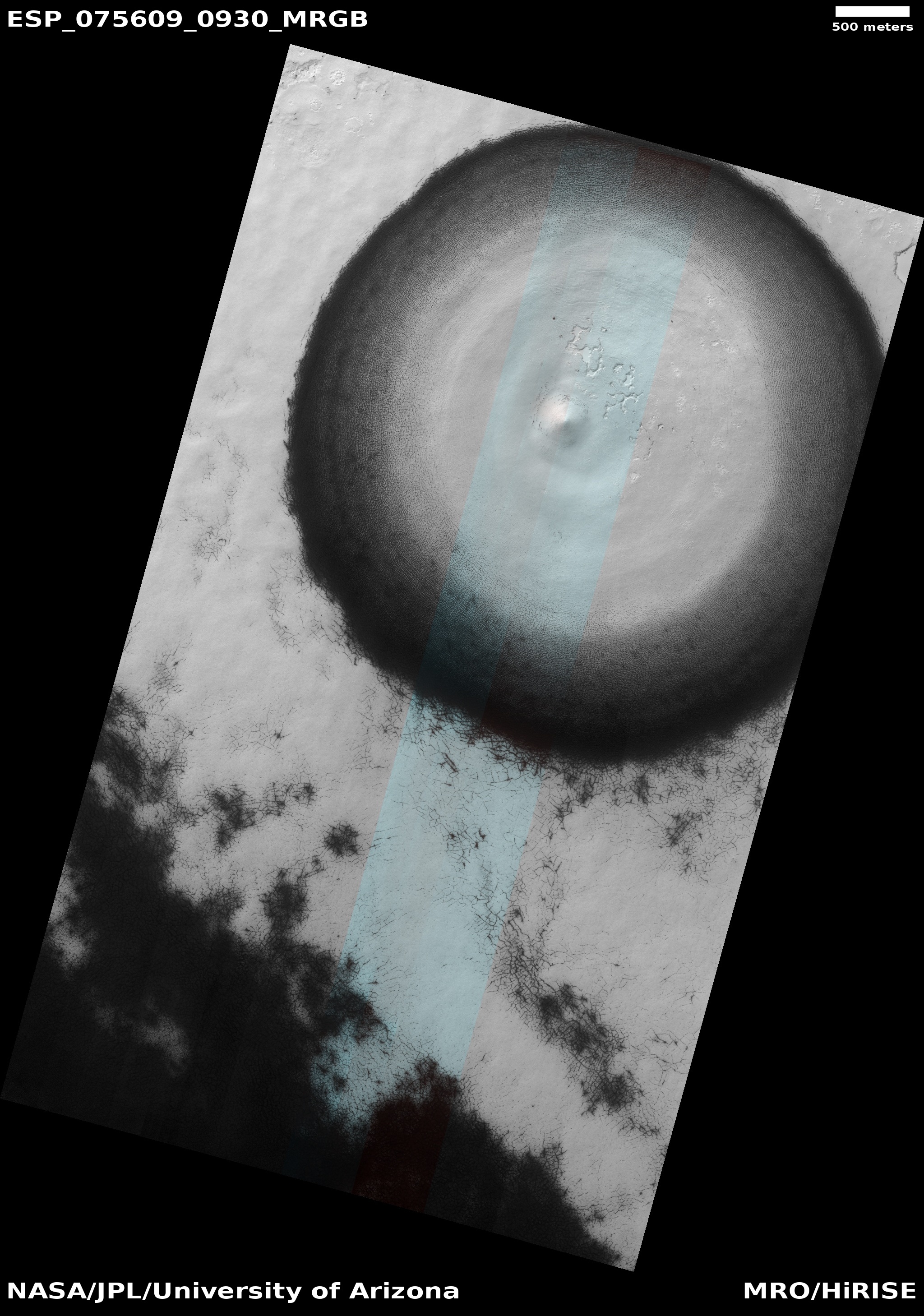
Cool image time! The photo to the right, rotated, cropped, reduced, and sharpened to post here, was taken on September 12, 2022 by the high resolution camera on Mars Reconnaissance Orbiter (MRO). The image is rotated so that south is at the top. The science team labels this a “subsidence feature,” or in plain English, a sinkhole.
Its perfectly circular shape, plus its central peak, strongly suggests we are looking at an impact crater. However, the lack of a raised rim of debris, produced by the ejecta from the impact, raises questions about this conclusion, and is one reason why the scientists think this is a sinkhole instead. Its shape however could be telling us that this sink is simply mirroring the existence of a buried crater.
The overview map below as always provides more context.
» Read more


