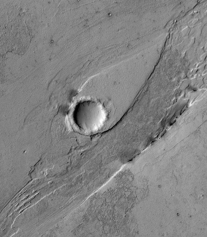
Mars rover update: Sept 27, 2016

Curiosity

Curiosity traverse map, Sol 1471

For the overall context of Curiosity’s travels, see this post, Pinpointing Curiosity’s location in Gale Crater.

In the past week Curiosity finally left Murray Buttes and began moving south towards Mount Sharp, and, for at least one day, I thought tracking the rover’s movements might become easier. Early in the week the science team published an updated overhead traverse map that not only showed the topographical elevation contour lines for the surrounding terrain, but also included a blue line roughly indicating the rover’s future route. For reasons I do not understand, however, they only did this for one day, and then went back to the un-annotated traverse maps they had been using previously. I have therefore revised the most recent traverse map, shown on the right, to include these contour lines as well as the planned future route. The contour lines are hard to read on the full image, but below the fold on the right is a zoomed in view of Curiosity’s position as it left Murray Buttes, which shows the rover’s elevation at about 4376 meters below the peak of Mount Sharp. This means the rover has gained about 1,150 meters, or about 3,775 feet, since its landing, but only 50 meters or about 150 feet since March of this year. It is still not on the mountain but in the low foothills at its base.
» Read more

0 comments

An ancient volcanic mountain chain on Mars

Using data from Mars Odyssey scientists have determined that a mountain chain on Mars was likely created as a chain of volcanoes.

They analyzed the geography and mineralogy of this area they termed Greater Thaumasia, which is about the size of North America. They also studied the chemistry of this area based on Gamma Ray Spectrometer data collected by the Mars Odyssey Orbiter, which was launched in 2001. What they found was the mountain ridge that outlines Greater Thaumasia was most likely created by a chain of volcanoes.

Their research also looked to see if water influenced the mountains’ formation and found no evidence for it. The mountain chain itself is south of the giant Valles Marineris canyons and southeast of the Tharsis region where Mars’ biggest four volcanoes are located.

0 comments

Mars’ weird windblown surface

Wind scoured Martian surface

Cool image time! The image on the right, taken by Mars Reconnaissance Orbiter (MRO) and cropped from a wider view of a small crater and a small volcano caldera, certainly appears blurred and out of focus. Is MRO malfunctioning?

Nope. The blurring is actually an optical illusion caused almost entirely by our own assumptions of what a planet surface should look like combined with the alien processes occurring on Mars that have no equivalent here on Earth.

Below the fold is a wider view from the full image, showing the area of the cropped image to the right as well as the entire crater. Below that is another full resolution inset, this time showing the features on the crater rim that are sharp and stand out clearly. The blurriness of the rest of the image is not because the image is out-of-focus, but because a steady northwest-to- southeast wind has distorted everything in the same direction.
» Read more

3 comments

An avalanche pile on Mars

Avalanche pile on Mars

Cool image time! The Mars Odyssey science team has released this very interesting image, cropped on the right, of an avalanche debris pile formed when the large section of cliff on the left broke off and collapsed into the valley below. The valley is called Tiu Valles and is located close to Mars’ equator.

The wide spread of the debris is an indication of several things. For one, it illustrates the light Martian gravity, which allowed the debris to flow much farther than it would have on Earth.

For another, the spread of the debris pile suggests to me that the material that fell was very crumbly. It might have been able to hold together as a cliff for a long time, but when it collapsed the material broke apart almost like sand. Think of a sand castle you might have built as a kid on the beach. With a little moisture you can pack the sand to form solid shapes, but if your shape breaks apart the sand falls not as large blocks but as crumbly soft and loose sand. That is what appears to have happened here.

There is also the suggestion to me that water might have been involved somehow in this collapse. I am not a geologist so this speculation on my part is very unreliable. However, the shape of the debris pile suggests a liquid flow. The flow itself wasn’t liquid, but liquid might have somehow been involved in causing this geological event. We would need a geologist however to clarify these guesses on my part.

3 comments

Mars rover update: September 20, 2016

Opportunity comes first this time because it actually is more interesting.

Opportunity

For the overall context of Opportunity’s travels at Endeavour Crater, see this post, Opportunity’s future travels on Mars.

Having several choices on where to head, the Opportunity science team this week chose took what looks like the most daring route, heading almost due east towards the floor of Endeavour Crater. In fact, a review of their route and the images that the rover continues to take suggests that the panorama I created last week looked almost due east, not to the southeast as I had guessed. I have amended the most recent overhead traverse image, cropped and reduced below, to show what I now think that panorama was showing.
» Read more

1 comment

New evidence of lakes and streams in Mars’ recent past

Using data from three different orbiters scientists have mapped out a region of lakes and streams on Mars that appear to have contained liquid water a billion years after the red planet is believed to have dried up.

To bracket the time period when the fresh shallow valleys in Arabia Terra formed, scientists started with age estimates for 22 impact craters in the area. They assessed whether or not the valleys carved into the blankets of surrounding debris ejected from the craters, as an indicator of whether the valleys are older or younger than the craters. They concluded that this fairly wet period on Mars likely occurred between two and three billion years ago, long after it is generally thought that most of Mars’ original atmosphere had been lost and most of the remaining water on the planet had frozen.

The characteristics of the valleys support the interpretation that the climate was cold: “The rate at which water flowed through these valleys is consistent with runoff from melting snow,” Wilson said, “These weren’t rushing rivers. They have simple drainage patterns and did not form deep or complex systems like the ancient valley networks from early Mars.”

This region, Arabia Terra, is the same area where scientists have found fossilized rivers.

0 comments

A Mars Rover Update

I have decided to continue my Mars rover updates, and make them a regular mid-week feature here on Behind the Black. This is the first.

Curiosity

For the overall context of Curiosity’s travels, see this post, Pinpointing Curiosity’s location in Gale Crater.

Since my last updates here and here, Curiosity has moved south through the gap between buttes to exit the Murray Butte area. The initial slopes of Mount Sharp lie ahead, an open road with no apparent rough terrain to slow travel.

Doing science however does slow travel, and for good reason. Once through the gap the science team decided to swung the rover west and up against the base of the gap’s western butte, rather than immediately head south to climb the mountain. The Mars Reconnaissance Orbiter image below, cropped and reduced, illustrates this path.
» Read more

3 comments

The flowing formations of Lethe Vallis

Cool image time! The Mars Reconnaissance Orbiter science team yesterday released several new images. Below is just one, cropped and reduced in resolution to post here. It shows a large flow channel called Lethe Vallis, formed first by lava, then hit by an impact which created a walled crater in its middle. Flood waters then followed, creating the tear-shaped dune surrounding the crater. In addition, erosion exposed the dark lava basalt below the surface on the edge of that tear-shaped dune. Within the crater itself can be seen ripple dunes formed by wind. As the scientists note,

This single image thus contains features formed by periglacial, volcanic, fluvial, impact, aeolian and mass wasting processes, all in one place.

Be sure to check out the full image.

Lethe Vallis

0 comments

Mars rover update

It is time for an update on the journeys of Curiosity and Opportunity on Mars!

First, Curiosity. Though the science team has not yet updated the rover’s Mars Reconnaissance Orbiter traverse map showing its travels, it appears from Curiosity’s most recent navigation camera images that the rover has moved passed the first butte that had been ahead and directly to the south in the traverse map shown in the last image of my post here. The image below the fold, cropped and reduced to show here, looks ahead to the second butte and the gap to the south. Beyond Mt Sharp can be seen rising up on the right, with the upcoming ground open and relatively smooth. The only issue will be the steepness of that terrain. Based on my previous overall look at the rover’s journey, I suspect they will contour to the left.
» Read more

1 comment

Opportunity’s steep downhill path

An update on Opportunity: The panorama I have created below from two images taken by its navigation camera and transmitted from Opportunity today, shows the steepness of the slope in Lewis and Clark Gap down which engineers are thinking of sending Opportunity. It appears also that Opportunity has moved closer to the gap since my post on Friday outlining the rover’s future travels.

I have not followed Opportunity’s entire journey on Mars close enough to say whether this will be the steepest downhill slope the rover has ever attempted. If not I suspect it is close to the steepest. I also suspect that they are still unsure whether they are going to attempt it, and are creeping slowly towards it to assess the situation.

Lewis and Clark Gap within Endeavour Crater's rim

7 comments

Opportunity’s future travels on Mars

Opportunity's future path

Approaching the gap

Having spent a lot of time recently analyzing the travels of Curiosity in Gale Crater and in the foothills to Mount Sharp, I decided this week that I also needed to do the same with Opportunity at Endeavour Crater.

The image above is a panorama that I have assembled from images taken by Opportunity’s navigation camera on Sol 4477 (sometime last week). To the right is a panorama assembled from images taken by the navigation camera several days later, on Sol 4481, after Opportunity had moved closer to the gap shown in the first picture above. The inset in the image above shows the location of the image on the right. The X shows Opportunity’s approximate position.

Below the fold is the most recent orbital mosiac showing Opportunity’s recent travels near Endearvour Crater and in Marathon Valley, cropped and annotated by me to indicate the areas seen by the two panoramas above. The red dot shows Opportunity’s present position.
» Read more

2 comments

NASA sets InSight’s new launch date to Mars

NASA has now set 2018 as the new launch date for its Mars InSight mission.

The mission was originally supposed to launch in 2016, but missed that launch window when significant problems cropped up during construction of the spacecraft’s French-built prime instrument. NASA has now taken much of the responsibility for building that instrument away from the French and given it to JPL.

The SEIS instrument — designed to measure ground movements as small as half the radius of a hydrogen atom — requires a perfect vacuum seal around its three main sensors in order to withstand harsh conditions on the Red Planet. Under what’s known as the mission “replan,” NASA’s Jet Propulsion Laboratory in Pasadena, California, will be responsible for redesigning, developing and qualifying the instrument’s evacuated container and the electrical feedthroughs that failed previously. France’s space agency, the Centre National d’Études Spatiales (CNES), will focus on developing and delivering the key sensors for SEIS, integration of the sensors into the container, and the final integration of the instrument onto the spacecraft.

The cost for the changes and reschedule is estimated to be more than $150 million, adding to the budget strain in NASA’s science programs already caused by the overruns from the James Webb Space Telescope.

1 comment

The alien buttes of Mars

Weird Mars

The image above is cropped from a panorama created by reader Phil Veerkamp from images taken by Curiosity’s mast camera on August 25, 2016 of the terrain that partly surrounds the rover since it passed the Balanced Rock and traveled beyond Murray Buttes

The full image is too large to post here. However, if you click on the first link above you can either download it and peruse it at your leisure, or view it with your browser. You will definitely want to do so, as it is high resolution and shows a lot of strange and alien geology, including multiple slabs seemingly hanging in space because of the low gravity. (Hint: Be sure to pan all the way to the right!) On the image’s left Mount Sharp can be seen raising in the background. Below the fold I have annotated the most recent Mars Reconnaissance Orbiter image of Curiosity’s location to indicate what I think is the area included in this panorama. This MRO image also shows that once Curiosity gets through the narrow gap to the south, the path heading south up the mountain’s slopes will, for awhile at least, be relatively open with few large obstacles. The view will also change, as the rover will be out of the region of buttes.
» Read more

6 comments

Another balanced rock!

A new balanced rock

Cool image time! The image to the right, cropped to show here, was taken by Curiosity’s mast camera this week as it surveys the upcoming terrain so that scientists can choose its route. It shows another balanced rock that is far more unbalanced than the one the rover passed last week.

In reviewing the survey images, I am not exactly sure whether this rock is located along Curiosity’s future route, as I have not been able to locate it in any of the panorama images the rover has taken. If it is in the gap they are aiming for, then we shall soon see some additional close-ups. If not, then we will have to content ourselves with some other views that, when you think about it, are really just as good.

4 comments

Fossilized rivers on Mars

The uncertainty of science: Using high resolution images from Mars Reconnaissance Orbiter scientists have identified more than 10,000 miles of fossilized rivers on Mars.

The new study examined images covering an area roughly the size of Brazil at a much higher resolution than was previously possible – six metres per pixel compared to 100 metres per pixel. While a few valleys were identified, the team revealed the existence of many systems of fossilised riverbeds which are visible as inverted channels spread across the Arabia Terra plain.

The inverted channels are similar to those found elsewhere on Mars and Earth. They are made of sand and gravel deposited by a river and when the river becomes dry, the channels are left upstanding as the surrounding material erodes. On Earth, inverted channels often occur in dry, desert environments like Oman, Egypt, or Utah, where erosion rates are low – in most other environments, the channels are worn away before they can become inverted. “The networks of inverted channels in Arabia Terra are about 30m high and up to 1–2km wide, so we think they are probably the remains of giant rivers that flowed billions of years ago. Arabia Terra was essentially one massive flood plain bordering the highlands and lowlands of Mars. We think the rivers were active 3.9–3.7 billion years ago, but gradually dried up before being rapidly buried and protected for billions of years, potentially preserving any ancient biological material that might have been present,” added Joel Davis.

These geological forms are different than most of the more well-known Martian channels in that they are not channels but meandering riverlike ridges, higher than the surrounding terrain. Arabia Terra, where they are located, is a transition region in the northern mid-latitudes between Mars’s southern highlands and its northern flat plains, where some believe an ocean once existed.

2 comments

China unveils its 2020 Mars lander/rover

The competition heats up: China today released design concepts of its planned 2020 Mars lander and rover.

According to Ye Peijian, one of China’s leading aerospace experts and a consultant to the program, the 2020 mission will be launched on a Long March-5 carrier rocket from the Wenchang space launch center in south China’s Hainan province. The lander will separate from the orbiter at the end of a journey of around seven months and touch down in a low latitude area in the northern hemisphere of Mars where the rover will explore the surface.

If they succeed they will have definitely moved ahead of Russia in the ranks of space-faring nations.

0 comments

Mars’ wet streaks might not be wet

The uncertainty of science: An analysis of five years of data from Mars Odyssey suggests that the dark streaks flowing down Martian slopes might contain very little and possibly no water at all.

This year, planetary scientists Christopher Edwards and Sylvain Piqueux took a closer look at the feature using a thermal imaging instrument on board Mars Odyssey, another orbiter. They found no temperature differences between the dark RSL streaks and surrounding terrain — which suggests that the streaks aren’t really patches of wet sand streaming down a slope. At best, they say, the RSLs could contain no more than 3 percent liquid water — making them more like mildly damp, slightly salty dirt. And that’s an optimistic interpretation, Edwards said; it’s possible the RSLs contain no water at all. “Why this process is happening in this area, or what is causing this darkening, I don’t think is exactly obvious at this point,” he continued. “But to say it’s flowing liquid water, I don’t think it’s the whole story. It’s not necessarily even the right story.”

This data once again illustrates why we must be very careful with our conclusions when looking at features on an alien world that seem to resemble things we are familiar with here on Earth. Just because they might look alike is not evidence that they are the same. Mars has a very different gravitational field (one-third of Earth’s) and a significantly different make-up. We might be witnessing processes we’ve never seen before that produce features that mimic Earthlike forms.

2 comments

Beyond Murray Buttes

Panorama ahead for Curiosity, Sol 1438

Time for a Curiosity update. Above is a panorama I’ve created from raw images released today from the rover’s left navigation camera of the mesa filled terrain within which Curiosity now sits. Since my last update they have traveled about 200 feet south, moving away from the mesa with the balanced rock

Below the fold is a Mars Reconnaissance Orbiter image with Curiosity’s path indicated. I have marked the balanced rock with an X, and have indicated with the yellow lines the area covered by the panorama above.

They appear to be aiming due south for the narrow gap between the long ridge-like mesas. This will bring Curiosity out into the open and sloping terrain that can be seen in the distance in the last image of my last update. I suspect they want to get a closer look at those parallel grooves, even if it means the journey will be a little rougher.
» Read more

6 comments
1 100 101 102 103 104 128