
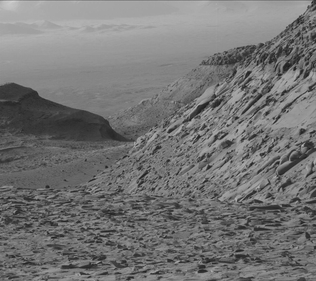
Curiosity’s most damaged wheel appears to be surviving the rough terrain on Mount Sharp
For original images go here and here.
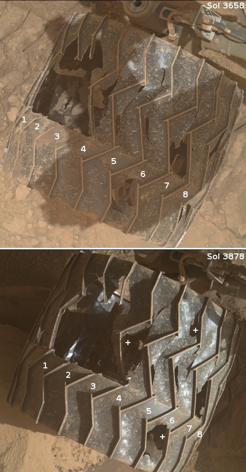
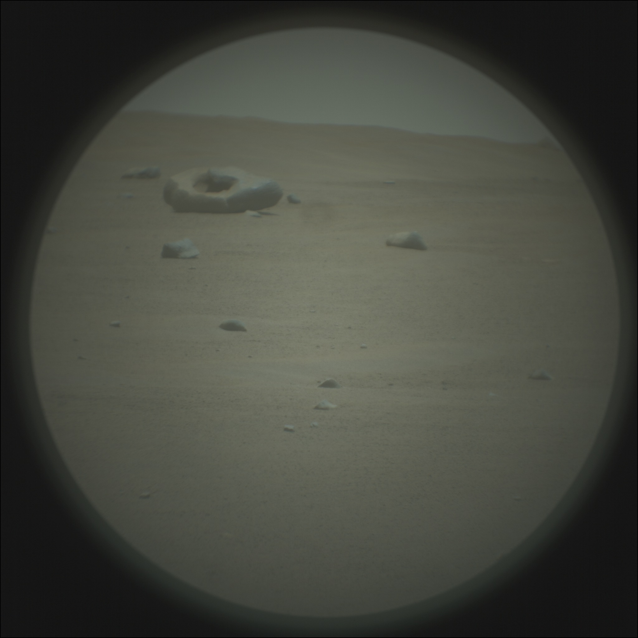
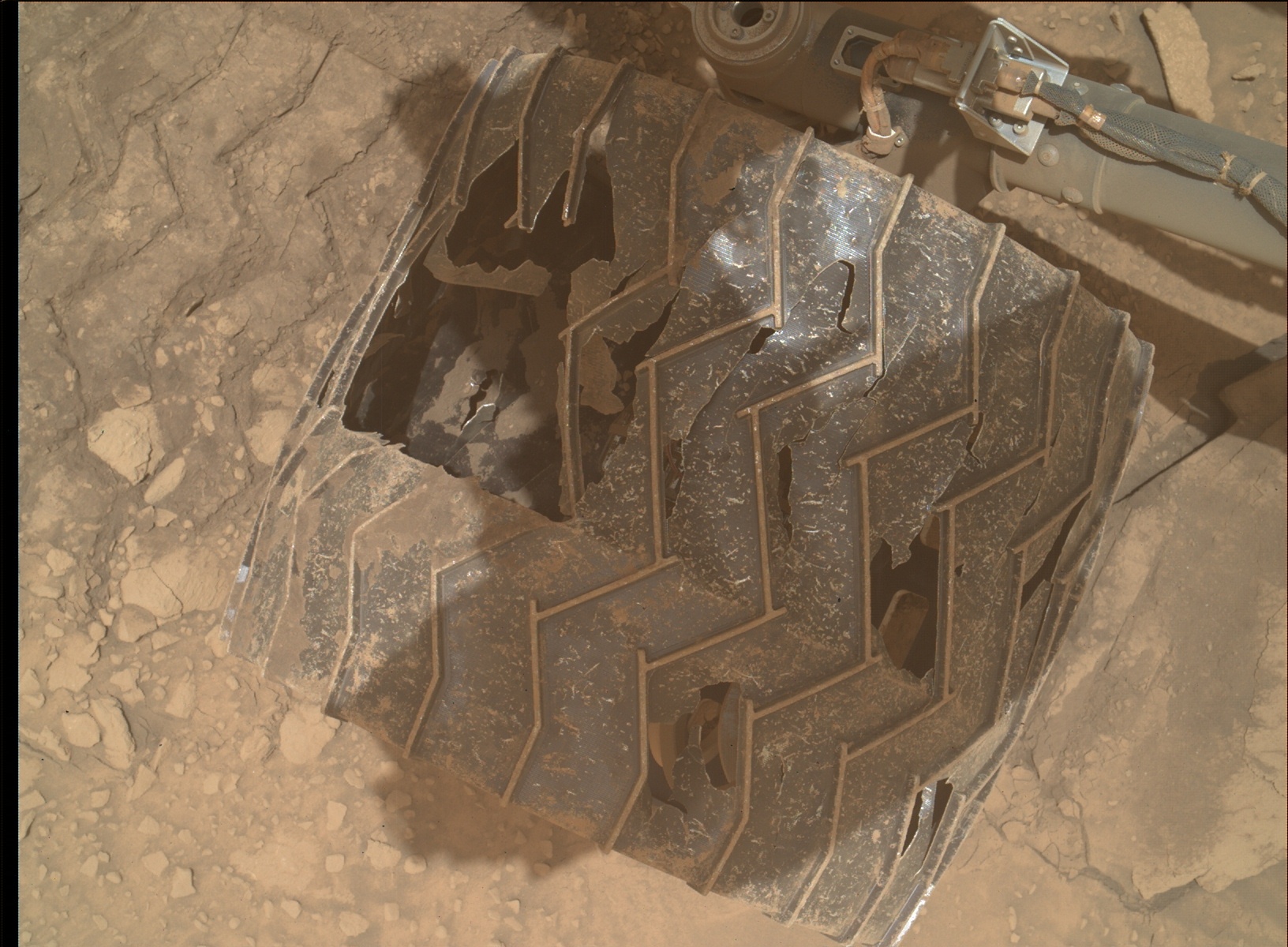
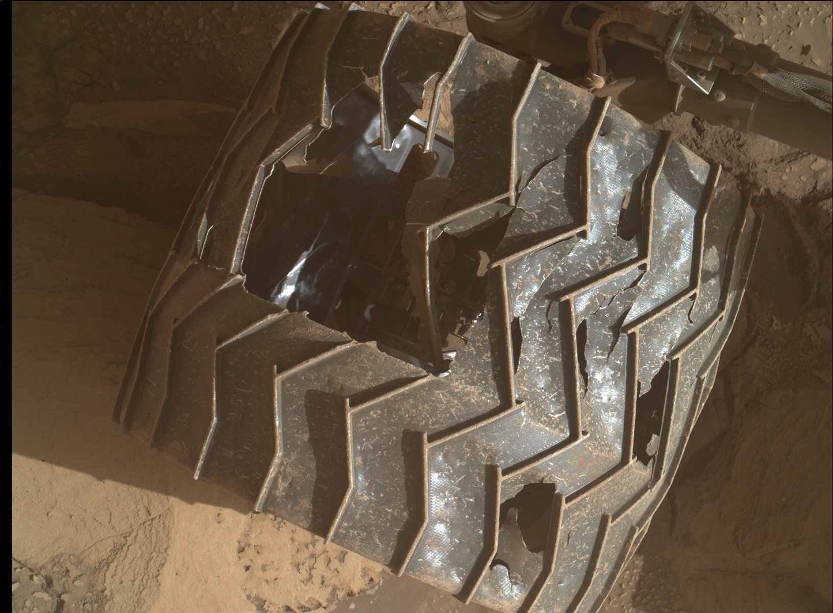
In today’s download of images from Curiosity was a set of pictures taken by its Mars Hand Lens Imager (MAHLI) of the rover’s wheels, as part of the science team’s routine inspection procedures after every 500 meters of travel.
The picture to the right shows what I think is the rover’s left middle wheel, its most heavily damaged, comparing what that wheel looks like now versus what it looked like in November 2022. At that time five of the wheel’s zig-zag grouser treads were broken, three of which are visible in both pictures. The numbers indicate identical wheel treads.
As you can see, after more than seven months of travel across some of the roughest and rockiest ground so far seen on Mars, no more grousers have broken in the new picture. The plus (“+”) signs indicate places where I think some additional metal between the grousers appears to have broken away, but even here the additional damage appears minimal.
Based on past wheel inspections, I expect more images will be taken in the next day or so. We shall see if those pictures indicate any further damage elsewhere. Based on this new picture, however, it appears that the care the science team takes in picking Curiosity’s route, as well as its software (designed to avoid the worst terrain), is continuing to preserve the wheels from further significant damage.


