The very end of an 800-mile-long Martian canyon

The very end of an 800-mile-long Martian canyon
Click for full image.

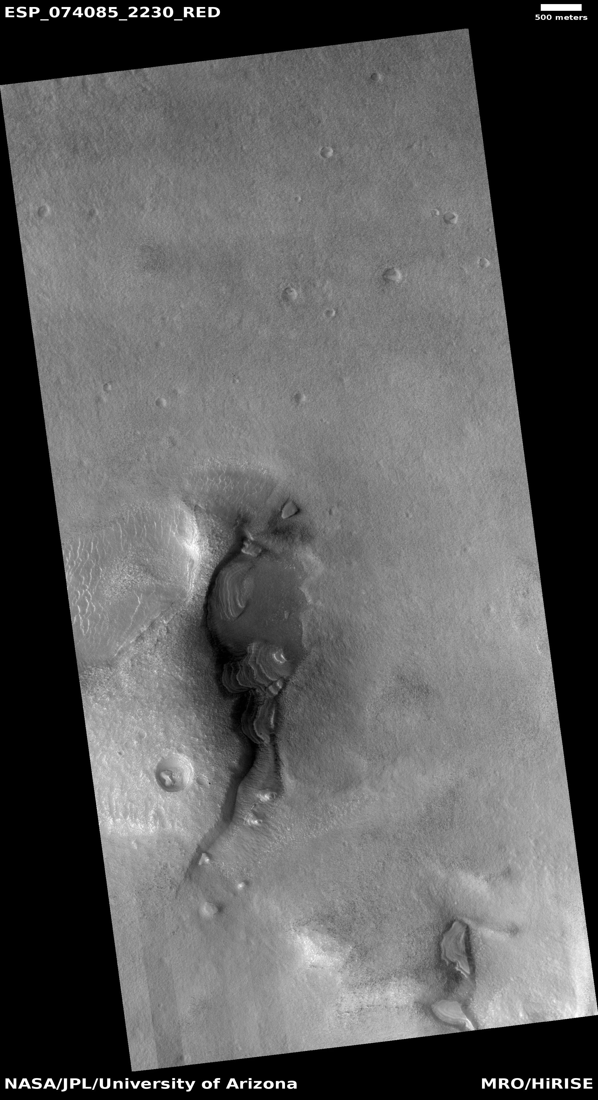
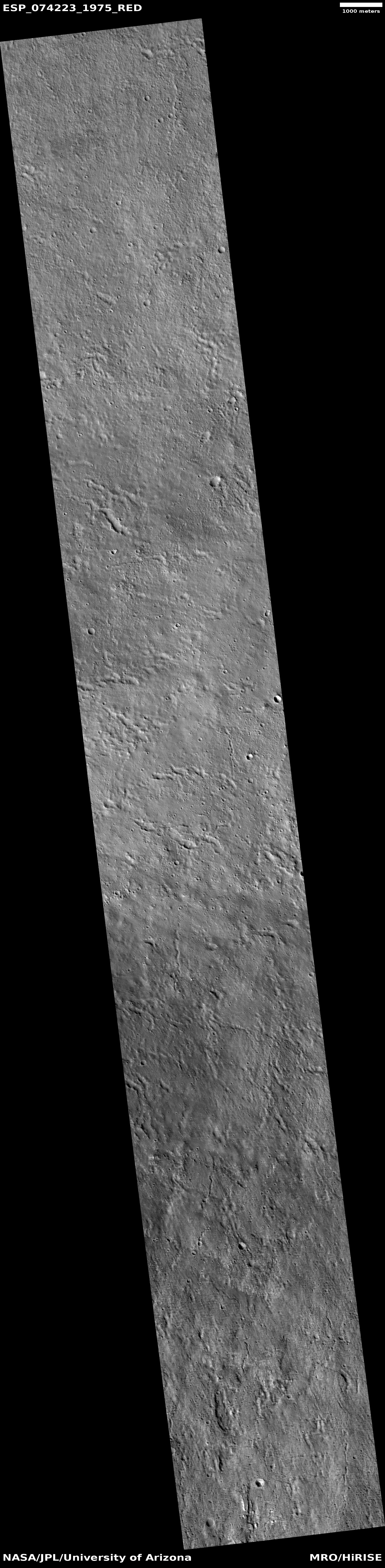
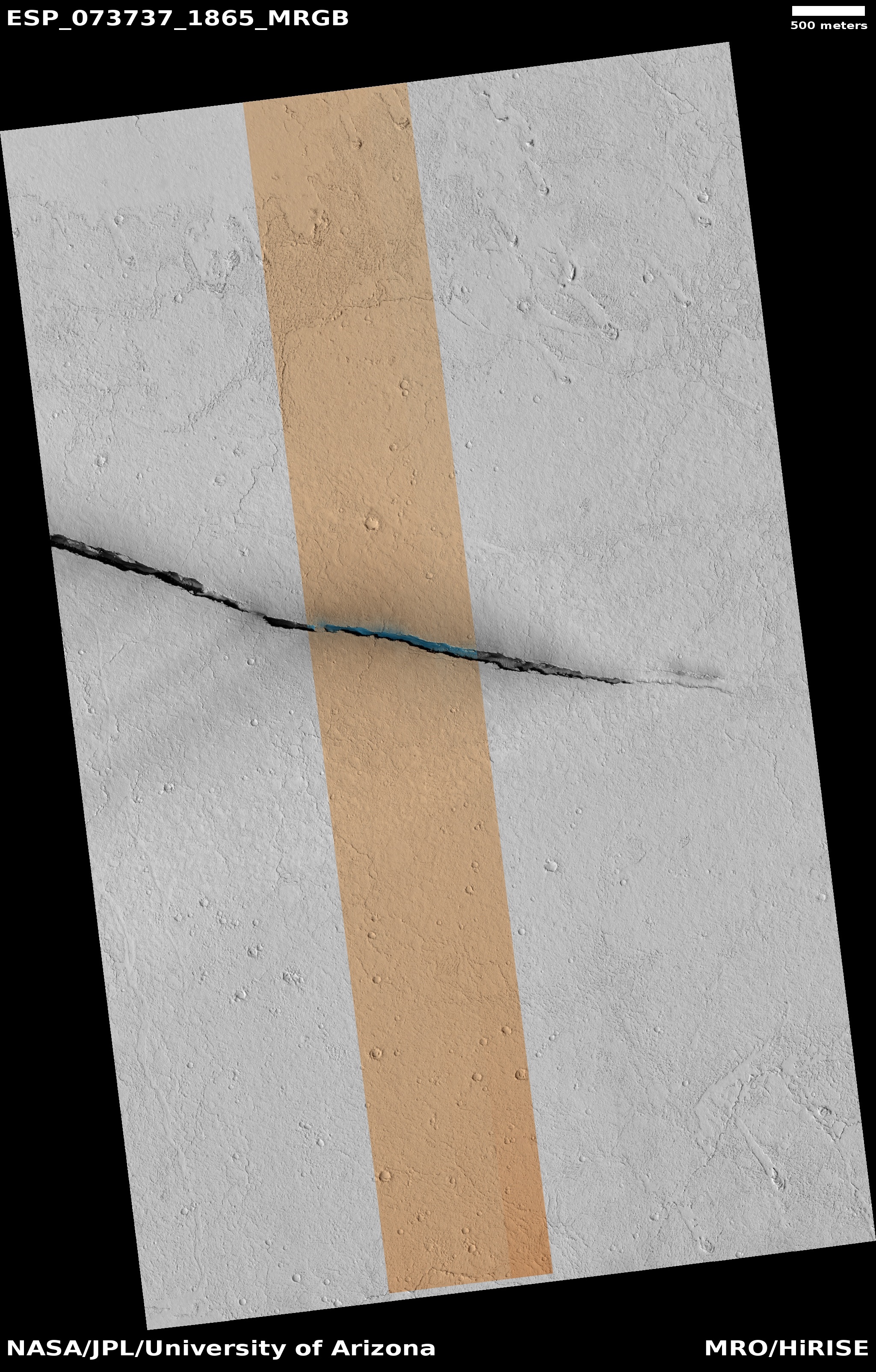
Cool image time! While most geeks interested in Mars are familiar with Valles Marineris, the largest canyon in the solar system, Mars has other large canyons that while not a big are impressive in their own right. The picture to the right, rotated, cropped, and reduced to post here, shows us the very very end of one such canyon. Taken on April 19, 2022 by the high resolution camera on Mars Reconnaissance Orbiter (MRO), it shows the easternmost spot where Cerberus Fossae begins. From here, this narrow fracture-caused canyon extends another 800 miles to the west, sometimes splitting into two or three parallel cracks, but always oriented in the same direction, slightly north of due west.

The overview map below provides the context and wider view.
» Read more

3 comments

Curiosity looks ahead

Curiosity looks ahead
Click for full resolution. For original images go here and here.
Overview map
Click for interactive map.

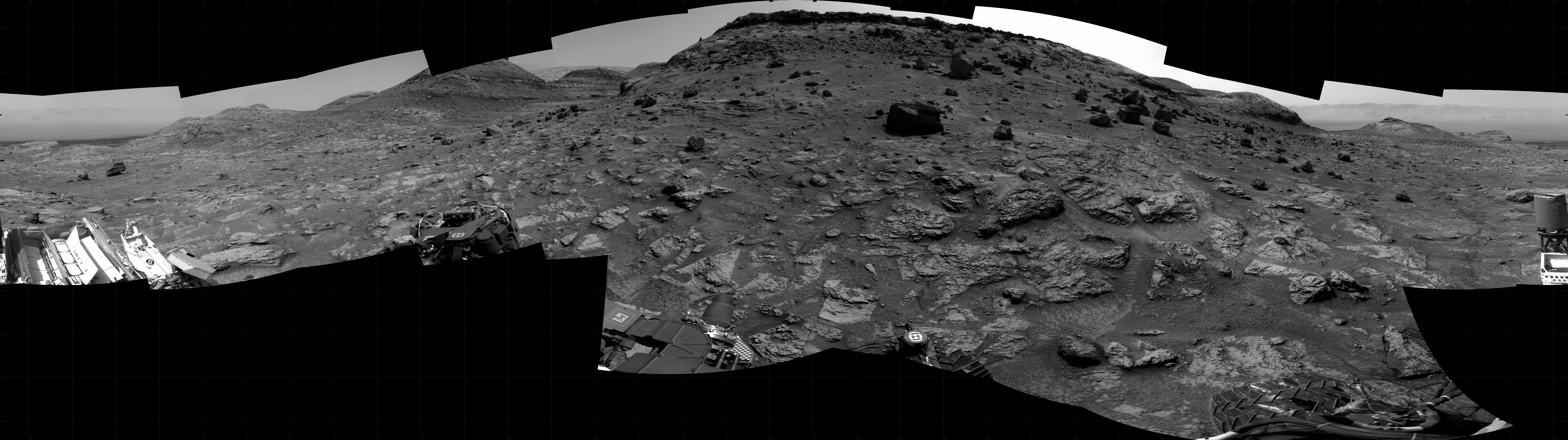
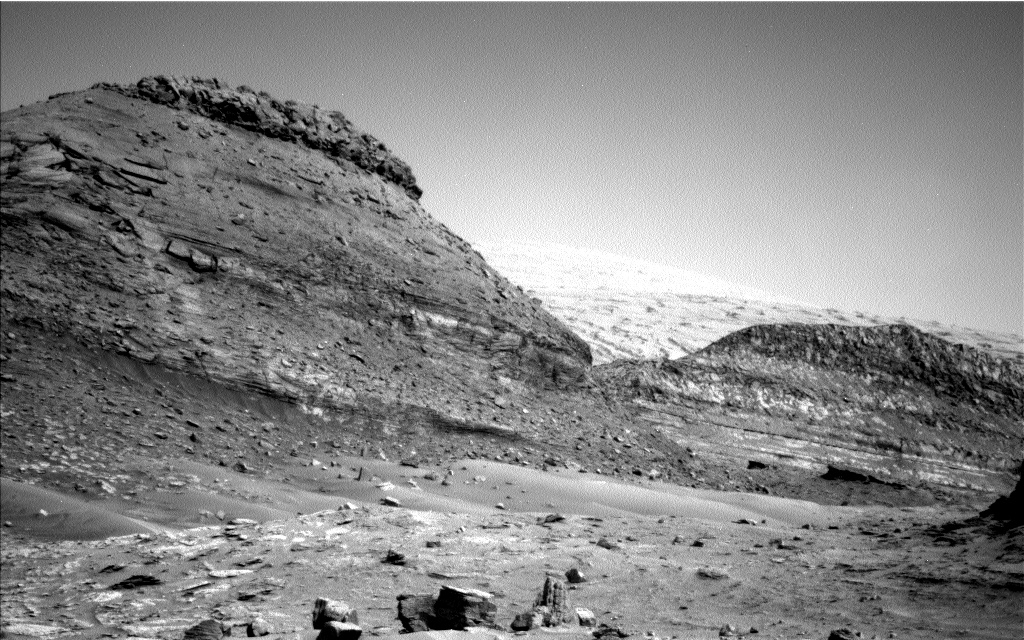
Cool image time! The panorama above, taken by one of the navigation cameras on the Mars rover Curiosity on July 23, 2022, forms a nice bookend to yesterday’s panorama. Yesterday Curiosity looked back at its past travels. Today it looks forward at where it is almost certainly heading in the days ahead.

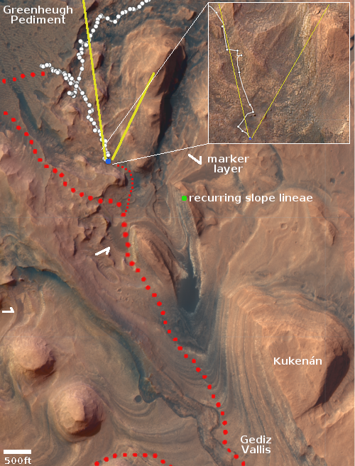
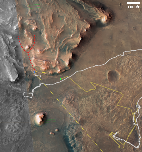
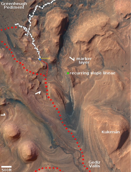
On the overview map to the right, the yellow lines indicate the approximate area viewed by the panorama. The large red dotted line marks the rover’s original planned route, abandoned when the science team found the terrain on the Greenheugh Pediment too rough for Curiosity’s wheels. The smaller red dotted line is my present guess as to the rover’s future route to get back on course.

The flat-topped mountain dubbed Kukenán by the science team has probably been one of the prime goals of the entire mission, from the beginning. Its almost vertical face has innumerable layers, all of which record in great detail the geological history of Mars and Gale Crater. As noted by Abigail Fraeman from the Jet Propulsion Laboratory on June 30, 2022:

Kukenán’s Earth namesake is a tepui, or distinctive isolated table-top mountain, found in South America. The Martian Kukenán is also somewhat flat topped and an impressive expression in Mt. Sharp’s topography. While it looks like it’s about the same size as the hills that bound it in the above Navcam image (“Deepdale” on the left and the edge of “Bolivar” on the right), this effect is just due to forced perspective. In reality, Kukenán is nearly five times farther away and over three times as tall as Deepdale! Curiosity’s strategic traverse path takes the rover right past Kukenán in about a kilometer or so, so this feature will become a familiar landmark rising in our windshield for months to come.

The science team will likely park Curiosity in the saddle of the gap ahead for at least a week and spend a lot of time documenting that cliff face with multiple cameras, since at this location the rover will have an excellent view of that entire face. As it gets closer the angle looking up will get steeper, thus making viewing of the upper layers more difficult.

1 comment

Curiosity looks back

Curiosity looks back
Click for full image.

Overview
Click for interactive map.

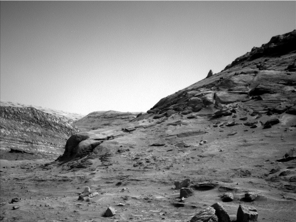
Cool image time! Normally I’d be hiking today, but since it is raining in southern Arizona at every mountain location we might want to go, I am forced to imagine hiking on Mars instead. The photo above, cropped to post here, was part of a mosaic of images taken on July 22, 2022 by the right navigation camera on the rover Curiosity.

Curiosity had just completed several drives that had it skirt around those two boulders visible in the center of the picture, as shown in the inset in the overview map to the right. The yellow lines indicate the approximate area covered by the photo. The blue dot marks Curiosity’s present location. The larger red dotted line the rover’s original planned route, with the smaller dotted line my guess as to the route the science team now plans to take to return to that course.

The rim of Gale Crater can be seen in the far distance, about 20 to 30 miles away and largely obscured by the winter dust that presently fills the atmosphere.

The science team had hoped to get close enough to these two boulders to touch them with the rover’s instruments, but decided to keep away because of both appeared a bit unstable.

2 comments

China releases one photo of Phobos taken by its Tianwen-1 Mars orbiter

Phobos as seen by Tianwen-1
Click to see original photo.

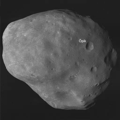
China today released a single photo of the Martian moon Phobos, taken by its Tianwen-1 Mars orbiter, to mark the second anniversary of the orbiter’s launch.

The English press release at the link conveniently did not provide the image to the non=Chinese world, but the Chinese language release did. That picture is to the right, reduced slightly to post here. Considering its disinterest in making it easy to find this photo for English speakers, it is intriguing that China included the English language name Opik for one crater.

Moreover, this single picture release illustrates the paucity of Tianwen-1 photos made available to the public by China. Very few have been released, and though eventually China has been making its raw data available, it has not been doing so in a manner that makes it easy for outsiders to access it.

Nonetheless, this is one of the best pictures of Phobos I have yet seen.

5 comments

Collapsed dunes in Jezero Crater

Collapsed dune on Mars
Click for full image.

Cool image time! The photo above, cropped and reduced to post here, was taken on July 20, 2022 by one of high resolution cameras on the rover Perseverance. It shows what appears to be a collapsed dune on the floor of Jezero Crater.

The arrows mark the highest dune ridge line that suddenly ends at a cliff, with the sand that is piled up at its base appearing almost like it flowed like thick mud outward away from that cliff. Apparently, that material broke off in one single event sometime in the past.

Note the many parallel lines pointing outward from the base of the cliff. These lines appear to reflect the internal structure visible in the cliff itself. Somehow, when that sand collapsed, it flowed away while retaining some of that structure.

When this collapse happened is unclear. I don’t think it has happened recently, since Perseverance’s arrival, but I could be wrong.

1 comment

Perseverance spots a string on Mars!

A piece of string on Mars
Click for full image.

According to the Perseverance science team, they believe the strange spaghetti-like object to the right, taken by one of the rover’s hazard avoidance camera’s on July 12, 2022, is actually a piece of string that fell here during the rover’s landing in February 2021.

The string could be from the rover or its descent stage, a component similar to a rocket-powered jet pack used to safely lower the rover to the planet’s surface, according to a spokesperson for the Perseverance mission at NASA’s Jet Propulsion Laboratory in Pasadena, California. Perseverance had not previously been in the area where the string was found, so it’s likely the wind blew it there, the spokesperson said.

The string, which appears to be a few inches across, was apparently gone four days later, when another hazard avoidance picture was taken of the same spot

An official description from the scientists is expected in a week or so.

6 comments

Martian terraces

Overview map
Glacier country on Mars

Martian terraces
Click for full image.

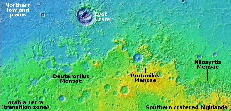
Cool image time! The photo to the right, cropped and reduced to post here, was taken on May 17, 2022 by the high resolution camera on Mars Reconnaissance Orbiter (MRO). It shows what the scientists have labeled “Dipping layers against mound in Deuteronilus Mensae.”

Deuteronilus is the westernmost mensae region in the 2,000-mile-long strip of heavy glaciers found in the northern mid-latitudes that I dub glacier country. This photo, the location of which is marked by the white cross on the overview map above, is another example, though somewhat strange and puzzling. Normally the layers will dip away from the high point. Here, the layers dip towards the mound. I can think of only one explanation, that of prevailing winds causing the erosion in this unusual manner, but I also find that explanation very unsatisfactory.

The layers themselves illustrate the cycles that have shaped Martian geology, caused by the wide swings in the planet’s rotational tilt, from 11 to 60 degrees. When that tilt is high, the poles are warmer than the mid-latitudes, and water ice migrates from the poles towards the equator. When the tilt is low, the mid-latitudes are warmer, and the water ice heads back towards the poles. Thus, the many many layers the orbiters and rovers are now finding everywhere on Mars.

Right now scientists think, because Mars’ tilt is in the middle of these swings at 25 degrees, the planet is in equilibrium, with the water at the poles and mid-latitudes essentially going no where. This conclusion however is not yet confirmed.

0 comments

Perseverance gains a little height

View of Jezero Crater from Perseverance
Click for full image.

Overview map
Click for interactive map.

Cool image time! The photo above, rotated and cropped to post here, was taken on July 18, 2022 by the right navigation camera on the Mars rover Perseverance.

The view isn’t that remarkable, when compared to many other pictures from Mars. What makes it newly interesting is that it shows that Perseverance has gained a little elevation as it explores the base of the delta that flowed into Jezero Crater. It is no longer on the crater floor, but above it, though not by much.

You can see the far rim of Jezero Crater in the distance, obscured somewhat by the dust that builds up in the Martian atmosphere during the winter. You can also see the gentle left-to-right downward slope of material that flowed down from that delta some time in the past. Also, though the resolution isn’t good enough to show it, the helicopter Ingenuity probably sits somewhere near the center of this picture, just to the right of the nose of the biggest ridgeline.

The overview map on the right gives the context, with the yellow lines showing my estimate of the area viewed by the picture above. The blue dot is Perseverance, the green dot is Ingenuity. The red dotted line is my present guess as to the planned route of Perservance up onto the delta.

2 comments

Relativity signs deal to launch Impulse Space’s missions to Mars

Capitalism in space: The commercial rocket startup Relativity has now signed a deal with the orbital tug startup Impulse Space to launch at least one mission to Mars, possibly as early as 2024.

Impulse Space has announced that the company will launch the first commercial payload to Mars on board Relativity Space’s Terran R rocket. Under the new partnership, Relativity will launch Impulse’s Mars Cruise Vehicle and Mars Lander from Cape Canaveral, Florida, as part of an exclusive agreement until 2029.

The earliest anticipated launch window occurs between 2024 and 2025 and would make use of Relativity’s fully reusable Terran R rocket launching from Space Launch Complex 16 (SLC-16) at the Cape Canaveral Space Force Station.

Terran R is planned to complete the trans-Mars injection burn to place the cruise vehicle, carrying the lander, on a trajectory toward Mars. The cruise vehicle will then separate from the lander that, protected by an aeroshell, will enter the Martian atmosphere and attempt to propulsively land on the surface of the red planet.

To say that this plan is tentative is to state the obvious. First, Relativity has not yet launched its first rocket. It hopes to do so before the end of this year, but that rocket is the Terran-1, much smaller than the proposed Terran-R. Second, Impulse itself has not yet launched any tugs, though its founder, Tom Mueller, was the head engine development at SpaceX when it developed the Merlin, Draco, Super Draco, and Raptor engines. After leaving SpaceX he created Impulse Space to provide orbital and interplanetary transportation for others. It appears he has decided that an early Mars mission will be the best way to put his company on the map.

4 comments

Layered mesa on Mars

Layered mesa on Mars
Click for full image.

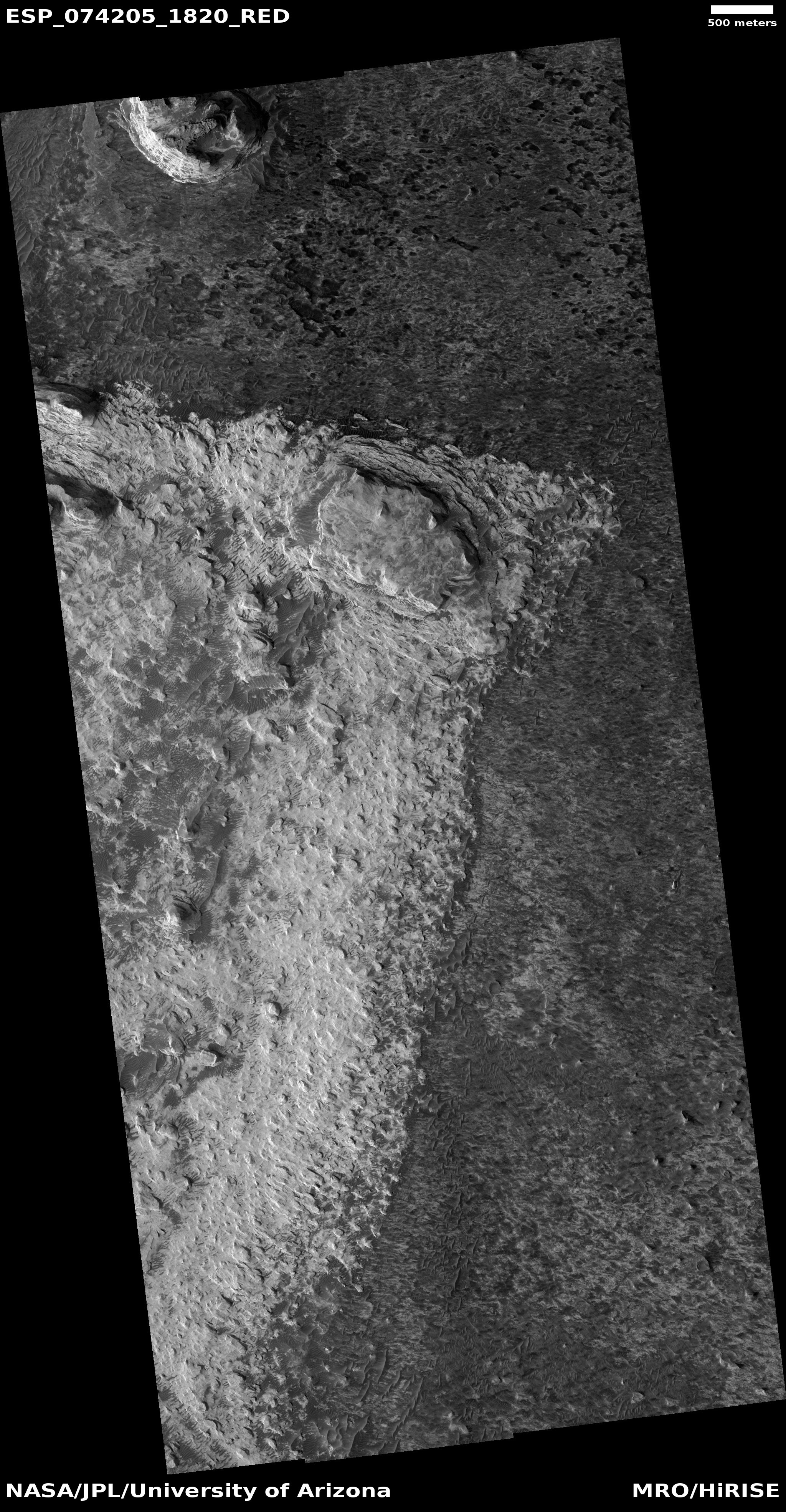
Cool image time! The photo to the right, cropped and reduced to post here, was taken on May 26, 2022 by the high resolution camera on Mars Reconnaissance Orbiter (MRO). It shows a mesa about three quarters of a mile in length that appears to be many-layered, from top to bottom.

The brightness of the mesa, compared to the surrounding plains, also emphasizes the different layers, though in this case it suggests two major epochs where the material being laid down in each was fundamentally different.

Or the difference could simply mean that the surrounding terrain is covered with dust, hiding its true color.

There is no question that winds in the thin Martian atmosphere have contributed to the erosion that formed this mesa, much like the buttes in the American southwest are shaped by winds. Whether water was a factor for this Martian butte is far less certain.

The overview map below provides context.
» Read more

1 comment

No more Ingenuity flights until August

Because it is now winter on Mars, with lots of seasonal dust in the atmosphere, the engineering team operating the helicopter Ingenuity have decided to suspend further flights until August.

Dust levels are expected to subside later in July, so the team has decided to give the helicopter’s batteries a break for a few weeks and build their daily state of charge back up. Weather permitting, Ingenuity is expected to be back in the air around the start of August.

This decision is not a surprise. When the team announced in May the plans for the helicopter’s most recent flight, completed in June, they suggested flights would pause for awhile thereafter. They have now made it official.

0 comments

Icy scarps in the high southern latitudes of Mars

Icy scallops in the high southern latitudes of Mars
Click for full image.

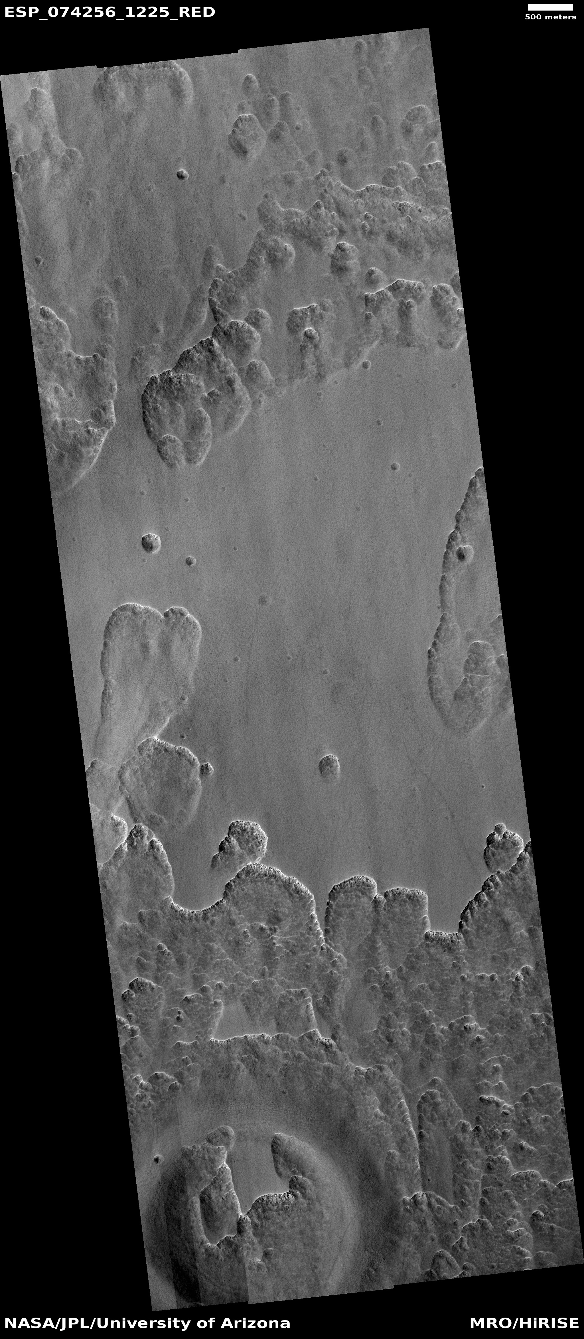
Cool image time! The photo to the right, rotated, cropped, and reduced to post here, was taken on May 30, 2022 by the high resolution camera on Mars Reconnaissance Orbiter (MRO). It shows what the scientists label “Patching Mantling Unit,” located at about 57 degrees south latitude in a region where scientists have found good evidence of near surface ice. The top layer, or mantle, is likely patchy because it has a high content of water ice and is sublimating away. That almost all the cliffs are south-facing, which in the southern hemisphere gets the least direct sunlight, supports this supposition. For example, in the crater at the bottom of the image the ice would have disappeared first from the north-facing interior rim slopes, with the sublimation slowly working its way northward. Thus we have that butte extending out from the north rim.

The global map below not only indicates the location of these scallops with the green dot, it illustrates the overall icy nature of most of the Mars.
» Read more

0 comments

Roscosmos forbids its astronauts from using Europe’s robot arm

In response to the final decision this week by the European Space Agency to officially end its cooperation with Russia on its ExoMars mission, Roscosmos today forbid its astronauts from using Europe’s new robot arm that was recently installed on the Russian Nauka module of ISS.

Russia’s crew onboard the International Space Station (ISS) will stop using the European ERA manipulator arm in response to the European Space Agency’s (ESA) refusal from cooperation on the ExoMars project, CEO of Russia’s state space corporation Roscosmos Dmitry Rogozin said on Tuesday.

“In my turn, I instruct our ISS crew to stop using the European Robotic Arm (ERA). Let [ESA Director General Josef] Aschbacher along with his boss [EU foreign policy chief Josep] Borrell fly to space and do at least something useful in their entire lives,” he wrote on his Telegram channel.

The arm was designed to work on the Russian part of ISS, so it appears this decision by Rogozin is an example of someone cutting off his nose to spite his face. It essentially reduces Russia’s capabilities on the station.

As for ExoMars, it is unclear what will happen to the lander that Russia built to put Europe’s Franklin rover on Mars. Roscosmos has said it might proceed with its own mission to Mars, using that lander, but it has not made the full commitment to do so.

0 comments

The highest point on Mars

The highest point on Mars
Click for full image.

Today’s cool image is cool not because of anything visible within it, but because of its location. The picture to the right, cropped to post here, was taken on May 27, 2022 by the high resolution camera on Mars Reconnaissance Orbiter (MRO). While the terrain shown is a relatively featureless plain of craters and gullies not unlike the surface of the Moon, what we are really looking at is the peak of Mars’ tallest mountain, Olympus Mons.

That’s right, this spot on Mars sits about 70,000 feet above Mars’ mean “sea level”, the elevation scientists have chosen as the average elevation on Mars from its center. At 70,000 feet, this peak is more than twice as high as Mount Everest on Earth.

Yet you wouldn’t really know you are at this height if you stood there. The scale of this mountain is so large that this peak, which actually forms the southern rim of the volcano’s 50 to 60 mile wide caldera, is actually relatively flat. If you stood here, you would not see the vast distant terrain far below. Instead, you’d see an ordinary horizon line in the near distance only slightly lower than where you stand.
» Read more

1 comment

Collapse pits on Mars

Elongated collapse pit on Mars
Click for full image.

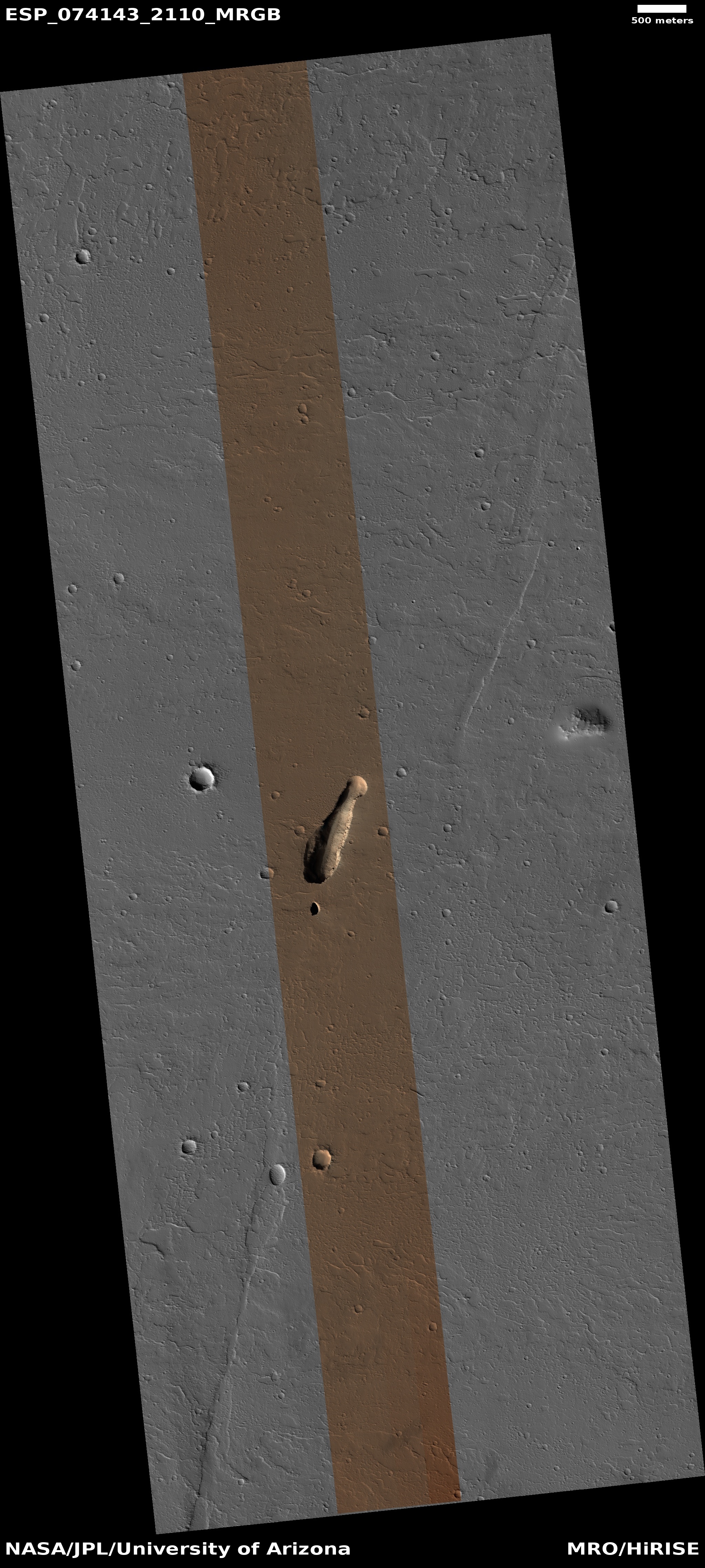
Cool image time! The photo to the right, cropped to post here, was taken on May 21, 2022 and was today’s picture of the day from the high resolution camera on Mars Reconnaissance Orbiter (MRO). Dubbed “An Elongated Collapse Pit” by the science team, their caption explains:

This observation can help to tell whether or not there is a subterranean connection to this pit. As an added bonus, the much smaller depression to its south also appears to be another collapse pit.

This image had already been in my queue for a future cool image post, but since the scientists have posted it, it is time that I did as well.

In the inset I have brightened the image drastically to try to illuminate the darkest spots in both pits. The elongated pit appears to slope downward towards a hole in the southeast corner, while the interior of the second pit to the south remains completely dark. Both appear to suggest a void below that both reach.

The wider context image and overview map below shows that there is further evidence of more voids in this region of Mars, dubbed Ceraunius Fossae, because of its many north-south parallel fissures.
» Read more

3 comments

More lacy Martian rocks

lacy Martian rock
Click for full image.

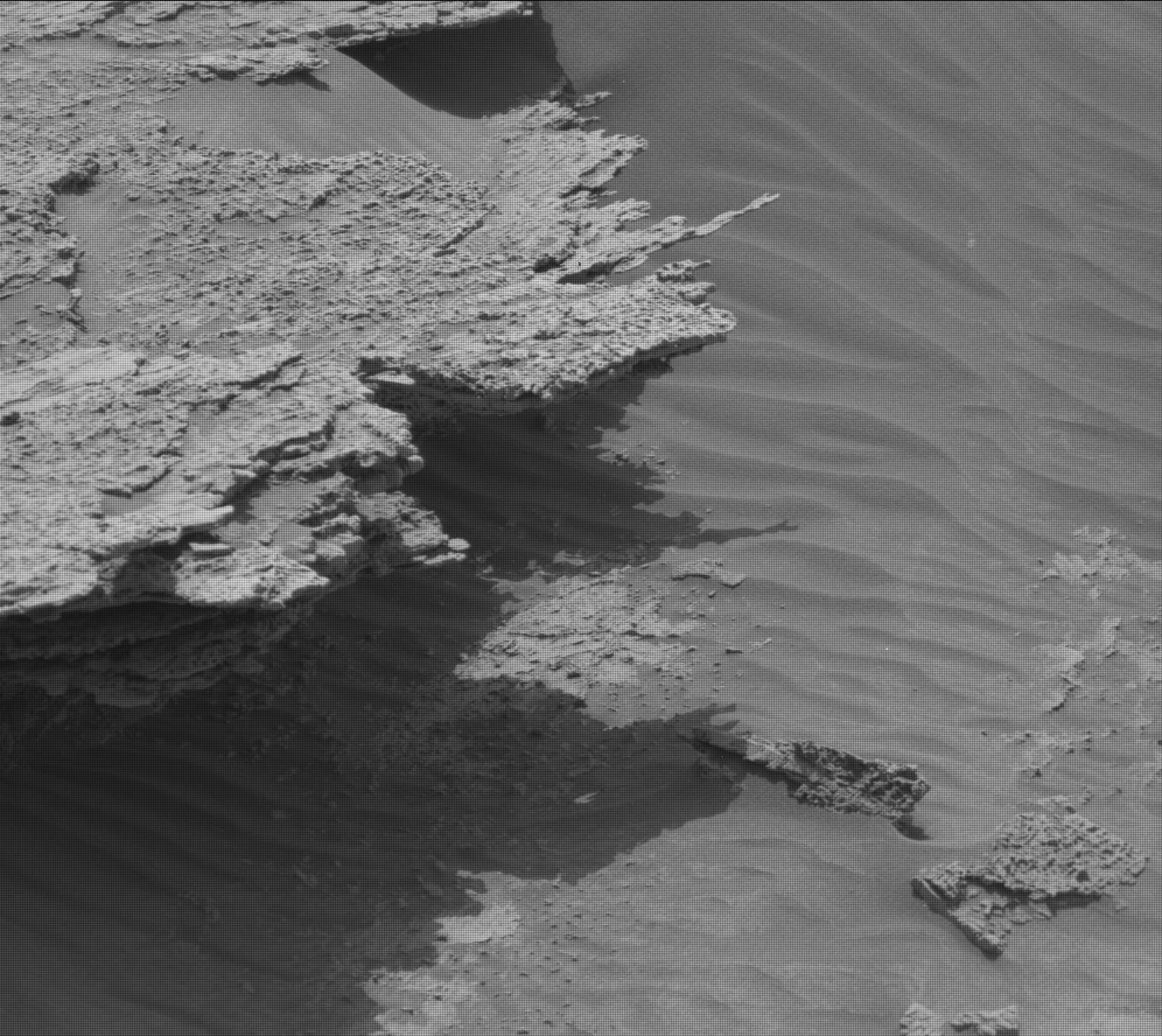
Cool image time! Because the Curiosity team is presently conducting a drilling campaign at its present position in the lower mountains of Gale Crater, the rover has not moved in the past few weeks. At these times, the science team also has the rover’s other cameras do extensive surveys of the surrounding terrain, including high resolution mosaics by its high resolution camera.

To the right is one photo from the most recent mosaic, cropped to post here. It was taken on July 10, 2022, and shows one many layered rock on the ground near the rover. Though no scale is provided, I suspect the extended flake from this rock is somewhere between six to twelve inches long.

Another illustration of the alien nature of Mars. This flake could not exist on Earth, where the heavier gravity and atmosphere would have acted to break it.

1 comment

The colorful layers of the Martian north pole icecap

Colorful layers in the Martian north pole ice cap
Click for full image.

Wider view
Click for full image.

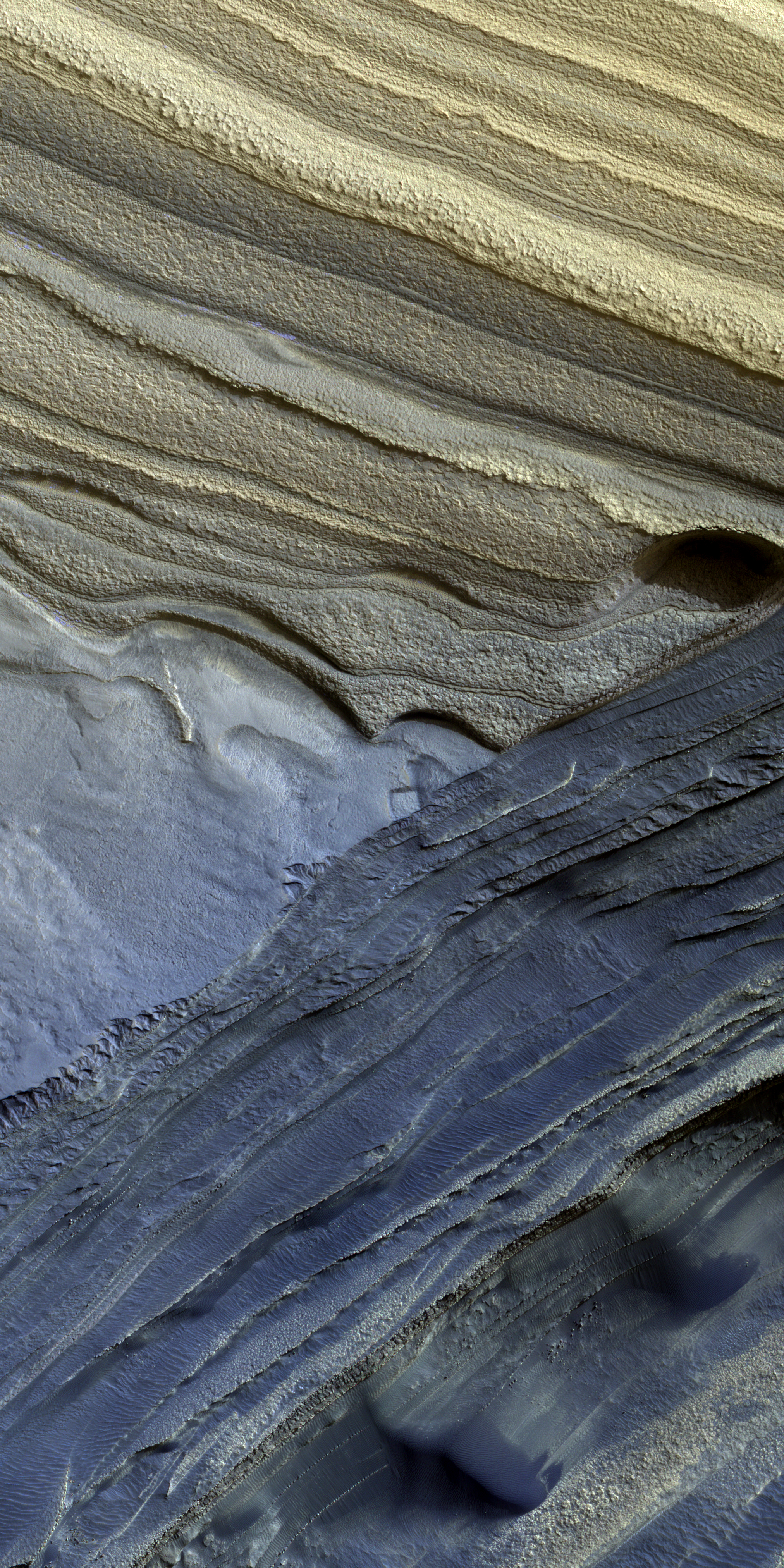
Today’s cool image above, rotated, reduced, and annotated to post here, comes from today’s picture of the day for the high resolution camera on Mars Reconnaissance Orbiter (MRO), which in turn is a retrospective of a captioned image first taken in 2010. The photo to the right, rotated, cropped, and reduced to post here, shows a larger area to provide some context. For this image north is towards the top. The rectangle indicates the area covered by the picture above.

The ice cap at the north pole is about 600 miles across and a little less than 7,000 feet deep, made up of many layers that are a mixture of water ice and cemented dust and sand. From the picture’s caption:

In many locations erosion has created scarps and troughs that expose this layering. The tan colored layers are the dusty water ice of the polar layered deposits; however a section of bluish layers is visible below them. These bluish layers contain sand-sized rock fragments that likely formed a large polar dunefield before the overlying dusty ice was deposited.

The lack of a polar ice cap in this past epoch attests to the variability of the Martian climate, which undergoes larger changes over time than that of the Earth.

The overview map below provides some further context.
» Read more

1 comment

From the rim to the floor of Valles Marineris

Overview map

From the rim to the floor of Valles Marineris
Click for full image.

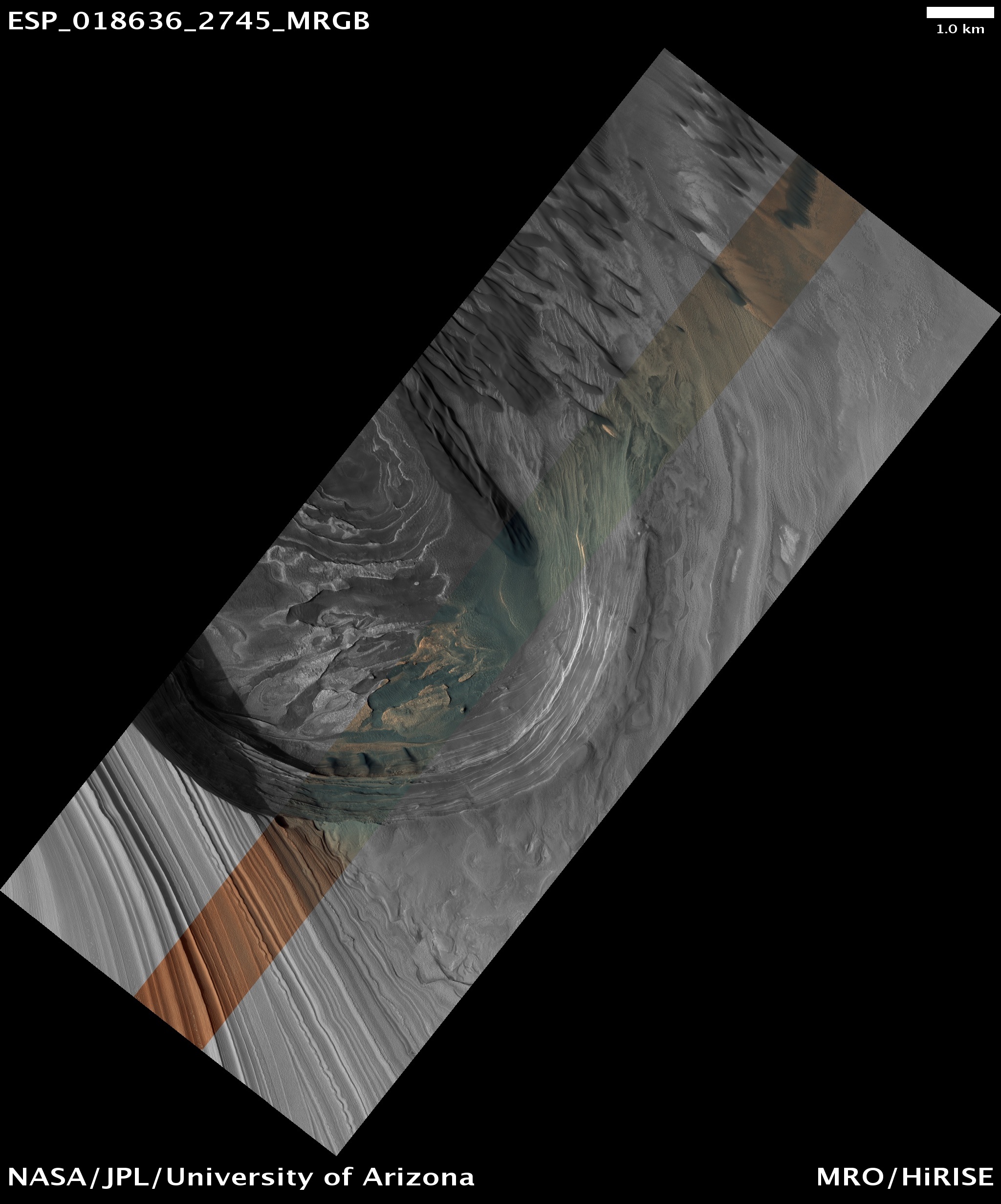
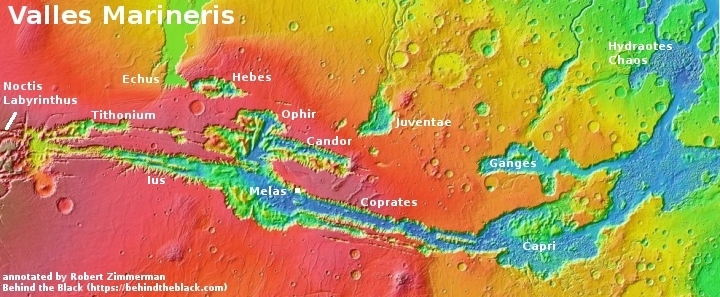
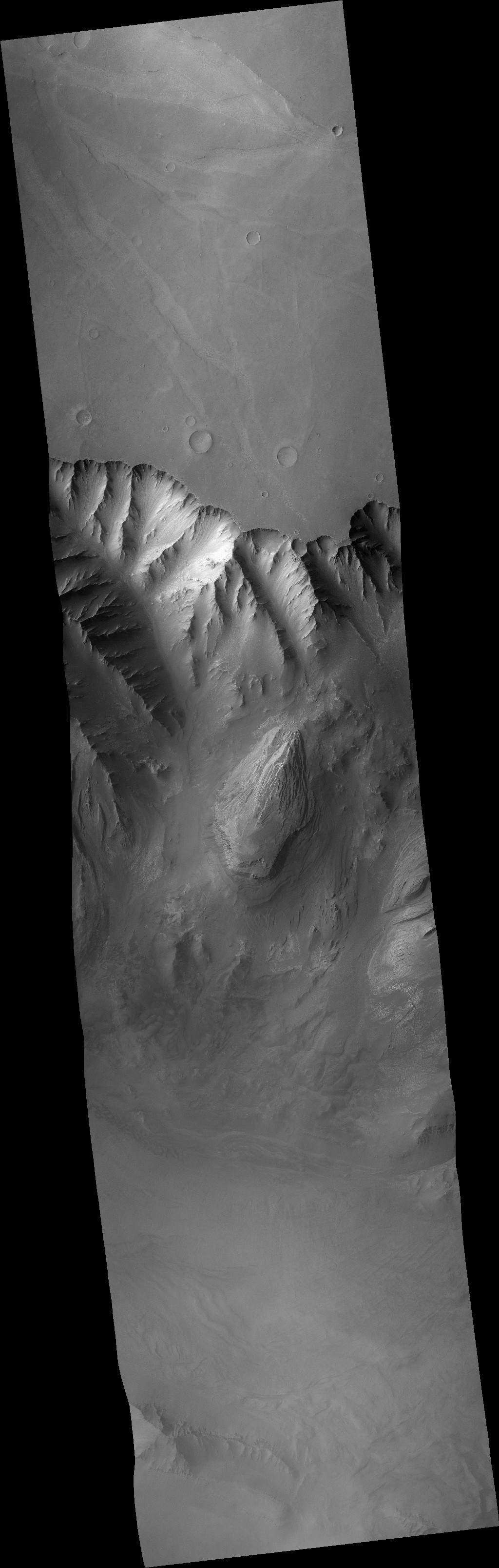
For today’s cool Martian image, we begin from afar and zoom in. The overview map above shows the solar system’s largest canyon, Valles Marineris, 1,500 miles long, and 400 miles wide at its widest. The white dot on the north rim of the section of the canyon dubbed Melas marks the location of the photo to the right, rotated, cropped and reduced to post here and taken on January 28, 2011 by the wide angle context camera on Mars Reconnaissance Orbiter (MRO).

I have added elevation numbers to this picture to give it some understandable scale. From the rim to the interior canyon floor — a distance of about ten miles — the canyon wall drops about 19,000 feet. Compare this with Bright Angel Trail in the Grand Canyon, which from the rim to the Colorado River drops about 4,400 feet in about the same distance. The wall of Valles Marineris is about four times steeper.

Even that doesn’t give you the full scale. Having hiked down to that interior canyon floor, you are still about 10,000 feet above Valles Marineris’s main canyon floor, with fifteen more miles of hiking to go to reach it.

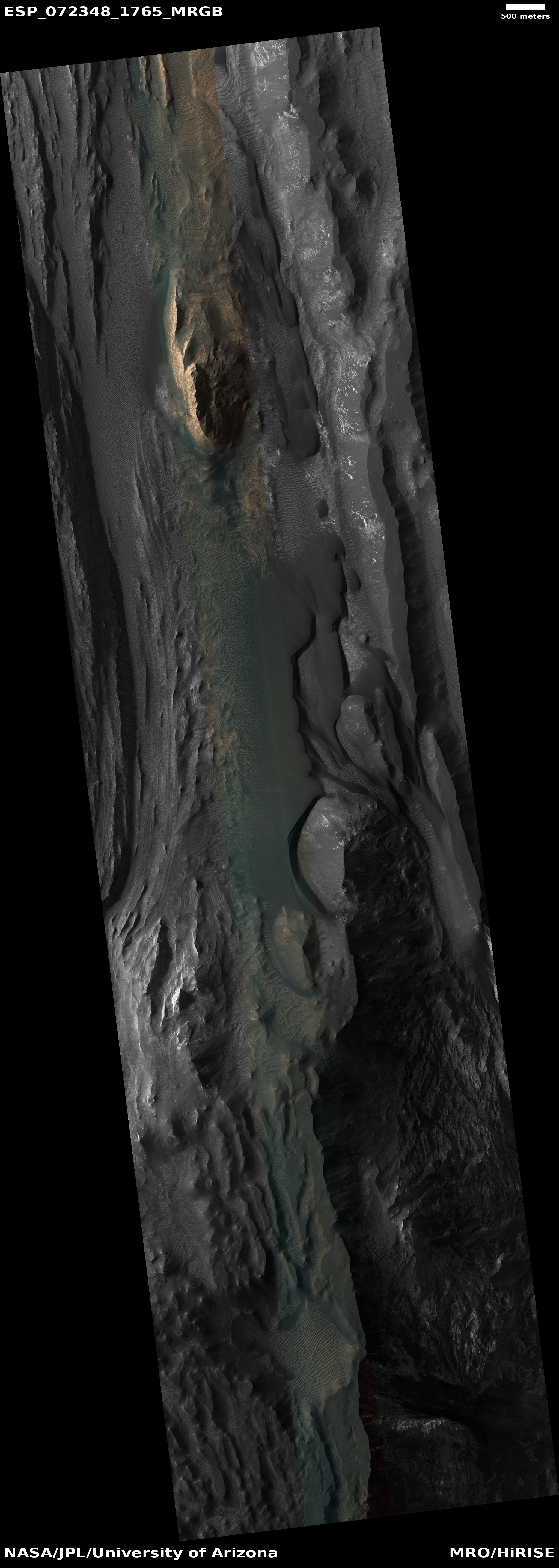
The white rectangle marks the area covered by the MRO high resolution image below.
» Read more

0 comments

How did sand dunes get to the top of a Martian mesa?

Sand dunes at the top of a Martian mountain
Click for full image.

Cool image time! The photo to the right, cropped and reduced to post here, was taken on January 1, 2022 by the high resolution camera on Mars Reconnaissance Orbiter (MRO) and shows one of the peaks of a 5,000+ foot high mesa inside Juventai Chasma, one of Mars’ deep mostly-enclosed chasms north of Valles Marineris.

I grabbed this picture because its label, “Bedform Change Detection in Juventae Chasma”, suggested something had changed from past photos, probably related to the sand dunes that hug the upper slopes of this peak. Unfortunately, in comparing this image with the earliest high-res image taken by MRO back in February 2018, I could not spot any change, probably because the resolution of the pictures released is not as high as MRO’s raw images.

However, the caption written for that 2018 image tells us where that change has likely occurred:

This image reveals a unique situation where this small dune field occurs along the summit of the large 1-mile-tall [mesa] near the center of Juventae Chasma. The layered [mesa] slopes are far too steep for dunes to climb, and bedform sand is unlikely to come from purely airborne material. Instead, the mound’s summit displays several dark-toned, mantled deposits that are adjacent to the dunes and appear to be eroding into fans of sandy material.

In other words, somewhere in the full resolution image scientists have spotted a change in the bedform sands that make-up these high mountain dunes that hug the peak. Since the data so far has suggested that the source for the sand of these high elevation dunes likely comes from the mesa itself — not from any distant source — any change found will help confirm or disprove that hypothesis.

The white box indicates the area covered by the close-up higher resolution picture below. Also below is an overview map, showing both the location of this mountain in Juventai Chasma as well as Juventai’s location relative to Valles Marineris.
» Read more

1 comment

Engineers propose flying gliders on Mars

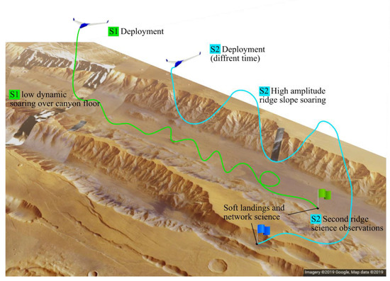
Proposed sailplane flights in Valles Marineris
Proposed sailplane flights in Valles Marineris. Click for full image.

Engineers at the University of Arizona are developing a prototype sailplane that they think could fly for long distances on Mars at higher altitudes than a helicopter and not be reliant on solar batteries.

Using dynamic soaring, the sailplane utilises increases in horizontal wind speed with gaining altitude to continue flying long distances. It’s the same process albatrosses use to fly long distances without flapping their wings and expending crucial energy.

After lifting themselves up into fast, high-altitude air, albatrosses then turn their bodies to descend rapidly into regions of slower, low-altitude air. With the force of gravity providing downward acceleration, the albatross uses this momentum to slingshot itself back to higher altitudes. Continuously repeating this process enables albatross and other seabird species to cover thousands of kilometres of ocean, flap-free.

It’s the inspiration for the sailplane’s own propulsion system, enabling it to cover the canyons and volcanoes dotted across the red planet currently inaccessible to Mars rovers.

The graphic above, figure 1 from the engineers’ research paper, shows one possible sailplane mission, deploying two gliders, one to observe the canyon wall and a second to survey the canyon floor. Both would become a weather station upon landing. While the paper doesn’t state a Mars location for this concept, the graphic strikes a strong resemblance to the section of Valles Marineris where scientists have recently taken “Mars Helicopter” high resolution images using Mars Reconnaissance Orbiter (MRO). This paper and those images might be related, or they could be illustrating the general interest by many scientists for this Mars’ location.

Regardless, the engineers are now planning test flights at 15,000 feet elevation, an elevation that will most closely simulate the atmosphere of Mars, on Earth.

8 comments
1 42 43 44 45 46 128