Wavy crescent ridges on Mars

Wavy crescents on Mars
Click for full image.

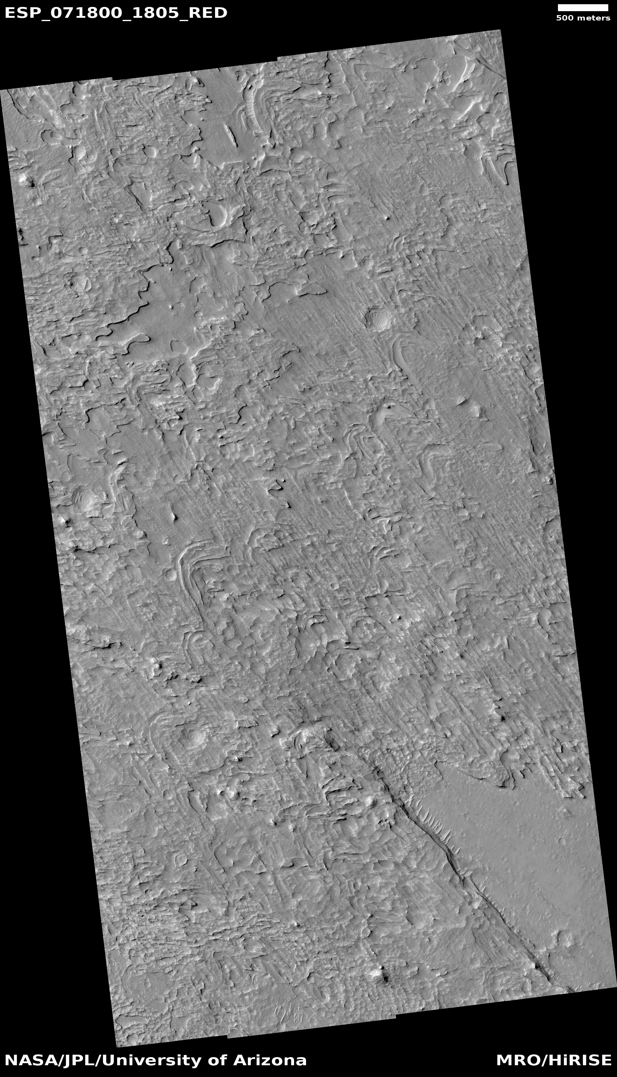
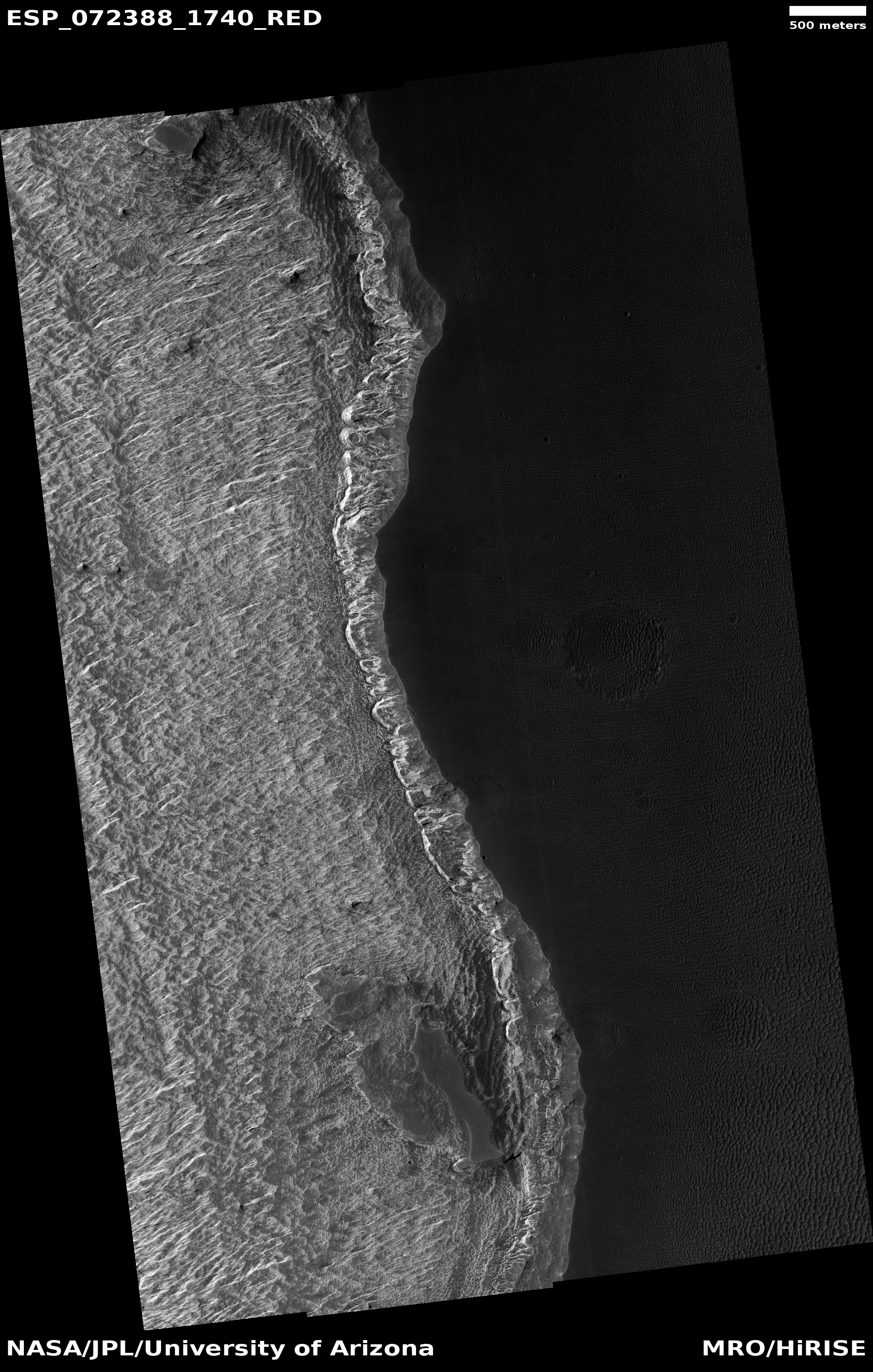
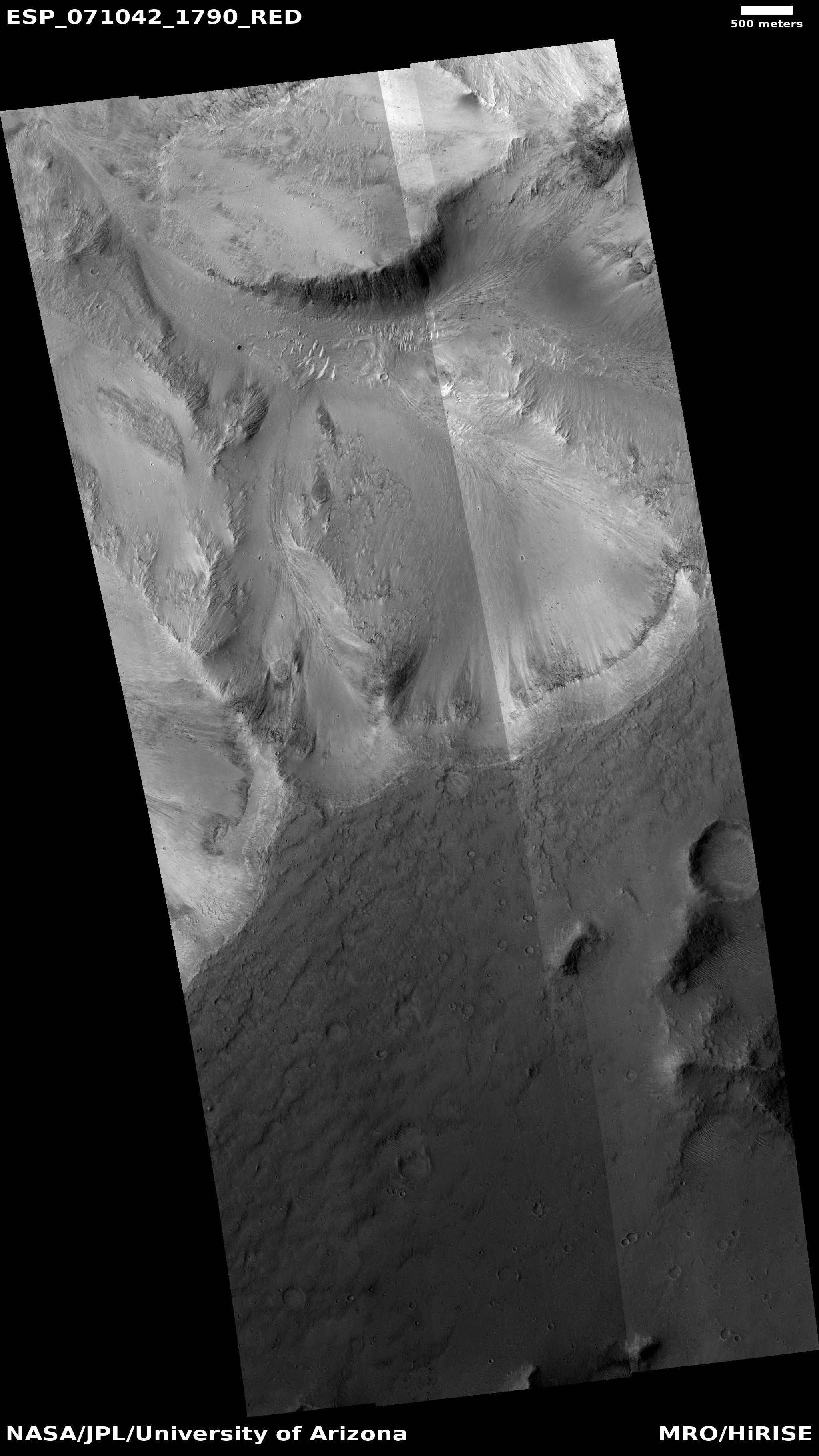
Cool image time! The photo to the right, cropped and reduced to post here, was taken on November 19, 2021 by the high resolution camera on Mars Reconnaissance Orbiter (MRO). It shows what the science team has labeled “Crescentic forms,” which in some ways resemble crescents that I featured in a cool image back in November 2020.

Unlike those earlier crescents, today’s are linked together to form a longer wavy line. Furthermore, today’s crescents include some positive relief, with some parts standing above the surrounding terrain. The earlier crescents were entirely carved out of the ground, forming depressions.

And yet, the method of formation for both must be somewhat similar. I say this based on their location, as shown in the overview map below.
» Read more

0 comments

Rock growths on Mars!

Rock growths on Mars!
Click for full image.

Cool image time! The photo to the right was taken by the high resolution camera on the Mars rover Curiosity on May 15, 2022, and shows several incredibly strange vertical fingers of rock that appear to grow out of the ground. From the caption:

These likely formed as groundwater trickled through rock in the ancient past, depositing mineral cements over time; many years later, when the rock was exposed to the atmosphere, wind eroded the softer material around the cemented portions.

This formation explanation of course is only an educated guess. There are other possibilities, suggested by how cave formations grow over time, that are less likely but still must be considered. For example, maybe we are looking at a feature that grew upward as condensation from Mars’ once thicker and wetter atmosphere deposited new material on it over time.

Unfortunately, the image release does not provide a scale. My guess is that the longest finger is between six to twelve inches long, but it could be much smaller.

4 comments

Curiosity: Into the mountains

Panorama on Mars, June 15, 2022
Click for full image.

Overview map
Click for interactive map.

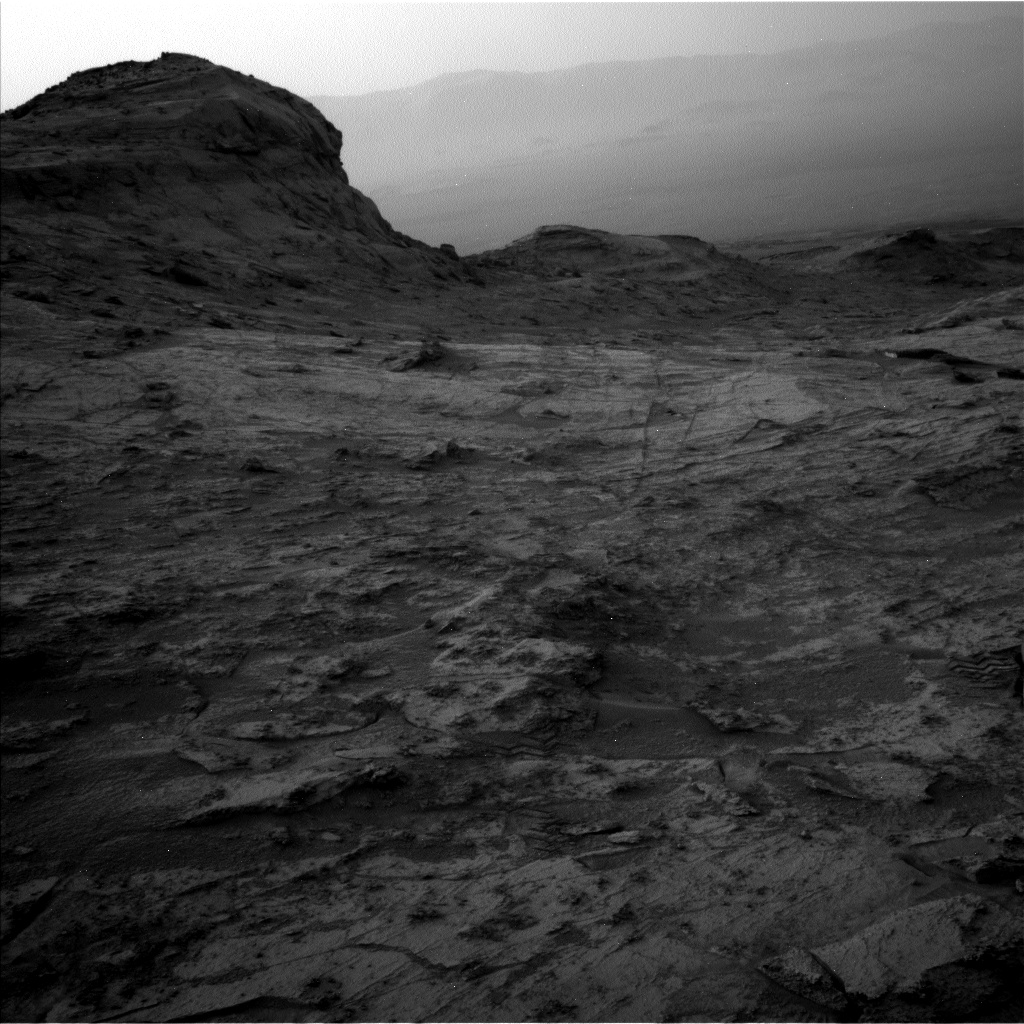
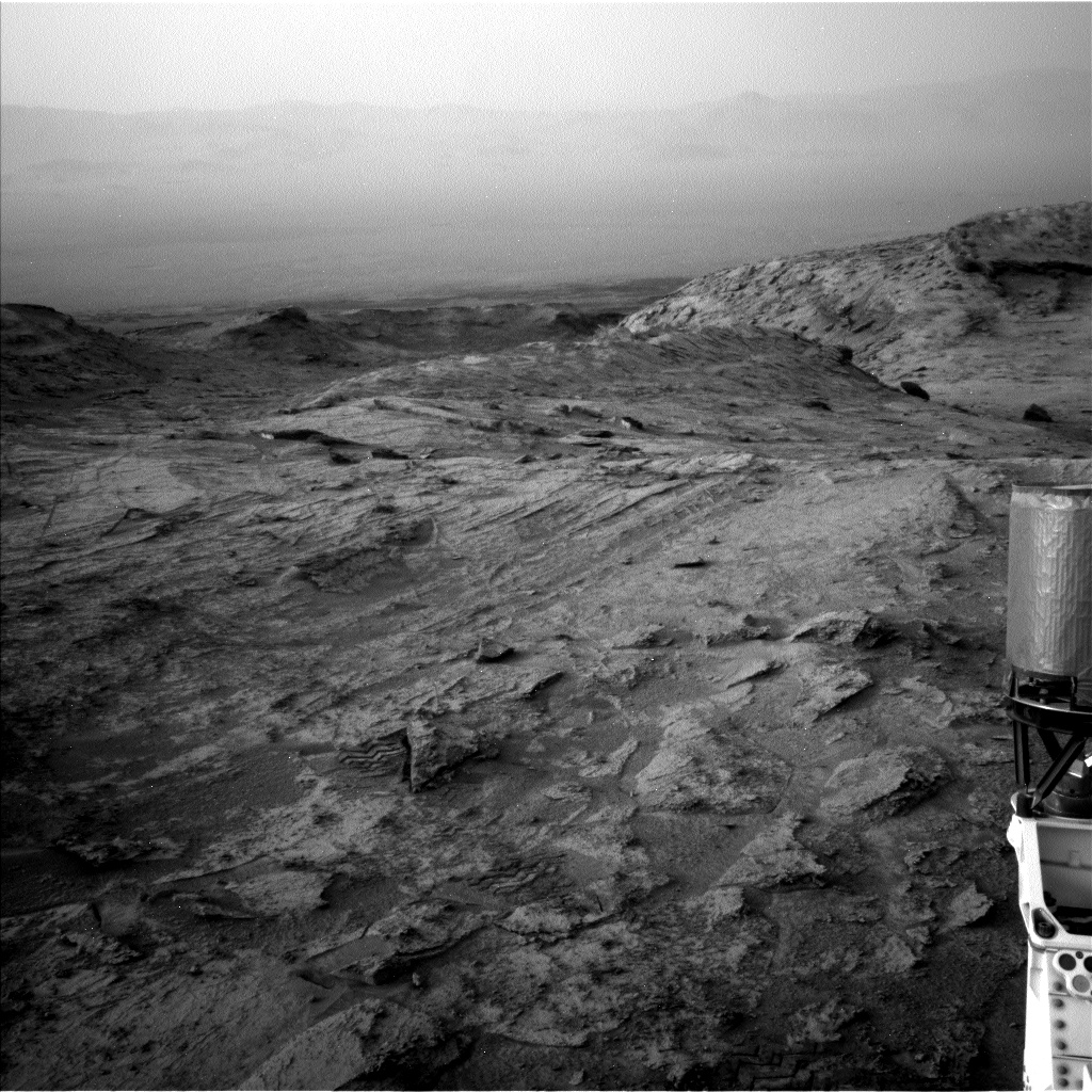
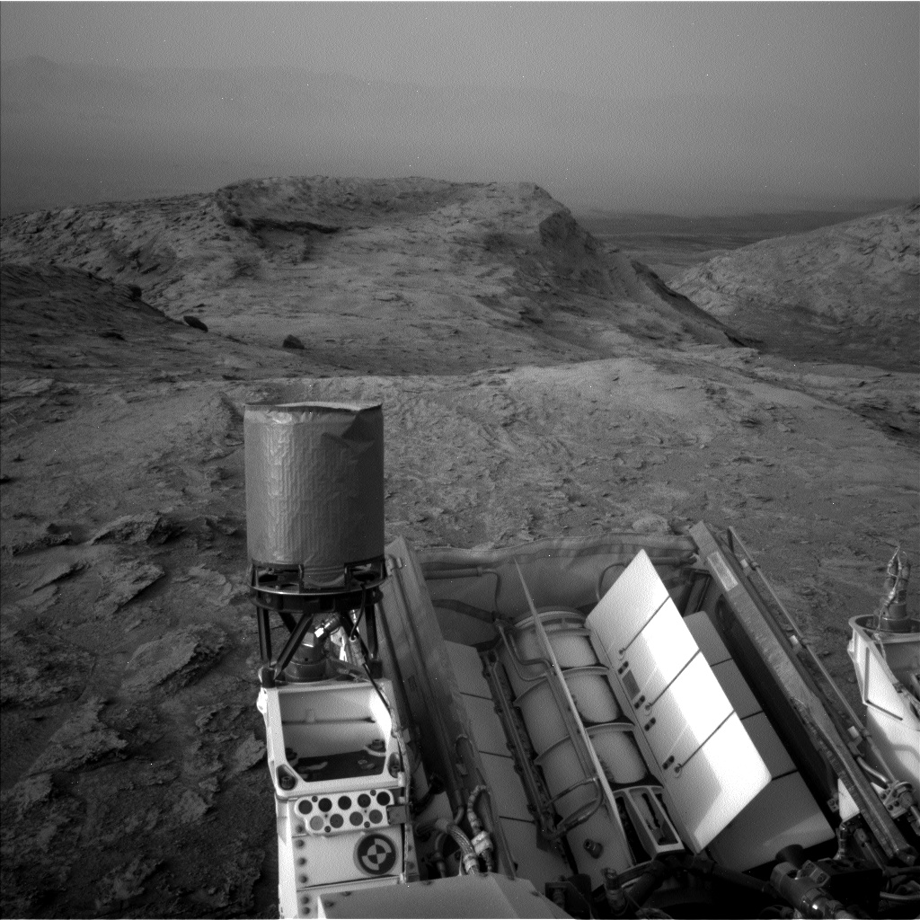
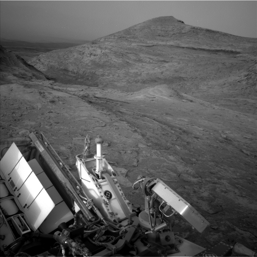
Cool image time! The journey of Curiosity into the mountains of Gale Crater continues. The photo above, taken on June 15, 2022 by the rover’s left navigation camera, looks straight ahead at one possible route into those mountains.

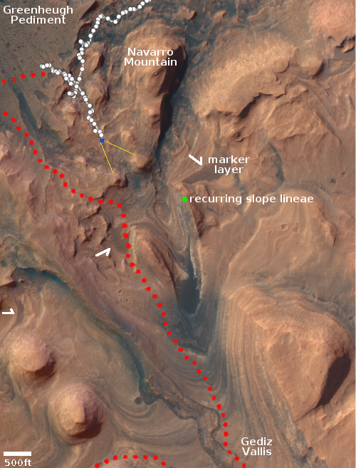
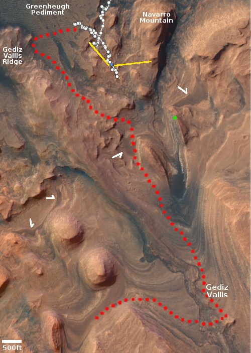
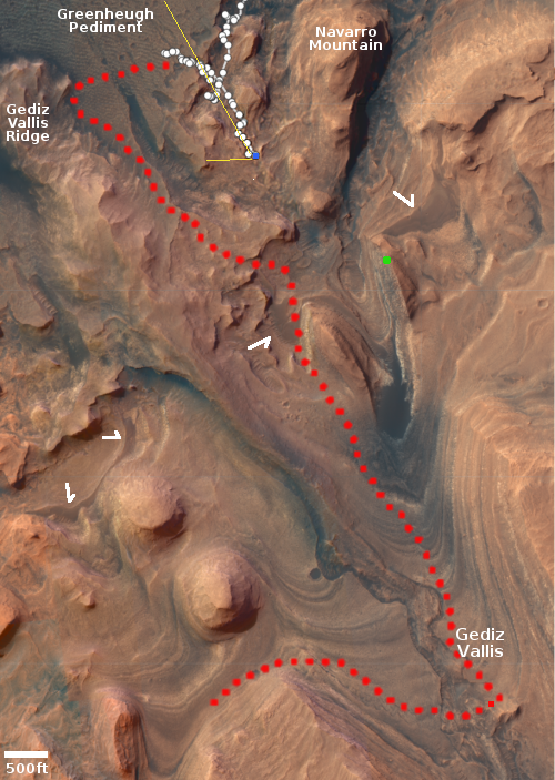
The blue dot on the overview map to the right indicates Curiosity’s position. The yellow lines show the approximate area covered by the photo, by my estimate. The recurring slope lineae is a streak that comes and goes seasonally, and could be caused by some form of seepage. The marker layer, as indicated by the arrows, is a geological layer found at about the same elevation in many places on the flanks of Mount Sharp.

The red dotted line indicates the planned route of Curiosity, which it is presently striving to return to, having been forced to retreat from the Greenheugh Pediment because of its too-rough terrain.

For scale, Navarro Mountain is estimated to be about 450 feet high. Thus, the peak in the center of the panorama, which I think is the large mesa in the lower right corner of the overview map, is probably twice that height, about 1,500 to 1,700 feet high, and much higher than the two mesas that frame it on either side. Distance and perspective hide this difference.

When Curiosity finally gets inside Gediz Vallis and close to the side of that many-layered mesa, the view should be unbelievably amazing.

The science team has not yet revealed the precise route they plan to take to return to the planned route. While they may aim straight over the saddle in the photo above, I suspect they will instead bear west, following ground that is less steep.

0 comments

Ingenuity successfully completes its 29th flight on Mars

Ingenuity's 29th flight, estimated

Based on this tweet posted yesterday, Ingenuity has successfully completed its 29th flight on Mars, placing it in “a better communication position with the rover.”

According to the helicopter’s flight log, the flight lasted about 66 seconds, was about 587 feet long, and had a maximum altitude of 33 feet.

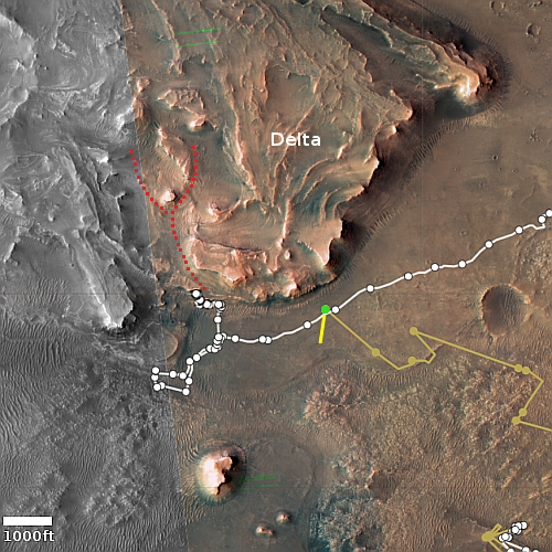
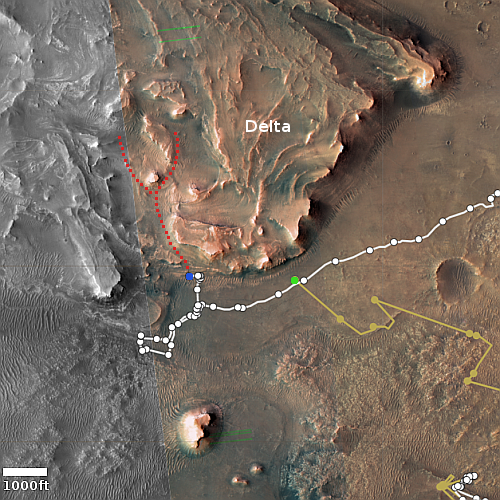
On the overview map to the right the green dot marks Ingenuity’s position before the flight. The yellow line is my guess as to the approximate flight path for this 29th flight. In this new position the helicopter is better aligned with the hollow that Perseverance will climb (as indicated by the red dotted line), and will therefore also have better line of sight communications with it.

The flight itself tells us that the engineers have not only gotten the helicopter recharged, they have developed new flight software to compensate for the loss of a sensor that was used to determine Ingenuity’s elevation.

0 comments

Perseverance gets close to its first cliff

Perseverance's first cliff
Click for full image.

Time for some cool images from Perseverance! The rover, now on Mars for more than a year, has finally begun its journey up the delta of material that some time in the past flowed through a gap in the rim of Jezero Crater. In doing so, it has also finally got close to a nearby cliff, within fifty feet or so, and used its high resolution left mast camera (mastcam) to take the photos to the right. The first, cropped and reduced to post here, was a wider shot taken on June 10, 2022, with the red arrow pointing to the part of the cliff featured in the second image below, taken on June 12, 2022, after the rover had moved in closer. This second photo is also cropped and reduced to post here.
» Read more

6 comments

Russia proposes restart of ExoMars partnership with ESA

Russia’s aerospace corporation Roscosmos has proposed to the European Space Agency (ESA) that its partnership to launch and land ESA’s Franklin rover on Mars be renewed, despite the Ukraine War and Roscosmos’ confiscation of 36 OneWeb satellites.

[According to Roscosmos head Dmitry Rogozin] the equipment and Kazachok landing platform for the mission have the potential for launch in 2024. “ESA colleagues promised to make requests to their patrons, who are ESA member states. If they cooperate and give their consent, the mission may be implemented,” Rogozin said.

He estimates the likelihood of this scenario to be at about 708%. [sic] Roscosmos plans to get the response in late June. [emphasis mine]

It would not be surprising if ESA made this deal, despite its stupidity. Roscosmos’ actions recently, especially related to OneWeb, prove the people running it are very untrustworthy business partners. Yet Europe’s historic willingness to deal with the devil for short term gain — eventually and repeatedly leading to overall disaster — is legendary.

4 comments

Dusty Gale Crater in the winter

Curiosity's view to the north, May 25, 2022
Click on image for full resolution panorama. For original photos, go here, here, here, here, and here.

Overview map
Click for interactive map.

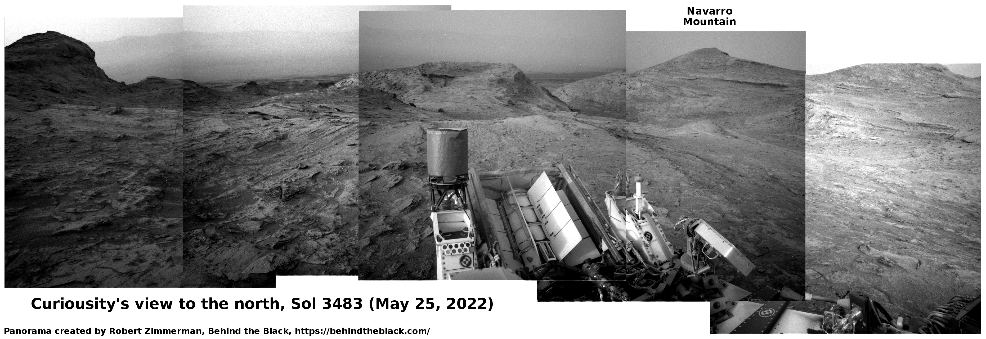
Cool image time! The panorama above, created from five images taken by Curiosity’s left navigation camera on May 25, 2022, looks north across the floor of Gale Crater at its rim about 25 miles away.

The butte on the left I think (though I am not certain) is the backside of the same butte seen from the front in December 2021. Then, Curiosity was below it looking up. Now, Curiosity is above it looking down.

For scale, that butte is about ten feet high. Navarro Mountain on the right is about 450 feet high, but looks less impressive because it is farther away.

It is now winter in Gale Crater, a time period when there is more dust in the atmosphere. This fact becomes very evident if you compare this panorama with a similar one taken in December 2021 in the Martian fall. Then, the air is crystal clear, and the rim can be seen in great detail. Now, though visible (barely) on the left, the haze makes the more distant peaks on the right almost invisible.

Curiosity has climbed about 1,750 feet since it landed in 2012. It is still about 12,600 feet below the peak of Mount Sharp. The blue dot and yellow lines in the overview map to the right indicates Curiosity’s location when the panorama was taken, and the approximate area covered by it.

Be sure and look at the full resolution panorama, especially the section near the middle, where the dramatic nature of this terrain is most evident.

2 comments

Close-up on another flaky Martian rock

Close-up on another flaky Martian rock
Click for full image.

Overview map
Click for interactive map.

Cool image time! The picture above, reduced to post here, was taken by Curiosity’s high resolution camera on June 5, 2022 (sol 3494). It shows a close up of another flaky rock near where the rover is presently sitting (the blue dot on the map to the right), similar to the one that I highlighted on May 28, 2022 but zoomed in closer.

Not only can you seen the layered flakes extending out from the rock’s main body, you can see what appear to be small deposits of material between the flakes, as if at one point the material was being placed here by condensation, either from the atmosphere or liquid.

The curvy rounded edges of the rock’s larger flakes could have been caused by the same process, or by long slow wind erosion over the eons since the flakes were formed.

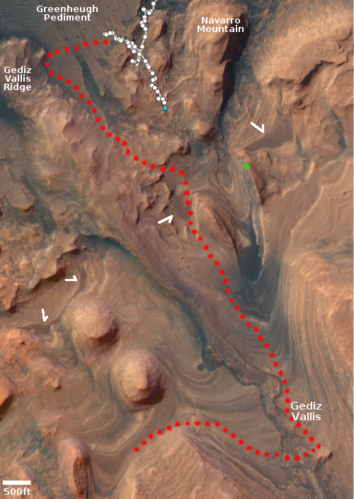
The photo appears to be part of a larger mosaic that the rover’s science team is having the camera take of the strange geology that now surrounds Curiosity. The science team also appears to be continuing its beeline south towards the rover’s original planned route, indicated by the red dotted line on the map. The green dot marks the approximate location of a seasonal recurring dark streak on the cliffside, suggesting some form of seepage, while the white arrows mark a distinct layer that scientists have identified in many places on the flanks of Mount Sharp.

3 comments

Spiders galore on Mars!

Spiders galore on Mars
Click for full image.

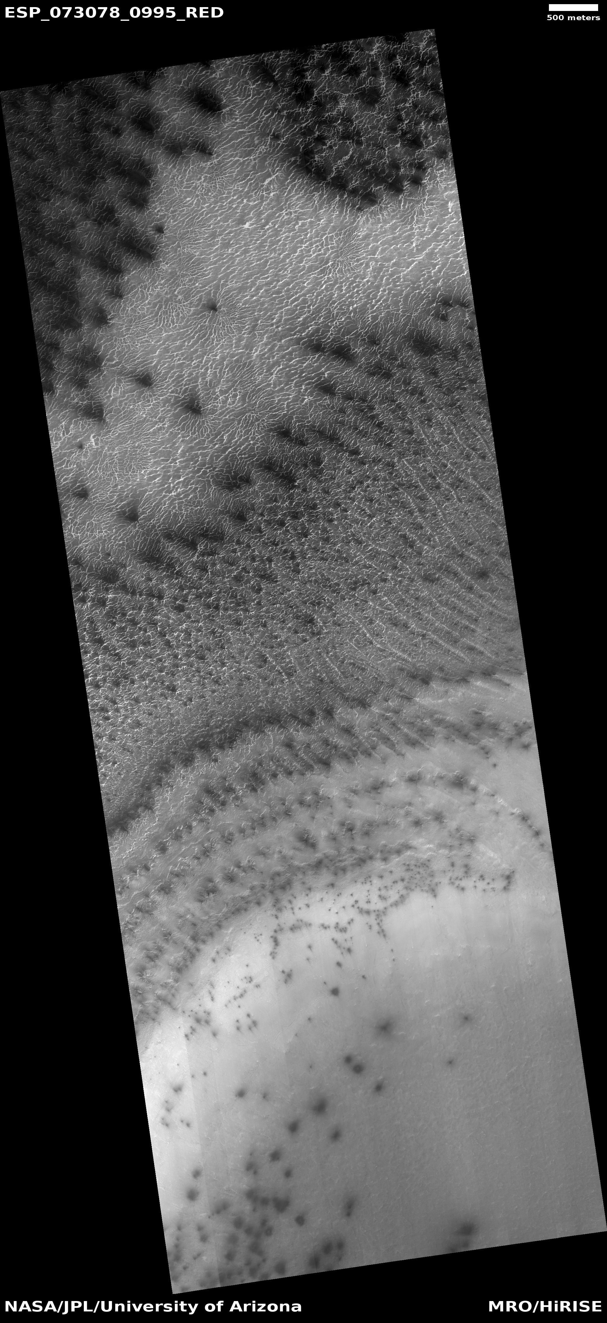
Cool image time! The photo to the right, cropped to post here, was taken on February 27, 2022 by the high resolution camera on Mars Reconnaissance Orbiter (MRO) and shows a nice collection of what scientists have informally (but permanently) labeled as spiders, strange formations that exists only in the regions of the Martian south pole.

The spiders are believed to have formed because of the coming and going of the dry ice mantle in the polar regions that falls as snow in the winter and then sublimates away come the spring. Because dry ice is mostly clear, the spring sunlight penetrates it and warms the underlying surface, which acts to warm the base of the dry ice mantle. CO2 gas builds up, trapped below the dry ice, until the pressure causes it to break the dry ice at a weak point and spew outward, carrying with it dust that blackens the surface above. You can see three examples in today’s image.

Spiders however only happen at the south pole. In the north much of the terrain is formed by unstable dunes, which change from year to year, thus causing the gas breakage to occur at random and different spots.

In the south however the terrain is more stable, a surface of ice and dirt. The spiders form because the trapped gas always follows the same path from year to year to the same weak points, carving riverlike tributaries until these feeders combine and build up enough gas pressure to crack the overlying dry ice so that the gas can escape.

Though the gas functions much like a river of water, it has one fundamental difference that makes this phenomenon wholly Martian and quite alien. On Earth rivers flow downhill. On Mars, the gas in these spider tributaries is flowing upward, seeking a path into the atmosphere above.

2 comments

A rock stows away on Perseverance

Perseverance's stowaway
Click for full image.

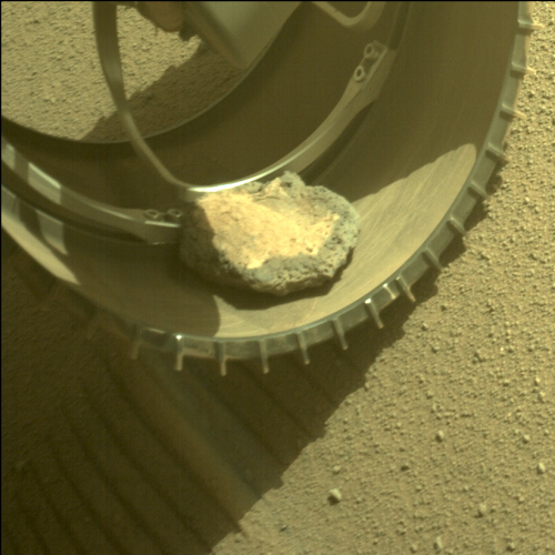
Since early February the Mars Rover Perseverance has been toting with it a small rock in its front left wheel, as shown in the image to the right, cropped and reduced to post here and taken by the rover’s left hazard avoidance camera on February 6, 2022.

From an update today by the Perseverance science team:

Back on sol 341โ€” thatโ€™s over 100 sols ago, in early Februaryโ€” a rock found its way into the roverโ€™s front left wheel, and since hitching a ride, itโ€™s been transported more than 5.3 miles (8.5 km). This rock isnโ€™t doing any damage to the wheel, but throughout its (no doubt bumpy!) journey, it has clung on and made periodic appearances in our left Hazcam images.

You can see the most recent photo of the rock, taken on May 26, 2022, here. It is very clear that the rock’s repeated tumbling inside the wheel well has worn away its sharp edges as well as reduced its overall size. Given enough time its surface could even become somewhat smooth.

As the update notes, when this rock finally drops off it will create a potential mystery for future geologists, who if they are not aware that Perseverance moved it, will wonder how it got where it was, being geologically out-of-place in its new location.

5 comments

MAVEN returns to full operation

NASA announced yesterday that engineers have finally completely restored its Mars orbiter MAVEN, after a three month period when the spacecraft was in safe mode due to an attitude control problem.

To fix the problem engineers uploaded new software that allowed the spacecraft to determine its orientation in space not from its onboard inertial units, but from locking onto stars in the sky.

All instruments were healthy and successfully resumed observations; however, the spacecraft was constrained to pointing at the Earth until testing of all-stellar mode was completed, so the instruments were not oriented as they normally would be during science operations. Nevertheless, some limited science was still possible, and MAVEN even observed a coronal mass ejection impact Mars less than two days after the instruments were powered on.

Moreover, for some parts of the year it will still need its inertial units, so a fix for those time periods is still required.

Regardless, MAVEN can now resume acting as a communications relay between the Earth and the rovers on Mars, which for the past year has become its prime mission. While both rovers can communication without that relay, it is often necessary depending on a number of factors, and it also provides redundancy and a greater communications capacity.

0 comments

Curiosity on a steep slope

null
Click for full panorama.

Overview map
Click for interactive map.

Cool image time! The panorama above, cropped, reduced, and enhanced to post here, was compiled from 29 photos taken on May 31, 2022 by the right navigation camera on the Mars rover Curiosity. It shows the steepness of the slope that the rover ended up parking on yesterday after it completed its drive. As noted in today’s rover update by Abigail Fraeman, Planetary Geologist at NASA’s Jet Propulsion Laboratory:

Curiosity starts the plan parked at an impressive 17หš pitch (front up) and 17หš roll (left up) for a total 24หš tilt. You can get a bit of a sense of the roverโ€™s non-horizontal position by looking at its orientation with respect to the ground in the above Navcam mosaic. Even though this slope is getting close to the limit of what Curiosity can traverse, we donโ€™t think weโ€™ll have any problems unstowing the arm or driving the rest of the way to the top because of the terrain weโ€™re on โ€“ nice smooth bedrock with only a thin sand cover is almost the Martian equivalent of a paved road.

On the far right of the image you can also see Curiosity’s tracks. The rover had first approached this slope about 80 feet to the west, then backed off slightly to parallel the slope as it came east and then turned uphill. In the far far distance can be seen the rim of Gale Crater, about about 30 miles away and obscured by the atmosphere’s winter dust.

The overview map above shows Curiosity’s location with the blue dot. The approximate area covered by the section of the panorama above is indicated by the yellow lines. The red dotted line shows the roverโ€™s original planned route. The white arrows indicate what the scientists have dubbed the โ€œmarker horizon,โ€ a distinct layer found in many places on the flanks of Mount Sharp that they are very eager to study up close. The green dot marks the approximate location of a recurring slope lineae, a place where the cliff is seasonally darkened by a streak that appears each spring and then fades.

0 comments

MAVEN out of operation since February

The American Mars orbiter MAVEN has been unable to do any science observations since February 22, 2022 because its attitude control system has not been functioning properly, according to a NASA update only released on May 18th, almost two months later.

In the weeks that followed, NASA managed to revive MAVEN from safe mode, but in a limited capacity. The orbiter is in a stable orbit with its primary antenna pointed at Earth to maintain high-rate communications with its flight control team. “In this configuration, however, MAVEN cannot perform communications relays for other spacecraft on Mars and is performing only limited science observations,” NASA officials wrote in the update (opens in new tab). “The mission team began science instrument recovery on April 20.” The orbiter normally serves as a communication relay for NASA’s Curiosity rover and Perseverance rover on Mars to beam the latest images and research from the Martian surface to Earth.

Though it can still do its own observations, MAVEN’s main task at this time is to act as a communications relay for the rovers on Mars. This issue prevents that task.

1 comment

Flaky Martian rock

Flaky Martian rock
Click for full image.

Overview map
Click for interactive map.

Cool image time! The photo to the right, reduced and enhanced to post here, was taken on May 15, 2022 (sol 3474) by the high resolution camera on the Mars rover Curiosity, and shows a rock that was near the rover at that time that I estimate to be around three to four feet long.

This picture was taken the same day Curiosity also took a panorama and close-up images of a row of teeth-like boulders that sat a short distance in front of the rover. Those rocks, much larger than the one to the right, had numerous large flakes protruding from their sides.

This smaller rock has even more such flakes, all much smaller and clearly more delicate.

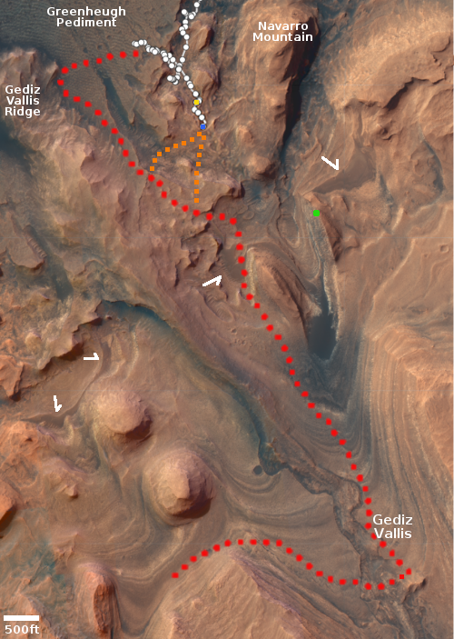
The overview map to the right shows Curiosity’s present position with the blue dot. The yellow dot marks where it was when it took this photograph. The red dotted line shows the rover’s original planned route. The white arrows indicate what the scientists have dubbed the “marker horizon,” a distinct layer found in many places on the flanks of Mount Sharp that they are very eager to study up close.

The green dot marks the approximate location of a recurring slope lineae, a place where the cliff is seasonally darkened by a streak that appears each spring and then fades.

The two orange dotted lines are my guesses for the two possible routes the rover will take from here to get back to its planned route, abandoned in mid-April when the Greenheugh Pediment was found too rough for Curiosity’s wheels. Though science team has not published a new route, the direction traveled in recent weeks suggests these are the possibilities. If I had to choose, I would favor the east route, as it bypasses more completely the pediment with its rough terrain.

4 comments

Engineers rethinking Ingenuity operations to keep it alive through the winter

The engineering team operating the Ingenuity helicopter on Mars have now determined that the cold oncoming winter temperatures on Mars are causing its systems to shut down during the night — at the edge of their designed temperature limits — and then reboot each morning, thus resetting its clock to the wrong time.

The result has been that the helicopter’s future is now definitely threatened. To address the cold winter temperatures and possibly keep Ingenuity alive, the engineers have come up with the following plan. First, they have focused on downloading from the helicopter all the remaining data still on-board, in case it shuts down permanently.

After all critical logs are transferred, the team will proceed with a recommissioning phase during which we will reestablish Ingenuityโ€™s flight-readiness given our ongoing overnight cold-cycling. Like during the technology demonstration phase, we will perform a high-speed spin before proceeding to flight. Should Ingenuity receive a clean bill of health, we would be ready to execute a short sortie to the southwest in Flight 29. This flight will improve our radio link for approximately the next four to six months while Perseverance samples at the river delta.

In the meantime, the Ingenuity flight software team will be preparing a series of upgrades to enable advanced navigation features. These new capabilities will help Ingenuity ascend the river delta and continue its missions as a forward scout for Perseverance past winter.

All this effort will carry much greater risk, especially because Ingenuity is now operating far beyond its original planned capabilities, and the worst and coldest winter temperatures are yet to come. For the next three months or so the amount of sunlight available will be insufficient to power it as planned, and thus it will face a possibility of permanent failure almost every day. That 29th flight is thus likely critical to survival.

0 comments

A high mountain inside Valles Marineris

A high mountain inside Valles Marineris
Click for full image.

Cool image time! The photo to the right, cropped, reduced, and annotated to post here, was taken on January 4, 2022 by the high resolution camera on Mars Reconnaissance Orbiter (MRO). It shows the flat top of a mountain inside Candor Chasma, one of the side canyons of the solar system’s largest canyon, Valles Marineris.

The image was taken when the sun was about 32 degrees above the horizon, to the west, and thus apparently low enough to put the flat top mostly in shadow.

What is most spectacular about this photo is the sense of scale it portrays once you know the overall context. Note the many layered slope to the west. That slope will continue downward far beyond the left edge of this image, dropping for dozens of miles and about 13,000 feet. The overview map below makes this clearer.
» Read more

0 comments

Martian ridge sticking up out of a lava flood plain

Martian ridge sticking up out of a lava flood plain
Click for full image.

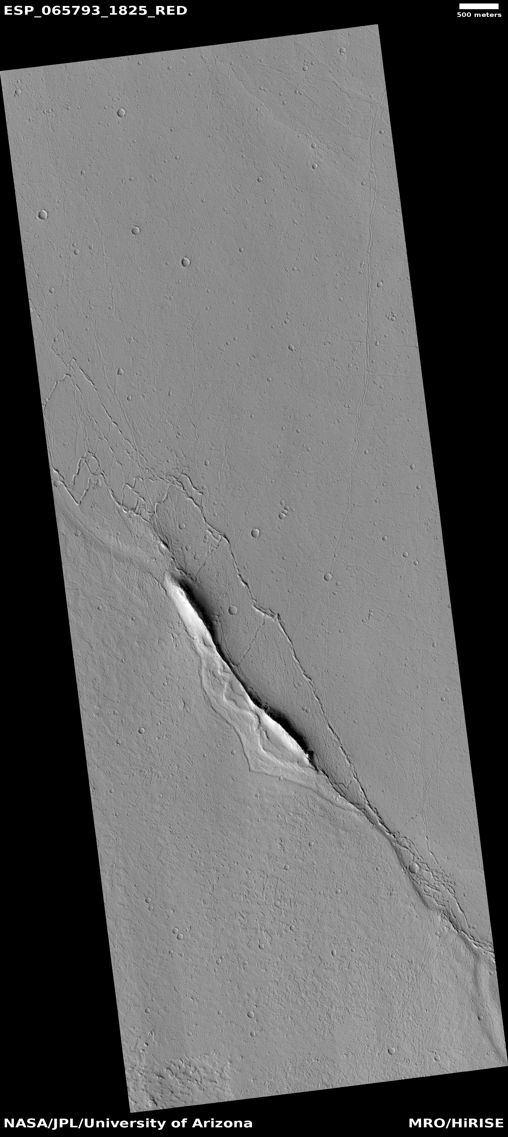
Cool image time! The photo to the right, rotated, cropped, and reduced to post here, was taken on August 9, 2020 by the high resolution camera on Mars Reconnaissance Orbiter (MRO) and was featured today as this camera’s picture of the day. As today’s caption notes:

This observation focuses a ridge that is standing above the old lava surface of the floor of Echus Chasma. What is this ridge doing here? Is it preexisting material surrounded by lava? Is it material pushed up at a restraining bend? If the ridge is not lava, it may have colorful flanks.

The overview map below shows that this location in Echus Chasma is even more interesting, as some scientists believe it once also held a large lake.
» Read more

2 comments

Mars: Are these eroding glaciers or impacts in lava?

Eroding lava or glaciers?
Click for original image.

Cool image time and a mystery! The photo to the right, cropped to post here, was taken on March 29, 2022 by the high resolution camera on Mars Reconnaissance Orbiter (MRO) of an 18-mile-wide crater in the southern cratered highlands of Mars. The full picture, dubbed “Steep Cliff,” was taken apparently to get a good view of the crater’s northern rim. The rim’s steepness suggests that the floor of the crater is significantly filled.

More intriguing however are the scattering of strange depressions about six miles south of the rim. What caused them? The crater’s location is in a part of Mars where it is not unusual to find both glacial features as well as flood plain lava. In fact, the crater’s northeast and southwest rims appear to have been buried by what appears to be flood lava. The northern rim’s shallowness also suggests the crater is well filled with flood lava.

However, the crater is also at 38 degrees south latitude, a latitude where planetary scientists have found lots of glacial features. Much of this crater fill could be glacial.

The overview map below illustrates this mystery.
» Read more

1 comment

Dry flows on Mars?

Flows in Orson Welles Crater
Click for original image.

Cool image time! The picture to the right, rotated, cropped, reduced, and annotated to post here, was taken on September 21, 2021 by the high resolution camera on Mars Reconnaissance Orbiter (MRO) and shows what appear to be a variety of flows, from alluvial fill to slope streaks to dust coming down the southeastern interior rim of 77-mile-wide Orson Welles Crater on Mars.

The location is almost right on the equator, so none of these flows are ice- or water-related. Nor are such flows unusual in the meandering 800-mile-long canyon that cuts through Orson Wells crater, dubbed Shalbatana Vallis. I featured similar flows at a spot to the north and downstream from this one in May 2021, also on the canyon’s eastern rim.

The overview map below provides some context.
» Read more

0 comments

Perseverance’s upcoming travel plans

Overview map
Click for interactive map.

Today’s update from the Perseverance’s science team provided a rough outline of their travel and drill-sampling plans for the Mars rover in Jezero Crater as it begins its climb up onto the delta that once poured into the crater. The route they plan to travel initially is dubbed Hawksbill Gap.

At Hawksbill Gap, however, we may instead carry out the first portion of the sampling sol path (which includes abrasion and collecting observations using our proximity science instruments) at up to 5 locations along our ascent. After that, weโ€™ll turn around and begin a descent back down Hawksbill Gap and collect rock core samples at 3 of our abrasion locations.

This modified sampling strategy is intended to provide the team with valuable contextual information as we climb Hawksbill Gap and interpret the delta stratigraphy around us. With proximity science data in-hand, we can down-select our sampling sites to ensure weโ€™ll be collecting the most scientifically valuable cores along our descent. Of course, we still maintain the option of collecting sample cores at any point during our ascent, if the team decides a particular abrasion site warrants immediate sampling.

The map above shows my guess (the red dotted lines) as to their potential routes uphill. As the science team has so far not published a map indicating exactly where Hawksbill Gap is, I can only guess at this point. The blue dot indicates Perseverance’s present position, the green dot Ingenuity.

As for the helicopter, there is no word yet whether the engineers have successfully gotten its batteries back to full charge. Until then, it cannot fly, and is also at risk of freezing up in the cold Martian winter.

0 comments
1 44 45 46 47 48 128