Sand dunes inside the Martian north polar icecap
Click for original image.
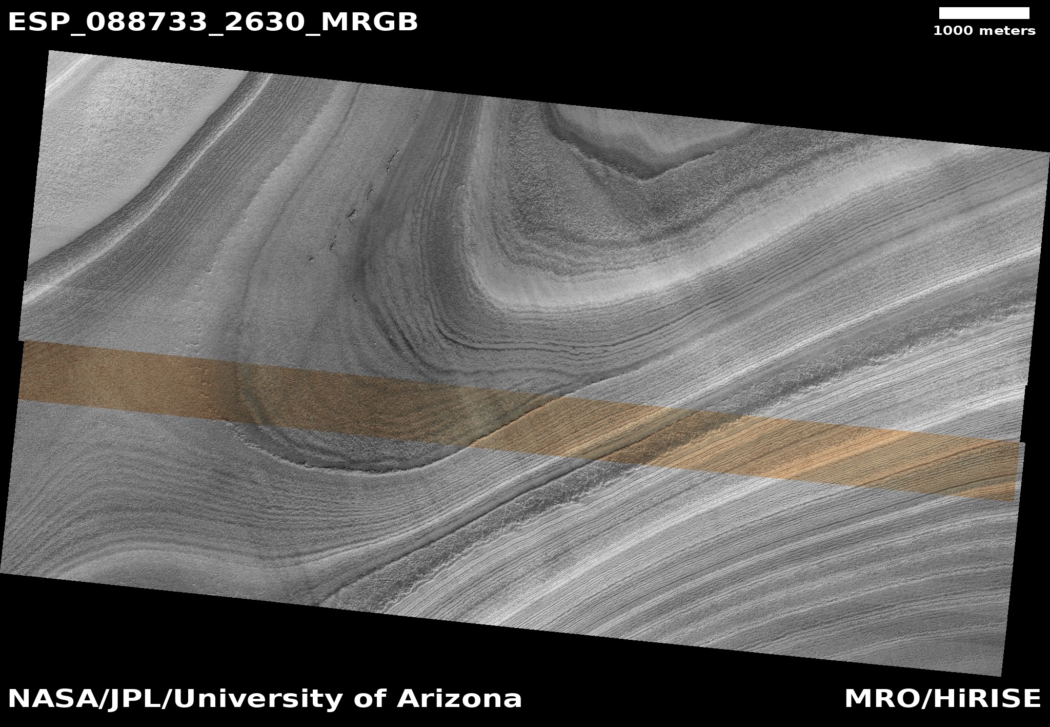
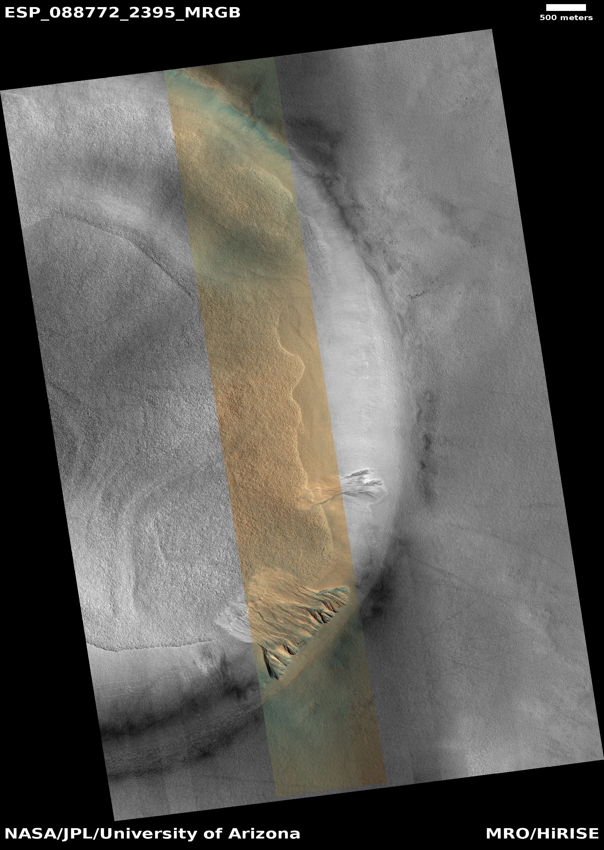
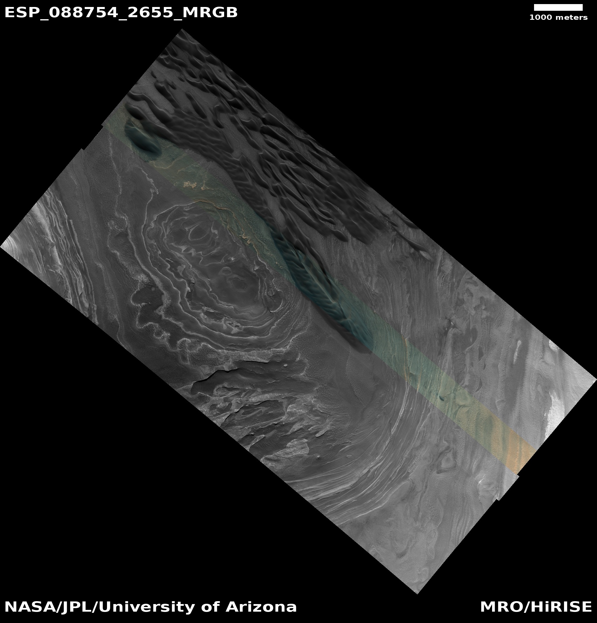
Today’s cool image returns to the Martian north pole. The picture to the right, rotated, cropped, reduced, and enhanced to post here, was taken on July 3, 2025 by the high resolution camera on Mars Reconnaissance Orbiter (MRO). It shows the top of a ridge near the edge of that icecap, with dunes visible in the hollow several thousand feet below.
The angle of this picture does not show us the many layers on the cliff leading down to those dunes. It does show evidence, however, of the top few layers on the flat crest of that ridge. The white lines delineate those layers, each line marking the edge of a series of wide terraces.
The dunes in the canyon below are of interest because their source is likely the dust that is mixed into thick icecap’s ice. As that ice sublimates away on the face of the cliff, the dust falls into the canyon, where it is trapped.
» Read more