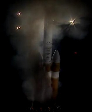
“Damaged cable” causes Russians to delay Progress launch

Because of the discovery of a “damaged cable” on a Progress freighter, the Russians have delayed its launch from December 1 to December 6.

On the morning of November 25, Roskosmos announced that issues had been found during the preparations of Progress MS-13 for launch. “Problems are now resolved and the checks of onboard systems are ongoing,” the State Corporation said. “There will be a separate announcement on the launch date…” the announcement said, hinting that the planned December 1 launch window was no longer valid. Before the end of the work day in Moscow on November 25, Roskosmos posted an update announcing that the launch of Progress MS-13 had been rescheduled for December 6, 2019, at 12:34 Moscow Time, due to an issue with an onboard cable found by specialists from RKK Energia. The problem was resolved after the replacement of the cable, the company said. According to a posting on the online forum of the Novosti Kosmonavtiki magazine, specialists spent past two days trying to find a source of electric charge on the body of the spacecraft and then discovered a damaged cable in the vehicle’s instrument compartment. [emphasis mine]

Considering the drillhole found in an earlier Soyuz capsule, I cannot help wondering if this damage was intentional. The Russians never revealed if they had identified the culprit of that earlier damage, and the reports from Russia today are somewhat vague about this new damage.

This Progress launch had earlier been rescheduled from December 6 to avoid a conflict with the launch of a Dragon cargo capsule. There is no word yet on how that conflict will be mitigated now that the launch is back on that date.

Home destroyed by Long March 3B 1st stage

It appears from a number of twitter-type sources coming from China that the spent first stage of the Long March 3B rocket that successfully launched two GPS-type satellites this weekend crashed onto a house, destroying it.

Video footage emerged on Chinese social media shortly after launch showing the apparent destruction of a rural building. Flames are seen within the building along with fumes from residual propellant rising from the booster wreckage.

…The first stage and four side boosters of the Long March 3B use a toxic hypergolic propellant combination of hydrazine and nitrogen tetroxide.

There have so far been no state media reports on the incident. The footage and social media comments suggest the owners returned home following standard evacuation ahead of launch.

According to other such reports, the home-owners will be compensated, but this is not confirmed.

Regardless, because of China’s effort to increase its launch rate, launches coming from its inland spaceports are either going to develop controlled landing for the expendable stages or will cease. The damage both to their own citizens as well as the bad press these crashes garner are aspects that the Chinese government will want to avoid, with the bad press likely its greater concern.

Mars Express confirms ancient glaciers in northern Martian mid-latitudes

Perspective view of Deuteronilus Mensae
Click for full image.

The European Space Agency’s orbiter Mars Express has confirmed the presence of large fractured ice sheets suggestive of buried and ancient glaciers. These ice sheets are within one region on Mars located in the mid-latitudes where many such glacial features have been found. They are also in the transition zone between the northern lowlands and the southern highlands.

This landscape shows clear and widespread signs of significant, lasting erosion. As is common with fretted terrain, it contains a mix of cliffs, canyons, scarps, steep-sided and flat-topped mounds (mesa), furrows, fractured ridges and more, a selection of which can be seen dotted across the frame.

These features were created as flowing material dissected the area, cutting through the existing landscape and carving out a web of winding channels. In the case of Deuteronilus Mensae, flowing ice is the most likely culprit. Scientists believe that this terrain has experienced extensive past glacial activity across numerous martian epochs.

It is thought that glaciers slowly but surely ate away at the plains and plateaus that once covered this region, leaving only a scattering of steep, flat, isolated mounds of rock in their wake.

Smooth deposits cover the floor itself, some marked with flow patterns from material slowly moving downhill – a mix of ice and accumulated debris that came together to form and feed viscous, moving flows of mass somewhat akin to a landslide or mudflow here on Earth.

Studies of this region by NASA’s Mars Reconnaissance Orbiter [MRO] have shown that most of the features seen here do indeed contain high levels of water ice. Estimates place the ice content of some glacial features in the region at up to 90%. This suggests that, rather than hosting individual or occasional icy pockets and glaciers, Deuteronilus Mensae may actually represent the remnants of an old regional ice sheet. This ice sheet may once have covered the entire area, lying atop the plateaus and plains. As the martian climate changed this ice began to shift around and disappear, slowly revealing the rock beneath.

Overall, the data coming from both Mars Express and MRO increasingly suggests that there is a lot of buried glacial ice in the mid-latitudes. Mars might be a desert, but it is increasingly beginning to look like much of the planet is a desert like Antarctica, not the Sahara.

Chang’e-4 and Yutu-2 begin 12th lunar day

Chinese engineers have reactivated both their lunar lander, Chang’e-4, and its rover, Yutu-2, for their twelve lunar day on the far side of the Moon.

The lander woke up at 5:03 p.m. Thursday (Beijing Time), and the rover, Yutu-2 (Jade Rabbit-2), awoke at 0:51 a.m. the same day. Both are in normal working order, according to the Lunar Exploration and Space Program Center of the China National Space Administration.

No word on where Yutu-2 will be sent over then next two weeks.

Posting was light during the day today because Diane and I were on a hike that I needed to do for the upcoming planned second edition of my hiking guidebook, Circuit Hikes of Southern Arizona. My boss (me) allowed me to go, since this hike was not pure pleasure, but reconnaissance for one of my books.

A house in the forest

An evening pause: They call this an off-grid house, but that really isn’t true. Though he isn’t linked to either an electric or water utility, pay close attention to the amount of technology he uses to make the house and living there functional and practical.

Nonetheless, it is fascinating and educational to see some of the tricks that people will do to live as they wish.

Hat tip Cotour.

Mid-latitude Martian glacier?

Glacier on Mars?
Click for full image.

Cool image time! I have posted a lot of Mars photographs in the past few months showing possible glaciers in the mid-latitudes of Mars, where scientists think they have identified a lot of such features. Today is another, but unlike many of the previous examples, this particular feature more closely resembles a typical Earth glacier than almost any I have so far posted.

Based on the image’s title, “Lineated Valley Fill in Northern Mid-Latitudes,” given by the science team for the high resolution camera on Mars Reconnaissance Orbiter (MRO), I suspect that it remains unproven that these are features of buried glacial ice. Thus, they use a more vague descriptive term, lineated, to avoid pre-judging what these features are.

Nonetheless, a glacier is sure what this lineated valley fill looks like. See for example the Concordia confluence of two glaciers in the Karakoram Mountains of Pakistan, near the world’s second highest mountain, K2. Though obviously not the same, you can see many similarities between this Martian feature and Concordia.

MRO has taken only three photographs of this particular valley, with one image useless because it was taken during a dust storm. Yet, the other good image, farther downstream in this valley, shows very similar features.

The valley itself is formed from chaos terrain, located in the transition zone between the southern cratered highlands and the flat northern lowlands where a possible intermittent ocean might have once existed. Thus, for buried ice to be here is quite possible.

Unearthly pit in Martian northern icecap

Giant pit in Martian North polar icecap
Click for full image.

Cool image time! It is spring in the Martian north, and thus the Sun has risen and remains in the sky for most if not all of each day, circling the horizon. As such, it illuminates polar icecap features that are strange and weird and hard to decipher based on our expectations here on Earth.

The photograph to the right, cropped and reduced to post here, is a good example. It was taken on September 20, 2019 by the high resolution camera on Mars Reconnaissance Orbiter (MRO), and shows a pit in the outer regions of the polar icecap, an area where that water icecap remains relatively stable, but that is also at a low enough latitude that summer sunlight can cause some erosion and sublimation of the ice.

The bottom of the pit is the center of the bullseye, with the layered features in the surrounding walls showing the many layers inside the icecap, built up over centuries, then slowly revealed as the ice in this pit slowly sublimated away.

You can get a better sense of what you are looking at by the overview map below.
» Read more

ULA backing off from reuseablity and Vulcan upgrades?

Capitalism in space: According to this Space News story today, it appears that ULA is shifting away from building a major upgrade to the upper stage of its Vulcan rocket, even as it also appears to be backing off from pushing plans to recover and reuse its first stage engines.

ULA spokeswoman Jessica Rye told SpaceNews by email that the company still plans to introduce an “advanced upper stage,” but only after Vulcan flies. Rye also declined to provide a specific timeline.

Similarly, ULA officials also refused to give a timeline for when they will begin recovering Vulcan’s first stage engines and reusing them.

Right now the company expects to launch the first iteration of Vulcan, using as Atlas 5 Centaur upper stage, sometime in 2021. It also appears that those first launches will not recover the first stage Blue Origin BE-4 engines.

In the long run, I do not see how ULA can compete. They certainly appear hesitant about introducing any new innovations or upgrades to Vulcan, which will result in an expendable rocket that costs far too much.

In fact, the arrival of this apparent timidity seems to have occurred almost to the day the company accepted a development contract for Vulcan from the Air Force. Thus, it increasingly appears that it is our federal government that is squelching the company’s creativity.

Why am I not surprised?

SpaceX ‘s decision to slash prices/provide reliable launch schedule upends smallsat industry

Capitalism in space: Apparently SpaceX’s decision in August to further slash its launch prices for smallsats while also establishing a regular launch schedule is causing major shifts in that industry.

From the first link::

The revamped smallsat rideshare program, the company announced late Aug. 28, will provide launch opportunities at least once per month starting in March 2020, at a cost of $1 million for a 200-kilogram smallsat.

From the second link:

With the new SpaceX price list, the cost of reaching low Earth orbit falls so dramatically “you should select the cheapest launcher even if it does not go exactly where you need it and then use propulsion to go where you need to be,” Henri said. “From a total system cost standpoint, that will make the most sense.”

This situation is comparable to the shifts that occurred in the ship business when its technology changed from sails to engines. Sailing ships generally did not sail on a schedule. Instead, they sat at port until they filled their cargo holds, then waited for favorable weather before sailing. Customers could only wait.

Once ships were powered this all changed. Ship companies established firm schedules so customers knew exactly when their cargo would ship. This also led to a reduction in the price of shipping.

SpaceX’s ability to reuse its first stage often and quickly is now allowing them to treat the Falcon 9 rocket more like a powered ship rather than a sailing ship. Rather than only launching when they’ve filled their cargo capacity, they can afford to launch on a regular and reliable schedule, allowing customers to jump on board at their own convenience.

India confirms details of Vikram’s crash on Moon

India’s government has finally officially admitted that its Vikram lunar lander crashed in September.

In a written answer to a question posed to the Department of Space in Lok Sabha, Minister of State in the Prime Minister’s Office (PMO) Jitendra Singh said the “reduction in velocity” of the Vikram lander during the final phase of its descent on the moon’s surface “was more than the designed value”. As a result, Vikram “hard-landed” on the moon “within 500 metres of the designated landing site”, he said.

…“The first phase of descent was performed nominally from an altitude of 30 km to 7.4 km above the moon surface. The velocity was reduced from 1,683 m/s to 146 m/s. During the second phase of descent, the reduction in velocity was more than the designed value. Due to this deviation, the initial conditions at the start of the fine braking phase (final phase below 7.4 km altitude) were beyond the designed parameters. As a result, Vikram hard-landed within 500 m of the designated landing site,” the minister said in a written answer in the Lok Sabha.

Except for the detail that they think Vikram landed within 500 meters of its planned landing site, this answer really doesn’t tell us much new. It was very obvious during the landing that the spacecraft was traveling too fast as it began its final braking phase, and that it then descended much too fast thereafter.

In fact, the couched language and the unwillingness so far of ISRO, India’s space agency, to provide a detailed report on the failure does not reflect well on them. This kind of cutting edge engineering requires a hard kind of intellectual honesty. They have so far not shown that kind of honesty in their response to this failure.

Explosion during Starship tank tests

During tests today of SpaceX’s Starship Mk1 test prototype there was a sudden explosion, damaging the spacecraft. Below is a clip from today’s live stream showing the explosion.

They had been doing a variety of tank and venting tests for the past day. (The link includes a video showing the first pressurization test yesterday.)

The Mk1 (Mark 1) was being built with an initial hoped-for schedule targeting the first orbital flights by next year. No one took that seriously, and today’s incident reinforces that skepticism. At the same time, SpaceX has routinely recovered very quickly from its engineering test failures, treating them as opportunities for improving their designs. It is for this reason that most knowledgeable observers of the company also expected any delays to that target schedule to never be very extended.

Moreover, earlier this week SpaceX revealed that it had already decided not to fly this version and proceed to their next version. A Mk2 version is being built in Florida, so in Boca Chica they will proceed to the Mk3, with the goal to get to build toward the final operational version, what Musk labeled the Mk5. Based on past SpaceX policy, however, expect them to begin commercial flights with the earlier versions as they upgrade to the Mk5.

UPDATE: It appears the explosion occurred during a maximum pressurization test, which means they now have data telling them the limits of their tank design.

Sierra Nevada updates Dream Chaser status, names its cargo module

Capitalism in space: In providing a detailed update in the construction of its reusable Dream Chaser mini-shuttle, Sierra Nevada yesterday revealed that it has named the small expendable cargo module that it will be attached to its Dream Chaser “Shooting Star.”

As part of Dream Chaser’s overall design, the vehicle itself does not contain the berthing port or solar arrays needed for it to perform its mission. Instead, those elements are mounted on what had been, before today, referred to as the cargo module – an element of Dream Chaser that now has a dedicated name: Shooting Star.

The name is a nod to the fact that it is the only part of Dream Chaser that is disposable and will burn up in the atmosphere as a streaking ball of fire – just like a shooting star.

The module itself, while containing the solar arrays and main propulsion elements for orbital maneuvering, will also be capable of transporting a large amount of internal cargo to the Station. It is also the part of Dream Chaser on which external cargo can be mounted for delivery and disposal of external elements that are no longer needed for the orbital outpost.

The article provides many details about the status of Dream Chaser that are worth reading, including noting its other potential uses beyond supplying ISS with cargo.

Blue Origin wins protest against Air Force

Capitalism in space: The Government Accountability Office (GAO) has sustained Blue Origin’s protest against the Air Force’s launch procurement rules that would have limited bidding on all launch contracts for the first half of the 2020s to only two companies.

In a “pre-award” protest, Blue Origin challenged the terms of a request for proposals (RFP) issued by the Air Force earlier this year for the National Security Space Launch (NSSL) Phase 2 Launch Service Procurement, which aims to award two contracts next year expected to cover 30 or more medium- and heavy-lift satellite launches the Air Force plans to conduct between 2022 and 2026.

Blue Origin, owned by Amazon.com founder Jeff Bezos, is one of four companies that submitted bids for the contracts by the Air Force’s Aug. 1 proposal deadline. The other three companies bidding for the contracts are Northrop Grumman and incumbents United Launch Alliance and SpaceX.

After submitting its bid, Blue Origin filed a formal protest with the GAO arguing that several terms of the RFP unduly restrict competition, are ambiguous, or are inconsistent with customary commercial practice.

The GAO agreed.“GAO sustained the protest, finding that the RFP’s basis for award is inconsistent with applicable procurement law and regulation, and otherwise unreasonable,” Patton said in the statement.

The Air Force’s plan here never made any sense at all. Why put a limit now on the companies that can bid on launches as far in the future as 2026? Why not instead allow all the launch companies, already certified by the Air Force, to bid when the time comes, thus increasing competition while providing the Air Force the most options?

This is good news for the entire American launch industry. It means they will all have the Air Force as a potential customer. It is also good news for the taxpayer, as the competition for business will certainly drive innovation and the lowering of launch prices.

NASA expands list of companies certified to bid on lunar launch/payload contracts

Capitalism in space: NASA today announced that it is expanding the list of companies eligible to bid on lunar launch/payload contracts from 9 to 14.

From the NASA press release:

NASA has added five American companies to the pool of vendors that will be eligible to bid on proposals to provide deliveries to the surface of the Moon through the agency’s Commercial Lunar Payload Services (CLPS) initiative.

The additions, which increase the list of CLPS participants on contract to 14, expand NASA’s work with U.S. industry to build a strong marketplace to deliver payloads between Earth and the Moon and broaden the network of partnerships that will enable the first woman and next man to set foot on the Moon by 2024 as part of the agency’s Artemis program.

…These five companies, together with nine companies selected in November 2018, now are eligible to bid on launch and delivery services to the lunar surface. [emphasis mine]

The added companies are SpaceX, Blue Origin, Ceres Robotics, Sierra Nevada, Tyvak Nano-Satellite Systems.

I have highlighted the most important word in this press release, which is most interestingly buried to make it as little noticed as possible. The addition of SpaceX to this list and the mention that the program has now added the ability to for the companies to bid on launch contracts means that NASA’s goal here is to create a situation where it can replace SLS with a bidded contract to private industry that will costs far less and can launch frequently and on time, features that SLS is completely incapable of, and SpaceX can provide easily and reliably. This analysis by me is further reinforced in that Boeing, the builder of SLS, was not included in this list, even though only last week that company offered SLS to NASA in a wider array of launch configurations, for exactly this purpose.

If NASA had made this fact too obvious it might upset certain people in Congress (I’m talking to you Richard Shelby R-Alabama) who are wedded to SLS and its wasteful pork spending in their home states and districts.

The fact remains however that eventually SLS is going to go away. The Trump administration appears very wedded to its Artemis program to get back to the Moon by 2024, and it is apparently discovering that to make that landing happen the administration needs better alternatives.

Sinkholes galore!

Sinkholes galore south of Olympus Mons
Click for full image.

Cool image time! The photograph to the left, cropped to post here, was part of the November image dump from the high resolution camera on Mars Reconnaissance Orbiter (MRO). It shows a wind-swept dusty plain trending downhill to the west that is filled with more than a hundred depressions or sinkholes.

Unlike other pit images I have posted previously, this one is not focused on one particular pit or a string of pits. Instead, what makes it interesting is the large number of pits, scattered across the terrain in a random pattern. Their random distribution suggests that they are unrelated to any specific underground feature, such as a lava tube. Instead, some aspect of the underground geology here is causing the ground to sink at random points.

Below is an overview map showing where this dusty pit-strewn plain is located, indicated by the blue cross.
» Read more

Lunar Reconnaissance Orbiter locates crashed Chinese orbiter

Before and after images showing Longjiang-2 impact site

Lunar Reconnaissance Orbiter (LRO) has located the Chinese microsat lunar orbiter Longjiang-2, which was sent to impact the Moon in August 2019 after it completed its technology demonstration mission.

The image above shows the before and after of the location, with the satellite’s remains visible as indicated by the arrow.

Through a careful comparison of pre-existing NAC images, the LROC team was able to locate a new impact crater (16.6956°N, 159.5170°E, ±10 meters), a distance of only 328 meters from the estimated site! The crater is 4 meters by 5 meters in diameter, with the long axis oriented southwest to northeast. Based on proximity to estimated crash coordinates and the crater size, we are fairly confident that this new crater formed as a result of the Longjiang-2 impact.

The picture of the impact site might not be very impressive, but remember, this satellite only weighed about a hundred pounds. The engineering however is impressive, on all counts. First, the Chinese built a tiny cubesat that reached lunar orbit and operated there for more than a year, during which it even took a picture of the Earth. Second, the engineering team of LRO was able to find this tiny impact site for such small spacecraft in less than four months.

Recent impact on Mars

Recent impact on Mars
Click for full image.

Cool image time! While finding recent impacts on Mars is not that unusual, the image to the right, found among the November image download from the high resolution camera on Mars Reconnaissance Orbiter (MRO), was dramatic enough that I decided that more people besides planetary scientists should see it. For scale the photograph is exactly 500 meters wide.

The photograph, taken September 26, 2019, also illustrates all the typical aspects of impact craters, and how they change the landscape.

This impact took place sometime between July 17, 2012 and January 4, 2018. We know this because it wasn’t there in a low-resolution image taken by the wide angle survey camera on MRO on the first date but was there when that same camera took another picture on the second date. Below is a side-by-side comparison of that July 17, 2012 image with the high resolution 2019 image above.
» Read more

First global geologic map of Titan

Global geologic map of Titan
Click for full image.

Planetary scientists today released the first global geologic map of the Saturn moon Titan. The image on the right is a reduced version of the full image.

In the annotated figure, the map is labeled with several of the named surface features. Also located is the landing site of the European Space Agency’s (ESA) Huygens Probe, part of NASA’s Cassini mission.

The map legend colors represent the broad types of geologic units found on Titan: plains (broad, relatively flat regions), labyrinth (tectonically disrupted regions often containing fluvial channels), hummocky (hilly, with some mountains), dunes (mostly linear dunes, produced by winds in Titan’s atmosphere), craters (formed by impacts) and lakes (regions now or previously filled with liquid methane or ethane).

To put it mildly, there is a lot of uncertainty here. Nonetheless, this is a first attempt, and it shows us that the distribution of these features is not homogeneous. The dunes favor the equatorial regions, the lakes the polar regions. Also, the small number of craters could be a feature of erosion processes from the planet’s active atmosphere, or simply be because Cassini’s radar data did not have the resolution to see smaller craters. I suspect the former.

Indonesia to building rocket and spaceport

The new colonial movement: Officials from Indonesia’s space agency, LAPAN, today revealed that they picked a location for a new larger spaceport, and will use it to test their own home-grown rocket.

Indonesia plans to construct its first spaceport in Biak, Papua, to serve the country’s rocket test launches, the country’s National Institute of Aeronautics and Space (LAPAN) has confirmed.

LAPAN flight and aerospace study centre head Robertus Heru Trijahyanto said Indonesia will build the spaceport following LAPAN’s existing rocket launch site in South Garut on West Java. However, it will be bigger so that it can be used for larger test launches.

The article mentions that they will get help from international partners, but provides little detail.

Second Kuaizhou-1A launch in less than a week

The new colonial movement: China today successfully completed its second Kuaizhou-1A launch in four days, placing two communications satellites into orbit.

In just a little more than a four day period, from the very same pad, with the very same launch team and launch truck, China has launched yet another Kuaizhou-1A rocket carrying satellites into orbit.

…The Kuaizhou-1A is a 4 stage, mostly solid fuel powered launch vehicle developed by China Aerospace Science and Technology Corporation (CASIC) and commercialized by the China Space Sanjiang Group Corporation (also known as Expace Corporation).

Promoted by CASIC as being high reliability, high precision and low cost, the launch vehicle can send a 200 kg payload into a 700 km altitude sun-synchronous orbit. The vehicle is possibly based on the road-mobile DF-21 missile, with two additional solid fuel upper stages and a re-startable liquid fuel upper stage. It was designed with the goal to provide an easy to operate quick-reaction launch vehicle, that can remain in storage for long periods and to provide launch missions on short notice.

The leaders in the 2019 launch race:

25 China
17 Russia
11 SpaceX
6 Europe (Arianespace)

In the national rankings, China widened its lead over the U.S. to 25 to 23.

Islands of ice on Mars and Pluto

Ice-filled craters near Martian south pole

In a paper published today in the Journal of Geophysical Research: Planets, scientists describe the identification of 31 ice-filled craters in the high southern latitudes of Mars. The map to the right, from their paper, shows the locations of these craters. The scientists also took a look at Pluto, and found five craters there that had similar features, though these were likely filled with frozen nitrogen, not water ice.

From their abstract:

These new 31 ice deposits represent an inventory of more than 10 trillion cubic meters of solid water, similar to but greater in number and volume than previously studied features near the north pole. Similar features of nitrogen ice may exist in craters on Pluto, suggesting that craters are a favorable location for the accumulation or preservation of ices throughout the Solar System. [emphasis mine]

These results are reinforced by the existence of glacial features found in numerous Martian craters at much lower latitudes, as well as the ice suspected to exist in the permanently shadowed craters on the Moon and Mercury. The processes that put the ice there on these different planets might be fundamentally different, but the results are the same: Ice accumulating within craters.

One aspect of these high latitude craters that remains somewhat unexplained is their asymmetrical distribution around the south pole, favoring the side of the planet south of Mars’ giant volcanoes. Moreover, in looking at the ice deposits within these craters the scientists found that the ice seemed to lie off-center within the craters, favoring a similar direction.

Based on the available data, the scientists theorize that the most likely cause of this asymmetric off-center pattern is wind. From their paper:

Basic physical arguments, mesoscale atmospheric models, and geomorphological observations predict deflection of winds emanating from the south pole by the Coriolis Force. Such deflection results in a general westward trend of winds (i.e., easterlies) in the south polar regions outside the [south pole cap], matching the [ice-filled crater] offsets we observe.

This correlation implies that wind is important in … formation and/or evolution [of craters with ice]. For the case where winds control [their] formation, katabatic winds may travel down the east side of crater walls and preferentially deposit ice on the west side of the crater via orographic precipitation as they flow up the west crater wall. This mechanism thus favors local accumulation of ice within craters.

I find it fascinating that the location of ice within craters on Mars might indirectly provide scientists with information about the planet’s global weather patterns. This unexpected connection highlights the need to dismiss no data or feature in trying to understand planetary formation. Unlikely things might answer our questions.

Inspector general slams NASA’s management for bonus payments to Boeing

In a report [pdf] issued yesterday, NASA’s inspector general blasted the agency’s manned commercial space management for issuing a $287 million bonus payment to Boeing to help it avoid delays in developing its Starliner capsule — which would have caused gaps in future American flights to ISS — even though the cost to use Russian Soyuz capsules would have been far less.

Worse, the agency never even allowed SpaceX to make its own competitive offer.

NASA agreed to pay Boeing Co (BA.N) a $287 million premium for “additional flexibilities” to accelerate production of the company’s Starliner crew vehicle and avoid an 18-month gap in flights to the International Space Station. NASA’s inspector general called it an “unreasonable” boost to Boeing’s fixed-priced $4.2 billion dollar contract.

Instead, the inspector general said the space agency could have saved $144 million by making “simple changes” to Starliner’s planned launch schedule, including buying additional seats from Russia’s space agency, which the United States has been reliant on since the 2011 retirement of its space shuttle program.

…NASA justified the additional funds to avoid a gap in space station operations. But SpaceX, the other provider, “was not provided an opportunity to propose a solution, even though the company previously offered shorter production lead times than Boeing,” the report said. [emphasis mine]

I’ve read the report, and from it the impression is clear that when NASA management discovered that Boeing was facing delays in Starliner and needed extra cash, it decided to funnel that cash to it, irrespective of cost. While it is likely that the agency did so because it did not wish to buy more Russian Soyuz seats, it makes no sense that it didn’t ask SpaceX for its own competitive bid. By not doing so the management’s foolish bias towards Boeing is starkly illustrated

Eric Berger at Ars Technica also notes that the report makes clear how Boeing’s prices for Starliner are 60% higher than SpaceX’s Crew Dragon prices, further illustrating how the agency favors Boeing over SpaceX.

Boeing’s per-seat price already seemed like it would cost more than SpaceX. The company has received a total of $4.82 billion from NASA over the lifetime of the commercial crew program, compared to $3.14 billion for SpaceX. However, for the first time the government has published a per-seat price: $90 million for Starliner and $55 million for Dragon. Each capsule is expected to carry four astronauts to the space station during a nominal mission.

What is notable about Boeing’s price is that it is also higher than what NASA has paid the Russian space corporation, Roscosmos, for Soyuz spacecraft seats to fly US and partner-nation astronauts to the space station. Overall, NASA paid Russia an average cost per seat of $55.4 million for the 70 completed and planned missions from 2006 through 2020. Since 2017, NASA has paid an average of $79.7 million.

I don’t have a problem with NASA favoring Boeing over Russia, considering the national priorities. I can also understand the agency’s willingness to keep buying some Starliner seats in order to guarantee an American launch redundancy. However, giving Boeing even more money to keep its schedule going, when SpaceX is available to fill the gaps, demonstrates the corruption in the agency’s management. They haven’t the slightest understanding of how private enterprise and competition works.

The report is also filled with the same tiresome complaints about the on-going delays to the manned commercial program, focusing greatly on past technical issues (now mostly solved) while hiding in obscure language how it is NASA’s paperwork that is likely to cause all further delays.

A journey into the depths of Valles Marineris

Valles Marineris

Cool image time! Rather than start with the cool image, let’s begin with the long view. To the right is a wide mosaic of Valles Marineris on Mars, the largest known canyon in the solar system. About 2,500 miles long and 400 miles wide, this canyon is so large that it would cover most of the United States if put on Earth. The Grand Canyon, 500 miles long by 19 miles wide, could easily fit within it and not be noticed. In depth Valles Marineris is equally impressive, with a depth of more than four miles, about four times deeper than the Grand Canyon.

A closer view of the central regions of Valles Marineris

The white cross in the mosaic above is where we are heading. You can see it as the white box in the zoomed in overview to the right. This central part of Valles Marineris is named East Melas Chasma, and the red boxes indicate locations where the high resolution camera of Mars Reconnaissance Orbiter (MRO) has already taken images.

As you can see, we do not yet have many high resolution images of this part of the canyon floor. The white box is the most recent image, and is the subject of today’s post.
» Read more

Celebrating Apollo 12

The Apollo 12 landing site on the Moon
Click for the full resolution image.

Fifty years ago today Apollo 12 was launched, landing on the Moon several days later to become the second manned mission to land on another world.

To celebrate that achievement, let’s review a few of the mission’s high points. The image to the right, cropped and reduced to post here, shows that landing site, the lunar module Intrepid, the various tracks for the two moon-walks Pete Conrad and Alan Bean took, and the unmanned Surveyor-3 probe. The image was taken by Lunar Reconnaissance Orbiter late in 2011 and released to the public in 2012. To really see some detail you will look at the full resolution version by clicking on the image. Or you can explore the landing even more thoroughly at the original release site.

First, there was Pete Conrad’s point blank landing. They wanted to land close enough to Surveyor 3 so that the two astronauts would be able to walk over to it during a spacewalk. He did this perfectly, bringing Intrepid down only 600 feet away. They were thus able to recover the probe’s scoop, camera, television cable, and other assorted parts. Once back on Earth the big discovery was that a single bacterium, Streptococcus mitis, had survived the journey from Earth and was still alive upon its return. Scientists theorized its survival occurred because prior to launch it had been freeze-dried during prelaunch vacuum tests.

Second, there were Pete Conrads’s first words upon stepping off the lunar module. As the third man to walk on the Moon and also one of the shortest Apollo astronauts, he won a bet with a French reporter, who did not believe he had the freedom to say whatever he wanted as his first words, by saying, “Whoopee! Man, that may have been a small step for Neal, but it’s a long one for me!”

Third, the astronauts installed the second seismometer on the Moon, which functioned for eight years.

Fourth, they brought back 75 pounds of material, which showed that while the Ocean of Storms was a mare lava field like the Sea of Tranquility, it had formed 500 million years more recently.

Fifth and most important, Apollo 12 proved that the Apollo 11 landing was not a fluke, that the engineering behind the Saturn 5 rocket, the Apollo capsule, and the lunar module, was sound. With courage and determination and a little clever re-engineering, those vehicles had been capable of taking humans anyway in the solar system. It is a shame we never took advantage of that possibility.

Hat tip to Mike Nelson for reminding me to post this.

Upcoming big satellite constellations vex and worry astronomers

Astronomers are expressing increasing distress over the possible negative consequences to their Earth-based telescope observations from the several new giant satellite constellations being launched by SpaceX and others.

[M]any astronomers worry that such ‘megaconstellations’ — which are also planned by other companies that could launch tens of thousands of satellites in the coming years — might interfere with crucial observations of the Universe. They fear that megaconstellations could disrupt radio frequencies used for astronomical observation, create bright streaks in the night sky and increase congestion in orbit, raising the risk of collisions.

The Nature article then details the issues faced by some specific telescopes. Hidden within the article however was this interesting tidbit that admitted the problem for many telescopes is really not significant.

Within the next year or so, SpaceX plans to launch an initial set of 1,584 Starlink satellites into 550-kilometre-high orbits. At a site like Cerro Tololo, Chile, which hosts several major telescopes, six to nine of these satellites would be visible for about an hour before dark and after dawn each night, Seitzer has calculated.

Most telescopes can deal with that, says Olivier Hainaut, an astronomer at the European Southern Observatory (ESO) in Garching, Germany. Even if more companies launch megaconstellations, many astronomers might still be okay, he says. Hainaut has calculated that if 27,000 new satellites are launched, then ESO’s telescopes in Chile would lose about 0.8% of their long-exposure observing time near dusk and dawn. “Normally, we don’t do long exposures during twilight,” he says. “We are pretty sure it won’t be a problem for us.” [emphasis mine]

The article then proceeds with its Chicken-Little spin as if the astronomical world is about to end if something is not done to stop or more tightly control these new satellite constellations.

As indicated by the quote above, it appears however that the threat is overstated. The constellations might reduce observing time slightly on LSST, scheduled for completion in 2022 and designed to take full sky images once every three nights. Also, the satellite radio signals might impact some radio astronomy. In both cases, however, the fears seem exaggerated. Radio frequencies are well regulated, and LSST’s data should easily be able to separate out the satellite tracks from the real astronomical data.

Rather than demand some limits or controls on this new satellite technology, the astronomical community should rise to the occasion and find ways to overcome this new challenge. The most obvious solution is to shift the construction of new telescopes from ground-based to space-based. In fact, this same new satellite technology should make it possible for them to do so, at much less cost and relatively quickly.

But then, astronomers are part of our modern academic community, whose culture is routinely leftist and therefore fascist in philosophy (even though they usually don’t realize it). To them too often the knee-jerk response to any competition is to try to control and squelch it.

We shall see if the astronomers succeed in this case.

Both methane and oxygen fluctuate in unison seasonally in Gale Crater

The uncertainty of science: According to a new science paper, data from Curiosity on Mars has now found that both methane and oxygen fluctuate in unison seasonally in Gale Crater.

From the paper’s abstract:

[T]he annual average composition in Gale Crater was measured as 95.1% carbon dioxide, 2.59% nitrogen, 1.94% argon, 0.161% oxygen, and 0.058% carbon monoxide. However, the abundances of some of these gases were observed to vary up to 40% throughout the year due to the seasonal cycle. Nitrogen and argon follow the pressure changes, but with a delay, indicating that transport of the atmosphere from pole to pole occurs on faster timescales than mixing of the components. Oxygen has been observed to show significant seasonal and year‐to‐year variability, suggesting an unknown atmospheric or surface process at work. These data can be used to better understand how the surface and atmosphere interact as we search for signs of habitability.

The data shows that the unexpected and so far unexplained seasonal oxygen fluctuation appears to track the same seasonal methane fluctuations. While biology could cause this signature, so could geological processes, though neither can produce these fluctuations easily.

Meanwhile, adding to the uncertainty were results from the two European orbiters, Mars Express and Trace Gas Orbiter. Both have failed to detect a June 19, 2019 dramatic spike in methane that had been measured by Curiosity.

1 238 239 240 241 242 504