Massive Martian landslides

Massive Martian landslides
For original images go here and here.

Overview map

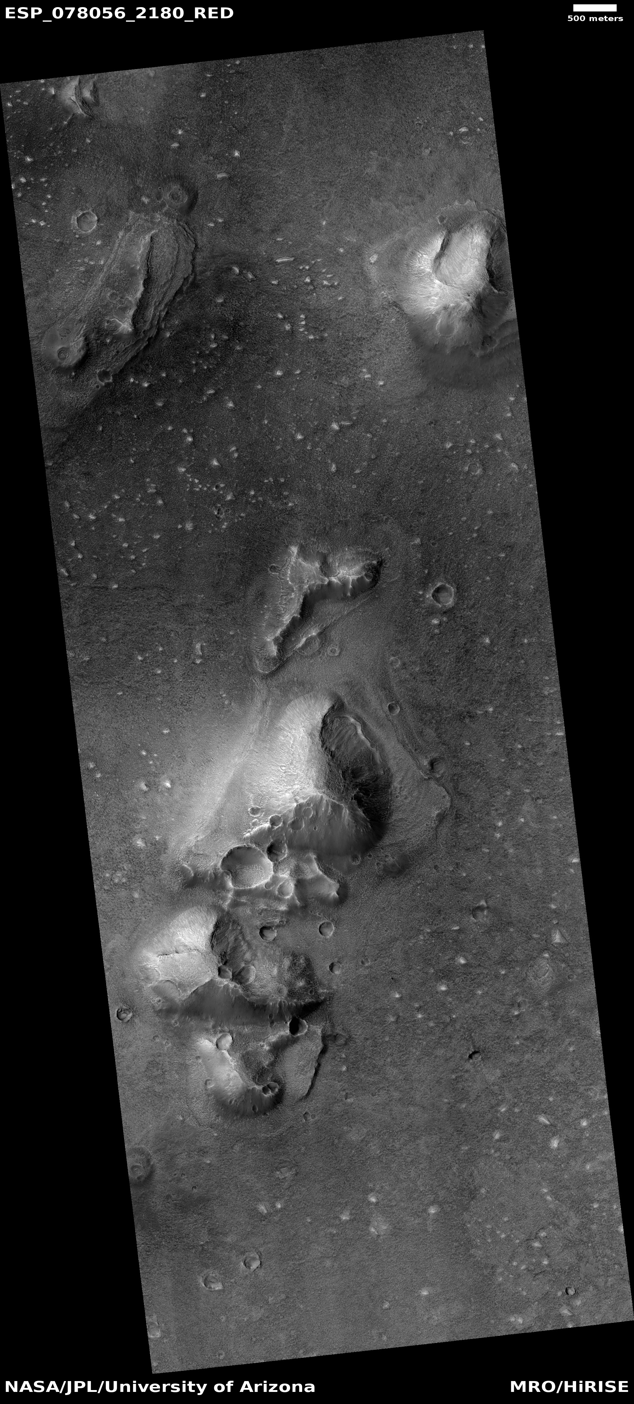
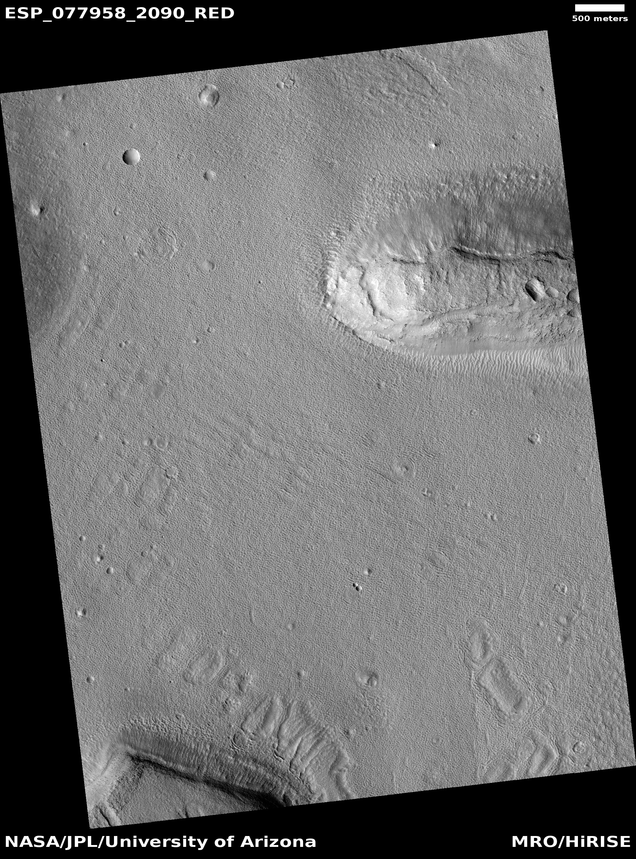
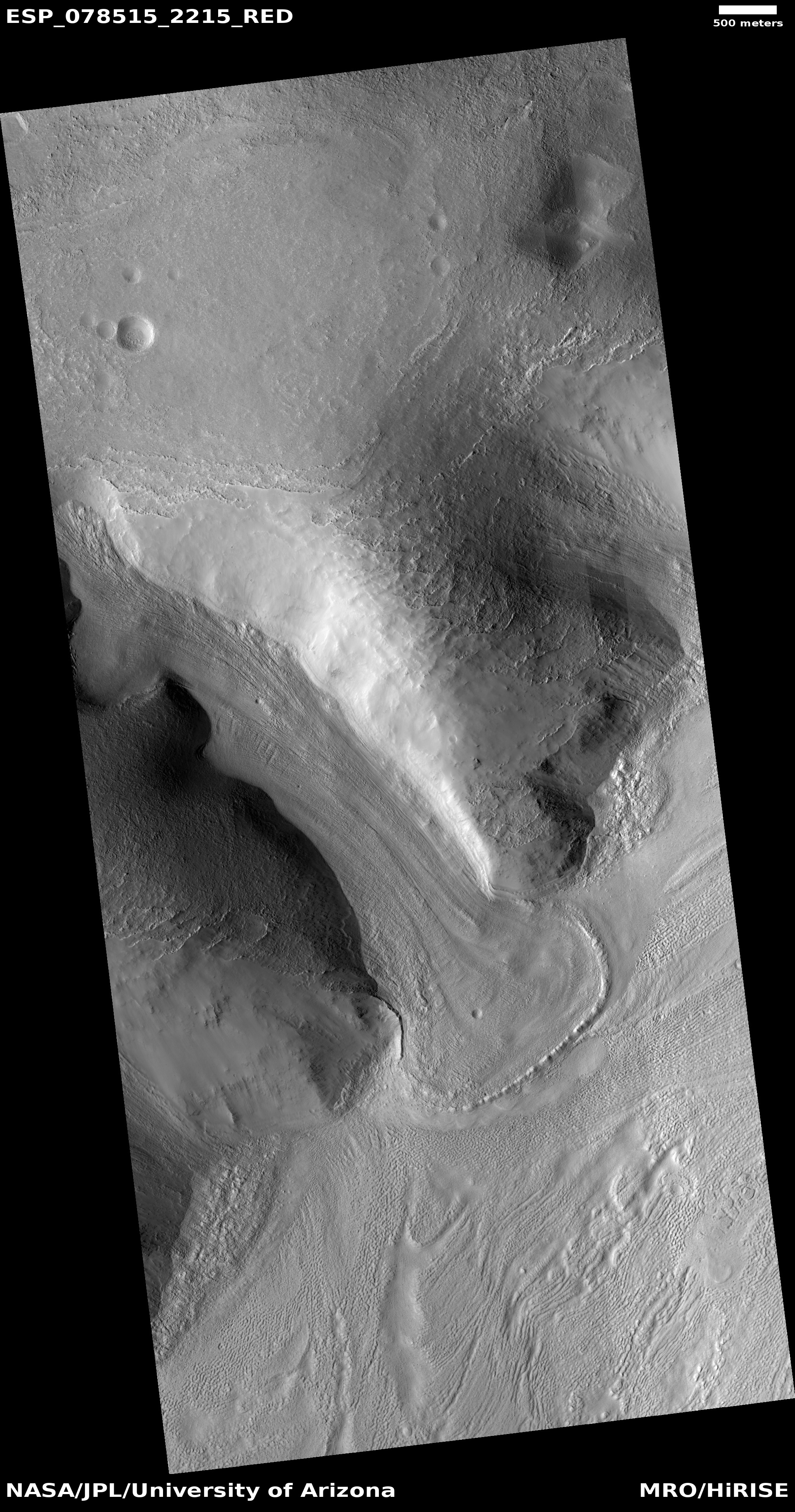
Today’s two cool images above provide a nice sense of the massive nature of many Martian landslides. Scientists often call this kind of slide “mass wasting,” because rather than it occurring because a single rock propagates a larger flow of rocks as it starts rolling downhill, this slide occurs because a large section of the hillside suddenly breaks free and moves downward as a unit, carving a path as it goes.

Mars has a lot of these kinds of slides, likely caused partly by its lower gravity, 39% that of Earth’s.

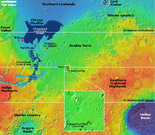
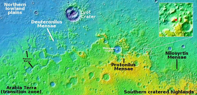
The overview map to the right marks the location of both slides by their numbers. Number one took place on the eastern interior rim of a 56-mile-wide and 7,000-foot-deep unnamed crater the dry tropics of Mars. The slide dropped about 3,000 feet, beginning about halfway down from the top of the rim and not quite reaching the crater floor. The picture was taken by the high resolution camera on Mars Reconnaissance Orbiter (MRO) on March 31, 2024.

Number two occurred on the western interior rim of a 32-mile-wide and 6,500-foot-deep unnamed crater in the mid-latitudes where near-surface ice and glacial features are often found. In this case the slide fell downward about 3,500 feet. The picture was taken by MRO’s high resolution camera on March 14, 2024.

Despite the different latitudes and thus different climates and geological settings, both landslides look similar. It is possible they occurred under similar conditions, but at very different times. Or it is also possible that the Mars gravity and general environment promotes these mass wasting events everywhere.

3 comments

The insane mountain slopes of Mars’ deep canyons

Overview map

The insane mountain slopes of Mars' deep canyons
Click for original image.

Cool image time! The picture to the right, rotated, cropped, reduced, and sharpened to post here, was taken on April 25, 2024 by the high resolution camera on Mars Reconnaissance Orbiter (MRO).

The scientists label this layered deposits, but that hardly describes what we are looking at. This slope, as shown in the overview map above, is the north flank of the central ridgeline inside the giant enclosed canyon depression dubbed Hebes Chasma, located just north of the main canyon of Valles Marineris, the largest known canyon in the solar system.

From floor to peak the ridge is around 16,000 feet high. Yet, its peak sits more than 6,000 feet below the plateau that surrounds Hebes. In this one picture the drop from high to low is only 5,700 feet, with thousands of feet of cliff unseen below and above.

Yet every single foot of these gigantic cliffs is layered. Based on close-up data obtained by Curiosity on the slopes of Mount Sharp in Gale Crater on the other side of the planet, the layers we can see here only represent the most coarse sedimentary boundaries. Within these layers are likely thousands upon thousands of thin additional layers, each likely representing some cyclical climate proces on Mars, even down to individual years.

Note too that the lower slopes in this picture (near the top) suggest some form of erosion flowing downhill. What caused that erosion process however remains unknown. It could have been liquid water, or glaciers, or some other process unique to Mars that we still haven’t uncovered.

0 comments

Perseverance looks up at the rim of Jezero Crater

Panorama on June 10, 2024 by Perseverance
Click for full resolution. For original images, go here, here, here, and here.

Overview map
Click for interactive map.

Cool image time. The panorama above was created from four pictures taken on June 10, 2024 by the left navigation camera on the Mars rover Perseverance (captions found here, here, here, and here). It looks north at the nearest hill that forms the north part of the rim of Jezero Crater.

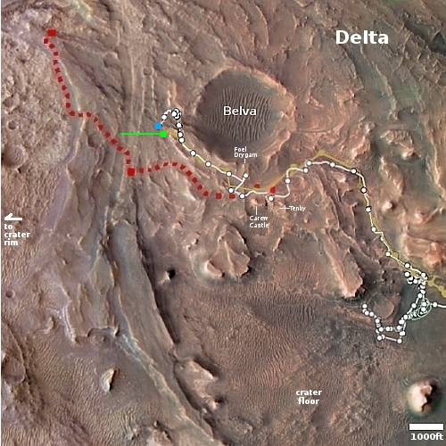
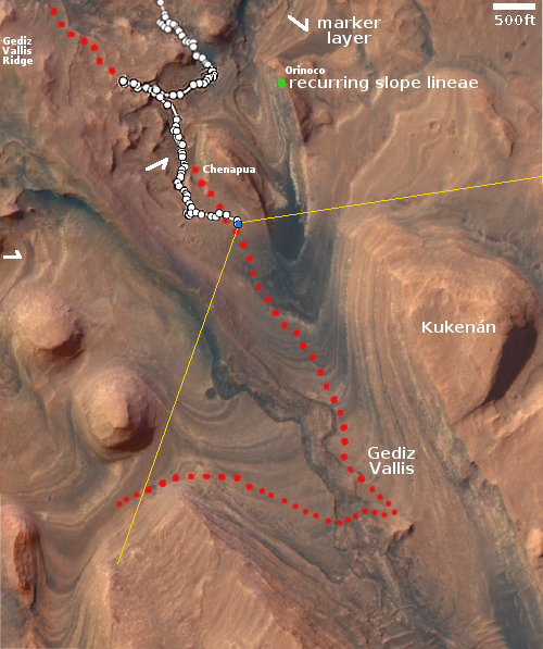
The overview map to the right provides context. The blue dot marks Perseverance’s present location, when it took these pictures. The yellow lines indicate the approximate area covered by the panorama. The red dotted line marks the rover’s planned route, while the white dotted line the route it has actually taken.

Because the rover is now at the base of this hill, it can no longer see the top of the crater’s rim. What it sees instead is the barren foothills of that rim, covered with dust, dunes, and many broken rocks.

As I have noted numerous times, the utter lack of life marks this as a truly alien landscape, compared to Earth. Nowhere on our home planet would you see terrain this empty of life. While NASA likes to claim that Perseverance’s main mission is the search for life on Mars, that claim is always a lie. It is very unlikely any life is going to be found here by Perseverance, and if that was its true scientific purpose it would never have been built nor launched.

What the scientists are doing is studying the alien geology of Mars, to try to understand how this utterly alien planet got to be the way it is now. Such knowledge is critical for the future explorers of space, as it will make it easier for them to understand the alien landscapes they will find elsewhere, within the solar system and eventually in other solar systems far beyond.

0 comments

A close-up of rocks on Mars

Curiosity's robot arm about to take a close look at the ground
Click for original image.

Close-up of rocks on Mars
Click for original image.

Cool image time! The picture to the right, cropped, reduced, and sharpened to post here, was taken on June 6, 2024 by Curiosity’s Mars Hand Lens Imager (MAHLI), located at the end of the rover’s robot arm and designed to get close-up high resolution images of the ground that the arm is exploring.

The picture above, taken just after the one to the right and cropped, reduced, sharpened, and annotated to post here, shows the robot arm shortly after it has rotated upward after placing MAHLI right up against the ground. Note the tread marks. The science team apparently chose these target rocks because they were likely ground somewhat as the rover rolled over them, breaking the rocks to expose new faces.

According to the scientists, the camera was about two to three inches away from these rocks when it snapped the picture, with the scale about 16 to 25 microns per pixel. Since a micron is one millionth of a meter, this picture is showing us some very small details within a much larger rock.

I post this because I have rarely seen such colorful and crystal-like surface features from Curiosity.

1 comment

Gully erosion in a Martian dune field

Overview map

Gully erosion in a Martian dune field
Click for original image.

Today’s cool image is another example of how little we really understand the geology of Mars. The picture to the right, rotated, cropped, reduced, and enhanced to post here, was taken on February 22, 2024 by the high resolution camera on Mars Reconnaissance Orbiter (MRO).

The focus of the image is the eastern end of a large and very distinct dune field inside 31-mile-wide Matera Crater, as shown by the white rectangle in the overview map above. The field fills an area 10 by 11 miles inside the floor of the crater. On that eastern end is a very pronounced drainage gully dropping downhill about 2,000 feet to the east.

Gullies on Martian slopes, especially on the interior rims of craters, are not unusual. Though their true cause is not yet confirmed, the theories behind their existence all relate to some form of water/ice process, mostly relating to the seasonal freeze-thaw cycle.

This picture was taken in the spring, exactly when seasonal changes might be spotted. In fact, scientists have been taking regular MRO images of this gully since 2007, when it was featured image. From that 2007 caption:
» Read more

0 comments

The wind-carved north edge of Mars’ largest volcanic ash field

The wind-carved north edge of Mars' largest volcanic ash field
Click for original image.

Cool image time! The picture to the right, cropped, reduced, and sharpened to post here, was taken on February 26, 2024 by the high resolution camera on Mars Reconnaissance Orbiter (MRO). It shows what the scientists label as the “relation between flutes and flows”.

The flood lava plain in the northern part of this picture represents the flows. At some point in the distant past some event, either a volcanic eruption, or a large impact, caused lava to spew out across this terrain, leaving behind a smooth plain that has only partly been marked by later crater impacts.

The many parallel ridges pointing to the northeast in the southern part of the picture represent the flutes.

One other very important flow is not directly visible. The prevailing winds that blow to the southwest are what carved these flutes, slowly pushing the material southward while carving out the many gaps between the ridges.
» Read more

0 comments

A Martian lava flow so strong it eats mountains

A Martian lava flow so strong it eats mountains
Click for original image.

Cool image time! The picture to the right, rotated, cropped, reduced, sharpened, and annotated to post here, was taken on March 19, 2024 by the high resolution camera on Mars Reconnaissance Orbiter (MRO). It shows a crater that appears to sit on top of a plateau that was created by a flow of material coming from the northeast that — as the flow divided to get around that crater — it wore away the ground to leave the crater sitting high and dry.

What was the material in that flow? The location is at 9 degrees north latitude, in Mars’ dry tropics, so it is highly unlikely that the flows here are glaciers, even though they have some glacier-like features.

Instead, this is frozen lava, but Martian in nature in that its ability to push the ground out of its way suggests it was moving very fast, far faster than lava on Earth.
» Read more

0 comments

Glacial tributaries draining south on Mars

Glacial tributaries draining south on Mars
Click for original image.

Cool image time! The picture to the right, rotated, cropped, reduced, and sharpened to post here, was taken on March 27, 2024 by the high resolution camera on Mars Reconnaissance Orbiter (MRO). It shows what the scientists label as a “valley network”, what appears to be several tributaries flowing downhill from the northeast to come together into a larger single flow to the southwest. The elevation drop from the high to the low points in this picture is about 600 feet.

What formed the valleys? This location is at 35 degrees south latitude, so we are almost certainly looking at what appear to be shallow glaciers within those valleys, protected by a thin veneer of dust and debris. It also appears that the stippled surrounding plains might also contain a lot of near-surface ice, also protected by a thin layer of dust and debris. The stippling indicates some sublimation and erosion.
» Read more

3 comments

A really really big landslide on Mars

A really really big landslide on Mars
Click for original image.

Sometimes the cool geological features I find in the Mars Reconnaissance Orbiter (MRO) image archive are so large they are difficult to present on this webpage. Today is an example. The picture to the right, cropped, reduced, and sharpened to post here, was taken on March 13, 2024 by the high resolution camera on MRO. It shows the distinct run-out of debris from a landslide that flowed downhill to the north as a single unit of material. Along the way it carved its track in the ground, almost like a ramp.

The full picture however suggested something much more spectacular. In that full image this landslide is merely a small side avalanche to a landslide many times larger. And that high resolution picture only shows what appears to be a small section of that giant slide. Obviously, this required a look at the global mosaic produced by MRO’s context camera to find out how far that avalanche actually extended.
» Read more

1 comment

ISRO to land its Chandayaan-4 lunar sample return mission near where Chandrayaan-3 landed


Click for interactive map. To see the original
image, go here.

India’s space agency ISRO announced on May 11, 2024 that the landing site for its Chandayaan-4 lunar sample return mission will be in the same area where its Chandrayaan-3’s Vikram lander touched down, carrying the Pragyan rover.

The map to the right shows that location, at about 69 degrees south latitude. The mission will require two launches, and will have five components, a propulsion module, a transfer module, a lander module, an ascender module and a re-entry module. The two rockets will use India’s LVM-3 and PSLV rockets.

The actual mission concept, including which modules will be launched with which rocket as well as whether they will dock in Earth or lunar orbit, has not yet been released. This most recent tweet however mentioned that the lander will only operate for one lunar day, which means it will land, grab its samples quickly, and send the ascender capsule up, all within an Earth week.

A launch timeline for the mission also remains unclear.

0 comments

The edge of a vast frozen lava sea on Mars

The edge of a vast frozen lava sea on Mars
Click for original image.

Cool image time! The picture to the right, rotated, cropped, reduced, and sharpened to post here, was taken on February 10, 2024 by the high resolution camera on Mars Reconnaissance Orbiter (MRO). It shows what the scientists label boringly “Lava Interactions with Landscape.”

What is the lava, and what is the landscape? Here’s is my initial guess, based simply on looking at this image alone. The mound in the middle is the landscape, the rounded top of a very ancient mountain or hill. The flat plain that surrounds it is flood lava, that in the far past poured in and mostly buried the mountain.

Everything here signals a very old terrain. To get this mountain worn so smooth from the thin Martian atmosphere has to have taken more than a billion years. And that flood lava has to also be as old, because of the number of craters on its surface. I don’t know the impact rate, but I know it takes time to accumulate this number of impacts.

The sense of age is further underlined by the moat that surrounds the hill. When that lava poured in, it would have flooded right up to the mountain slope. Over time the weakest section of lava, most prone to erosion, would be that contact point. To wear it away as we now see it must have taken many eons.

All these speculations are a very unreliable guesses. To get a better understanding of this terrain it is essential we look at more than this picture alone.
» Read more

0 comments

Taffy terrain in Mars’ death valley

Taffy terrain in Mars' death valley
Click for original image.

Cool image time! The picture to the right, rotated, cropped, and enhanced to post here, was taken on December 17, 2023 by the high resolution camera on Mars Reconnaissance Orbiter (MRO). It shows what the scientists label “banded terrain and possible breached crater.”

Banded terrain is another name for a geological feature dubbed “taffy terrain” and only found on Mars, and furthermore only found there in Hellas Basin, the deepest giant impact basin on the red planet. This taffy terrain is considered very young, no than 3 billion years old, and formed from the flow of some form of viscous material, though what that material is remains unsolved.

This image however may help solve that mystery. The breached crater is just off frame to the upper right. The two-fingered flow coming down from the picture’s top is the flow coming out of the crater’s gap.
» Read more

0 comments
1 41 42 43 44 45 89