InSight power levels continue to hold steady
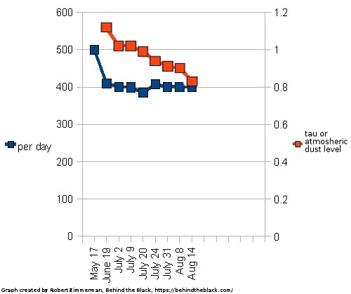
InSight power levels through August 27, 2022

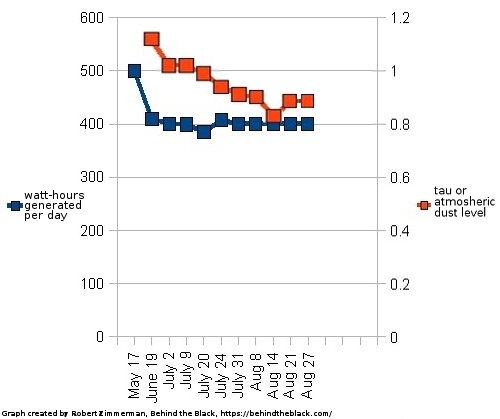
According to a new update posted today by the InSight science team, the power being generated by the lander’s dust-covered solar panels once again did not decline last week, holding at 400 watt-hours generated per day for the fifth week in a row.

The graph to the right shows the trends since May. The dust in the atmosphere is indicated by the red line, marking what scientists call the tau level. A normal level outside of the winter dust season should be between 0.6 and 0.7 tau. Even though that dust season has been ending, that level has remained high, thus cutting off more of the sunlight that the Mars lander could use to generate the electricity needed by its seismometer.

That the power generated continues to hold steady however suggests that InSight’s seismometer might be able to continue working into September, detecting Martian earthquakes. The scientists had predicted the spacecraft would die sometime around now. Without doubt they are thrilled their prediction appears wrong.

That the lander might last longer also increases the chance that it might experience a wind event, such as a dust devil, that could blow the solar panels clear of dust and save the lander entirely. All it needs is one such event, which sadly has not occurred since InSight landed on Mars in 2018.

0 comments

Martian auroras as seen by UAE’s Al-Amal orbiter

Aurora types on Mars
Click for full image.

Using data gathered by the Al-Amal orbiter (“Hope” in English), scientists have identified three types of aurora on Mars. The image to the right, figure 1 from their paper, shows these types, crustal field aurora, patchy aurora, and sinuous aurora. From the abstract:

We categorize discrete auroral patterns into three types: those near strong vertical crustal magnetic field, patchy aurora near very weak crustal fields, and a new type we call โ€œsinuous,โ€ an elongated serpentine structure that stretches thousands of kilometers into the nightside from near midnight in the northern hemisphere.

All three types generally occur during the Martian night, and evolve quickly over periods of less than 45 minutes. The first type, which is generally the brightest, forms over terrain where Mars’ residual magnetic field is strongest and vertically oriented, and was most often seen over the southern cratered highlands centered between the large impact basins Argyre and Hellas. The third type, sinuous aurora, was more unusual:

These we are calling โ€œsinuous discrete aurora,โ€ due to their thin, elongated, and sometimes serpentine shapes. They share several key traits: (a) they appear in the northern hemisphere away from strong crustal fields, (b) they usually connect to the dayside in the far north but also sometimes separately at lower latitudes, (c) they extend for thousands of kilometers into the night side, (d) they appear on both dusk and dawn sides, and (e) their shapes change moderately and brightnesses shift by factors of up to two over timescales of โˆผ20 min (i.e., the time between swaths, as shown in the differences between Figures 1j and 1k [in the figure above).

The existence of aurora on Mars has been known since the 2000s. These observations however are the first that show more details beyond a fuzzy patch.

1 comment

Changes on Mercury detected by Messenger over four year time period

Changes on Mercury seen by Messenger from 2011 to 2015

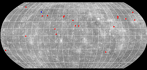
Using archival data collected from 2011 to 2015 while the orbiter Messenger circled Mercury, scientists have located twenty spots on the planet where something changed during that time period. The map to the right, adapted from the paper, indicates those locations. From the paper’s abstract:

We identified at least one change likely resulting from a newly formed impact crater with bright rays that extend away from the site. If all the changes result from impact events, then the present-day rate of impactors striking the innermost planet is 1,000 times higher than models predict. Therefore, we investigate other sources for these detected changes. We located several changes on steep slopes near tectonic landforms, consistent with ongoing tectonic activity. Additionally, we identified several changes in areas adjacent to hollow formations, consistent with present-day activity. These detected changes will be critical targets for the upcoming BepiColombo mission.

The data suggests several things. First, if the changes all come from impacts, than the number of asteroids in the inner part of the solar system where Mercury orbits the Sun is much higher than believed. Since it is very hard to observe asteroids there because of the Sun, this very well might be true.

Second, if the changes were not all caused by impacts, then they occurred either from earthquakes or the environmental extremes caused by daily and seasonal changes.

2 comments

Curiosity in the valley of Gediz Vallis

Curiosity's view on sol 3576 (August 28, 2022)
Click for full image.

Overview map
Click for interactive map.

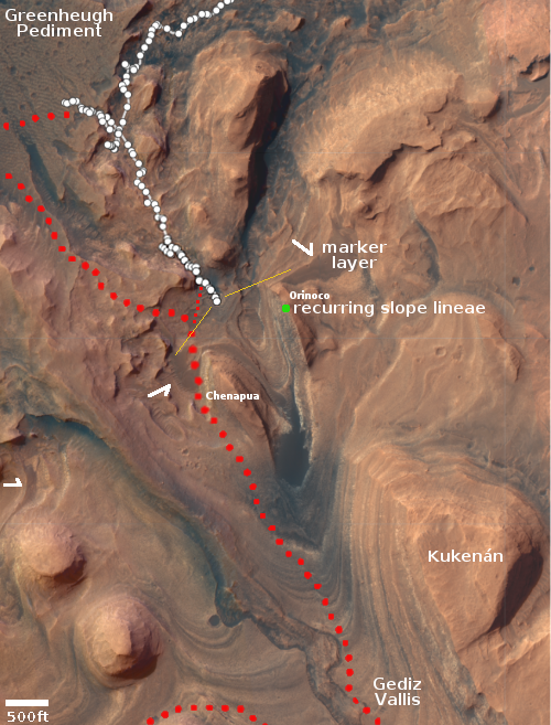
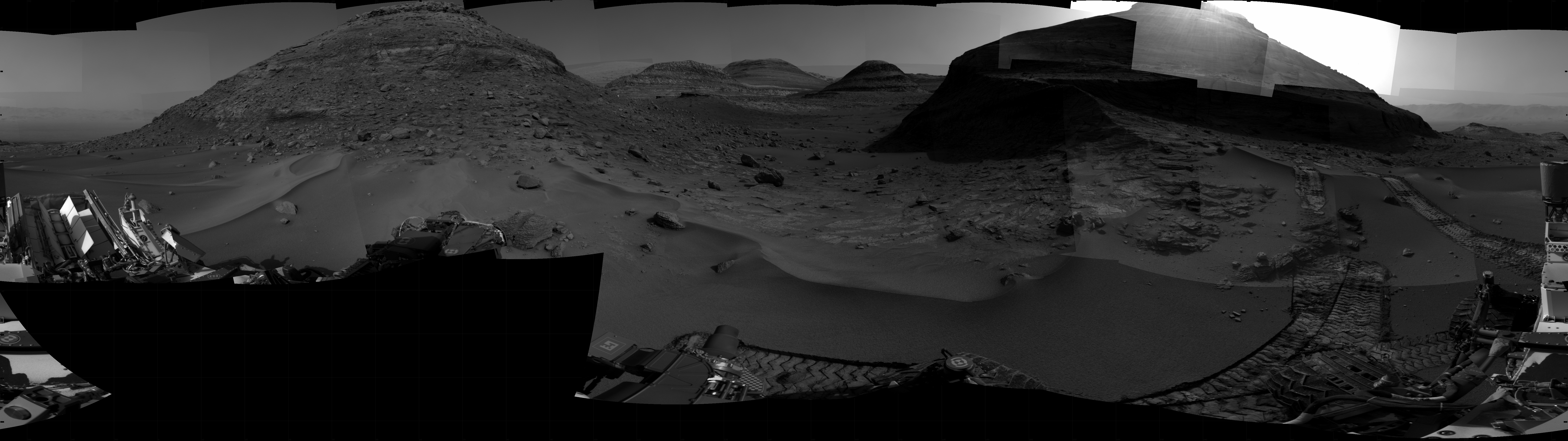
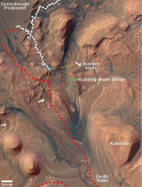
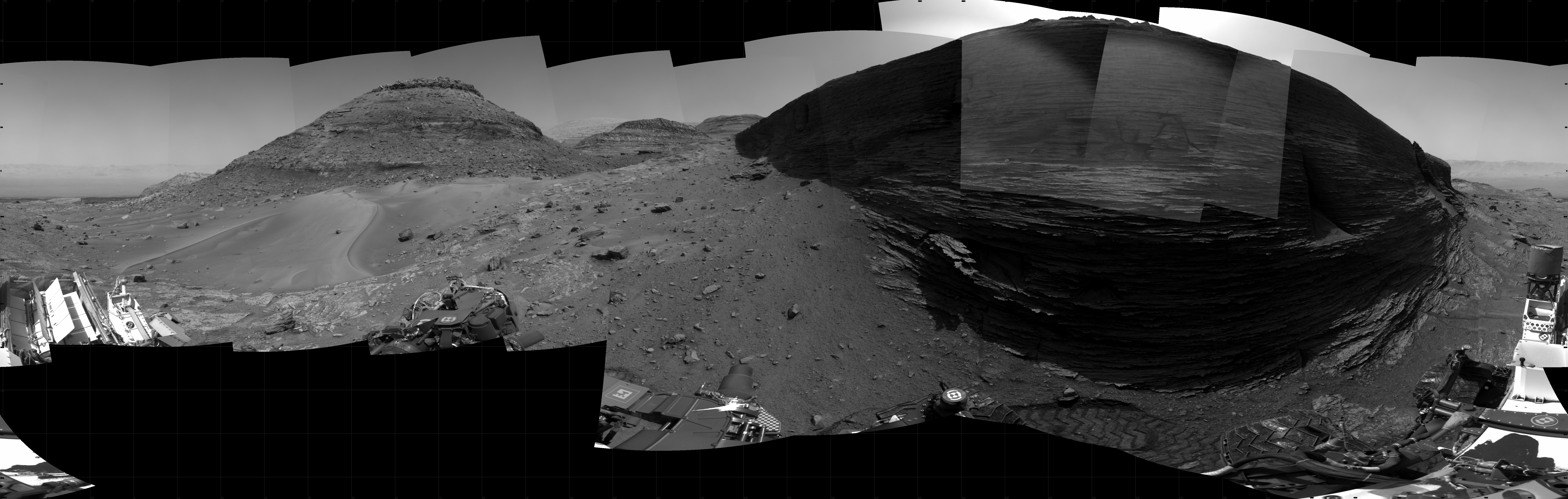
The panorama above was created by Curiosity’s right navigation camera on August 28, 2022, and shows the strangely paved Martian terrain directly in front of the rover now that it is inside the valley of Gediz Vallis, scattered flat rocks interspersed with dust. The yellow lines in the overview map to the right indicates the area covered by this panorama. The red dotted line indicates the rover’s likely future route to circle around the small mesa Chenapua.

The paved rocks however may not be separate, but merely covered in their low spots by dust. What makes these light rocks significant is that they appear to be the first close examples of the sulfate-bearing layer that the rover has seen in the higher reaches of Mount Sharp since it landed in Gale Crater more than ten years ago. You can see this bright layer clearly in the distance in a panorama taken by Curiosity in June 2021. The rover has now finally reached it, and is about to delve into another layer in the geological history of Mars, a layer that appears easily weathered and carved by the thin Martian atmosphere.

Other details in this panorama are of important note. In the overview map, I have indicated that a recurring slope lineae is supposed to exist on the cliff face of the mesa dubbed Orinoco. These lineae, seen from orbit, appear to be streaks on slopes that come and go seasonally. No one has come up with a theory to explain them, though the most favored theory today says they are staining dust flows of some kind.

However, if you click on the panorama and zoom in on the cliff face of Orinoco, you will see an incredibly rough rocky terrain. It seems impossible for any streak of any kind to flow down this cliff anywhere, suggesting that the streaks might possibly be like the rays that radiate out from craters on the Moon, visible only from orbit and invisible on the surface.

The marker layer is another important geological target, now almost within reach. This flat layer is found in many places on the flanks of Mount Sharp, all at about the same approximate elevation. It is distinctly flat and relatively smooth. Knowing why it stands out so differently from the layers above and below will help geologists better write the geological history of this Martian mountain and the crater in which it sits.

4 comments

Swirls and mesas in Valles Marineris

Swirls and mesas in Valles Marineris
Click for full image. For the original of the inset go here.

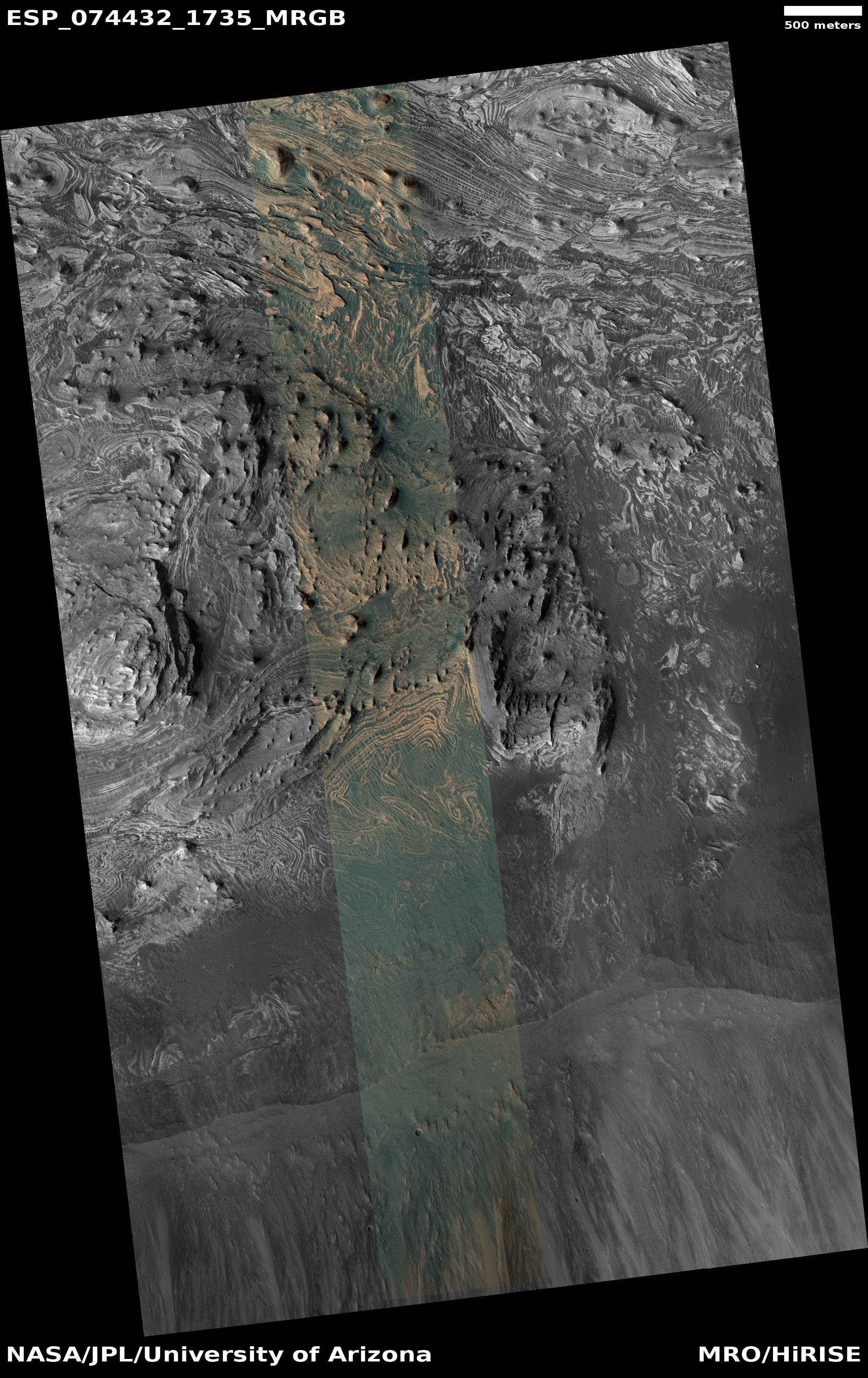
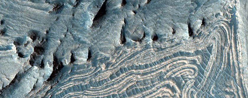
Cool image time! The picture to the right, rotated and cropped to post here, was taken on June 13, 2022 by the high resolution camera on Mars Reconnaissance Orbiter (MRO). It shows what the scientists label as “fractures in West Candor Chasma,” one of the side canyons that form Mars’ gigantic Valles Marineris, the largest canyon system known in the solar system.

To my eye, I don’t see fractures as much as swirling and curving outcrop ridges, as if the twisted layering here is so steeply tilted so that it is almost vertical, with the more resistant edges sticking up out of the dust and dunes. The color corrected inset zooms in on some of these swirls, though this better view hardly clarifies things. Note how the upper curves seem to suddenly cut off, almost as if someone had sliced them with a knife. Don’t ask me to explain.

The overview map shows us where this spot is within Valles Marineris.
» Read more

1 comment

Eroding glacial ice on Mars, dipping in the wrong direction

Dipping wrongway ice terraces
Click for full image.

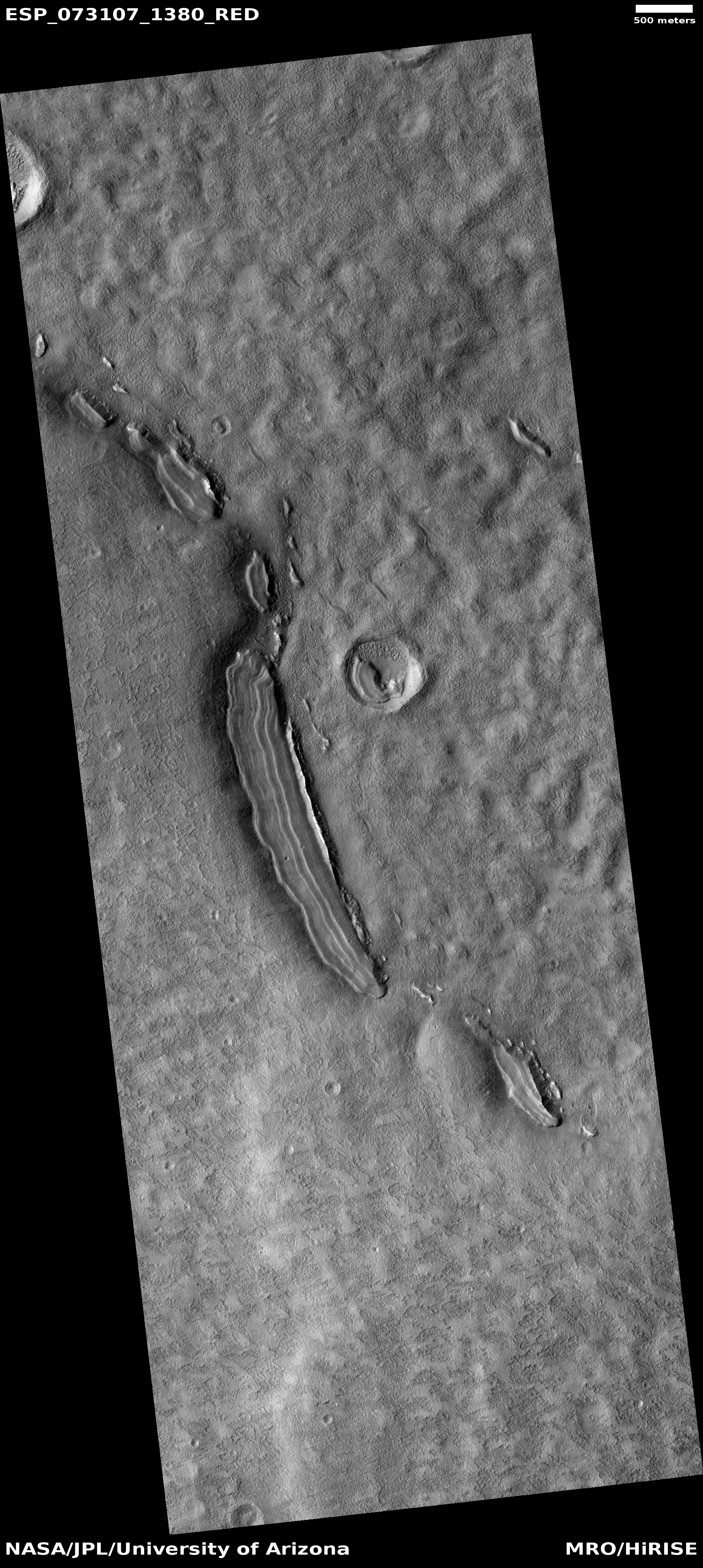
Today’s cool image is a variation of a similar phenomenon shown in a cool image I posted in July, dipping terraced layers stepping downhill toward a cliff face, rather than away from the cliff as you would expect. That previous example was located in chaos region in the northern mid-latitudes that I dub glacier country.

This example is instead found a completely different region of Mars, halfway across the planet. The photo to the right, cropped, reduced, and annotated to post here, was taken on March 1, 2022 by the high resolution camera on Mars Reconnaissance Orbiter (MRO). The arrows indicate the downward trend of those dipping layers, toward the cliff face.

The overview map below provides the context.
» Read more

3 comments

A pit in the dry-ice polar cap of Mars

A pit in the dry-ice cap of Mars
Click for full image.

This cool image is possibly of some of the most alien terrain on Mars. The photo to the right, rotated and cropped to post here, shows a pit (not a peak) in the dry-ice cap that covers a small portion of the southern polar ice cap on Mars. North is up. It was taken on June 16, 2022 by the high resolution camera on Mars Reconnaissance Orbiter (MRO). In fact, at 88 degrees south latitude, the image is just about as far south as it is possible for MRO to take pictures. Beyond this the orbit does not reach.

If you look close, you can see that there are several distinct layers in the sunlight eastern interior slopes of the pit. The base of the pit itself appears to have ripples, as if their might be Martian dust trapped inside.

This is a very cold and alien place. The ground is made of dry ice. The temperatures are always cold, well below minus 100 degrees Fahrenheit.

If you look at the full image, you will see that, except for the very tiny pit nearby to the east, this pit is all by itself. If the underlying terrain caused this sinkhole to form, why only here?

The overview map below shows the location, which might help explain things.
» Read more

0 comments

Perseverance gets a glimpse into the history of Jezero crater

A glimpse into the history of Jezero Crater
Click for full image.

Cool image time! The photo to the right, cropped, reduced, and enhanced to post here, was taken on August 17, 2022 by one of Perseverance’s high resolution camera. It shows the exposed layers of a nearby cliff face that comprises the end of the delta that once flowed into Jezero Crater in the distant Martian past.

My guess is that this cliff is about 20 feet high. The more massive, thicker and younger layers near the top, compared to the thinner and older layers below, suggest a major change in the cyclic events. The early cycles that lay down this delta were initially shorter and able to place less material with each cycle, while the last few cycles were longer, producing thicker layers.

The difference in layers also strongly suggests that all the blocks at the foot of the cliff fell from more massive layers at the top. Material that broke off from the lower thinner layers has likely long ago eroded away.

5 comments

A global map of Mars’ future mining regions

A global map of Mars' future mining regions
Click for labeled image.

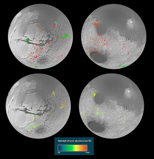
Using data accumulated in the past decade from orbiters, scientists have now published a global map of Mars, showing the regions on the red planet where there are high concentrations of hydrated minerals, minerals formed in the past in conjunction with the presence of water.

The maps to the right show those regions in various colors, indicating different types of minerals.

On Earth, clays form when water interacts with rocks, with different conditions giving rise to different types of clays. For example, clay minerals such as smectite and vermiculite form when relatively small amounts of water interact with the rock and so retain mostly the same chemical elements as the original volcanic rocks. In the case of smectite and vermiculite those elements are iron and magnesium. When the amount of water is relatively high, the rocks can be altered more. Soluble elements tend to be carried away leaving behind aluminium-rich clays such as kaolin.

The big surprise is the prevalence of these minerals. Ten years ago, planetary scientists knew of around 1000 outcrops on Mars. This made them interesting as geological oddities. However, the new map has reversed the situation, revealing hundreds of thousands of such areas in the oldest parts of the planet.

Though this data once again suggests that liquid water once flowed on the surface of Mars, for future colonists it is more important in that it identifies the regions where the most valuable resources will likely be found. For example, most of the colored regions on the map are located in the dry equatorial parts of Mars. However, south of the giant canyon Valles Marineris is a mineral region at about 30 to 40 degrees south latitude, to the northwest of Argyre Basin. This is also a region with a high concentration of glacial features. The two combined will likely make this region very valuable real estate.

1 comment

Strings in Perseverance’s drill?

String in Perseverance's drill
Click for full image.

Since August 5th, the Perseverance science team has been trying to figure out the origin as well as the consequences of “two string-like pieces” of foreign object debris (FOD as used by today’s acronym-happy scientists) that they have spotted next to one of the rover’s coring drill bits.

The photo to the right, cropped and reduced to post here, looks directly down at that core drill bit and shows one of those strings both to the side of the bit as well in full resolution in the inset. From today’s update:

Since first identified Aug. 5 in imagery of the roverโ€™s sample collection system after a 12th rock core sample was taken, the FOD has been the focus of several methodical diagnostic activities in an attempt to better understand the nature of the debris.

Weโ€™ve commanded the rover to move, rotate, or vibrate components we think could harbor FOD. And weโ€™ve obtained multiple sets of images of the components from different angles and in different lighting conditions from rover cameras: Mastcam-Z, Navcam, Hazcam, Supercam, and even the WATSON (Wide Angle Topographic Sensor for Operations and eNgineering) camera located on the roverโ€™s turret. Finally, a thorough review of recent coring and bit-exchange activities confirm that they all executed nominally with no indication of interference from the FOD.

Analysis of the latest round of imaging, downlinked earlier today, indicates that while the two small pieces remain visible in the upper part of the drill chuck, no new FOD has been observed. In addition, imagery taken of the ground beneath the robotic arm and turret, as well as the rover deck, also showed no new FOD.

Because these strings do not appear to interfere in any way with the drill’s operation, the science team has decided neither is a cause for concern, and will therefore command the rover to leave this just-completed drill site and move on to the southwest to a location at the base of the delta the rover visited about three months ago.

The strings themselves are likely pieces from the equipment released during the rover’s landing, and might even have come from the tangled string the rover imaged on the nearby ground in July, and that was gone just four days later. The wind had blown it away, and may have even at that time blown pieces into the drill.

6 comments

A “What the heck!?” crater on Mars

A
Click for full image.

Today’s cool image falls into what I call my “What the heck?” category. The photo to the right, cropped and reduced to post here, was taken on May 31, 2022 by the high resolution camera on Mars Reconnaissance Orbiter. It was also picked by the science team as that camera’s picture of the day on July 12, 2022. From the caption:

This seems to belong to a class of craters in the Cerberus Plains that was flooded by lava, which was subsequently uplifted and fractured by an unknown process. This class of filled, uplifted and fractured craters is informally called โ€œthe waffle.โ€ A combination of volcanic and periglacial processes seems possible.

In other words, the scientists only have a vague idea what created the broken up floor of this crater. For example, why did only the material in the interior of the crater get uplifted and fractured? Did this uplift occur before, during, or after the lava event?

The overview map below tells us a little about where that lava came from, and when.
» Read more

1 comment

Get above 30 degrees latitude on Mars and you can find ice everywhere

Global overview of Mars' ice features

Glacial features inside a Mars crater
Click for full image.

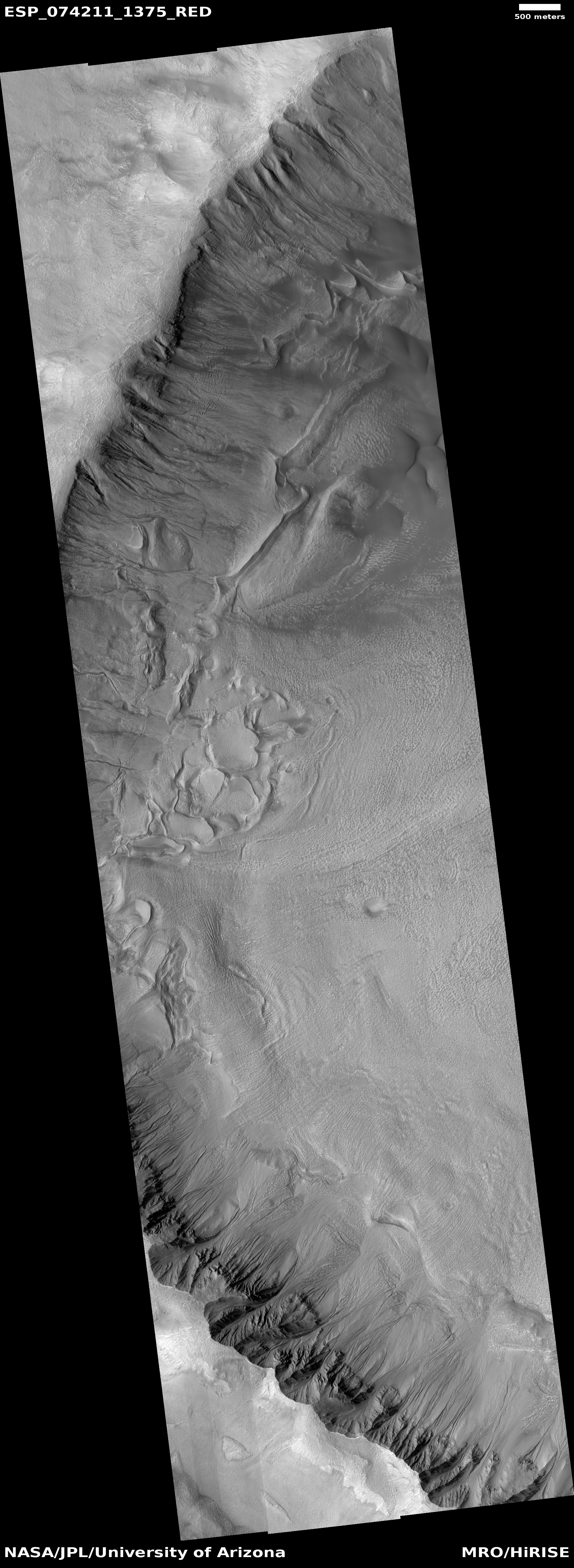
Today’s cool image provides further proof that there is ample near surface ice almost anywhere on Mars once you get above 30 degrees latitude, in either the northern or southern hemispheres. The photo to the right, rotated, cropped, reduced, and annotated to post here, was taken on May 26, 2022 by the high resolution camera on Mars Reconnaissance Orbiter (MRO). It shows the interior slope of an unnamed 15-mile-wide crater that sits inside the much larger 185-mile-wide Newton crater, located in the cratered southern highlands of Mars.

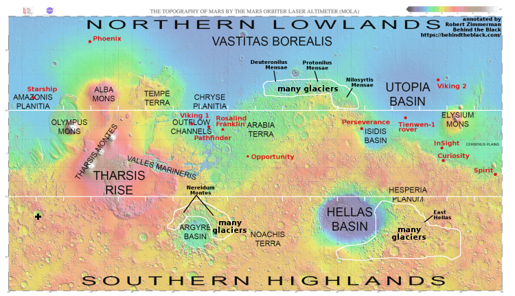
The black cross on the global map of Mars above marks the location of this crater.

The photo was taken as part of the routine monitoring planetary scientists are doing of the gullies that flow down this crater’s interior rim, a monitoring program that goes back to 2007. It is thought that those gullies might be created by seasonal frost, either water ice or dry ice, that causes erosion.

What struck me about the photo however was the glacial features on the floor of the crater. Near the bottom of the interior slope those features look broken up, as if the pressure from above pushed the ice sheets apart. Farther from the interior slope the features more resemble a typical glacial flow, slowly inching downward toward the crater’s low spot. All these glacial features also lend weight to the theory that water ice somehow caused or contributed to the formation of those gullies.

The global map above shows that this crater, while well within the 30 to 60 degrees mid-latitude band where many Martian glaciers are found, is also far from the many regions on Mars that scientists have mapped as having high concentrations of glaciers. And yet, the glacial features are here as well.

Near surface ice will not be found at every spot on Mars. However, once you get above 30 degrees latitude, the evidence increasingly suggests that you won’t have to go far or dig down deep to find it.

0 comments

InSight’s power status continues to hold steady on Mars

InSight power status through August 14, 2022

According to a new status update posted today by the science team, the power status for the Mars InSight lander continues to hold steady.

The graph to the right adds the new data, showing that the daily watt hours of power produced each day continues to hold at 400, while the dust in the atmosphere continues to drop towards its normal level of between 0.6 and 0.7 tau during the non-dust seasons.

These new numbers appear to be generally good news. Even though the dust continues to settle out of the atmosphere, it does not appear to be adding dust on the solar panels that would reduce their capability to generate power. Though the science team had predicted that the power levels would cause the mission to end sometime in August, at 400 watts per hour InSight has apparently continued to generate enough electricity to keep its seismometer running for at least another week.

0 comments

More evidence of recent active volcanism on Venus

In a just published paper, scientists using archive data from the Magellan radar orbiter that circled Venus from 1990 to 1994, combined with data from Europe’s Venus Express that orbited from 2006 to 2015, have detected more evidence of recent volcanic activity in a canyon dubbed Ganis Chasma located in a rift zone called Atla Regio.

From the paper’s conclusion:

The pattern of the radar emissivity in these regions is consistent with relatively young and unweathered materials. The transient IR-bright spots in these regions detected 20 years after Magellan, provide independent corroboration of active volcanism in Ganis Chasma since the 1990’s.

As a possible site of current tectonic and volcanic activity, Atla Regio represents one important science target for the upcoming missions to Venus.

There are presently four missions planned for Venus, Europe’s EnVision orbiter, NASA’s VERITAS and DAVINCI+ probes, and Russia’s Venera-D missoin. All will certainly take a closer look at this region to see if there is active volcanism going on there now.

4 comments

Cones south of Starship’s prime landing sites on Mars

Cones near Phlegra Mountains
Click for full image.

Cool image time! The photo to the right, cropped and reduced to post here, was taken on May 7, 2022 by the high resolution camera on Mars Reconnaissnace Orbiter (MRO). It shows what the scientists have labeled as “Cones in Phlegra.”

Cones such as these are one of the prime geological mysteries of Mars’ northern lowland plains. Scientists do not know yet whether they are either mud or lava volcanoes, or even if they are sedimentary mesas that resisted subsequent erosion. In fact, it was hoped by some American scientists that the Chinese would send its Zhurong rover north towards a nearby cone to find out, but alas, the Chinese decided to head south instead.

Zhurong however was on the other side of Mars. The overview map below shows us where these cones are located.
» Read more

2 comments

A distant cliff and a rocky path forward

Mosaic of Gediz Vallis
Click for full image.

Close-up of distant cliff face
Click for full image.

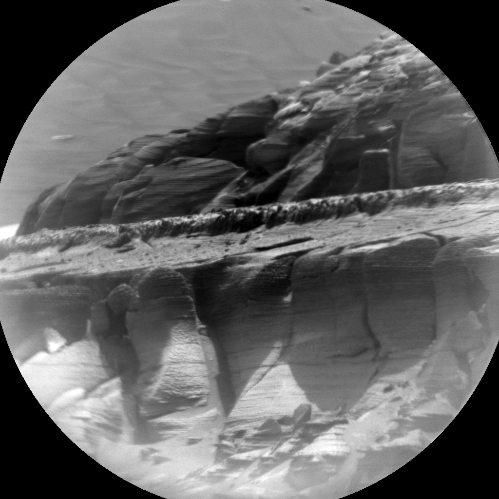
Two cool images arrived today from Curiosity, as it is about to enter the Martian canyon of Gediz Vallis. The mosaic above, cropped, reduced, and annotated to post here, was assembled from photos taken by the rover’s right navigation camera on August 15, 2022. The photo to the right, cropped and reduced to post here, was taken the same day by the rover’s Chemistry camera, normally designed to take very close-up pictures of nearby features. In this case the science team aimed it at a distant cliff face, marked by the arrow in the panorama above, to get a preview of some of the many layers in that mesa.

And has become quite expected from Mars, the number and types and variety of layers is astonishing. The layer that forms the flat bright area at the center of this image is what scientists have dubbed “the marker layer”, since they have found it at similar elevations in many places on the flanks of Mount Sharp. (See the annotated overview map from a post last week.)

Curiosity’s planned route is to head to the right of this mesa, circling around it to get into the upper reaches of Gediz Vallis. First however engineers are going to have to figure out how to get the rover past the somewhat large scattered rocks on the ground directly ahead, without further damaging Curiosity’s already tattered wheels. At first glance there does not appear to be any clear path.

1 comment

Curiosity finally looks out into Gediz Vallis

First look into Gediz Vallis
Click to view full mosaic.

Overview map
Click for interactive map.

Cool image time! Curiosity’s right navigation camera today produced the mosaic above, cropped and reduced to post here, taking its first good look into Gediz Vallis, the canyon that the rover has been aiming for since it landed on Mars ten years ago.

The green dot on the overview map to the right marks the approximate location of a recurring slope lineae, a streak that comes and goes depending on the seasons whose cause remains uncertain. The yellow lines show the approximate area covered by the mosaic. The red dotted lines show Curiosity’s upcoming route. According to previously announced plans, the rover will not head straight into Gediz Vallis, but circle to the west or right of the mesa to the right of Kukenan.

The valley of course looks spectacular. For scale, the cliff face of Kukenan is estimated to be about 1,500 feet high.

The most important revelation from this image however is the ground terrain. It looks like Curiosity will have no problem moving forward into the canyon from this point, something the science team could not know for sure until the rover reached the saddle and could look down and actually see ahead.

0 comments

InSight seismometer data suggests no underground ice at landing site

Using a computer model combined with seismometer data gathered by the Mars lander InSight, scientists have concluded that there is little or no underground ice in the equatorial region where InSight sits.

From the paper’s abstract:

We use rock physics models to infer cement properties from seismic velocities. Model results confirm that the upper 300 m of Mars beneath InSight is most likely composed of sediments and fractured basalts. Grains within sediment layers are unlikely to be cemented by ice or other mineral cements. Hence, any existing cements are nodular or formed away from grain contacts. Fractures within the basalt layers could be filled with gas, 2% mineral cement and 98% gas, and no more than 20% ice. Thus, no ice- or liquid water-saturated layers likely exist within the upper 300 m beneath InSight. Any past cement at grain contacts has likely been broken by impacts or marsquakes.

As the lander sits just north of the equator in the red planet’s equatorial zone, which ample orbital data has suggested is a dry region (as shown in the global map below), this result is not a surprise. It does provide further confirmation however of this conclusion, that if there is any water on Mars within 30 degrees latitude of the equator, it will be deep underground, and likely only in certain regions.
» Read more

1 comment

A typical Martian rock on Mount Sharp

Panorama of pass
Click for full 360 degree panorama.

Typical Martian rock
Click for full image.

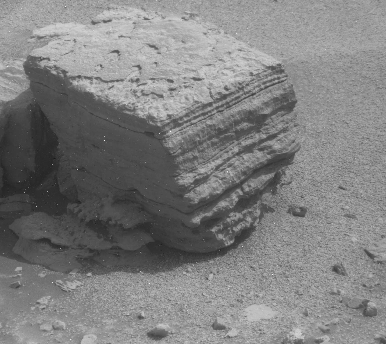
Cool image time! The photo to right, taken by the Mars rover Curiosity on August 9, 2022, provides a nice close-up of what might be a somewhat typical rock on the flanks of Mount Sharp in Gale Crater, many layered with some of those layers extending outward to the side for somewhat ridiculous distances as thin flakes.

The scientists call it a float rock, because they think it actually fell from the cliff dubbed Bolivar in the panorama above. Thus, it gives geologists data on the layers higher up that are not easily accessible from Curiosity’s present position.

The panorama is a mosaic created from images taken by the rover’s right navigation camera on August 8, 2022. The white arrow marks the rock. The green dot marks the approximate location on the cliff face of a previously observed recurring slope lineae, streaks that appear to come and go seasonally whose origin is still not understood.

The red dots mark my guess as to the route engineers will pick for Curiosity as it weaves its way around the other float rocks ahead.
» Read more

10 comments

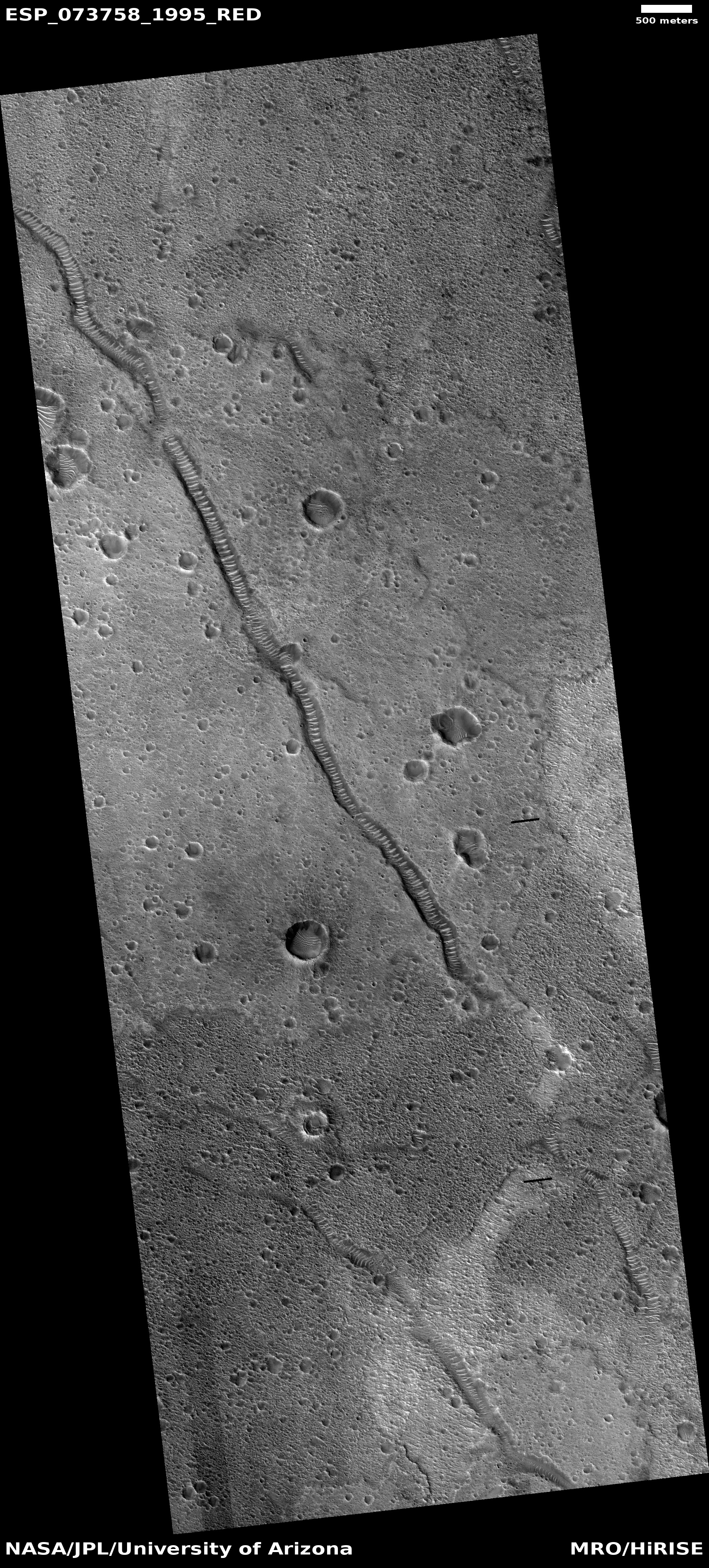
Fractures in the Martian northern lowland plains

Fractures in the northern lowland plains
Click for full image.

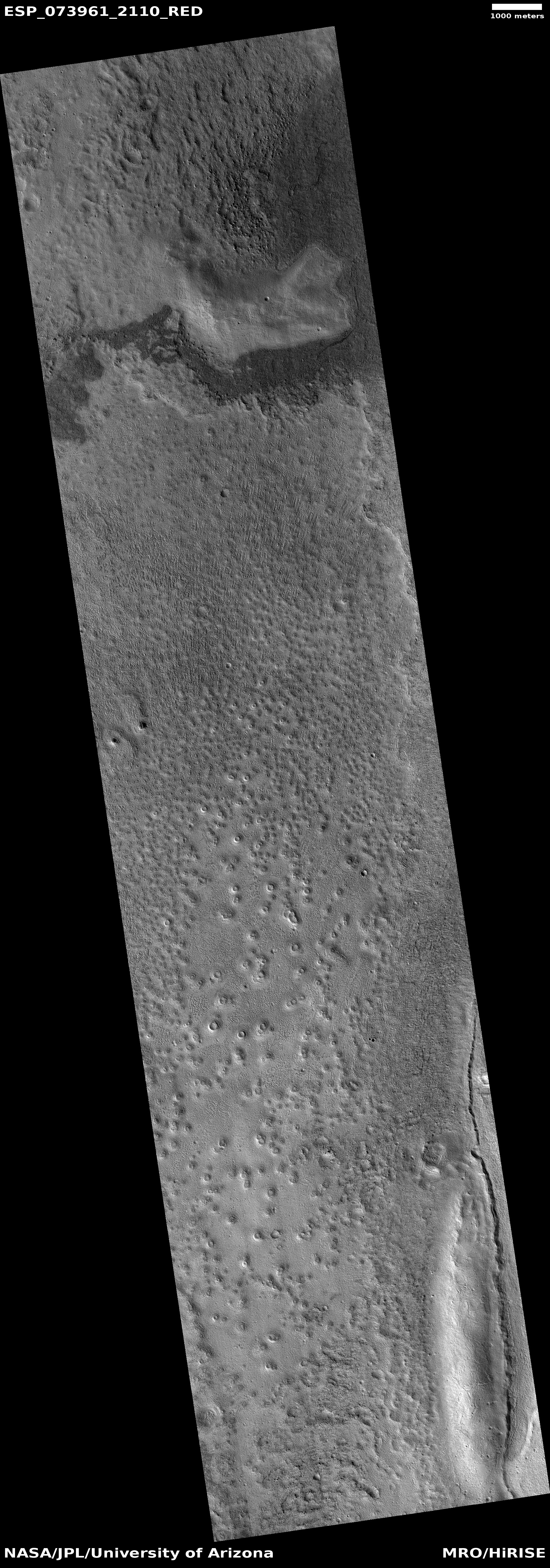
Cool image time! The photo to the right, rotated, cropped, and reduced to post here, was taken on April 21, 2022 by the high resolution camera on Mars Reconnaissance Orbiter (MRO) of a spot in the Martian northern lowland plains.

Generally the surface of these lowland plains — especially at high latitudes above 30 degrees — tends to appear very water saturated, producing blobby features and what look like mud volcanoes. This picture however features something different, what the scientists have labeled fractures, geological features that appeared caused by dry conditions and sudden quake-like events. The break in the fracture near the top of the photo illustrates why water flow had little if anything to do with its formation. Other fractures in the full image show the same thing. Also the stippled surface along the picture’s right edge also suggest there is little near surface water or ice at this location.

The location, as shown by the overview map below, suggests that water might still have played a part, but only a long time ago.
» Read more

1 comment
1 41 42 43 44 45 95