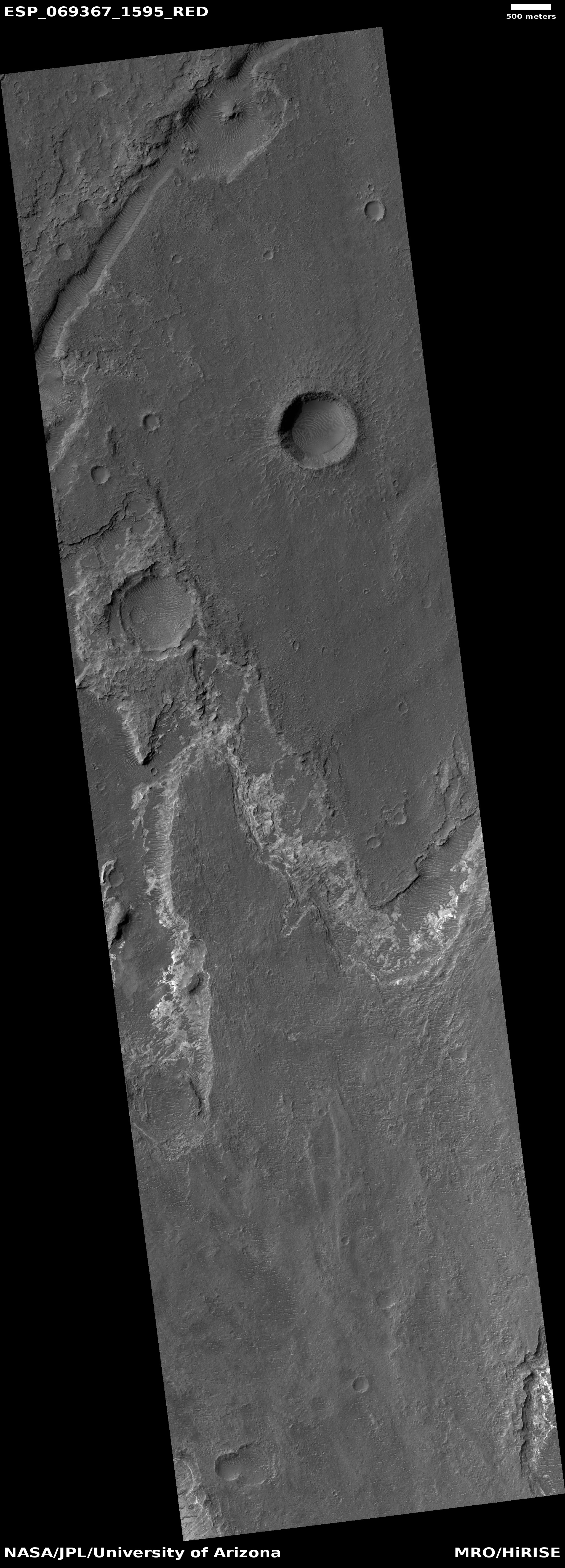
A chain of Martian sinkholes
Click for full image.
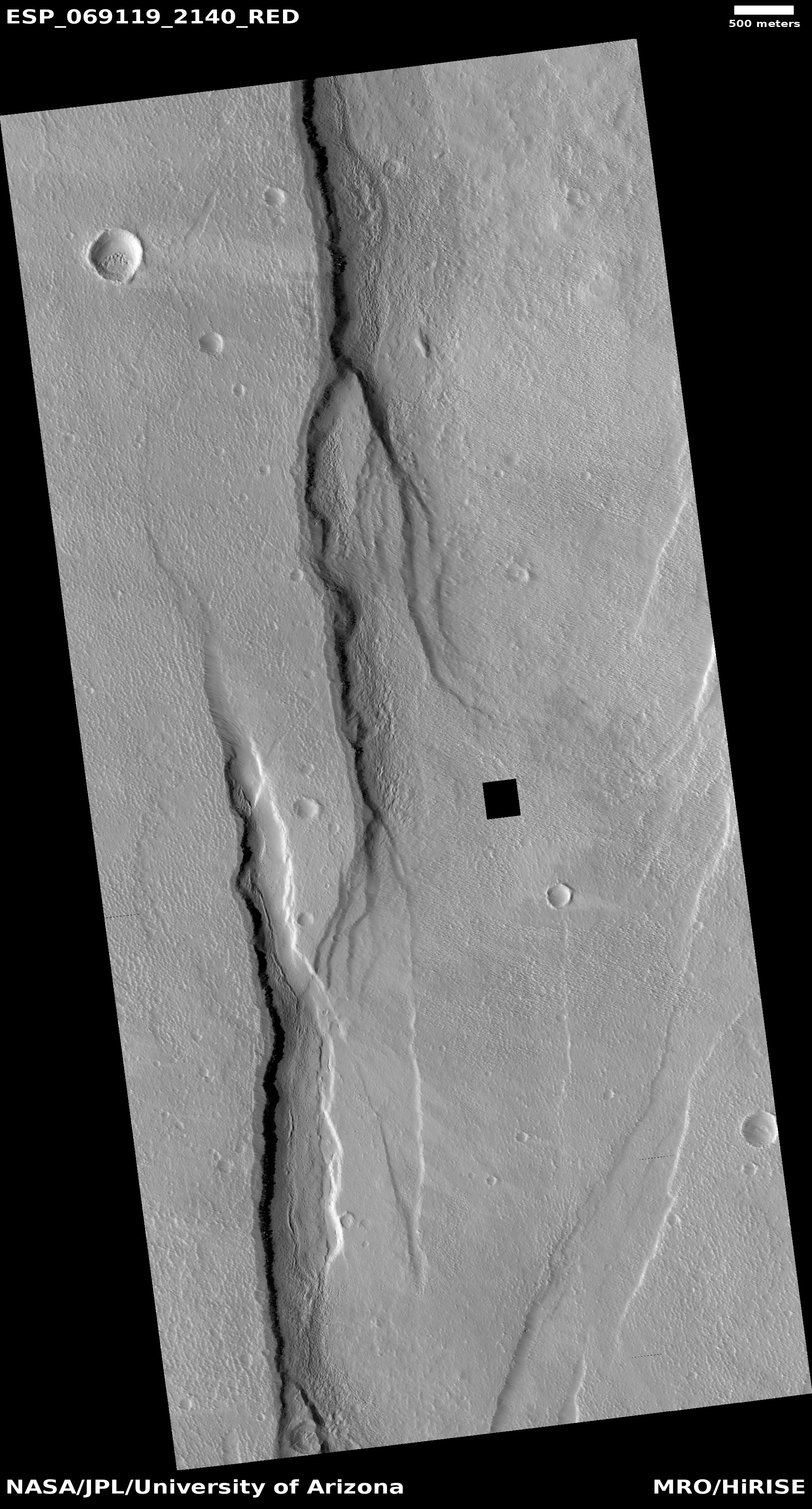
Cool image time! The photo to the right, rotated, cropped, and reduced to post here, was taken on June 17, 2021 by the high resolution camera on Mars Reconnaissance Orbiter (MRO). It shows a somewhat straight depression with several wider and deeper pits along it.
The feature immediately suggests sinkholes that exist because the ground is sagging into voids below ground. Yet, both the straight and circular depressions also appear filled, showing no evidence that they connect to any below ground cavities.
Are the sinks the result of a fissure produced by a graben, when two large blocks shift relative to each other to cause a fissure to appear? Or are they evidence of an underground lava tube? Or maybe they are the filled remains of a now mostly buried canyon carved by water or ice?
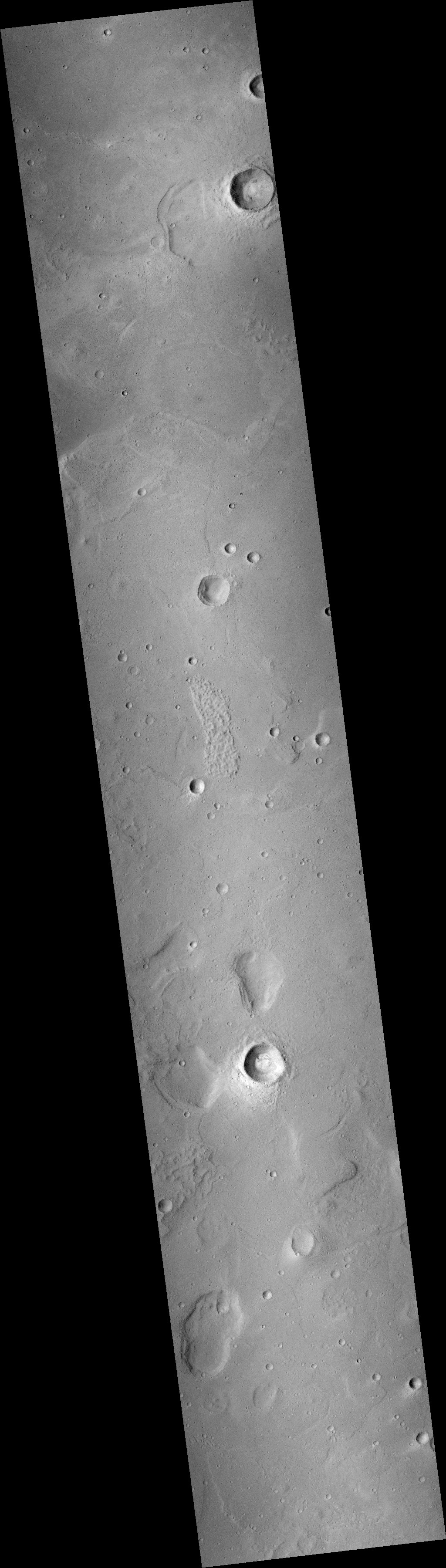
As always, a wider view helps clarify things, though whether it answers the question is uncertain.
» Read more