Click for original image.
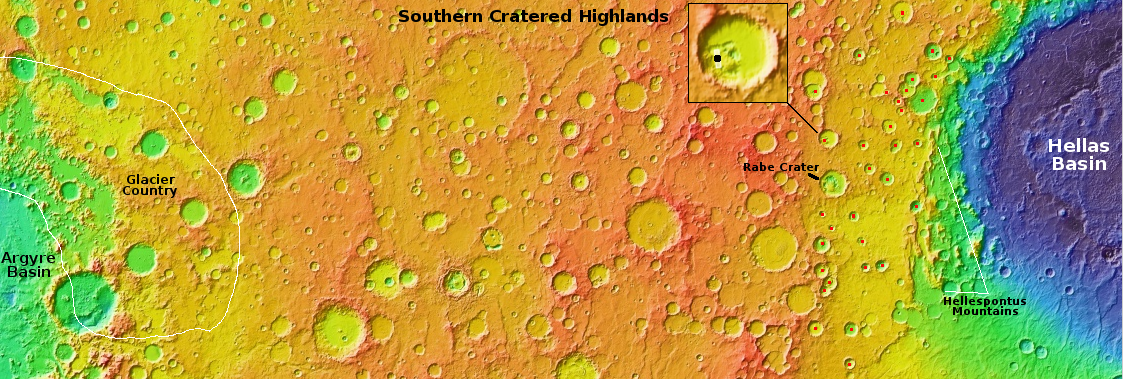
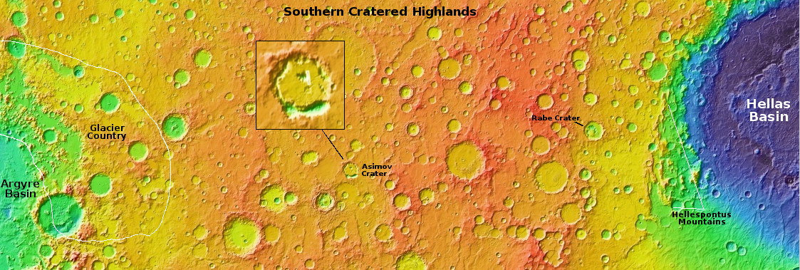
This is the third part of this week’s series taking a look at some of the strange features in the southern cratered highlands of Mars. In the first part I posted a beautiful image of what appears to be a crater filled to the brim with glacial ice, surrounded by an ice sheet plain. In part two we took a look at the interior of Rabe Crater, which though very nearby does not appear to have obvious glacial features within it at all. What it has instead are deep open air pits and a lot of sand dunes.
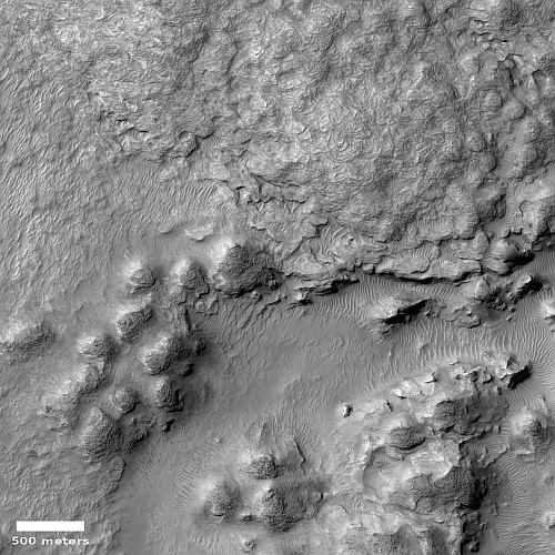
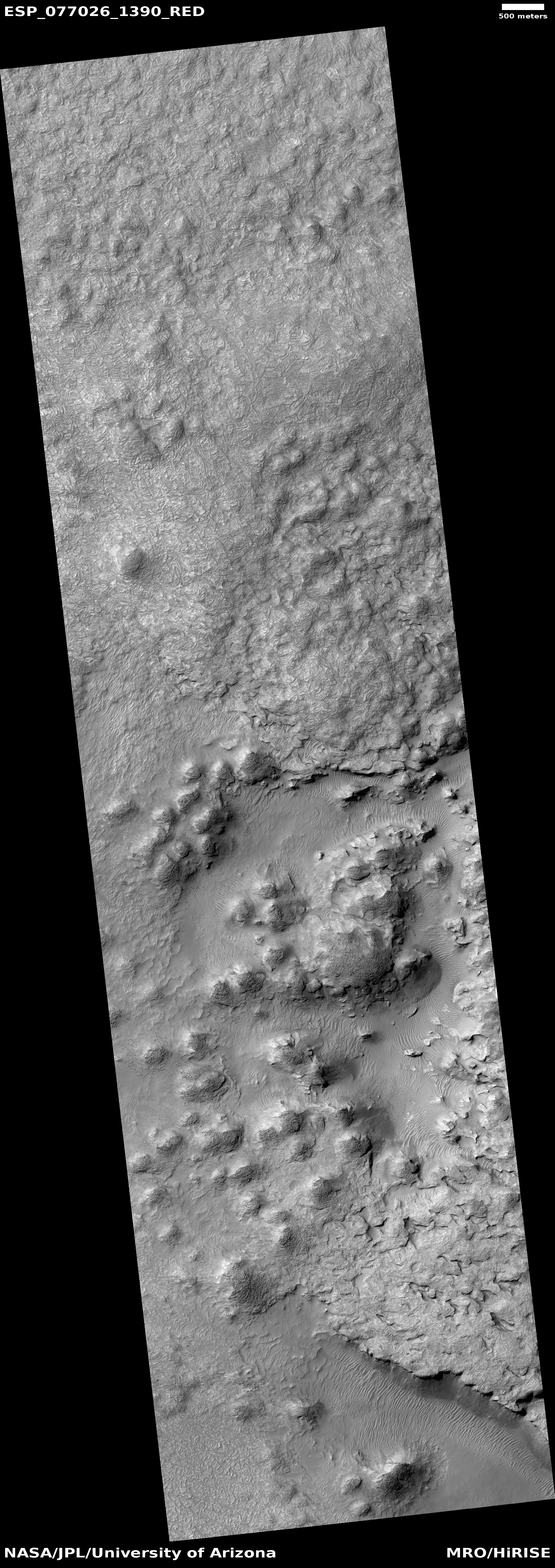
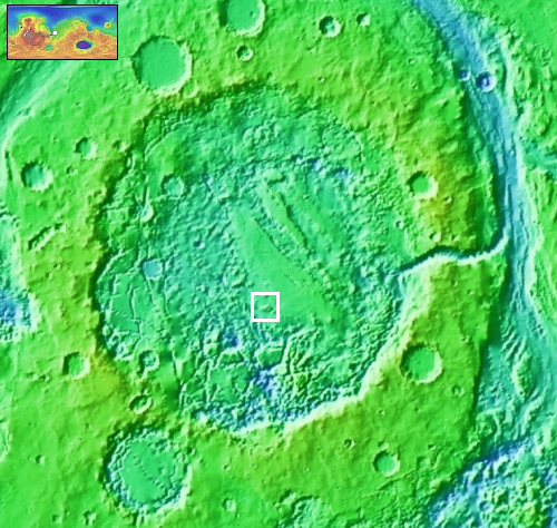
Today’s image to the right, cropped, reduced, and sharpened to post here, takes us to the interior of an unnamed 45-mile-wide crater only about 70 miles north of Rabe. The black dot in the inset on overview map above indicates the photo’s location. The picture was taken on January 1, 2023 by the high resolution camera on Mars Reconnaissance Orbiter (MRO). Like Rabe, this crater also has many large open-air pits. In the picture one pit, near the lower center of the picture, is surrounded by soft-looking mounds and a strangely swirling textured and uneven terrain that makes up the majority of the crater’s floor.
This picture might help explain what we saw in Rabe. The textured terrain in this unnamed crater could easily be ice-impregnated and now hardened sand dunes. The pit could be where that impregnated ice has sublimated away, leaving behind the dust from those ancient dunes which then forms new sand dunes. In Rabe, the crater floor above its pits looks very similar to this swirling textured surface, suggesting the same process is going on there.
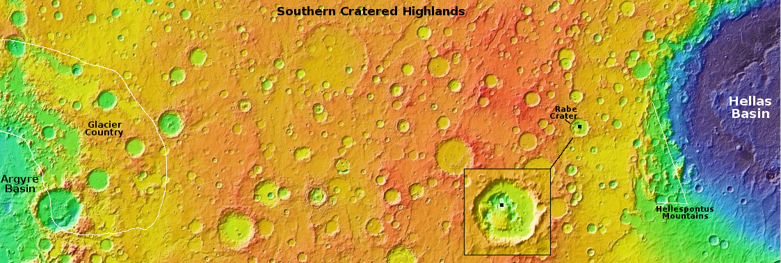
What strengthens this explanation is the many other craters nearby, all indicated by red dots in the overview map above, that also have pits or distorted crater floors. Their proximity suggests that there is an underground ice layer in this region, always at about the same elevation, and each crater impact exposed it. With time that exposed ice, no longer pure but filled with material from the impacts, sublimated partly away, producing the pits as well as ample sand to form sand dunes.


