
China’s continued silence about Zhurong suggests Mars rover is dead
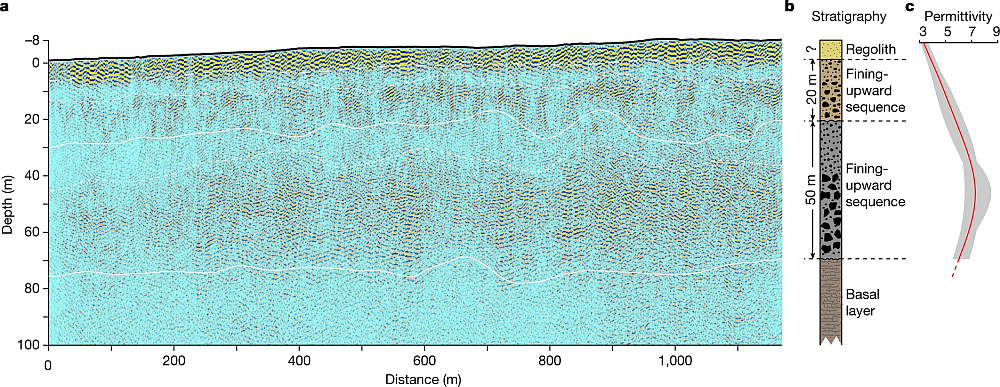
The data from Zhurong’s ground-penetrating radar instrument.
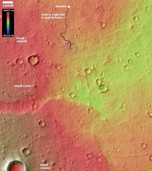
Zhurong’s final location is somewhere in the blue circle.
China’s continued silence about Zhurong — which should have come out of hibernation sometime in late December-early January — suggests the Mars rover did not survive the Martian winter, which this year was also lengthened near the end by some additional dust storms.
Zhurong went into hibernation in May 2022, at the start of winter, with plans to awaken in December. Like the helicopter Ingenuity and the lander InSight, it depends on solar power, and had to contend with a very relatively severe winter dust season this Martian year.
Even though the Chinese press has loudly touted Tianwen-1’s first two years in Mars orbit, it has made little or no mention of Zhurong, a silence that is deafening.
The silence is also foolish, because China has nothing to be ashamed of concerning Zhurong. The mission was only supposed to operate for 90 days. Instead it lasted more than a year, traveling much farther than planned. Most important, the data from its radar instrument (shown above) showed that, at this location at 25 degrees north latitude, there is no underground ice to a depth of 260 feet. That data confirmed that the Martian equatorial regions below 30 degrees latitude are very dry, with any underground ice existing rarely if at all. The icy regions above 30 degrees latitude do not appear to extend much farther south than that latitude.


