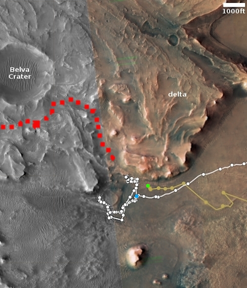
Ingenuity about to fly up onto the delta
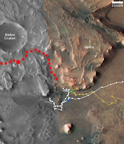
Click for interactive map.
The engineering team that operates the helicopter Ingenuity on Mars announced today that the next flight, #39, will go about 456 feet and travel to the northeast.
The green dot on the map to the right shows Ingenuity’s present location. The yellow lines indicate the territory within which this flight will head. If successful it will be the first time the helicopter has left the floor of Jezero Crater, and moved uphill onto the delta that flowed into that crater sometime in the far past.
The blue dot marks Perseverance’s present location. The dotted red line indicates its eventual planned route on that delta.
The engineers state that their flight goal is to “flight test new software”. This new software is supposed to allow Ingenuity to fly over rougher terrain. On the 38th flight, it proved its worth by not only flying over an area of rippled sand dunes, it landed between two.
This next flight, scheduled for sometime today, will be even more challenging, because the helicopter will have to fly upward above higher terrain.