
A rock stows away on Perseverance
Click for full image.
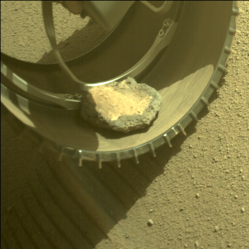
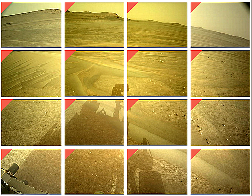
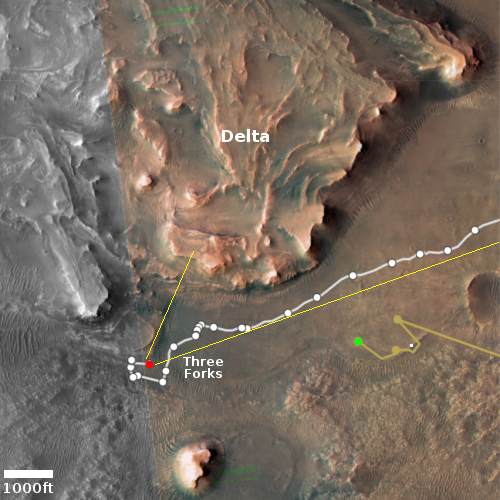
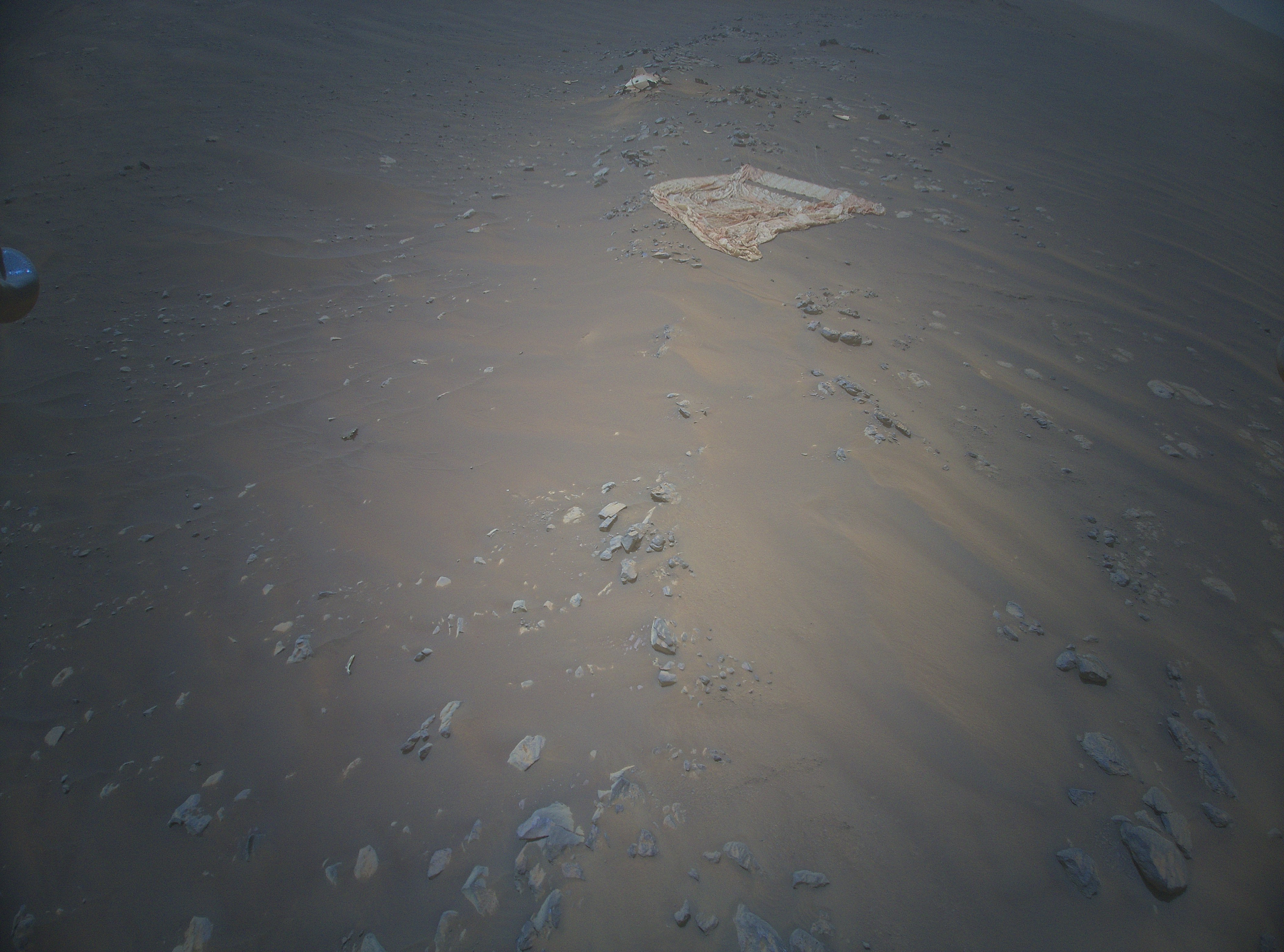
Since early February the Mars Rover Perseverance has been toting with it a small rock in its front left wheel, as shown in the image to the right, cropped and reduced to post here and taken by the rover’s left hazard avoidance camera on February 6, 2022.
From an update today by the Perseverance science team:
Back on sol 341— that’s over 100 sols ago, in early February— a rock found its way into the rover’s front left wheel, and since hitching a ride, it’s been transported more than 5.3 miles (8.5 km). This rock isn’t doing any damage to the wheel, but throughout its (no doubt bumpy!) journey, it has clung on and made periodic appearances in our left Hazcam images.
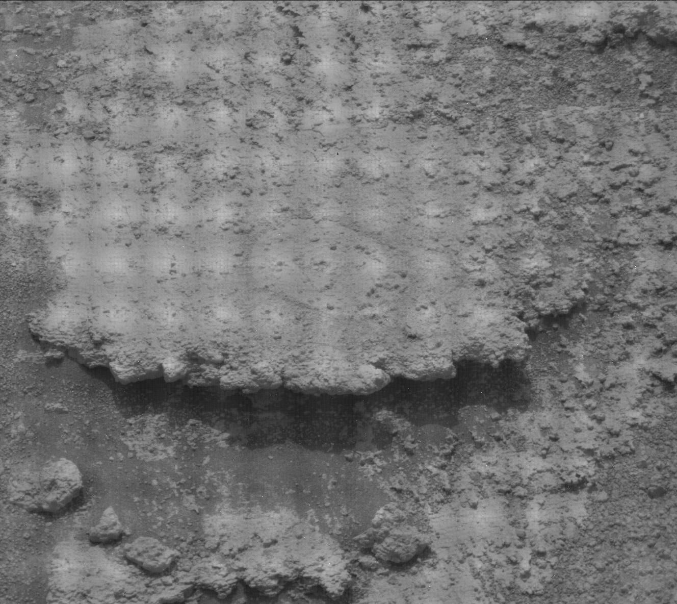
You can see the most recent photo of the rock, taken on May 26, 2022, here. It is very clear that the rock’s repeated tumbling inside the wheel well has worn away its sharp edges as well as reduced its overall size. Given enough time its surface could even become somewhat smooth.
As the update notes, when this rock finally drops off it will create a potential mystery for future geologists, who if they are not aware that Perseverance moved it, will wonder how it got where it was, being geologically out-of-place in its new location.
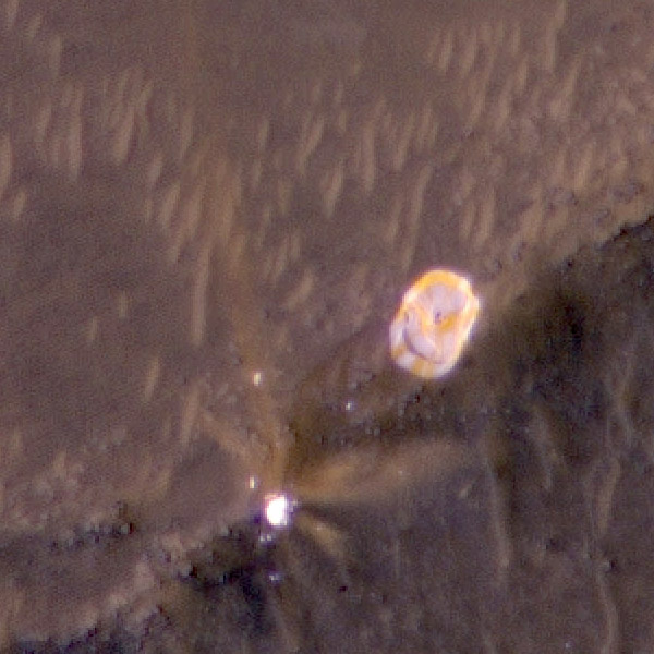
Click for full image.
Since early February the Mars Rover Perseverance has been toting with it a small rock in its front left wheel, as shown in the image to the right, cropped and reduced to post here and taken by the rover’s left hazard avoidance camera on February 6, 2022.
From an update today by the Perseverance science team:
Back on sol 341— that’s over 100 sols ago, in early February— a rock found its way into the rover’s front left wheel, and since hitching a ride, it’s been transported more than 5.3 miles (8.5 km). This rock isn’t doing any damage to the wheel, but throughout its (no doubt bumpy!) journey, it has clung on and made periodic appearances in our left Hazcam images.
You can see the most recent photo of the rock, taken on May 26, 2022, here. It is very clear that the rock’s repeated tumbling inside the wheel well has worn away its sharp edges as well as reduced its overall size. Given enough time its surface could even become somewhat smooth.
As the update notes, when this rock finally drops off it will create a potential mystery for future geologists, who if they are not aware that Perseverance moved it, will wonder how it got where it was, being geologically out-of-place in its new location.


