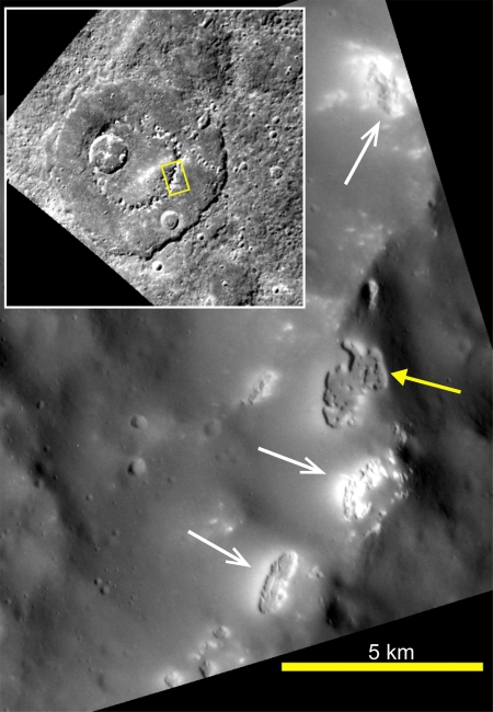
The vast southern highlands of Mars

Small section of Rocky Highlands

Rocky highlands

Cool image time! This week the Mars Reconnaissance Orbiter (MRO) science team made available its monthly release of new images taken by the high resolution camera on Mars Reconnaissance Orbiter (MRO). The image above is just a small cropped section from one of those new images, released under the name “Rocky Highlands.” The image on the right is a cropped and reduced section of the full photograph, with the white box indicating the small section above. If you click on either you can see the full resolution uncropped photograph and explore its complex and rough terrain.

What should immediately strike you looking at the small inset section above is the difficulty anyone is going to have traversing this country. There are no flat areas. Every inch seems to be a broken and shattered collection of ridges, pits, craters, or rippled dunes. And the inset above is only a tiny representation of the entire image, all of which shows the same kind of badlands.

This forbidding place is located in the southern highlands of Mars, north of Hellas Basin and south of the transition zone that drops down to the northern lowland plains. The white cross on the map below indicates the image location, with green representing the transition zone, blue the northern plains, and red/orange the southern highlands..
» Read more

4 comments

More ice cliffs found on Mars!

Another ice cliff

In my review of the November image download from the high resolution camera on Mars Reconnaissance Orbiter (MRO), I am, as a cave explorer and cartographer, naturally attracted to any image with “pit” in the title. The image to the right, cropped, rotated and reduced to post here, was released with the title “Pit in Mid-Latitude Mantle”. That immediately caught my eye, and in looking at it I was at first unimpressed. The three apparent collapses are interesting in that they all have south-facing sharp cliffs, but other than that I wasn’t sure why they were of interest.

Then I took at look at this image’s location. It is somewhat far south on Mars, at latitude -60 degrees, sitting south of Hellas Basin, the deepest basin on Mars. This location is in the same general area where scientists announced in January the discovery of eight cliffs with visible exposed ice layers. The white horizontal bar below Hellas Basin on the map below and to the right shows the region where seven of those ice cliffs were located. To quote the January press release:

The location of known ice scarps on Mars

These eight scarps, with slopes as steep as 55 degrees, reveal new information about the internal layered structure of previously detected underground ice sheets in Mars’ middle latitudes.

The ice was likely deposited as snow long ago. The deposits are exposed in cross section as relatively pure water ice, capped by a layer one to two yards (or meters) thick of ice-cemented rock and dust. They hold clues about Mars’ climate history. They also may make frozen water more accessible than previously thought to future robotic or human exploration missions.

Researchers who located and studied the scarp sites with the High Resolution Imaging Science Experiment (HiRISE) camera on MRO reported the findings today in the journal Science. The sites are in both northern and southern hemispheres of Mars, at latitudes from about 55 to 58 degrees, equivalent on Earth to Scotland or the tip of South America. “There is shallow ground ice under roughly a third of the Martian surface, which records the recent history of Mars,” said the study’s lead author, Colin Dundas of the U.S. Geological Survey’s Astrogeology Science Center in Flagstaff, Arizona. “What we’ve seen here are cross-sections through the ice that give us a 3-D view with more detail than ever before.”

In an email correspondence today with Dr. Dundas, he confirmed that the image to the right was of ice cliffs not included in the January paper. The image was a follow-up of an earlier MRO image and was taken to confirm the ice cliff’s existence.

What I noticed in reviewing the January paper was that these three new ice scarps were actually outside the white bar on the map above, located at -60.7 degrees latitude, 83.5 degrees longitude.
» Read more

0 comments

Present and future landing sites on Mars

With InSight’s landing on Mars set for 11:54 am (Pacific) this coming Monday, November 26, 2018, I decided to put together a map of Mars showing the location of all the successful landers/rovers, adding the landing sites for the planned landers/rovers through 2020. This will give some context to InSight’s landing site.

Landing sites on Mars

The map does not show the landing sites for the failed Soviet, American, and British landers.

As I noted in describing the Mars2020 landing site, the location of the bulk of these landing sites, along the transition zone from the southern highlands and the northern lowlands, demonstrates the areas of the planet that interest geologists the most. It is here that we find many shoreline features, suggestive of the ocean that many scientists theorize existed intermittently in the northern lowlands. It is here that planetary scientists can quickly gather the most information about Martian geological history. And it is here that they have the opportunity to study the widest range of rock types.

From an explorer’s perspective, however, this approach has its limits. It does not provide us a look at a wide variety of locations. It is not directly aimed at finding lower latitude locations where ice might actually exist. And it is decidedly not focused in studying the planet from the perspective of future colonists. I am sometimes frustrated that we have as yet no plans to send any rovers into Marineris Valles, or to the western slopes of Arsia Mons, the southern most volcano in the chain of three giant volcanoes where there are indications that ice might exist underground, or to any of the places where caves are known to exist where a colony could be built more easily. In fact, the caves on the slopes of Arsia Mons seems a prime exploration target.

Eventually these locations will be explored, likely by private landers aimed at scouting out locations for future private settlements. I am just impatient.

6 comments

The soft landslides of Mars

A soft avalanche on Mars

Context image of landslide

The light gravity of Mars, combined with different materials, a lot of dust, and a geological history different from Earth, produces events that — though reminiscent of similar geological events on Earth — are definitely not the same.

The image above, cropped and reduced to post here, was taken by the high resolution camera on Mars Reconnaissance Orbiter (MRO) and was one of the many uncaptioned images released in the November archive. If you click on the image you can see the full resolution version. It shows the tongue of a landslide inside a crater located in the planet’s southern highlands.

You can immediately see why I call it a soft landslide. The craters on its top are barely visible, as if they hit a soft surface that absorbed most of the impact. The grooves spreading southward in the slide suggest that this solid material flowed almost like mud. And the soft, smooth surface head of the slide suggests an almost liquid-like flow. As far as I can tell, this landslide had few large boulders. It was made up instead of small particles of about the same size.

To the right is an image showing the wider context of the above image, taken by Mars Odyssey and cropped and annotated by me to post here. The white box shows the entire area photographed by the full resolution image of the landslide, with the tongue of the landslide at the bottom of the box. If you look at the floor of this crater, you can see what looks like the ghost of a past smaller impact, seemingly buried in either a field of lava or soft dusty regolith. The smoothness of the crater floor also suggests a material softness, allowing it to settle into a pondlike featureless flat plain.
» Read more

0 comments

Volcanic rivers on Mars

Granicus Valles

Cool image time! The photo on the right, cropped and reduced to post here, was part of the November image release from the high resolution camera on Mars Reconnaissance Orbiter (MRO). If you click on the image you can see the full resolution picture.

The uncaptioned release webpage is dubbed “Faults in Granicus Valles.” The image itself only shows a small part of Granicus Valles, named after a river in Turkey, that flows down from the estern slopes of the giant volcano Elysium Mons. While far smaller than the four big Martian volcanoes in the Tharsis region to the east and near Marines Valles (which I highlight often), Elysium Mons still outshines anything on Earth at a height of almost 30,000 feet and a width of 150 miles. It sits at about the same northern latitude of Olympus Mons, but all by itself, rising up at the very northern edge of the transition zone between the southern highlands and the northern plains, with the vast Utopia Basin, the second deepest basin on Mars, to the west.

Overview of Elysium Mons and Granicus Valles

Granicus Valles itself is almost five hundred miles long. At its beginning it flows in a single straight fault, but once it enters the northern plains of Utopia Basin it begins to meander and break up into multiple tributaries. The MRO image above shows only a tiny portion in the northern plains, as illustrated by the white box in the overview map to the left.
» Read more

0 comments

More Pits on Mars!

Pits near Arsia Mons

Cool image time! In the November image release from the high resolution camera on Mars Reconnaissance Orbiter (MRO) were three images, dubbed by me in the collage above as number one, number two, and number three, showing pits south of Arsia Mons, the southernmost volcano in the chain of three giant volcanoes to the east of Mars’s largest volcano, Olympus Mons, and to the west of the Marineris Valles valley.

Mars overview showing pit locations

The image on the right provides the geographical context of the three pits. They are all south of the volcano on the vast lava flow plains that surround it. The location of pits #1 and #2 is especially intriguing, on the east and west edges of what appears to be a large lava flow that had burst out from the volcano, leaving a large lava field covering a vast area several hundred miles across just to the south. You can also see a similar large lava field to the north of the volcano. Both fields appear to have been formed when lava poured through the breaks created by the fault that cuts through the volcano from the northeast to the southwest.
» Read more

2 comments

The ExoMars 2020 landing site

ExoMars 2020 landing site

Last week the European Space Agency (ESA) announced the final chosen landing site for their 2020 ExoMars rover, a region called Oxia Planum.

Since then they have posted several detailed overview maps describing this region. The image on the right, reduced slightly to post here, shows the final two candidate elliptical landing sites in black, with Oxia Planum on the left. The caption for this image adds this tantalizing detail:

Both landing site candidates lie close to the transition between the cratered northern highlands and the southern lowlands of Mars. They lie just north of the equator, in a region with many channels cutting through from the southern highlands to the northern lowlands. As such, they preserve a rich record of geological history from the planet’s wetter past, billions of years ago.

To understand better what they mean by this, we need to zoom out.
» Read more

1 comment

The endorsement of election theft

The coming dark age: Voter recounts in three close elections in Florida and Arizona, all won initially by Republicans, now suggest there is significant misconduct going on to favor the Democratic candidates in order to change the results.

Are the local Democrats in Arizona and Florida trying to steal these elections? Maybe. The evidence sure looks that way, based on past behavior. For one thing, in practically every close election requiring a recount in the past two decades the recount somehow always finds more votes for Democrats, sometimes in very suspicious circumstances. Moreover, practically every voter fraud case investigated in the past few years has also appeared to be fraud in favor of the Democrats. While I am sure I could do some digging and find a case or two that was done to favor the Republicans, that would be the exception that proves the rule.

The problem here is not that the Democrats are doing this, but that it has been obvious for the past decade that this party has become very corrupt and power-hungry, and needs a major house-cleaning. Unfortunately, in the election that just passed, the voters across America did not do this. Instead, if anything they gave the Democrats an endorsement, electing them to more seats in the House and not defeating them soundly in the Senate. They also gave them more power at the statewide level, including more governorships.

The result? Americans have essentially told the Democrats they can continue their bad behavior, and in fact are free to expand it as much as they want.

I expect the results of these elections in Florida and Arizona to become Democratic wins. Nor will this be the end. Americans decided it was all right to forgive political corruption, including the most disgusting smear campaign I have seen since the McCarthy era in the 1950s.

17 comments

Mars rover update: November 8, 2018

Summary: Curiosity finally gets drill samples from the top of Vera Rubin Ridge. Opportunity’s silence now extends to five months.

For a list of past updates beginning in July 2016, see my February 8, 2018 update.

Curiosity

Curiosity's travels on and off Vera Rubin Ridge

For the overall context of Curiosity’s travels, see Pinpointing Curiosityโ€™s location in Gale Crater.

The traverse map on the right, unchanged from my last rover update on July 17, 2018, shows almost all of Curiosity’s travels on Vera Rubin Ridge. The yellow dotted line is the oldest travel, up onto the ridge and then back down to get a successful drill sample. The green dotted line shows the rover’s return back up onto the top of the ridge, where it attempted and failed to drill into the ridge’s top layer, then experienced a serious computer issue in mid-September that essentially shut down science operations for about five weeks.

With the resumption of science operations about two weeks ago, the rover has moved a short distance on the top of the ridge to a new drill location, where it finally succeeded this week in drilling a hole in the hardest top layer of Vera Rubin Ridge.
» Read more

2 comments

How a monolithic leftist academia poisons America

The coming dark age: To understand how dominant and monolithic the left’s control over America’s modern academic community, one need only to take a scan at this series of research articles being assembled regularly by the website Campus Reform:

Except for SMU, every single one of these colleges is a public institution, funded in great part by tax dollars. Yet, instead of being a vehicle for educating the young about the principles of western civilization which has made them and our wealthy society possible, they have become propaganda machines for the Democratic Party and the leftist socialist/communist utopia dreams that have always led to bankruptcy, poverty, starvation, and societal collapse.

So, have any of the legislatures from the states where these colleges are located done anything about this? Obviously, leftist states like Oregon are likely to applaud the fact that leftist teachers control their colleges, but what about Texas, Georgia, Missouri, Florida? The simple fact is that while we might sometimes have had conservative state legislatures, none of them have had the courage for the past five decades to demand better from these colleges.

Worse, Campus Reform only began this series about two weeks ago. I expect in the coming months they will find that almost every college nationwide is dominated in the same way.

The result is that we have bankrupt intellectual community in the United States. It sees only one right answer to all our problems (government and socialism), and it cannot think deeply about any subject since it has never been challenged to do so. And when it is challenged with alternative ideas or even facts, it acts like a four-year-old having a temper tantrum, running to Twitter to issue short, emotional, insulting attacks at those who dare disagree with its rigid beliefs. Smear tactics become standard operating procedures, and civilized discourse impossible.

And in that atmosphere thugs end up getting elected to office, wielding power for all the wrong reasons.

Unless some effort is made to change this, the political and intellectual culture of the United States is only going to decline further. Unfortunately, I do not see such a major effort happening. For one, there are not very many people in power who wish to do it. Second, it will take great courage and fortitude to stand up to the future temper tantrums that such an effort will produce. In my entire life, I have never seen anyone willing to do it.

6 comments

Freedom dying

The results of yesterday’s election, when taken in the context of the stories below, confirm for me the sad belief that freedom in the United States is steadily dying. Freedom might return, but for the next few decades I think we are headed for oppressive times. Be prepared.

The stories are only a sampling, and are cited because of what they show: In every case they describe attacks against individuals defending freedom of speech and diversity of thought, and all the attacks come from the students, the future of our society.

The election yesterday further demonstrates the bad future we are facing, not so much that the Democrats won the House after two years of repeated and insane smear campaigns against anyone who opposed them, but because a very very large percentage of the population has decided to support them in that behavior. As I like to say, it’s the audience that counts. The audience here is increasingly oppressive, intolerant, and eager to exercise power to impose its will.

That audience yesterday decided to give power to those who are equally intolerant, and like to wield that power to impose their will.

I could also cite many personal experiences, in just the past few months. The key is that I as a conservative know that if I express my opinions among friends, I will likely lose those friends, and get ostracized. I must choose my words carefully. My liberal friends however feel no such fear, and routinely spout their political views, always assuming that everyone agrees with them.

Meanwhile, I am also gathering that my willingness to express my political views professionally here on my own website has had a negative effect on the website. In recent months certain space aggregate sites no longer link to Behind the Black. Others have even told me that they will block all emails or communications from me.

None of this will stop me from expressing my point of view. It is my curse. I must say what I believe. However, be warned. Bad times are coming. Be prepared.

31 comments

The vast northern plains of Mars

The vast northern plains of Mars

Cool image time! Actually, this image, found in the October image release from the high resolution camera of Mars Reconnaissance Orbiter (MRO), is not that interesting, in its own right. Context is all!

The image on the right is a small section cropped and reduced in resolution from the full image, which you can see by clicking on it. It shows one of the only interesting features in this long image strip, a small mesa sticking out all by itself in a flat featureless plain pockmarked by various small craters.

The release has no caption, though it is entitled “Northern Plains Survey.” The northern plains, while having a lot of interesting features that attract the attention of planetary scientists and thus get photographed at high resolution, is mostly featureless, at least at the resolution of the wide field survey cameras on many Mars orbiters. In order to know what is really there, they need to take high resolution images systematically, of which this image is obviously a part.

Overview image

The problem is that there is so much ground to cover. This particular image was taken of a spot in the middle of the plains just to the north of the drainage outlets from Valles Marineris, as shown by the context map to the right. The tiny white spot to the right in the middle of the blue plains north of those drainage outlets is the location of this image.

Detail area of overview map

To understand how much ground needs to be covered, to the right is a close-up of the area shown by the white box in the first image above, with red rectangles indicating where MRO has already taken images. The white cross is the subject image. As you can see, most of this immense plain has not yet been imaged. It is almost as if they threw a dart to pick this one location. Most everything around it remains unseen at high resolution. Thus, to understand the geology of this one image is hampered because the surrounding terrain remains unknown, in close detail.

Mars is a big place. It is an entire planet, with the same land surface as the Earth’s continents. It still contains many mysteries and unexplored places. It will take generations to see it all.

1 comment
1 66 67 68 69 70 139