
Mars will be mystery until we can walk its surface

Click for original image.
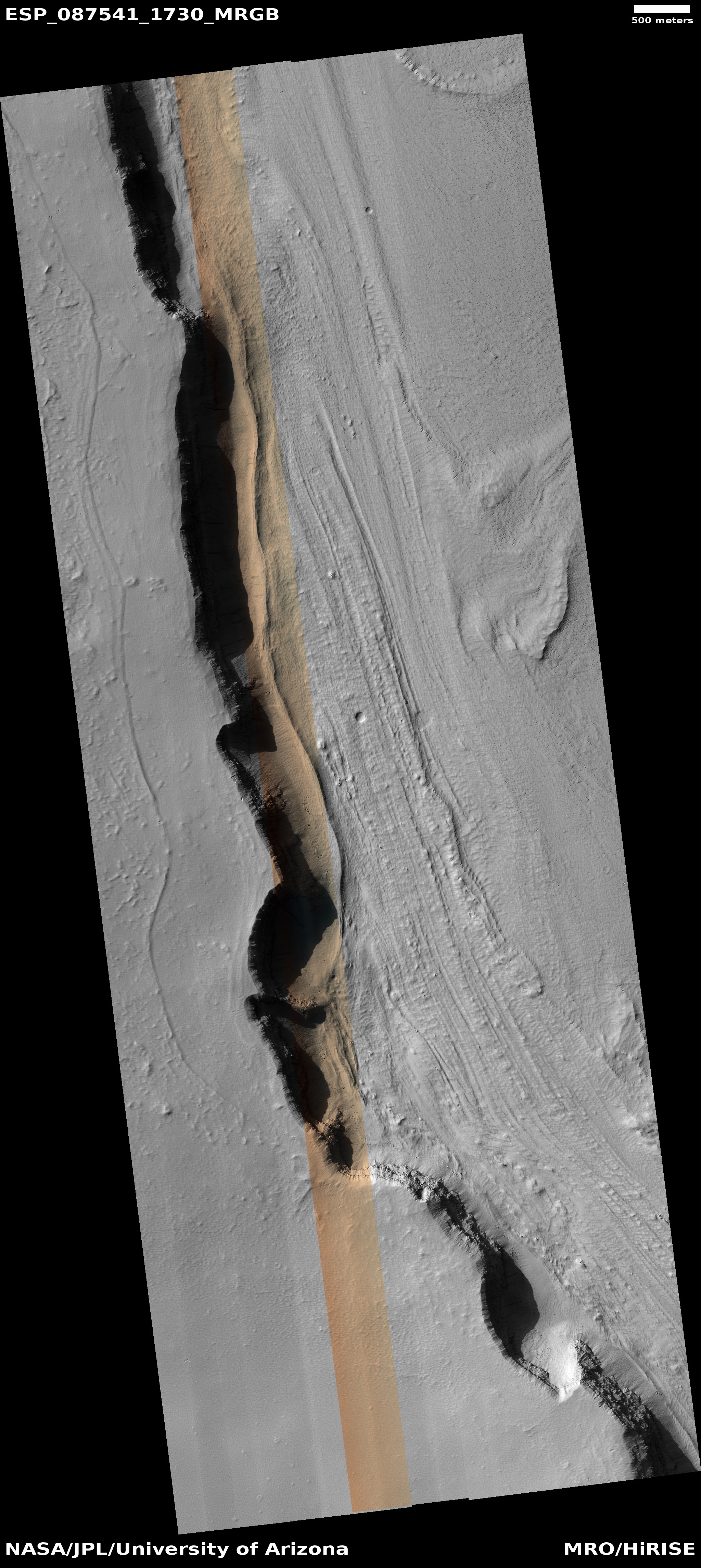
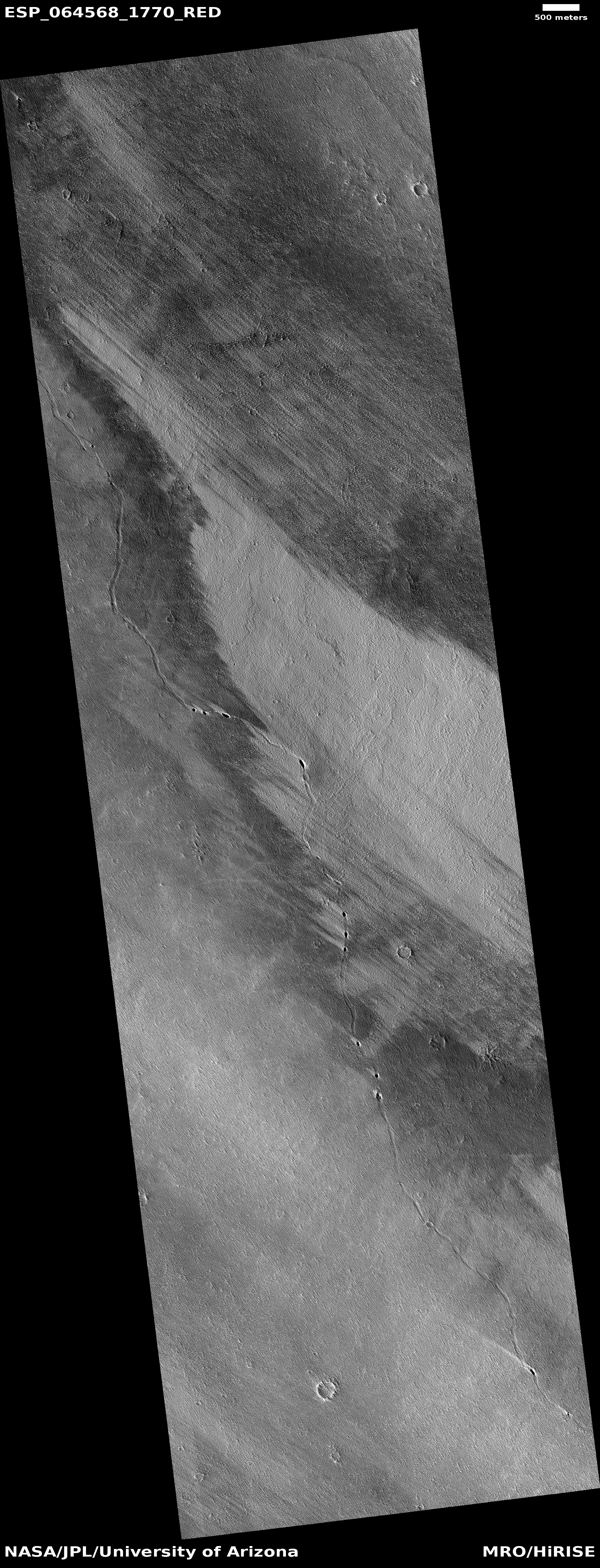
Today’s cool image illustrates starkly the limitations of orbital imagery. The picture to the right, rotated, cropped, reduced, and sharpened to post here, was taken on March 30, 2025 by the high resolution camera on Mars Reconnaissance Orbiter (MRO). It shows flow features inside a depression that strongly resemble glacial features, with the downhill grade roughly heading south.
Such features are seen in many places on Mars, almost always in the 30 to 60 degree mid-latitude bands in both the northern and southern hemispheres (see here, here, and here for just three examples. For many more simply search this website using “glacier” or “glacial feature” as search terms).
The problem is that this location is not within that 30 to 60 degree latitude band. In fact, at this location no near surface ice should exist at all.
» Read more
Click for original image.
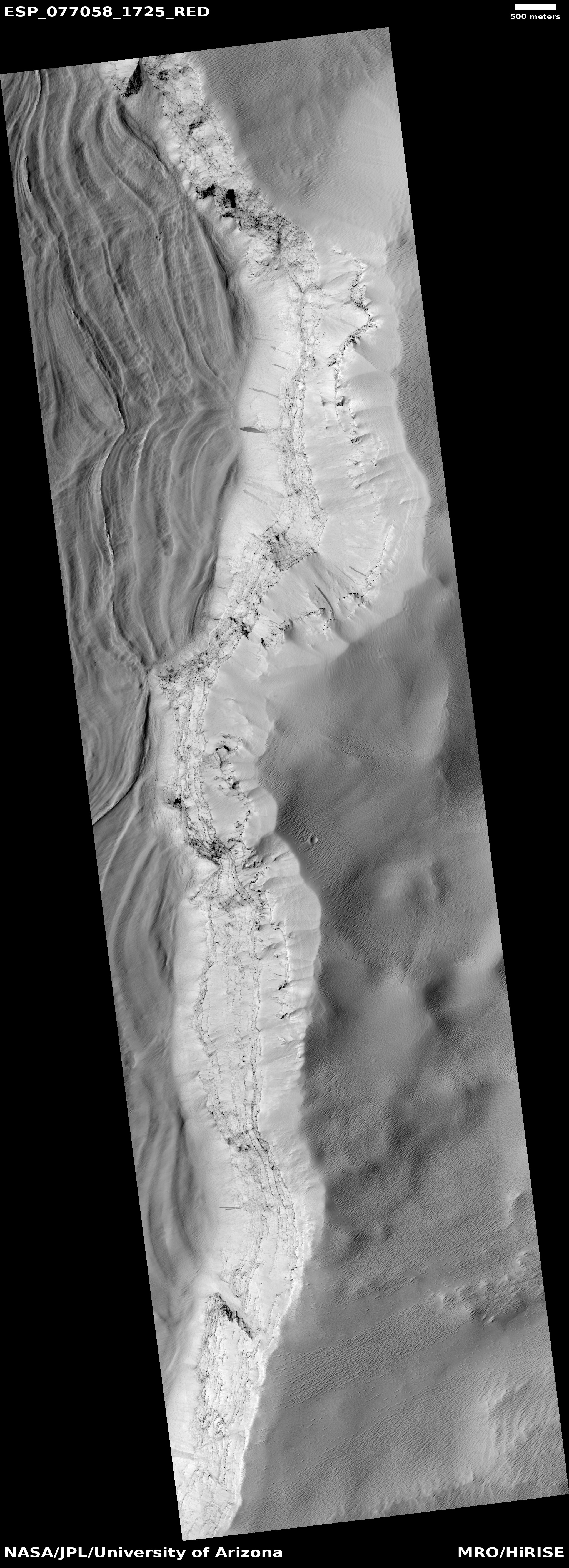
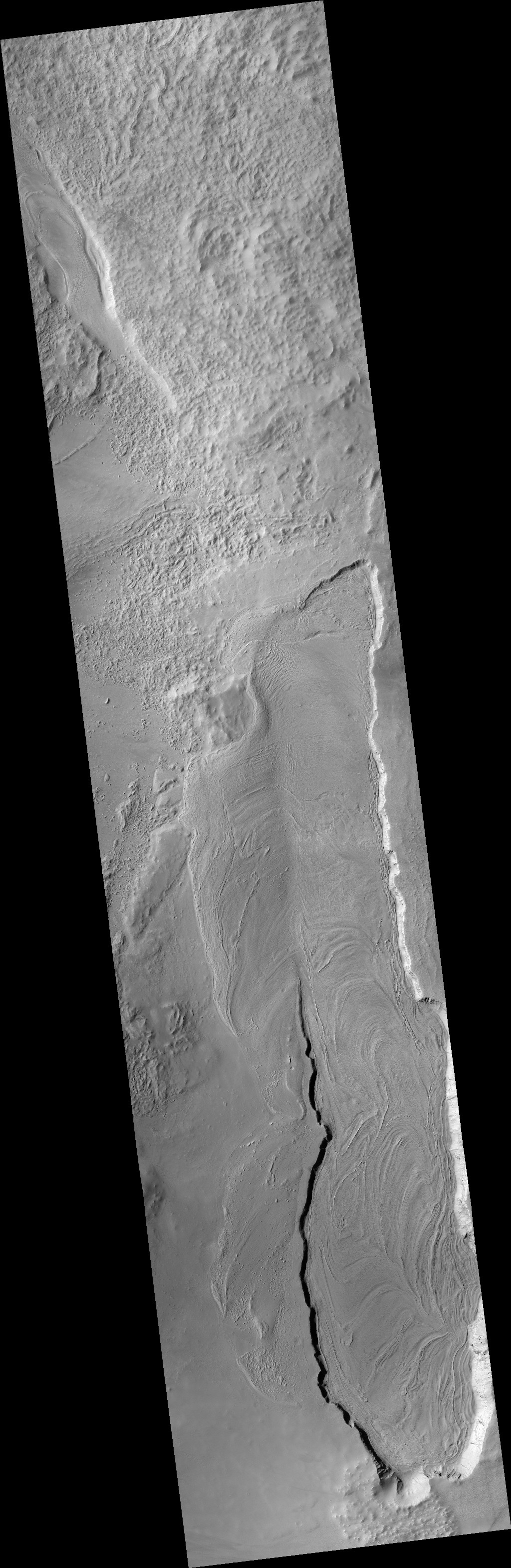
Today’s cool image illustrates starkly the limitations of orbital imagery. The picture to the right, rotated, cropped, reduced, and sharpened to post here, was taken on March 30, 2025 by the high resolution camera on Mars Reconnaissance Orbiter (MRO). It shows flow features inside a depression that strongly resemble glacial features, with the downhill grade roughly heading south.
Such features are seen in many places on Mars, almost always in the 30 to 60 degree mid-latitude bands in both the northern and southern hemispheres (see here, here, and here for just three examples. For many more simply search this website using “glacier” or “glacial feature” as search terms).
The problem is that this location is not within that 30 to 60 degree latitude band. In fact, at this location no near surface ice should exist at all.
» Read more


